Scan the QR code and open PeakVisor on your phone
Forming the crest of the Continental Divide along the southern part of the border between the Canadian provinces of Alberta and British Columbia, the Elk Range is a small collection of peaks that dominate the southern part of the view from Upper and Lower Kananaskis Lakes. The range contains 13 named mountains, the highest and most prominent of which is Mount Pocaterra (2,888m/9,475ft).
The Elk Range is a small subrange of the Canadian Rockies within the provinces of Alberta and British Columbia. It is located within both the Regional District of East Kootenay in British Columbia and within the Kananaskis Improvement District of Alberta, though it is not to be confused with the Elk Range in the western part of the US state of Colorado.
Situated just to the southeast of the Upper and Lower Kananaskis Lakes, the Elk Range extends down the border for about 32.2km (20 mi) between the two provinces until its terminus to the north of Mount McPhail.
It is also located to the east of its namesake Elk River, which separates it from Elk Lakes Provincial Park and Height of the Rockies Provincial Park, and to the north of the Elbow River, which separates it from the Elbow-Sheep Wildland Provincial Park, the Spray Valley Provincial Park, and the Kananaskis Country Public Land Use Zone.
Moreover, the Elk Range is bounded by Alberta Highway 40 to the east, which serves as a border between the range and the nearby Sheep River Provincial Park and Bluerock Wildland Provincial Park.
Due to its location within the heart of the southern Canadian Rockies, the Elk Range is surrounded by other nearby mountain ranges. This includes the Highwood Range to the east, the Spray Mountains to the west, the Opal Range and the Kananaskis Range to the north, and the Harrison Group to the south.
Finally, the Elk Range is located partially within 2 different provincially-managed recreation areas, Peter Lougheed Provincial Park and Don Getty Wildland Provincial Park, both of which are in Alberta.
As part of the Canadian Rockies, the Elk Range shares a similar geologic history with many of its neighboring ranges. Geologically, the range is a small part of the massive American Cordillera, which extends from the Andes in the southern tip of Chile and Argentina, all the way through the United States, into Canada, and north to the Brooks Range in Alaska.
The Canadian Rockies as a whole started to take shape about 100 million years ago, through the collision of the North American plate with a microcontinent off its west coast. This mountain building event helped to create the region’s many peaks, while the widespread glaciation that followed during the Pleistocene carved out many of the range’s geological features.
For the most part, the rock within the Elk Range and the surrounding region is sedimentary in origin. There are a number of different geologic formations in the region, including the limestone and dolomite-dominated Kananaskis Formation.
However, the most dominant rock layers within the Elk Range are the Upper Jurassic and Lower Cretaceous-age sandstone, siltstone, and mudstone layers within the Kootenay Group, the Jurassic-age shales and sandstones of the Fernie Formation, and the Upper Devonian limestone of the Palliser Formation.
The region is also known for its sizable coal deposits, which include economically-viable seams of both bituminous and semi-anthracite coal. Moreover, the Kootenay Group, in particular, is known for containing a sizable amount of both dinosaur trackways and plant fossils.
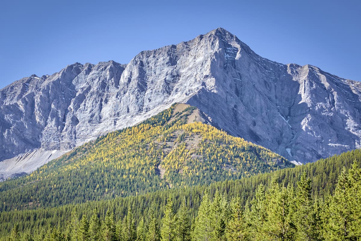
Major peaks within the Elk Range include Mount Pocaterra, Storelk Mountain, Mount Tyrwhitt, Mount Bishop, and Mount Loomis.
The Elk Range shares a similar ecology with its many mountainous neighbors, boasting a collection of ecosystems that are typical for this part of the Canadian Rockies.
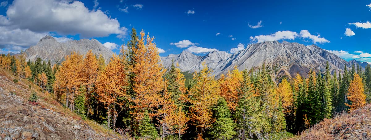
In particular, like much of the rest of the region, the Elk Range contains dense forests of trees such as white spruce, lodgepole pine, Douglas fir, and balsam poplar. Moreover, the parts of the range that extend above the treeline are home to beautiful alpine meadows, where you can find wildflowers in bloom in the summer months.
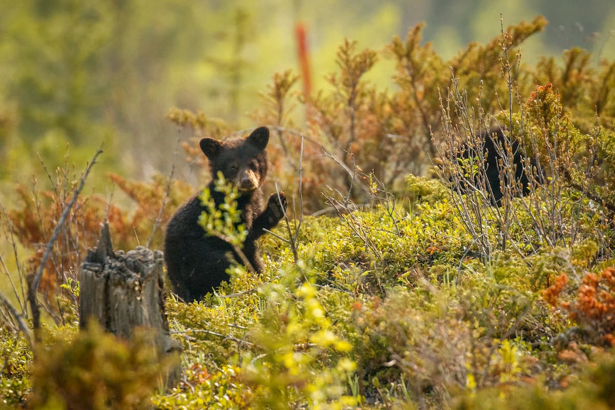
That being said, as you might surmise from the name, the Elk Range is known for its wildlife. In addition to species such as black bears, grizzly bears, bighorn sheep, wolves, mountain lions links, mountain goats, deer, and moose, the Elk Range is home to a sizable population of elk, which live both in the range and in the Elk River Valley to the west.
Although the Elk Range is now sparsely populated, the region has been home to humans since time immemorial. In particular, the Elk Range and the surrounding area are part of the traditional territory of many First Nations, including the Stoney Nakoda First Nation, the Yaqan Nukiy (Lower Kootenay Band) of the Ktunaxa Nation, the Blood Tribe, the Piikani Nation, and the Tsuut'ina Nation, among others.
Perhaps one of the first people of European descent to visit the region was the British-Canadian David Thomspon, who traveled around the Elk River in the early 1800s. The river to the west of the Elk Range, which is know called the Elk River, was also first labeled on European maps in the mid-1800s after John Palliser of Ireland traveled across what is now Canada on the British North American Exploring Expedition (often called the Palliser Expedition).
That being said, the region didn’t see substantial settlement by Canadian settlers until well into the 20th century, when coal mining really started to take off in the area. In particular, the town of Elkford to the south in British Columbia became a major settlement, having been established initially as a mining camp to support the coal mines in the region.
During the 1970s, Elkford was officially incorporated as a town and it still continues to have a strong mining-based economy in the Elk River Valley. Not long after, in 1977, the province of Alberta established the Peter Lougheed Provincial Park (then called the Kananaskis Provincial Park) just to the north of the Elk Range.
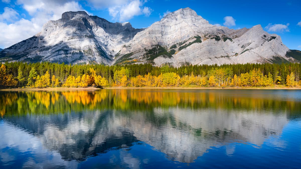
These days, while much of the recreation in the area is centered around Upper and Lower Kananaskis Lake, the Elk Range remains a stunning backdrop to any outdoor adventure.
Looking to go on an adventure in the Elk Range? Here are some of the best trails and hiking areas to check out in the region:
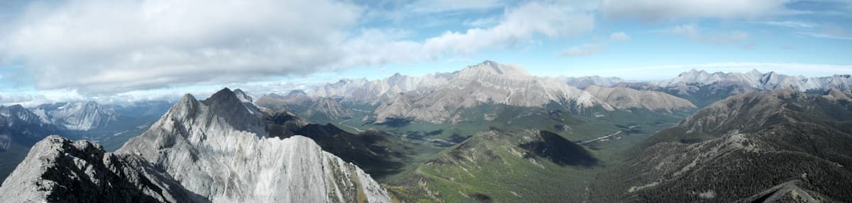
A fan-favorite for anyone in the Kananaskis Lakes region, the 12km (7.5mi) Pocaterra Ridge Trail hike follows along the pretty ridge just to the east of Mount Pocaterra and Mount Roberta. In fact, the ridge itself has a notable high point (Pocaterra Ridge), which offers excellent views of the surrounding region.
This hike can be completed either as a point to point or as an out and back adventure, though most people opt for an out and back trip because of the difficulties of organizing a car shuttle.
Starting from the Little Highwood Parking Lot, the Pocaterra Ridge Trail follows Pocaterra Creek for a while until it starts to gain elevation and pop out above the treeline. Once you’re above treeline, you get excellent vistas of Elbow Lake and the nearby peaks. Eventually, you make it to the summit of Pocaterra Ridge, which provides you with good views of Highwood Ridge and Mount Tyrwhitt to the south.
If you’re looking for a bit of a scrambling adventure in the Elk Range, then an ascent of Mount Tyrwhitt and Mount Pocaterra is a must.
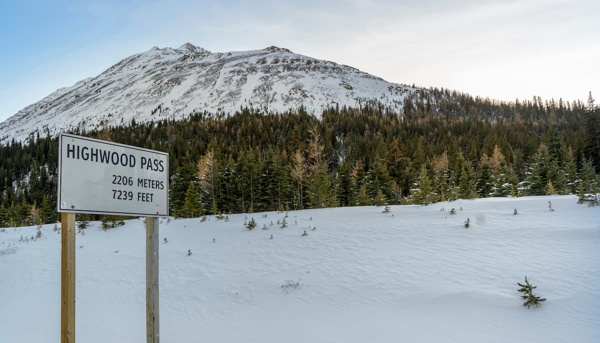
Most climbers start this scramble from the Highwood Pass Day Use Area and follow the Highwood Meadows Trail toward Pocaterra Cirque for the first portion of the hike. Eventually, this 9.5km (6mi) hike branches off and heads up a scree slope to Grizzly Col, where the real scrambling begins.
From the end of the path in Grizzly Col, hikers will need to tackle a steep scramble with plenty of loose rock and fall potential, so only people that feel confident in their navigation skills should continue on from the col.
Eventually, the scramble takes you past a funk natural rock arch formation before you reach the summit of Mount Tyrwhitt and the top of the Continental Divide. If you’re feeling up for even more of an adventure, you can continue down the summit ridge toward Mount Pocaterra and enjoy the views from the highest peak in the Elk Range.
If you’re planning a trip to the Elk Range, you’ll need a great place to stay. Here are some of the best towns and cities near the range for you to check out:
The largest city in Alberta, Calgary is home to around 1.2 million residents, who live just a short drive away from the Elk Range. Calgary’s location just to the east of the Canadian Rockies make it a prime destination for anyone looking to visit the range.
It boasts one of the largest airports in the region as well as an excellent array of hotels and restaurants for visitors to check out.

The small town of Elkford, British Columbia is situated to the south of the Elk Range in the Elk River Valley. It is home to a few thousand residents and it has a strong mining-based economy. Elkford also hosts an annual festival called Wildcat Days to celebrate Canada Day each year.
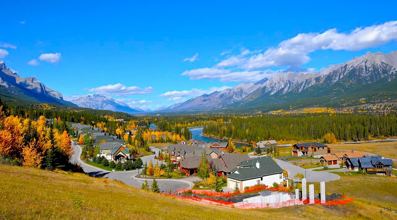
Located just to the north of the Elk Range, the town of Canmore is home to about 14,000 residents and an abundance of stunning mountain landscapes. Also known as the Queen Town of the Rockies, Canmore is a popular destination for outdoor recreation.
The town has a bustling arts and festival scene, as well as excellent access to the region’s outdoor recreation opportunities. Canmore is also just a short drive away from nearby Banff National Park, so it’s a nice place to stay if you’re looking to experience all that this part of the Canadian Rockies has to offer.