Scan the QR code and open PeakVisor on your phone
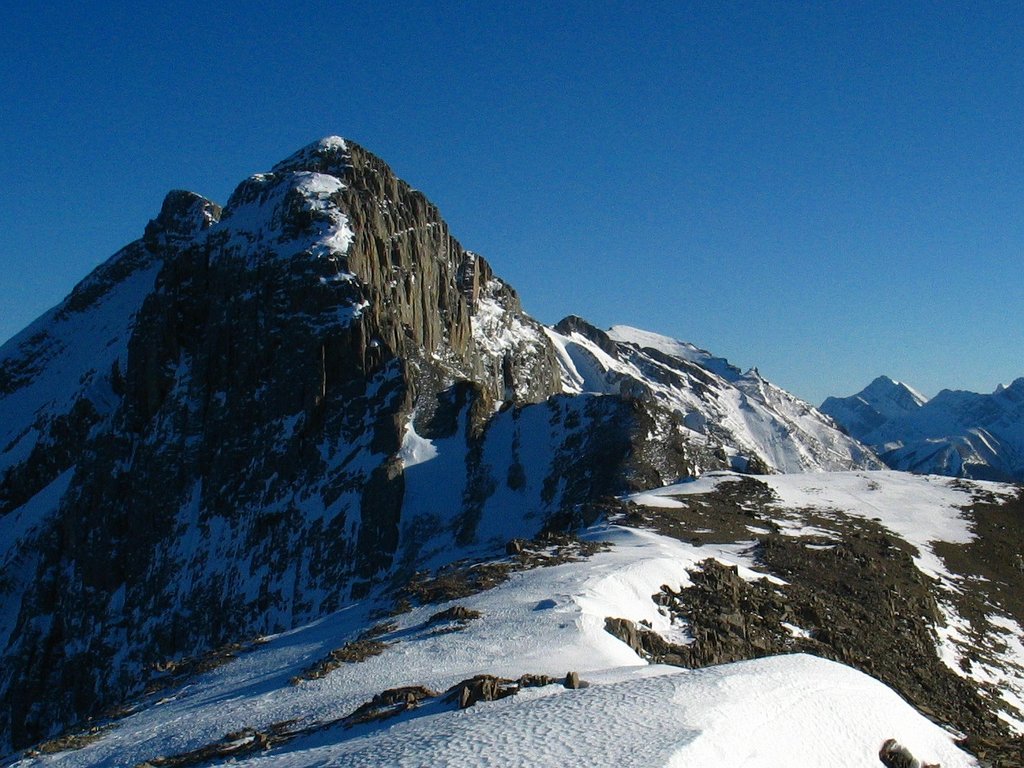
The Jacques Range is a chain of five summits located within central Alberta, Canada in the Front Ranges of the Canadian Rockies. Mount Merlin (2,711 m/ 8,894 ft) is the tallest of the five summits and the 2,616 m (8,583 ft) tall Emir Mountain has 812 m (2,664 ft) of prominence, making it the most prominent peak in the range.
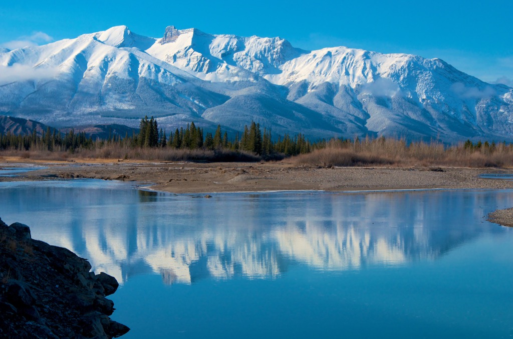
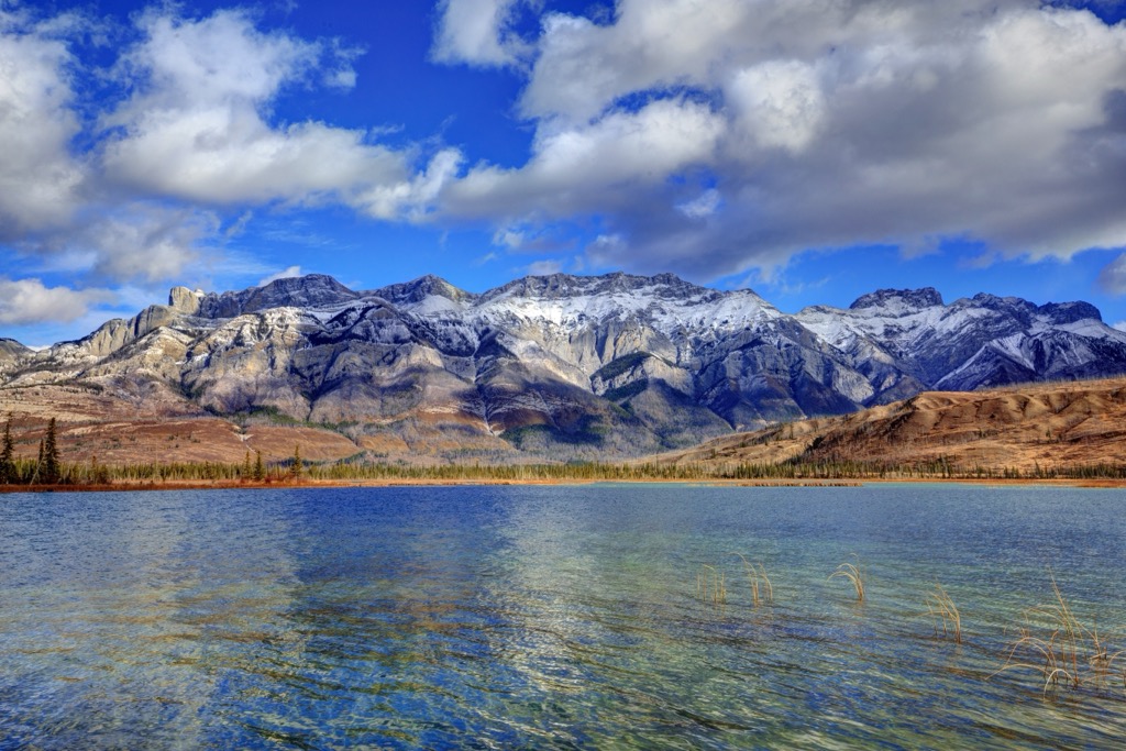
The Jacques Range is located south of Highway 16, the Athabasca River, and Talbot Lake and is one of the Front Ranges of the Canadian Rockies. The Front Ranges span the eastern edge of the Rockies in Alberta, Canada and include many of the most picturesque mountains of the Rockies.
The Colin Range, Maligne Range, Nikanassin Range, Bosche Range, and the Miette Range are adjacent to and near the Jacques Range and are all on the eastern side of Jasper National Park.
Most of the Canadian Rockies are protected as part of national and provincial parks and the Jacques Range is no exception, as it lies within Jasper National Park. Other major parks and recreational areas near the Jacques Ranges include the following:
The Canadian Rockies formed primarily during the Laramide orogeny, which is a mountain building event that began about 75 million years ago and lasted until about 45 million years ago. The Jacques Range was formed in the same manner and the same rocks as the rest of the Canadian Rockies.
Before the Laramide orogeny, the west coast of Canada had expanded significantly as exotic land terranes, in the form of microcontinents and volcanic island arcs were accreted, or stuck, to the west coast of Canada. These accreted terranes created most of modern British Columbia.
The new terranes were accreted to North America as their tectonic plates subducted beneath the western edge of North America and the buoyant islands were skimmed from their plate and added to what is now western Canada.
The Rocky Mountains were among the final mountains to form as part of the Western Cordillera. The tectonic collisions that added most of British Columbia’s land had been occurring for many millions of years and had already created the Columbia, Interior, Coast, and Insular Mountains of the province.
The mountain formation of the Laramide orogeny was a little unusual compared to the preceding orogenies, in which the mountains formed significantly inland of the coast. The tectonic collision of the Laramide orogeny caused deformation and buckling along the ancient continental margin, which was roughly along the Alberta – British Columbia border.
As the western Cordillera was forming, a vast inland sea had formed east of the mountains. The depths of the inland sea were covered in layers of Paleozoic marine sediment and then covered further by layers of Cretaceous silt, mud, and sand that had been eroded from the continent.
As the Farallon plate subducted beneath the continent, accreting the Wrangellia terrane to the west coast, the ancient continental margin was put under immense pressure. The pressure caused the layers of rock to heat up and become pliable. The heated layers of rock bent, folded, broke, and were eventually thrust up to stack upon the rock layers to the northeast.
The erosive forces from rain, flowing water, and wind were constant throughout the formation of the Rockies and the Jacques Range; however, it was the Pleistocene glaciers that left their lasting mark on the topography of the range. These glaciers were responsible for creating the U-shaped valleys, cirques, aretes, and horned peaks that we see today.
The glaciers and ice sheet of the Pleistocene were forceful enough to clear previous topography and leave the range with new features. As the glaciers retreated, new formations of glacial till were deposited across the range and filled the valleys with a near universal veneer of gravel and silt.
Moraines, kames, drumlins, and eskers are some of the till formations to look for. Moraines are deposited along the edges of glaciers and at its extremity. kames are mounds of unsorted debris that are deposited at a glacial terminus by the runoff.
Drumlins are small hills that are shaped by the passing glaciers. Finally, eskers are sinuous deposits of glacial debris created by subglacial rivers. It was only about 12,000 years ago when the ice had finally melted from the Jacques Range enough to create a viable ecosystem for the ancient fauna that inhabited the region.
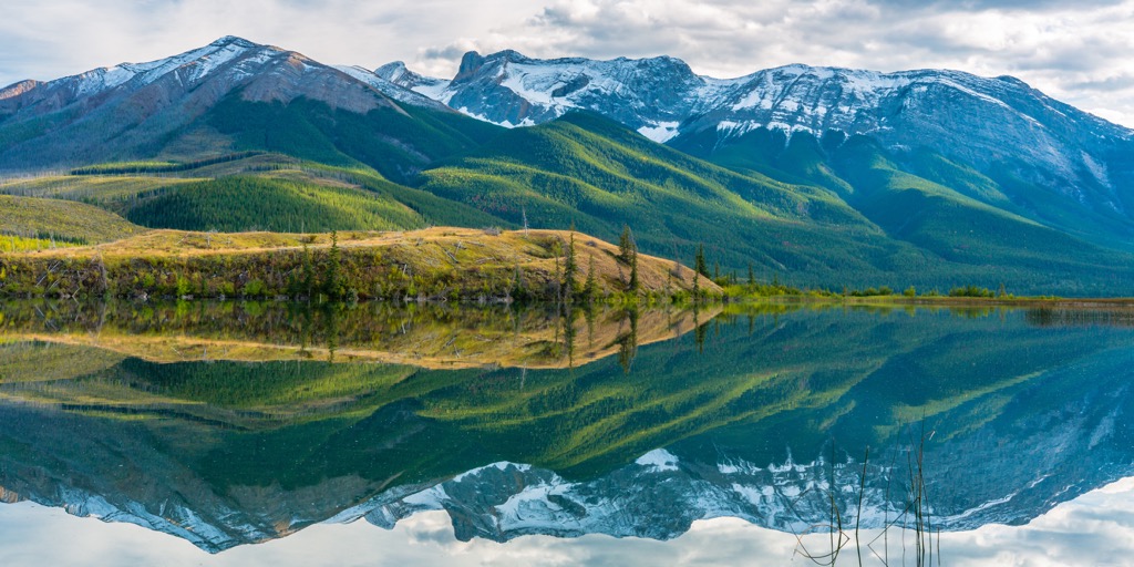
The ecosystems of the Jacques Range extend from the alpine that dominates the peaks, the subalpine upon the slopes and finally the montane subregion of the Rocky Mountain Natural Regions in the valley bottoms. The Rocky Mountain Natural Region contains a wide variety of flora and fauna that are unique to the region.
The alpine of the Jacques Range is the coldest and receives the most precipitation of any of the subregions in the range. The winters are long and cold, and the growing season is short upon the mountain peaks.
The peaks in the range are rocky, though they feature communities of sedge and heath growing above the treeline. The trees try to grow as high in elevation as they can; however, the harsh winter winds stunt the growth of the trees into gnarled stands of krummholz.
Marmots, pika, and ground squirrels live in rocky burrows along the tree line, feeding off the alpine heath, while being preyed upon by eagles, foxes, and other predators. White-tailed ptarmigan and the American pipit are among the few birds that inhabit the alpine; however they typically do so during nesting season.
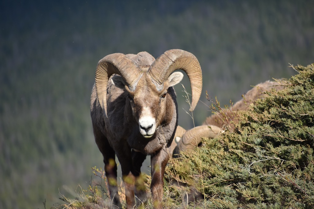
Mountain goats and bighorn sheep are the largest mammals that continuously inhabit the alpine terrain. Deer and elk may spend part of their year in the alpine; however, most animals seek refuge in the subalpine forests during the winter months.
The rocky alpine transitions to a parkland like mosaic of trees and meadows along the treeline, and finally to dense forests of Engelmann spruce and subalpine fir along the slopes. There are also dense forests of lodgepole pine that have grown along the base of the mountains and into the valleys.
Willow and poplar tend to grow only in the valleys where there is significant moisture, along streams and creeks. The ridges are home to larch trees and stands of aspen that are scattered throughout the range.
The Jacques Range is home to a wide variety of animals that are typical to the Canadian Rockies, such as grizzly bears, moose, elk, black bears, wolves, deer, cougars, and foxes. There are many opportunities to look for the mountain goats and bighorn sheep that inhabit the rocky peaks of the range.
While visiting the range you’ll likely hear the whistle of the marmots and see them scurry among the cover of the alpine rocks. There are also many birds to watch for, such as warblers, bald eagles, finches, and pipits.
The contemporary First Nations that claim the Jacques Range as part of their traditional territory are the Ktunaxa, Tsut T’ina, Stoney Nakoda, and Cree, as well as the Métis Nation. The range was the eastern extent of the Ktunaxa territory, which traditionally included the land between Columbia River Valley in the Regional District of Central Kootenay and the eastern slopes of the Rockies.
The Stoney Nakoda are related to the Sioux First Nations of the Great Plains of what is now North Dakota and the surrounding area. The Cree are Algonquin-speaking First Nations from the Great Lakes region in the east.
The Tsuu T’ina were originally part of the Dane-zaa (Beaver) Nation, though they eventually moved further south. They traditionally inhabited the regions around what are now Jasper and Edmonton until conflict with the Cree drove them further south to near what is now Calgary.
Both the Stoney Nakoda and Cree migrated west under pressure from the westward settlement of people of European descent. The Cree and Stoney Nakoda often worked as guides for European fur traders and as intermediaries in the fur trade between other First Nations and Europeans.
The fur trade was responsible for early European settlement near the Jacques Range, which primarily occurred at Jasper House and what is now the town of Jasper in Jasper National Park. As the fur trade declined, mining became a major economic driver as vast ore deposits were discovered along the eastern slopes in the late nineteenth and early twentieth centuries.
With an abundance of easily accessible peaks and hiking trails in Jasper National Park, the peaks and scenery of the Jacques Range receive relatively few visitors. The following are some of the major hikes and destinations within the range.
The five false summits along the 6 km (3.6 mi) trail to the true summit of Cinquefoil Mountain make many hikers want to cry out in dismay; however, stunning views of the surrounding peaks await those that persevere.
The hike to this summit is considered difficult and it has some sections that are considered to be a scramble. While the trail is generally considered to be well defined, many hikers have been fooled by the wildlife trails and veered off course.
With a trailhead that is located at the side of Highway 16, this hike is nearly 12 km (7.2 mi) long and has nearly 1,300 m (4,250 ft) of elevation gain. It is a relatively straightforward hike; however, it is not for the faint of heart.
In addition to Cinquefoil Mountain, which can be classified as a minor scramble, Roche Jacques and Emir Mountain are other peaks that scramblers may attempt to summit. While Cinquefoil Mountain is accessible via a trailhead off of Highway 16, access to the rest of the range requires a bit of a hike along the valley between the Jacques and Colin Range.
The proposed routes to the summits of Roche Jacques and Emir Mountain approach the peaks from their west side and require a lot of scrambling. Arriving at the summit of these peaks would require significant effort and planning, and should not be attempted by beginners.
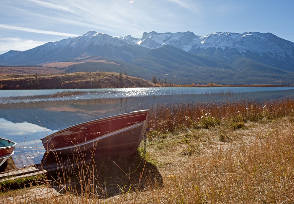
Jacques Lake sits at the south end of the Jacques Range at the base of Mount Merlin and Sirdar Mountain, of the Colin Range. Considered to be an easy hike, the 12 km (7.2 mi) trail leads through forest to a backcountry campground upon the shore of the lake.
The hike to Jacques Lake is popular year-round and the different seasons offer multiple views into the beauty of the area. Most visitors spend a night at the backcountry campground before returning the following day.
The Jacques Range is situated along Highway 16 as you travel into and through Jasper National Park. The range has several notable features that are popular for locals and visitors. The following are some of the nearby cities and towns from which you can start your adventures in the range or stock up on supplies:
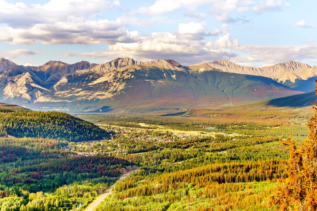
Originally established in 1813 as a trading post named Jasper House, the town of Jasper was established in 1907 as the commercial center for the newly created Jasper National Park. The town of Jasper is located about 40 km (24 mi) to the west of the Jacques Range, in the heart of the national park.
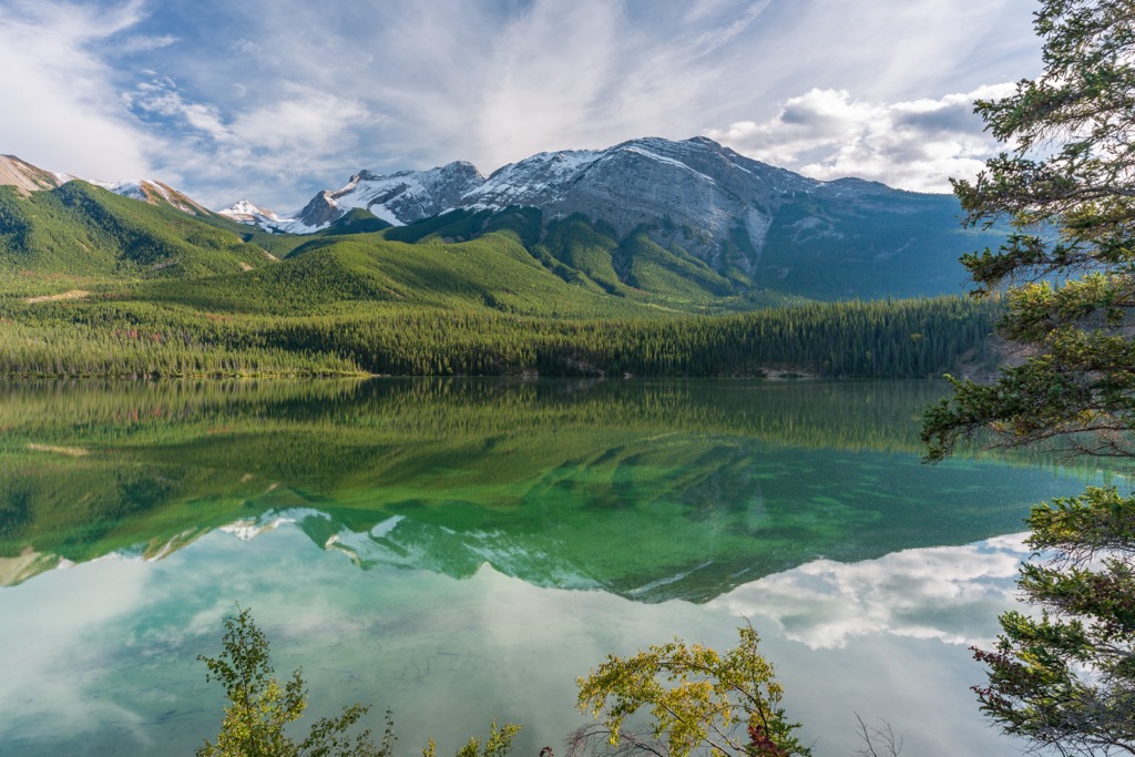
Jasper National Park is considered to have some of the most stunning landscapes and beautiful scenery in Canada. Some of the most popular hikes from Jasper are the hike to Sunwapta Peak, the Sulphur Skyline Trail, and the Maligne Canyon Hike.
Other attractions include the Miette Hot Springs and the boat ride across Maligne Lake. The scenery of the park is spectacular, with the lush forests at the base of the rugged limestone peaks. Glaciers creep along the alpine heights and the wildlife is abundant, with visitors regularly sighting grizzly bears, moose, elk, black bears, and countless species of birds.
The town of Hinton was founded in 1911 when the Grand Trunk Railway built a station house at the current Hinton townsite. The town is located about 25 km (15 mi) to the east of the Miette Range and has experienced a coal boom and bust. It was revived in the 1950s when a pulp mill was built in the town.
Hinton is home to the Wild Mountain Music Fest and is a popular staging area for expeditions into the Willmore Wilderness Park, which is located to the north of the town. Hinton is also a gateway to the incredible wilderness of central Alberta and the Rocky Mountains.
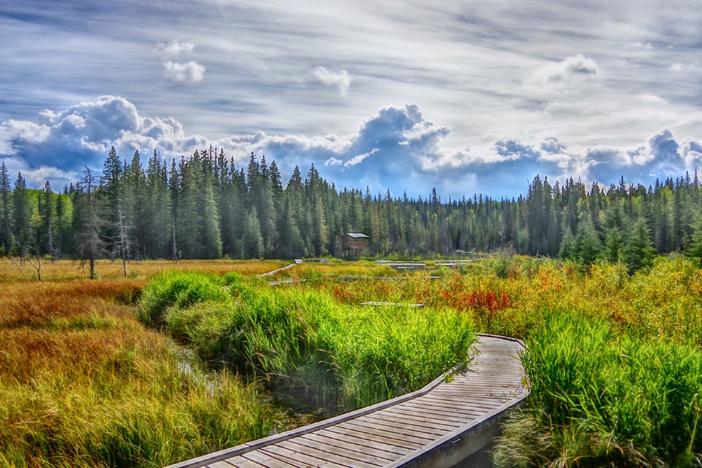
While in the town, visitors can walk the 3 km (2 mi) Beaver Boardwalk to view the beavers and other local wildlife. Hinton is also situated near the eastern entrance of Jasper National Park, which contains countless incredible trails to hike.