Want to Experience the Real Switzerland? Forget Zermatt. Forget Grindelwald. Check Out These Places Instead.
Switzerland is perhaps the world's most iconic mountain country. It's home to some of the Alps' highest peaks and biggest glaciers (including the longest, the Aletsch), as well as a distinct pastoral mountain culture that has evolved to coexist with the land over thousands of years. The largest city, Zurich, has just 400,000 people; this is truly a country of small towns and villages.
However, the most iconic destinations have long since shed their local roots and become resorts for the international jet-set crowd. Zermatt and St. Moritz are famous for their excessive luxury, but many other classic Swiss resorts are now overcrowded as well, such as Engelberg and Verbier.
So we wanted to compile a list of hiking destinations that 99% of internationals will have never heard of. These are destinations that don't have ski resorts in the winter, and therefore have managed to retain much of their culture. Don't expect to find luxury or much lift-access terrain. However, you will find endless hiking trails on ancient farm paths, from forests to glaciated peaks.
And best of all? You won't find nearly as many people. Because these are places for people who want to hike, not just be seen.
10 hikes · 7 cantons
4 of them are tucked into a single canton — Grisons.
Tap a marker to jump to that destination. 10 under-the-radar hikes across Switzerland.
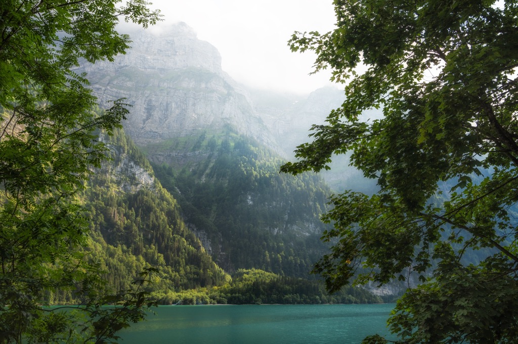
Val Bregaglia, Grisons/Graubünden
Val Bregaglia is Switzerland's strongest contender for the title of most underrated alpine valley.
Like many of the destinations in this list, Val Bregaglia sits along the Italian border, tucked into the southeastern corner of the Grisons/Graubünden canton (famous for St. Moritz, Davos, and Engadine). It’s slightly harder to get to, which is one of the main reasons these inner valleys are less famous.
There are no 4,000-meter peaks here, another reason most people have never heard of Val Bregaglia. But the valley delivers nearly everything hikers associate with the famous Alpine destinations: towering granite walls, hanging glaciers, massive vertical, high passes, and mountaineering heritage. And it’s just so much less crowded and less expensive than neighboring valleys.
The Bregaglia Range contains 249 named mountains, including Monte Disgrazia (3,678 m), the region's highest peak (it’s in Italy, but still part of the Bregaglia group). Though it’s relatively low-altitude by Swiss standards, PeakVisor also identifies 42 glaciers.
Val Bregaglia also has enviable geology. While much of the Alps are limestone, Bregaglia is granite. Think of the spires of the Mont Blanc Range, or Patagonia. Piz Badile’s northeast face is regarded as one of the six great north faces of the Alps. For climbers, the North Ridge and Cassin routes are some of the world’s most classic Alpine climbs.
However, you don’t have to scale these cliffs to get pleasure from them. The sharp spires and walls provide the perfect backdrop for all sorts of hikers and non-technical sightseers.
For most hikers, the best introduction is the Via Panoramica Val Bregaglia, which traverses the forested mountainsides above the valley floor, with views of glaciers and granite peaks. This ancient trail is a collection of old farm trails that connect historic villages and alpine pastures, offering a cultural history that is increasingly difficult to find in heavily developed parts of the Alps.
Those seeking easier access should focus on the Maloja Pass and the nearby Lägh da Cavloc. Gentle trails wind through larch forests and open meadows beneath some of the range's most dramatic peaks.
Experienced hikers can venture deeper into the valley systems surrounding Albigna and Forno, where trails approach glaciers, cross passes, and enter some of Switzerland’s wildest terrain.
Sleeping in the mountains? Browse every hut in Val Bregaglia on PeakVisor’s hut finder — filter by photos, car or lift access, altitude, or huts with a restaurant to plan a hut-to-hut weekend or a longer trip.
Binntal Nature Park, Valais
Binntal Nature Park is located in eastern Valais, again near the Italian border. Binntal offers exceptional hiking in a setting that feels quiet and local. The village of Binn, with a year-round population of about 150 denizens, is a gem with its own brewery and 19th-century hotel.
Despite its proximity to the famous Bernese Oberland and Aletsch Glacier, Binn remains firmly off the beaten path. There are no particularly high summits in the park, and with the exception of one local drag lift, no ski resorts. Meanwhile, other “Valais valleys” have become synonymous with major ski resorts and internationally recognized peaks like the Matterhorn.
The Binntal Nature Park contains 78 named mountains, according to PeakVisor, with Helsenhorn (3,273 m) being the highest and Monte Cervandone (3,211 m) the most prominent. Some of the first explorers in this valley were crystal hunters and gem seekers. The valley is internationally renowned among mineralogists; more than 300 different minerals have been discovered here.
Culturally, the valley punches above its weight. The village of Ernen, at the valley’s entrance, offers world-class classical music in a festival series that’s been running for over 50 years.
The village of Binn is home to countless accessible hiking trails through forests, meadows, and alpine pastures. In summer, wildflowers blanket the valley slopes. For a more ambitious objective, several historic passes have connected Switzerland and Italy for centuries, including the Bochtepass, Bocchetta d’Arbola, and Passo del Contrabbandiere (I wonder what they used that one for). Multi-day hikers can stop at mountain huts such as Binntalhütte. Unlike the rest of the Valais, there are no lifts or mountain railways here; you’re on your own for every meter of ascent.

Sleeping in the mountains? Browse every hut in Binntal Nature Park on PeakVisor’s hut finder — filter by photos, car or lift access, altitude, or huts with a restaurant to plan a hut-to-hut weekend or a longer trip.
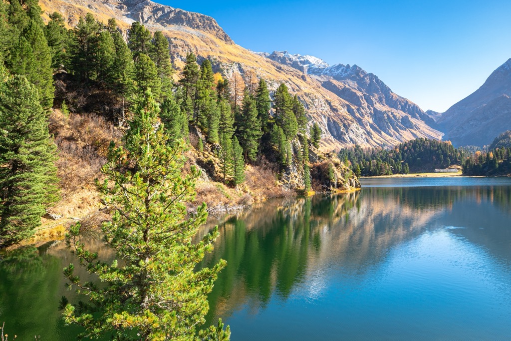
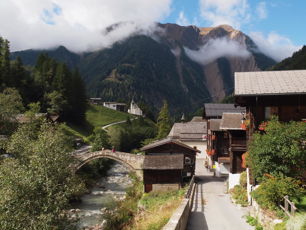
Val Müstair & Biosfera Val Müstair, Grisons/Graubünden
Val Müstair occupies one of the most remote corners of Switzerland, not far from our first destination, Val Bregaglia.
The region is protected as Biosfera Val Müstair. According to our PeakVisor data, the park contains 67 named mountains, with Piz Murtaröl (3,180 m) the highest and Piz Tavrü (3,168 m) the most prominent. Like most places on this list, traditional villages remain woven into the landscape.
If there is a signature hike in Biosfera Val Müstair, it is the route from Ofen Pass (Pass dal Fuorn) into Val Mora. The hike begins near the pass at over 2,100 meters and traverses alpine terrain overlooking Val Müstair before entering one of the most beautiful high valleys in southeastern Switzerland, on the edge of the Swiss National Park.
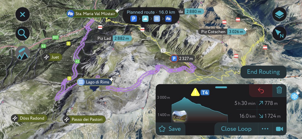
Meanwhile, the hike from Umbrail Pass to Piz Umbrail and Lago da Rims is another standout point-to-point route. The trail begins at the Umbrail Pass on the Swiss-Italian border and heads toward the summit of Piz Umbrail. The scenic descent includes a stop at the alpine lake Lago di Rims. For most parties, this spectacular hike requires transportation to the Umbrail Pass to start (it would add about 10 km and 1,000 meters of elevation gain to complete the full loop from Val Müstair in a day).
Sleeping in the mountains? Browse every hut in Val Müstair on PeakVisor’s hut finder — filter by photos, car or lift access, altitude, or huts with a restaurant to plan a hut-to-hut weekend or a longer trip.
Elm & Klöntalersee, Glarus
Few regions illustrate the difference between popularity and quality as clearly as Glarus. Located less than two hours from Zurich, this canton remains largely absent from international hikers’ itineraries.
Glarus is a minuscule canton with only three municipalities. One classic outing is the Klöntalersee Trail along the shoreline of Klöntalersee, one of the most beautiful mountain lakes in the country. Because it follows the lake and remains relatively flat, this trail is an accessible introduction to the Glarus Alps. A summit objective is the Hirzli Summit Trail. Although not particularly high (1640 meters), Hirzli offers expansive views over the Glarus Alps and still requires a solid 700 meters of climbing to reach it.
The Elm–Ämpächli–Chüebodensee–Wildmadfurggeli route is another option that starts with lift access from Elm. The route is 11.7 km (7.3 miles) long with 882 m (2,893 ft) of elevation gain. From the town of Elm, hikers can take a gondola to Ämpächli. From there, the trail travels through the lush alpine, passing forest, streams, meadows, and small alpine lakes. The jagged peaks of the Glarus Alps are visible throughout the trail’s entirety.
Sleeping in the mountains? Browse every hut in Glarus on PeakVisor’s hut finder — filter by photos, car or lift access, altitude, or huts with a restaurant to plan a hut-to-hut weekend or a longer trip.
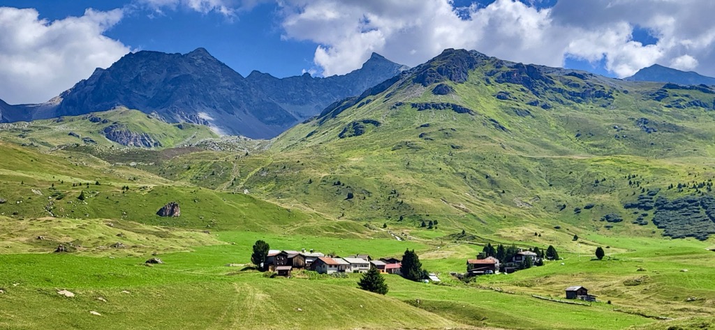
Parc Ela, Grisons/Graubünden
Let’s return to familiar territory: the canton of Grisons/Graubünden. This time, we’re exploring the peaks of Parc Ela, one of Switzerland’s largest regional parks. According to our PeakVisor database, Parc Ela contains no less than 366 named mountains. The highest point is Piz Kesch (3,418 m), a prominent glaciated summit that dominates parts of the park's skyline.
One of the highlights of Parc Ela is Alp Flix, a remarkable high plateau located at 2,000 meters. Often described as one of Switzerland's most beautiful alpine meadow landscapes, the Alp Flix Loop is a signature hike in Parc Ela.
Another standout hike is from Bivio over Lunghin Pass toward Maloja. Starting from the historic mountain village of Bivio, the trail ascends through open terrain to Lunghin Pass. In this hydrological divide, water ultimately flows toward three different seas through separate river systems. From there, the route continues through a landscape of lakes, passes, and broad alpine views toward Maloja.
Sleeping in the mountains? Browse every hut in Parc Ela on PeakVisor’s hut finder — filter by photos, car or lift access, altitude, or huts with a restaurant to plan a hut-to-hut weekend or a longer trip.
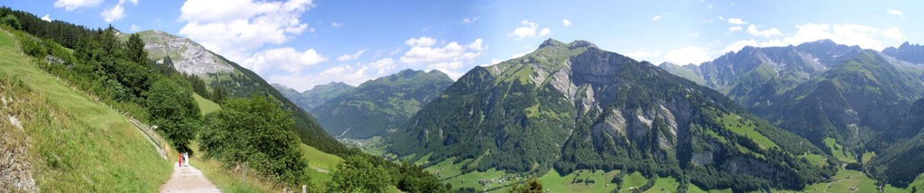
Riviera–Pays-d'Enhaut, Vaud
Many visitors arrive in Switzerland searching for a combination of mountains, lakes, and easy access. Most end up in Interlaken. Yet on the northeastern shore of Lake Geneva lies a region that delivers many of the same ingredients with a fraction of the crowds. While the Riviera–Pays-d’Enhaut mountains don’t quite stand up to the Swiss Alps, the overall scenery is just as spectacular. Plus, the access is very straightforward by road or from Geneva’s international airport.
The region contains 95 named mountains, according to PeakVisor’s data, and stretches from the shores of Lake Geneva into the rugged Vaud Prealps, where the highest point is Vanil Noir (2,389 m), a handsome limestone summit. For hikers seeking a more challenging objective, Vanil Noir is the go.
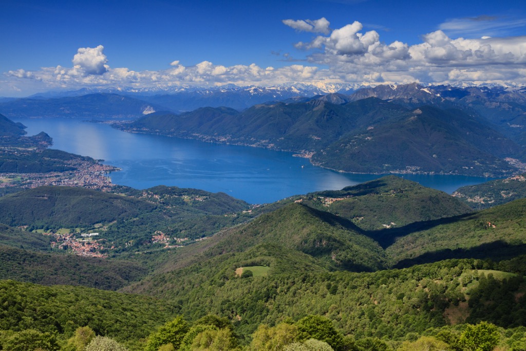
No matter where you hike in this region, you’ll spend much of your time overlooking Lake Geneva, one of Europe's largest lakes. The magnificently blue lake is framed by vineyard-covered slopes, forested ridges, and distant Alpine peaks; hence, it has long been known as the Swiss Riviera.
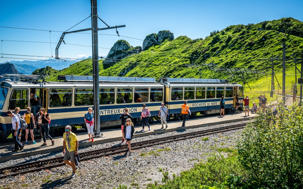
For many tourists, the standout destination is undoubtedly Rochers de Naye, one of Switzerland's finest viewpoints. Rising above Montreux, this mountain features a historic cogwheel railway that climbs directly from the lakeshore. From the summit, hikers enjoy panoramic views spanning Lake Geneva, the Vaud Alps, the Bernese Alps, and, on clear days, Mont Blanc. From the summit, you can venture off for a day on the trail; one of the best options is the ridge surrounding Dent de Jaman.
One of the Riviera’s strengths is its infrastructure. It’s not as remote as the other valleys on this list. There are plenty of mountain huts/restaurants to visit, and lift systems that provide access to moderate hiking terrain.
Sleeping in the mountains? Browse every hut in Riviera–Pays-d’Enhaut on PeakVisor’s hut finder — filter by photos, car or lift access, altitude, or huts with a restaurant to plan a hut-to-hut weekend or a longer trip.
Verzasca & Vallemaggia, Ticino
Southern Switzerland has three large, mountainous cantons. We’ve already featured the Valais and Grisons; Ticino is the third of these cantons.
When travelers think of Ticino, they picture palm trees, lakeside promenades, and the Mediterranean atmosphere of Lugano and Locarno. Many visitors don’t even realize that Ticino is in Switzerland because of its Italian name.
Beyond the famous—and crowded—waterfronts lies one of the most diverse mountain landscapes in Switzerland. For hikers, the real appeal of Ticino begins where the lakefront ends. The mountains rise abruptly above Lake Maggiore and Lake Lugano. Hikers encounter chestnut forests, stone villages, granite gorges, and a culture that feels like a mix of Swiss and Italian.
One of the finest routes near the lakes is the Monte Lema to Monte Tamaro traverse, one of Switzerland's great panoramic ridge walks. The route offers sweeping views of Lake Lugano, Lake Maggiore, the Maggia Valley, the Verzasca Valley, and the Ticino mountain scape.
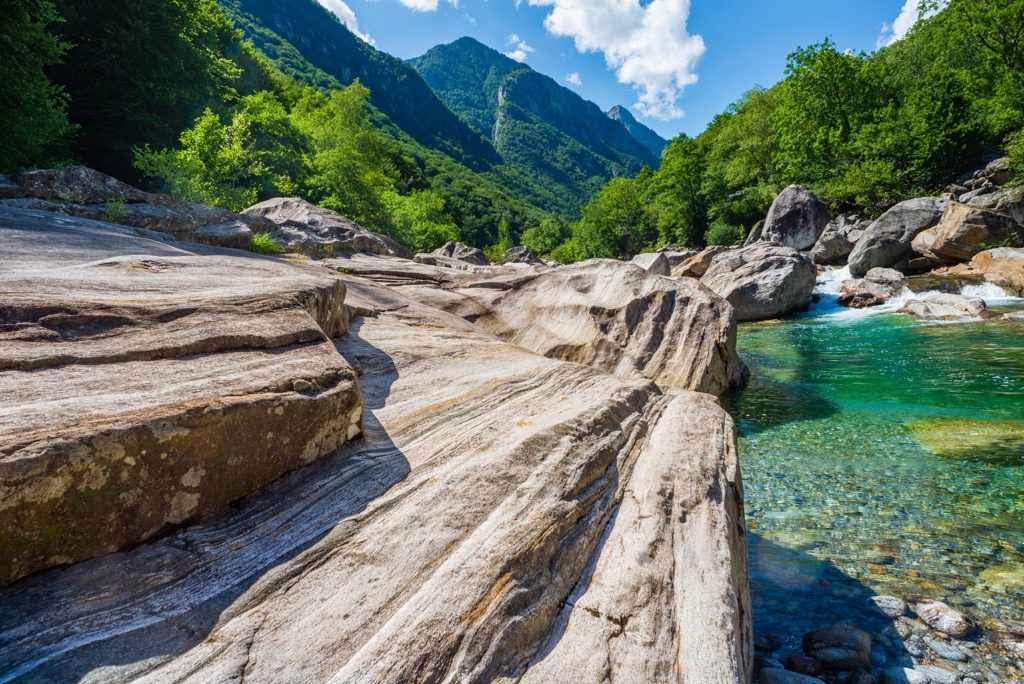
To truly understand the Verzasca Valley, hike beyond the famous emerald pools of the Verzasca River and into the upper reaches of the Valley. While most visitors stop at the heavily photographed stone bridge in Lavertezzo, hikers can continue north through increasingly wild terrain toward Sonogno, the valley's last village, and then onward to the river’s headwaters and several different alpine basins. Because this terrain follows the valley of the Verzasca River, these hikes are relatively accessible and “family-friendly,” at least until you start ascending into the basins.
If you want to head beyond the Verzasca River, two standout hikes to check out are the ascents from Sonogno toward Capanna Barone and Capanna Efra, both famous mountain huts where you can stop for a meal and a well-deserved rest.
Meanwhile, nearby Vallemaggia is equally rewarding. Highlights include routes around Lago del Narèt and Capanna Cristallina, as well as Val Bavona, a side valley of Vallemaggia, which is famous for its enormous glacial erratic boulders, stone hamlets, and waterfalls cascading from steep granite walls.
Though close as the crow flies, it will take some time to drive between Verzasca & Vallemaggia if your goal is to do day hikes. Of course, you could always hike between the two and stay at mountain huts along the way!
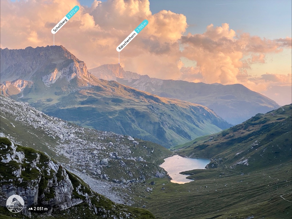
The Rätikon, Grisons/Graubünden
The Rätikon offers yet another kind of mountain experience, deep in the canton of Grisons/Graubünden. Instead of Italy, this part of Grisons stretches along the borders of Switzerland, Austria, and Liechtenstein and is characterized by limestone peaks, as opposed to the granite of Val Bregaglia.
Though most people would not have heard of the Rätikon, it does have a significant claim to fame. That’s because one of its peaks, Schesaplana, is featured in the 1880 children’s book Heidi, one of the best-selling books of all time.
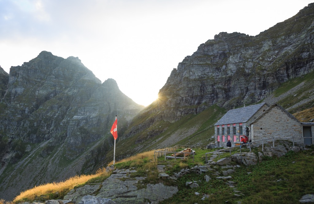
The finest hike in the Swiss Rätikon is arguably the traverse from St. Antönien to the Carschinahütte, one of the classic mountain huts. Beginning in the mountain village of St. Antönien in Prättigau, the route climbs through alpine meadows toward a spectacular limestone amphitheater. The massive limestone walls of Drusenfluh, Sulzfluh, and neighboring peaks rise above the trail.
Although the Austrian side is more popular, you can also hike Schesaplana from the Swiss side and stop at the Schesaplanahütte. It’s much less crowded than the Austrian side, but it is also more difficult to access (no lift access).

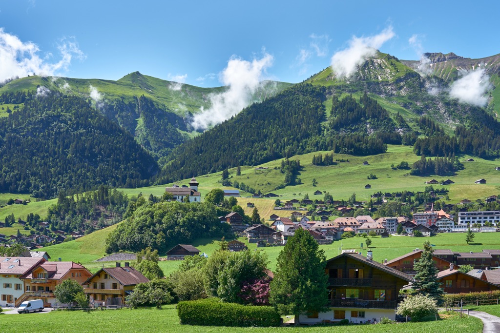
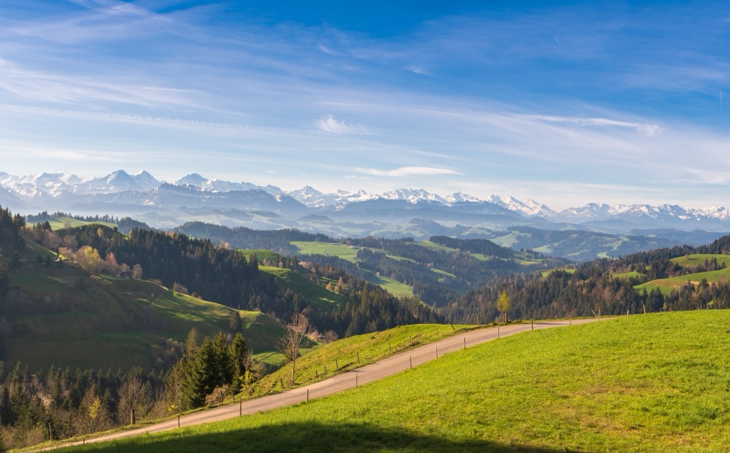
Emmental, Bern
Though undoubtedly more famous for its cheese, the Swiss Emmental region is also a standout hiking destination, with a relatively gentle landscape of rolling hills, farms, forests, meadows, and villages. It's a part of Switzerland that many international visitors drive through on their way to more famous destinations, without realizing that they're already exactly where they need to be.
The wider Emmental contains 168 named mountains, according to our PeakVisor data, and encompasses a stretch between the Bernese Alps and the Swiss Plateau. The most famous peak is Napf (1,408 m), one of the great viewpoints of central Switzerland. Beyond the bucolic pastureland, you can see the peaks of the Bernese Oberland shining in the distance.
Napf has a railway running to the summit, so it's not exactly off the beaten path. To break away from the crowds, we recommend the high ridge between Lüderenalp and Napf. This rolling ridge traverses a sizable tract of the range, clocking in at 12.2 km one-way. So not exactly an easy hike, despite the relatively gentle terrain (compared to the Alps).
While Napf occupies the pastoral side of Emmental, Hohgant (2,197 m) sits along the alpine edge. Check out the trail to the summit as well as the nearby Hohganthütte.
Jura Mountains
Want to avoid the Alps entirely but still sneak in some stellar hiking? Look no further than the Jura, which forms Switzerland's northwestern frontier along the French border. From many parts of Switzerland, such as Geneva, the Jura is quick and easy to access, and locals often choose to hike, bike, and recreate here rather than make the trek to the touristy Alps.
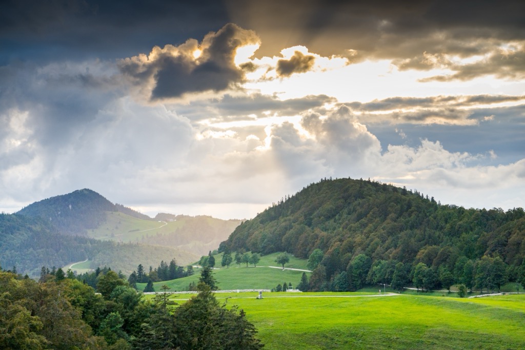
One of the classic Jura hikes is the Le Noirmont Trail, which traverses forests and idyllic pastureland. Another highlight is the area surrounding the Étang de la Gruère. This protected peat bog and wetland environment is highly biologically productive and, therefore, ecologically important. Trails around the pond pass through forests and open moorland.
The Jura is a great place to check out if you find yourself in Switzerland in the shoulder seasons. While many Alpine regions remain snow-covered well into spring or become difficult to access late in autumn, much of the Jura remains walkable for a significantly longer portion of the year. In fact, much of the range now remains snow-free in winter due to our new climate regimen.
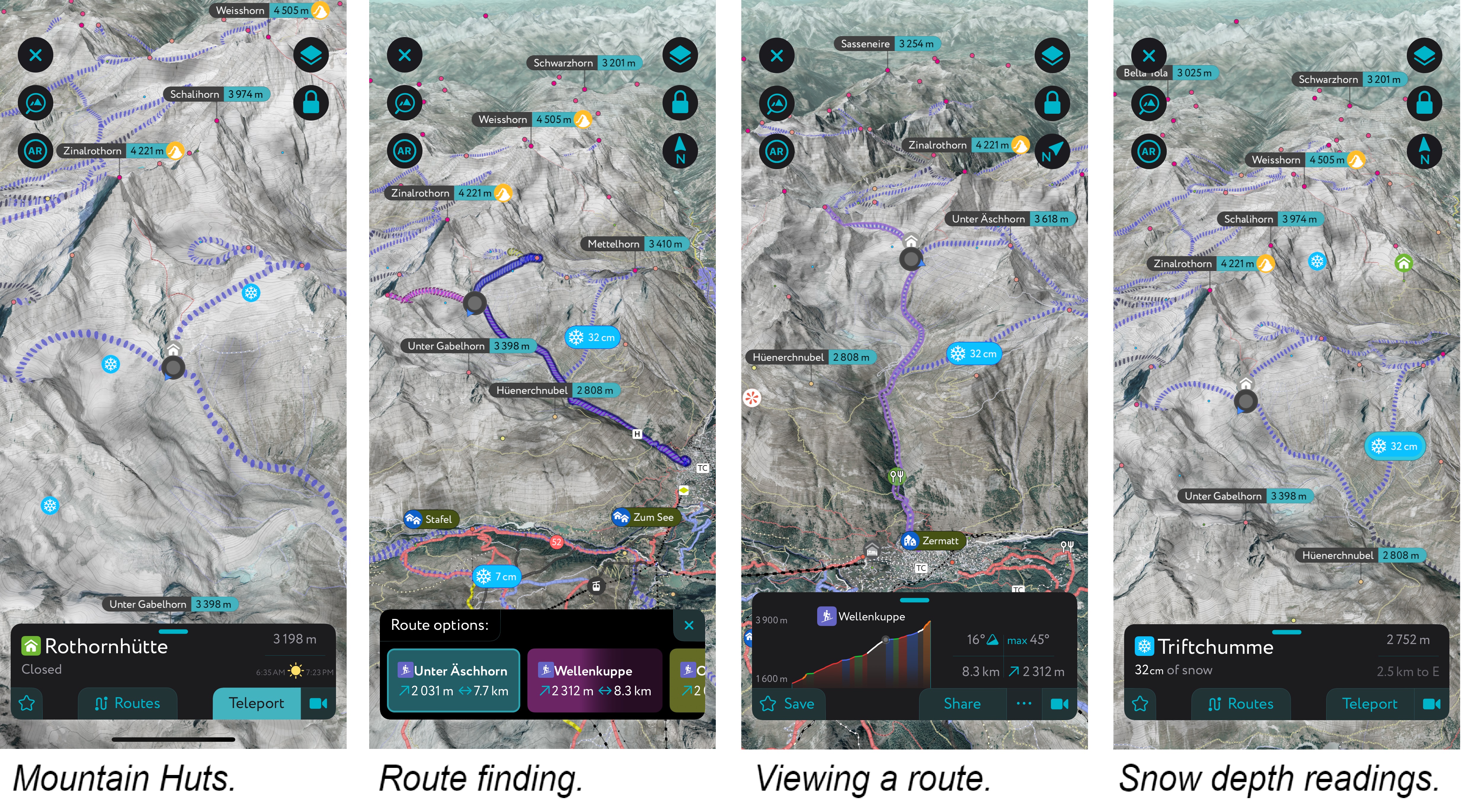
Using PeakVisor to Plan Hikes
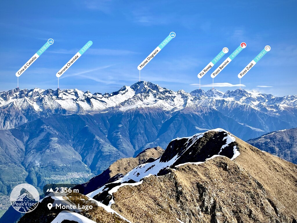
If you liked this story, you should know that it was brought to you by the one and only PeakVisor App. PeakVisor is a leader in the augmented reality 3D mapping space; we're the product of nearly a decade of effort from a small software studio smack dab in the middle of the Alps.
PeakVisor Features
In addition to the visually stunning maps, PeakVisor's advantage is its variety of tools for the backcountry:
- Summer and winter modes let you use the app year-round, whether hiking on trails or skiing backcountry routes.
- Thousands of hiking and ski touring routes throughout Switzerland, the European Alps, and beyond.
- Slope angles help evaluate hiking terrain and difficulty.
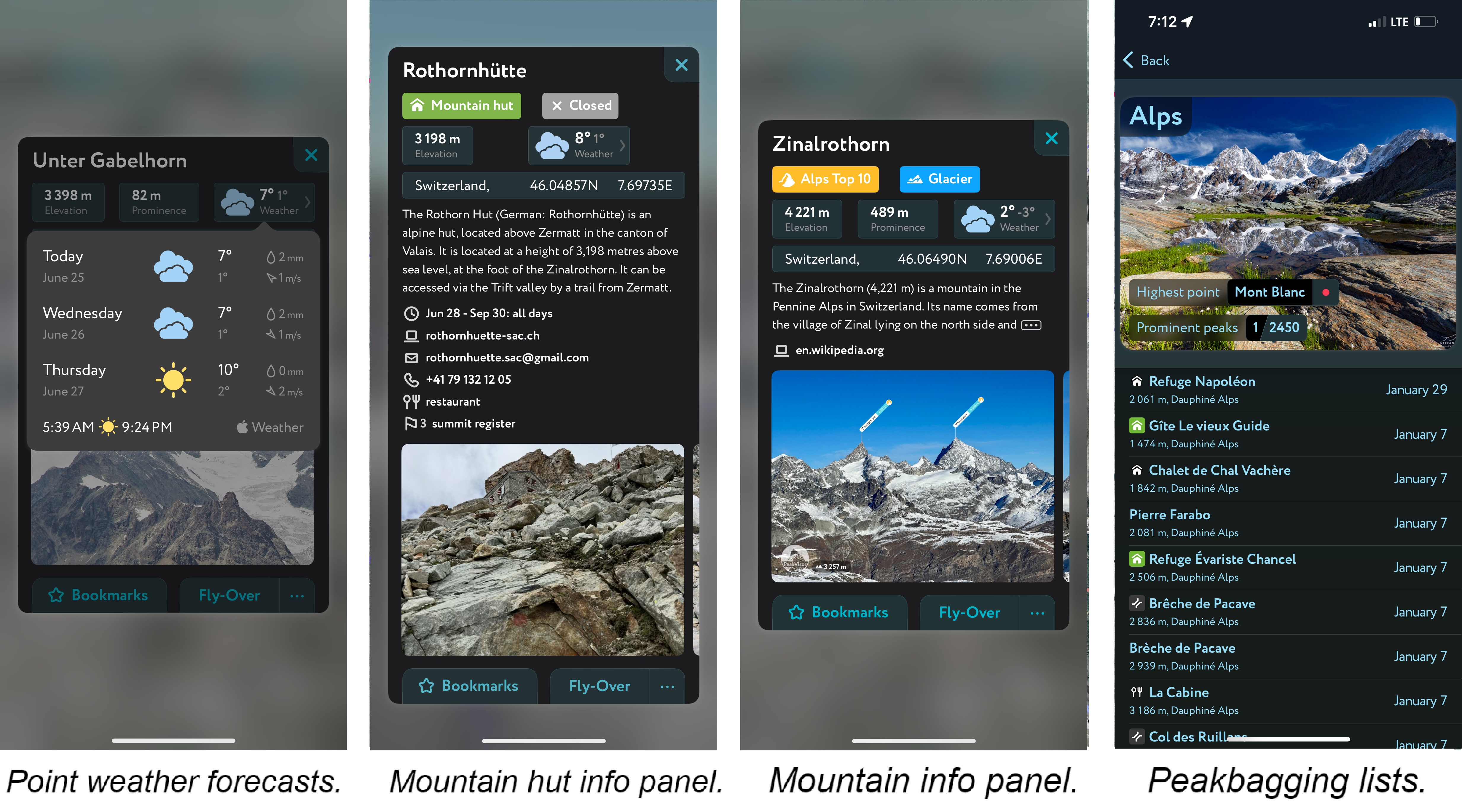
- Mountain hut schedules and contact info save the time and hassle of digging them up separately.
- The route finder feature generates a route for any location on the map. You can tap the route to view it in more detail, including the maximum and average slope angle, length, and elevation gain.
- A point weather forecast for any tap-able location on the map, tailored to the exact GPS location to account for local variations in elevation, aspect, etc., that are standard in the mountains.
- You can use our Hiking Map and Ski Touring Map on your desktop to create GPX files for routes to follow later in the app.