
What if the mountains in your videos could introduce themselves?
We are testing a new feature in the PeakVisor mobile app: import a mountain video and, when the clip includes location data, PeakVisor can identify the summits in view and place their names directly over the footage.
The video below shows an early demo, not the final interface. We plan to make the demo available later in September, and we want to test it against a much wider range of landscapes before then.
Why Location Data Matters
The location attached to a video tells PeakVisor where the camera was. The app can then align the footage with the surrounding 3D terrain, work out which mountains were visible from that viewpoint, and add the corresponding labels.
That means the original file is important. A copied or forwarded version may no longer contain the location metadata needed for the demo.
From Photos to Moving Landscapes
This experiment builds on Import Photo, which PeakVisor introduced several years ago. The existing tool can identify mountains and other landscape features in a geotagged photograph. The new demo brings the same idea to a moving scene.
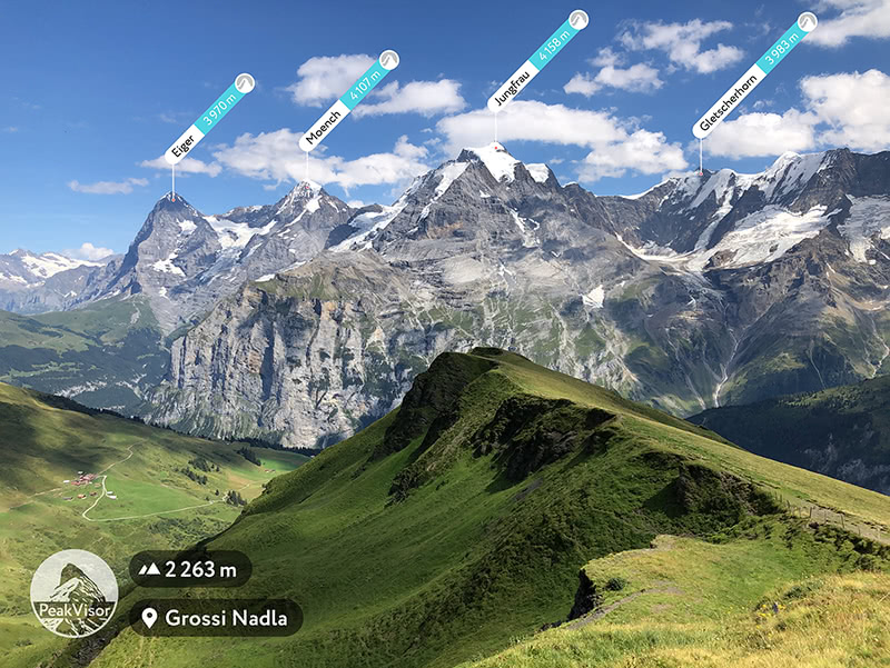
Help Us Test the Demo
The Alps are a useful test case, but they are not enough. We are looking for mountain videos from every kind of terrain and from as many parts of the world as possible. The farther-flung, the better.
Please send:
- a video with a clear mountain landscape;
- the original file, with its location metadata intact;
- the name of the place where you filmed it, if you know it.
Email your video to info@peakvisor.com. If you are happy for us to share the resulting demo publicly, mention that in the email too.
We will run the footage through the current build and see how the labels stack up. Remote ridges, volcanic skylines, desert ranges, island mountains — we want to see what the demo makes of them.