
Scan the QR code and open PeakVisor on your phone
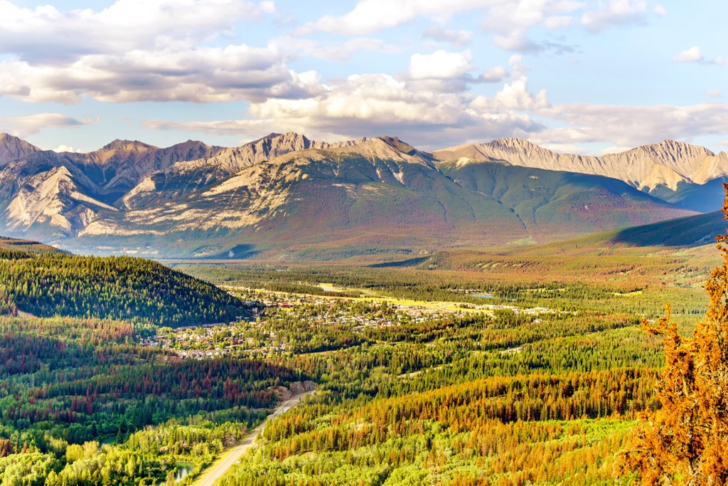
Yellowhead County is in central Alberta, Canada, east of Jasper National Park and Willmore Wilderness Park. With an area of 22,293 square kilometers (8,607 square miles), the county reaches from the Front Ranges of the Rocky Mountains through the foothills and has over 41 peaks. Ruby Mountain (2,900 m/9,514 ft) is the tallest and Blackface Mountain (2,867 m/ 9,406 ft) is the most prominent.
Yellowhead County is in central Alberta, Canada, and it covers 22,293 square kilometers (8,607 square miles), including some of the front ranges of the Canadian Rockies and their foothills. The Yellowhead Highway, Highway 16 is the primary highway through the county which runs between Jasper National Park and Edmonton, the capital of the province.
Going clockwise around the county, Yellowhead County is bordered by the Municipal District of Greenview in the north, followed by Woodlands County, Lac Ste. Anne County, Parkland County, Brazeau County, Clearwater County, Jasper National Park, and Willmore Wilderness Park.
Jasper National Park and Willmore Wilderness Park border the west side of the county, and the following are provincial parks and other recreational and wilderness areas in the county.
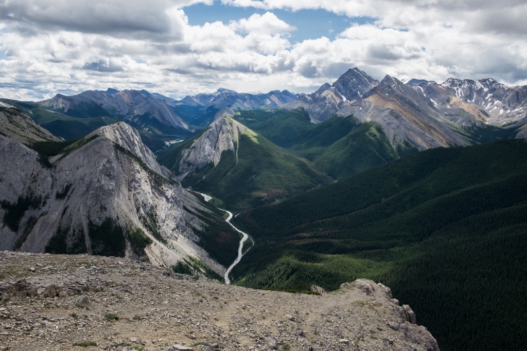
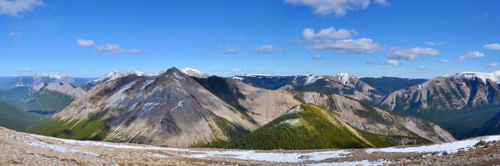
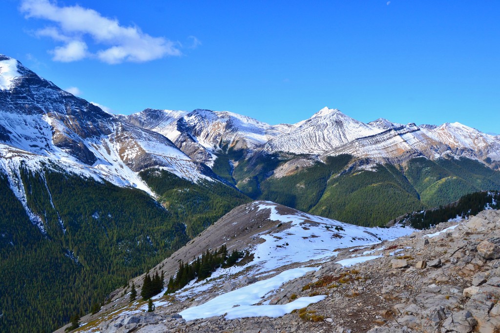
The physiography of Yellowhead County includes the Canadian Rockies and their foothills. There are 40 named peaks in Yellowhead County which are part of the Bosche Range, De Smet Range, Fiddle Range, and the Nikanassin Range.
While the mountains of Yellowhead County started forming about 100 million years ago, the rocks that make the mountains of the county are often over 350 million years old. Over 350 million years ago, the western shores of Canada were located somewhere in western Alberta with a vast shallow that covered the continental shelf.
Over millions of years, layers of marine sediment from cyanobacteria and other organisms settled to the bottom of the sea, with the calcite cementing the sediment together into layers which were many kilometers thick. The layers of marine sediment were pressed together to form limestone, which is the most common type of rock in the Rocky Mountains.
Around 100 million years ago, most of the mountains of the Canadian Cordillera had started forming, such as the Columbia Mountains, BC’s interior mountains, and the Coast Mountains. These mountain ranges formed as oceanic tectonic plates collided with the west coast, adding exotic terranes, and compressing the land.
The Rockies were formed during an event called the Laramide orogeny, which lasted from about 85 million years ago to 40 million years ago. During this time the mountains rose above sea level, likely no faster than 30 cm (12 in) a century.
Typically, during tectonic collisions the mountains form along the coastline, such as what happened with the rest of the Canadian Cordillera. However, it is speculated that since the land between the Rockies and the coast had already been compressed, folded, broken, and uplifted into mountains that the force of the tectonic collision pressed inland, until it cracked the rocks along the ancient continental margin.
As such, the fact that the Rockies are younger than their western counterparts is one of the many reasons that make them special. While some of the other ranges in the cordillera were made in part by volcanism, the Rockies were created through the process as thrust faulting.
Thrust faulting is where the layers of rock are broken along fault lines and thrust (pushed) over younger layers of rock. The Rocky Mountains which are on the west side of the county consist mainly of Paleozoic limestone that was pushed on top of Cretaceous sandstones and shales.
The foothills, which are located to the east of the mountains, are mainly made of Cretaceous shale and sandstone. The foothills were made towards the end of the Laramide orogeny, when the force of the tectonic collision was waning and there was no longer sufficient force to crack and uplift the layers of Paleozoic limestone.
The foothills are predominately made from the Cretaceous aged layers of shale and sandstone that buckled, broke, and were thrust up. Since the layers of rock in the foothills didn’t stack like the layers that formed the mountains, the foothills look like rows of shingles on a roof with predictable valleys and ridges.
As the mountains and foothills were being created, forces of nature were tearing them down. Water and wind eroded the rock and shaped the landscape for millions of years. Furthermore, several million years ago the earth cooled, and glaciers began to cover Canada, and ice sheets coalesced along the eastern slopes of the county.
Each time glaciers formed and crept down the mountains, they wiped out most of the evidence of previous glacial maximums. As such, most of the current topography of Yellowhead County was created from the final major glacial maximum of the Pleistocene, which ended about 12,000 years ago.
The pre-glacial valleys were buried in sand and gravel from at least four ice sheets of the Pleistocene. Furthermore, Yellowhead County is where the cordilleran and continental ice sheets met and there is a delineation where glacial debris to the east is only from the Canadian Shield and debris found in the west originated in the Rocky Mountains.
As the glaciers advanced, they carved out valleys cirques and as the glaciers retreated, deposits of sand, gravel, and rocks were left across the county. Some of the deposits filled in low lying areas while other deposits created kames, moraines, and eskers.
The ecosystems in Yellowhead county are part of the Rocky Mountain and the Foothills Natural Regions. The Rocky Mountain Natural Region covers the slopes and valleys of the Nikanassin and Fiddle Range which lay along the western border of the county while the rest of the county is in the foothills.
In the mountains, a mosaic of forest and meadows are typical, with forest of lodgepole pine, Douglas fir, Engelmann spruce, white spruce, and jack pine. Stands of aspen are common, especially in dry meadows. Poplar and willow can be found along damp creek banks and larch tend to grow along the subalpine ridges.
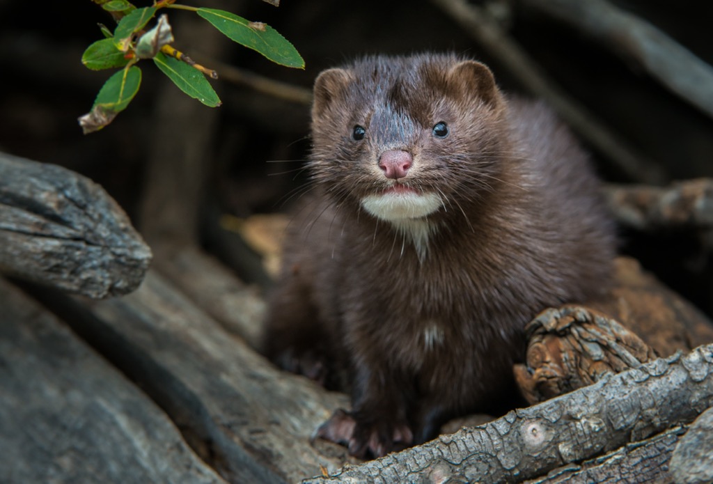
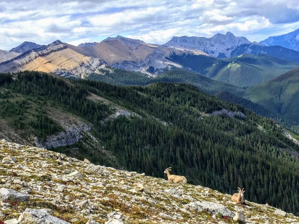
Grizzly and black bears, moose, elk, deer, wolves, and cougars are some of the large mammals that inhabit the mountains of Yellowhead County. Mountain goats and bighorn sheep can be found in the alpine areas of the county as well as hoary marmots and pika.
There are many bird species that live in and migrate through Yellowhead County. Some of the birds that you may see while exploring the county are the hermit thrush, white-crowned sparrow, and Brewer’s sparrow which are often found just below the alpine subregion. MacGillivray’s warbler, warbling vireo, and the lazuli bunting prefer stands of aspen and poplar.
In the foothills of Yellowhead County, the ecosystem is similar to the lower elevations of the Rockies. The forests are filled with stands of lodgepole pine, Douglas fir, and white spruce. Aspen and poplar are common in the valleys between the foothills.
The foothills are a transitionary ecosystem that bridges the Rockies with the prairies and the boreal forests, and therefore have many of the same animals that inhabit the mountains. Some of the additional animals that are more common in the foothills than the mountains of Yellowhead County are white-tailed and mule deer, Columbian ground squirrels, grey jays and crows.
The recent history of Yellowhead County includes the environmental recovery of many areas that have been logged and the closure of many coal mines along the eastern slopes. The eastern slopes have an abundance of coal that has been mined since the nineteenth century and the foothills have long held productive forests for commercialization and industry.
In the beginning of the twentieth century, the Grand Trunk Railway completed their “Coal Branch”, which is a rail line that services the mines along the eastern slopes of the Rockies, south of Hinton. However, most of the mines closed as coal prices plummeted mid-century and the residents of the area moved away in search of work.
Before settlers, the westward expansion of the fur trade brought members of the Cree and Stoney First Nations during the seventeenth and the eighteenth centuries. As the Cree and Stoney migrated west, into what is now Yellowhead County, they encountered members of the Tsuu T’ina and Ktunaxa First Nations.
The Tsuu T’ina now reside near the city of Calgary, in southern Alberta; however, they were originally a group that broke off from the Dane-zaa, who lived in the boreal forests to the north. After separating from the Dane-zaa, the Tsuu T’ina originally settled near Edmonton, in central Alberta. However, conflict with the migrating Cree, who came with the fur traders, forced the Tsuu T’ina to migrate south.
For generations, the Ktunaxa inhabited and hunted from their homes in the Columbia and Kootenay River Valleys to the foothills and prairies, east of the Rocky Mountains. Their traditional hunts included venturing east of the Rockies to hunt bison; however, the advancing of the Stoney and Blackfoot Confederacy forced the Ktunaxa to withdraw back across the Rockies.
The territory along the eastern slopes of the Rockies is part of a migration route that began to open at the end of the Pleistocene when the glaciers receded. The archeological record shows that people began to hunt in and inhabit the foothills and mountain valleys about 10,000 years ago.
Encompassing some of the eastern ranges of the Canadian Rockies and their foothills, Yellowhead County has some incredible places for hiking and exploring. The following are some of the major parks, trails, and attractions in Yellowhead County.
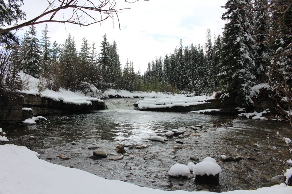
About 30 km (18 mi) south of Hinton, Gregg River Falls offers enjoyable scenery and a fun place to spend a hot afternoon. The large, flat rocks that line parts of the river make excellent spots for picnicking and enjoying the sun. The clear pool and the falls are a fun place to cool off throughout the day.
A local favorite, Gregg Falls is located off Highway 40, south of Hinton The wilderness setting and proximity to other great attractions make it a wonderful place to spend an afternoon.
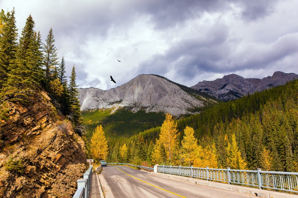
The Coal Branch Public Land Use Zone (PLUZ) is an area of public lands that are adjacent to the eastern border of Jasper National Park. The PLUZ includes the Fiddle Range and the Nikanassin Range, both of which have some incredible trails for hiking, as well as OHV use.
Some of the popular trails in the Coal Branch PLUZ are the Devona Lookout Trail and the trail to Mystery Lake. The Fiddle Peak Loop is a challenging excursion where hikers summit Fiddle Peak, Roche á Perdrix, and Folding Mountain.
The wilderness surrounding Rock Lake and Solomon Creek has an extensive network of trails. Some of the trails have been constructed as recreational trails, while others are abandoned resource roads, old pack trails, fur trade routes, and historic trails that were used by the indigenous.
Some of the popular trails in Rock Lake – Solomon Creek Wildland Provincial Park are the trail that takes hikers into Ogre Canyon along Brule Lake, and the trail to Busby and Moosehorn Lake, which are often used as a rest area before continuing trekking into Jasper National Park. There is also the Mumm Creek trail that leads travelers through the wildland provincial park and into Willmore Wilderness Park.
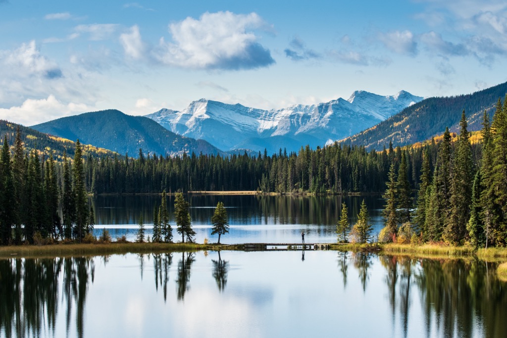
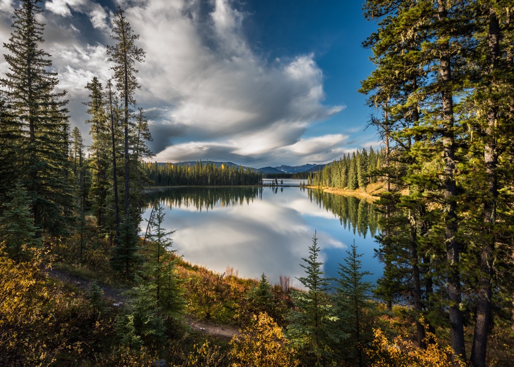
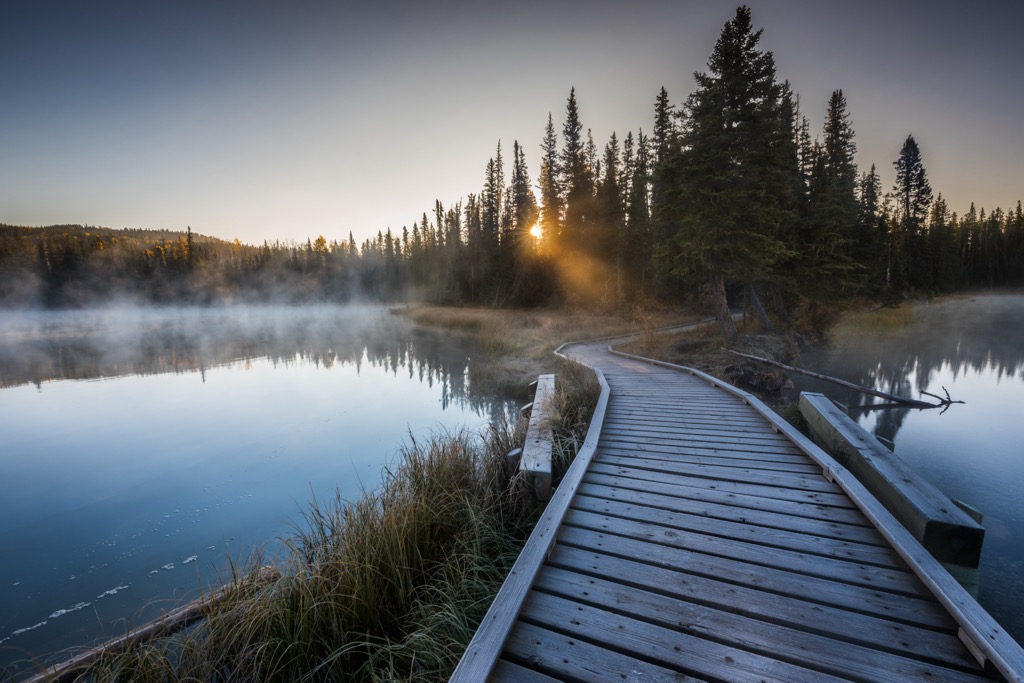
There are many activities to enjoy in William A. Switzer Provincial Park, no matter the time of year. The park is situated in a valley and encompasses five lovely lakes that are connected by Jarvis Creek. Some of the activities to enjoy in the park are swimming, boating, fishing, hiking, and camping.
There are over 65 km (39 mi) of trails in the park that are great for hiking and biking in the summer or snowshoeing and cross-country skiing in the winter. During the winter, visitors can ice fish along the creek, or wait for summer and take a boat onto one of the five lakes to cast a line.
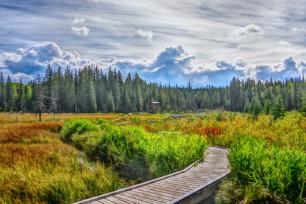
Furthermore, Jarvis Creek has a wonderful canoe route. Visitors can follow the interpretive canoe route along Jarvis Creek, which is one of the most ecologically intact river valleys in the Alberta foothills.
Yellowhead County is between Edmonton, the capital of Alberta, and Jasper National Park. The following are the towns in the county and some nearby communities where you can find accommodations, food, services, and whatever you may need to explore the wilderness in and around Yellowhead County.
Edmonton is about 100 km (60 miles) east of Yellowhead County, and it is the capital city of Alberta. The city is North America’s most northern metropolis, and it is the gateway to Canada’s incredible northern wilderness.
The winters are long and dark; however, there are spectacular views of the northern lights from around the city. The summer days are long and give plenty of time to explore the wilderness areas around the city.
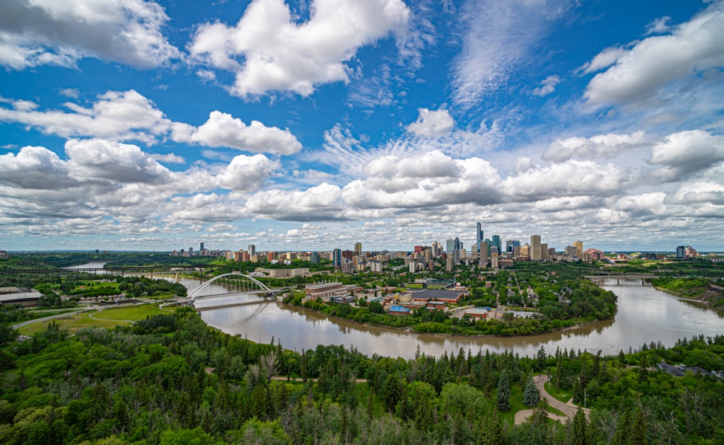
Within the city, there are many park areas that are great for walking, especially along the shores of the North Saskatchewan River. Some of the hiking and wilderness recreation areas around Edmonton are Jasper National Park, Elk Island National Park, Miquelon Lake Provincial Park, and Beaverhill Lake Heritage Rangeland Natural Area.
Hinton is situated at the west end of Yellowhead County and is essentially the gateway to Jasper National Park. The town is nestled beside the Rockies, and it has many opportunities for wilderness experiences and adventures.
In town you can walk along the Athabasca River at Athabasca Riverfront Park, or you can walk along the Beaver Boardwalk, which is the world’s longest freshwater boardwalk. Furthermore, you can practice your bike skills at the Hinton Mountain Bike Park before you hit the wilderness trails or cool off at the local spray park on a hot day.
Once you’re ready to get out of town, Jasper National Park is just west of Hinton and there are many opportunities for hiking, skiing, biking, camping, and much more. There are also many places outside of the national park that are worth a visit, such as the lakes of William A. Switzer Provincial Park to cool down on a hot summer day or perhaps a hike or trail ride along the eastern slopes, touring the Coal Branch area.
Edson is situated along the Yellowhead Highway, which runs through the middle of Yellowhead County. The town is among the foothills of the Rockies, and it provides a great location to rest from a long day of driving or to prepare for wilderness adventures. You and the kids can cool down at the local spray park or escape the weather by visiting the local museum.
Some of the popular activities around Edson include boating, fishing, camping, cross country and downhill skiing, paddling, snowmobiling, mountain biking, hiking, trail riding, and hunting. Some of the nearby places to enjoy these activities are at Sundance Provincial Park, Obed Lake Provincial Park, Rock Lake – Solomon Creek Wildland Provincial Park, and Jasper National Park.
Situated along the Athabasca River, in the Athabasca Valley, Jasper is the commercial and service center for Jasper National Park. It is a quaint town that has the stunning scenery of the Rockies, accommodations, restaurants, and access to some of the most beautiful wilderness areas in Canada.
The 80 km (48 mile) route from Hinton to Jasper is incredibly scenic and you’ll have the pleasure of passing beside many of the park’s stunning ranges. The Fiddle Range, Miette Range, Jacques Range, and Colin Range are along the south side of the highway and the Boule Range, Bosche Range, De Smet Range and Victoria Cross Ranges are north of the Yellowhead Highway.
Pyramid Mountain overlooks Jasper from the north while Roche Noir, Majestic Mountain, and Mount Edith Cavell are seen to the southwest. There are many opportunities for hiking, backpacking, wildlife viewing, fishing, and paddling throughout the park.
Some of the most popular places to visit while staying in Jasper are the nearby Miette Hot Springs and the stunning Maligne Lake. While some of the best trails include Valley of the Five Lakes, Maligne Canyon Loop, Sulphur Skyline Trail, and Edith Cavell Meadows Trail.


