
Scan the QR code and open PeakVisor on your phone
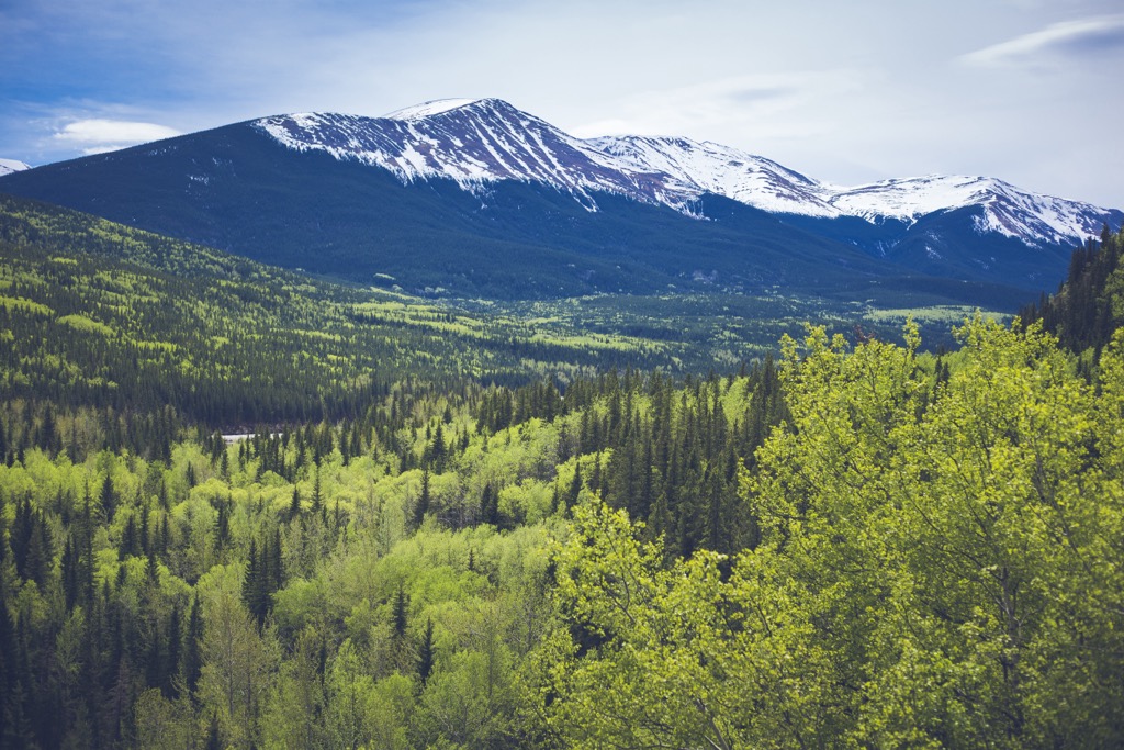
The Municipal District of Greenview (Greenview) stretches to the prairies from the eastern slopes of the southern Hart Ranges of the Far Northern Rockies in Alberta, Canada. Mount May (2,450 m/8,038 ft) is the tallest of the district’s 36 named peaks and Grande Mountain (1,987 m/6,519 ft) is the most prominent, with 859 m (2,818 ft) of prominence.
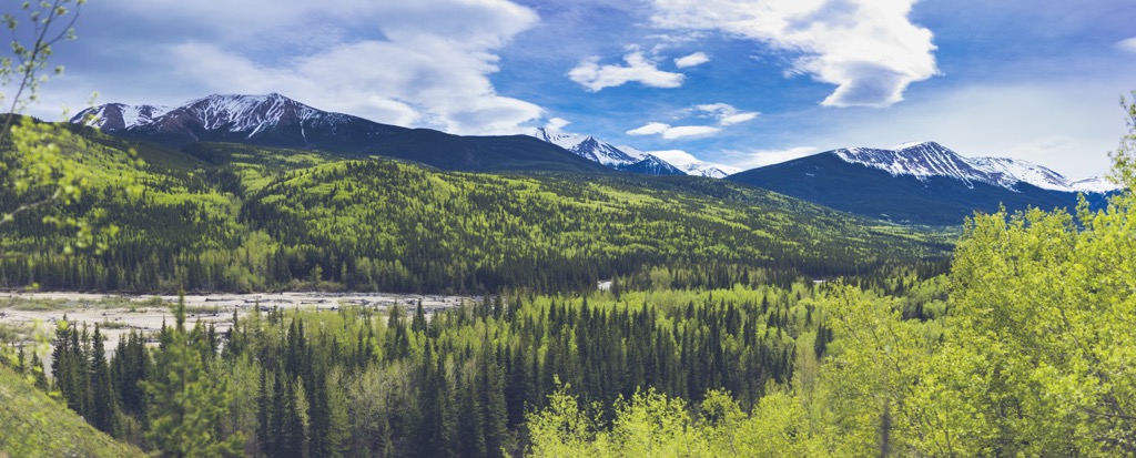
Located in central Alberta, Canada, Greenview is filled with the majestic peaks of the Rocky Mountains, stunning blue lakes, wild rivers, untouched meadows, and a vast wilderness to explore. Greenview stretches east from the Hart Ranges along the BC- Alberta border into the vast forests and prairies of central Alberta.
Greenview is the largest municipal district in Alberta, covering 32,984 square kilometers (12,735 sq mi). The bordering counties include the County of Grande Prairie which is north of Greenview, Big Lakes County which is located to the east, and Yellowhead County shares Greenview’s southern border.
The administrative offices are in the town of Valleyview, and Fox Creek is the only other town in Greenview. The district also includes the hamlets of Grande Cache, Little Smoky, Ridgedale, Landry Heights, Grovedale, and DeBolt, as well as many smaller localities.
The Sturgeon Lake Cree Nation is within the borders of Greenview and the district is serviced by Highway 40, 43, 49 and a railway. The city of Grande Prairie is northwest of Greenview, and it is a major service center. Grande Prairie has a regional airport that provides transportation from major cities, such as Edmonton and Calgary, and to destinations in the Peace Region of Alberta and BC.
Kakwa Wildland Provincial Park is in the southwest corner of Greenview and the municipal district is bordered by Willmore Wilderness Park, and Kakwa Provincial Park in BC. The following are some other major parks that are near the MD of Greenview:
Greenview encompasses two major geological features, which are the Far Northern Rockies, along with their foothills, and the Western Canadian Sedimentary Basin which underlies the rolling forests and prairies of the district.
The southeast Hart Ranges of the Far Northern Rockies reach into the west side of Greenview and are protected as part of Kakwa Wildland Provincial Park. The six tallest peaks in the district are Mount May, George Peak, Francis Peak, Mount Gorman, La Creche Mountain, and Kakwa Mountains, which are all in Kakwa Wildland Provincial Park and part of the Hart Ranges.
The Hart Ranges and Canadian Rockies were created from the uplift of the ancient continental margin. The Rockies formed during an event called the Laramide orogeny which occurred between 85 and 45 million years ago. The Laramide orogeny was caused when tectonic plates under the Pacific Ocean continued to collide and subduct beneath the west coast of North America.
Before the Laramide orogeny and the formation of the Rockies, tectonic subduction had added to the west coast of Canada and created the mountains between the Rockies and coast. As the tectonic plates continued to press against the continent, the fractured and buckled land wouldn’t give anymore, so the force was transferred inland, along the ancient continental margin.
Layers of Paleozoic limestone were overlain with Cretaceous aged sandstone and shale along the ancient continental margin. During the Laramide orogeny, the force of the collision compressed, heated, bent, fractured, and thrust up the Paleozoic layers upon the surface to the east, forming mountains. For millions of years the pressure would create faults which would then be lifted to create the Rockies.
The foothills which are east of the Rockies are like an afterthought to the orogeny. The foothills are lower than their mountainous counterparts to the west in large part because the orogeny was running out of energy.
As the orogeny was ending, there was only enough energy to crack and uplift the upper layer of Cretaceous aged rocks. As such, the Hart Ranges are primarily composed of limestone, whereas the foothills are mostly peaks of younger layers of sandstone, shale, and other terrestrial origin sedimentary rocks.
The Western Canadian Sedimentary Basin (WCSB) is a relatively flat wedge of sedimentary rocks that extend from the Rockies to the Canadian Shield. From Precambrian times until the Jurassic, the area of the WCSB was along the continental margin of ancient North America and was typically submerged beneath the ocean.
For hundreds of millions of years marine sediment accumulated along the continental margin upon an Archean aged platform. The accumulation of marine sediment along the coast was relatively uninterrupted until the Jurassic, when two major orogenic events changed the west coast of North America.
During the Columbian and then the Laramide orogeny, North America collided and accreted outboard terranes to the west coast. During the collision, the western edge of the basin, which was extending from the continental margin, was pushed down.
Subsequently, the downwarp of the basin filled with the rubble which was shed from the developing Rocky Mountains. While much of the wedge was destroyed through uplift and erosion, the western edge of the basin is still about 6 km (3.6 mi) thick under the Rocky Mountains. The erosional sediment from the forming mountains formed the upper layers of the basin.
The WCSB is one of the world’s largest reserves of oil, gas, and coal. How and when the different layers of the basin formed created the different fuel sources that are found throughout the basin. Conventional oil has been discovered across most of the basin, while the oil sands are primarily found in northern Alberta. Coal is abundant along the eastern slopes of the Rockies and natural gas is most abundant in southern Alberta.
Three of the six natural regions of Alberta are found in Greenview. The southwest of Greenview is part of the Rocky Mountain Natural Region which transitions to the Foothills Natural Region. The north end of Greenview is part of the Boreal Forest Natural Region.
Starting in the north end of the district, the forests are part of the great boreal forest which spans northern Canada. These forests are among the warmest of the Boreal subregions and it has the longest growing season. Wetlands commonly occur in low-lying areas and forests of aspen, poplar, jack pine, and white spruce cover the uncultivated areas of the region.
Moving south through Greenview, the gently rolling landscape of the boreal forest gives way to the sandstone ridges and hills of the foothills. The foothills are a transition between the mountains and the flatlands and as such they contain a wider variety of plant and wildlife then the adjacent natural regions.
The forests of the foothills typically contain lodgepole pine, Engelmann and white spruce, Douglas Fir, aspen, and poplar. The absence of lodgepole pine is what delineates the forests of the foothills with the forests of the Boreal Forest Natural Region which covers the north end of the district.
Finishing in the southwest corner of the district, the foothills end, and the eastern slopes of the Rockies rise dramatically above the densely forested foothills. The Rocky Mountain landscape is divided into a matrix of forest and grasslands. The typical Rocky Mountains forests have lodgepole pine, Engelmann spruce, aspen, subalpine fir, and larch.
In Kakwa Wildland Provincial Park, which is part of the Rocky Mountain Natural Region, over 450 plants have been identified, including 30 listed as rare in Alberta. There are also 28 plant species that are at the extreme edge of their range.
There are a wide variety of bird species that inhabit and migrate through the region. Some of the species you may see are yellow warblers, American redstarts, song sparrows, northern waterthrush, and fox sparrows. Other bird species in the area include the yellow-bellied sapsucker, Swainson’s thrush, solitary vireo, and the magnolia warbler. Osprey and loons nest near the lakes of Two Lakes Provincial Park.
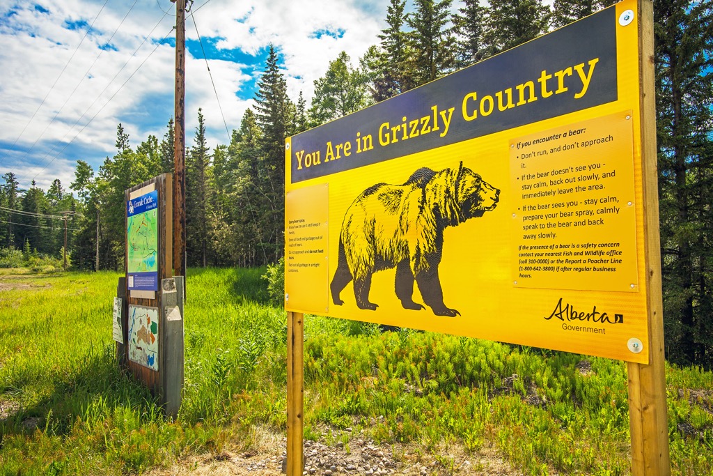
Elk, grizzly bears, bighorn sheep, and mountain goats inhabit the mountains and foothills. Gray wolves, black bears, moose, woodland caribou, wolverines, lynx, white-tailed and mule deer, and red fox travel throughout the area. Other mammals you may see are the red squirrel, snowshoe hare, ermine, beaver, fisher, and river otter.
During the Pleistocene there were two massive ice sheets that affected Greenview, the Cordilleran ice sheet which flowed from the mountains in the west and the Laurentian ice sheet which flowed from the east. At times these ice sheets converged in the foothills of the Rockies and at times the ice sheets retreated to create an ice-free corridor through the foothills.
At the end of the Pleistocene the ice sheets were retreating, and a habitable corridor began to open along the eastern slopes of the Rockies. The ice first began melting in the south end of the Canadian Rockies, such that people began migrating north about 12,000 years ago.
About 10,000 years ago the inhabitable area had reached Greenview so large prey animals inhabited the newly spreading grasslands, and their predators followed. There is archeological evidence of human habitation in the Grande Cache area from about 10,000 years ago.
The Municipal District of Greenview is in the traditional territory of the Cree, Tsuu T’ina, and Secwépemc First Nations as well as the Métis Nations of British Columbia and Alberta. During the eighteenth century, European fur traders started moving west and they eventually came to the Rocky Mountains where they contacted many First Nations.
Many of the Métis that settled in the area at the beginning of the twentieth century are descendants of Scottish and French traders as well as Iroquois, Beaver, Chippewa, and Sekani First Nations. Several Métis families migrated to the Grande Cache area during the Jasper Exodus, which was the eviction of settlers from what is now Jasper National Park, when the park was being created.
The towns and hamlets of Greenview have grown from settlements that were focused on resource extraction and agriculture. There are coal mines, as well as prime lumber crops nearby. Other settlements are the result of agreements made with the families that were part of the Jasper Exodus, which resulted in four Métis land cooperatives and two land enterprises in the area.
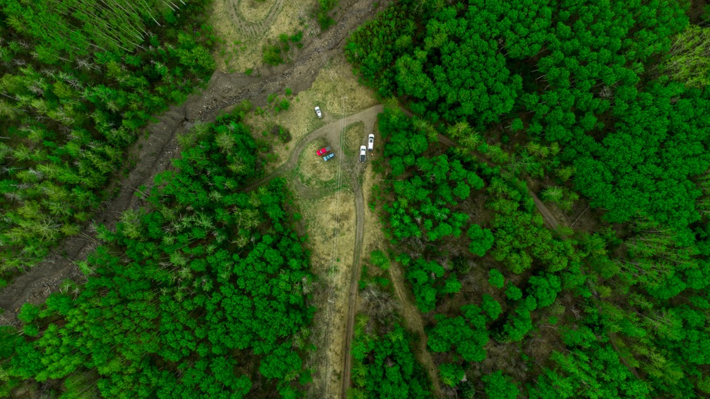
Situated in the shadow of the Rocky Mountains and extending through the prairies, Greenview has many different trails and wilderness areas to enjoy. The following are some of the major hiking areas and trails in the municipal district.
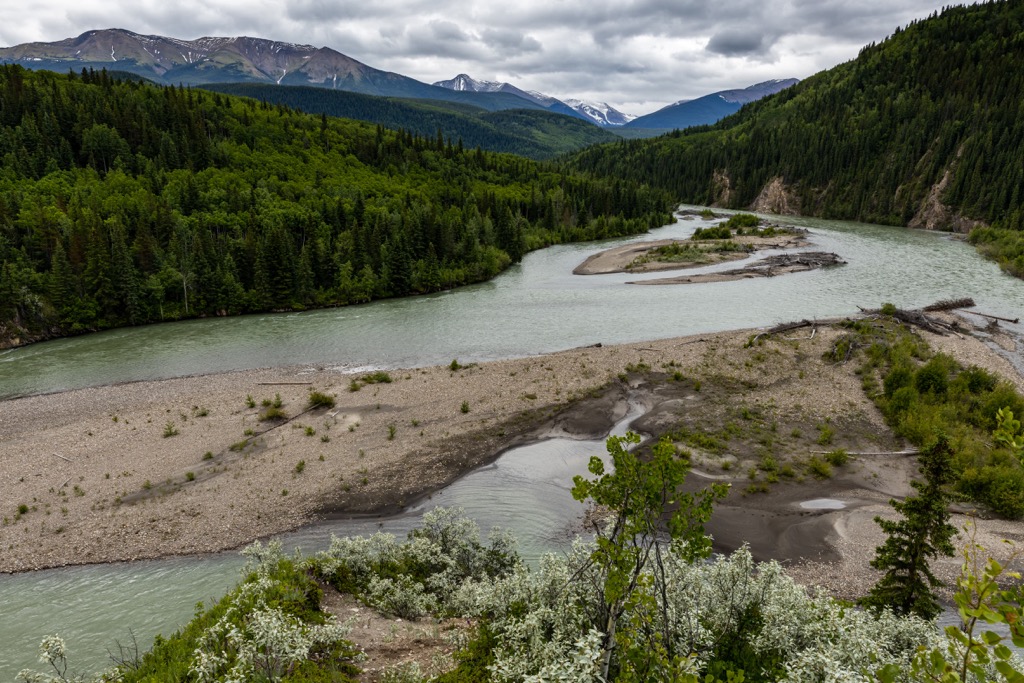
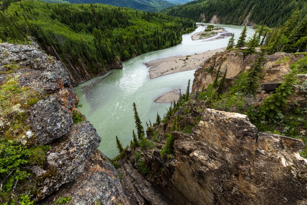
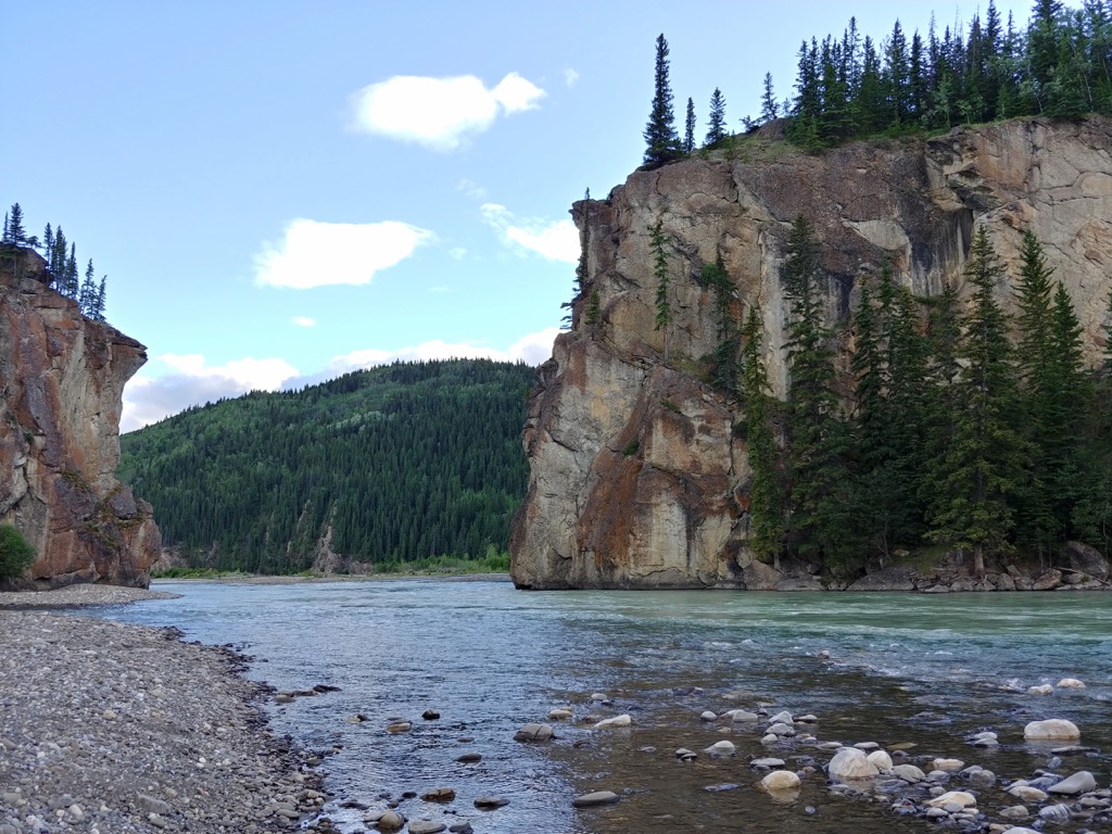
Across the Smoky River, west of Grande Cache is Sulphur Gates Provincial Recreation Area. The relatively small recreation area has a campground and is situated along the western banks of the Smoky River. The recreation area has trailheads to many of the local and regional trails.
Some of the east trails include the short jaunt along Sulphur Gates Trail or the trail to the Split Rock at Sulphur Gates. Other options include following the Smoky River to Eaton Falls or further to the Muddy Water campsite along the Kvass-Flats Trail.
Some of the accessible, albeit difficult nearby peaks that have trailheads in Sulphur Gates are Mount Stearn, Mount Mawdsley, Mount Russell, Mount Braithwaite, and Lightning Ridge. Nearby are trails to Ambler Mountain, Mount Hamell, Mount Louie, and Grande Mountain. Legs of the Canadian Death Race also run through Sulphur Gates.
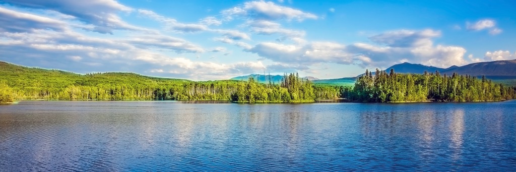
Named for its two small lakes which are surrounded by the forested foothills of the Rocky Mountains, Two Lakes Provincial Park is great for hiking, fishing, and wildlife viewing. Boats are permitted on the lakes and there are several hiking trails to choose from.
Easy trails run between the lakes and there are several harder trails that lead to viewpoints of the area. Some of the more difficult trails include the route up Gunderson Ridge and another to Torrens Falls.
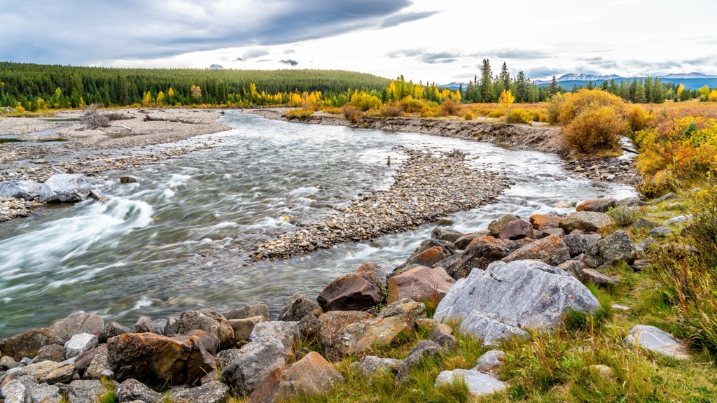
Kakwa Wildland Provincial Park is over 650 square kilometers (250 square miles) of mountains, forested valleys, crystal clear creeks, and rushing rivers. While none of the trails are maintained, there are over 100 km (60 mi) of trails leading to some of the attractions in the park.
One of the main attractions of the park is Kakwa Falls, which is the tallest waterfall in Alberta, plunging 30 m (98 ft) to the river below. Other attractions include Lower Kakwa Falls and Francis Peak Creek Falls.
Trails in the park give access to Mount May, George Peak, Francis Peak, Kakwa Mountain, and La Creche Mountain. The trail network leads south to the Willmore Wilderness Park and there are trails that lead west, across the provincial border to British Columbia’s Kakwa Provincial Park.
Access to the Kakwa Wildland Provincial Park is by the road that leads south out of Two Lakes Provincial Park to Deadhorse Meadows. The road between the parks is typically rough and an OHV or 4x4s are recommended for travel to the park.
The Municipal District of Greenview is the largest municipal district in Alberta; however, it has a rather sparse population. Among the mountains, forests, rivers, and lakes, the following are some of the major communities in and around Greenview.
Grande Cache is in the southwest corner of Greenview and was originally incorporated as a “new town” in 1966. The “new town” status allowed the government to help with the financing of the town. Construction of the town began in 1969 and by 1983, Grande Cache received town status.
However, Grande Cache was essentially built for the single purpose of providing a community for the employees of the coal mines. Relying on a single employer that was dependent upon a single commodity caused the town to suffer through a boom-bust cycle.

Due to the decline in demand and prices for coal, the population of Grande Cache has dwindled and in 2019, the residents voted to dissolve their town, to become a hamlet under the jurisdiction of the MD of Greenview.
There were attempts to diversify the economy and wilderness tourism has become a popular industry in recent years. Grande Cache is located adjacent to Willmore Wilderness Park and is seen as a jumping off point for wilderness excursions.
Grande Cache has also become the home of the Canadian Death Race, which started in 2000. The race is a 118 km (71 mi) course that passes over three mountain summits and includes over 5,180 m (17,000 ft) of elevation change. The course description can be found online and the bold can test their grit against one of the world’s toughest ultramarathons.
Grande Prairie is located northwest of the MD of Greenview in Grand Prairie County, which is in a geographical area referred to as Peace River Country. Grande Prairie is the seventh largest city in Alberta, and it provides regional services to the surrounding counties, such as Greenview.
It was the fur traders that began the modern settlements in the region, as the North West Company and later the Hudson’s Bay Company would trade with the Dane-zaa people who inhabited the region. Settlements increased as Cree and Iroquois expanded to the region in the late nineteenth century, and later when homesteading land grants were offered in the early twentieth century.
Oil and gas have been major economic drivers in the city, as well as agriculture and forestry. As with many municipalities, Grande Prairie leverages the local, natural beauty to draw in tourists. Nearby Pipestone Creek Provincial Park has been a meeting place for travelers since the 1800’s and Two Lake Provincial Park adds to the recreational opportunities.
West of Grande Prairie, situated among the Far Northern Rockies are many more fantastic wilderness recreation and hiking areas, such as Gwillim Lake Provincial Park, Monkman Provincial Park, and Pine LeMoray Provincial Park. The Tumbler Ridge Geopark is also located west of Grande Prairie, and it includes many paleontological significant destinations for fans of dinosaurs and fossils.
Situated in the southern Peace Region, Valleyview is located between Sturgeon Lake and the Little Smoky River. While the region has been inhabited for thousands of years, the initial settlement was founded in 1916 as farmers came for the rich soil.
Originally named Red Willow Creek, the name changed to Valleyview in 1929 when the post office opened and has since become the administrative center for the MD of Greenview.
Some of the popular wilderness destinations for hiking and boating around Valleyview are at Young’s Point Provincial Park and Williamson Provincial Park which are on the shores of Sturgeon Lake. Winagami Lake Provincial Park and Winagami Wildland Provincial Park are north of Valleyview and offer many opportunities for outdoor recreation.


