Scan the QR code and open PeakVisor on your phone
The County of Grande Prairie lies north of the Wapiti River and east of the Smoky River in northern Alberta, Canada. Encompassing 5,790 square kilometers (2,235 square miles), the county stretches across vast rolling plains that are punctuated by several high points. The tallest and most prominent summit in the county is Saskatoon Hill which has an elevation of 954 m (3,130 ft) and 202 m (6663 ft) of prominence.
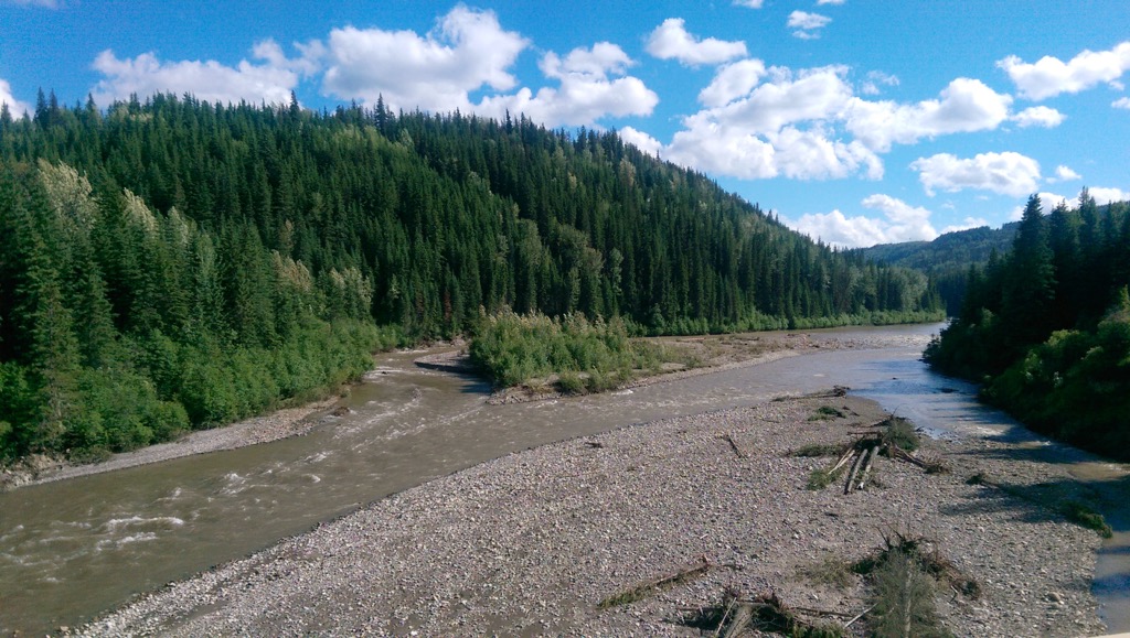
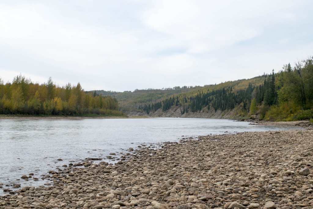
Previously referred to as the Buffalo Plains, the vast prairies of the County Grande Prairie extend across northwest Alberta, Canada. The county extends east from the border with British Columbia to the Smoky River and north from the Wapiti River.
The landscape mostly consists of rolling plains with forests along the west side and several prominent hills dotting the county. Saskatoon Hill (954 m/3,130 ft) is the tallest point in the county and is encompassed by Saskatoon Mountain Provincial Recreation Area.
While there are no other major wilderness areas in the county, the city of Grande Prairie is the heart of Peace Country and there are many wilderness areas nearby. The following are wilderness areas near Grande Prairie that are great for hiking, backpacking, horseback riding, fishing, skiing, and much more.
Grande Prairie is the only city in the county and it is the largest city in the region and it is at the crossroads of Highway 40 and Highway 43. Along with the city of Grande Prairie, the inhabitants of the county live among three towns, a dozen hamlets, and many localities with a total population that’s nearing 100,000.
During the Cretaceous North America was split by a sea which was called the Bearpaw Sea. The sea stretched from the south end of North America and reached across the Arctic Circle, bringing warmth to the north.
The climate across North America was much warmer than it is now, even though North America was closer to the north pole and the County of Grande Prairie would have been near the Arctic Circle. Furthermore, Grande Prairie would have been situated along the western shore of the vast inland sea.
Around this time, the mountains of the Canadian Cordillera were forming, such as the Rocky Mountains, which created a new Continental Divide. As the Continental Divide formed, seasonal rains and meltwater in the mountains now flowed west towards the Bearpaw Sea. Between 80 and 69 million years ago, the current County of Grande Prairie and the surrounding region east of the foothills of the Rockies became a vast floodplain.
The water from the mountains now supplied streams that meandered across the floodplain as rivers; however, there were also lakes and wetlands. The climate of the region at this time was tropical and the coastal area was covered with lush, tropical vegetation and dinosaurs, such as the Pachyrhinosaurus.
The floodplain of the ancient County of Grande Prairie slowly filled with sand, mud, and silt from the mountain runoff. The layers became part of a geological formation that is called the Wapiti Formation, which consists of interbedded sandstone, siltstone, shale, and mudstone.
The tropical vegetation was slowly covered by the sediment and the resultant pressure and heat turned the vegetation into coal. There are also vast deposits of hydrocarbons trapped between the layers of sedimentary rocks beneath the county.
The slow deposition of sediments also created ideal conditions for the creation and preservation of dinosaur fossils. Some of the fossils that have been found in and around the County of Grande Prairie include Pachyrhinosaurus, Edmontosaurus, and Hadrosaurs, which are the most common in the region.
East to west, the County of Grande Prairie shifts through several different ecological subregions which are the Peace River Parkland, Dry Mixedwood Boreal Forest, and finally the Central Mixedwood Boreal Forest along the British Columbia border.
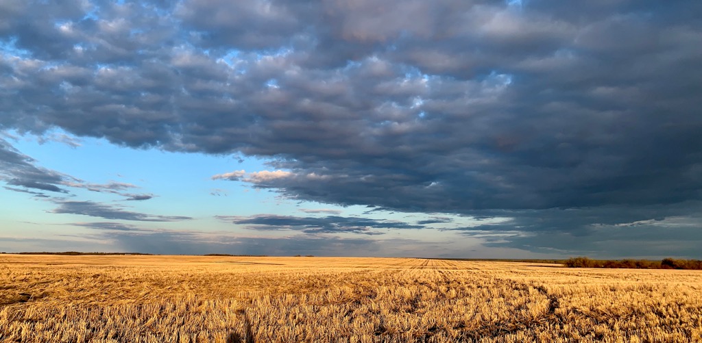
The Peace River Parkland is characterized by extensive prairie within a largely forested landscape. Due to agricultural development that started in the early twentieth century, most of the native prairie was turned to agricultural use.
Where native grasslands exist, they are typically full of sedges, intermediate oat, grass, western porcupine grass, bearded wheat, grass, inland bluegrass, three-flowered avens, and low goldenrod. While the upland forests are dominated by white spruce and aspen, along with stands of balsam poplar on wetter sites. The forests of the Parkland are nearly indistinguishable from the adjacent Boreal Forest.
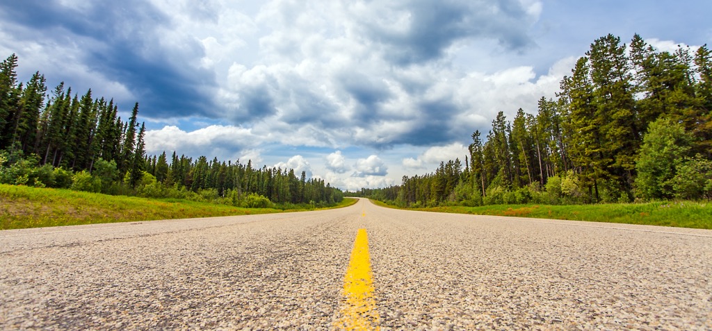
The rolling landscape continues through to the western border of the county; however, the prairies with their stands of trees are replaced by the dense boreal forests and low-lying marshes and wetlands. The Parklands are the warmest of the county’s regions and the Central Mixedwood Boreal Forest along the western border is the coolest of the county’s regions.
In addition to the white spruce and aspen forests that dominate the other regions of the county, the western edge is part of the Central Mixedwood Boreal Forest which also has forests with Jack pine, black spruce, and tamarack.
Moose, black bears, foxes, coyotes, deer, and wolves inhabit the county. Furthermore, beavers, muskrats, and otters inhabit the rivers, lakes, and wetlands. The wetlands and forests are important habitats for migrating and nesting birds.
The county is home to significant Boreal songbird populations. Some of the songbirds that are found in the county are the black-throated green warbler, Canada warbler, Western tanagers, and Swainson’s thrush. The regional wetlands also host thousands of ducks and geese during their annual migration.
Archeological digs conducted around Saskatoon Hill discovered campsites that were dated to 9,500 years ago, indicating that humans have inhabited the region since at least that time. When the fur traders arrived in the region during the early eighteenth century, the region was inhabited by the Dane-zaa or Beaver people.
Throughout the nineteenth century the North West Company and Hudson’s Bay Company built trading posts throughout the county. Many of these forts are at or near the present day locations of Grande Prairie, Dunvegan, and Sexsmith.
The fur trade picked up near the end of the nineteenth century which brought more traders to the region. Furthermore, groups of Cree and Iroquois, who migrated west with the traders, acting as their guides moved to the county from the nearby Jasper and Lac Ste. Anne areas, displacing many of the Dane-zaa.
It took a lot of effort to create a route to Grande Prairie, and as such, large scale settlement came late compared to farming areas in the south. By 1911 the Edson Trail was completed; however, this was really no more than a tract cut through the bush and forest. Settlement and growth increased dramatically when the railway arrived in 1916.
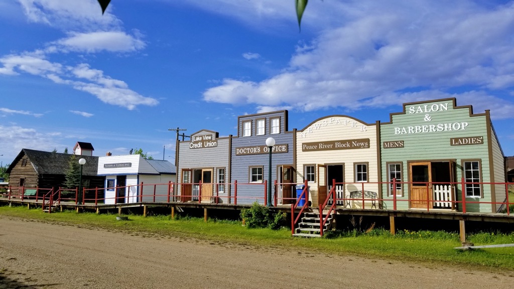
During the Second World War, the city of Grande Prairie was a major staging area for the equipment and personnel that were going to construct the Alaska Highway. Until the 1950s, Grande Prairie was competing with the towns of Peace River and Dawson Creek as the most important commercial center for the Peace Region.
It was especially due to the exploration for oil and gas that the population of the county grew, and the city of Grande Prairie became the most important city in the region. Further development of the regional highways through the county enhanced accessibility and increased the economy of the county.
During the 1950s a radar station was built upon Saskatoon Hill which consisted of three radar towers, a power plant, residences, and administrative buildings. The station was part of the Distant Early Warning (DEW) Line and was operated between 1954 and 1988. After the station was closed, all the buildings were removed except for the Doppler radar station.
While most of the county has been turned to agricultural use, the following are some of the areas that have great hiking trails through wilderness settings.
Located about 30 km (18 mi) west of the city of Grand Prairie, Saskatoon Mountain Provincial Recreation Area (PRA) is the largest and most popular wilderness area in the county. Encompassing parts of Saskatoon Hill, the PRA is a favorite place for locals to go hiking, birding, and cross-country skiing.
Saskatoon Hill was once the site of a military radar station and it offers magnificent views of the Rocky Mountains. There are several different trailheads that lead toward the summit of Saskatoon Hill, from where hikers can enjoy the wilderness setting and the wonderful view.
Less than 20 km (12 mi) west of the city of Grand Prairie, Saskatoon Island Provincial Park sits between Saskatoon Lake and Little Lake. The park has a campground and several kilometers of hiking trails that are good for a day hike and a picnic on a nice day.
The Wapiti Nordic Ski Club was established in 1979, south of the city of Grande Prairie. The club maintains about 35 km (21 mi) of trails that are favorites for trail runners, mountain bikers, hikers, and especially cross-country skiers. A day pass or seasonal pass must be purchased to enjoy these trails.
South of the city of Grande Prairie, the county maintains about 30 km (18 mi) of multi-purpose trails for the residents and visitors. The terrain is easy, and the path is paved, making it accessible for families and seniors. Furthermore, the path is paved in the winter, allowing hikers to enjoy the winter views without having to break a trail.
While visiting the Peace Region of Alberta’s north, the following are the major cities in and around the County of Grande Prairie.
The city of Grande Prairie is named for the vast plains that early explorers encountered when they arrived in the eighteenth century. The city is the seventh largest city in Alberta and is Canada’s northernmost city with over 50,000 inhabitants.
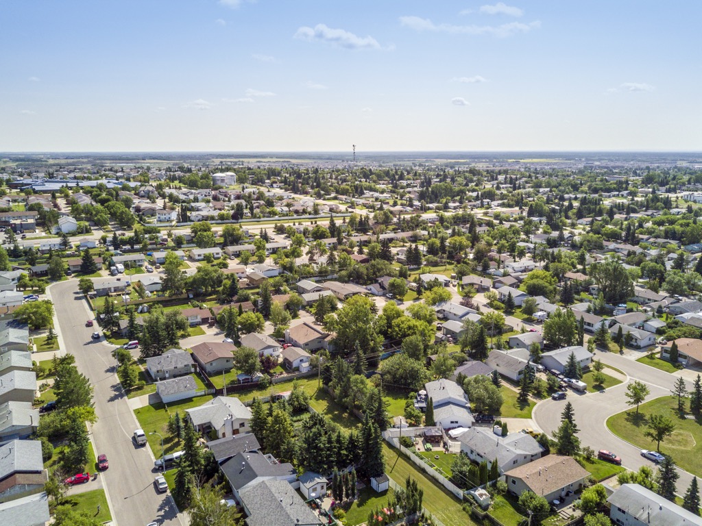
The area was historically referred to as Buffalo Plains, when there were buffalo traversing the vast northern prairie. While traders arrived during the in the early nineteenth century, not many settlers arrived until after the railway reached Grande Prairie in the early twentieth century. With the arrival of the railroad, settlers fanned out across the vast plains and tamed the landscape.
While most of the county was settled, planners kept parts of the city in its natural state and within these pockets of wilderness are some wonderful hikes and walks. Visitors to the city can walk along Bear Creek or travel the Muskoseepi Reservoir Trail. Nearby Saskatoon Mountain Provincial Park and Saskatoon Island Provincial Park provide locals with easy and moderate hiking trails and great picnic areas.
Across the border, in British Columbia, Dawson Creek is one of the larger cities in the northern reaches of the provinces. Situated about 130 km (78 mi) northwest of the city of Grande Prairie, Dawson Creek is Mile 0 of the famous Alaska Highway.

While the town was popular during the construction of the highway, growth slowed in the 1960s and Grande Prairie won out as the de facto commercial center for the region. However, Dawson Creek is still situated among incredible wilderness areas and there are many great local hikes as well.
Some of the local hikes to look for are the Dawson Creek Trail, Loeppky Park Trail, and the Rim Rocks Trail. Nearby wilderness parks include Bearhole Lake Provincial Park, Gwillim Lake Provincial Park, and Pine River Breaks Provincial Park.