Scan the QR code and open PeakVisor on your phone
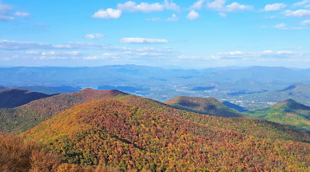
The Mark Trail Wilderness is a protected region within Chattahoochee-Oconee National Forest that’s located in the northeastern part of the US state of Georgia. The wilderness lies within the Chattooga District of the forest and contains 24 named peaks. The tallest and most prominent peak is Horsetrough Mountain at 4,042 ft (1,232 m) with 1,017 ft (310 m) of prominence.
The Mark Trail Wilderness lies in northwestern Georgia within the Chattahoochee-Oconee National Forest, which extends across the northern portion of the state.
Overall, the wilderness encompasses 16,400 acres (6,637 ha) of land across northern Georgia. The wilderness contains land that is located within White, Towns, and Union counties.
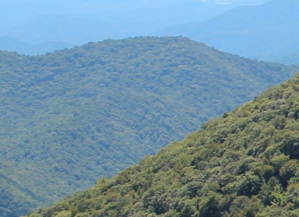
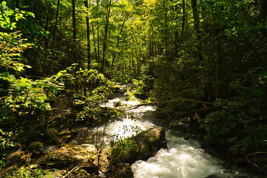
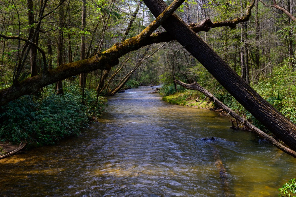
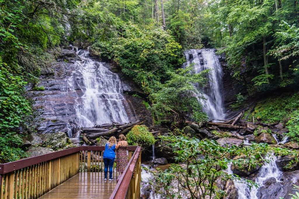
The landscape of the region is defined by rolling hillsides and steep ridgelines. Much of the region is forested with multiple seasonal creeks and streams running throughout. The ridgelines in the region are often densely forested, featuring minimal amounts of lookouts or buttes.
The main body of the water in the wilderness is the Chattahoochee River which cuts through the center of the protected land in a north to south direction. Other nearby bodies of water include the Nottely River along the western boundary and the Hiwassee River to the north.
The peaks within the Mark Trail Wilderness mark some of the most southern peaks of the Blue Ridge Mountains. This range marks a subrange of the larger Appalachian Mountains, which travel northeast across the eastern US and into the Canadian province of Newfoundland and Labrador.
Additionally, the Mark Trail Wilderness is surrounded by popular outdoor recreation areas. The Blue Ridge District of the Chattahoochee-Oconee National Forest lies to the north and west while the rest of the Chattooga District is to the south and east. Directly east of the wilderness lies the Tray Mountain Wilderness while Sumter National Forest lies further east.
The peaks within the Mark Trail Wilderness are part of the larger Appalachian Mountains. More specifically, the peaks are part of the Blue Ridge Mountains system. This range is part of a physiographic province, known for its distinct features and landforms.
Rocks found in the wilderness date back to the Precambrian and Paleozoic eras. The entire Appalachian Mountain Range began forming around 1 billion years ago during the Grenville and Alleghenian orogenies.
The geological history of the Blue Ridge Mountains dates back hundreds of millions of years older than other notable ranges. Both the Alps and the Himalaya, were formed during the Alpine orogeny which took place just 65 million years ago.
Common rocks found in the region include granites, gneisses, metagreywacke, and schists. Over the course of millions of years, the Blue Ridge Mountains have slowly been eroded by the various waterways of the region. This erosion has left behind the rugged ridgelines and alternative valleys and ridges.
Major peaks within the Mark Trail Wilderness include Horsetrough Mountain, Red Knob, Blue Mountain, Spaniards Knob, and Sheep Rock Top.
The Mark Trail Wilderness, and surrounding Chattooga District, are part of the larger Blue Ridge Mountains ecoregion, which covers land within Georgia, North Carolina, South Carolina, Tennessee, and Virginia. The varied topography allows a diverse array of both fauna and flora to thrive.
A majority of the landscape is covered in mixed pine-hardwood forests. Common species include shortleaf pine, oak, hickory, and loblolly. The relatively low elevation of the wilderness has limited the amount of spruce-fir forests, which are common throughout the eastern US.
Though the wilderness is relatively small in size, the surrounding network of national forest land has enabled a plethora of fauna to flourish. Larger animals found in the region include bobcats, coyotes, black bears, and weasels. Various species of owls, eagles, hawks, sparrows, and hummingbirds are also common.
Those visiting the region should also be sure to explore during dusk as the forest is home to the Phausis reticulata, which is more commonly known as the blue ghost firefly. Named after its distinct blue color, visitors can often spot it just after sunset during the summer months.
The land in what is now the Chattahoochee-Oconee National Forest has been inhabited by humans for thousands of years, long before the arrival of Europeans. This portion of land marks part of the ancestral homelands of the Muscogee (Creek) and Cherokee Nations.
During the 1800s, the US forcibly removed the Indigneous peoples of the region following the 1830s Indian Removal Act. This resulted in the Indigneous Tribes being relocated to present-day Oklahoma. Other tribes of the region were relocated throughout present-day Louisiana, Texas, Alabama, and North Carolina.
The first European believed to have explored the region was the Spaniard Hernando de Soto. His expedition traveled throughout what is now the southeastern US, traveling as far as present-day Tennessee and making contact with many Tribal Nations along the way.
Many Cherokee Tribes in the region created trade deals with the English, Irish, and Scottish immigrants who began settling in the region. In the early 1700s the Cherokee established a unified national government consisting of their various Tribes.
During the 18th century Georgia became a British colony centered around agriculture with slavery being brought to the region’s many plantations during the late 18th century. In the following decades gold was discovered throughout the Blue Ridge Mountains, leading to an influx of new settlers.
This influx led to harassing, attacking, killing, and the forced removal of the Indigneous people of the region by the settlers. The Indian Removal Act resulted in the Trail of Tears, marking the long journey the Indigneous people had to endure to reach the midwest.
Those who made it all the way to Oklahoma would later go on to form the Cherokee Nation. The few Indigenous people that managed to stay in their native land formed the Eastern Band of Cherokee Indians, whose headquarters are located in North Carolina on the Qualla Boundary.
Land purchased by the United States Forest Service in 1911, would later become the Chattahoochee National Forest. A few decades later, in 1959, 96,000 acres (38,850 ha) of federal land was established as the Oconee National Forest.
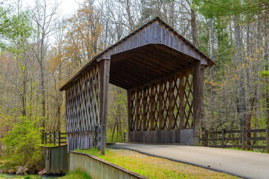
The two forests were administratively combined to form the Chattahoochee-Oconee National Forest. Today, the surrounding region is home to hundreds of miles of hiking trails, campsites, and wilderness areas.
The Mark Trail Wilderness is home to numerous trails for hiking and other outdoor adventures. Here are a few popular trails to check out on your next visit:
A portion of the Appalachian Trail cuts across the wilderness as it travels northward along the eastern US. This route takes hikers to the summit of Rocky Mountain along the eastern border of the wilderness.
The trail climbs steadily throughout, following along the Appalachian Trail. Once at the summit hikers have partial views of the rolling forested hillsides that surround the wilderness. This out and back trail is 2.9 miles (4.7 km) roundtrip and features 1,053 feet (321 m) of elevation gain.
Jack’s Knob Trail takes hikers along one of the most prominent ridgelines in the wilderness. The trail begins at Jack’s Gap before traveling south along the ridge. Before reaching the summit of Jack’s Knob, hikers pass along Henry Knob, Brookshire Top, and Eagle Knob.
Just past the summit of Jack’s Knob marks the headwaters of the Chattahoochee River which flows south from the peak. This out and back trail features numerous short climbs and descents. The entire route is 5.3 miles (8.5 km) round trip with 1,771 feet (540 m) of elevation gain.
This out and back route begins by climbing steeply through the forested landscape. Hikers pass along the summit of Blue Mountain before reaching Red Knob and Spaniards Knob. There are multiple creeks, campsites, and viewpoints along the trail.
This route is relatively flat after the initial climbs. The out and back trail is 7.6 miles (12.2 km) long round trip and features 1,958 feet (597 m) of elevation gain.
Looking for a place to stay near the Mark Trail Wilderness? Here are some of the best cities and villages to check out in the region.
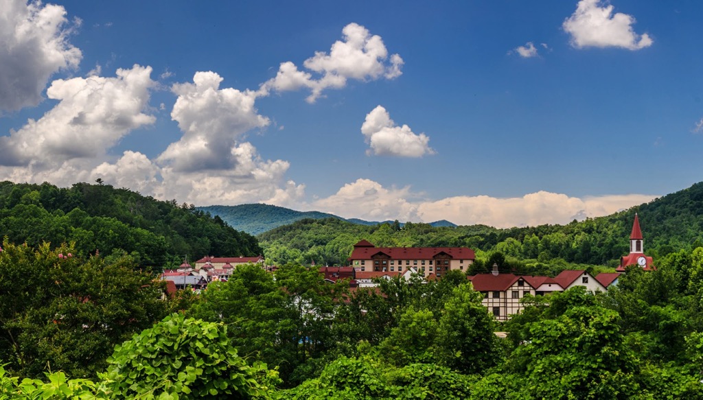
Dahlonega is the closest city to the wilderness, situated just south of the national forest. Home to around 7,000 residents, the city is known for its gold mining history and thriving vineyards. The city marks the home of the first major gold rush in the US which began in 1829.

The historic downtown area of Dahlonega is even featured on the National Register of Historic Places and is centered around the Dahlonega Gold Museum. Amicalola Falls lies just west of the city while Lake Lanier is situated to the south. The small city of Dahlonega is home to a plethora of outdoor activities including close proximity to the hundreds of miles of trails in the Chattahoochee-Oconee National Forest.
The city of Atlanta lies just an hour's drive to the south of Dahlonega, marking the closest major city to the wilderness. Home to around 500,000 residents, Atlanta marks the capital city of the state and the most populous city in Georgia.
Atlanta has a long and rich history and acts as the commercial and cultural hub for the surrounding region. Popular sites to visit in the city include the Martin Luther King, Jr. National Historical Park, High Museum of Art, Centennial Olympic Park, Piedmont Park, and the Atlanta Botanical Garden. The local cuisine is showcased through the variety of restaurants found throughout the downtown area.