Scan the QR code and open PeakVisor on your phone
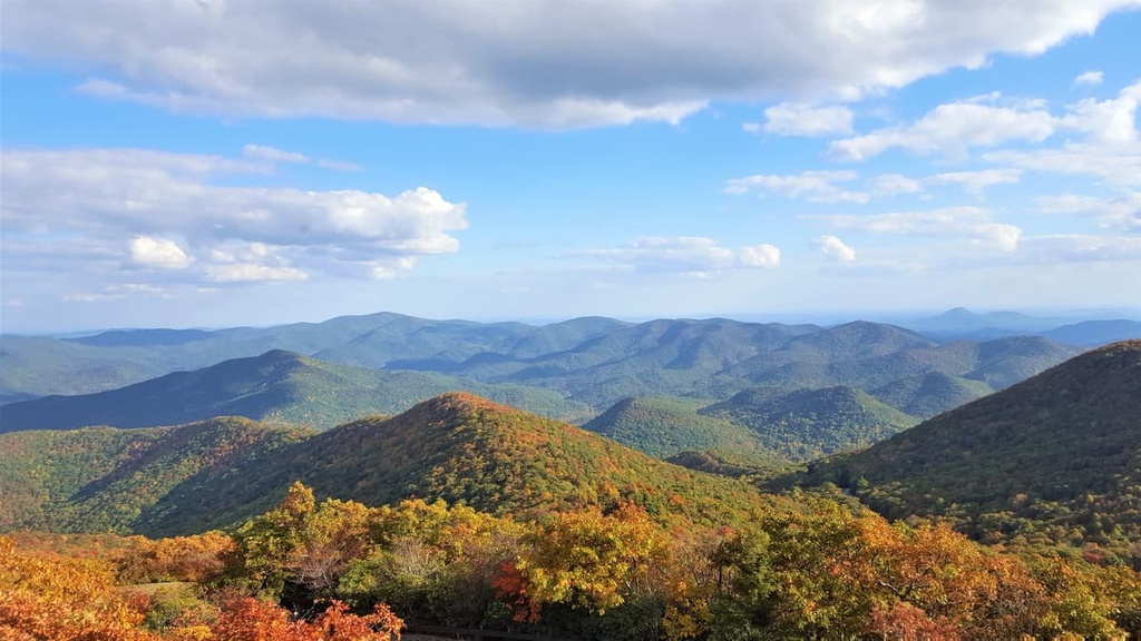
The Tray Mountain Wilderness is a protected area that encompasses 9,702 acres (3,926 ha) of terrain in the Chattahoochee National Forest within the US state of Georgia. There are 11 named mountains in the Tray Mountain Wilderness, the highest and most prominent of which is Tray Mountain (4,419 ft/1,347 m).
The Tray Mountain Wilderness covers 9,702 acres (3,926 ha) of terrain in the Chattooga District (also known as the Chattooga River Ranger District) in the Chattahoochee portion of the jointly administered Chattahoochee-Oconee National Forest.
Located in the northeastern corner of Georgia, the Tray Mountain Wilderness includes portions of four counties: Habersham, Rabun, Towns, and White. It is also part of a much larger complex of public land that covers parts of Georgia, South Carolina, and North Carolina.
The wilderness is situated to the east of the Brasstown Wilderness, Mark Trail Wilderness, and Raven Cliffs Wilderness, all of which are located in the Blue Ridge District of the Chattahoochee-Oconee National Forest.
The Tray Mountain Wilderness is surrounded by several smaller parks and wildlife management areas, including the Swallow Creek Wildlife Management Area, Unicoi State Park, Anna Ruby Falls Scenic Area, Lake Burton Wildlife Management Area, and Swallow Creek Wildlife Management Area.
The mountains within the Tray Mountain Wilderness are part of the Blue Ridge Mountains, a subrange of the Appalachian Mountains that includes about 550 miles (885 km) of rugged terrain in Georgia, Tennessee, South Carolina, North Carolina, Virginia, West Virginia, and Maryland.
From a geological standpoint, the Tray Mountain Wilderness is part of the Blue Ridge Mountains system, which is a physiographic province with distinct features and landforms.
The Tray Mountain Wilderness straddles the crest of the Blue Ridge Mountains, which was created by the uplift of the Earth’s tectonic plates about 1.1 billion to 250 million years ago. Though they’ve been heavily eroded over the years, the Blue Ridge Mountains were once among the highest peaks in the world, and they even rivaled the much younger Alps and Himalaya in terms of their height.
The eastern Blue Ridge Mountains consist of a variety of igneous and high-grade metamorphic rocks that date back as far as the Precambrian and the Paleozoic. These include schists, gneisses, slates, and quartzites, though the entire range also features extensive igneous intrusions.
As it is located in Georgia’s Blue Ridge ecoregion, the Tray Mountain Wilderness sustains a wide range of flora and fauna.
The low-elevation peaks in the region are decorated with mixed pine-hardwood forests, which contain various species of loblolly and shortleaf pine as well as oak and hickory trees. A high cove of old-growth buckeyes and a colorful display of wildflowers can also be found in the Tray Mountain Wilderness area’s Ramp Cove.
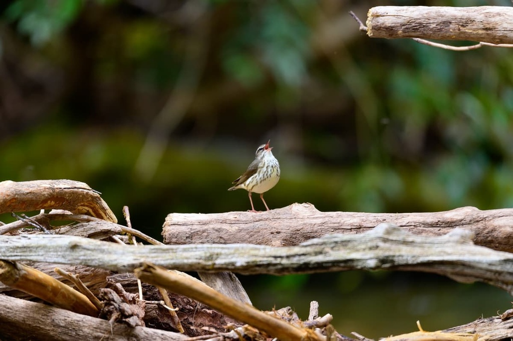
In terms of wildlife, deer, squirrels, grouse, and wild turkeys are commonly seen inhabitants of the Tray Mountain Wilderness. Other wildlife that you might spot in the area includes black bears, raccoons, doves, quail, and woodcocks.
The area surrounding the Tray Mountain Wilderness has been home to humans for thousands of years. Many Indigenous cultural sites have been identified in the Chattahoochee National Forest, particularly near the Chattahoochee River and its tributaries.
One of the main tribes with ancestral homelands in the region is the Muscogee (Creek), who are the descendants of a culture that, before about 1500 CE, lived throughout the entire region that’s now known as the southeastern US. The Muscogee traditionally constructed extensive cities from earthwork mounds within the region’s broad river valleys.
Today, the Muscogee (Creek) are associated with the creation of many extensive multi-mound centers in contemporary Georgia, such as what’s seen at the Ocmulgee Mounds National Historic Park and Etowah Mounds.
The Nacoochee Mound, which is located roughly 20 miles (32 km) to the south of the Tray Mountain Wilderness, is also believed to be the traditional burial grounds for the people of the South Appalachian Mississippi Culture, who lived in the area between 1350–1600 CE.
In the mid-sixteenth century, Spanish conquistador Hernando de Soto, on a quest for gold, led the first documented European expedition into what is now Georgia. Throughout his travels, he encountered the highly sophisticated agriculturalists of the Mississippian culture as well as a number of other tribal nations.
By the mid-eighteenth century, European Americans had begun their westward movement into Georgia, encroaching on the lands of the Cherokee and Muskogee (Creek). The discovery of gold in northeastern Georgia further enticed large numbers of prospectors to the region.
The ensuing gold rush prompted rapid colonization of Georgia and spurred the forced removal of the Cherokee, Muscogee (Creek), and other southeastern tribes from their ancestral homelands. This forced removal culminated in the Trail of Tears, which was a series of paths that tens of thousands of Indigenous people who lived in the southeastern US were forced to walk to Oklahoma after the passage of the 1830 Indian Removal Act.
In 1911, the US Forest Service purchased 31,000 acres (12,545 ha) of land as part of the Nantahala and Cherokee National Forests. In 1936, the Chattahoochee National Forest was designated a separate national forest and work began to restore the landscape.
Several decades later, the Tray Mountain Wilderness was created within the Chattahoochee National Forest as part of the Georgia Wilderness Act of 1986. This act also created the Raven Cliffs Wilderness, Brasstown Wilderness, Rich Mountain Wilderness, and Cohutta Wilderness areas within the state of Georgia.
The Tray Mountain Wilderness is a remote area of the Chattahoochee-Oconee National Forest that offers extraordinary opportunities for outdoor recreation. Here are some of the best places to check out in the wilderness area during your next visit.
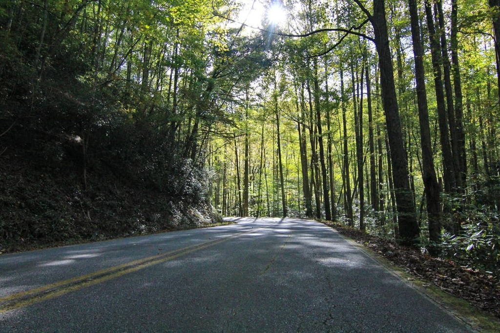
One of the most popular trails in the Tray Mountain Wilderness climbs to the summit of Tray Mountain via the Appalachian Trail.
This 5-mile (8 km) trail from Indian Gap to the summit of Tray Mountain traverses through a dense mountain laurel forest before ascending a ridgeline with sweeping views of the surrounding landscape. Large slabs of granite at the summit provide the perfect place to soak in views of the Blue Ridge Mountains and Chattahoochee National Forest.
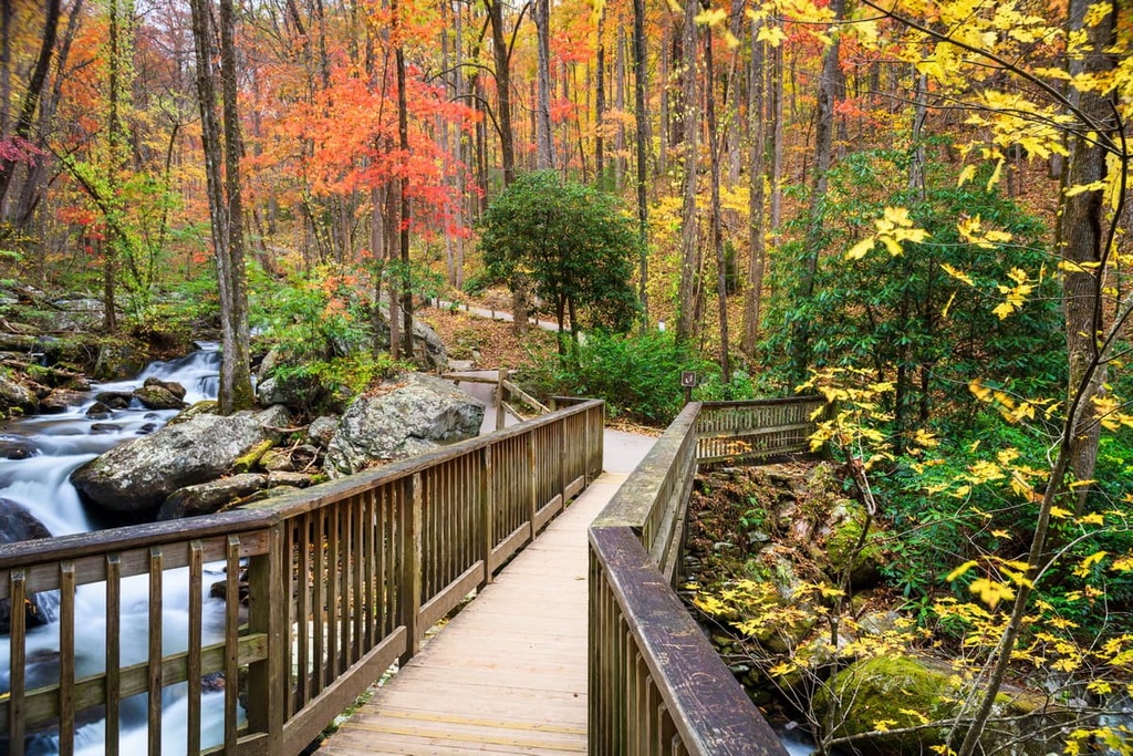
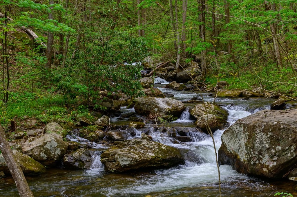
The Anna Ruby Falls Trail is a casual, paved footpath that leads to a pair of spectacular cascading waterfalls that are located within the wilderness area. This family-friendly trail to Anna Ruby Falls climbs along a babbling creek and traverses through a lush, boulder-filled forest.
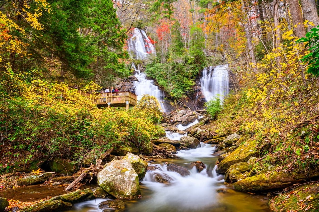
The double waterfalls of Anna Ruby Falls are formed by the waters of Curtis Creek and York Creek as they tumble over a towering cliff that’s situated below the summit of Tray Mountain. At the base of the waterfall, the two creeks form Smith Creek, which eventually joins the Chattahoochee River as it flows to Atlanta.
Looking for a place to stay near the Tray Mountain Wilderness? Here are some of the best places to check out during your next trip to the region.
Located just over 100 miles (161 km) to the southwest of the Tray Mountain Wilderness, Atlanta is the largest and most populous city in the state of Georgia.

Its location at the foothills of the Appalachian Mountains and large international airport make it a great hub for exploring the state’s many parks and natural places. Atlanta is also the economic and cultural heart of the Atlanta metropolitan area, and it hosts a wide variety of museums, restaurants, music venues, and various other tourist attractions for visitors to enjoy.
Clayton is a Blue Ridge Mountain community known for its unique lodging options, locally sourced cuisine, charming downtown area, and proximity to world-class vineyards.
It’s located on the eastern continental divide and serves as a gateway community to many scenic parks and natural attractions in the region, including Black Rock Mountain State Park, Tallulah Gorge State Park, Warwoman Wildlife Management Area, Lake Burton, and the Tray Mountain Wilderness.

Helen is a bustling Bavarian-style alpine village that’s located in the heart of the Blue Ridge Mountains. Its cobblestone streets, vibrant shops, and authentic German cuisine entice thousands of visitors to the village from Atlanta each year.
Helen can also serve as an outstanding basecamp for outdoor adventure in the Blue Ridge Mountains. Visitors to Helen can go tubing on the Chattahoochee, hike to one of the many nearby waterfalls, or explore the many acres of beautiful wilderness that lie just outside the community.