Scan the QR code and open PeakVisor on your phone
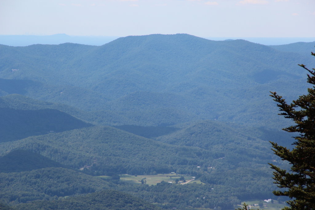
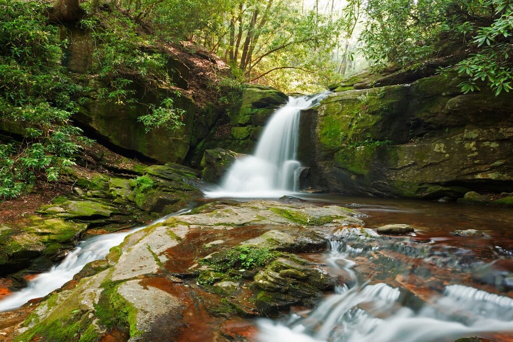
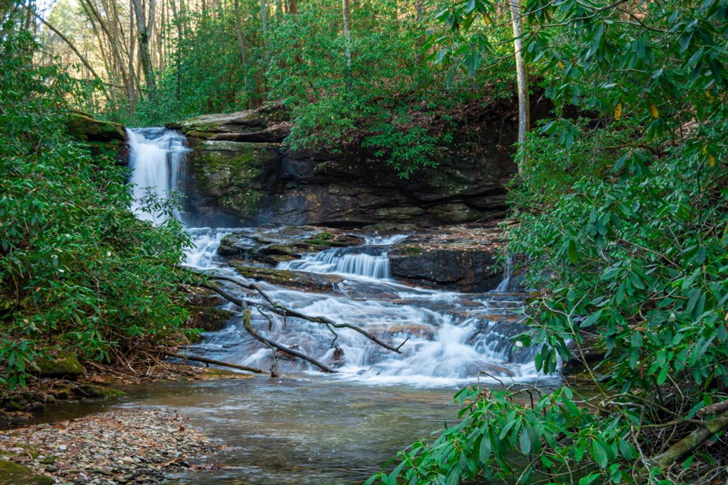
Raven Cliffs Wilderness covers 9,240 acres (3,740 ha) in Chattahoochee National Forest – Blue Ridge District in northern Georgia, USA. A portion of the Appalachian Trail follows the Blue Ridge crest through the wilderness and the namesake Raven Cliffs waterfall is an impressive cascade falling 90 ft (27 m) from a narrow crevice. There are 24 named mountains in the wilderness. Levelland Mountain is the tallest (3,885 ft/1,184 m) and most prominent (784 ft/239 m).
The 9,240 acre (3,740 ha) Raven Cliffs Wilderness is located in northern Georgia within Chattahoochee National Forest – Blue Ridge District. The wilderness was established in 1986. Elevations in the area range from 1,800 ft (549 m) near Boggs Creek to 3,885 ft (1,184 m) on Levelland Mountain.
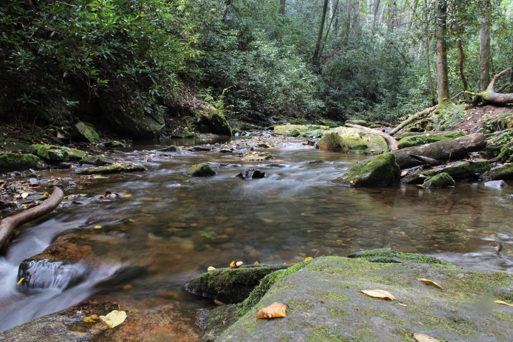
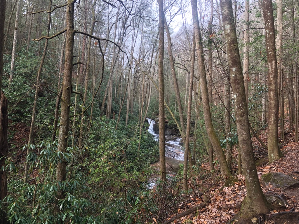
6.6 mi (10.6 km) of the Appalachian Trail follows the Blue Ridge crest through the wilderness area and a shelter is located at Whitley Gap. The popular namesake trail to Raven Cliffs Falls goes 3 mi (4.8 km) upstream to an impressive 90 ft (27 m) waterfall.
The tallest peaks in the wilderness are Levelland Mountain (3,885 ft/1,184 m), Cowrock Mountain (3,842 ft/1,171 m), Green Cliff Top (3,842 ft/1,171 m), Wildcat Mountain (3,776 ft/1,151 m), and Wolf Laurel Top (3,776 ft/1,151 m).
The Mark Trail Wilderness lies to the north, the Blood Mountain Wilderness is located on the other side of US 129 from Raven Cliffs Wilderness, and the Chestatee and Chattahoochee Wildlife Management Areas neighbor the wilderness.
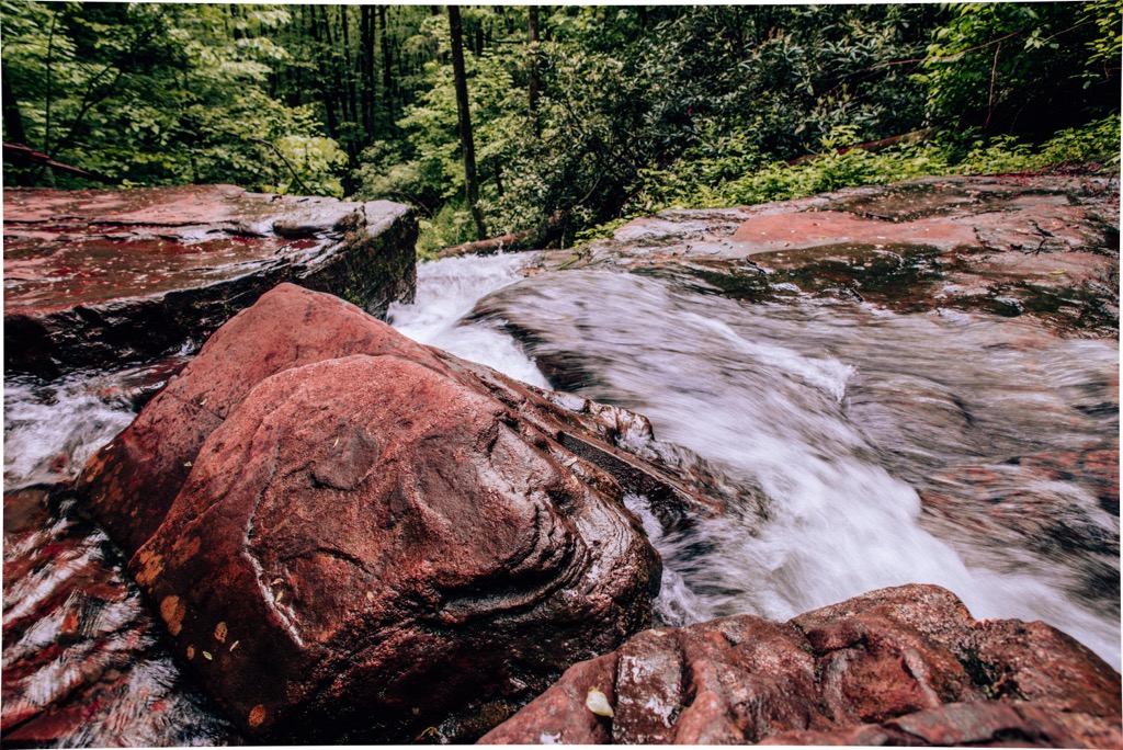
The mountains in Raven Cliffs Wilderness are part of the Blue Ridge Mountains, a subrange of the Appalachian Mountains. The mountain range began forming one billion years ago, with significant changes happening until around 250 million years ago.
The Grenville and Alleghenian Orogenies were the two major mountain building events that shaped the region. Rocks within the range are primarily metamorphic rocks such as schists, gneisses, slates, and quartzites, punctuated by numerous igneous intrusions.
The forests of Raven Cliffs Wilderness have rebounded well from heavy logging in the late 1800s and early 1900s. Chestnut, oak, hickory, and shortleaf pine predominate at lower elevations, shifting to mixed pine-hardwood forests at middle elevations, and spruce and fir at the highest elevations.
Deer, squirrels, coyotes, black bears, and raccoons are all common inhabitants of the forests here. Common birds include meadowlarks, blackbirds, starlings, owls, warblers, nuthatches, woodpeckers, wrens, cardinals, grouse, turkeys, and chickadees.
Northern Georgia is the traditional territory of the Cherokee and Creek peoples. In the 1820s, the discovery of gold in the region led to the tragic, forced removal of these tribes from their native lands. As thousands of settlers migrated into the region searching for gold, Native Americans were forced along the “Trail of Tears”, with thousands of people dying on the long trek to reservations in Oklahoma.
Intense mining and logging damaged almost all streams in northern Georgia and stripped many forests of their old growth forest. In the 1880s, railroads were constructed through the mountains so that the timber industry could access more forest. There was intensive logging for lumber, as well as for the bark of chestnut, chestnut oak, and hemlock trees to extract tannic acid used in leather tanning.
The Forest Service first purchased 31,000 acres (12,545 ha) in 1911. This was the first step in protecting the damaged landscape. A series of further purchases and consolidations led to the formation of Chattahoochee National Forest in 1936. Raven Cliff Wilderness was established in 1986.
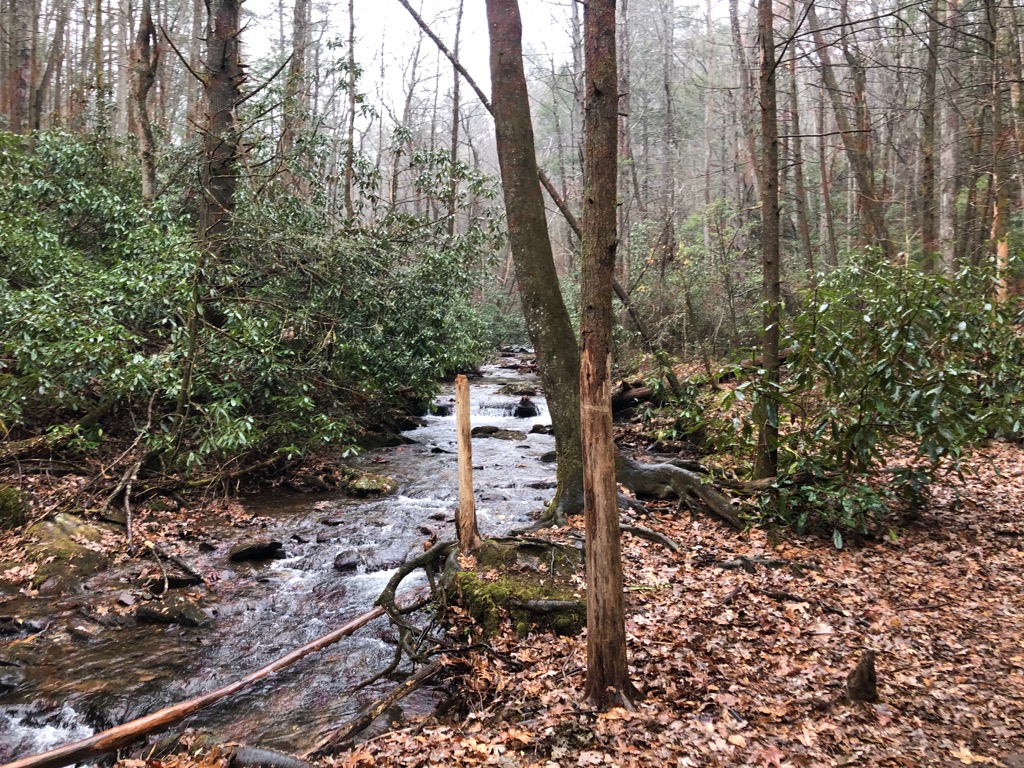
No wheeled vehicles, including bikes, are allowed in Raven Cliffs Wilderness. There are several tent camping spots above the Raven Cliffs Falls trailhead, as well as along the trail, on several mountain summits, and a shelter along Whitley Gap.
The Raven Cliffs Falls trail runs just over 6 mi (9.7 km) out and back to the namesake waterfall. Expect a few water crossings as the trail follows and occasionally crisscrosses Dodd Creek. The waterfall itself is impressive as the stream above pours through a crevice about 90 ft (27 m) high. There is a $5 parking fee at the trailhead.
This trail runs 4.3 mi (6.9 km) out and back and ascends 1,250 ft (381 m). It is part of the Appalachian Trail, running from Tesnatee Gap over Cowrock Mountain (3,842 ft/1,171 m) to the ridge of Wolf Laurel Top (3,776 ft/1,151 m). There is a campsite on Wolf Laurel Top and a decently reliable water source halfway between Cowrock and Wolf Laurel Top. Many hikers say the best view is from the summit of Cowrock Mountain.
This trail is another small portion of the Appalachian Trail, measuring 2.7 mi (4.3 km) total and climbing 750 ft (229 m). The trail ascends Wildcat Mountain (3,776 ft/1,151 m) and there are a couple campsites near the summit. At the top, the trail splits from the Appalachian Trail to descend the mountain.
The Raven Cliffs Wilderness is conveniently located only a couple hours from several cities in Georgia and Tennessee.
Atlanta is the closest large city to the wilderness, under two hours away by car. The city’s population is just shy of half a million people and has a rich history surrounding the nation’s civil rights movement. Visit the Martin Luther King Jr National Historical Park, the National Center for Civil and Human Rights, and the Atlanta History Center.

There are a number of green spaces to escape to such as Centennial Olympic Park, Piedmont Park, and the botanical gardens. The city offers a wide range of places to stay to accommodate any budget. The dining scene here is diverse, with international cuisines mixed into the abundant offerings of classic Southern dishes.
Under three hours away by car, Knoxville, Tennessee is home to a population of 190,000. Concerts, live music, and art and cultural festivals fill the events calendar year round. The Ijams Nature Center and Urban Wilderness both offer opportunities to get outside, exercise, and enjoy wildlife close to the city center.

Dining options span a number of cuisines, breweries, dog friendly patios, and cafes. There are lots of lodging options, including peaceful cabins and campgrounds in the surrounding forests.
Another city less than three hours drive away is Chattanooga, Tennessee. The city of 180,000 inhabitants has a fantastic bike share program that lets visitors explore the city with ease. Some of the city’s main attractions are its museums, distilleries, breweries, nearby zipline adventures, cruises along the Chattanooga River, and cave systems such as Ruby Falls. It is also possible to combine some of the city’s highlights by going on tours such as a Bike and Brew Tour.
The city has a decent selection of restaurants, including lots of southern and American classics like burgers, fried chicken, and BBQ. Lodging options range from budget motels to hotels with views out across Chattanooga River, as well as B&Bs, rental properties, and campsites.