
Scan the QR code and open PeakVisor on your phone
The Warm Springs District of the George Washington National Forest covers roughly 171,000 acres (69,200 ha) of land in Bath County and Highland County in the US state of Virginia. The district features 54 named mountains, the highest of which is Paddy Knob (4,478 ft/1,365 m) and the most prominent of which is Bald Knob (4,242 ft/1,293 m).
The Warm Springs Ranger District is an administrative area of the George Washington National Forest that’s located in the western part of the US state of Virginia along the state’s border with West Virginia.
The George Washington National Forest and Jefferson National Forest were administratively combined in 1995 to form one of the largest areas of public land in the eastern US.
Together, the two forests cover 1.8 million acres (728,434 ha) of the Appalachian Mountains. About 1 million acres (404,686 ha) of these forests are remote and undeveloped and nearly 140,000 acres (56,656 ha) are part of designated wilderness areas.
There are more than half a dozen other ranger districts in the George Washington National Forest and Jefferson National Forest. The Warms Springs District lies between the North River Ranger District to the north and the James River Ranger District to the south. Other ranger districts in the forest include:
Together, the James River District and Warm Springs District protect 336,464 acres (136,162 ha) of land along the eastern slopes of the Allegheny Mountains.
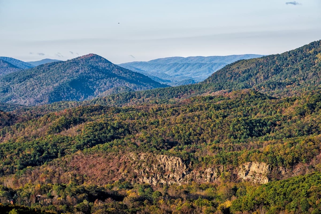
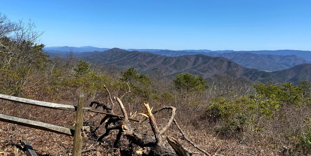
Shenandoah Mountain, a prominent feature of the George Washington National Forest, is a ridge that stretches for 73 miles (117 km) from northern Bath County, Virginia to southern Hardy County, West Virginia.
Along the way, it traverses through the Warm Springs District, reaching an elevation of 4,252 feet (1,296 m) at the summit of Bald Knob. Its highest point, Reddish Knob, lies roughly 50 miles (80 km) to the north in the North River District.
Another prominent feature of the Warm Springs District, Warm Springs Mountain, contains one of Virginia’s most pristine watersheds, the Cowpasture River. The 9,000-acre (3,642 ha) Warm Springs Mountain Preserve pieces together thousands of acres of intact forest and conservation lands within the Allegheny Highlands.
To the north and west of the Warm Springs Ranger District is the 920,000-acre (372,311 ha) Monongahela National Forest, which is located in West Virginia. Shenandoah National Park and the Shenandoah Wilderness are situated to the east of the Warm Springs Ranger District, just beyond the Lee District of the George Washington National Forest.
The mountains found in the Warm Springs District of the George Washington National Forest are part of the Appalachian Mountains, a vast system of mountain ranges that extends for roughly 1,500 miles (2,400 km) from the US state of Alabama in the south to Newfoundland and Labrador in Canada to the north.
More specifically, the Warm Springs District lies along the eastern slopes of the Allegheny Mountains, a rugged region of the Appalachians composed primarily of erosion-resistant sandstone and quartzite from the Appalachian orogeny.
Most districts of the George Washington National Forest lie in the Appalachian Valley and Ridge province, which contains folded and faulted rocks that range in age from Precambrian to early Mississippian.
A small part of the Warm Springs District also stretches into a transitional zone of the Allegheny Plateau physiographic province. This area contains characteristics of both the relatively flat-lying, dissected Allegheny Plateau and the folded and faulted Valley and Ridge province. The plateau province also contains most of the minable coal and extractable petroleum in the state of Virginia.
The topography in the Warm Springs District is characterized by high, narrow, mountain ridges that run in a northeast to southwest direction and that form relatively narrow river valleys. The predominant geological structure underlying the area is a complex formation of sandstone, limestone, shale, and dolomite.
The Warm Springs District is located in the Appalachian Hardwood Forest ecoregion, where over 40 tree species and 2,000 species of shrubs and herbaceous plants can be found. Hardwood-dominated woodlands comprise about 80 percent of the forest’s total acreage, while conifers dominate the remaining 20 percent of the region.
Together, the George Washington National Forest and Jefferson National Forest provide habitats for at least 55 species of mammals, several of which are listed as threatened or endangered.
Before conservation efforts began in western Virginia, miners, timber operators, and hunters had pushed animal species, including elk, mountain lions, foxes, black bears, white-tailed deer, and wild turkeys to the brink of extinction in the region. Until 1765, buffalo were also known to frequent the Bullpasture River area.
Fortunately, through preservation efforts, many species have been re-established in the region. Today, wildlife known to inhabit the Warm Springs District includes black bears, white-tailed deer, bobcats, bald eagles, otters, chipmunks, raccoons, squirrels, and weasels.
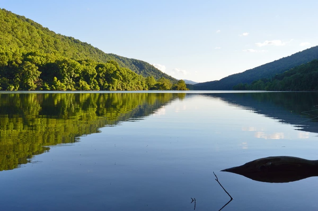
The Warm Springs District lies in the James River Watershed and contains several tributaries of the Jackson River. Many small streams descend from mountain ridges into the Jackson and Cowpasture rivers.
These critical waterways sustain many species of trout, mussels, and smaller fish. Moreover, Lake Moomaw, a 2,530-acre (2,530 ha) cold water lake on the Jackson River, contains steelhead, brown and rainbow trout, as well as bass, catfish, and panfish.
Long before the arrival of Europeans, the land now designated as the George Washington National Forest was the traditional territory of many Indigenous peoples, including the Massawomeck, Manahoac, Monacan, Cherokee, Sapony, Shawnee, and Tutelo tribes, among others.
When the first European settlers arrived in the Shenandoah Valley in the seventeenth century, the Shawnee were the primary people who lived throughout much of the region. Throughout the eighteenth century, rapid colonial expansion sparked repeated conflicts between the tribes and European settlers.
Ultimately, the US government forced the Shawnee onto three reservations in present-day Ohio. As a result, an increasing number of settlements cropped up in the Warm Springs and James River regions.
Hot Springs, Virginia, the closest town to the Warm Springs District, has long been celebrated for its medicinal natural springs. Though these natural springs have been used by Indigenous peoples for at least 9,000 years, European settlers first learned of them sometime in the mid-eighteenth century. Not long after, settlers began building lodges near the pools to accommodate visitors.
In May 1917, the George Washington National Forest was included as part of the Shenandoah National Forest. However, in 1932, the forest was renamed the George Washington National Forest to avoid confusion with the newly established Shenandoah National Park.
The Warm Springs District was created sometime in the 1930s when the George Washington National Forest was expanded by more than 400,000 acres (161,874 ha).
In the subsequent 50 years, the district was expanded to include the Warwickton Mansion, a nineteenth-century plantation near the Jackson River that was built and operated using slave labor, and Lake Moomaw, a reservoir constructed by the Army Corps of Engineers between 1965 and 1981.
Together, the James River District and Warm Springs Ranger District boast more than 240 miles (386 km) of multi-use trails and many natural attractions. These are some of the best places to check out in and around the ranger district during your next trip to the region.
Lake Moomaw is one of the most popular developed recreation areas in the George Washington National Forest. The lake features 43 miles (69 km) of undeveloped shoreline, many campgrounds, two sand beaches, and 3 boat launches. Visitors to the lake can enjoy a variety of recreation opportunities, including fishing, boating, picnicking, hiking, camping, swimming, and kayaking.
The Bolar Mountain Recreation Area, which is located at the northern end of Lake Moomaw, features 11 miles (18 km) of hiking trails that lead to two impressive scenic overlooks: Island Overlook Spur and Grouse Point Overlook.
Located along the shores of the southern end of Lake Moomaw, the Coles Point Day Use Area boasts two fishing docks, two boat ramps, and a swimming beach. The 1-mile (1.6 km) Morris Hill Bike Trail and 3-mile (5 km) Fortney Loop Tail are also popular destinations among hikers and bikers.
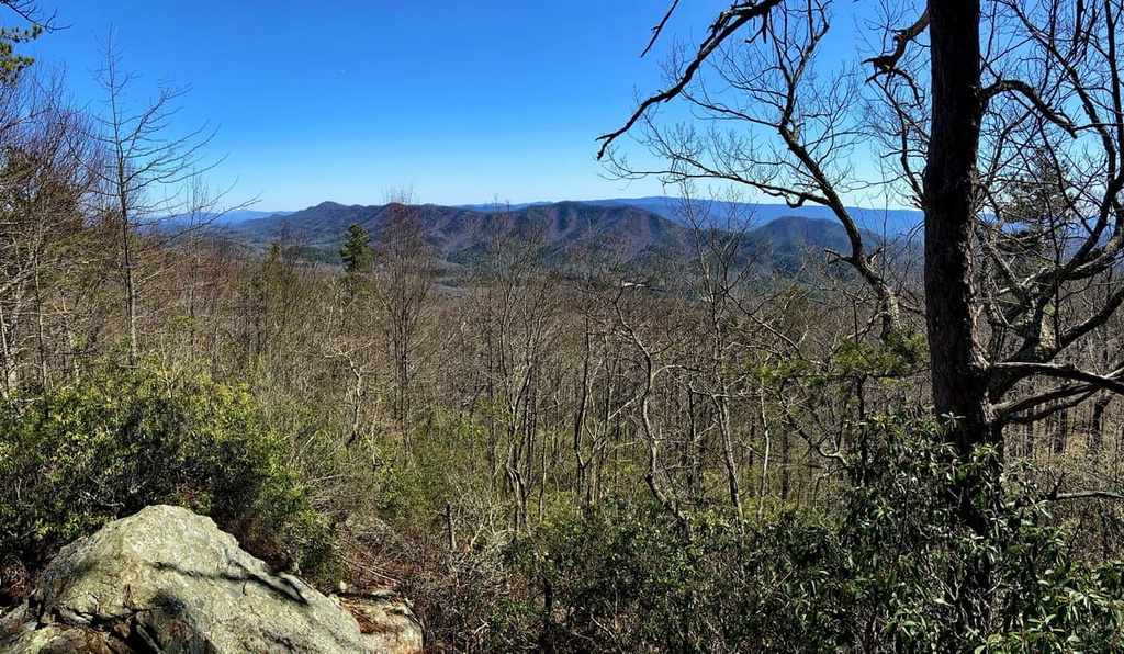
Located in the Allegheny Mountains, just outside of the Warm Springs District, Douthat State Park protects 4,545 acres (1,839 ha) of picturesque Virginia wilderness and a 50-acre (20 ha) lake stocked with trout. More than 43 miles (69 km) of trails traverse the park, and mountain biking is permitted on nearly every trail.
The park also has two furnished lodges that can accommodate 15 to 18 guests. Popular trails and attractions in the park include the Blue Suck Falls Trail, Mountain Top Trail, Brushy Hollow Trail, and Beard’s Gap Hollow Trail. From the summit of Beards Mountain, hikers are rewarded with spectacular views of Warm Springs Mountain and the Cowpasture River Valley.
Home to Virginia’s only substantial montane pine barren landscape, the Warms Springs Mountain Preserve pieces together roughly 77,000 acres (31,161 ha) of unfragmented forest and conservation lands in western Virginia’s Allegheny Highlands.
The primary goal of the preserve is to protect and restore key wildlife habitats and the headwater tributaries of both the Jackson and Cowpasture rivers. Three trails wind through the preserve, allowing visitors to immerse themselves in one of the most ecologically significant forests in the Appalachians.
Looking for a place to stay near the Warm Springs District? Here are some of the best cities and villages to check out in the region.
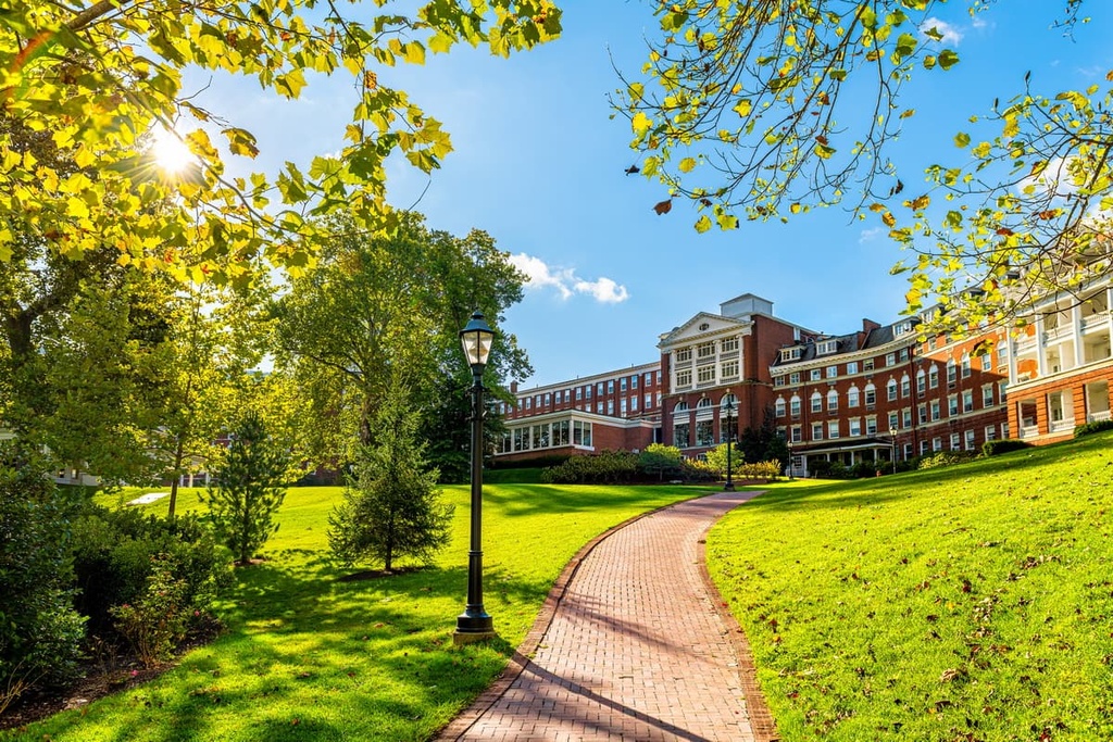
Located just outside the Warm Springs District, Hot Springs is a modest community that is home to fewer than 1,000 residents. Despite its small population, however, Hot Springs is a premier tourist destination. It is home to Virginia’s most famous hot springs resort, the Omni Homestead Resort.
Natural springs in the area have been utilized by indigenous peoples for thousands of years. Their healing properties also enticed eighteenth-century European colonists and travelers to visit and settle in the area.
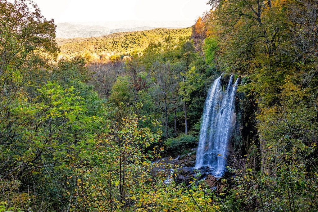
In addition to soaking in the area’s natural springs, visitors to Hot Springs can enjoy 45 acres (18 ha) of ski trails in the winter, hike on hundreds of miles of trails in the nearby George Washington National Forest, and visit one of the area’s most beautiful waterfalls, Falling Spring Falls.
Located in the Shenandoah Valley between the Blue Ridge and Allegheny Mountains, Staunton is a charming city that’s best known for being the birthplace of Woodrow Wilson, the twenty-eighth president of the US. Downtown Staunton is home to a vibrant art and music scene, a wide variety of delicious dining options, and an array of independent shops and galleries.
Not far from town, visitors can also access many scenic areas for outdoor recreation, including the nearby Blue Ridge Parkway, Shenandoah National Park, and George Washington National Forest.
Located at the confluence of the Jackson River and Dunlap Creek, Covington offers a wide range of amenities, accommodations, and restaurants for visitors to the Allegheny Highlands. Covington is home to around 5,700 people and it is the seat of Alleghany County.
Covington is also an ideal place to base yourself if you’re looking to take a trip to one of the region’s famous resorts. In fact, both the Omni Homestead and The Greenbrier are located just a 45-minute drive away from the city.
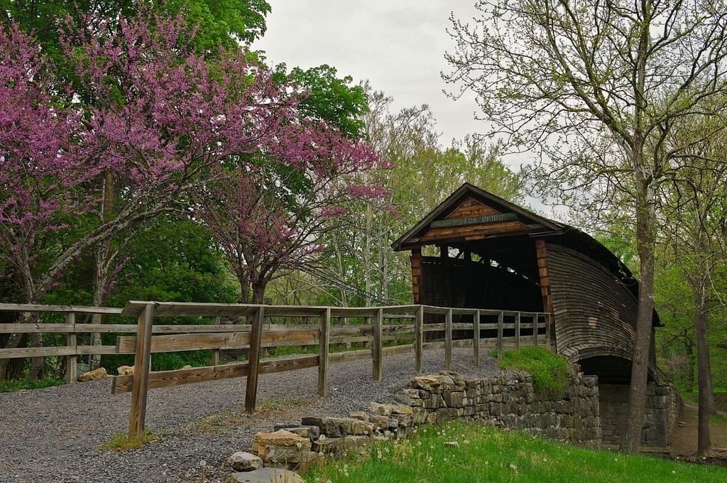
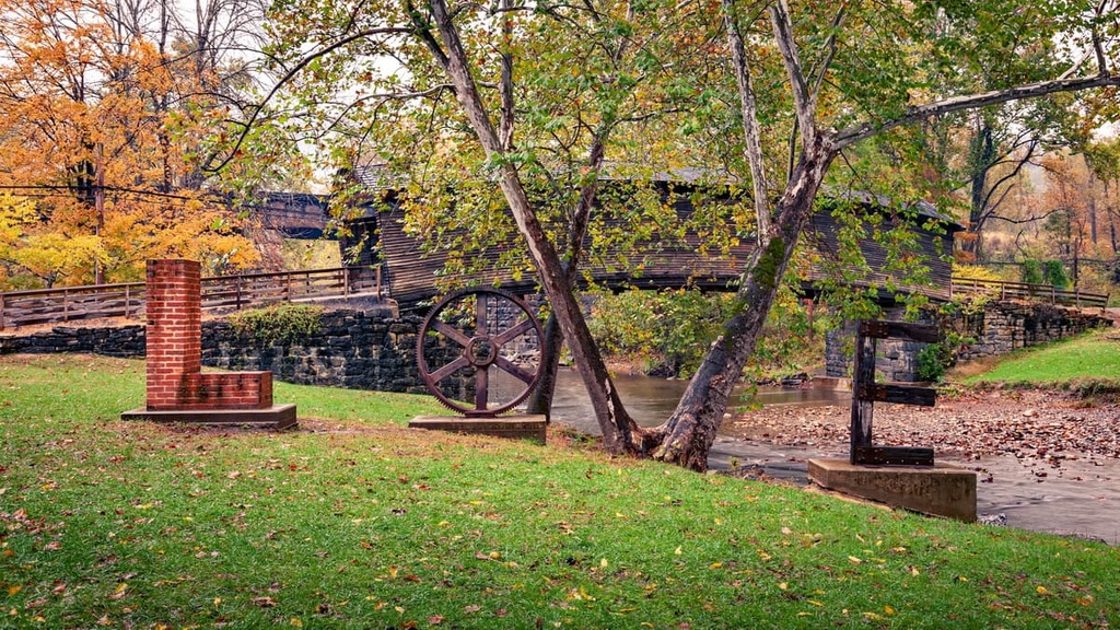
From Covington, travelers can experience many natural and historic treasures, like Fall Springs (a scenic waterfall located on Route 220), Humpback Bridge (the oldest remaining covered bridge in Virginia), and Dunlap Beach (one of the most scenic beaches in the area).


