Scan the QR code and open PeakVisor on your phone
The Glenwood-Pedlar District of Jefferson National Forest is an outdoor recreation destination located within the US state of Virginia. The ranger district features a forested landscape with 34 named mountains. The tallest and most prominent peak in the ranger district is Sugarloaf Mountain, which is 3,629 ft (1,106 m) in elevation and has 1,768 ft (539 m) of prominence.
The Glenwood-Pedlar District of Jefferson National Forest lies in western Virginia, just to the north of the James River.
Jefferson National Forest is administratively combined with the adjacent George Washington National Forest. Together, these two forests cover 1,136 sq. miles (2,941 sq. km) of terrain. The Glenwood-Pedlar District is located in western Virginia’s Amherst, Augusta, Bedford, Botetourt, Nelson, and Rockbridge counties.
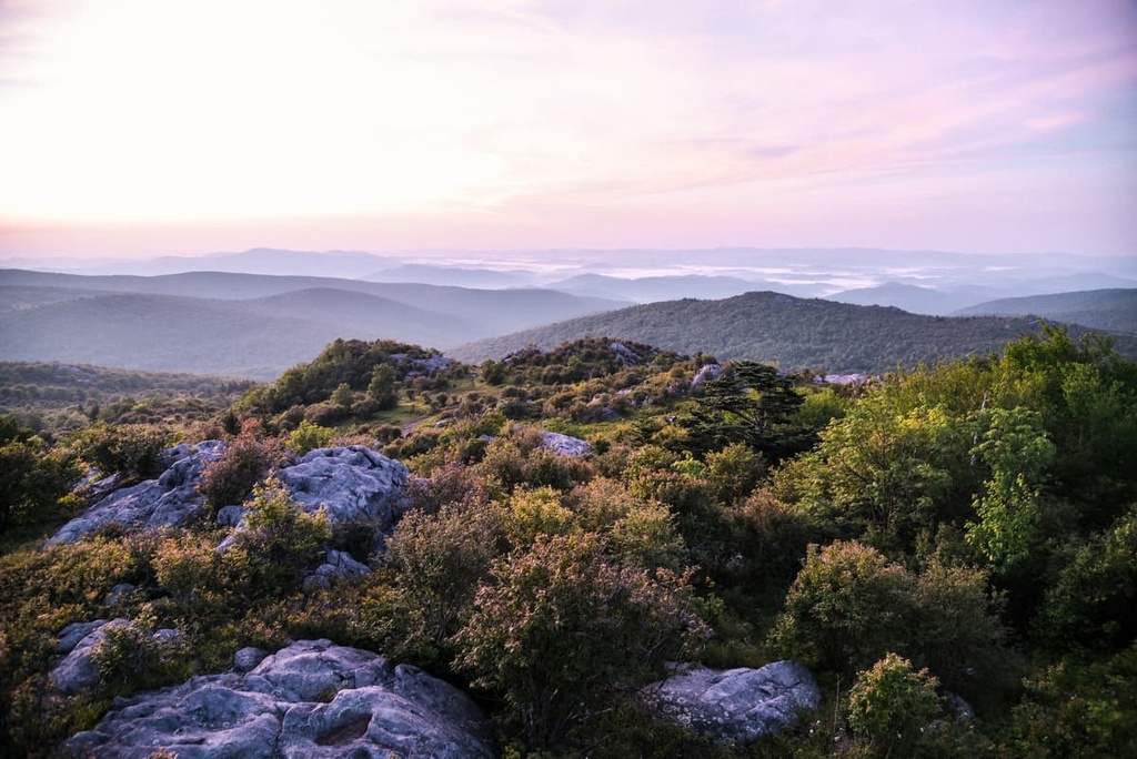
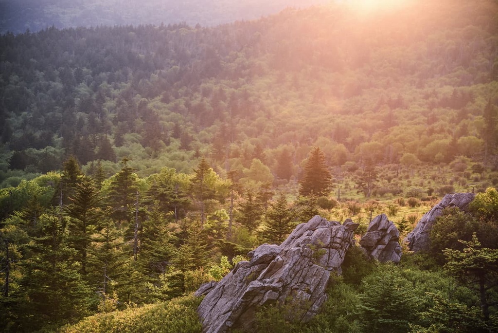
The landscape of the district is defined by its forested rolling hillsides. The James River marks the southwestern border of the district while the ridgelines of the Appalachians define the district’s other borders. The forested hillsides in the ranger district are interspersed with rocky bluffs and meadows along with some seasonal creeks.
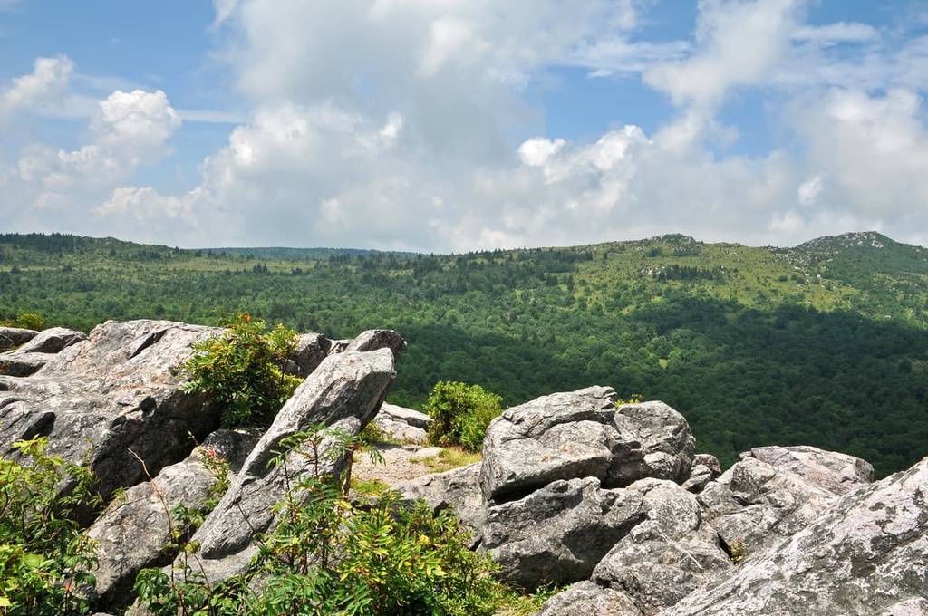
Despite the fact that most of the ranger district is densely forested, hikers can often reach viewpoints in the area that showcase the alternating ridges and valleys that define much of the region. The confluence of Craig Creek and the James River lies along the southern border of the district, too, and is a cool sight to behold.
Additionally, the Glenwood-Pedlar District is surrounded by popular outdoor recreation areas. For example, the James River District of George Washington National Forest lies directly to the west of the ranger district while Douthat State Park and Rich Hole Wilderness are situated to the north. Other portions of Jefferson National Forest lie to the south of the district near the Blue Ridge Parkway.
The peaks and ridgelines found in the district, along with the other portions of Jefferson National Forest, are part of the larger Appalachian Mountains. The entire range extends from the US state of Alabama in the south into the Canadian province of Newfoundland and Labrador in the north.
The Appalachian Mountains are the major mountain range found in the eastern US. The peaks within the Glenwood-Pedlar District are part of the Appalachian Ridges, which is a subrange of the Appalachian Mountains.
This subrange was named after the long series of alternating ridges and valleys that define the district and the surrounding region. To the east of the ranger district lies the Blue Ridge Mountains, while the Appalachian Plateaus are situated to the west.
The peaks and valleys found within the Glenwood-Pedlar District started to take shape as a result of the continual folding and thrusting of the Earth’s crust during the Alleghanian orogeny. Erosion from the region’s rivers further carved out the landscape, creating the deep valleys that we see to this day.
A majority of the ridgelines in the ranger district are folded in a westward fashion and consist primarily of sedimentary rock. Common sedimentary rocks found in the region include shales, limestones, and conglomerates. The region has historically been mined for its natural resources, which include coal, iron, zinc, marble, slate, and salt.
Major peaks found within the Glenwood-Pedlar District include Sugarloaf Mountain, North Mountain, Purgatory Mountain, Sheets Mountain, and Biggs Mountain.
The Glenwood-Pedlar District features flora and fauna that are commonly found throughout the Appalachian-Blue Ridge forests ecoregion. As a result, plants and animals that live within the district also typically live throughout a large portion of the eastern US.
That said, the Appalachian-Blue Ridge forests ecoregion is home to a multitude of endemic species, which makes it one of the most biodiverse temperate deciduous forests in both the country and the world. The lower elevations in the region support populations of oak trees. As elevations increase, these oak trees transition into spruce-fir forests.
Nevertheless, widespread logging throughout the land that is now Jefferson and George Washington National Forests has extirpated numerous species from the region. Prior to the start of commercial logging in the area, elk, mountain lions, and even bison once roamed the land.
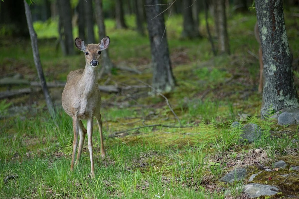
Nowadays, the region is primarily populated by white-tailed deer, opossums, squirrels, foxes, chipmunks, raccoons, and weasels. The nearby James River is home to various species of trout and smaller fish. Birds of prey such as owls, eagles, and hawks are also occasionally spotted in the region.
This region of the Appalachian Mountains is part of the ancestral homelands of the Shawnee Tribe. The Shawnee and their ancestors inhabited land surrounding the James River for countless generations, using the surrounding hillsides for hunting and gathering valuable resources.
Indigenous peoples have lived in what is now western Virginia for thousands of years, long before European settlers started to arrive in the area. These settlers began moving into the region during the seventeenth century. Some of the settlers made contact with the Indigenous people who lived in the region and had a semi-harmonious relationship with them that was based on trade.
At the beginning of the eighteenth century, settlers began flocking to the nearby Shenandoah Valley. During this time, the Shawnee primarily inhabited the northern stretches of the valley and many settlers attempted to drive the Tribe out of the region.
This influx of settlers resulted in numerous battles between the two groups as the Shawnee fought to protect and preserve their homelands. Nevertheless, by the end of the French and Indian War, settler populations quickly rose throughout the region.
Throughout this time, the US government repeatedly attacked, killed, and displaced the Shawnee people. In 1817, the Treaty of Fort Meigs was signed and the US Government forced the remaining Shawnee onto reservations in other parts of the country, such as Ohio and Oklahoma.
Nowadays, there are three federally recognized Shawnee Tribes: the Shawnee Tribe, the Eastern Shawnee Tribe of Oklahoma, and the Absentee Shawnee Tribe of Indians of Oklahoma.
After decades of extensive logging, efforts were made to preserve and protect the remaining landscape in the region. The nearby George Washington National Forest was established in 1918, making it one of the first national forests in the country. Jefferson National Forest would later be established in 1936, and the two forests were administratively combined in 1995.
The Glenwood-Pedlar District is home to numerous hiking trails. Here are a few of the popular routes within this portion of the national forest.
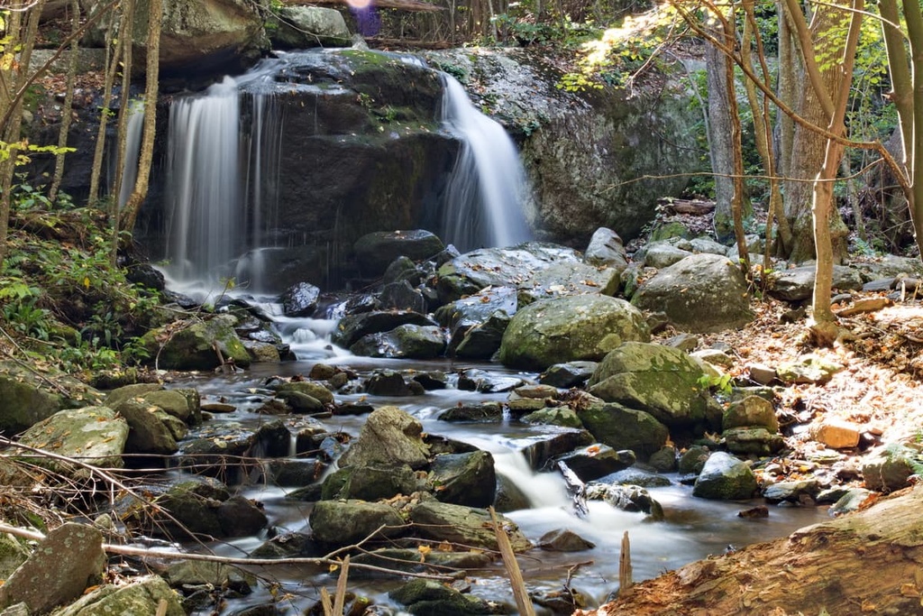
The Apple Orchard Falls Trail is a National Recreation Trail that winds its way through the ranger district. This trail descends down Apple Orchard Mountain while roughly following the banks of North Creek.
Hikers on this trail can witness stunning forested landscapes as they work their way to a viewpoint of the falls. An elevated boardwalk leads from the trail to a location near the base of the falls. The entire route is approximately 3.3 miles (5.3 km) in length, so it’s doable for most people in an afternoon.
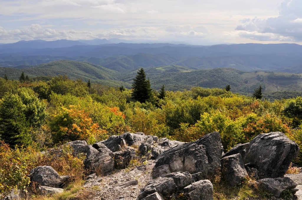
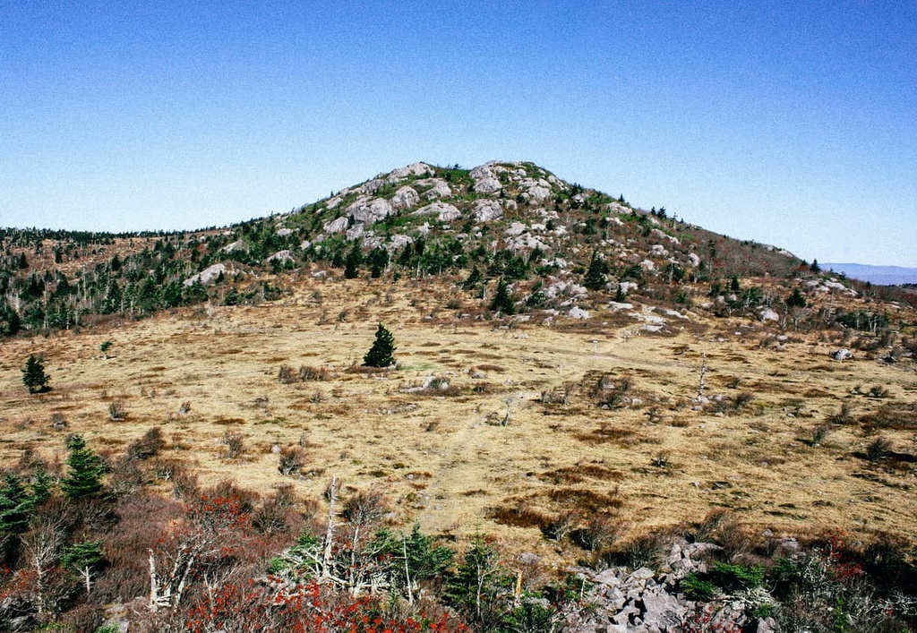
The Spy Rock Trail, which is also known as Forest Trail #732, is an out-and-back trail that offers views of the many mountains in the ranger district. This route is accessible from the Appalachian Trail, which is a major long-distance walking path that traverses the eastern US.
From the Spy Rock vista point, hikers can stand atop a large rock outcropping that offers sweeping views of the forested ridgelines and valleys that define the region. This trail is about 6.5 miles (10.5 km) in length round trip.
Looking for a place to stay near the Glenwood-Pedlar District? Here are some of the best cities and towns to check out in the region.
The city of Covington lies just to the west of the Glenwood-Pedlar District in the heart of the James River District of George Washington National Forest. Covington is situated at the confluence of the Jackson River and Dunlap Creek, and it is home to about 5,700 residents.
Local shops and restaurants line the downtown streets of Covington while national forests and wilderness areas extend outward in every direction. The vast parcels of protected land located around the town have allowed the region to become a hub for outdoor recreation.
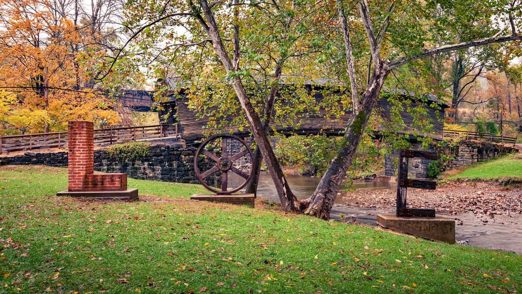
A network of trails for hiking, camping, and mountain biking provide year-round entertainment for visitors to Covington. During the summer months, rafting along the town’s surrounding waterways is a popular activity for outdoor enthusiasts. Nearby attractions in the area around Covington that are worth checking out include Lake Moomaw, Humpback Bridge, and Falling Springs Waterfall.
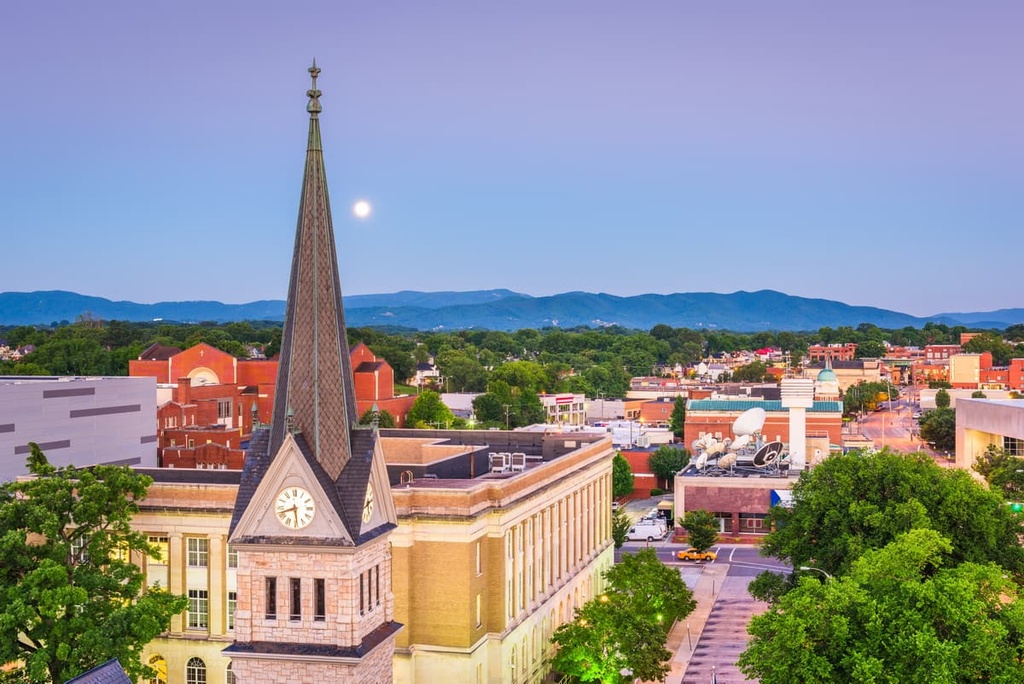
Roanoke is a major city that lies to the southwest of the ranger district. It is home to around 100,000 residents, which makes it the most populous city in the state to the west of Richmond. Aptly named, the city is situated along the Roanoke River within the Roanoke Valley.
The city’s relatively large population has allowed Roanoke to become the cultural and financial hub of western Virginia. A vast network of trails surrounds the city, including a portion of the Appalachian Trail, so it’s a popular destination among hikers.
Roanoke is also occasionally referred to as America’s East Coast Mountain Biking Capital due to the fact that it’s home to dozens of designated mountain biking trails. Breweries, shops, and restaurants are situated throughout the downtown streets of Roanoke, too, providing a nearly limitless array of activities for visitors to enjoy when they’re not in the mountains.