Scan the QR code and open PeakVisor on your phone
The James River District of George Washington National Forest is an outdoor recreation destination located within the US state of Virginia. The district features a forested and rugged landscape with 72 named mountains. The tallest peak in the ranger district is Big Knob at 4,058 ft (1,237 m) in elevation and the most prominent is Brushy Mountain with 1,424 ft (434 m) of prominence.
The James River District of the George Washington National Forest lies in western Virginia, along the state’s border with West Virginia. True to its name, the James River cuts across the easter portion of the James River District.
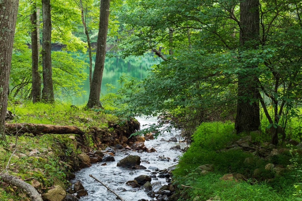
Other waterways in the ranger district include the Jackson River, Cowpasture River, and Potts Creek. The landscape of the district is similar to that of much of George Washington National Forest, which primarily features rolling forested hillsides and bluffs.
A majority of the peaks within the district are forested with only a few rocky bluffs providing scenic views. Lower elevations in the ranger district feature pastures and fields, which are often used by the people who live within the forest boundaries.
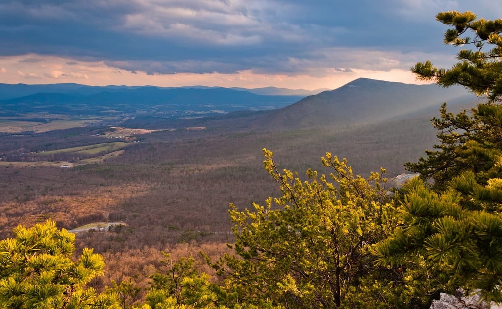
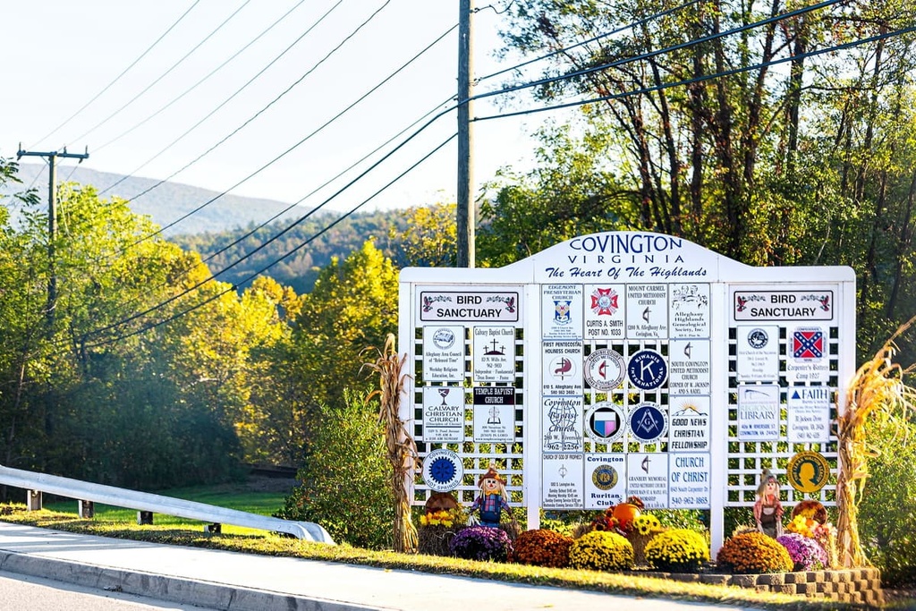
The main ranger office for the James River District is located in Covington, Virginia, and it serves Alleghany county. From the higher peaks in the ranger district, hikers can see the rugged mountainous landscape slowly transition into the flatlands to the east.
Additionally, the James River District is surrounded by popular outdoor recreation areas. The Jefferson National Forest lies directly to the south of the ranger district while the other ranger districts of the George Washington National Forest are located to the north and east. Mill Creek Springs State Natural Area Preserve also lies to the southeast of the ranger district.
The mountains found throughout the James River District and the rest of George Washington National Forest are part of the Appalachian Mountains. This mountain range spans from the US state of Alabama northward to the Canadian province of Newfoundland and Labrador.
Furthermore, the peaks in the James River Ranger District are part of the Appalachian Ridges, which are a subrange of the Appalachian Mountains. Alternating long ridges and valleys make up the landscape that is found throughout the region. The Blue Ridge Mountains lie directly to the east of the ranger district while the Appalachian Plateaus are situated to the west.
The unique alternating ridges and valleys in the ranger district were formed by continual folding and thrusting during the Alleghanian orogeny. This major mountain-building event laid the foundation for the Appalachian Mountains and its various subranges.
Nowadays, the rocks found throughout the district consist primarily of westward folded layers of sedimentary rock. Sedimentary rocks can be found throughout much of George Washington National Forest, too, while the Shenandoah National Park to the east consists primarily of granites and gneisses rocks.
Major peaks found within the James River District include Big Knob, Brushy Mountain, Mud Run Mountain, Lick Mountain, and Waits Mountain.
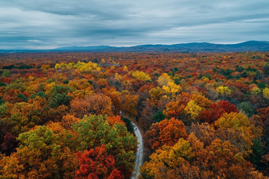
The James River District features flora and fauna that are commonly found in the nearby Allegheny Mountains. The vast majority of the district is densely populated by hardwood trees. Common tree species found in the area include mountain ash, red maple, eastern hemlock, red spruce, and oak.
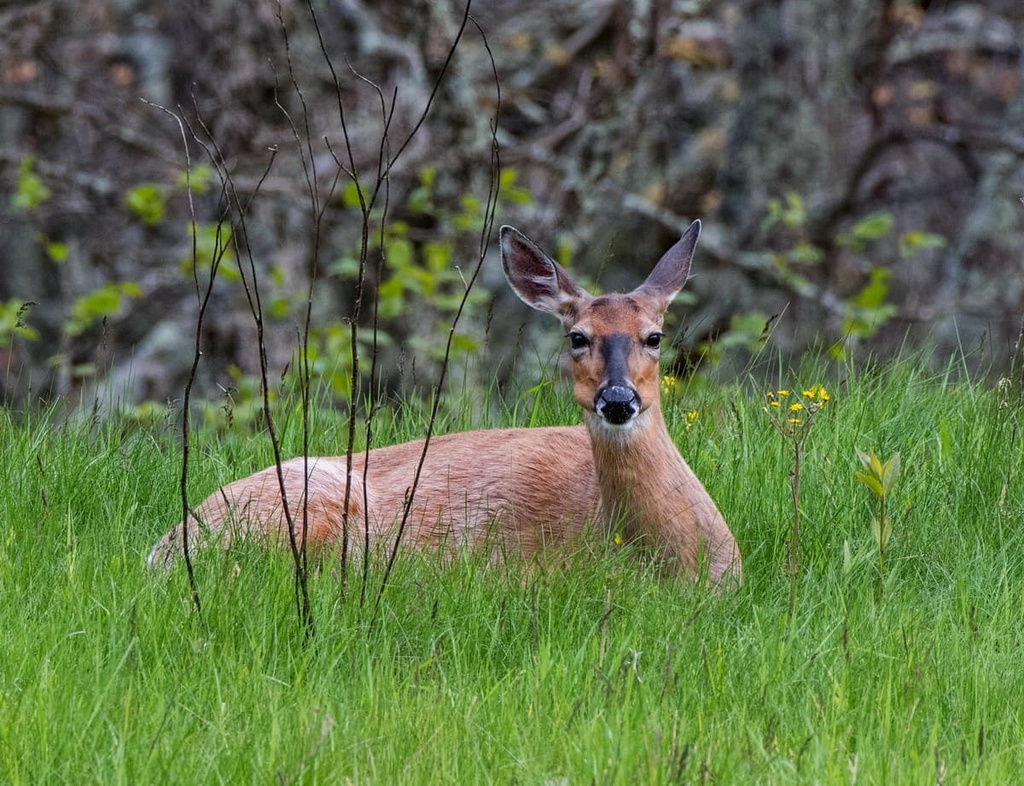
Larger mammals, such as elk, bison, and mountain lions, once roamed the region but were all extirpated during the extreme logging that took place throughout the nineteenth century. Nowadays, common mammal species include white-tailed deer, chipmunks, raccoons, opossums, squirrels, foxes, and weasels.
The waterways of the James River District are filled with various species of trout, mussels, and smaller fish. Species of hawks, owls, and eagles can all be spotted in the region, too, along with hermit thrushes and wood thrushes.
The land within and surrounding the James River District is part of the ancestral homelands of the Shawnee Tribe. The Shawnee and their ancestors have inhabited the region for thousands of years, long before the arrival of European settlers.
Throughout the seventeenth century, settlers of European descent started establishing homesteads in the area and making contact with the Shawnee Tribe. By the 1730s, colonizers began settling throughout the Shenandoah Valley.
By this time, the Shawnee primarily lived in the northern part of the valley. The increasingly large number of European settlers in the region led to numerous battles between the settlers and the Shawnee groups as the Shawnee fought to protect their land.
Following the French and Indian War, an increasingly large number of settlers began moving to the region that is now the James River District. The US Government eventually forced the Shawnee people onto three reservations in present-day Ohio following the Treaty of Fort Meigs in 1817.
In order to protect and preserve the region, the land was designated as Shenandoah National Forest in 1918, making it one of the first national forests on the east coast. The forest’s name changed to George Washington National Forest in 1932. It would later be administratively combined with Jefferson National Forest in 1995.
The James River District is home to numerous hiking trails. Here are a few of the popular routes within the James River District portion of the national forest:
The Jackson River Trail is the most popular hiking route within the James River District. This out-and-back trail consists primarily of packed gravel, making it accessible for hiking, running, or biking. This route is 14.3 miles (23 km) long round-trip and it has 413 ft (126 m) of elevation gain.
The route winds its way down the shores of the Jackson River, and it offers a number of great viewpoints along the way. Hikers on this trail can immerse themselves in the forested landscape while also taking the time to stop and relax in the water of the Jackson River. A number of interesting rock formations and steep cliffs can also be spotted along the route.
The Fore Mountain Trail is an out-and-back route that crosses the center of the James River Ranger District. This rather remote trail is 28 miles (45 km) in length and it has 6,420 ft (1,957 m) of elevation gain. The trail begins in the city of Covington before traveling northeast.
You can use the trail for a long day hike or as a route for a backpacking trip. Deciduous trees can be seen throughout the trail, offering hikers stunning forest views with the changing of the seasons. There are a few viewpoints located along the trail that give you a chance to see the surrounding mountains, valleys, and creeks, too.
Looking for a place to stay near the James River District? Here are some of the best cities and villages to check out in the region:
Covington lies in the heart of the James River District within George Washington National Forest. The city has a population of around 5,700 people and is situated at the confluence of the Jackson River and Dunlap Creek.
The quaint downtown streets of Covington are lined with a few local shops and restaurants, all while being surrounded by the stunning national forest. Visitors to the region can enjoy the city’s plethora of hiking trails, as well as its many areas for trail running, mountain biking, and rafting.
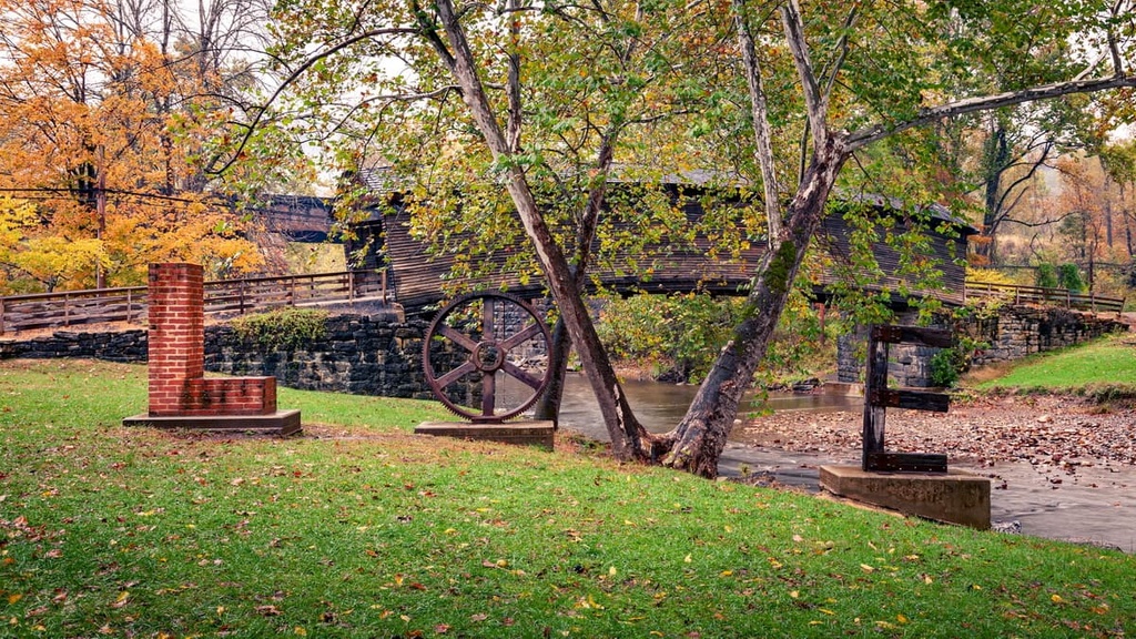
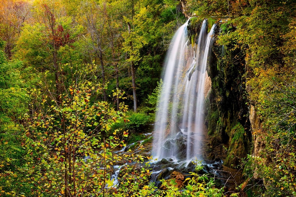
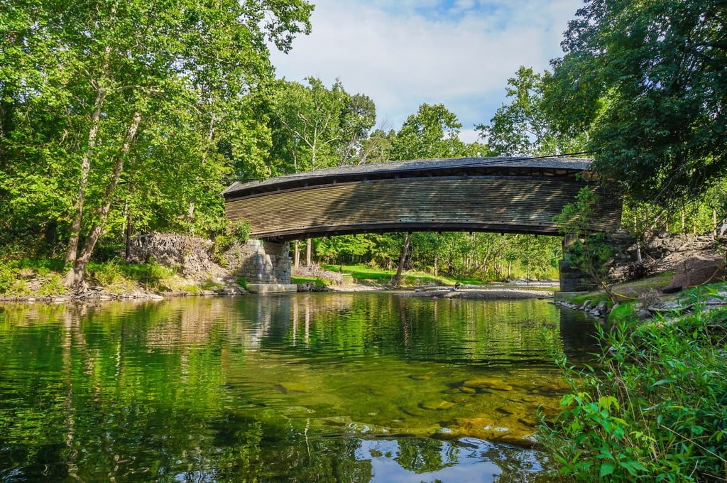
Popular attractions around Covington include Falling Springs Waterfall, Humpback Bridge, and Lake Moomaw.
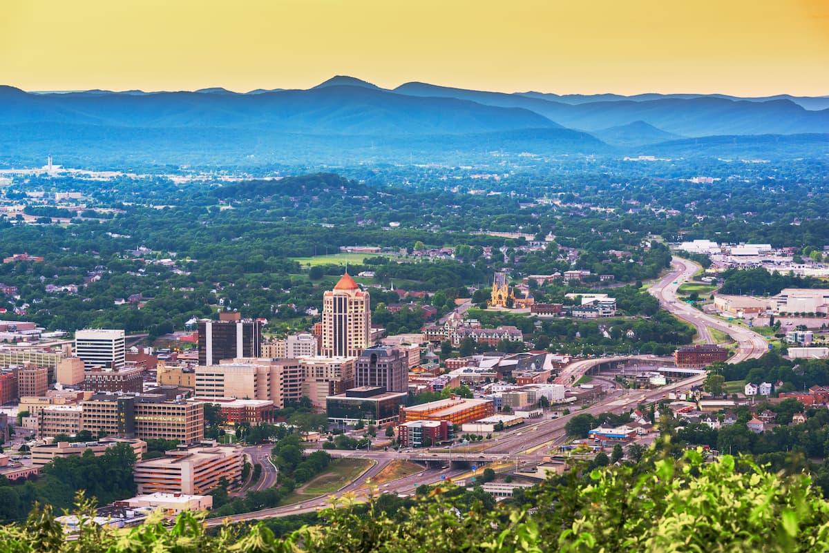
Just to the south of the James River District lies the city of Roanoke, Virginia. Home to around 100,000 residents, Roanoke is the largest city in the state to the west of Richmond. Situated in the Roanoke Valley, along the Roanoke River, the city acts as a cultural and financial hub for western Virginia.
The Appalachian Trail travels near Roanoke, too, as it passes through the state’s Blue Ridge Mountains. Locally, the city is known as America’s East Coast Mountain Biking Capital because Roanoke is home to hundreds of miles of trails. Numerous local shops, restaurants, and breweries line the downtown area of Roanoke, offering an ideal way to relax after a long day of hiking in the mountains.