Scan the QR code and open PeakVisor on your phone
The Lee Ranger District is the northernmost part of the George Washington National Forest, which is located along the border of the US states of Virginia and West Virginia. There are 107 named mountains in the Lee Ranger District, the highest of which is Mill Mountain (3,301 ft/1,006 m) and the most prominent of which is Lairds Knob (3,281 ft/1,000 m).
The Lee Ranger District is an administrative area within the massive George Washington National Forest. It is situated at the northernmost reaches of the forest on either side of Interstate 81 in the US states of Virginia and West Virginia.
There are technically more than half a dozen other ranger districts in the George Washington National Forest and the Jefferson National Forest, which have been administratively combined since 1995. The other ranger districts include:
Additionally, the forests contain the Mount Rogers National Recreation Area, which has its own district office in Marion, Virginia.
There are 23 total federally protected wilderness areas in the combined Jefferson and George Washington National Forests. However, none are located within the Lee Ranger District.
Rather, the nearest wilderness areas to the district are the Ramseys Draft Wilderness in the North River Ranger District and both the James River Face, Saint Mary’s, Three Ridges, and Thunder Ridge wildernesses in the Glenwood-Pedlar Ranger District.
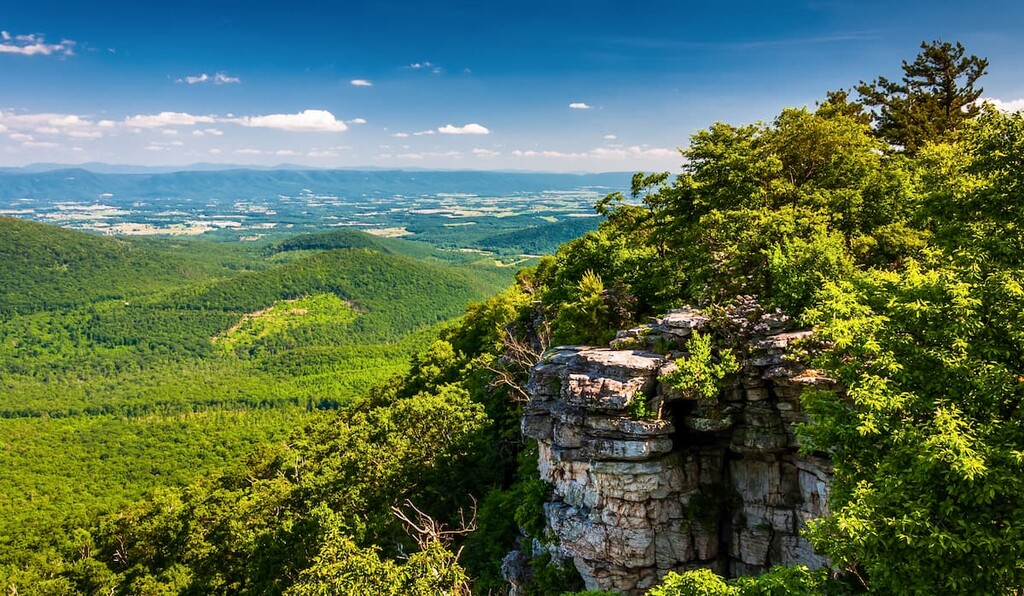
Despite its lack of designated wilderness areas, the Lee Ranger District of the George Washington National Forest is situated within close proximity to many other important areas of public land.
This includes the North River Ranger District and the Glenwood & Pedlar Ranger Districts to the south and both the Nathaniel Mountain Wildlife Management Area and the Short Mountain Wildlife Management Area to the north. Additionally, the ranger district is located to the west of the uber-popular Shenandoah National Park.
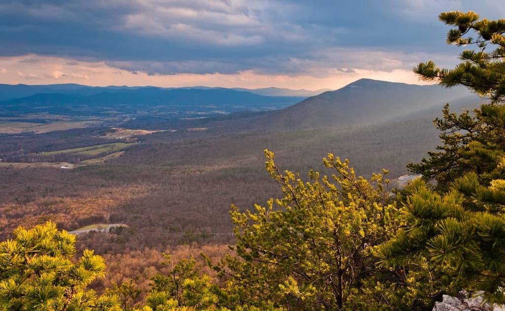
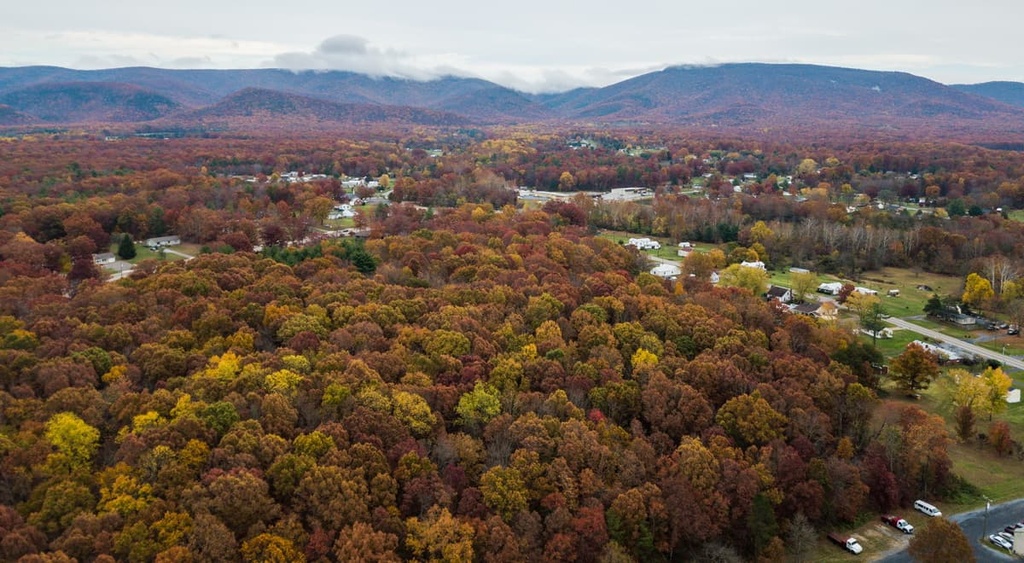
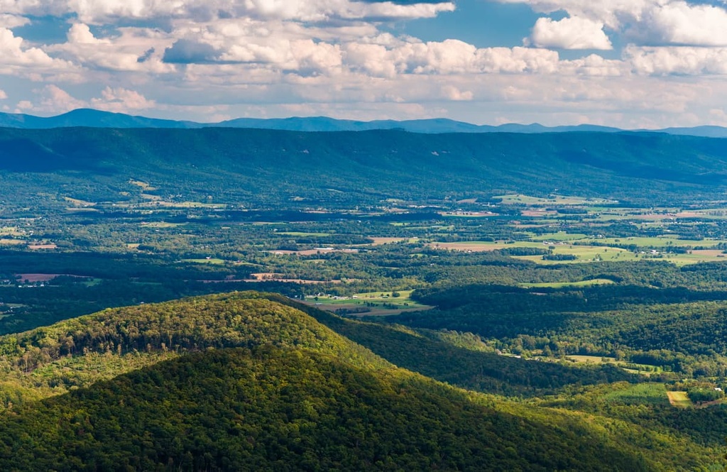
The peaks in the Lee Ranger District are part of the greater Appalachian Mountains. The Appalachians are a system of mountain ranges that extend from the province of Newfoundland and Labrador in Canada to the north all the way to the northern part of the US state of Alabama in the south.
Moreover, the Lee Ranger District of the George Washington National Forest mostly contains peaks that are part of the Appalachian Ridges subrange. This subrange extends from the state of New York in the north to the state of Alabama in the south.
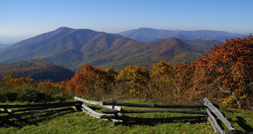
Additionally, the easternmost extent of the Lee Ranger District, particularly the area near Shenandoah National Park, could be considered part of the Blue Ridge Mountains. The Blue Ridge Mountains start in Georgia and run to the east of the Appalachian Ridges until their terminus in the state of Maryland.
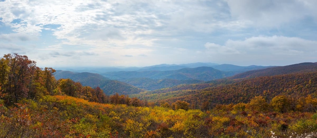
The Appalachian Ridges and the Blue Ridge Mountains have similar, albeit still unique, geologic histories. Both subranges can date the bulk of their mountain building to the Alleghenian orogeny.
However, the Blue Ridge Mountains are mostly composed of highly metamorphosed Precambrian rock, such as schists, slates, gneisses, and quartzites. The rocks in the Appalachian Ridges, on the other hand, are mostly Early Paleozoic in age and consist of various shapes, limestones, and conglomerates.
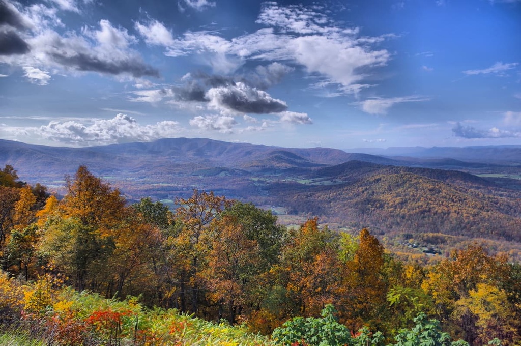
Major peaks in the ranger district include Mill Mountain, Lairds Knob, Devils Benchmark, Little Sluice Mountain, and Waonaze Peak.
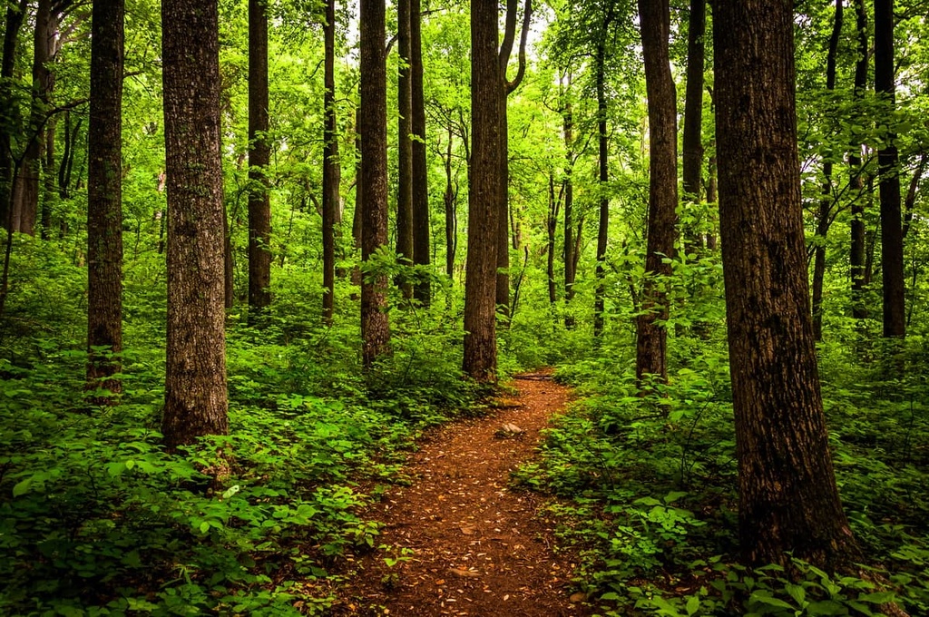
The Lee Ranger District features similar ecological characteristics to the rest of the George Washington National Forest.
Much of the region is part of the greater Appalachian-Blue Ridge Forests ecoregion. This ecoregion extends throughout both the Blue Ridge Mountains and the Appalachian Ridges. It is also considered to be one of the most biodiverse ecoregions in the eastern United States.
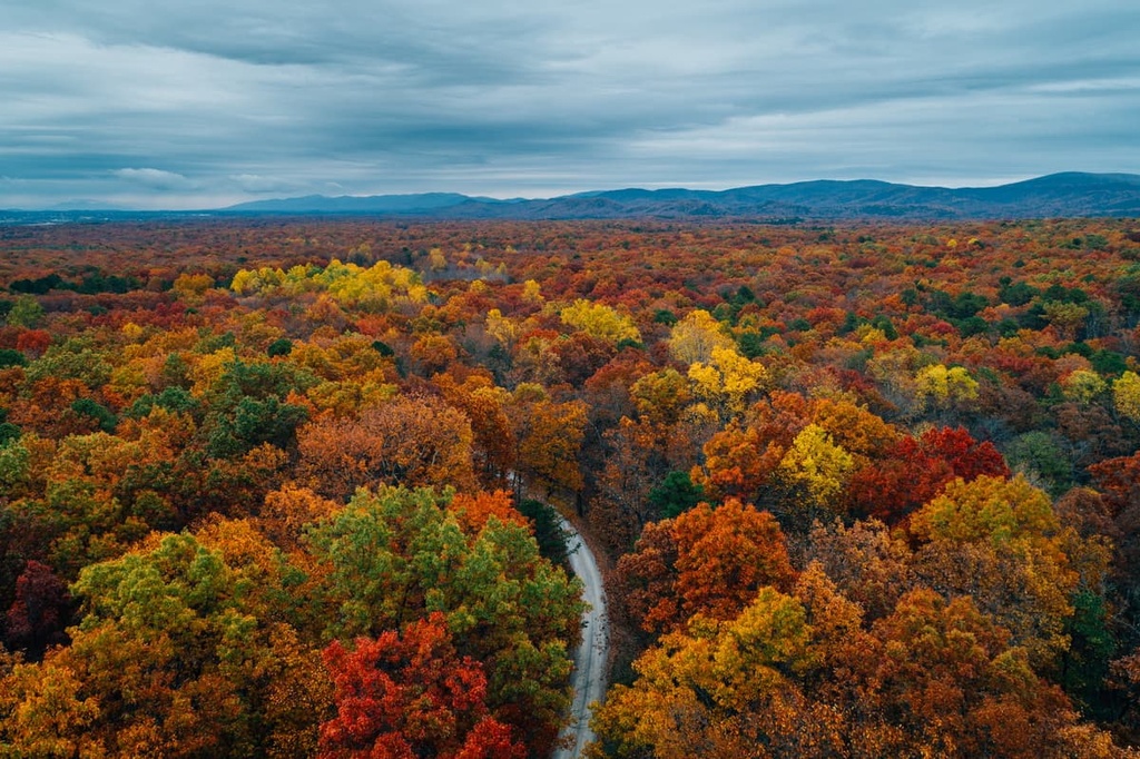
Most of the woodlands in the Lee Ranger District are hardwood and Appalachian mixed pine-hardwood forests. Here, the landscape is dominated by mountain maple, yellow birch, sugar maple, beech, tulip, red oak, black cherry, and sweet birch trees.
At slightly higher elevations, the region is home to a higher density of coniferous trees. Some of the more common conifers found in this area include red spruce and Fraser fir.
Additionally, the Lee Ranger District is home to a diversity of wildlife. Some of the more common species include white-tailed deer, martens, weasels, and otters. There are also bobcats and black bears, but encounters with these animals are less frequent.
The Lee Ranger District of the George Washington National Forest is a particularly interesting place when it comes to human history. The area that is now part of the George Washington National Forest is on the traditional territory of many Indigenous peoples, including the Massawomeck, Manahoac, Monacan, Cherokee, Sapony, Shawnee, and Tutelo tribes, among others.
Some of the earliest peoples of European descent to visit the region were members of the Knights of the Golden Horseshoe Expedition. This expedition was led by Lieutenant Governor Alexander Spotswood in 1716 in an attempt to travel through the Blue Ridge Mountains in what was then a remote part of the Colony of Virginia.
The nearby city of Harrisonburg was established in 1737 by a settler named Thomas Harrison. Harrison claimed more than 12,000 acres (4,900 ha) of land in the Shenandoah Valley, further precipitating the forced removal of Ingienous people from their homelands in the region. The region became particularly popular among settlers from Scotland, Ireland, and Germany during the eighteenth century.
Additionally, the region saw a number of battles during the Civil War. The Shenandoah Valley was an important slave-owning agricultural area for the Confederacy during the war. As such, taking control of the valley was important for the Union Army. After the war, many of the formerly enslaved peoples of the Shenandoah Valley established the city of Newtown, which is now part of Harrisonburg.
George Washington National Forest was formally established in 1918, though it was called Shenandoah National Forest at the time. It was later renamed as the George Washington National Forest in 1932.
In 1933, the George Washington National Forest was expanded to include what was then called the National Bridge National Forest. Additionally, in 1933, the Lee Ranger District became the site of the very first campground—Camp Roosevelt—that was established by the newly formed Civilian Conservation Corps (CCC).
The CCC was created by President Franklin D. Roosevelt in order to employ thousands of workers who had lost their jobs during the Great Depression. Through this program, single men between the ages of 18 and 25 could receive a job as well as room and board. The area that is now the Massanutten Visitor Information Center was actually the initial base of operations for the CCC.
The establishment of Camp Roosevelt was so important to the program that President Roosevelt himself was there to witness the dedication of the new campground. It would go on to become the first of more than 1,500 of such campgrounds built in national parks, forests, recreation areas, and monuments across the country during the Great Depression.
However, do note that segregation was prevalent during this time. While the CCC group that built Camp Roosevelt consisted only of White men, the nearby Wolf Gap Recreation Area was the main base for a CCC group that consisted of only Black men.
Segregation in the region existed well beyond a few CCC camps. Indeed, nearby Shenandoah National Park has an extensive history of segregation that continued until 1950. During this time, many of the most popular camping and hiking areas were available only to White visitors.
Desegregation of all national park facilities was first mandated in 1945. However, opposition from the park’s main concessionaire, Virginia Sky-Line Company prevented full integration from taking place until 1950. Similar events played out in many national parks and national forests across the country, including in the George Washington National Forest.
In more recent years, the George Washington National Forest was administratively combined with the Jefferson National Forest in 1995. Since then, the forests have become a popular hiking and outdoor recreation area in western Virginia.
George Washington National Forest contains thousands of miles of hiking and multi-purpose trails. Here’s a look at some of the most popular hikes in the Lee Ranger District:
The Kennedy Peak Loup is a 5.4 mile (8.7 km) hike that brings you to the summit of Kennedy Peak.
This hike starts at Edith Gap and follows the Massanutten Mountain East Trail until it connects with a spur trail that leads to an observation tower at the summit. At the top, you get superb views of the rest of the Page Valley and of Massanutten Mountain.
One of the more strenuous treks in the ranger district, the Signal Knob Loop is a 10.2 mile (16.4 km) hike that brings you to the top of Signal Knob.
This hike begins at the Bear Wallow/Signal Knob parking area on Virginia Route 678 near the Elizabeth Furnace Picnic Area. From here, it follows a series of four trails up to an outpost that served an important role for both Confederate and Union armies during the Civil War.
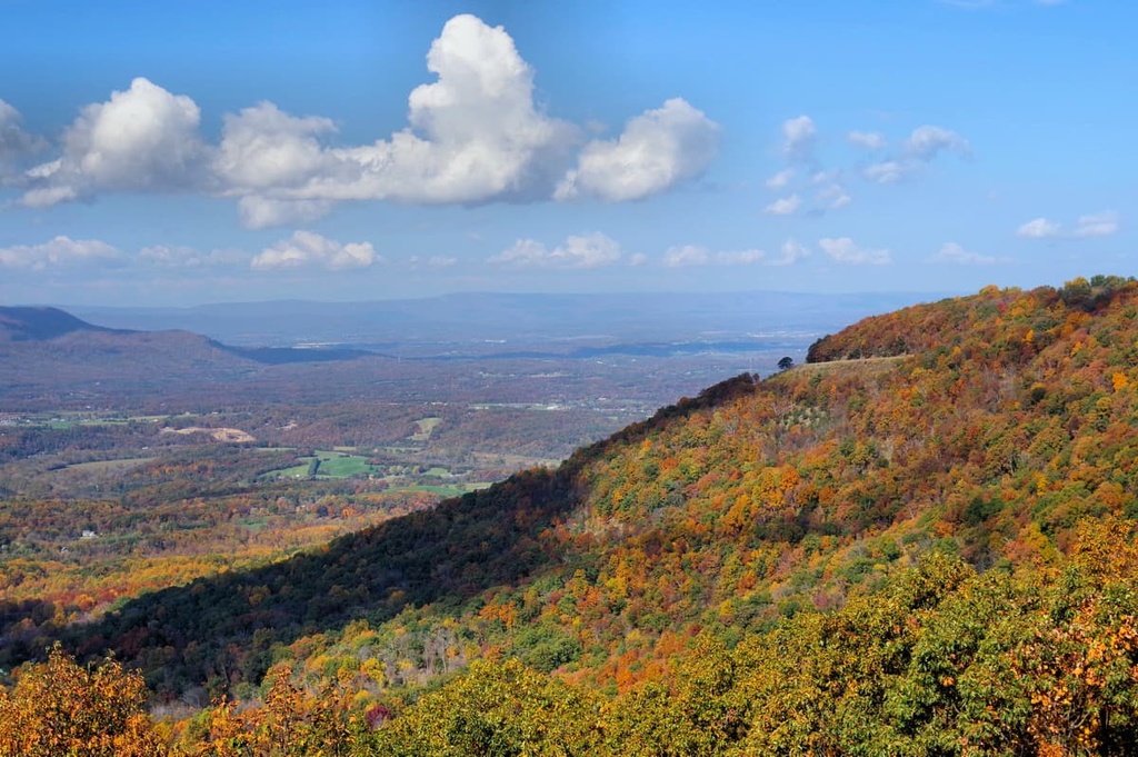
Along the way, you’ll be treated to a number of great vistas of the Shenandoah Valley. There are also usually great wildflowers in the spring and excellent blueberries for picking along the trail during the summer months.
The Mill Mountain Trail to Big Schloss is a 4.5 mile (7.2 km) hike that begins at the Wolf Gap Campground. It climbs to the summit of Mill Mountain where superb views await.
During this hike, you’ll also get to go to Big Schloss, which is a collection of craggy outcroppings. From here, there are excellent vistas of the Trout Run Valley.
George Washington National Forest contains a plethora of excellent places to stay within the forest boundaries. The Lee Ranger District is no exception. Here are some of the best accommodation options to consider if you’re looking to stay in the forest:
There are a number of excellent campgrounds within the Lee Ranger District that are perfect for anyone that wants to spend the night outside without sacrificing their comfort. The Lee Ranger District is home to five campground areas:
Also note that there are a handful of campgrounds available in the nearby North River Ranger District and in neighboring Shenandoah National Park.
Many of the campgrounds in the Lee Ranger District are available on a first come, first served basis. If you would like to make a reservation for a campground that accepts reservations, head to Recreation.gov and search for the site that you want to stay at.
Note that there are a few year-round campgrounds in the ranger district but many are seasonal. Most of the campgrounds also don’t offer electricity and water hook-ups for RVs, but the majority offer potable water. Always confirm which amenities are available at a given campground before you plan your trip.
US Forest Service rules generally allow anyone to camp wherever they want in a national forest, so long as they follow a few rules. This type of camping away from a designated camping area is called dispersed camping and it’s ideal for backpackers.
One of the most important rules to remember is that you must be on public land when dispersed camping. Check local maps for up-to-date information about private landholdings in the area. Additionally, note that you cannot camp in areas that are specially marked as off-limits to campers, such as developed areas.
Anyone camping in the backcountry of the Lee Ranger District must be at least 200 feet (60 m) from any water source, such as a lake or river. You must generally also be at least 200 feet (60 m) from a trail, unless otherwise posted.
Note that you cannot camp for more than 21 consecutive days at a time in the George Washington National Forest without acquiring a permit. Although there are no wilderness areas in the ranger district, you should note that the maximum group size in a wilderness is 10 people.
Finally, always follow Leave No Trace principles when dispersed camping in a national forest—or anywhere else for that matter. In particular, be sure to pack out any trash that you have while hiking. Also keep in mind that the Lee Ranger District is in bear country, so always store your food properly while in the mountains.
Although many national forests have cabins available to rent, there aren’t any cabins within the Lee Ranger District of the George Washington National Forest.
However, there are three cabins that you can rent in the Mount Rogers National Recreation Area and one cabin available in the Clinch Ranger District. Reservations are required for cabin rentals, so go to Recreation.gov to learn more.
Looking for a place to stay near the Lee Ranger District of the George Washington National Forest? Here are some of the best places to check out in the region:
Home to approximately 15,000 residents, Front Royal is the county seat of Warren County and the gateway to Shenandoah National Park. The town is located just outside one of the most popular entrances to Shenandoah’s Skyline Drive, so it has a strong tourism industry that’s driven by visitation to the park.
As such, Front Royal has a fantastic collection of hotels, restaurants, shops, and other similar amenities for visitors to enjoy. Front Royal is also just a short drive from Washington, DC, which is also accessible via a commuter bus service.
The city of Petersburg, West Virginia is situated just to the west of the Lee Ranger District. It is home to about 2,500 people, making it one of the most populous cities near the western border of the George Washington National Forest.
Although Petersburg is a relatively small city, there’s plenty to see and do in the community. There are some great restaurants to check out as well as a handful of historic sites to visit. Plus, Petersburg is also just a short drive from the Monongahela National Forest, so it offers great access to a range of outdoor recreation opportunities.
Staunton, Virginia is a city of approximately 25,000 people that’s located in the middle of the Shenandoah Valley. The city is one of the largest in the region and it’s considered to be a hub for commerce and culture in the valley.
Staunton is located just to the south of the Lee Ranger District at the intersection of Interstate 64 and Interstate 81. It offers excellent transportation links to the surrounding region, including into the neighboring North River Ranger District.
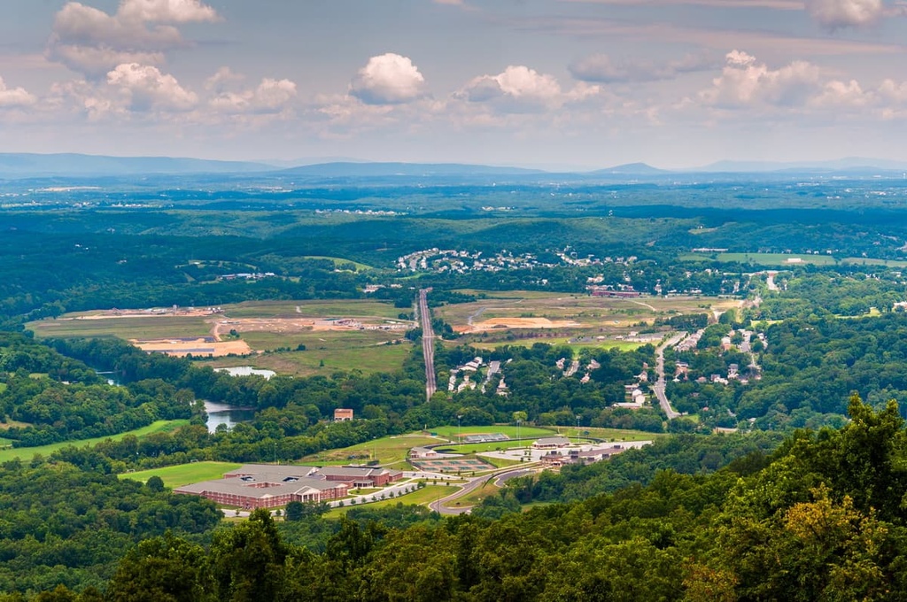
Harrisonburg is another major city in the Shenandoah Valley. It is located just to the west of Shenandoah National Park and just to the east of the Lee Ranger District.
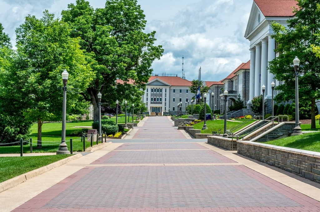
With approximately 55,000 residents, Harrisonburg is one of western Virginia’s major cities. It is home to James Madison University, which has more than 20,000 students, and the Eastern Mennonite University, which has about 2,000 students.
Furthermore, Harrisonburg is one of the more culturally diverse areas of western Virginia. The city has a large refugee community as well as sizable Pennsylvania Dutch and Mennonite communities. In fact, the language learning company Rosetta Stone was even founded in Harrisonburg in the 1990s.