
Share

Scan the QR code and open PeakVisor on your phone
Scan the QR code and open PeakVisor on your phone
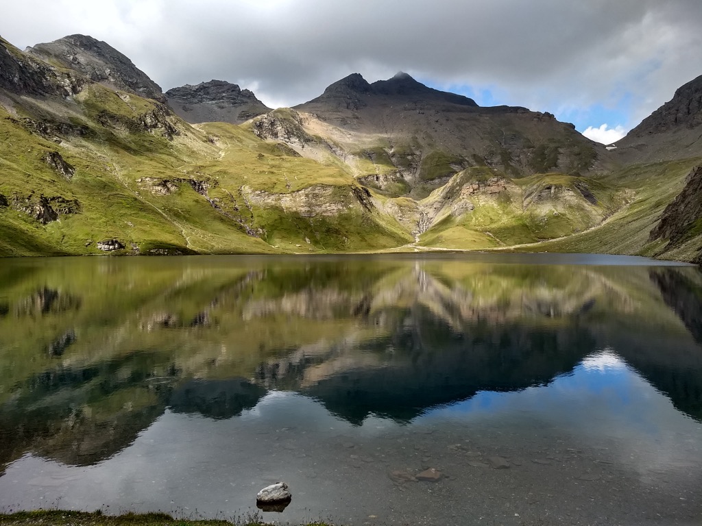
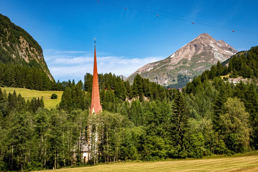
The Western Tauern Alps is one of the largest mountain ranges in the Eastern Alps, mainly in Austria. Its main feature is the Großglockner / Grossglockner—the highest (3,798 m / 12,460 ft) and, at the same time, the most prominent (2,428 m / 7,965 ft) mountain in the whole country in the High Tauern group coinciding with the High Tauern National Park, also the main one, with a million hiking trails and some ski resorts. In total there are 3296 named mountains in the Western Tauern Alps.
The word "Tauern" means "high mountain pass" in German. The full name of the range in German and Italian: Westliche Tauernalpen, and Alpi dei Tauri occidentali, respectively.
The Western Tauern Alps are located in the very center of the Eastern Alps, mainly in Austria, where it covers the states of Tyrol, Carinthia, and Salzburg. A little portion of the range is also located in Italy in the region of Trentino-Alto Adige/Südtirol.
Given its central location, it is surrounded at once by seven other large ranges (clockwise from the west): the Eastern Rhaetian Alps, the Tyrol Schistose Alps, the Northern Salzburg Alps, the Eastern Tauern Alps, the Carinthian-Styrian Alps, the Carnic and Gailtal Alps, and the Dolomites.
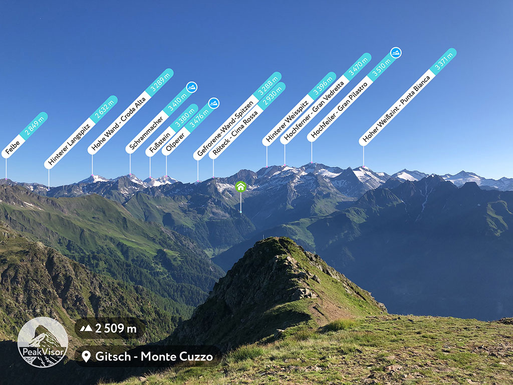
The main feature of the landscape of the Western Tauern Alps is its main subrange or group High Tauern (Hohe Tauern in German, Alti Tauri in Italian), in which the highest peaks are located (hence the name). It is not only high, but also large in the area: 130 km (81 mi) long, and 50 km (31 mi) wide.
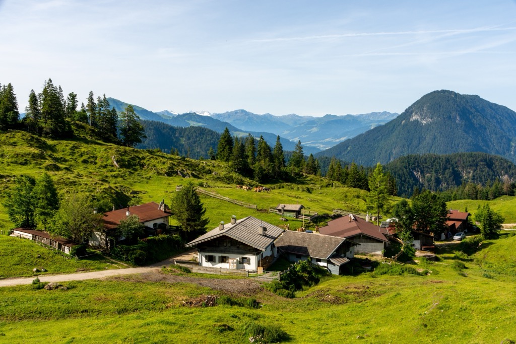
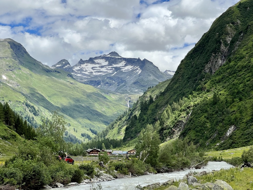
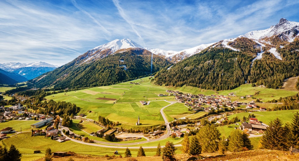
In addition to the mountains themselves, which will be discussed in more detail below, the range is surrounded by huge and long valleys: Saalach Valley (Saalach River), and Pusteria Valley (Rienz River), which form its northern and southern borders. In the west, there is Wipptal Valley (Eisack River), behind which is the famous Brenner Pass (1,370 m / 4,495 ft), which divides (or connects) Austria and Italy. There are no large valleys to the east, but there are many smaller ones, as well as inside the range, which it is also known for.
The easiest and fastest way to get to the Western Tauern Alps from its western borders is from Innsbruck in Austria or Bolzano in Italy. The first has an international airport, like neighboring Munich in Germany a little to the north, and the second can be quickly reached from Verona to the south, where you can also fly in from almost anywhere in the world. To the southeast of the range, the nearest large city is Klagenfurt, to Großglockner / Grossglockner is Lienz.
In terms of geology, the Western Tauern Alps are characterized by a large number of so-called tectonic windows and domes—sections of ancient geological strata that have reached the surface. In this way we can trace the geology of an area in one place and use it as an example to draw conclusions about the entire Alps almost to the beginning of their formation history. In particular, in the High Tauern area, there are visible crystalline basement rocks, the same that underlie the Mont Blanc / Monte Bianco (4,808 m / 15,774 ft), Matterhorn (4,478 m / 14,691 ft), Monte Rosa / Dufourspitze (4,633 m / 15,200 ft), and others.
The Western Tauern Alp is one of six large mountain ranges in the Central-eastern Alps of the Eastern Alps in the Italian classification of the Alps SOUISA, where it has number 17 out of 36 in this mountain system as a whole.
According to the same classification, the interior of the range is divided into four main subranges, as well as many "smaller" groups, namely:
According to the second common classification of the Alps, the AVE of the German-Austrian Alpine Club, which covers only its eastern part, things are a little different. Here it is also in the Central Eastern Alps, one of the four large parts of this part of the system, and is immediately divided into 10 groups, which, however, the same as in SOIUSA, where the 2nd to 6th, inclusive, are part of the larger High Tauern Alps.
It is also worth mentioning the existence of a mountain range called Low Tauern (Bassi Tauri, Niedere Tauern) or Eastern Tauern Alps (Alpi dei Tauri orientali, Austrians and Germans have no such term), which, as the name implies, are located to the east of the first and are characterized by lower mountains. This range is divided into the following subranges or groups according to the same AVE:
So together they make up the largest mountain ranges in the entire Eastern Alps.
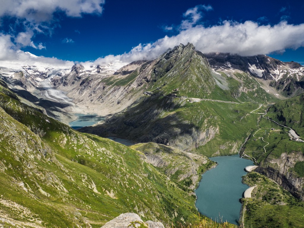
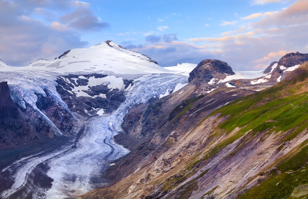
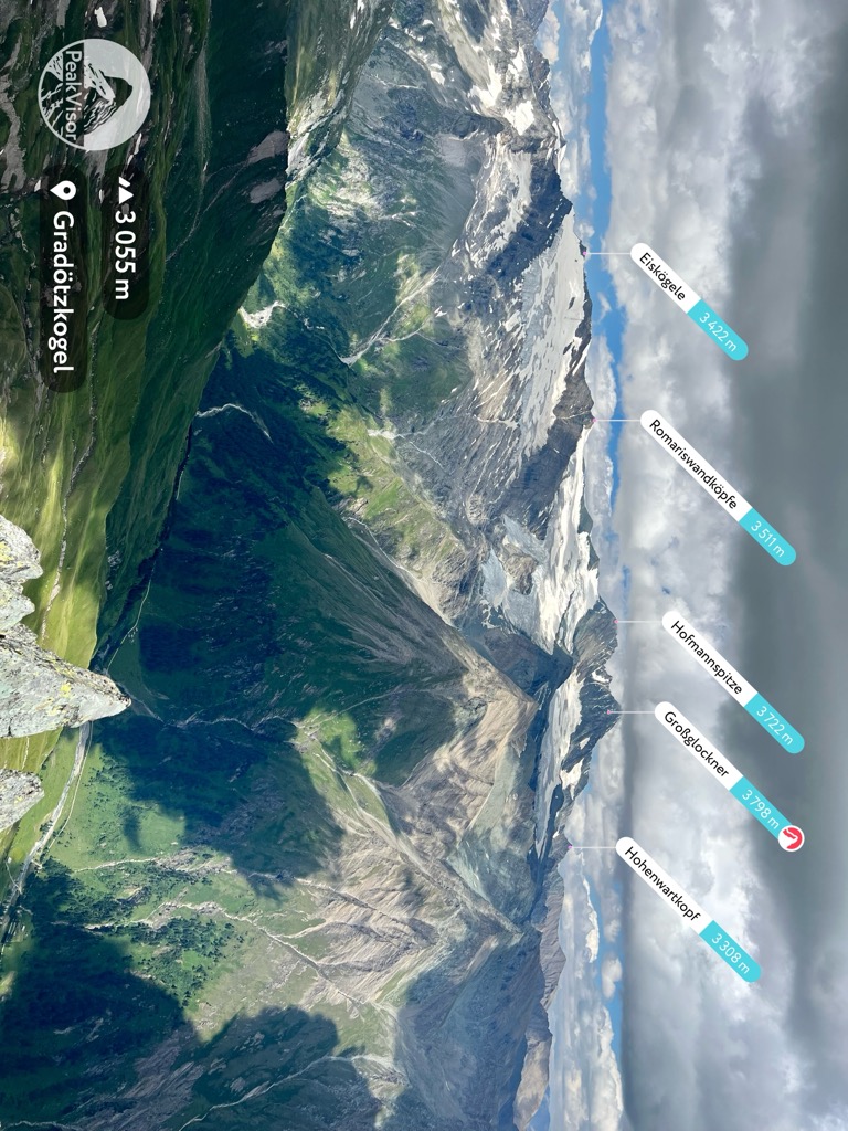
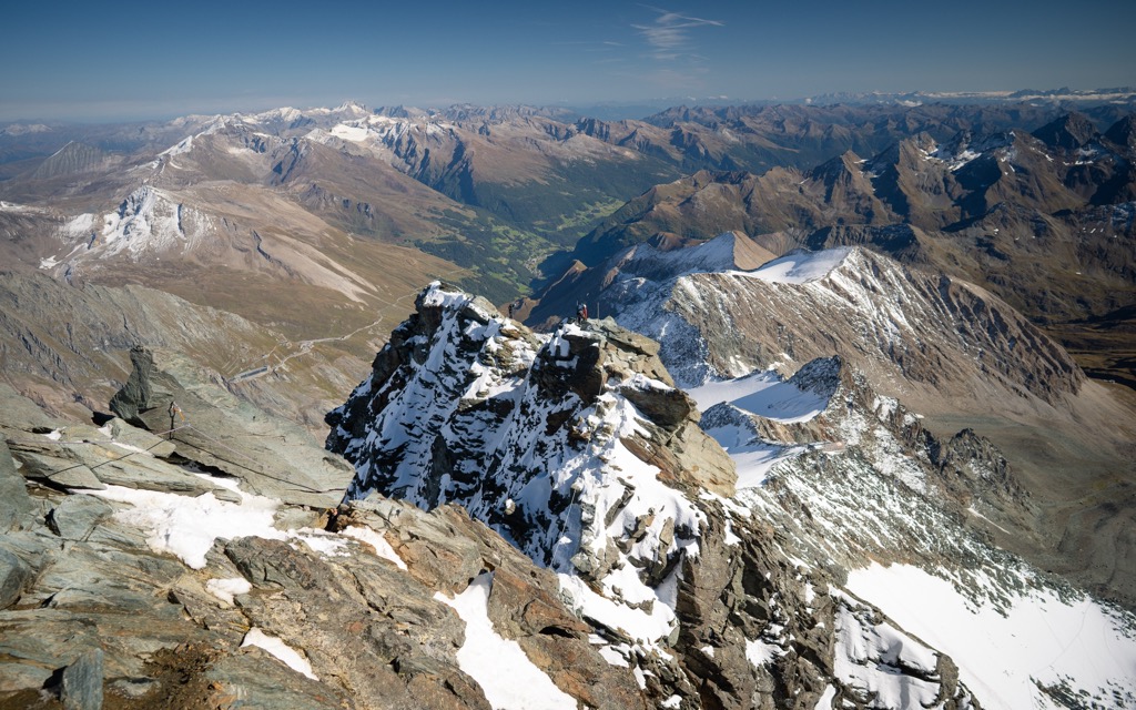
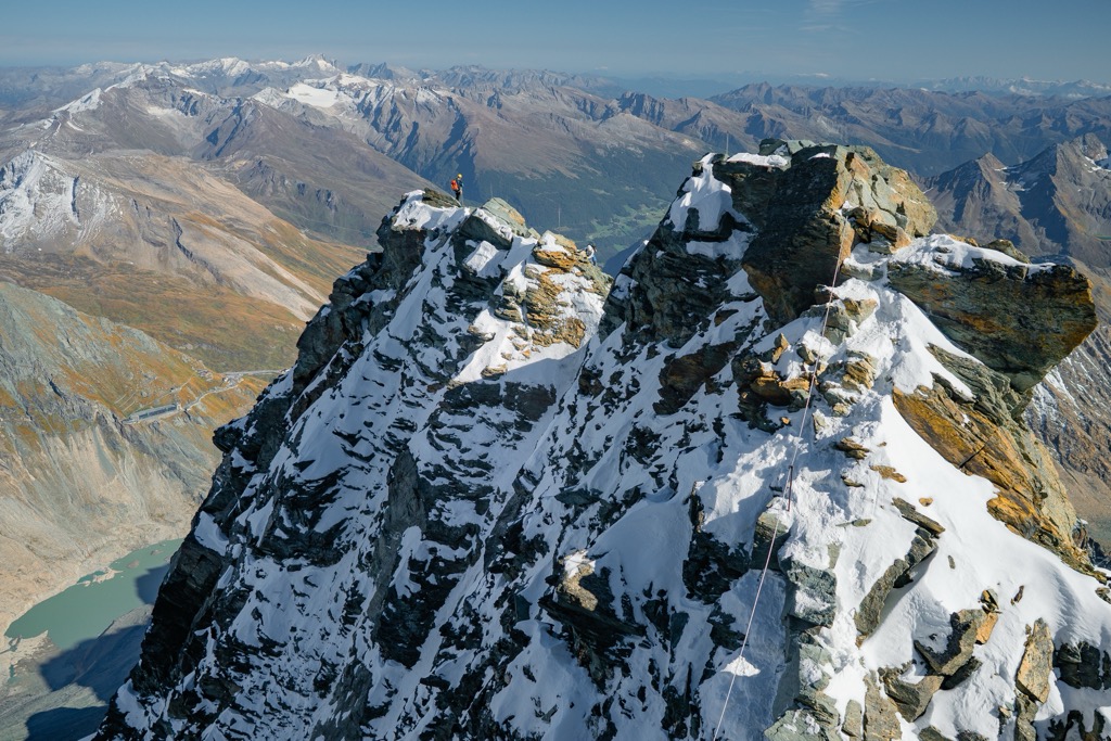
Among the major individual peaks of the Western Tauern Alps, it is certainly the highest and the most prominent Grossglockner / Großglockner (3,798 m / 12,460 ft). This enormous peak with many summits, also known simply as Glockner, is located in the heart of the range in one of its subgroups with the same name, the Glockner Group.
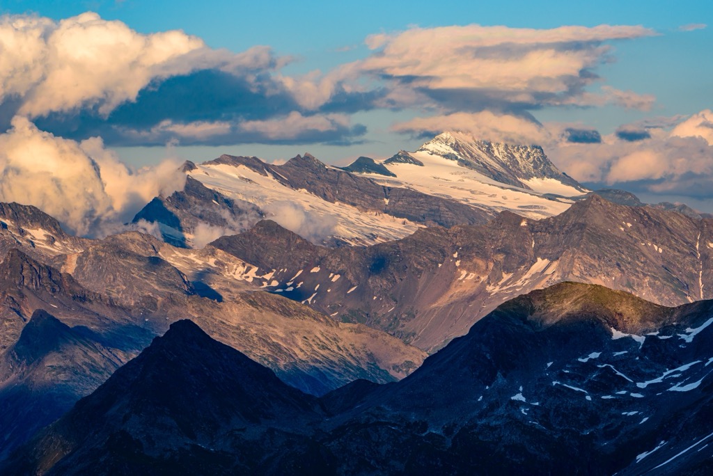
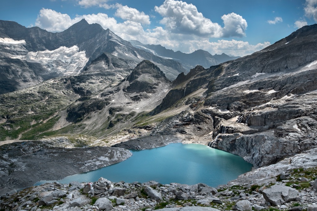
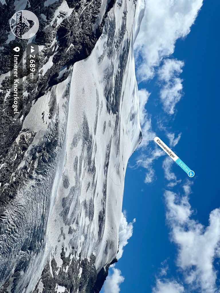
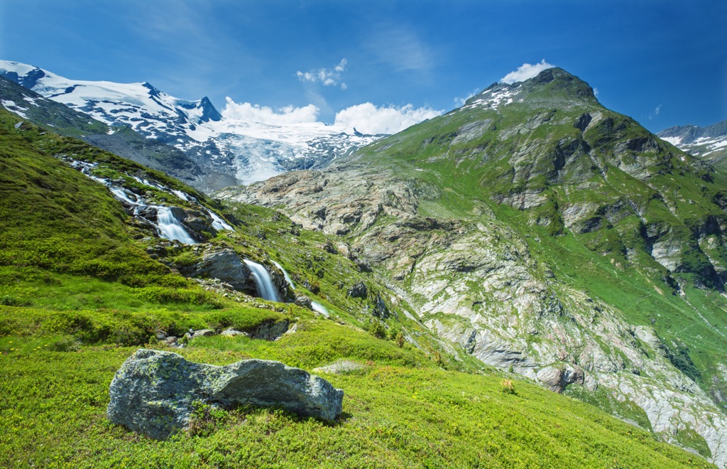
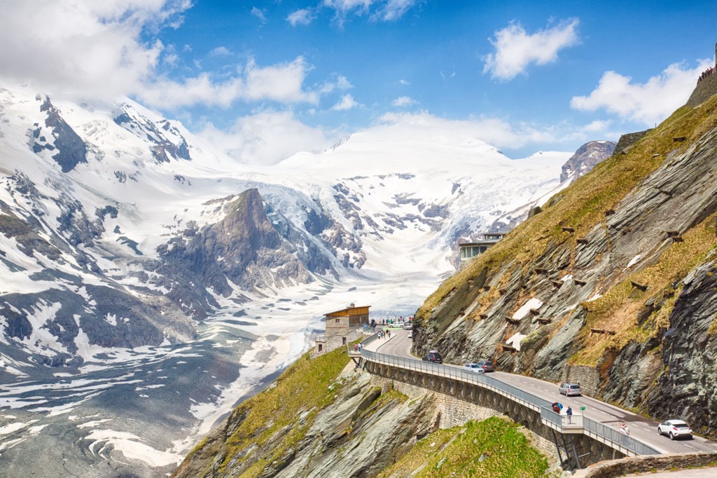
Grossglockner / Großglockner is also a glacier, as well as the two more of the top 5 highest peaks of the range are also glaciers: Großvenediger (3,662 m / 12,014 ft) and Großes Wiesbachhorn (3,564 m / 11,692 ft). In total there are 581 glaciers in the Western Tauern Alps for a total area of an incredible 180.9 sq km (69.8 sq mi) — and this is another of its most important landscape features.
Speaking about the prominence, there is also the second Ultra-mountain in the range, Polinik (2,478 m / 8,129 ft).
In general, the highest peaks and the most prominent peaks of the range covered by glaciers are distributed between its two subranges: High Tauern and the neighboring Zillertal Alps.
There are many hiking areas with many hiking trails in the Western Tauern Alps. For this section, I asked the PeakVisor founder as a local to make an overview:
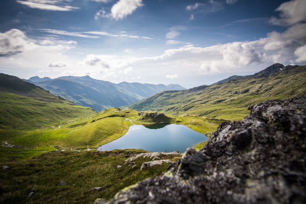
A vast majority of the Western Tauern Alps are under the protection of the High Tauern National Park which stretches along 100 km (62 mi) off the main range. With an area of about 1,834 sq km (708 sq mi), it is by far the largest national park in Austria and the main hiking area in the range.
To the south of the main range with significantly lower elevations, there’s the Kreuzeck Group. It is named after the strategically located in the very center of Kreuzeck which allows a perfect panorama of the whole group and many-many other peaks in three countries. Those include Austria’s highest Grossglockner, its very own Ultra Polinik, Slovenian Ultras Grintovec, and the highest in the country Triglav, Italian Ultras Jôf di Montasio and Antelao, "the King of the Dolomites". Actually, it might be the best spot for gazing over Ultra prominent peaks in the Alps.
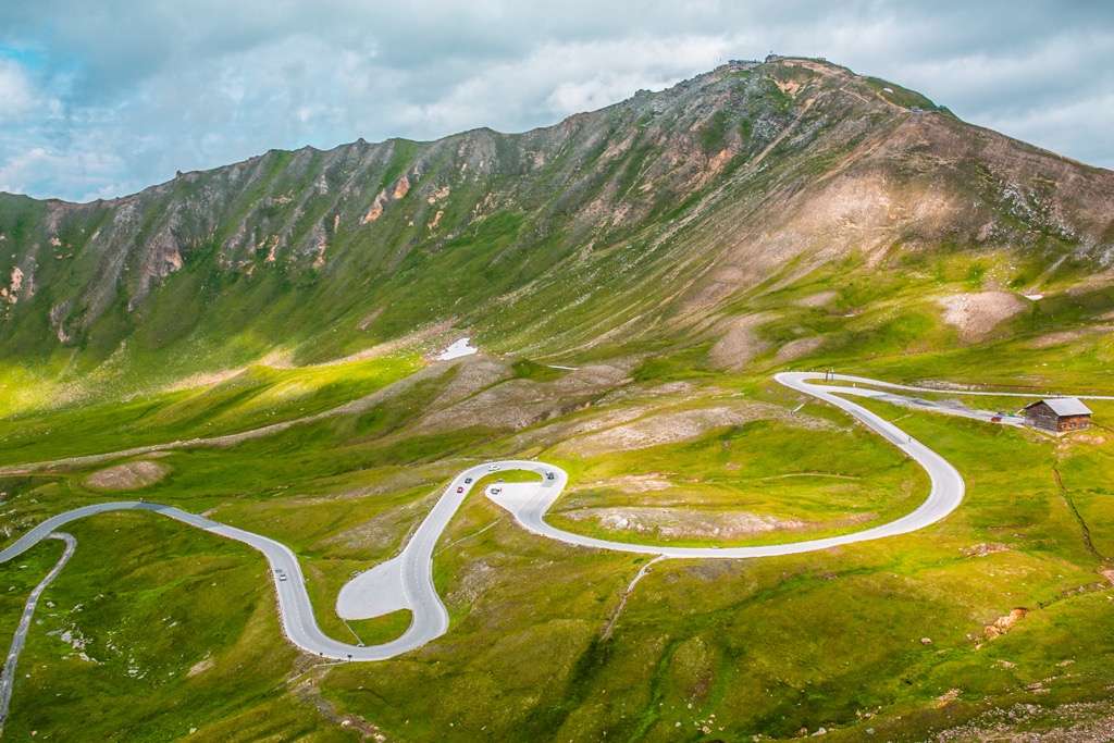
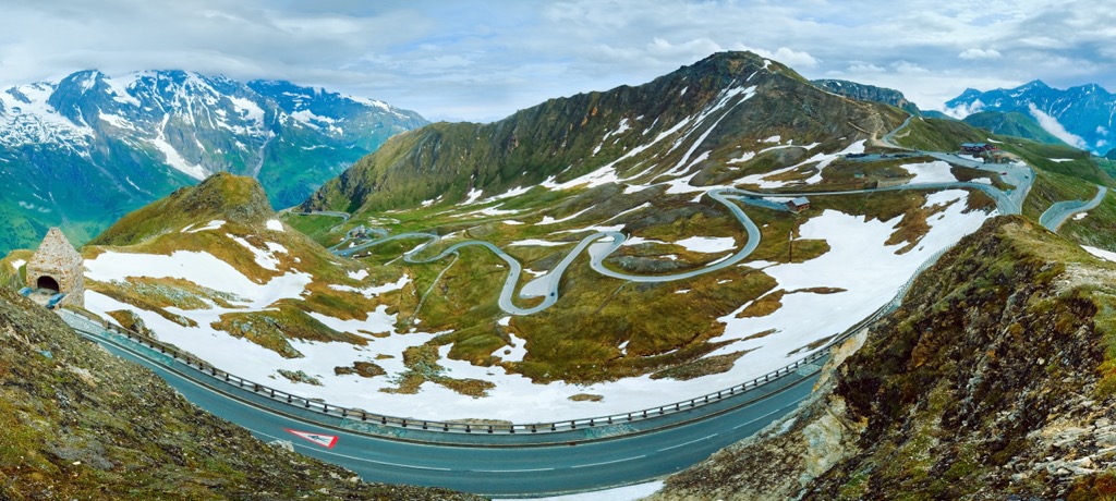
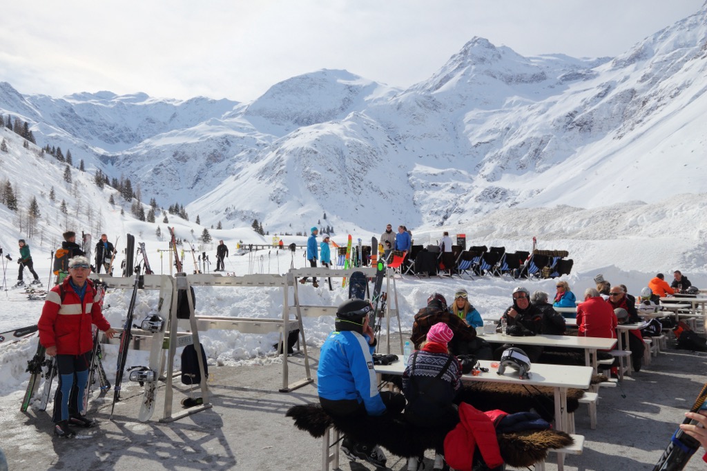
For those who won't have time for long hikes, I recommend taking advantage of one of the great hikes that work both in the winter for skiers and in the summer for hikers. You can find them literally all over the chain. For example, there are Grossglockner cable cards, or Kitzsteinhorn with over 60 lifts, which has been named "Austria's Best Summer Mountain Lifts." The others are:
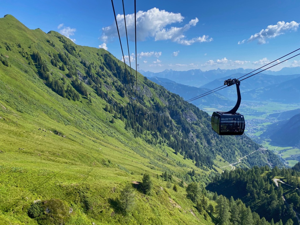
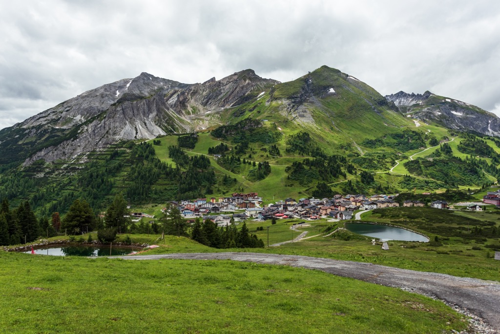
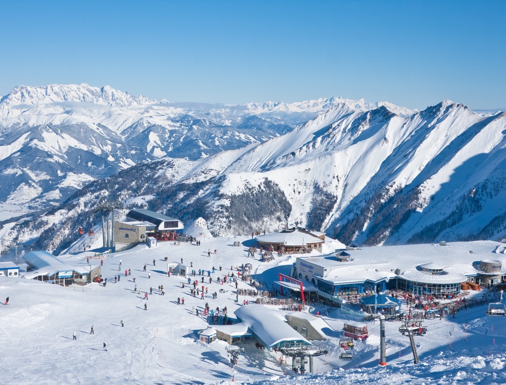
For skiing and snowboarding enthusiasts, there are more than 20 ski resorts in the High Tauern, the main skiing area in the Western Tauern Alps and the Austrian Alps in general. They are located throughout the subrange.
The largest ski resort in the High Tauern is Bad Gastein/Bad Hofgastein with more than 80 km (50 mi) of slopes and more than 15 ski lifts.
Other major areas for skiing in the High Tauern with more than 10 km (6 mi) of slopes and more than 3 ski lifts each include the following in descending order of size:
The main ski resorts near Innsbruck and Bolzano, the largest cities to the High Tauern, is Klausberg–Skiworld Ahrntal with more than 30 km (19 mi) of slopes and more than 10 ski lifts.
Check the High Tauern ski resorts map on the larger Austria ski resorts map in the World Mountain Lifts section of the site. It includes information about open ski lifts / slopes in the High Tauern in real-time with opening dates and hours. There are also year-round cable cars, funiculars, cog railways, aerial tramways, and all other types of mountain lifts.
Before or after hiking in the Western Tauern Alps, visit one of the region's official tourist offices, which can be found in almost all of its villages and towns. For example, in Lienz, the closest one to Großglockner / Grossglockner:
Tourist Information Osttirol
Mühlgasse, 11, 9900, Lienz, Austria
+4350212212
You may also be interested in the official tourist sites of the regions and provinces in the mountain range: Tyrol, Carinthia, and Salzburg in Austria, and South Tyrol and Trentino in Italy.
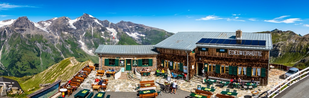
As in all other parts of the Alpine system, the main type of temporary accommodation in the Western Tauern Alps is a classical mountain hut, where you can get a place in the common room, plus dinner and breakfast with some additional services such as hot shower, a bar, and so others. But this and other ranges in the Austrian Alps are distinguished by the fact that they are the birthplace of a similar system, which then spread around the world. From here, to spend the night in one of the classic Austrian huts is at the same time an even deeper touch of Alpine history as a whole.
Given the huge number of huts in the region, which you can easily find on the 3D map in the app, I will name just a few located near Großglockner. These are Stüdlhütte, Oberwalderhütte, Rudolfshütte, Schwarzenberghütte, Trauneralm, Kalser Tauernhaus, Alpincenter Glocknerhaus, Karl Volkert Haus, and Glorer Hütte.
As you can see, almost all of them have the same name—hütte. It is only worth noting that in the Italian part it would be rifugio.
In the course of the guide, I have already named the main towns and villages in the Western Tauern Alps. So I will say a little more about Lienz, which is the starting point on the way to Großglockner from the south. It is located at the eastern end of the Puster Valley, so it can easily be reached by train or bus from Bolzano via Brixen and San Candido, or by your own or rented car, of course.
It is a small town with a population of just over 10,000 people. However, its municipality is quite large and synonymous with East Tyrol, one of the four large parts of the region, on a par with North Tyrol or Tyrol proper in Austria, and South Tyrol and Trentino in Italy.
The main architectural and cultural attraction of the town is the Bruck Castle (Schloss Bruck, Castello di Bruck), a medieval castle built in the 13th century. In addition, there are several locally important churches, named after various saints: Sant'Antonio, San Michele, and Sant'Andrea.
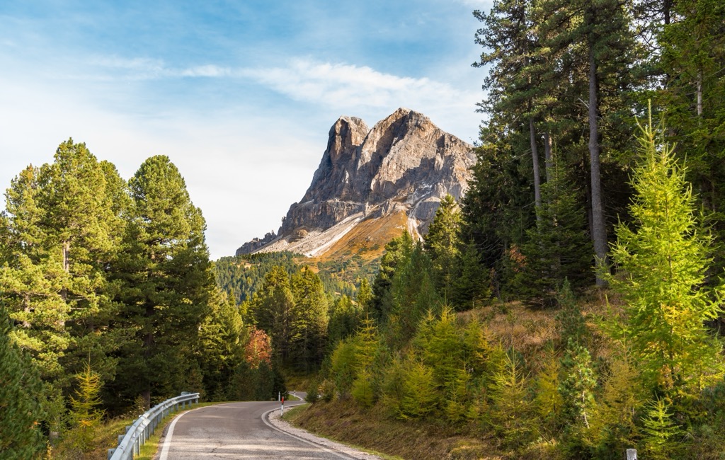
The municipality is also famous for the mountain group Lienz Dolomites (Dolomiti di Lienz) in the Carnic and Gailtal Alps, located away from the main groups of the Dolomites. They do not contain dolomite rock, at least in large quantities, but look very similar to the Pale Mountains, as this UNESCO World Heritage Site is also often called.

Explore Western Tauern Alps with the PeakVisor 3D Map and identify its summits.


