
Scan the QR code and open PeakVisor on your phone
The Sandwich Range include 113 named peaks. The highest is Mount Osceola at 1,316 m. Other notable peaks include Mount Osceola - Middle Peak, Middle Tripyramid and Mount Osceola - East Peak.
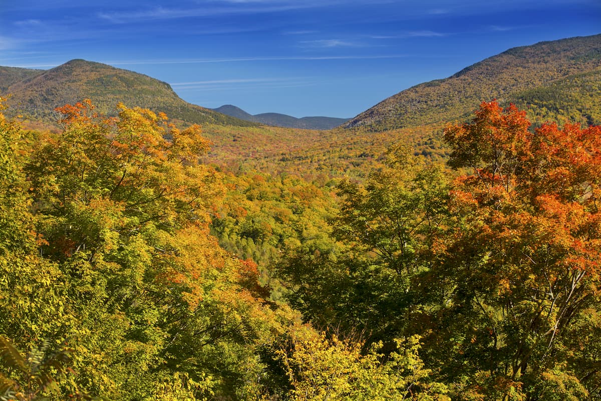
Providing excellent views and rugged adventure, the Sandwich Range is a collection of peaks located within the central part of the US state of New Hampshire. The range contains 86 named mountains, the highest and most prominent of which is Mount Osceola (4,321ft/1,317m).
Situated in the geographic middle of New Hampshire, the Sandwich Range is located within Grafton County and Carroll County in the central part of the state.
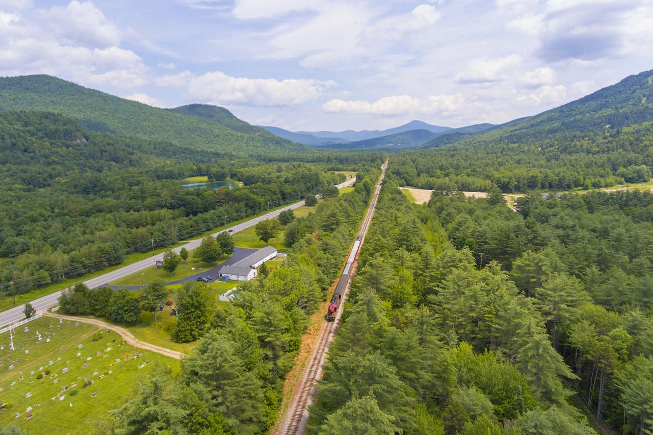
It is enclosed by highways on all sides, including I-93 to the west, Highway 112 (Kancamagus Highway) to the north, Highway 16 to the east, and Highway 25 to the south. Due to its proximity to some of the region's major roadways, the Sandwich Range is quite accessible from the cities of Conway, Lincoln, and Plymouth.
The range is actually a subrange of the White Mountains, which covers much of central and northern New Hampshire. It represents the southernmost extension of the range and it extends out of the White Mountains Region into the Lakes Region of the state.
To the south of the range is the Ossipee Mountains and the Belknap Mountains, both of which are ancient volcanic ring dikes. Meanwhile the Sandwich Range is surrounded by the rest of the White Mountains to the north and west and to the east by the rolling hills of the New England Upland.

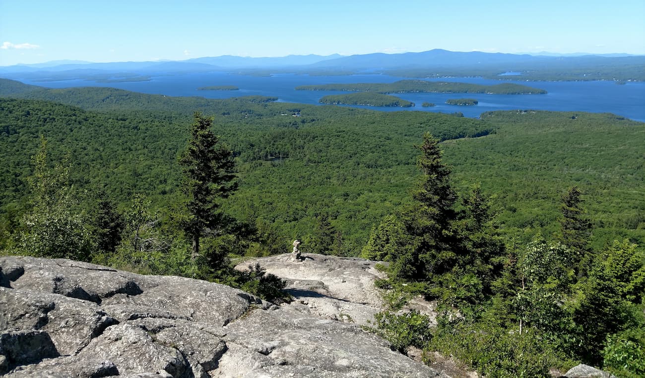
For the most part, the Sandwich Range is located within White Mountain National Forest. However, some parts of the range extend beyond the forest's boundaries to the northern shores of Squam Lake near the town of Holderness. The small Sandwich Range Wilderness is also located within the range and is mostly around Tripyramid, Mount Passaconaway, and Mount Whiteface.
Geologically speaking, the Sandwich Range is a subrange of the White Mountains. The White Mountains are also a subrange of the greater Appalachian Mountains which extend from the state of Alabama all the way to the province of Newfoundland and Labrador in Canada.
Both the Appalachian Mountains and the White Mountains have a fairly complex geologic history and the Sandwich Range subrange is no exception.
The most meaningful part of the range's geologic history begins some 500 million years ago around the Late Cambrian and Early Ordovician periods. At this time, the land that would later become North America was located near the equator and the region that would eventually become the White Mountains and Sandwich Range was under a shallow sea of water.
As the seafloor spread, natural forces deposited large amounts of sediment onto this sea floor, which eventually formed various sedimentary rocks, such as sandstones and shales. Interestingly, these rocks eventually metamorphosed to form the Littleton Formation that's now found near the summit of Mount Washington.
However, during the early Ordovician period, this sea floor started to change course and close up, causing compression that eventually broke off a section of the oceanic crust. This oceanic crust then started to subduct under the continental crust, forming a chain of volcanic islands.
Moreover, as this slab subducted a sizable amount of sediment scraped off the top of it and accumulated just inland of the island arc, close to the continent. There was also widespread thrust faulting in the region at this time, leading to the formation of the Taconic Mountains during the Taconic orogeny.
How does this relate to the White Mountains and the Sandwich Range? Well, not long after, during the Middle Devonian a microcontinent by the name of Avalonia collided with proto-North america, latching on to create a terrane.
In the process, it deformed and metamorphosed the bedrock in the area, creating a mountain chain that we now call the White Mountains and the Sandwich Range during the Acadian Orogeny.
Where this gets really interesting, however is what happened next. Volcanic activity in the region started to pick up after this mountain building event, causing large upwellings of magma that rose up to just below the surface of the Earth. This magma eventually cooled, creating the granite that the region is now known for.
Finally, no discussion of the Sandwich Range and the White Mountains is complete without mentioning one of the most important aspects of the region's more recent geologic history: glaciation.
During the Pleistocene, the Sandwich Range was extensively covered with ice, which carved out many of the features that we see today. In particular, the region's “notches” or U-shaped valleys, were all formed by glaciers during the Pleistocene.

Major Peaks in the range include Mount Osceola, Tripyramid, Mount Passaconaway, Mount Tecumseh, Mount Whiteface, and Sandwich Mountain.
The Sandwich Range, like the surrounding White Mountains, is home to a complex array of ecosystems located within the New England/Acadian forests ecoregion. This ecoregion covers much of the northeastern portion of the United States and Atlantic Canada, including parts of New Hampshire, Vermont, Massachusetts, Maine, Nova Scotia, New Brunswick, and eastern Québec.
With that in mind, the tree species and ecosystems in the Sandwich Range vary greatly by elevation.
At the lowest elevations, below about 3,000 feet (914m), the range is home to mixed northern forests. These forests contain mostly hardwoods, such as maple, yellow birch, and beach, as well as shrubs like wild raspberry and hobblebrush. The soil here is quite fertile, which is in stark contrast to the loftier slopes in the range.
Above 3,000 feet (914m) and below 4,000 feet (1,219m), the forests transition into a coniferous boreal forest that's dominated by spruce, fir, and the occasional paper birch, the latter of which is more of a pioneer species.
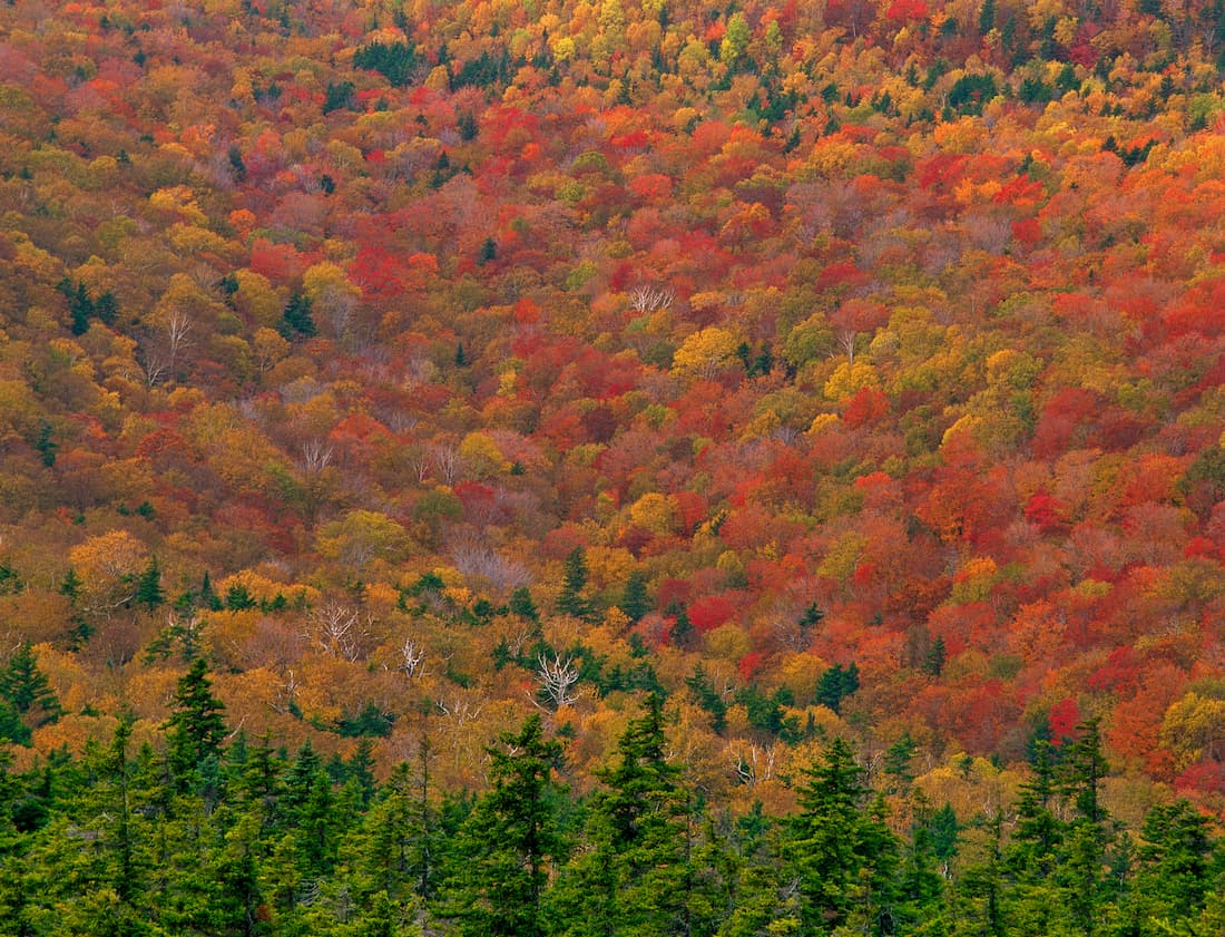
Finally, on the highest slopes in the range, above 4,000 feet (1,219m), the Sandwich Range contains small areas of krummholz, which are typically fir and black spruce trees. At these elevations, the trees are very exposed to the wind and other harsh weather, which stunts their growth.
Krummholz-style vegetation can be seen only on the tallest peaks in the range, including Mount Osceola.
However, unlike the highest peaks of the White Mountains, which are located to the north in the Presidential Range and the Franconia Mountains, those in the Sandwich Range aren't quite tall enough to feature true alpine areas.
Although the Sandwich Range is home to some truly rugged terrain, the region in and around the mountains has been home to humans for thousands of years. In particular, some of the tribes of the Wabanaki Confederacy and other Abenaki peoples, including the Pequawket, consider the range to be part of their ancestral homelands.
That being said, permanent European settlements in the region didn't begin until about the mid 17th century, in part because of the range's remoteness and ruggedness compared to the more coastal areas of New England. In the aftermath of the Revolutionary War, an increasing number of settlers came to the region, particularly around Lincoln and Conway, clearing forests for agriculture, grazing, and communities.
However, many of the communities and farms established during this time were abandoned relatively quickly as other economic opportunities arose in the cities or in the western United States. This led to a lengthy period of extensive logging in the region, and the clear cutting of many of the Sandwich Range's slopes.

As a result, many people lobbied for a better way to manage logging in the region. This spurred the creation of the white Mountain National Forest in 1918. Although the national forest is designated as a “land of many uses,” which permits mining, logging, and other resource extraction by permit, the region is best known for its recreational opportunities.
Indeed, outdoor recreation in the White Mountains and the Sandwich Range dates back to the early 19th century. While much of the recreation and tourism focused historically on the higher summits, such as Mount Washington in the northern portion of the White Mountains, the Sandwich Range is a popular hiking destination due to its relative accessibility.
Moreover, the completion of the Kancamagus Highway in 1957, which had been, up until that point, 2 dead end local roads from Conway and Lincoln, greatly increased traffic into the range. These days, the Kanc, as it's known, is driven by hundreds of thousands of cars a year, and the trailheads on the southern part of the road all lead into the Sandwich Range.
The Sandwich Range is a veritable treasure trove of hiking opportunities. Here are some of the best hikes to check out in the range.
Mount Tripyramid, as the name suggests, is a 3-point peak that includes the summits of North Tripyramid, Mount Tripyramid, and South Peak. There is an 11.6 mile (18.7km) loop trail that starts near the town of Waterville Valley and climbs steeply upward to each of the 3 summits.

This trail is steep and strenuous, with large sections of scrambling that are best for experienced hikers. At each of Mount Tripyramid's summits, however, you get fantastic views of the surrounding area.
Since the classic Mount Tripyramid Loop ascends the Tripyramid North Slide, it's not ideal for new hikers or for rainy days. If you'd like to hike to the summits of Tripyramid without the exposure, the friendlier Scaur Ridge Trail is a nice alternative.
Located near the town of Lincoln, Mount Osceola is a nice day hike that also allows you to tick 2 peaks off of your New Hampshire 4000 Footers list. The trail is steep and rugged, though when you finally poke your head above treeline near the summit, the hike is well worth the effort.

If you just want to hike Mount Osceola, you can expect a 6.4 mile (10.3km) round trip hike with quite a lot of elevation gain. The side trip to the East Peak adds another 1 mile (1.6km) to your journey if you want to hit another summit during the day.
The Sandwich Range is a popular hiking destination and with some great towns nearby for you to visit. Here are some of the best places to stay during your trip to the area.
Lincoln is located on the western edge of the Sandwich Range. Although it is the second largest town in the state of New Hampshire by land area, it is home to only 1,600 residents.
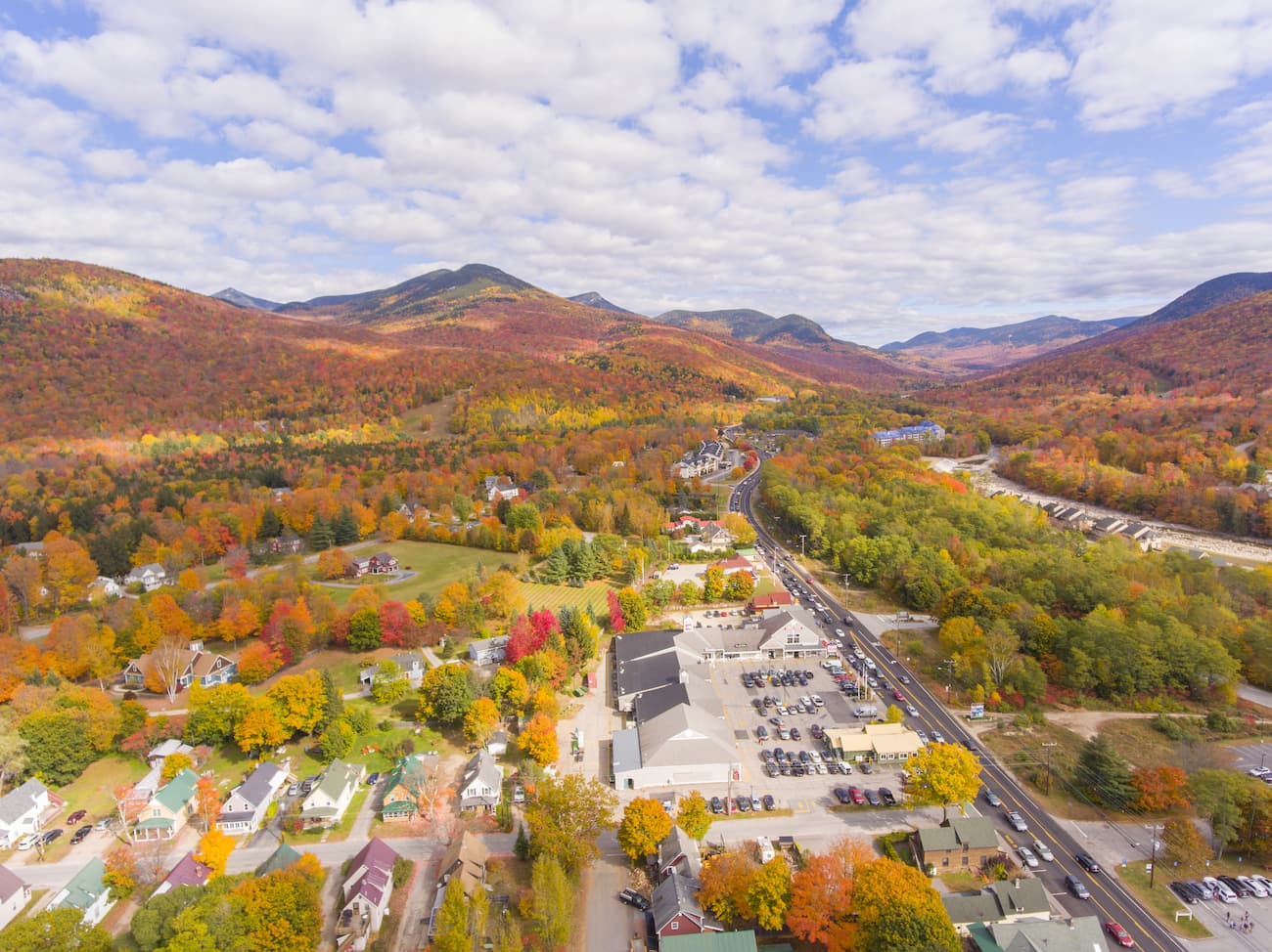
The town is popular among outdoor recreationalists as it is home to the Loon Mountain Ski Resort and it offers excellent access to both White Mountain National Forest and Franconia Notch State Park. From Lincoln, you can also visit The Flume, which is a gorge that happens to be one of the most visited tourist attractions in New Hampshire.
The town of Conway is located to the east of the Sandwich Range, at the start of the Kancamagus Highway. It is home to over 10,000 people and is a popular starting point for trips into the White Mountains, particularly around the Presidential Range.
While Conway is only accessible by road, it is just 2.5 hours from Boston, which has an international airport. There is also a bus that offers connections from Conway to Boston Logan International Airport for people traveling without a car.
Plymouth is situated at the southernmost edge of the Sandwich Range, along I-93. It is a college town, due to the nearby Plymouth State University, and it is home to about 4,500 residents.
The town offers good access to the southern part of the Sandwich Range and is a good place to stay if you also want to visit the Ossipee Mountains and the Belknap Mountains in the Lakes Region. Plymouth is also just under 2 hours from Boston by road.


new-england-4000ers
nh-4000ers
northeast-115-4000ers
ymca-alpine-club-nh
new-england-4000ers
nh-4000ers
northeast-115-4000ers
ymca-alpine-club-nh
new-england-4000ers
nh-4000ers
northeast-115-4000ers
ymca-alpine-club-nh
new-england-4000ers
nh-4000ers
northeast-115-4000ers
ymca-alpine-club-nh
new-england-4000ers
nh-4000ers
northeast-115-4000ers
ymca-alpine-club-nh
new-england-4000ers
nh-4000ers
northeast-115-4000ers
ymca-alpine-club-nh
new-england-4000ers
nh-4000ers
northeast-115-4000ers
ymca-alpine-club-nh
new-england-4000ers
nh-4000ers
northeast-115-4000ers
ymca-alpine-club-nh
new-england-4000ers
nh-4000ers
northeast-115-4000ers
ymca-alpine-club-nh
new-england-4000ers
nh-4000ers
northeast-115-4000ers
ymca-alpine-club-nh
new-england-4000ers
nh-4000ers
nh-52-views
ymca-alpine-club-nh
The highest peak in the Sandwich Range is Mount Osceola, at 1,316 m.
The Sandwich Range have 113 named peaks.


