
Scan the QR code and open PeakVisor on your phone
The Franconia Mountains include 90 named peaks. The highest is Mount Lafayette at 1,600 m. Other notable peaks include Mount Lincoln, North Lafayette and North Lincoln.
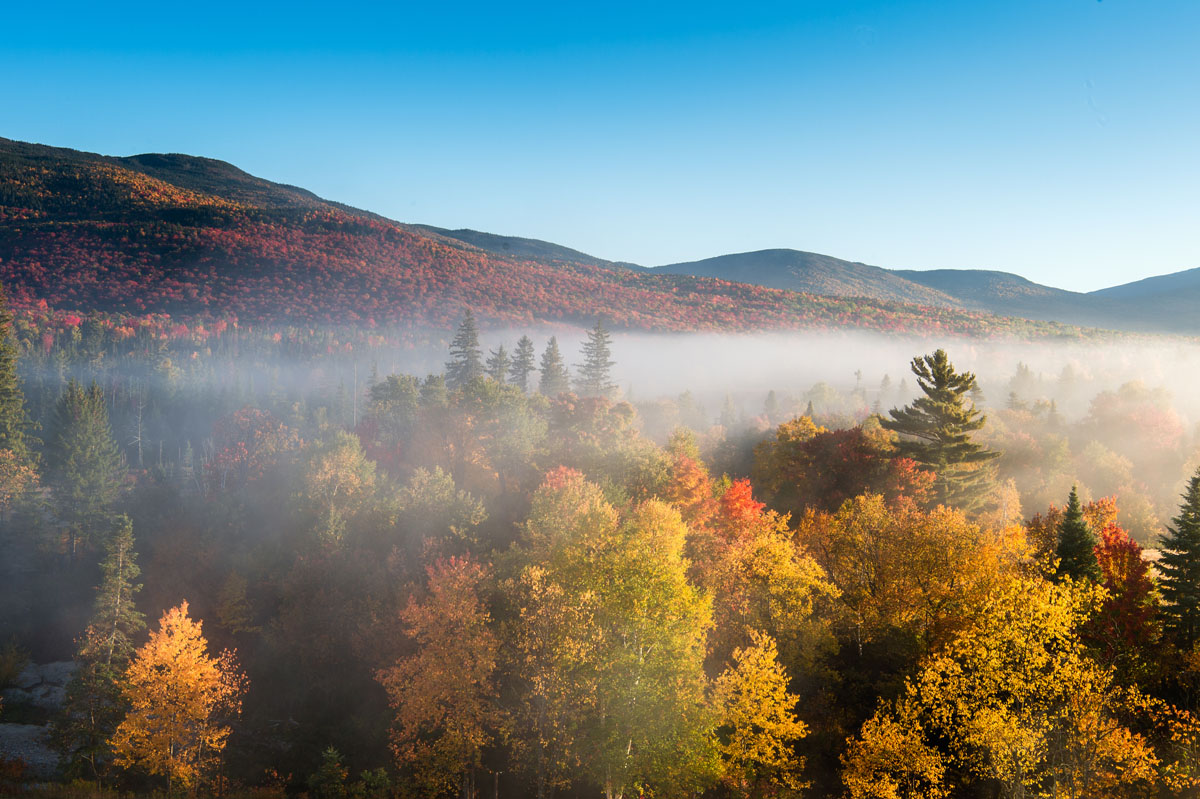
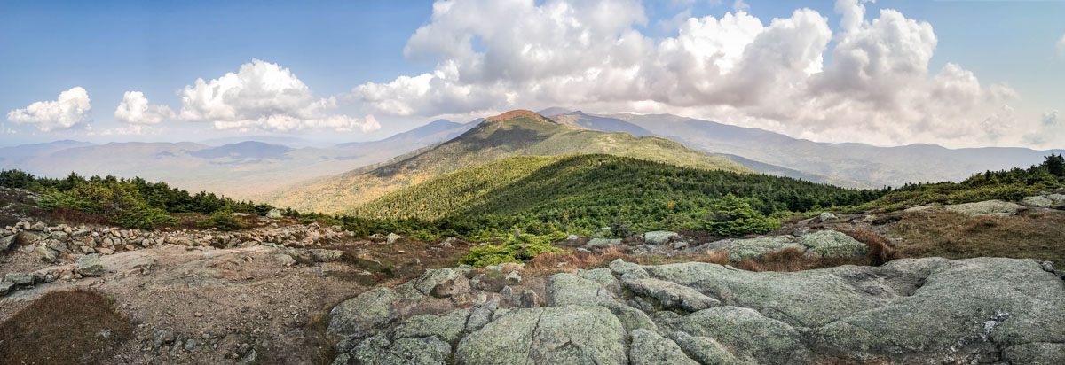
Claiming silver as the second highest range in the White Mountains of New Hampshire, the Franconia Range is a collection of rugged alpine peaks in the western part of the White Mountain National Forest. Forming a prominent ridge and the crest of the range, the Franconia Ridge dominates the area’s landscape, forming a semi-circular chain of all the major summits in the Franconia Range.
With 70 named summits in the Franconia Range, the highest and most prominent being Mount Lafayette (5,249ft/1,600m), the range is chock full of hiking possibilities. In fact, the Franconia Range is home to the third largest connected area of alpine tundra in the entirety of the Eastern United States, being surpassed in area only by the alpine zones of the Presidential Range and the Katahdin massif.
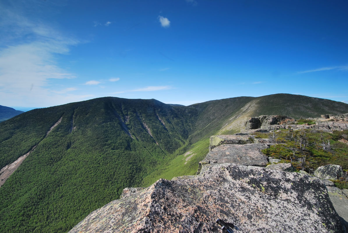
The Appalachian Trail crosses the Franconia Range along is main crest, in an area known as the Pemigewasset Wilderness. Here, the mountains of the Franconia Range form a classic glaciated valley, known as Franconia Notch. The notch itself is made primarily of relatively young Jurassic-age Conway Granite, which is a beautiful coarse-grained pink with frequent large feldspar crystals.
Due to extensive glacial cover throughout the last major glaciation, the White Mountains, and, indeed, the Franconia Range, still show evidence of this icy past. The large U-shaped valley of the Franconia notch is a testament to the land-carving power of these glaciers.
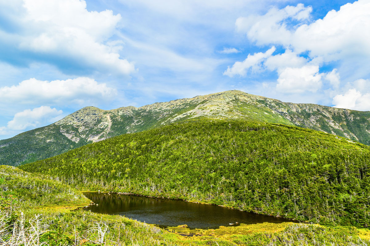
These days, the Franconia Range is free from glaciers but is still home to some wild weather. Thanks to the 2.5 miles of alpine zone along the crest of the Franconia Ridge, hikers are treated to 360-degree views of the surrounding area on a sunny day but get blasted by wind when the weather gets bad.
The Franconia Range is located with the Pemigewasset Wilderness, a massive area of some 45,000 acres (182 square kilometers). Here, the mountains are rugged, the trails steep, and the forests dense, but those who are brave enough to enter the wilderness are sure to find adventure in its mountains.
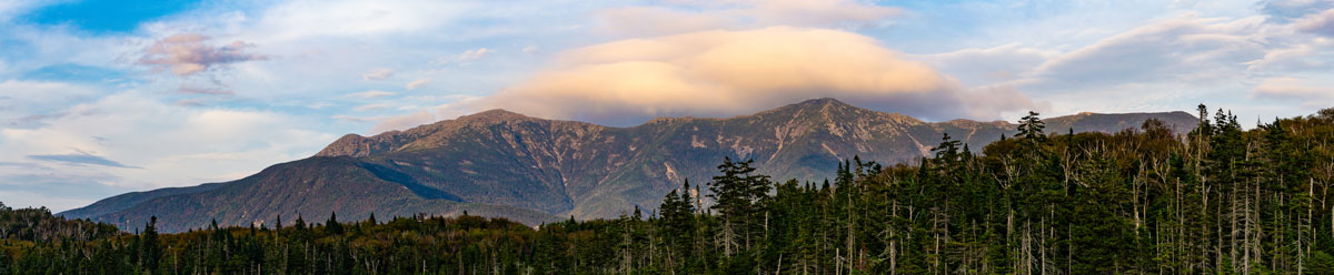
Geographically, the Franconia Range is located on the Western “lobe” of a horseshoe-shaped ridge that also includes the Twin and Bond ranges. This ridge forms an incredibly popular hike known as the “Pemi Loop”.
The best place to start this hike is at the Lincoln Woods Trailhead, near the town of Lincoln, New Hampshire. The uphill starts not long after leaving the trailhead, as hikers start to ascend a collection of small, yet formidable peaks, such as Potash Knob (2,684ft/818m) and Whaleback Mountain (2,586ft/1,093m).
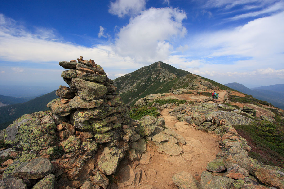
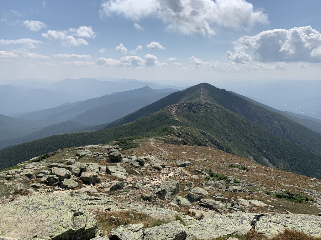
Making their way toward the crest of the Franconia Ridge, hikers must go up and over Mount Flume (4,328ft/1,319m) and across undulating terrain before reaching Mount Liberty (4,459ft/1,359m). Little Haystack Mountain (4,780ft/1,457m) forms the last of the seemingly “minor” bumps in the landscape before hikers pop out into the alpine zone and get a fantastic view of the ridge ahead.
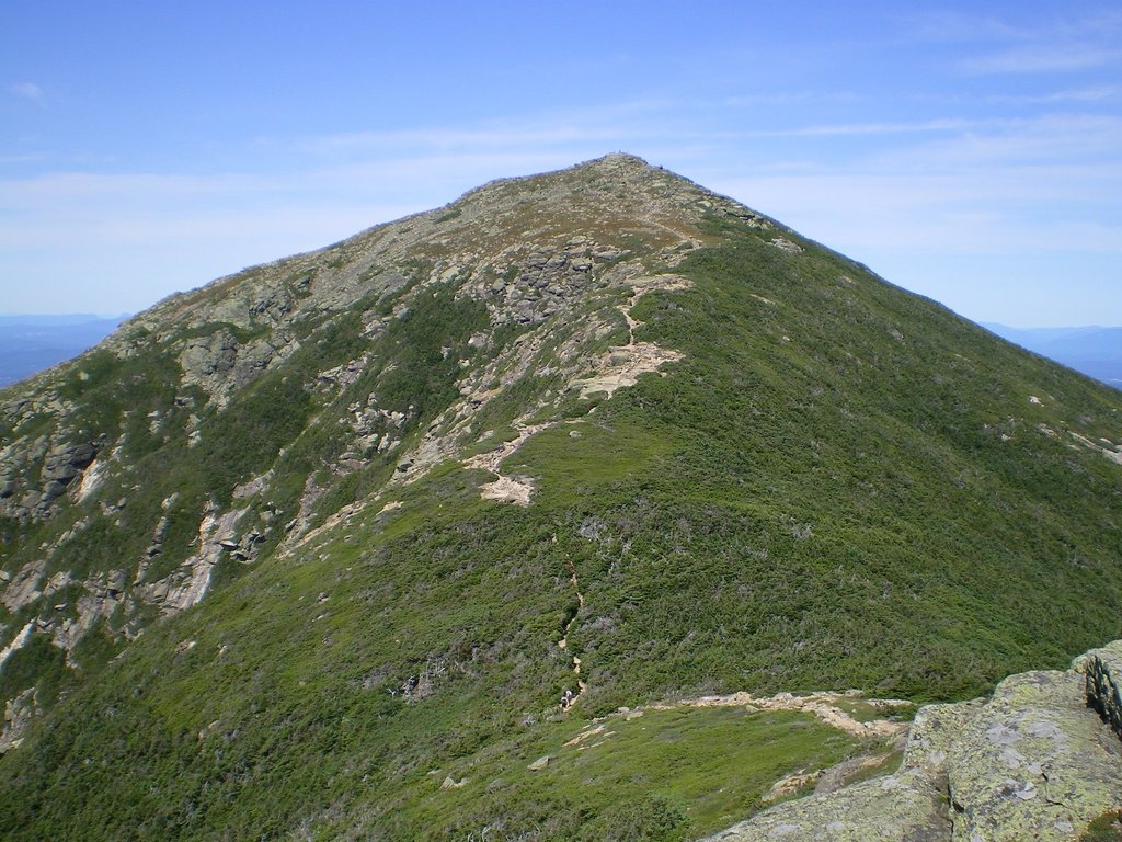
With panoramic views to either side, hikers continue on down the ridge toward Mount Lincoln (5,089ft/1,551m), crossing the 5,000ft (1,524m) elevation mark for the first time. Heading back down to a saddle, there is a final push upward yet again to the summit of Mount Lafayette (5,249ft/1,600m) - the tallest peak in the Franconia Range.
Weary hikers can now choose to head back down to the Lincoln Woods Trailhead or take a shorter, yet steeper exit trail to the west. Those brave enough to continue on along the Pemi Loop trail for an epic day hike or a lovely backpacking trip will continue on down the Garfield Ridge, eventually crossing Mount Garfield (4,500ft/1,372m) and Galehead Mountain (4,024ft/1,227m).
Yet again, the landscape offers escape options on the flanks of Mount Galehead. A long, but not difficult trail leads from the side of the mountain down to the valley below and toward the Lincoln Woods Trailhead. Others looking for a place to stay can find refuge in a beautiful lean-to built just to the east of Galehead’s summit.
Past Galehead, those of us still on our feet will continue on to the Twin subrange and hike South Twin Mountain (4,902ft/1,491m) before continuing on to Mount Guyot (4,580ft/1,369m), Mount Bond (4,698ft/1,432m), and Bondcliff (4,265ft/1,300m). After Bondcliff, hikers can finally make their descent down to the Lincoln Woods Trailhead and head into town to grab some well-deserved rest.
The Franconia Range might seem wild while you’re up in the alpine, but it’s surprisingly close to a bustling small town and some major cities. Here are the main populated areas around the Franconia Range:
Located just a short drive south of the Franconia Range, the mountain town of Lincoln loves the great outdoors. With ski shops and outdoor gear stores out the wahzoo, Lincoln is a great place to start your adventure into the Franconia Range. There are camping and hotel options in town, as well as plenty of supermarkets and nice dining options, too.
Less than three hours south from the Franconia Range is the major city of Boston, the metropolitan heart of New England. Home to an international airport, a great nightlife scene, and plenty of fellow outdoor enthusiasts, Boston is the perfect starting point for anyone visiting the Franconia Range from far away.


new-england-4000ers
nh-4000ers
northeast-115-4000ers
ymca-alpine-club-nh
new-england-4000ers
nh-4000ers
northeast-115-4000ers
ymca-alpine-club-nh
new-england-4000ers
nh-4000ers
northeast-115-4000ers
ymca-alpine-club-nh
new-england-4000ers
nh-4000ers
northeast-115-4000ers
ymca-alpine-club-nh
new-england-4000ers
nh-4000ers
northeast-115-4000ers
ymca-alpine-club-nh
new-england-4000ers
nh-4000ers
northeast-115-4000ers
ymca-alpine-club-nh
new-england-4000ers
nh-4000ers
northeast-115-4000ers
ymca-alpine-club-nh
new-england-4000ers
nh-4000ers
northeast-115-4000ers
ymca-alpine-club-nh
new-england-4000ers
nh-4000ers
northeast-115-4000ers
ymca-alpine-club-nh
new-england-4000ers
nh-4000ers
northeast-115-4000ers
ymca-alpine-club-nh
new-england-4000ers
nh-4000ers
northeast-115-4000ers
ymca-alpine-club-nh
The Franconia Mountains are part of the White Mountains.
The highest peak in the Franconia Mountains is Mount Lafayette, at 1,600 m.
The Franconia Mountains have 90 named peaks.


