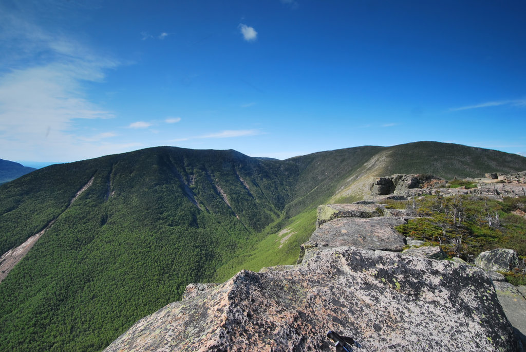
Mount Bond is a mountain located in Grafton County, New Hampshire, United States. The mountain is named after Professor George P. Bond (1825–1865) of Harvard University, and is the southernmost extension of the Twin Range of the White Mountains. Mount Bond is flanked to the north by Mount Guyot.
Mount Bond has two subsidiary peaks, West Bond and Bondcliff (or "The Cliffs"). All three peaks are included on the Appalachian Mountain Club's list of "four-thousand footers".
Mount Bond is located within the Pemigewasset Wilderness Area.
It drains to the east and west into the North Fork and Franconia Branch respectively of the East Branch of the Pemigewasset River, thence into the Pemigewasset and Merrimack Rivers, and into the Gulf of Maine in Massachusetts.
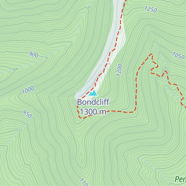
There's an alpine trail (T4) called Bondcliff Trail leading to the summit. Bondcliff is one of the 2 peaks along the Bondcliff Trail.
By elevation Bondcliff is
# 28 out of 393 in Grafton County # 60 out of 428 in White Mountain National Forest # 61 out of 1985 in New Hampshire # 61 out of 844 in the White Mountains (New Hampshire) # 22 out of 89 in the Franconia Mountains
We use GPS information embedded into the photo when it is available.
3D mountains overlay
Adjust mountain panorama to perfectly match your photos because recorded by camera photo position might be imprecise.
Move tool
Rotate tool
Zoom
More customization
Choose which peak labels should make into the final photo and what photo title should be.
Next
Photo Location
Satellitte
Flat map
Relief map
Latitude
Longitude
Altitude
OR
Latitude
°'''
Longitude
°'''
Apply
Register Peak
Peak Name
Latitude
Longitude
Altitude
Register
Teleport
PeakVisor
This 3D model of Sagarmatha National Park in Nepal was made using the PeakVisor app topographic data. The mobile app features higher precision models worldwide, more topographic details, and works offline. Download PeakVisor maps today.
Download OBJ model
PeakVisor
The download should start shortly. If you find it useful please consider supporting the PeakVisor app.
PeakVisor for iOS and Android
Be a superhero of outdoor navigation with state-of-the-art 3D maps and mountain identification in the palm of your hand!