
Scan the QR code and open PeakVisor on your phone
The White Mountain National Forest (WMNF) is the only National Forest in the northeastern states of both New Hampshire and Maine, though only about five percent of the forest is in the state of Maine. Readers should understand the difference between the White Mountains range versus the forest, which is administered by the United States Forest Service. While there are 361 named mountains within the WMNF, there are many more named mountains in the range, which comes under various other jurisdictions beyond the boundaries of the forest. But in either case, the highest and most prominent mountain is Mount Washington, the highest peak in the northeastern United States. It is also the most prominent, though not the highest, mountain in mainland North America east of the Rocky Mountains.
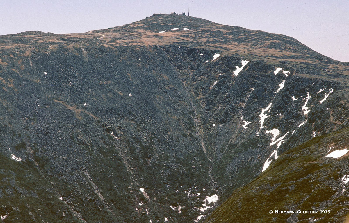
Mount Washington
With the bulk of the WMNF located in New Hampshire, it goes without saying that most of the significant mountains are also in this segment. Furthermore, the most popular mountains for hiking are in the New Hampshire part of the forest, including all 48 of the 4,000-footers in the White Mountains Range. There are several 4,000-footers in Maine, but they are not within the WMNF. Therefore, it is safe to assume that most of the recreation, especially as it pertains to hiking and climbing, takes place in the New Hampshire segment of the forest. But that should not be meant to discourage recreation in the Maine segment, especially in the Caribou-Speckled Mountain Wilderness, the only so-designated area in the entire state.
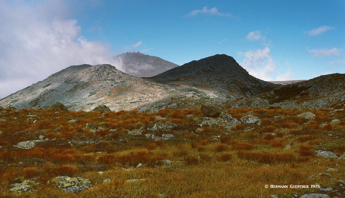
The WMNF is close to major metropolitan areas and includes 1,200 miles of hiking trails, 23 campgrounds and many ski areas within its boundaries. This makes it one of the most visited recreation areas east of the Mississippi River. One characteristic of the WMNF cannot be overstated – and the U.S Forest Service makes sure all visitors are aware of it through the installation of signs at the treeline. The higher mountain summit areas experience some of the worst weather in North America – some even claim the worst in the world. This is substantiated by the fact that the highest surface wind ever recorded on the planet was 231 miles per hour at the observatory on the summit of Mount Washington. Since 1849 over 135 people have died on that mountain – mostly due to exposure to the weather. Anyone doubting these statistics should read “Not Without Peril” by Nicholas Howe. It’s an eye-opener for those considering hiking up there unprepared. Even in summer.
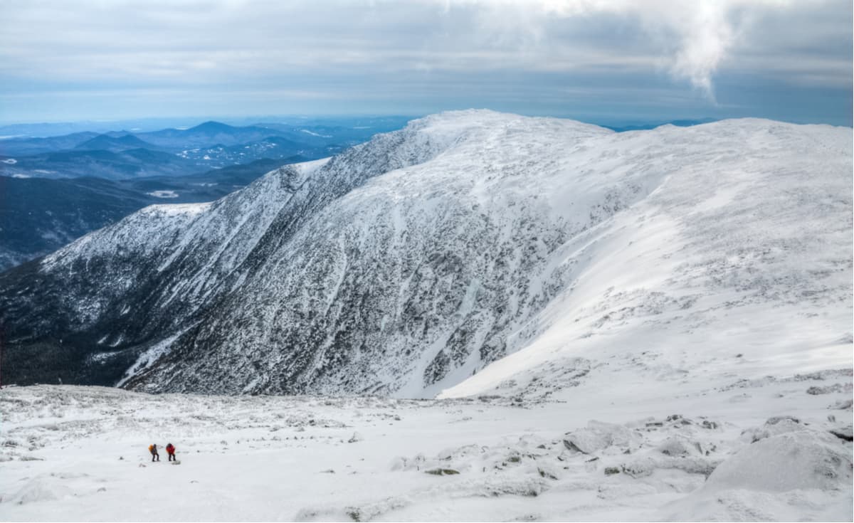
Mount Washington in Winter
There are six wilderness areas in the WMNF, five of which are in New Hampshire and one is in Maine. Of over 107 million acres of Wilderness across the United States, the 148,000 acres in the WMNF might seem small, but this is significant considering how small the forest itself is compared to others, especially in the western states. These six areas have 236 miles of trails.
Wild River Wilderness – This newest wilderness in the WMNF includes parts of the Carter-Moriah Range and extends easterly almost to the New Hampshire/Maine state line. In fact, the primary access to this wilderness is from Maine via a road that has minimal maintenance and is closed in winter. It has 29 miles of hiking trails.
Great Gulf Wilderness - This smallest wilderness in the WMNF includes the rugged terrain below the eastern slopes of the highest summits in the Presidential Range. It has 22 miles of hiking trails, with the Great Gulf Trail as the main trail across the wilderness. This giant glacial cirque is rugged indeed.
Great Gulf Wilderness, Mount Adams
Presidential Range - Dry River Wilderness – Much of the area southeast of the southern Presidential Range and east of Crawford Notch is included in this wilderness. It is the second largest wilderness in the WMNF, and has 43 miles of maintained trails.
Presidential Range-Dry River Wilderness, Mount Washington from Mount Isolation
Pemigewasset Wilderness – This is the largest wilderness area in the WMNF, and encompasses a wide area east of the Franconia Range, extending almost to Crawford Notch. It has about 60 miles of maintained trails that afford a magical wilderness experience.
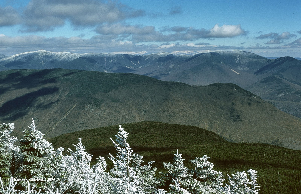
Pemigewasset Wilderness from Franconia Ridge Trail, Twin Range (upper left)
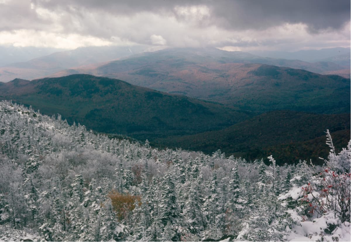
Sandwich Range Wilderness – The most southerly of the WMNF wilderness areas, the Sandwich Range Wilderness is not as high as the others, but it does have steep terrain and 57 miles of maintained trails.
View from Mount Whiteface, Sandwich Range Wilderness
Caribou-Speckled Mountain Wilderness – This wilderness area is the only one in Maine, where it resides in its entirety within Maine’s segment of the WMNF. It was an area of continuous logging up until the 1960s. It has 25 miles of maintained hiking trails and is not well-known to the rest of the world.
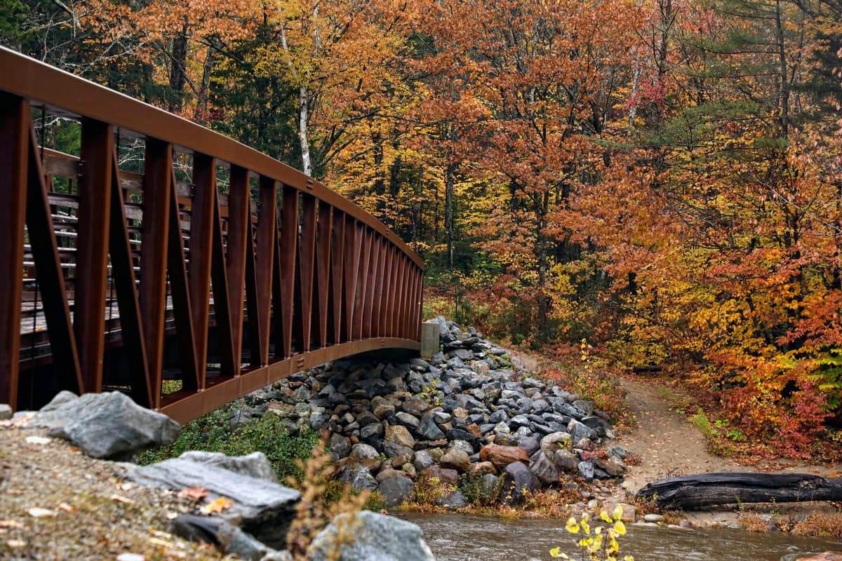
But there is far more to hiking in the WMNF outside of these wilderness areas. Of course, given the spectacular terrain and so many miles of trails in the White Mountains, the great majority of visitors to this forest will gravitate to these special areas. But what else is there to do here besides hiking? We have mentioned that there are many ski areas and campgrounds. Fishing in the many rivers and streams is also not bad. But the WMNF is also renowned for the spectacular displays of colors that lure thousands of visitors to the forest every autumn. That is when the highways, especially coming north from Boston, can become a traffic nightmare – but the rewards are long-lasting.
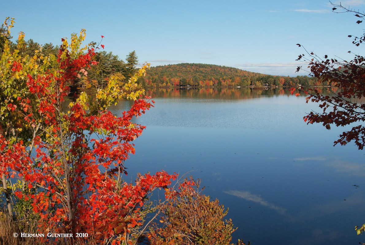
Autumn in Western Maine
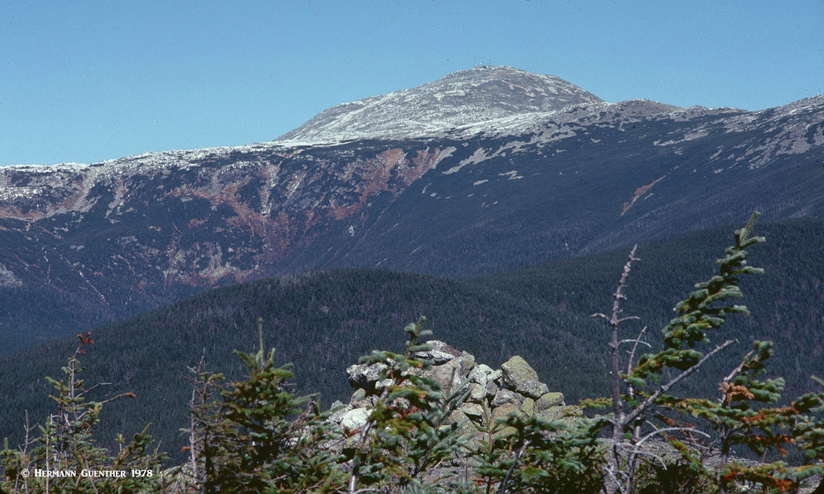
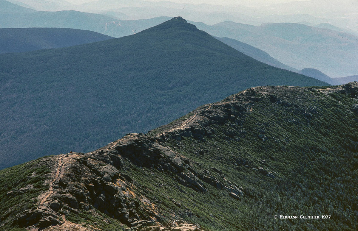
There are several major mountain ranges in the WMNF. Though mostly in the much larger New Hampshire segment, that is not to say that the small part of the forest in Maine does not offer some wonderful hiking opportunities. Contained in the mountains of the WMNF are two of the three largest contiguous expanses of alpine tundra east of the Rocky Mountains (Franconia Ridge and Presidential Range). The famous 2,200-mile Appalachian National Scenic Trail (AT) meanders through the forest, which has most of the total 161 miles of the trail that traverse New Hampshire. The state also has more miles of the AT above treeline than any other state through which the trail travels. The Maine segment of the WMNF does not have any part of the AT since it leaves New Hampshire to the north of that segment of the forest.
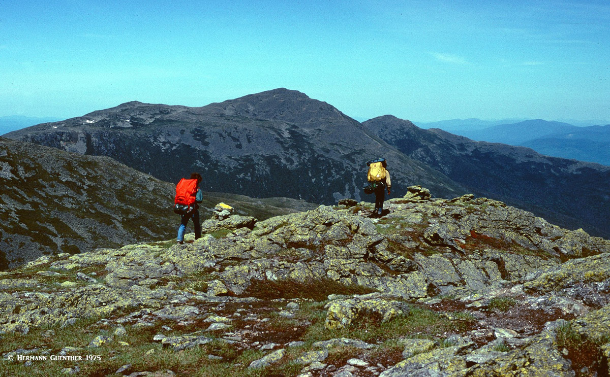
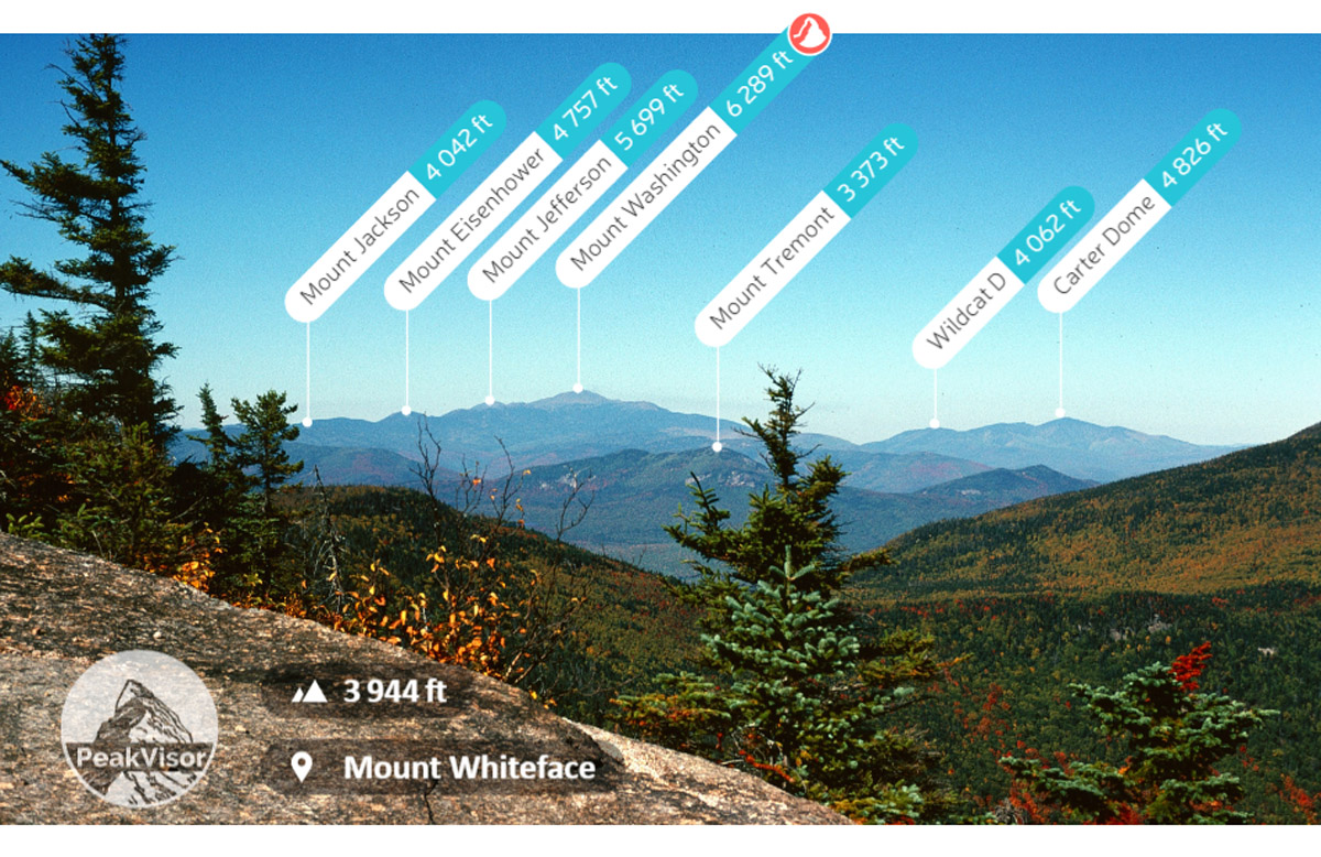
Presidential Range – This high range, almost all of which reaches above treeline, provides the ultimate hiking experience in WMNF in my opinion. In my younger years, I undertook a three-day hike (the Presidential Traverse) that encompassed the entire range and covered some 25 miles, including passing over every named summit in the range, with Mount Washington as the high point. We were blessed with outstanding weather – something that is more the exception than the rule up there. Needless to say, this trek requires a car shuttle, since the hike starts at the south end of Crawford Notch and finishes near the town of Randolph at the north end.
Presidential Traverse, Mount Washington, Mount Monroe
Franconia Range– This wonderful high range is only about five miles long and includes only five named mountains from Mount Lafayette in the north to Mount Flume in the south. Hiking this fine range is a sheer pleasure for those who are conditioned and properly equipped. The northern part is all in alpine tundra and follows a well-defined knife-edge. Once committed, there are few places where you can bail off the ridge except via the four trails that connect down to the highway that passes through Franconia Notch. Whether you do the whole ridge in one long day hike, or just parts of it, this is a strenuous hike. The delightful Old Bridle Path remains my favorite trail by which to reach Lafayette’s Summit. Never underestimate the weather on this range – it can get as bad as the weather can get anywhere.
Franconia Ridge Trail, Mount Liberty
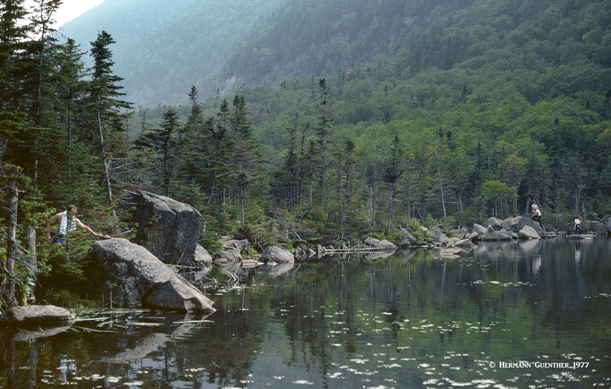
Carter-Moriah Range – By no means as high or severe as the previous two ranges, this range is east of the Presidential Range and includes six official 4,000-footers as well as a few lesser summits. With treeline in the White Mountains at around 4,500 feet, the views from much of this range will be obstructed by trees, but there are a few summits that have openings so that you can get a good view across the valley toward the Presidentials. I have hiked the entire range in whole as well as in several segments, each time staying the night in the hut at Carter Notch, beside a wonderful little pond where it is possible to have a refreshing swim after a long, hot hike.
Carter-Moriah Range, Pond at Carter Notch
Twin Range – Averaging between 4,000 and 5,000 feet in elevation, this centrally-located range has some very pleasant hiking options, some with awesome views of the Pemigewasset Wilderness, into which it extends deeply. This range takes up a large chunk of land between the Franconia and southern Presidential Ranges. I have some fond memories of several multi-day autumn hikes in this range where I encountered few other people. Of course this was more than 40 years ago, so I can’t guarantee similar experiences today. There are eight official 4,000-footers in this range. It is easily explored from the Galehead Hut of the Appalachian Mountain Club.
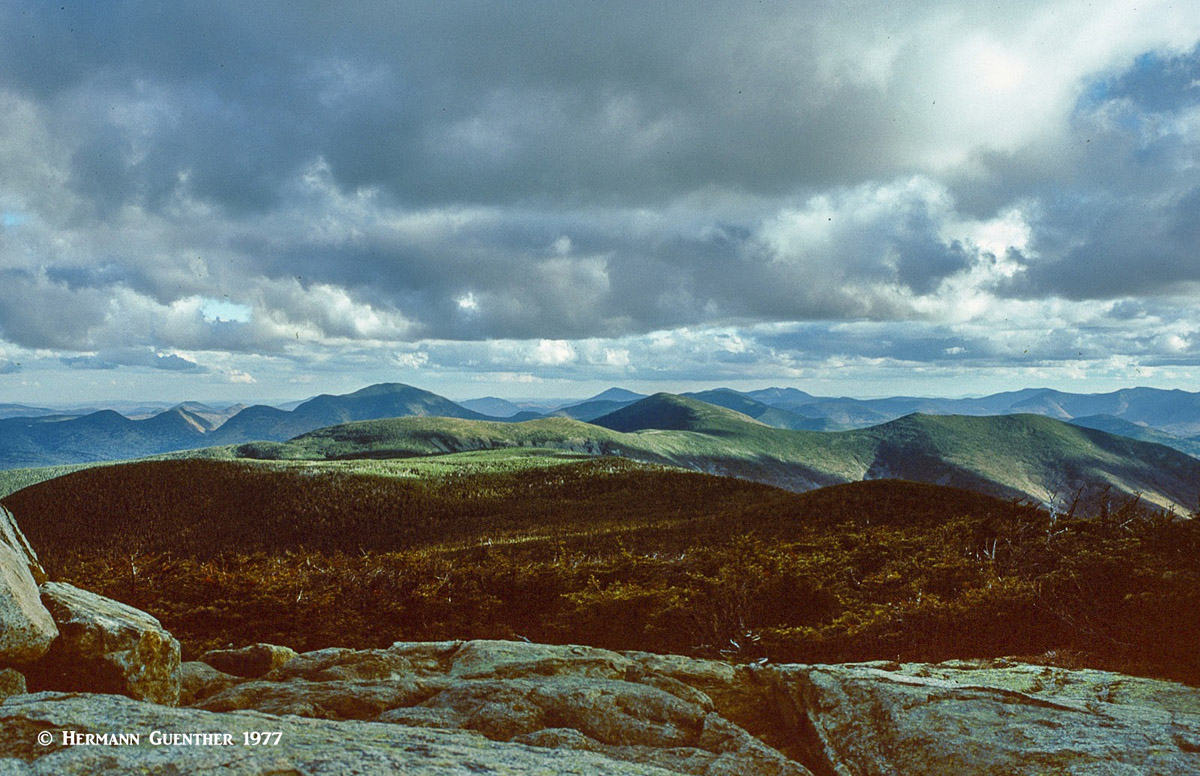
Twin Range from Mount Guyot
Caribou-Speckled Mountain Area – Caribou (reindeer) used to roam the wilderness in this segment of the WMNF in Maine until two brothers shot the last one in the region in 1854. That’s how Mount Caribou got its name. Speckled Mountain got its name due to the colorful autumn leaves that “speckle” the countryside around the mountain. These two peaks, both under 3,000 feet elevation, are the centerpieces of this heavily forested wilderness – the only one in Maine. This wilderness is perhaps the best-kept secret in the WMNF. Though the area is densely wooded, both summits are bare and rocky and thus afford some fine view indeed – especially over toward the higher ranges of the White Mountains in the west. The best access to this hiking area is via State Highway 113, which is closed in winter, but in the summer, a major trailhead can be found at the Brickett Place Wilderness Information Center, although there are several other trailheads along this road, which is also known as the Evans Notch Road. Other trail access points are available from a number of forest roads and State Highway 35 south of the town of Bethel.
Autumn Colors, Evans Notch
There are a number of major towns and cities which serve as gateways to the mountains of the WMNF, several of which are within New Hampshire and Maine. Within the heart of the White Mountains are some ritzy resorts as well. Therefore, exploration of this beautiful area is quite easy. Distances are short and highways are excellent, making much of the WMNF easily accessible from a single base location.
This major city and capital of Massachusetts, Boston is the best gateway to the WMNF for visitors arriving from distant places. It has a major international airport with non-stop flights from almost anywhere. And it is a city to be experienced due to its beautiful harbor setting and historical significance. Depending on what part of the WMNF one wishes to explore, Boston can serve as a starting base for trips into the higher ranges of the White Mountains, but it is not suitable for day trips into these mountains. Those excursions are better based in the closer towns of central and northern New Hampshire and southern Maine. Though I lived in New Hampshire, I always enjoyed venturing into Boston for some alternative activities such as partaking of the great choice of cultural venues and events.
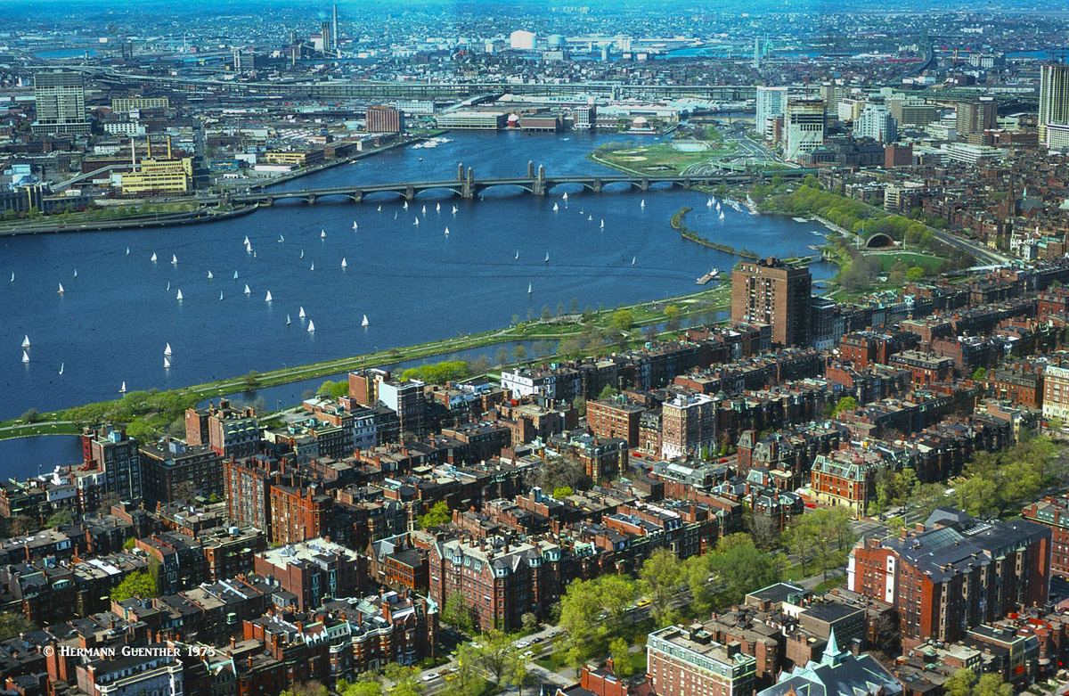
Boston, Massachusetts
This well-situated capital of New Hampshire has a somewhat “small-town” feel with a population of around 43,000 inhabitants. Before I moved to Colorado in 1980, I lived in Concord. This is an excellent town from which to explore pretty much most mountain areas in the WMNF, even just for day-hikes. One can easily drive from Concord to, for example, Franconia Notch and its wonderful trails in just about one hour. And for visitors who want to arrive in New Hampshire by air, the airport in nearby Manchester is only 24 miles from Concord. Even the major trailhead into the high Presidential Range at Pinkham Notch is a mere two-hour drive from Concord – at times.
This bustling little resort town is where you might want to stay if exploring the Presidential Range is your objective while in New Hampshire. It is handy to both the south end of the range if you want to do the Presidential Traverse, or if you just want to climb Mount Washington by one of the standard routes from the Pinkham Notch Visitor Center. There is no shortage of hotels, restaurants, bars, shops or people-watching in this town. It is also handy for exploring the Carter-Moriah Range a bit further northeast and the Caribou-Speckled Mountain Wilderness in nearby Maine.
If you have high-end tastes – and a budget to match – Bretton Woods might just be right for you. Not only is Bretton Woods the largest and one of the most acclaimed ski resorts in the eastern United States, it offers some fine accommodations in one of the most scenic areas in New England. The historic Mount Washington Hotel, with its namesake mountain as a backdrop, is one of the last surviving grand hotels in the White Mountains and is a National Historic Landmark. One could do worse than staying here.
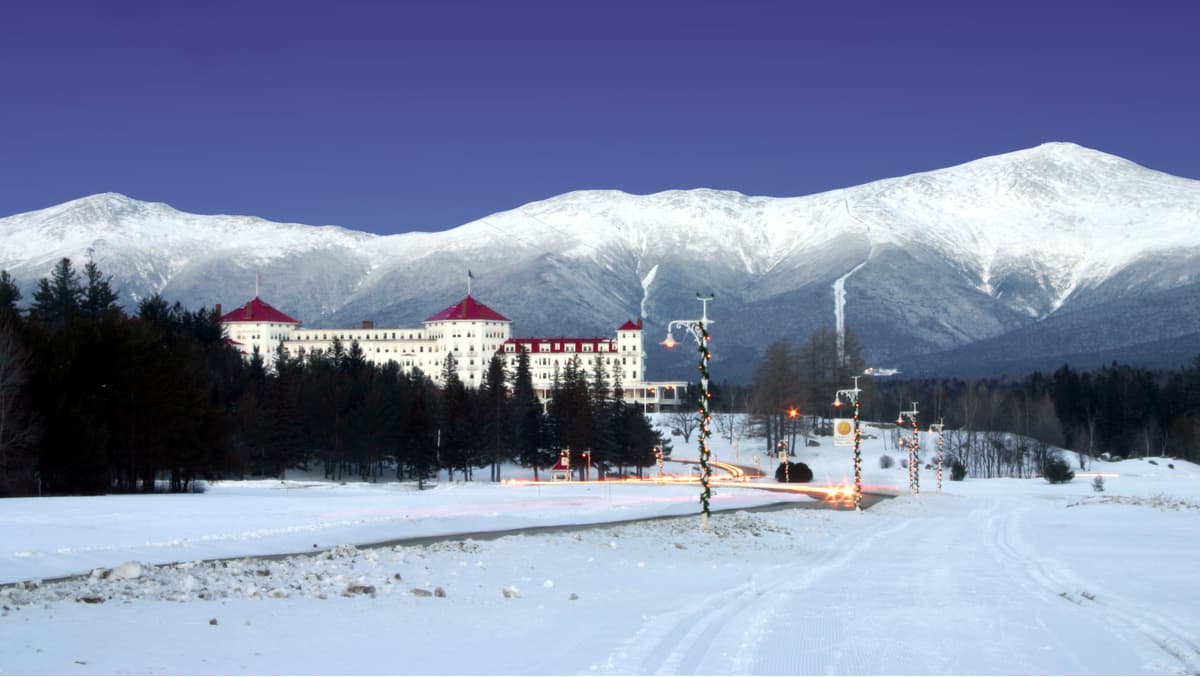
Mount Washington Hotel, Bretton Woods, Mount Jefferson (l), Mount Washington (r)
You might not think of this wonderful harbor city of 66,000 inhabitants in southern Maine a convenient base from which to explore the WMNF, but think again. From Portland to the Mount Washington trailhead at Pinkham Notch is 80 miles, while to get there from Boston is twice as far and over an hour longer. If you happen to be “camped out” in Portland, you might even be tempted to skip the mountains altogether (but please don’t), that’s how much this great town has to offer. For one thing, it has an international airport, which makes it easy to get to from just about anywhere. Then there are the attractions the town and its environs have to offer. I once spent an entire summer there on assignment – I never wanted to leave. And then there is the exceptional choice of restaurants – the seafood in Portland is to die for! Need I say more?
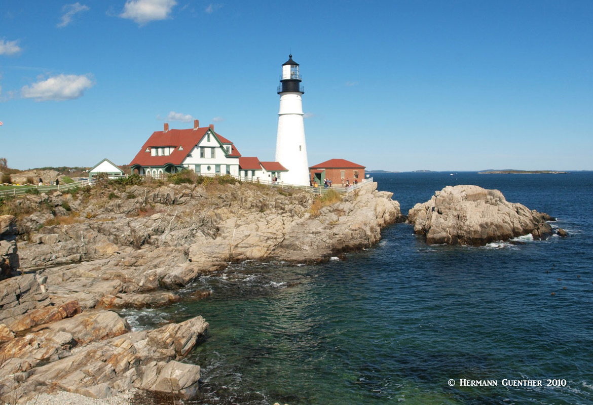
Portland Head Lighthouse, Maine
The Appalachian Mountain Club (AMC) maintains a series of eight mountain huts in the White Mountains. They are all located on the Appalachian Trail and are spaced about a day hike apart. They are a rustic, yet comfortable alternative, to more expensive lodging, and you don’t have to carry all the equipment you would normally carry when backpacking. They are all equipped with bunk-rooms and washrooms and even provide blankets and pillows in the summer months. Not only that, during full-service season (early June to early- or mid fall, depending on the hut) they provide full breakfast and dinner service. No menu - this is exclusively family-style dining. These huts are a wonderful off-the-grid overnighting experience. The capacities of the huts vary from 36 guests to 96. All bunkhouses or bunkrooms are coed.
Three of the lower-elevation huts are open year-round, but in the off-season are only available on a self-service basis. Which means that you must bring your own bedding (think warm sleeping bags – these huts are not heated and will get very cold in winter) and food. You can use their stoves and utensils but must take out all your own trash (no problem there – if you can bring it in, you can certainly take out the empty packaging). There is always a caretaker for certain hours at these times, who may even build a fire in the main common areas (but not the bunkrooms). The two high elevation huts in the Presidential Range are only open during full-service season (about 3½ months) due to the extreme weather conditions up there.
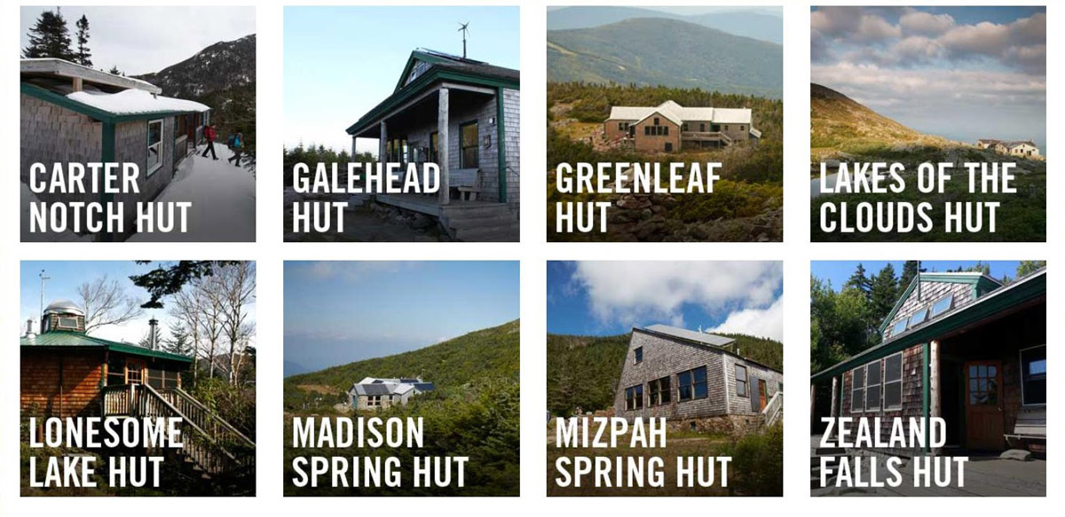
Huts of the Appalachian Mountain Club, White Mountain National Forest (AMC)
The list of major ski resorts in the WMNF. All these places are present in the PeakVisor app and provide real-time status information about open lifts and ski runs.


ultra
new-england-4000ers
nh-4000ers
northeast-115-4000ers
ymca-alpine-club-nh
fred-beckey-great-peaks
new-england-4000ers
nh-4000ers
northeast-115-4000ers
ymca-alpine-club-nh
new-england-4000ers
nh-4000ers
northeast-115-4000ers
ymca-alpine-club-nh
ultra
new-england-4000ers
nh-4000ers
northeast-115-4000ers
ymca-alpine-club-nh
fred-beckey-great-peaks
new-england-4000ers
nh-4000ers
northeast-115-4000ers
ymca-alpine-club-nh
new-england-4000ers
nh-4000ers
northeast-115-4000ers
ymca-alpine-club-nh
new-england-4000ers
nh-4000ers
northeast-115-4000ers
ymca-alpine-club-nh
new-england-4000ers
nh-4000ers
northeast-115-4000ers
ymca-alpine-club-nh
new-england-4000ers
nh-4000ers
northeast-115-4000ers
ymca-alpine-club-nh
new-england-4000ers
nh-4000ers
northeast-115-4000ers
ymca-alpine-club-nh
new-england-4000ers
nh-4000ers
northeast-115-4000ers
ymca-alpine-club-nh
new-england-4000ers
nh-4000ers
northeast-115-4000ers
ymca-alpine-club-nh


