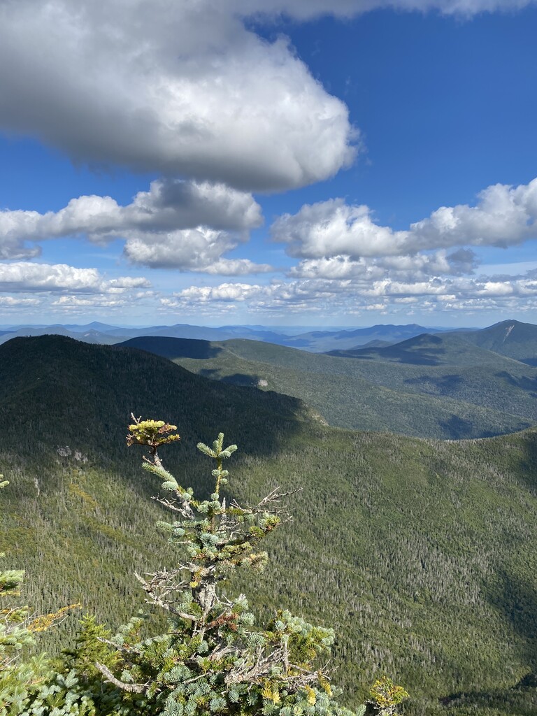
Mount Osceola is a 4,340-foot (1,320 m) peak within the White Mountains of New Hampshire. Located in the White Mountain National Forest, the mountain is named for Osceola, the early-19th century Seminole leader. It is the highest peak in the Waterville Valley region.
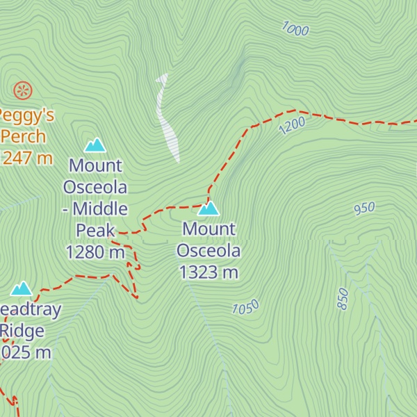
Osceola can be ascended from the Greeley Pond Trail to the northeast of the mountain, which requires crossing the East Peak of Osceola first, or from the Tripoli Road to the south. There was a fire lookout tower at the top of the mountain, which significantly expanded the view from the peak, but it was taken down in the late 1970s. Views from the summit cover a large portion of the White Mountains, extending from Mount Washington in the northeast to the town of Waterville Valley in the south.
There's a hiking trail (T2) called Mount Osceola Trail leading to the summit.
By elevation Mount Osceola is
# 23 out of 393 in Grafton County # 52 out of 428 in White Mountain National Forest # 52 out of 1985 in New Hampshire # 1 out of 94 in the Sandwich Range # 52 out of 844 in the White Mountains (New Hampshire)
By prominence Mount Osceola is
# 6 out of 393 in Grafton County # 8 out of 428 in White Mountain National Forest # 12 out of 1985 in New Hampshire # 75 out of 39823 in the Appalachian Mountains # 1 out of 94 in the Sandwich Range # 10 out of 844 in the White Mountains (New Hampshire)
We use GPS information embedded into the photo when it is available.
3D mountains overlay
Adjust mountain panorama to perfectly match your photos because recorded by camera photo position might be imprecise.
Move tool
Rotate tool
Zoom
More customization
Choose which peak labels should make into the final photo and what photo title should be.
Next
Photo Location
Satellitte
Flat map
Relief map
Latitude
Longitude
Altitude
OR
Latitude
°'''
Longitude
°'''
Apply
Register Peak
Peak Name
Latitude
Longitude
Altitude
Register
Teleport
PeakVisor
This 3D model of Sagarmatha National Park in Nepal was made using the PeakVisor app topographic data. The mobile app features higher precision models worldwide, more topographic details, and works offline. Download PeakVisor maps today.
Download OBJ model
PeakVisor
The download should start shortly. If you find it useful please consider supporting the PeakVisor app.
PeakVisor for iOS and Android
Be a superhero of outdoor navigation with state-of-the-art 3D maps and mountain identification in the palm of your hand!