
Scan the QR code and open PeakVisor on your phone
The Laurentides include 1,015 named peaks. The highest is Mont Raoul-Blanchard at 1,155 m. Other notable peaks include Mont Belle Fontaine, Mont de la Québécoise and Mont du Barbeau.
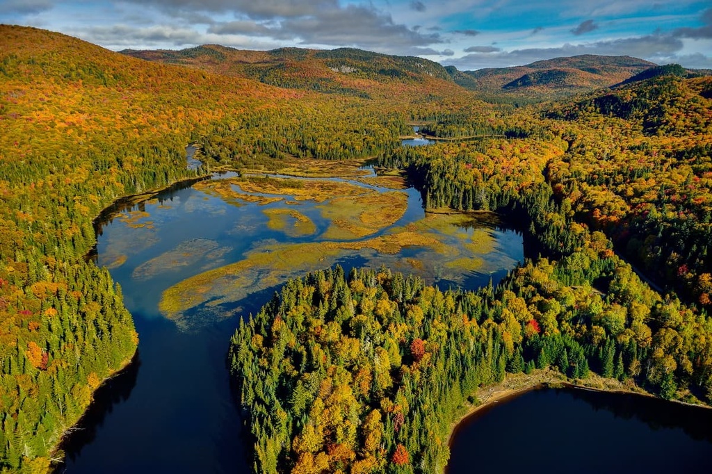
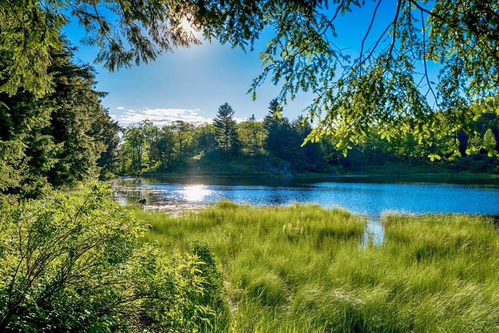
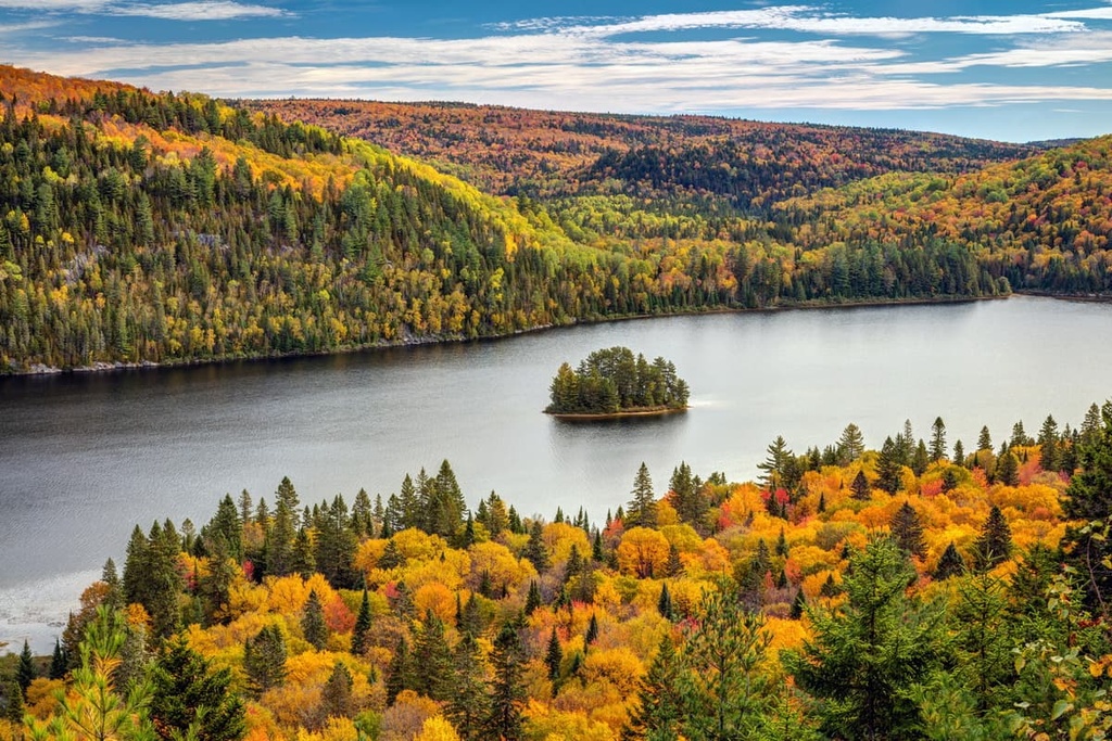
The Laurentides (Laurentian Mountains) is one of the major mountain ranges in the Canadian province of Quebec. Known for their dense forests, rugged terrain, and popular outdoor recreation areas, the Laurentian Mountains are a must-visit for any hiker in southern Quebec. There are 1015 named mountains in the Laurentides, the highest and most prominent of which is Mont Raoul-Blanchard (1,155 m/3,789 ft).
The Laurentian Mountains, or Laurentides as they are known in French, are a large collection of peaks situated in the southern part of the Canadian province of Quebec.
There are varying definitions of the Laurentides and the range’s boundaries are somewhat ill-defined. Most sources will agree that the southern and western boundaries of the range are the Ottawa River (Rivière des Outaouais/Kichi-Sìbì/Kitchissippi) and the Saint Lawrence River (Fleuve Saint-Laurent). However, the northern and eastern borders of the Laurentides are the subject of some debate.
According to some sources, the northern terminus of the range is the Saguenay River (Rivière Saguenay). However, other sources argue that the Laurentides continue further to the east and north into southern Labrador. That said, the strictest definition of the range typically marks the northern terminus of the Laurentides at the Saguenay River.
Further compounding this geographic issue is the fact that there is another physiographic region near the Laurentian Mountains that shares a similar name and geologic history.
In particular, some scholars recognize a Laurentian Highlands (Hautes terres laurentiennes) region to the south and west of the Laurentian Mountains. This Laurentian Highlands region is often defined as extending further to the south of the Ottawa River into Ontario where it then crosses the international border into the US.
Parts of the Superior Upland in Michigan, Minnesota, and Wisconsin may also be considered a part of the greater Laurentian Highlands. Some researchers also consider the Adirondacks in New York to be a southern extension of the Laurentian Highlands, though this definition of the highlands isn’t as common.
It’s also worth pointing out that the Laurentian Mountains, the Laurentides region, and the regional county municipality (MRC) of Les Laurentides do not share the exact same borders.
The MRC of Les Laurentides and the region of Laurentides are administrative districts of Quebec but they only include a southern section of their namesake range. Meanwhile, the Laurentian Mountains are also found in the Côte-Nord, Saguenay-Lac-Saint-Jean, Mauricie, Lanaudière, Outaouais, and Capitale-Nationale regions.
In any case, the Laurentides, however it may be defined, is one of the most important mountain ranges in Quebec, alongside the Canadian Appalachians (Appalaches Canadiennes) and the Torngat Mountains (Monts Torngat). The Laurentides are home to some of Quebec’s most popular hiking areas and their proximity to the province’s major cities makes them easy to access for day trips and longer expeditions.
The Laurentians are one of the more geologically interesting regions of Quebec. Regardless of how you define the range, the Laurentides is underlain by the Canadian Shield (Boucilier canadien; also called the Laurentian Plateau).
Found at the heart of the North American Craton, the Canadian Shield is a huge area of exposed Precambrian rock that forms the core of the continent of North America. It extends across much of eastern and northern Canada as well as parts of the upper Midwest in the United States.
Geologically, the Canadian Shield is home primarily to igneous and metamorphic rocks. These rocks are billions of years old (some of the rocks date back to between 2.5 and 4.2 billion years ago), which makes them some of the oldest rocks on the planet.
In fact, the Canadian Shield is arguably the largest area of exposed Precambrian rock on Earth. The rocks in the Canadian Shield actually underlie a huge portion of North America, but they are only exposed in this northernmost region where they cover around 50 percent of the total landmass of Canada.
The rocks within the Laurentian Mountains are generally considered to be a part of the Grenville Province, which extends from southeastern Ontario through southern Quebec to the southern part of Labrador. Some sources argue that all of the peaks found within the Grenville Province should be considered part of the Laurentian Mountains, which is why there is some confusion with respect to the range’s boundaries.
Nevertheless, the Laurentian Mountains themselves are also one of the oldest mountain ranges on the planet. Researchers believe that the Grenville orogeny, which occurred around 1 billion years ago, was one of the main mountain-building events responsible for the creation of the Laurentian Mountains.
The mountains created by this orogeny were once as large as the Himalaya. However, they have since been eroded away by billions of years of wind and water. Furthermore, the region that is now the Laurentian Mountains was heavily glaciated during much of the Pleistocene, which had a huge impact on the current topography of the range.
In particular, during the Wisconsin Glaciation, the Laurentides were covered by a huge sheet of ice called the Laurentide Ice Sheet, which was up to 3 km (1.9 mi) thick in some places. This ice sheet was responsible for much of the erosion that happened in the region in recent years and it was also the ice sheet that carved out the basins of the modern-day Great Lakes.
The rocks in the Laurentian Mountains are also relatively mineral-rich. Quebec’s Grenville province contains deposits of zinc, lead, and uranium as well as sizable areas of iron ore. There’s also an area near the range called the Abitibi gold belt, which is famous for its large deposits of gold and silver, though it’s technically part of the Superior Craton.
Major peaks in the Laurentian Mountains include Mont Raoul-Blanchard, Mont Belle Fontaine, Mont de la Québécoise, Pic Johannsen, Mont du Lac des Cygnes, and Mont François-De Laval.
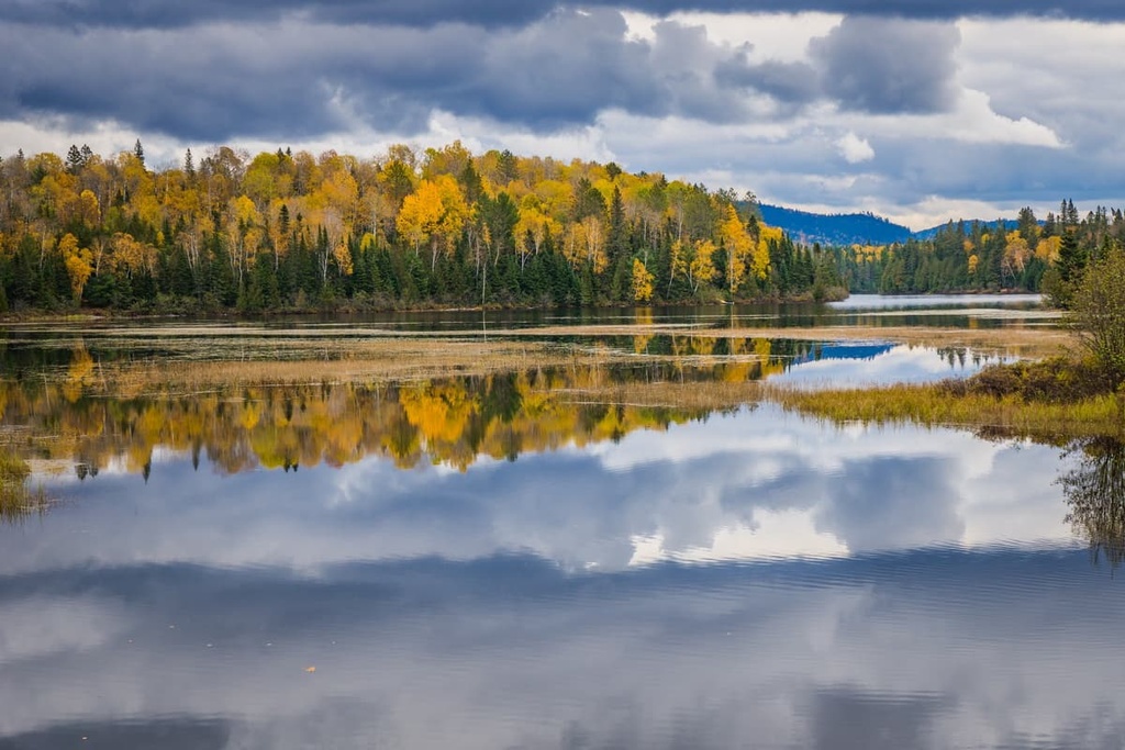
Due to the large size of the Laurentian Mountains, the range itself encompasses a number of different ecological areas. In particular, the government of Quebec recognizes five different bioclimatic domains within the Laurentian Mountains, which are split between two vegetation zones.
In the southernmost part of the range, we find the Northern Temperate Zone, which covers a huge area of land throughout southeastern Canada and the northeastern US. This zone is split into two main subzones (hardwood forest and mixed forest). There are also four bioclimatic domains within these zones that are found in the Laurentian Mountains, including:
The northernmost part of the Laurentian Mountains is actually part of the southernmost stretch of Quebec’s Boreal Zone.
Within the range’s Boreal Zone, we find the Balsam Fir-White Birch Domain, which is primarily home to stands of balsam fir and white spruce. There are also some stands of white birch, black spruce, trembling aspen, larch, and jack pine in this zone. Some of the southern sections of the Balsam Fir-White Birch Domain also feature red maple and yellow birch, though these trees aren’t common in this zone.
As far as wildlife goes, the Laurentian Mountains are home to most of the typical species that are found in southern Quebec. This includes black bears, Canada lynx, bobcats, eastern wolves, red foxes, coyotes, moose, white-tailed deer, elk, and northern river otters.
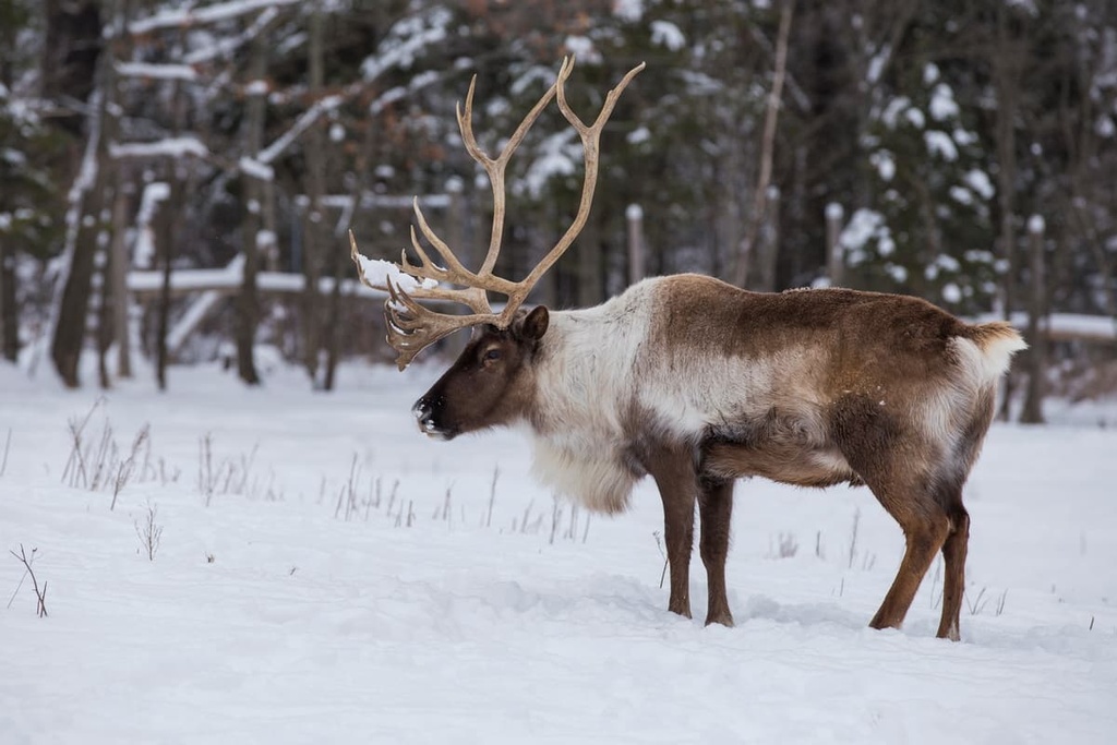
The Laurentian Mountains also technically overlap a small portion of the range of the boreal woodland caribou. However, caribou aren’t common in this part of Quebec, so you’re more likely to see them in the northern regions of the province.
The land that is now referred to as the Laurentian Mountains has been home to humans since time immemorial.
There are many First Nations with ancestral ties to the land in and around the range, including the Nation Huronne-Wendat, Nation Atikamekw, Eeyou First Nations (Cree First Nations), and Anishinabek Nation (including many of its 39 First Nations).
Many Algonquin-speaking First Nations in the area that is now called Quebec consider the range and its surrounding area to be part of their traditional territory, such as the Kitigan Zibi Anishinabeg and the Nation Anishinabe du Lac Simon. Much of the land that is now part of the range was never ceded to settlers or to Canada by First Nations in the region.
The first peoples of European descent to travel to the region around the Laurentian Mountains likely arrived during the early seventeenth century. Samuel de Champlain of France famously established a European settlement at what is now Quebec City in 1608.
In 1610, Étienne Brûlé, a French fur trapper, traveled up the Ottawa River as he made his way toward the Great Lakes. It’s believed that Brûlé was the first person of European descent to travel up the river, though First Nations had been living in the region and paddling on the river for countless generations.
European (in particular, French) settlement of the region didn’t really pick up momentum until the end of the seventeenth century. By that time, France had started rapidly expanding its colonial efforts in the region. The Laurentides were particularly popular during this period among trappers, loggers, and traders because they offered an abundance of valuable resources.
After the Seven Years’ War, Quebec became part of the British Empire, though it retained its decidedly French culture. It eventually joined the Dominion of Canada in 1867 alongside Ontario, Nova Scotia, and New Brunswick.
With the exception of the major cities that are located around the periphery of the range, however, the area in and around the Laurentian Mountains is still relatively sparsely populated. The main industries in the region have historically been mining and logging, though much of the range has since been protected on the federal, provincial, or local levels.
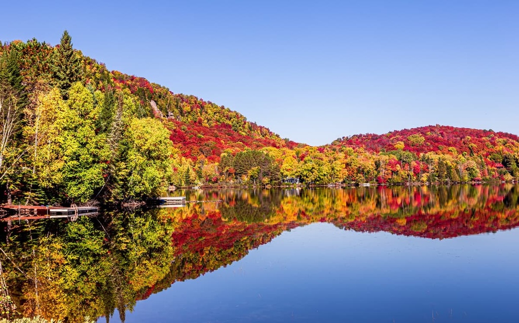
In recent decades, the Laurentian Mountains have also become particularly popular destinations for tourists. The range’s proximity to Montreal, Ottawa, and Quebec City and its plethora of parks and recreation areas continue to make it an excellent place for day trips and weekend mountain adventures for many residents of southern Quebec and Ontario.
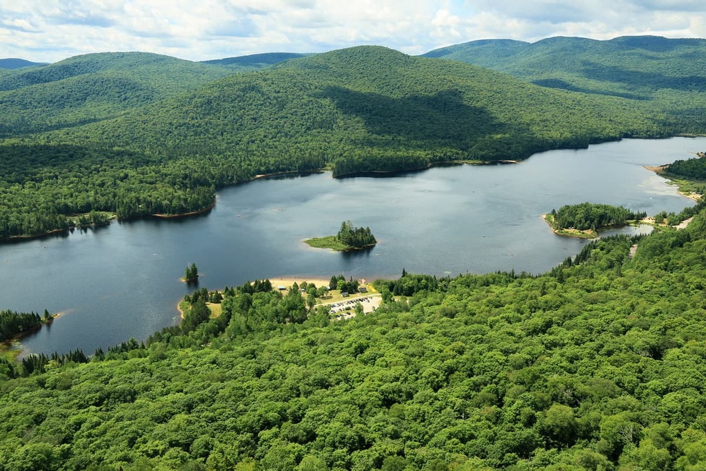
The Laurentian Mountains are home to a truly impressive collection of protected areas, most of which are open for hiking, climbing, biking, paddling, and skiing.
Within the range, there are a number of national parks of Quebec, including:
The Laurentian Mountains are also home to one national park of Canada, Parc national de la Mauricie, which is protected at the federal level and is administered primarily by Parks Canada.
Additionally, the range contains a large number of ecological, wildlife, biodiversity, and nature reserves, including:
One of the most common types of protected land in the Laurentian Mountains is a ZEC (zones d'exploitation contrôlée/controlled harvesting zone), which is a type of locally managed public land that’s unique to Quebec. Each ZEC is individually managed by its own governing body to provide for a mix of wildlife conservation and outdoor recreation.
Some of the ZECs found in the Laurentian Mountains include:
Last but not least, the Laurentian Mountains are home to a number of other assorted parks, which are managed at the federal, provincial, regional, or local level. These include:
There’s no shortage of destinations for outdoor adventure in the Laurentian Mountains. The range is home to dozens of outdoor recreation areas, so we can’t possibly discuss them all here. Up next, we’ll take a closer look at the hiking options available at the most popular parks in the Laurentian Mountains to help you plan your next trip to the region.
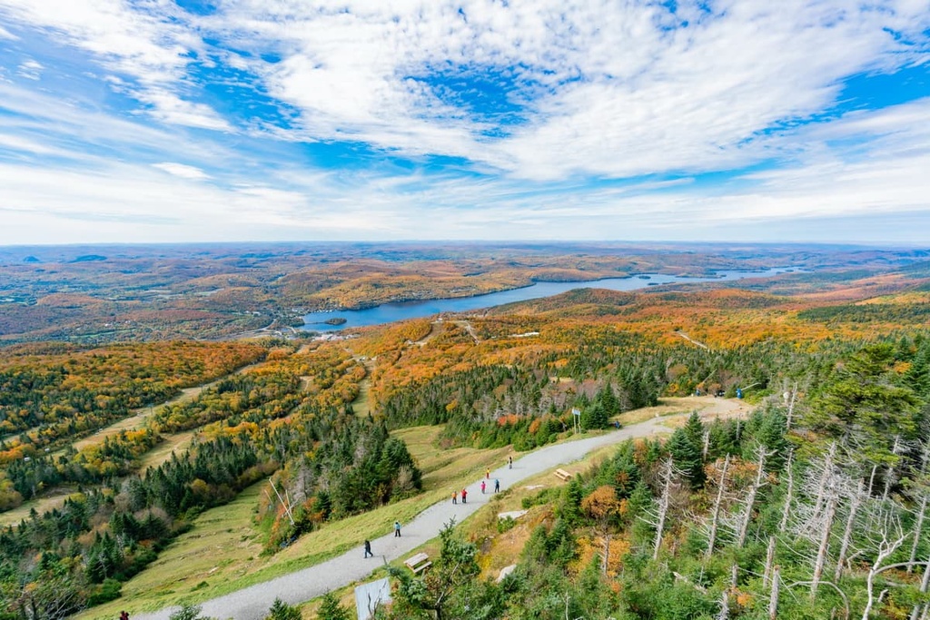
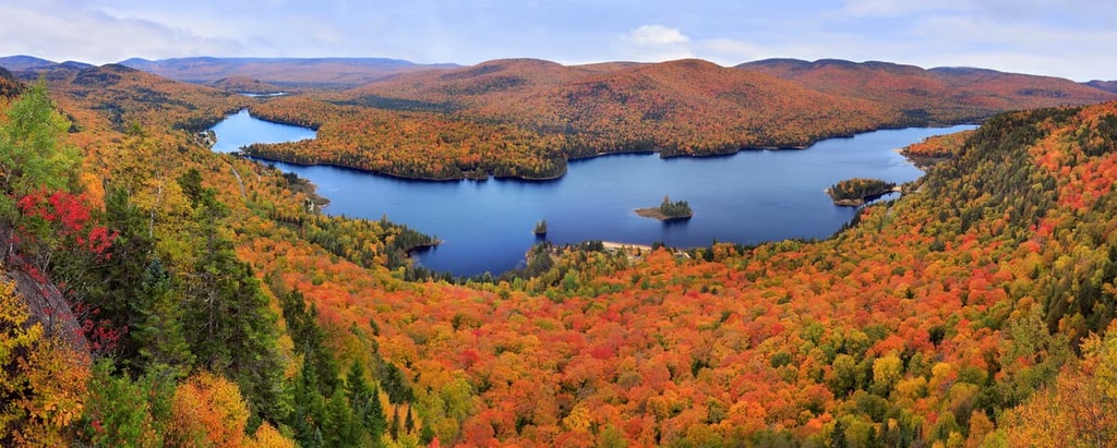
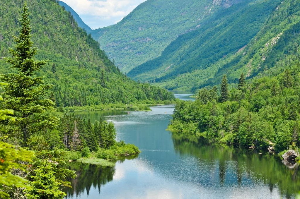
As the oldest national park of Quebec, Mont-Tremblant National Park is a fan-favorite hiking destination among residents and locals alike in the Laurentides. The park is home to 18 named mountains, the highest and most prominent of which is Pic Johannsen (932 m/3,058).
Pic Johannsen is the highest summit on the Mont Tremblant massif, which is the central feature of the park. Mont-Tremblant is known for its plethora of hiking trails, which include popular routes like La Coulée, La Chute-du-Diable, and Johannsen-Sommets-Grand Brule.
Other great activities that you can enjoy during a trip to Mont-Tremblant include water sports, via ferrata, and skiing. The park also offers a wide array of accommodation options for visitors in the summer months, including more than a dozen campgrounds and rentable huts, making it a great option for a weekend trip into the Laurentides.
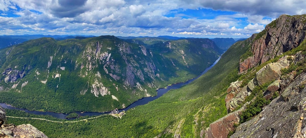
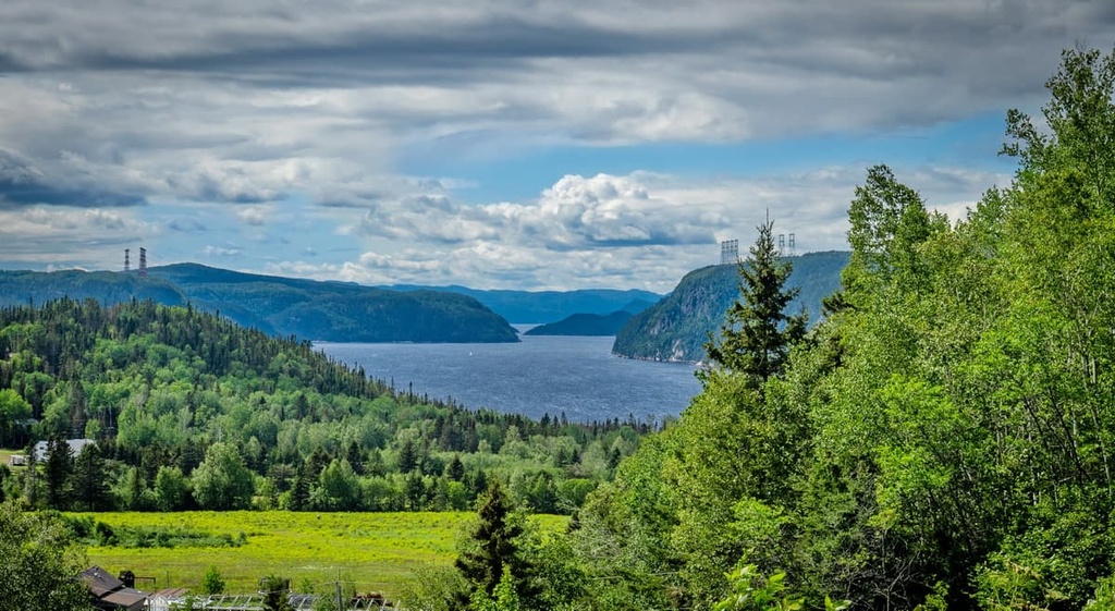
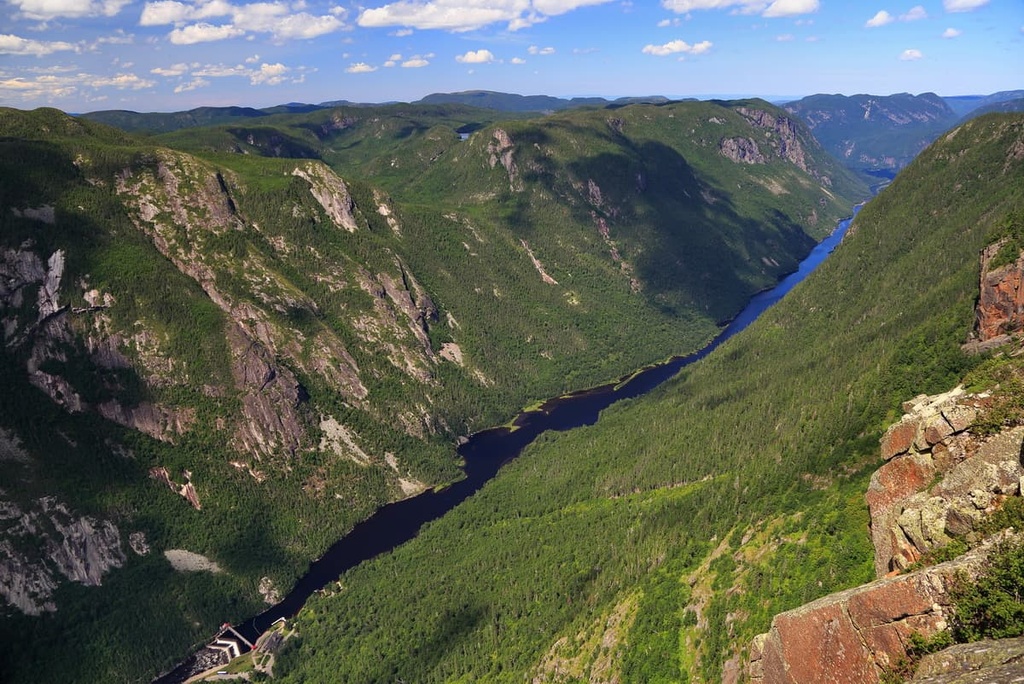
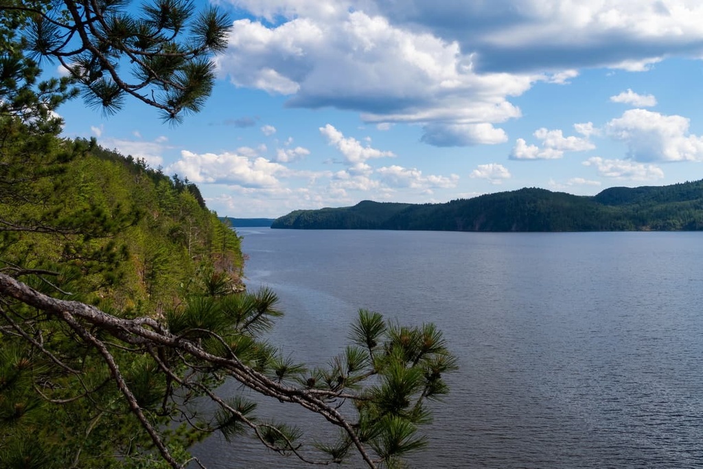
Aptly named, Fjord-du-Saguenay National Park is a provincially protected area that’s located along the shores of the Saguenay River. It is home to 35 named mountains, the highest and most prominent of which is Mont Jacques-Lévasque (622 m/2,041 ft).
Fjord-du-Saguenay is a superb destination for hikers as it offers dozens of kilometers of maintained trails for visitors to enjoy. Popular hikes in the park include the Méandres-à-Falaises, Des Chutes, and Le Fjord trails.
In Fjord-du-Saguenay, you can also enjoy one of three different via ferrata routes with the help of a local guide. You can also head out on the water in the park on a boat cruise to see more of what this magical landscape has to offer.
Grands-Jardins National Park is located in the northeastern part of the Laurentides in the Charlevoix Regional County Municipality. It contains 4 named mountains, the highest of which is Mont René-Richard (994 m/3,261 ft) and the most prominent of which is Mont du Lac des Cygnes (969 m/3,179 ft).
The park is known for its mountainous terrain and its unique geologic features, which include everything from glacially carved valleys to the remnants of a meteorite strike from 360 million years ago.
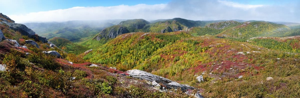
Grands-Jardins has plenty of great hiking trails to check out. This includes the Mont du Lac-des-Cygnes Trail, De La Tour Trail, Le Boréal Trail, and Le Gros-Pin Trail. You can also go kayaking, paddleboarding, fishing, rock climbing, and skiing in the park if you’re looking for other ways to adventure in the region.
Hautes-Gorges-de-la-Rivière-Malbaie National Park is located near Grands-Jardins National Park in the northeastern part of the Laurentides. It is home to 9 named mountains, the highest and most prominent of which is L’Acropole des Draveurs (1,045 m/3,428 ft).
Although it’s sometimes overlooked in favor of its larger neighboring parks and reserves, Hautes-Gorges-de-la-Rivière-Malbaie is often considered to be the centerpiece of the UNESCO Charlevoix Biosphere Reserve.
Within Hautes-Gorges-de-la-Rivière-Malbaie, visitors have a chance to see some of the most incredible terrain in the Laurentides. The park offers many different hiking trails, one of the most famous of which is the Acropole-des-Draveurs Trail.
In addition to hiking, you can also go kayaking, fishing, biking, canoeing, and wildlife watching in the park. During the winter, there are also opportunities for backcountry skiing, snowshoeing, ice climbing, and fat biking in Hautes-Gorges-de-la-Rivière-Malbaie.
Opémican National Park is a small park that’s located in the southwesternmost part of the Laurentides near Temiscaming. Unlike many of the other parks in the Laurentides, Opémican isn’t particularly mountainous, though it is known for its plethora of lakes and waterways.
The park is actually nestled in between Lac Kipawa and Lac Témiscamingue, so it’s the perfect place for water-based adventures. In Opémican, there are opportunities for hiking, fishing, canoeing, kayaking, paddleboarding, and biking, so there’s something for everyone to enjoy at the park.
Oka National Park is one of the smallest national parks in Quebec. It is located just outside of Montreal near the confluence of the Ottawa and Saint Lawrence rivers at Lac des Deux Montagnes.
Despite its small size, Oka National Park is a popular destination for outdoor recreation, thanks in no small part to its proximity to Montreal. The park is perhaps best known as being the site of one of the largest heron rookeries in Quebec and for being home to the historic eighteenth-century Calvaire d'Oka shrine.
Oka National Park offers a number of recreation activities, including hiking, kayaking, swimming, biking, and sailing. During the winter months, there are also opportunities for snowshoeing and sledding in the park.
Mauricie National Park is the only federally designated and managed national park in the Laurentides. Unlike the other national parks in the range, Mauricie is a national park of Canada, so it is managed by Parks Canada, instead of Sépaq. The park is situated near Shawinigan and it’s best known for its many lakes and ponds.
The park is a popular destination for both hiking and paddling. There are dozens of marked hiking trails in Mauricie that cater to trekkers of different experience levels. You can also go biking, camping, fishing, kayaking, swimming, and even ice climbing in the park, so there’s something for everyone to enjoy during a trip to Mauricie.
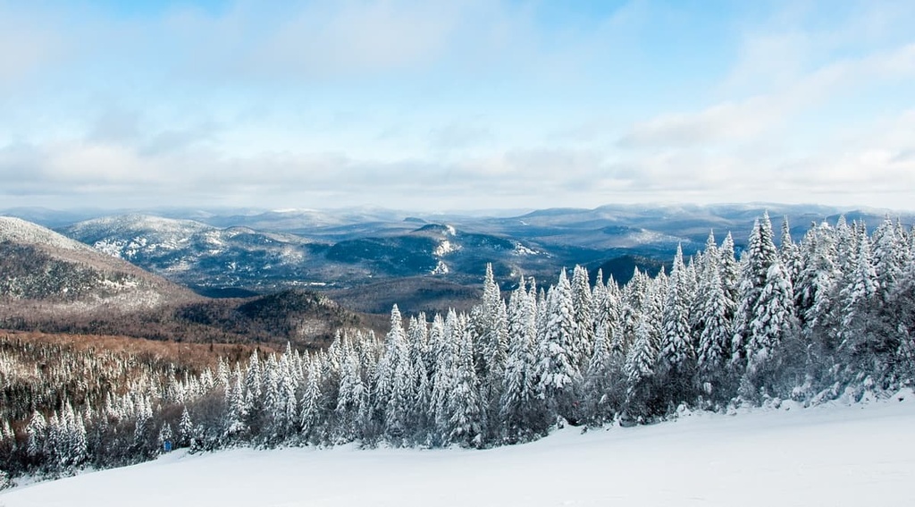
During the winter months, the Laurentian Mountains transform into one of the most popular regions for skiing in southern Quebec. The range contains a large number of downhill ski areas, each of which offers something unique for visitors to enjoy.
Here’s a quick look at the different ski resorts in the Laurentian Mountains so you can start planning your next winter trip to the range.
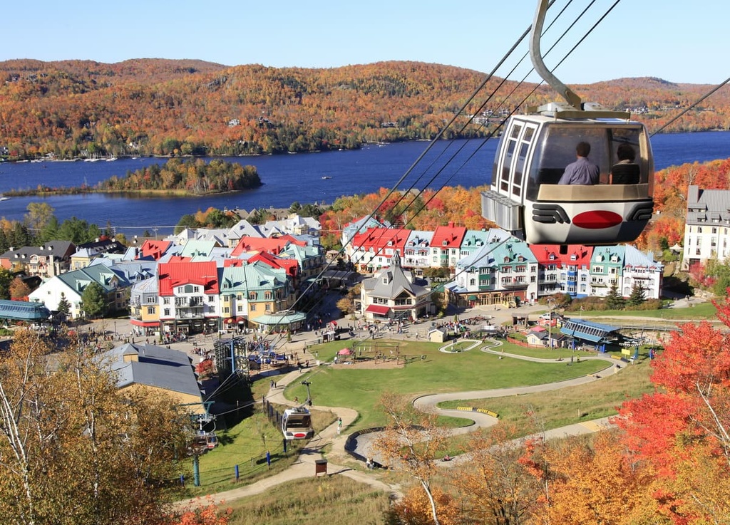
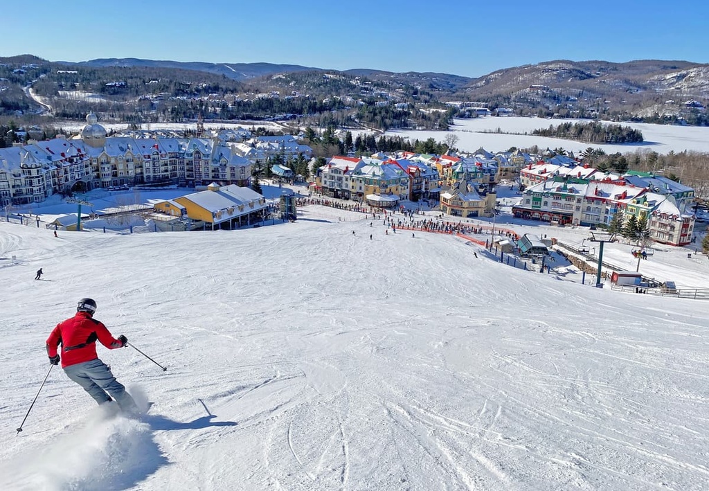
The most famous ski resort in the Laurentian Mountains is easily the Mont Tremblant Ski Resort. Aptly named, Mont Tremblant is situated on the slopes of the Mont Tremblant massif within Mont-Tremblant National Park.
Mont Tremblant boasts more than 100 trails and over a dozen ski lifts for visitors to enjoy during the winter months. In the summer, Mont Tremblant also offers an abundance of other activities, including hiking, climbing, via ferrata, kayaking, and cycling.
The resort is located just outside the village of Mont-Tremblant but it has its own pedestrian village that caters to tourists. There are plenty of hotel and condo accommodation options in the pedestrian village as well as a number of restaurants and shops that you can check out during your next trip to the area.
Not to be confused with the Alps’ Mont Blanc, the Mont Blanc Ski Resort is a mid-size ski area that’s located to the south of Mont Tremblant near the community of Mont-Blanc (formerly Saint-Faustin–Lac-Carré). It has over 35 slopes and 5 lifts that cater to skiers during the winter months.
Mont Blanc has a family-friendly atmosphere, so it’s a nice option if you’re looking to go skiing near Montreal or Ottawa but don’t want to deal with the hustle and bustle of a larger resort. During the winter, the resort has a ski school if you want to improve your technique, and it has a handful of different bars and cafés to help you refuel throughout your day on the slopes.
La Tuque is a small ski resort that’s located in the central part of the Laurentides near the town of La Tuque. It has 9 slopes and 2 lifts, so it’s a nice option if you’re looking for a half-day of skiing.
Even though La Tuque is a relatively small resort, it has a lot to offer to visitors. It’s particularly popular among families and it offers both day and night skiing. The resort is often thought of as a hidden gem by local skiers as it features well-groomed slopes and a family-friendly atmosphere.
Mont-Édouard – L'Anse-Saint-Jean is a ski resort situated in the Saguenay-Lac-Saint-Jean region that makes for a perfect getaway if you’re looking to ski in the northern part of the Laurentides.
The resort itself is relatively small, but it has over 30 trails for skiers to enjoy as well as a large backcountry area that’s known for its powder-filled terrain. Mont-Édouard also has cross-country skiing, fat biking, and snowshoeing trails for visitors to check out during the winter months when they’re not on the slopes.
Mont-Bélu is another ski resort in the Saguenay region that’s considered a bit of a hidden gem among locals. It’s fairly small as far as ski areas go as it only has about 10 trails, but it does have a terrain park and a number of challenging slopes for advanced skiers to test out.
Plus, Mont-Bélu is one of the more historic ski areas in this part of Quebec. The land that is now part of the resort was purchased by a man named Jos Fréchette in 1945 right after he was discharged from the Canadian Armed Forces at the end of World War II.
Soon after purchasing the land, Fréchette got to work constructing the ski area, which was known as Mont-Mars at the time. The mountain received its first T-bar in the 1960s, making it one of the first ski areas in the region to have a motorized lift system.
Nowadays, the resort is publicly owned, and it remains a great destination for people who want to avoid the crowds at some of the bigger ski areas.
Looking for a place to stay during a trip to the Laurentian Mountains? Here are some of the best cities and towns to check out in the region.
Montreal is the most populous city in Quebec and the second-most populous city in Canada. It is located just to the southeast of the Laurentian Mountains, primarily on the island of Montreal.
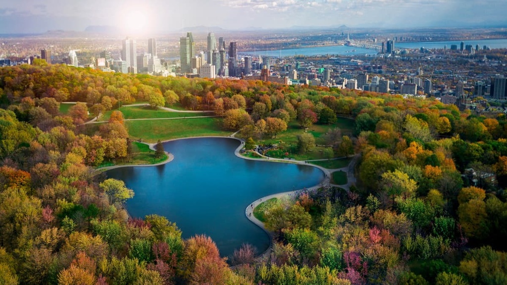
With a population of over 1.7 million people, Montreal is easily the largest metropolitan area in the greater Laurentian Mountains region. It is also one of the most bilingual cities in Canada as more than half of the population can speak both English in French.
Although Montreal can also serve as a good base camp for adventures in the Laurentian Mountains, it is a worthwhile destination in its own right. The city has plenty to keep any visitor busy, from museums and historic sites to shops and restaurants. Montreal’s namesake peak, Mont-Royal, and its surrounding park also offer hiking opportunities within the city’s urban core.
Montreal also serves as a transportation hub for Quebec. It is easy to get to the city by car, bus, and trail. Montreal is also home to Quebec’s largest airport, and it has great air connections to major cities around the world.
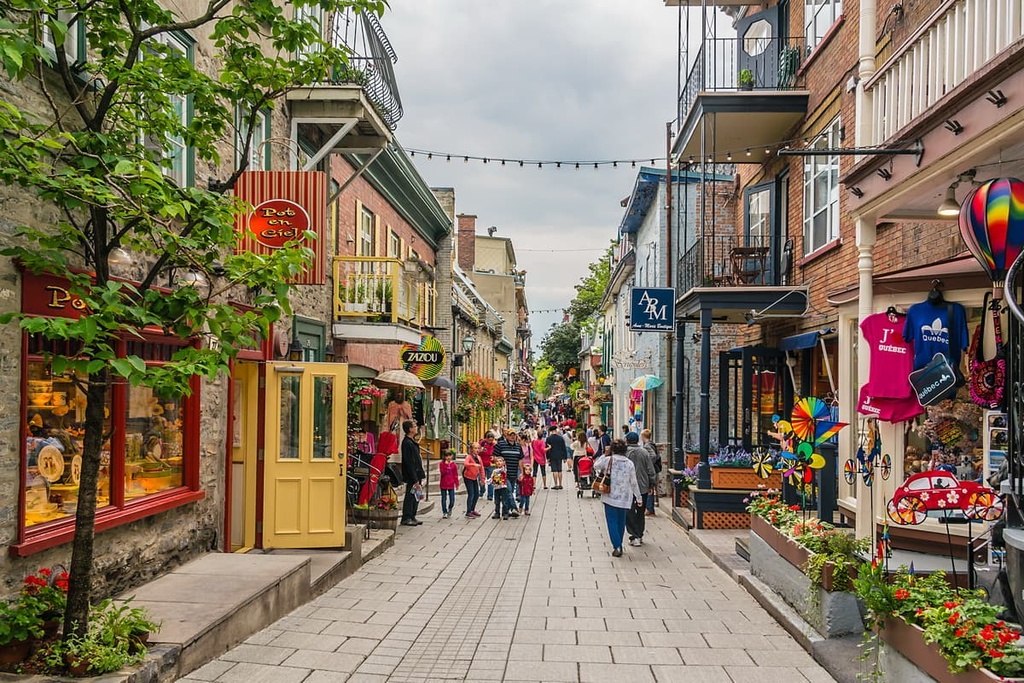
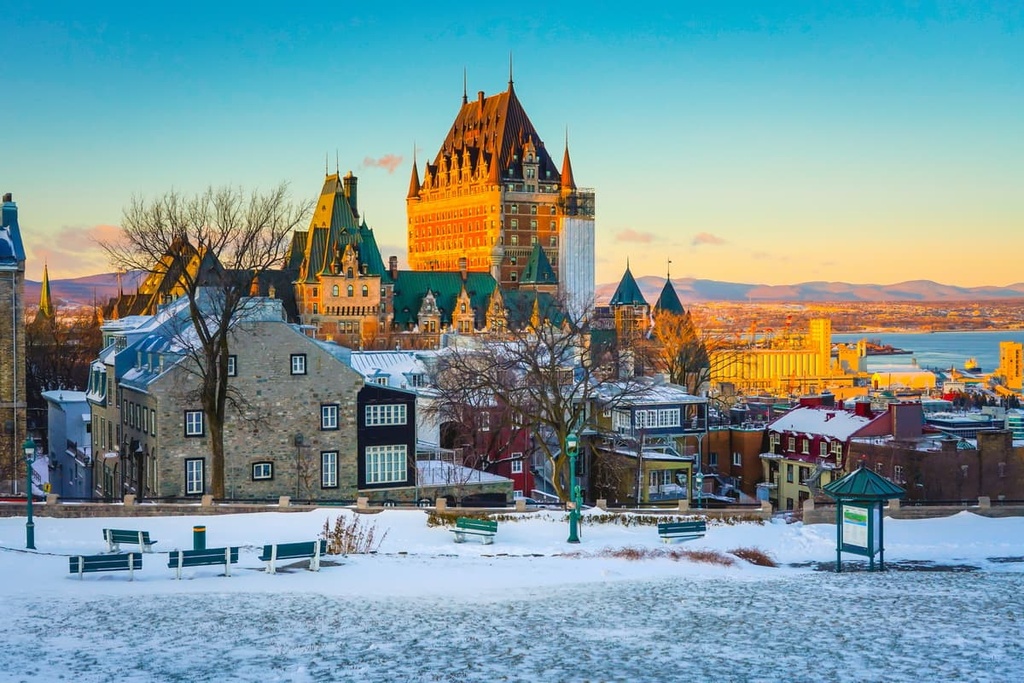
Quebec City (Ville de Québec) is the capital and second-most populous city in the province of Quebec. It is located along the eastern edge of the Laurentides on the banks of the Saint Lawrence River.
Although it is home to only half the population of Montreal, Quebec City is a very worthy destination for any visitor to the province. It is one of the oldest European-established cities in Canada and it is the only urban area on the continent to the north of Mexico to still have its fortified city walls.
There’s plenty to see and do in Quebec City, from strolling the streets of Old Quebec (which is a UNESCO World Heritage Site) and visiting the Citadelle of Quebec (Citadelle de Québec) to sight-seeing at the nearby Montmorency Falls (Chute Montmorency). Quebec City’s proximity to a number of major outdoor recreation destinations also makes it a good place to stay if you’re looking to hike in the eastern part of the Laurentian Mountains.
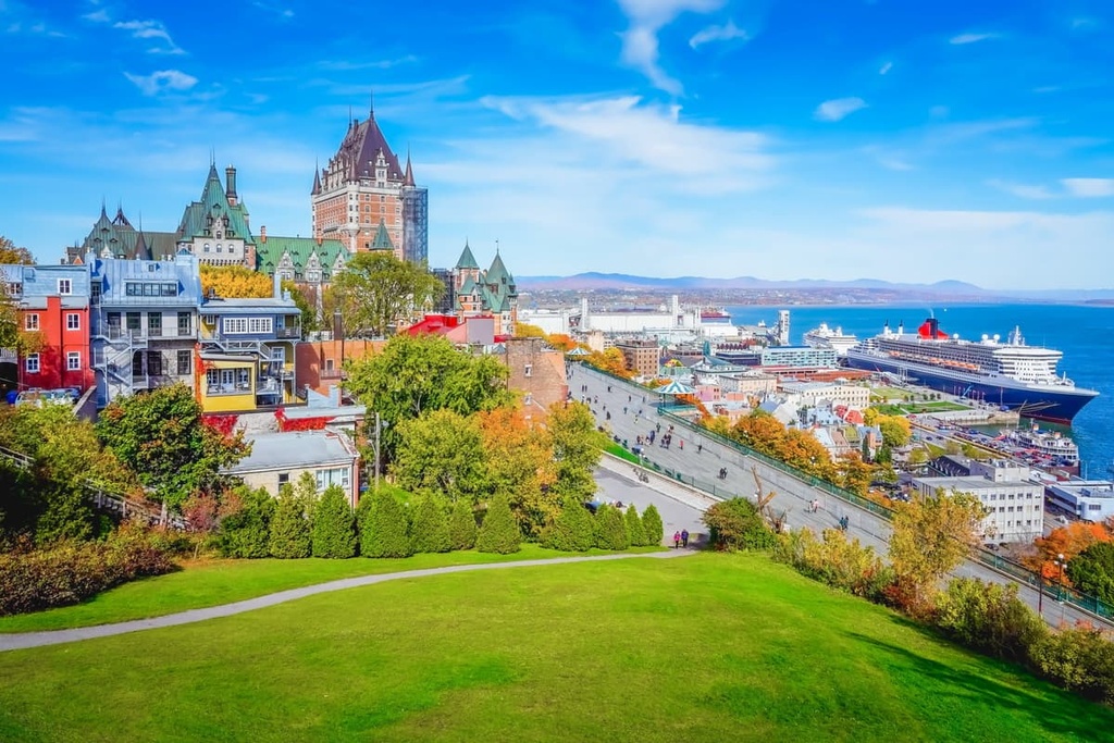
Quebec City also offers good transportation links to the rest of Quebec and Canada. You can get to the city easily via bus, car, and train. Quebec City also has its own airport that services flights to communities across eastern Canada and to a number of major international destinations.
Ottawa is the capital of Canada and the second-most populous city in Ontario. Although Ottawa is located in a different province than the heart of the Laurentian Mountains, it is situated just across the Ottawa River from the range, so it’s a good place to start your travels to the southern part of the Laurentides.
Furthermore, Ottawa is part of a major urban area alongside the city of Gatineau in Quebec, and the cities’ combined census metropolitan area is home to over 1.3 million people. It is also home to some of the country’s major universities and research institutions, such as the University of Ottawa, so it’s hard to deny the city’s importance as a major urban area in the greater Laurentian Mountains region.
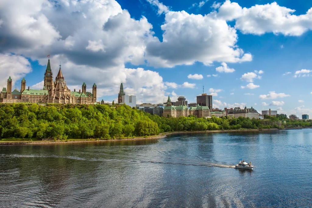
While Ottawa is sometimes overlooked by tourists in favor of larger nearby cities like Toronto and Montreal, there’s plenty to see and do in this incredible urban area. Some of the city’s major attractions include the ByWard Market, Golden Triangle, and Parliament Hill. Ottawa also hosts many major events each year, including the Fringe Festival and the Ottawa Bluesfest.
Ottawa is easy enough to get to from other locations in Canada and abroad. It has good road and rail connections to other cities in eastern Canada, including Toronto and Montreal, and it has an international airport with service to destinations across North America.
Saguenay is a city located along the banks of the Saguenay River at the northern edge of the Laurentian Mountains. It is home to nearly 150,000 people, which makes it the largest city in the Saguenay–Lac-Saint-Jean region.
The city of Saguenay is one of the largest communities in Quebec that’s not located along the banks of the Saint Lawrence River (though the Saguenay River is a tributary of the Saint Lawrence).
It is a popular destination for outdoor recreation in the region because it is located near a number of national parks (Fjord-du-Saguenay and Grands-Jardins) and because of its proximity to a number of ski resorts (e.g., Mont-Édouard - L’Anse-Saint-Jean and Mont-Bélu).
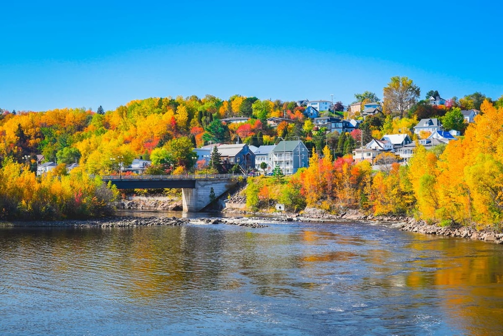
You can get to Saguenay by road fairly easily from Quebec City and there’s even train service to the city from Montreal. Saguenay also has its own airport that services flights primarily to Montreal and Quebec City.
Val-d’Or is a city located in the northwestern part of the Laurentian Mountains in the Abitibi-Témiscamingue region. It is home to around 32,000 residents and is located about 5 hours away by road from Ottawa.
The city of Val-d’Or is best known as a mining community, and its name translates to “Valley of Gold” in English. Its name is a reference to the fact that it is located near the Abitibi gold belt, which features more than 100 gold mines.
Gold was first discovered in the area in the 1920s, and mining has been the major economic activity in the region ever since. In more recent years, however, other metals, like zinc, lead, and copper have become more important for the regional mining economy.
While mining is easily the biggest part of Val-d’Or’s economy, however, it is also a fairly popular tourist destination. The city is located near La Vérendrye Wildlife Reserve and it is home to La Cité de l'Or (the City of Gold), the latter of which is a National Historic Site of Canada that showcases the history of gold mining in the region.


The highest peak in the Laurentides is Mont Raoul-Blanchard, at 1,155 m.
The Laurentides have 1,015 named peaks.


