
Scan the QR code and open PeakVisor on your phone
You’ll find a range of laid-back hikes near Canada's charming capital, Ottawa, from family-friendly river strolls to wooded hill walks with panoramic views of the surrounding countryside. There are 8 named summits in Ottawa. The highest and most prominent hill is Canaan Hill (110 m / 361 ft).
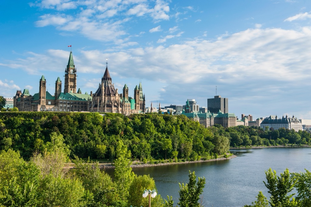
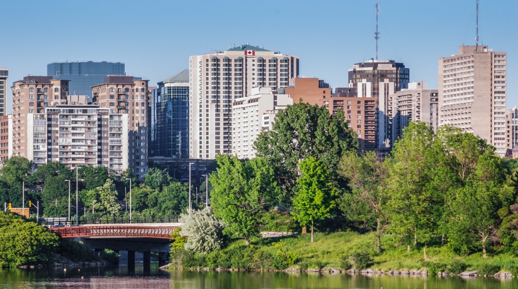
Ottawa is located in Southern Ontario in Southeastern Canada, roughly 80 km (50 mi) from the US border. It's Canada's fourth-largest city, with a population of 1,017,000.
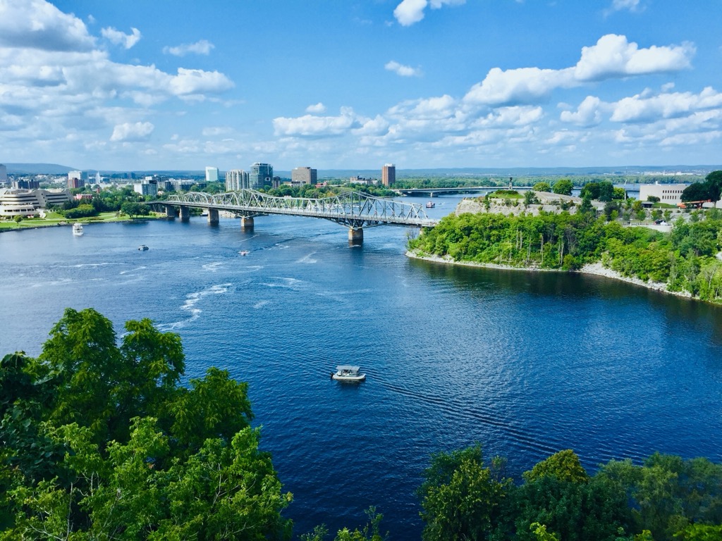
With its tree-lined river walks and ornate, varied architecture, Ottawa is an attractive city. It rests on the southern banks of the Ottawa River (Rivière des Outaouais) at its confluence with the Rideau River (Rivière Rideau) and Gatineau River (Rivière Gatineau). The name Ottawa is derived from an Algonquin word meaning "to trade", with the Ottawa River serving historically as a major trade route. Today, the Ottawa River serves partly as a border between Ontario and Quebec.
Across the Ottawa River from Ottawa lies Gatineau, a separate city within the Ottawa metropolitan area, with a population of roughly 300,000. Around 200 km (124 mi) east of Ottawa is Quebec's capital and Canada's second-largest city, Montreal.
Resting in the Ottawa Valley on Southern Ontario's limestone plains, Ottawa is relatively flat. Most hills have a prominence of only a few meters.
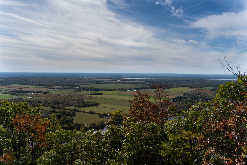
The highest hills near Ottawa are located across the Ottawa River in Quebec's Gatineau Park (Parc de la Gatineau), with several hills, such as Mont Fortune (361 m / 1,184 ft), exceeding 350 m (1,148 ft) in elevation. These hills are known as the Gatineau Hills (Collines de la Gatineau), which form the foothills of the Laurentides.
Aside from Gatineau Park, there's plenty of green space in and around Ottawa. The 203.5 sq km (78.6 sq mi) Ottawa Greenbelt — the largest public greenbelt globally — protects the natural landscape around Ottawa from development.
Ottawa is a lowland area characterized by rocks formed within the last 500 million years. The main reason Ottawa is low-lying is its position on the northeastern edge of the Ottawa-Bonnechere Graben, a 55 km (34 mi) depression between two fault lines. The Ottawa-Bonnechere Graben is part of the Saint Lawrence rift system, which roughly follows the course of the Saint Lawrence River (Fleuve Saint-Laurent).
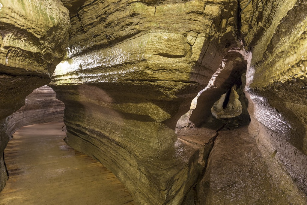
Sedimentary Paleozoic carbonates, shales, and limestones are among the most common bedrocks in Ottawa. Due to the presence of sedimentary limestones, Ottawa has some karstic areas, resulting in caves like the Bonnechere Caves near Eganville. Sediments such as gravel and sand overlay these rocks, deposited by prehistoric lakes and the 13,000-year-old Champlain Sea.
The basement rocks of Ottawa are Precambrian, as Ottawa lies on the southern tip of the 8,000,000 sq km (3,088,817 sq mi) Canadian Shield. The Canadian Shield is among the world's oldest geological areas, dating back at least 2.5 billion years and covering over 60% of Canada.
Within the Gatineau Hills north of Ottawa, Precambrian rocks are exposed at the surface, including granite, gneiss, and quartzites. Once believed to be as high as the Himalayas, the Gatineau Hills were shaped heavily during the last glacial period by giant ice sheets. Today, they rarely exceed 400 m (1,312 ft) in elevation.
The Canadian great outdoors is right on Ottawa’s doorstep. The surrounding greenbelt is home to hundreds of birds and over 50 mammal species.
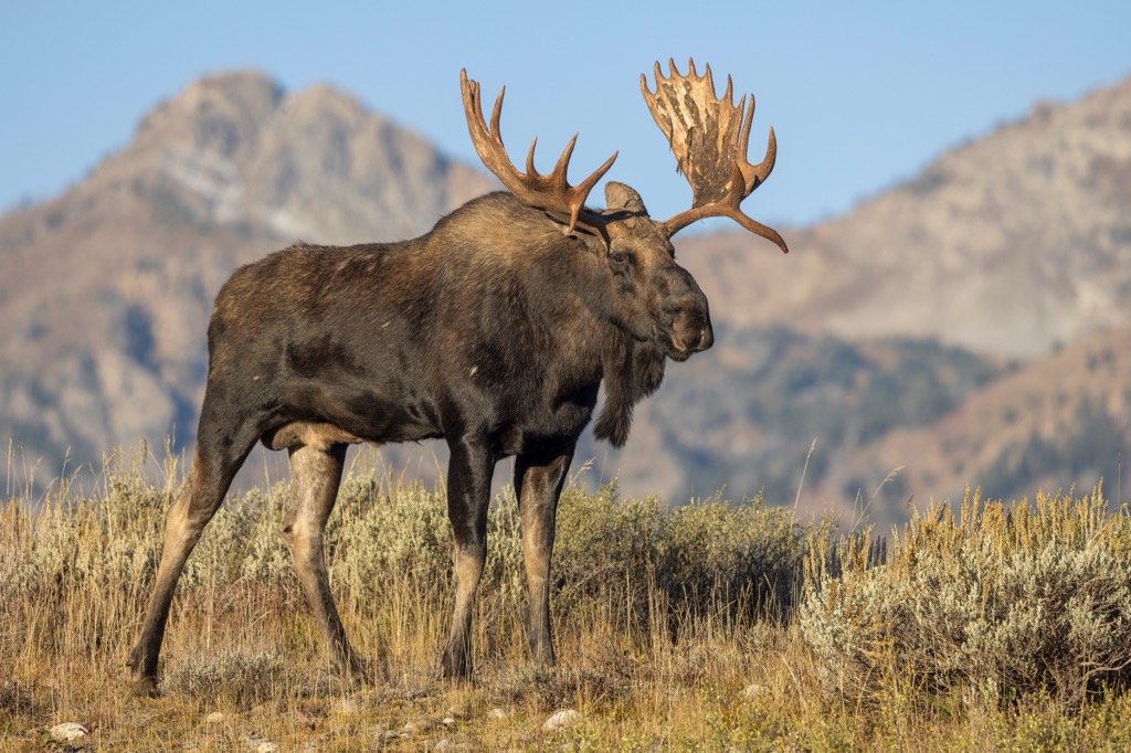
Moose are the largest mammals in the Ottawa region — an adult bull can stand at over 2 m (7 ft) tall and weigh over 544 kg (1,200 lbs). No wild grizzly bears live in Ottawa due to its low elevation; however, black bears are present, especially in Gatineau Park and the Ottawa Greenbelt. There have also been unconfirmed reports of mountain lions in the area.
Other notable mammals living in Ottawa include beavers, red squirrels, coyotes, Canada lynxes, river otters, striped skunks, raccoons, and white-tailed deer.
Hundreds of bird species can be seen along the Ottawa River, with around 180 species nesting in and around Ottawa. Many vibrant species reside in urban spaces, including blue jays, northern cardinals, common grackles, American goldfinches, and evening grosbeaks. Ottawa's forests are home to red crossbills, dark-eyed juncos, eastern towhees, and scarlet tanagers.
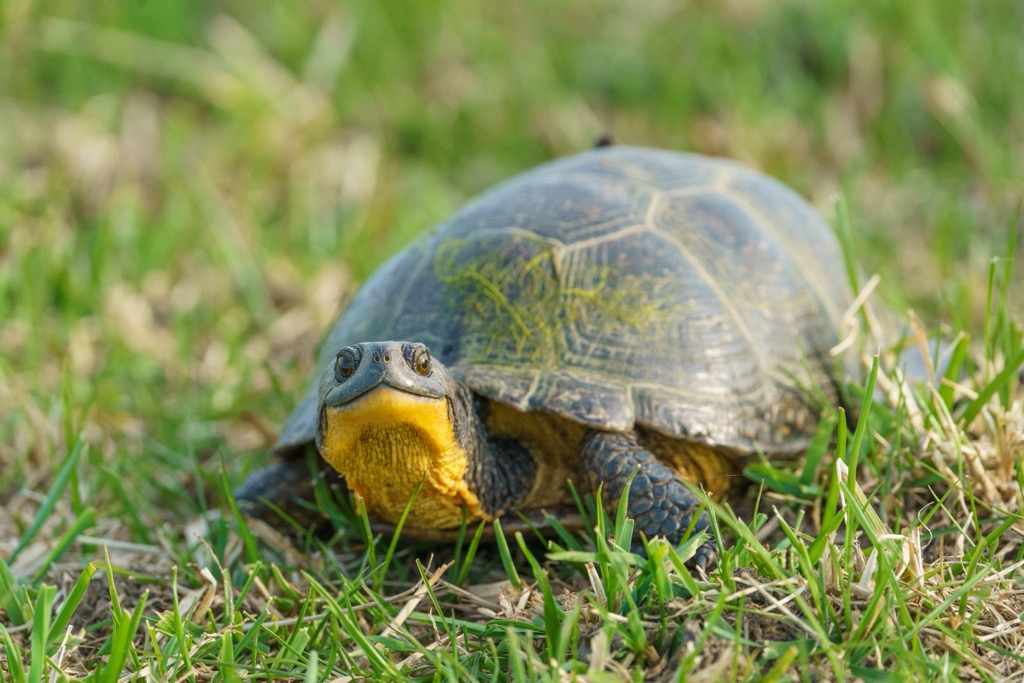
There are no venomous snake species in Ottawa — Ontario's only venomous snake, the Massasauga rattlesnake, is found primarily around Georgian Bay and the Bruce Peninsula. Native reptile and amphibian species in Ottawa include bullfrogs, common snapping turtles, smooth greensnakes, and Blanding's turtles.
Northern black widows are the only venomous spiders in Ottawa, but they're considered rare. Nearly 100 butterfly species have been recorded in the Ottawa region, including West Virginia whites, monarchs, mottled duskywings, black swallowtails, and striped hairstreaks.
The Ottawa River and Rideau Canal are popular fishing spots for bass, walleye, perch, and pike.
The City of Ottawa has recorded 1,569 types of plants in Ottawa, and 1,014 of these are considered native.
Ottawa has significant woodland coverage, with nearly a third of the city's undeveloped landscape carpeted in trees. Common tree species in Ottawa include red or bur oaks, white or yellow beeches, red or silver maples, and white birches. Smaller trees, like hawthorns, dogwoods, and white cedars, are also present.
Many ground-covering plants, which grow in shady areas underneath trees, grow across Ottawa, including wild strawberries, bearberries, Canada mayflowers, wild ginger, and violets.
Wildflowers — both native and introduced — are common across urban areas, with asters, blue flags, wild columbines, goldenrods, and cardinal flowers among the prevalent species.
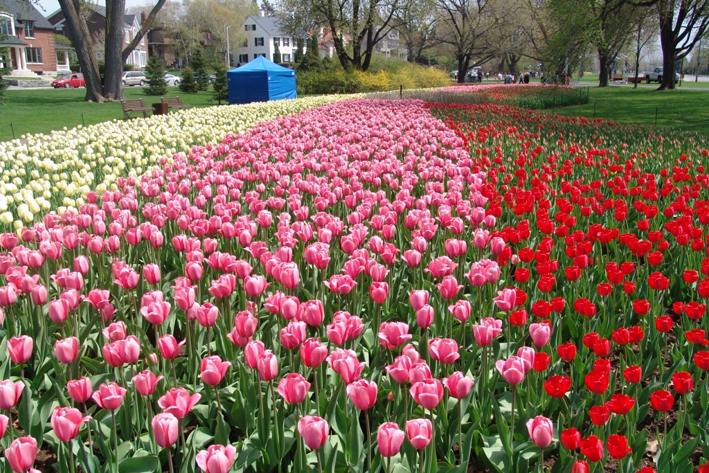
Tulips are the city flower of Ottawa, with over a million tulips blooming across the city between April and May. The Canadian Tulip Festival, held in mid-May over Victoria Day, attracts over 500,000 visitors each year.
Recreational hiking in Canada gained popularity in the early 20th century, as increased urbanization prompted residents to reconnect with nature. Concerns about fitness levels related to sedentary lifestyles also contributed to recreational hiking becoming a popular pastime.
Gatineau Park was established in 1938 to protect the Gatineau Hills and surrounding lakes from development. It has been a popular outdoor recreation area ever since. It was initially proposed that Gatineau Park become the first Canadian National Park outside the Rocky Mountains, but it remains a federal park.
Hiking continued to boom in popularity thanks to improved infrastructure and trailways, including the National Hiking Trail. Beginning in the 1970s, the National Hiking Trail was a project aimed at establishing a 10,000 km (6,213 mi) trail system across Canada. The trail system was officially launched at a ceremony in Ottawa in 1987.
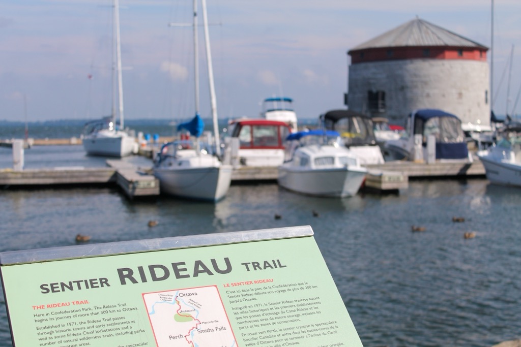
The Rideau Trail, a 387 km (240 mi) trail that runs from Kingston to Ottawa, helped popularize multi-day treks in Southern Ontario among casual hikers. The Rideau Trail officially opened in 1971.
With its low elevation, Ottawa provides leisurely hikes, with only a couple of challenging trails in the area. That said, some hiking areas, like Gatineau Park, are isolated, and black bears are a relatively common sight in the park. Check out the National Capital Commission's safety advice for black bears before venturing into Ottawa's rural areas.
At PeakVisor, we love information. That’s why we write articles like this one.
Check out the PeakVisor app for even more information on thousands of hikes, ski tours, and ski resorts across the world. In fact, we’ve compiled information on all publicly maintained walking tracks worldwide, formatted onto our 3D maps.

PeakVisor started as a peak identification tool—you’ll have noticed the photos throughout this article—but we’ve evolved into purveyors of the finest 3D maps available. We continue to expand our offerings. You can track your hikes directly on the app, upload pictures for other users, and keep a diary of all your outdoor adventures.
Most recently, the PeakVisor App has included up-to-date weather reports, including snow depths, at any destination. We've also been hard at work adding the details of hundreds of mountain huts, including information on overnight accommodation, dining options, and opening hours. You can also use our Hiking Map on your desktop to create .GPX files for routes to follow later on the app.
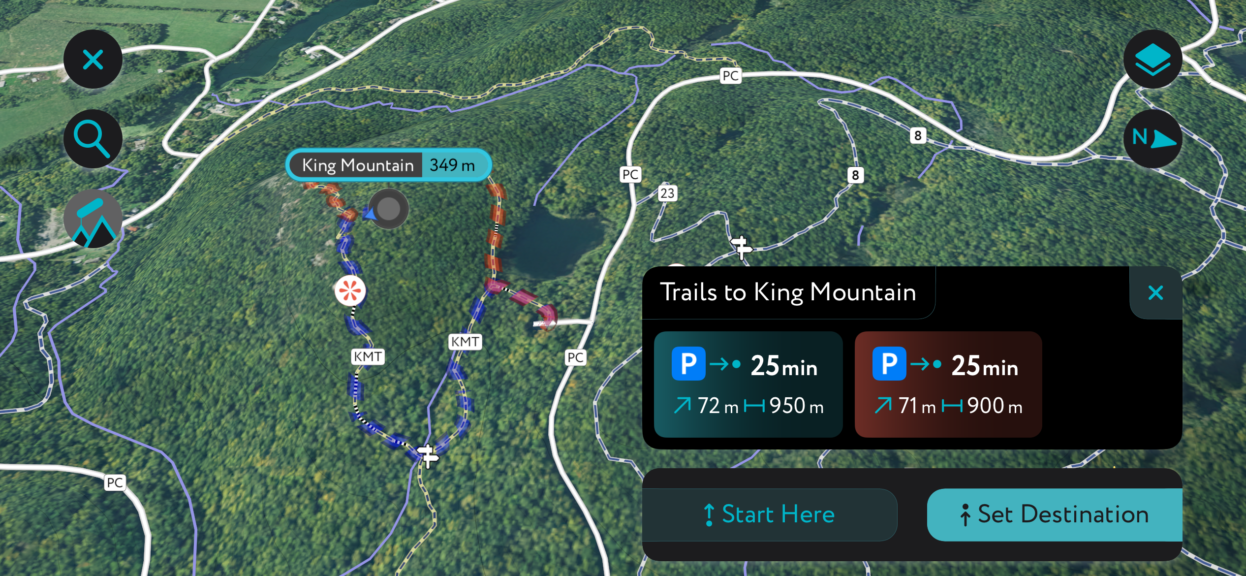
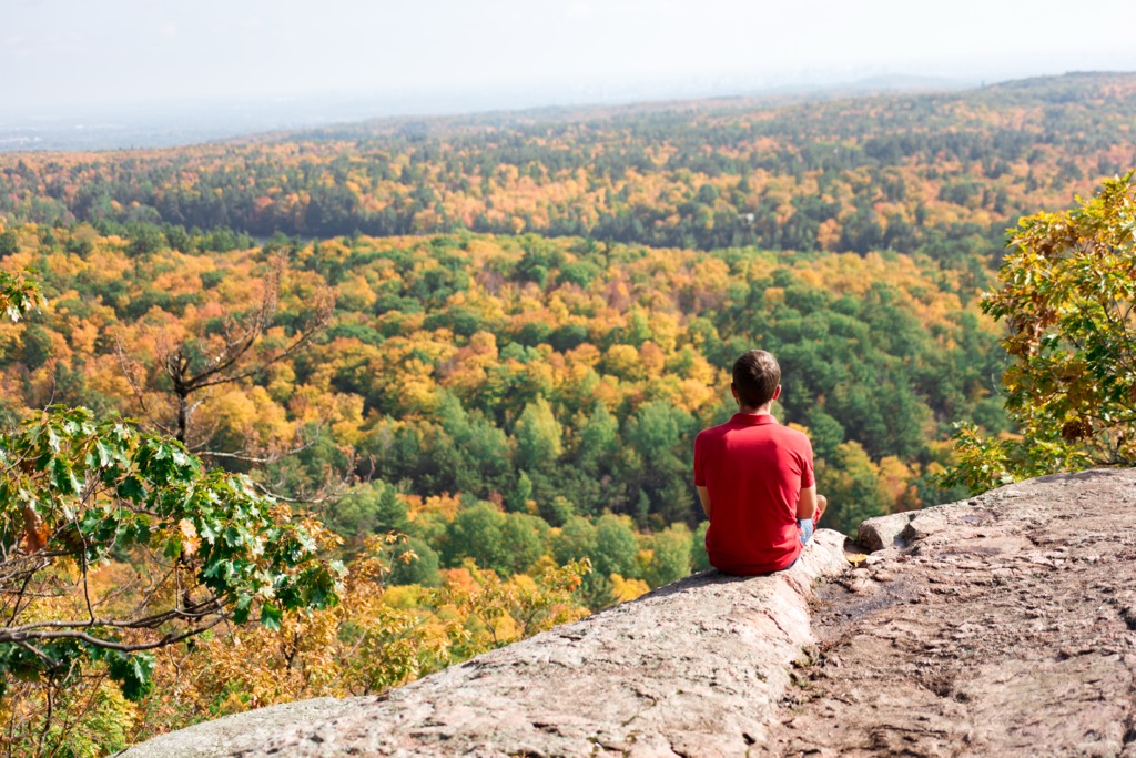
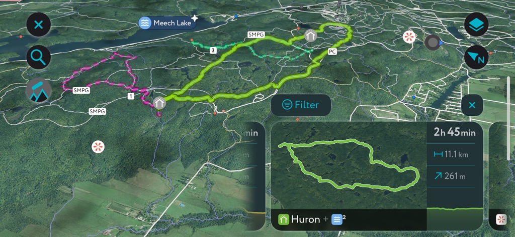
King Mountain (349 m / 1,145 ft) is one of the highest points in Gatineau Hills, providing sweeping panoramas across Gatineau Park and the Ottawa River. It's one of the most popular hikes in Gatineau Park, with its trailhead located less than 15 km (9.3 mi) from downtown Ottawa.
King Mountain Trail is well signposted and moderately difficult. It's also a popular cross-country ski spot in winter. It's worth noting you'll need to leave your dogs at home as they're not allowed on the King Mountain Trail (Sentier du Mont King).
The King Mountain Trail begins at the P7 Parking Lot and winds through picturesque forests to reach the summit of King Mountain, one of the finest viewpoints in Gatineau Park. The route follows Trail 30 and then Trail 8, before crossing the Champlain Parkway to the King Mountain Trail. Follow the King Mountain Trail in a loop before returning the way you came. This looped trail is around 5.5 km (3.4 mi) long.
Alternatively, you can enjoy a quick stroll to the King Mountain's summit when the Champlain Parkway road is open by parking at the King Mountain Parking Lot. This looped walk is around 2 km (1.2 mi) long.
The Skyline Trail is another scenic Gatineau Park stroll within 20 km (12.4 mi) of central Ottawa. As the trail's name suggests, its viewpoints offer panoramic views of Ottawa's skyline. It's a moderately challenging hike with some steep sections.
You can bring your dog along on the Skyline Trail, provided they remain on a leash at all times. You can pick up this trail from the P7 Parking Lot — ideal if you're looking to explore King Mountain as well. This trail can be muddy in places, so wear waterproof boots.
Start by following Trail 30 to Wattsford's Lookout (309 m / 1,014 ft), where you can rest on a bench while taking in vistas of forest-covered rolling hills. From Wattsford's Lookout, follow Trail 1 for roughly 100 m (328 ft) to reach the start of the Skyline Trail.
The Skyline Trail is a looped route leading to the Skyline Viewpoint (324 m / 1,063 ft), where Ottawa is visible across the meandering Ottawa River. Return the way you came from the start of the Skyline Trail. This walk is approximately 5.5 km (3.4 mi) long.
The Carp Hills are a low, rugged hill range consisting of a northwest-to-southeast ridge. This wilderness area covers approximately 4,000 ha (9,884 acres) and is under 25 km (15.5 mi) southwest of downtown Ottawa. The highest point in the Carp Hills is 129 m (423 ft).
The Carp Hills' heavily forested slopes are home to dozens of rare and vibrant bird species, including eastern whip-poor-wills, indigo buntings, eastern towhees, and northern shrikes.
Several popular walking trails zigzag across the Carp Hills. The Crazy Horse Loop is its longest and most difficult. Crazy Horse Loop trailhead is at the parking area on the intersection of Marsh Road and Huntmar Drive.
The Crazy Horse Trail is well-defined, leading through forests, over rocky escarpments, and past several ponds. There's also the side loop about halfway along the trail if you want to extend your walk. At the end of the trail is a loop leading around another small lake. Return the way you came. The Crazy Horse Loop is approximately 6.2 km (3.9 mi) long.
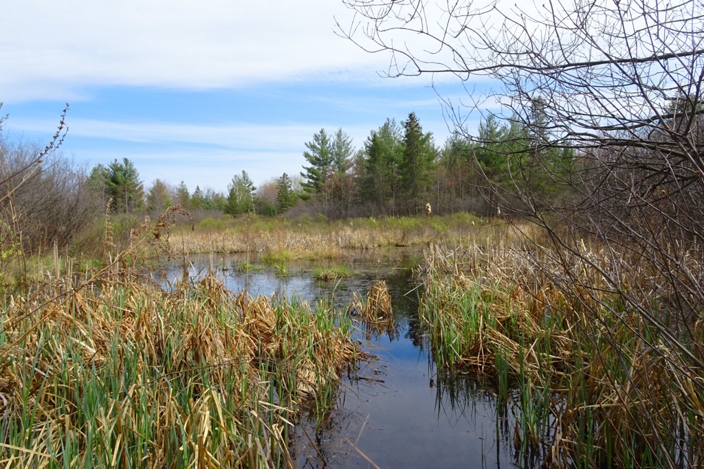
One of the best family-friendly walks in Ottawa is the Mer Bleue Bog Trail. The 33 sq km (13 sq mi) Mer Bleue Bog Conservation Area is among the most beautiful areas of the Ottawa Greenbelt. It consists of 7,700-year-old boreal wetlands rarely found this far south in Canada.
Its unique habitat means it's ideal for nature watching — it's home to aquatic animals like mink, muskrats, and beavers, as well as rare flora like Porsild's cottongrass.
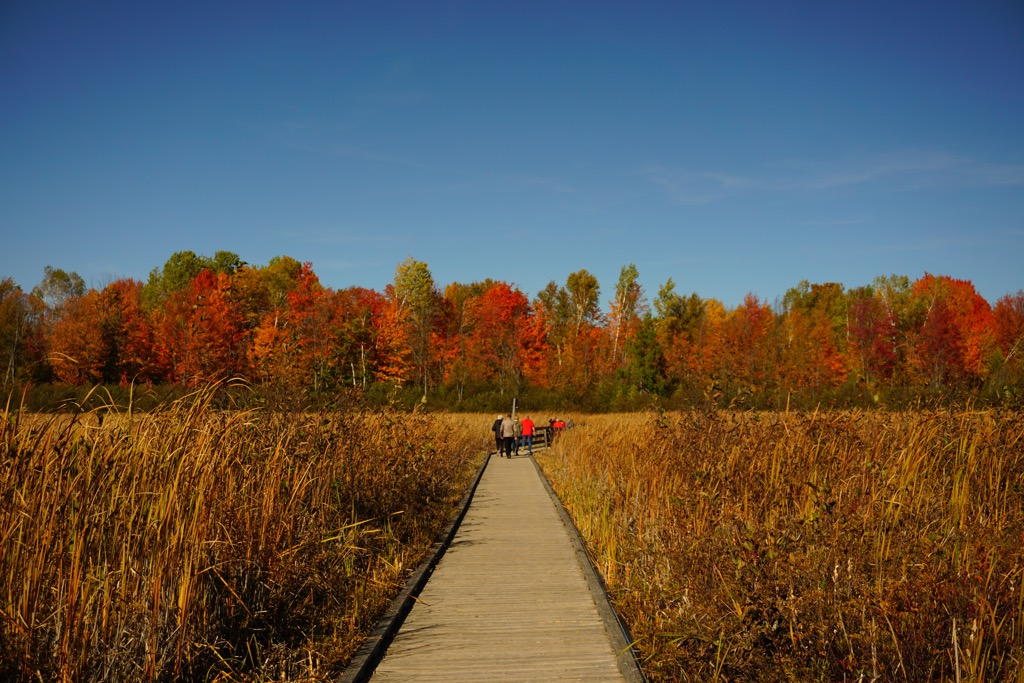
Extensive boardwalk trails snake across the Mer Bleue Bog, making it an idyllic and popular hiking destination. The Mer Bleue Bog Trail is one of the best ways to experience this remarkable landscape. You can pick up the trail from the P22 parking area.
This trail is very popular because its boardwalks are flat and wide, making it suitable for children, including those in strollers. It leads in an easy-to-follow loop for 1.4 km (1 mi) through the Mer Bleue Bog. Other popular, quieter trails in the Mer Bleue Bog include Trails 50 and 51.
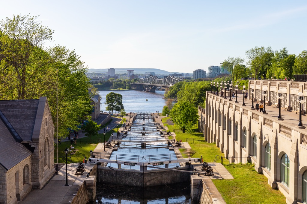
Searching for a relaxing walk without leaving downtown? Explore Ottawa's UNESCO World Heritage Site, the Rideau Canal, by strolling along its banks.
Built in the early 19th century as a result of the War of 1812, the Rideau Canal is one of Canada's most famous waterways. It's home to one of the world's largest ice skating rinks and is known for the beautiful scenery along its shoreline as it snakes south through Ottawa.
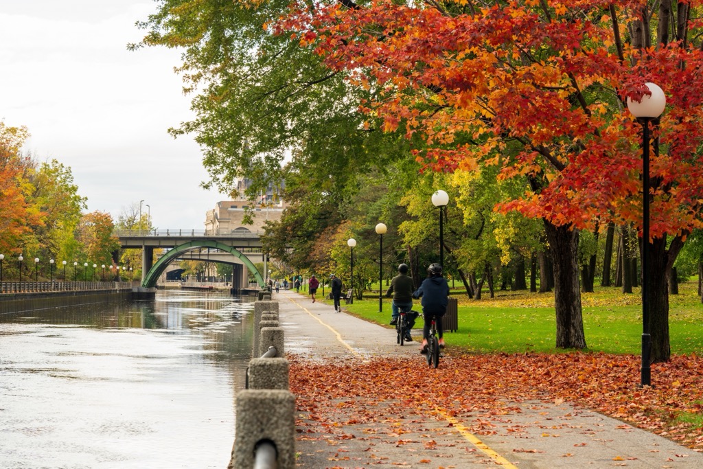
There are two Rideau Canal Pathways: east and west. The western pathway starts at Corktown Footbridge and leads just past Dow's Lake. Along the way, you'll pass several locks, the Patterson Creek Inlet, and Dow's Lake Pavilion. The Western Rideau Canal Pathway is approximately 11 km (6.8 mi) long out-and-back.
Alternatively, you can follow the longer Eastern Rideau Canal Pathway, which runs on the opposite side of the canal. The Eastern Rideau Canal Pathway leads from near the Senate of Canada Building to Hog's Back Park. At Hog's Back Park is the Hog's Back Falls Lookout, which overlooks a series of picturesque artificial waterfalls. The Eastern Rideau Canal Pathway is approximately 17 km (10.5 mi) long out and back.
While there are no ski resorts directly in Ottawa, there are several ski areas and resorts which are within a two-hour drive of downtown:
When snow blankets Ottawa and temperatures plummet, winter sports such as cross-country skiing, tobogganing, and ski touring become the go-to outdoor activities. There are plenty of excellent ski touring options near Ottawa, including in Gatineau Park, nearby ski resorts, and even within the city itself.
The Kìchì Sìbì Winter Trail, aka the SJAM Winter Trail, is easily the best ski route in downtown Ottawa. This trail network starts in Westboro, winding east along the Ottawa River for over 16 km (10 mi) through Remic Rapids, Tunney's Pastures, Bayview, and Pimisi. The Kìchì Sìbì Winter Trail is the perfect way for avid skiers to experience the shores of the Ottawa River.
Check out Dacre Heights if you're looking to step away from the city and ski through the surrounding countryside. Located approximately 125 km (77.6 mi) west of downtown Ottawa, Dacre Heights is an abandoned commercial ski hill that has become popular with hikers, bikers, skiers, and snowshoers. The hill is private property, but visitors are welcome.
One possible ski tour is to follow the blue-marked Firefly Trail, which zigzags up the hill. You can then take the Chicken Run uphill to a viewpoint which offers views of the surrounding countryside. Return the way you came. This Dacre Heights ski tour is a 5 km (3.1 mi) round-trip.
Whether you'd prefer to soak up the French-speaking culture of Quebec or immerse yourself in the heart of the nation's capital, Ottawa and Gatineau offer distinct experiences that'll please almost any traveler.
Ottawa International Airport is the second-busiest airport in Ontario, offering regular direct flights across North America and to two European destinations: Paris – Charles de Gaulle and London – Heathrow.
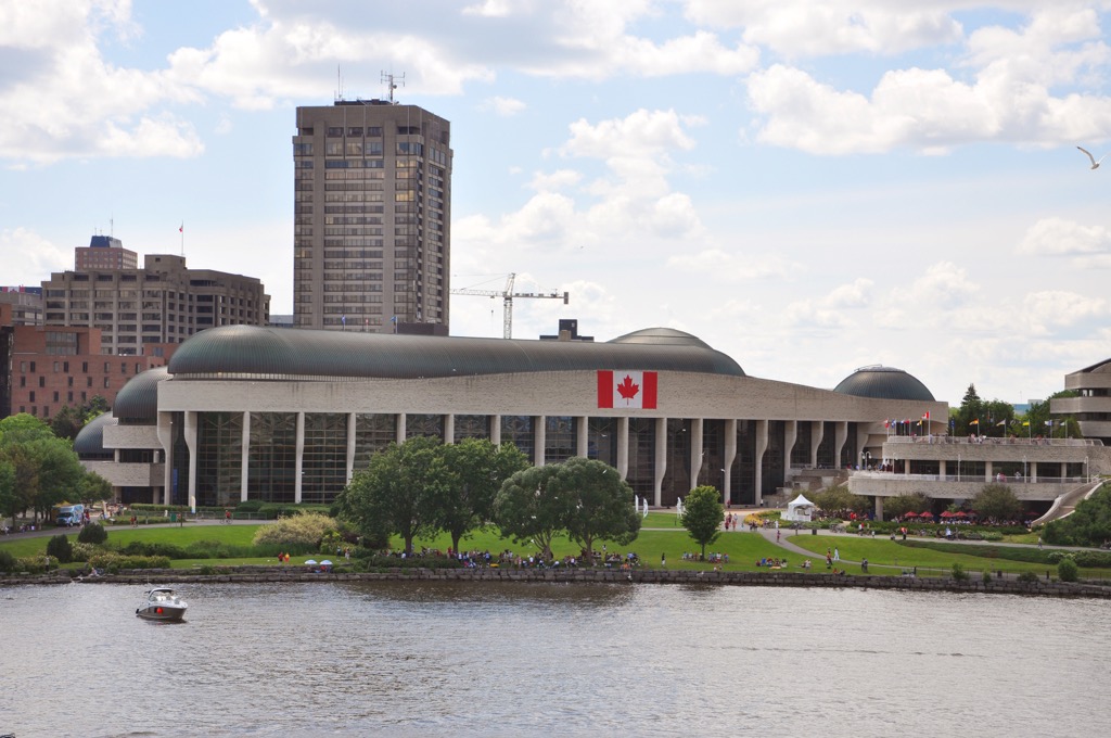
Despite its size, Ottawa is a tranquil city that boasts a diverse architecture and some of Canada's most significant historical sites. As the Canadian capital, Ottawa is home to many of the country's finest museums, from the National Gallery of Canada to the Canadian Museum of Nature.
Away from its green spaces and family-friendly activities, Ottawa has a vibrant nightlife scene — areas like ByWard Market are home to charming pubs and taverns with live music that lasts until late.
With the Ottawa River and Rideau Canal pathways, there are numerous hiking opportunities in Ottawa without needing to leave the city.
If you'd prefer to stay in Quebec, hop across the Ottawa River to neighboring Gatineau. It's a quieter, smaller city than Ottawa, with a population under 300,000. Like Ottawa, many of Gatineau's main attractions are museums, like the Canadian Museum of History and the Canadian Children's Museum.
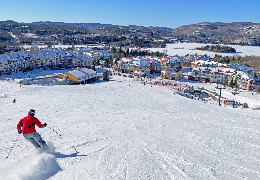
Gatineau is the best place to stay if you're planning several hikes in the Gatineau Hills, with Gatineau Park bordering the city to the northwest. Plus, Gatineau is slightly closer to many of the region's largest ski resorts, like Mont Tremblant, Mont Ste Marie, and Centre Vorlage.


