
The Valley Already Wrote the Guide
Every Alpine municipality has a tourist board, and that board has spent years writing down what there is to do: the loop that works with small children, the via ferrata that is harder than it looks, the waterfall worth the detour, the hut at the top of the lift. It is local knowledge, checked by people who live there.
That knowledge sits on a few hundred separate websites, in German or Italian, one valley at a time. You have to know the name of the valley before you can look it up.
842 places in Austria and Italy now have a page on PeakVisor, built from what their own tourist board publishes, put on our maps and linked to the peaks, huts and lifts you already use here.
What's New
468 places in Austria across seven regions and 374 in Italy across seven more, from resorts everyone has heard of to municipalities with one valley and a handful of trails. Between them the boards publish over 24,000 routes and 4,000 highlights.
- A page per place: Sölden, Kitzbühel, Bormio, Cortina d'Ampezzo, and 838 more.
- A catalogue: country, then region, then place.
- Tracks drawn from the GPX: the picture on a route card is that route's own line on our map.
Highlights link to our peak, hut and lift pages, and region pages list the destinations that sit inside them, so you can travel in either direction. Every page names the tourist board it draws on: on the card, in the text, and in the link out to the board's own site.
What a Destination Page Holds
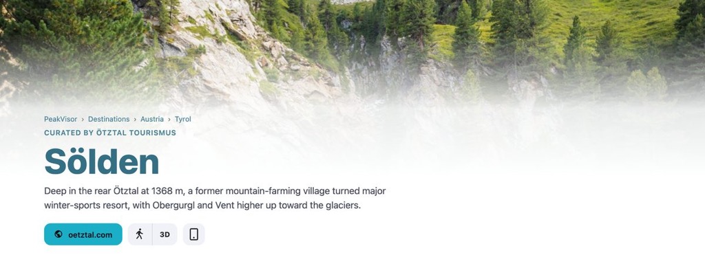
A destination page opens with a description of the place. Sölden is "deep in the rear Ötztal at 1368 m, a former mountain-farming village turned major winter-sports resort". Under that come the counts: how many highlights and routes the board publishes, and the most notable summit you can reach from them.
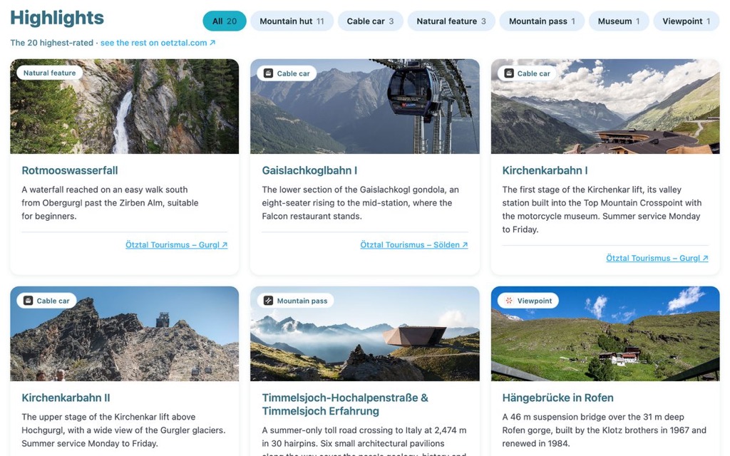
Highlights are the board's own picks, and they are not only summits. Mountain huts, cable cars, waterfalls, gorges, viewpoints, passes, museums and climbing halls all appear. Each card carries a short description of what the place is and why it is worth the walk, a category to filter by, and a link to the board's page for it. If the peak, hut or lift already has a page on PeakVisor, the card opens it on the map.
Routes and Their Tracks
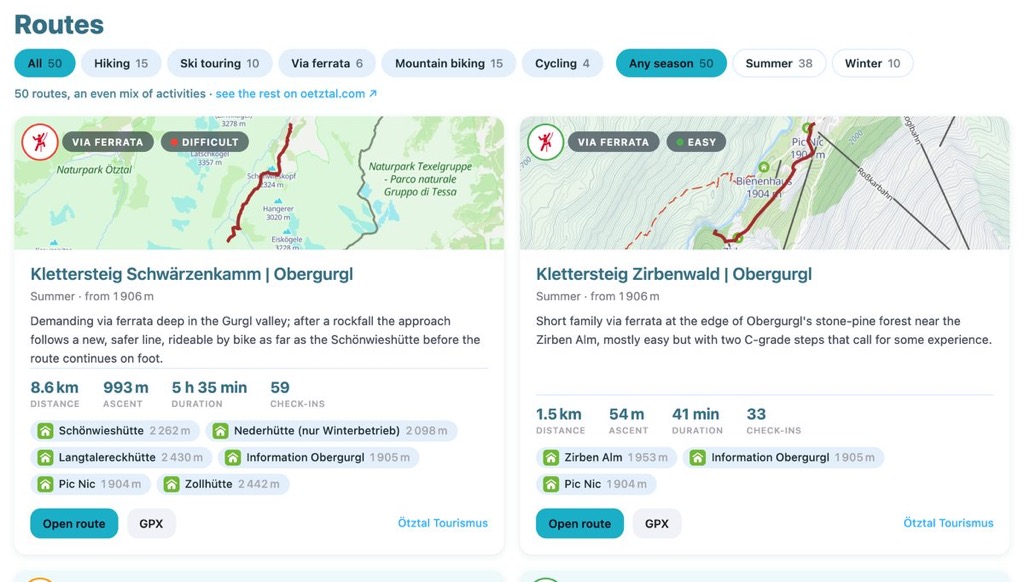
Every route carries the numbers that decide whether you go: distance, ascent, walking time, difficulty. We compute them from the GPX track itself rather than copying them from a listing. The huts and summits along the way are listed underneath.
The picture on each card is the track, drawn on our map. Open route puts it on the 3D hiking map or the ski-touring map, and GPX downloads the track file. Filters narrow the list by activity (hiking, ski touring, via ferrata, mountain biking, cycling) and by season.
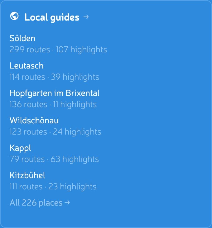
Pages show up to fifty routes and twenty highlights, the ones the board rates highest, and link to the board's own site for the rest. Sölden's board publishes 299 routes and 107 highlights: fifty are on our page, the other 249 are one click away.
Browse by Country and Region
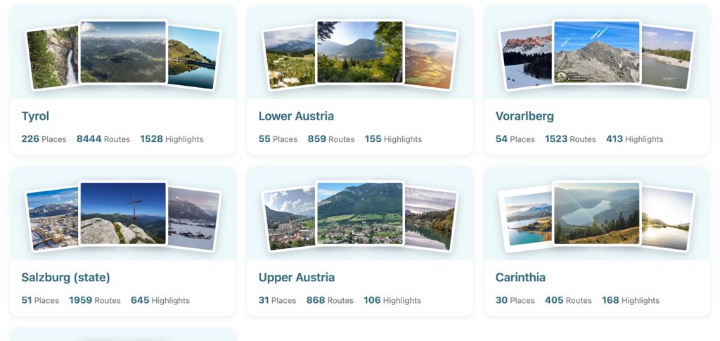
If you do not have a place in mind, start from the top. Where to go in the mountains opens into Austria and Italy, then into their regions. Tyrol alone holds 226 places. Each card shows how many places, routes and highlights are inside before you click.
Links to the Rest of PeakVisor
A region page like Tyrol now lists the local guides inside it, so you can go from a mountain range down to the towns that publish its routes. Highlights link to our peak, hut and POI pages. Nature parks link to our park pages. Every route opens in the same 3D terrain as a peak or hut page.
Where the Information Comes From
The tourist boards publish all of this as open data, and every page names the ones it draws on. The descriptions are theirs; the route measurements are ours, computed from the GPX tracks. Maps, terrain, peaks and huts are the usual PeakVisor ones.
When a board publishes something we do not carry, the page links straight to it. We are not trying to replace the local guide, only to make it easier to find.
Where to Start
Open Sölden, Livigno or Alpbach, or go through the catalogue by country and region. On any route card, Open route puts the track on the 3D map.
Austria and Italy first, because their boards publish the most. More countries will follow.