
Scan the QR code and open PeakVisor on your phone
The Great Dividing Range include 12,676 named peaks. The highest is Mount Kosciuszko at 2,228 m. Other notable peaks include Mount Townsend, Mount Twynam and Rams Head.
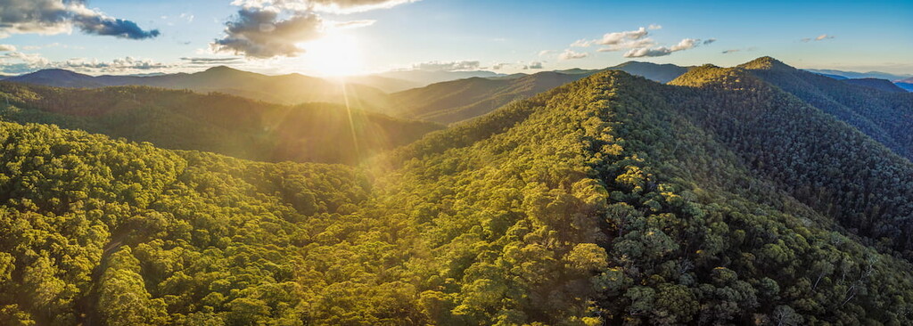
The Great Dividing Range, known as the Eastern Highlands, is Australia's most extensive mountain system. It stretches along the entire east coast of the Australian continent and is the fifth-longest mountain range in the world, spanning 3,500 km (2,200 mi) across three states and one territory. Of the approximately 12,676 named peaks in the range, Mount Kosciuszko (2,228 m / 7,309 ft) in New South Wales is the highest and most prominent.
The Great Dividing Range is not one continuous mountain range but rather a combination of smaller ranges, plateaus, upland areas, and escarpments along the east coast of Australia. It stretches from Cape York in Queensland down to the Grampians in Victoria, a distance of around 3,500km (2,200 mi).
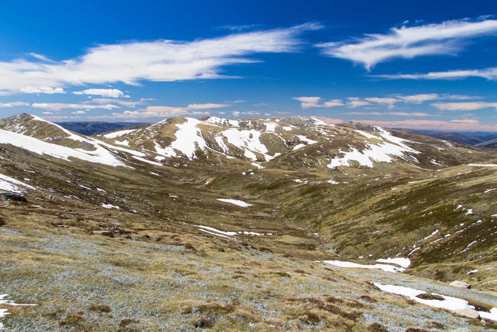
The width of the range varies from about 160 km (100 mi) to over 300 km (190 mi) as it traverses through three states and one territory. The elevation also differs vastly from low-elevation foothills of 300 m (985 ft) to mountains of over 2,000 m (6,562 ft) around the alpine regions of New South Wales and Victoria.
The watershed or boundary between the basins of rivers defines the crest of the Great Dividing Range; some rivers drain east into the Pacific Ocean, and others drain west into the Murray-Darling River system or the Gulf of Carpentaria. Many headwaters of Australia’s principal rivers are in the range, including the Snowy, Darling, Goulburn, Lachlan, and Murrumbidgee Rivers.
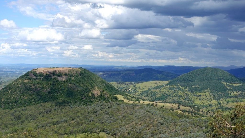
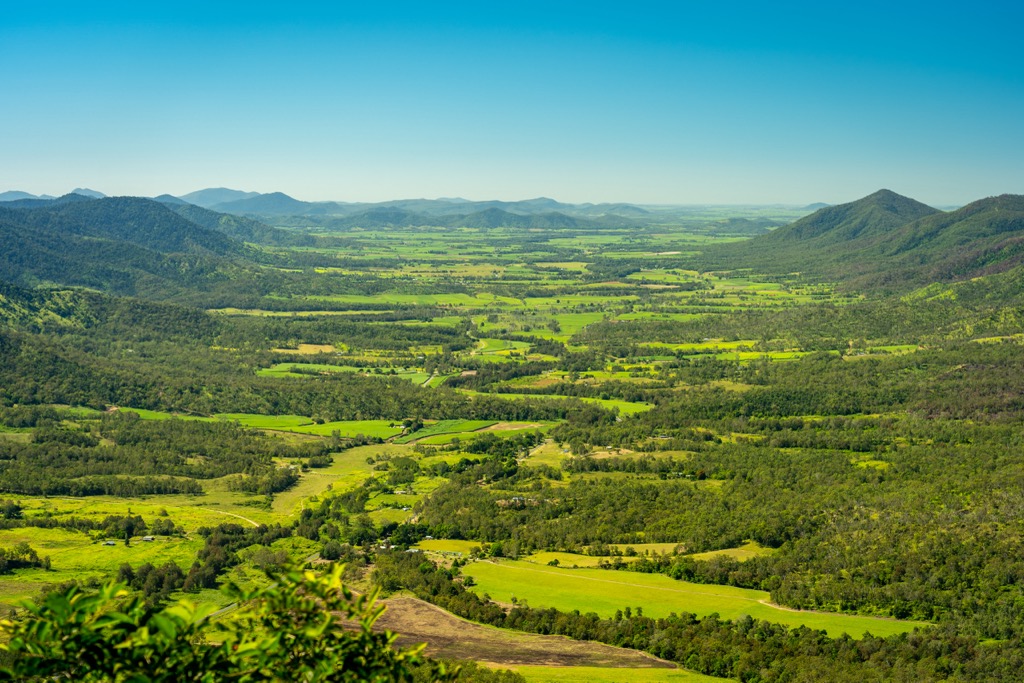
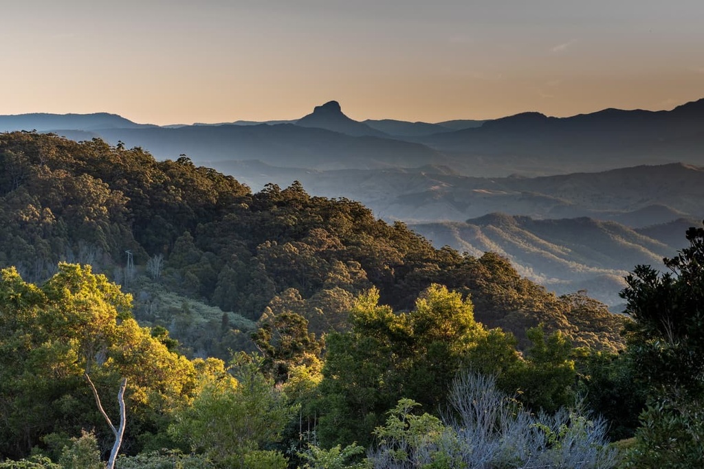
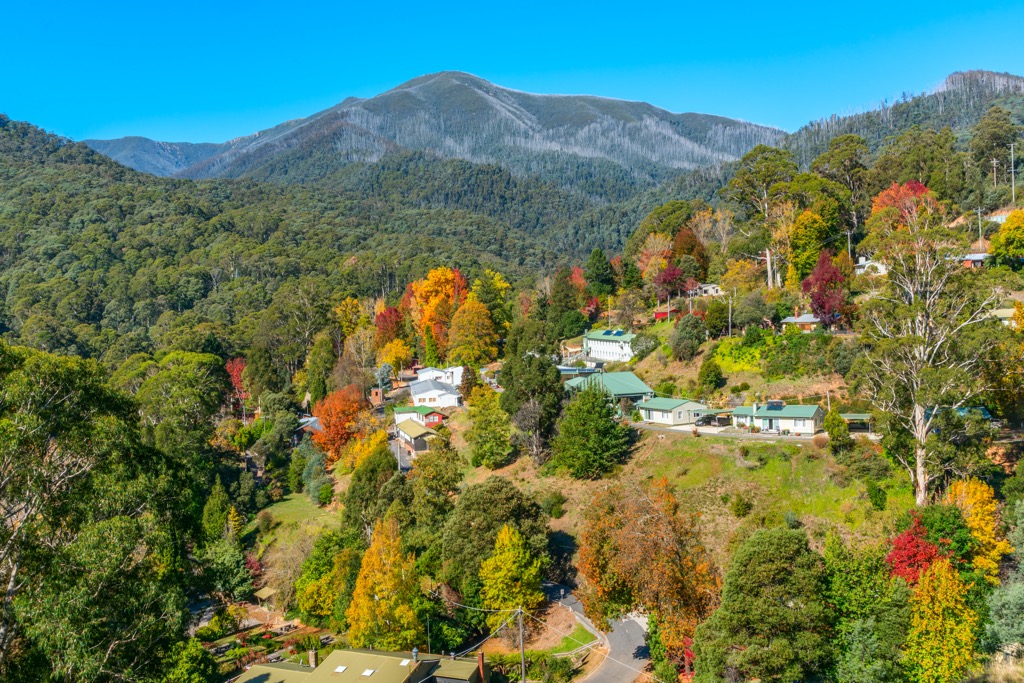
The Great Dividing Range covers most of the highland areas of eastern Australia. In its northern reaches, it encompasses the Atherton Tablelands, Darling Downs, and Gold Coast Hinterland in Queensland. In New South Wales, it covers the Northern Tablelands, Central Tablelands, and Southern Tablelands. Australia’s alpine regions are all part of the Great Dividing Range, including New South Wales, the Australian Capital Territory (ACT), and Victoria. At its southern end, the Great Dividing Range terminates in the Grampians in western Victoria.
National Park status protects many parts of the range. These parks are also the top destinations in Australia for various outdoor activities, including hiking, skiing, camping, and mountain biking. Some of the most prominent parks include:
Queensland
New South Wales
Australian Capital Territory
Victoria
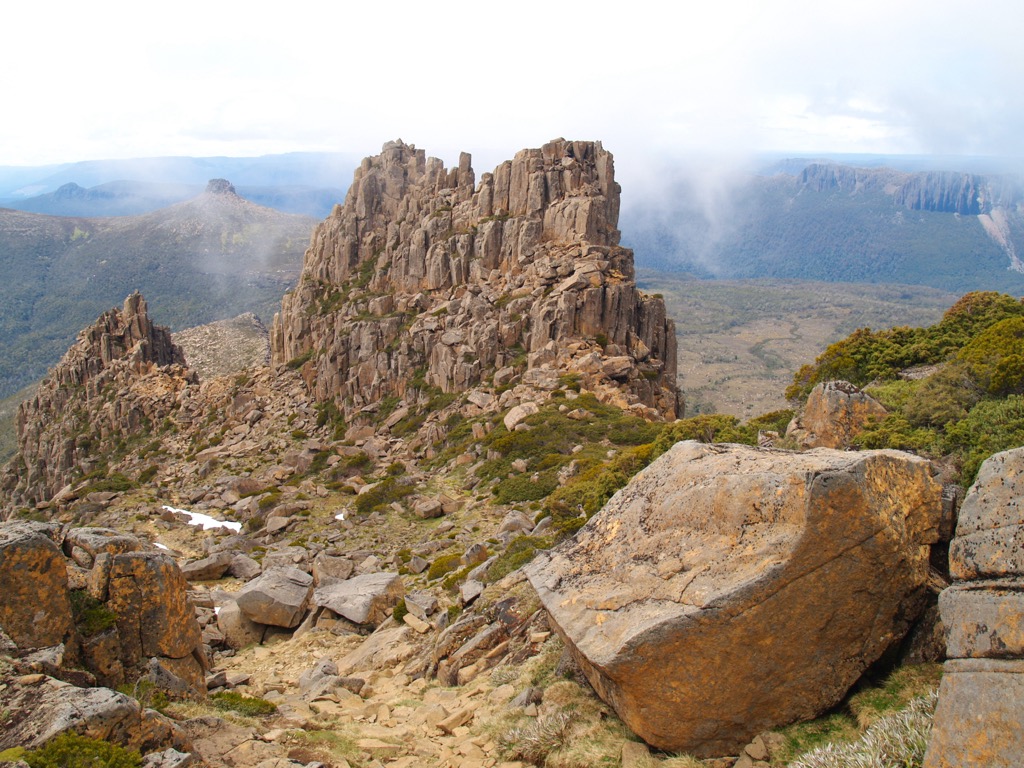
The Great Dividing Range has a much-contested geological history. While most mountain ranges in the world result from tectonic forces or volcanism, the exact process that formed the Great Dividing Range has puzzled geologists for years.
Rocks, fossils, and textures from the range’s bedrock suggest that they formed in an ancient ocean up to 500 million years ago. This ocean was likely a direct ancestor of the Tasman Sea we know today.
Australian geologists now hypothesize that the Australian Alps aren’t simply a result of erosion of an ancient mountain range but a newer range uplifted along old fault lines. The relatively recent uplift brought these ancient rocks to the surface. Two successive uplifting periods most likely formed the Great Dividing Range as we know it today.
The first was about 150 million years ago when East Gondwana broke up, separating Australia and Antarctica. The split dragged down the continent's eastern side as it collided with the Pacific plate. Then, about 100 million years ago, this process halted. A “rebound” effect forced the eastern edge upwards, forming the initial profile of the Eastern Highlands.
The second uplift was about 50 million years ago when Australia’s northward drift accelerated dramatically and saw the continent's eastern coast straddle the Pacific Superswell. This caused an uplift period, particularly in New South Wales's ranges, of a modest 700 meters (2,296 ft).
Erosion has since exposed much of the underlying rock, including limestone, sandstone, quartzite, schists, and dolomite, in various parts of the range; the Great Dividing Range's varied appearance results from this rock diversity.
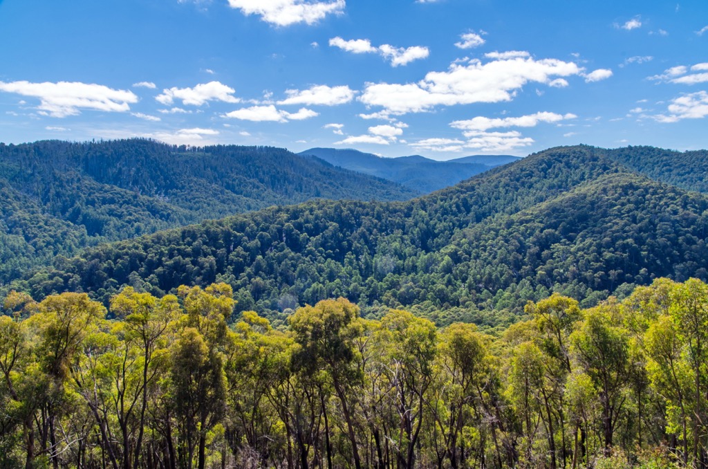
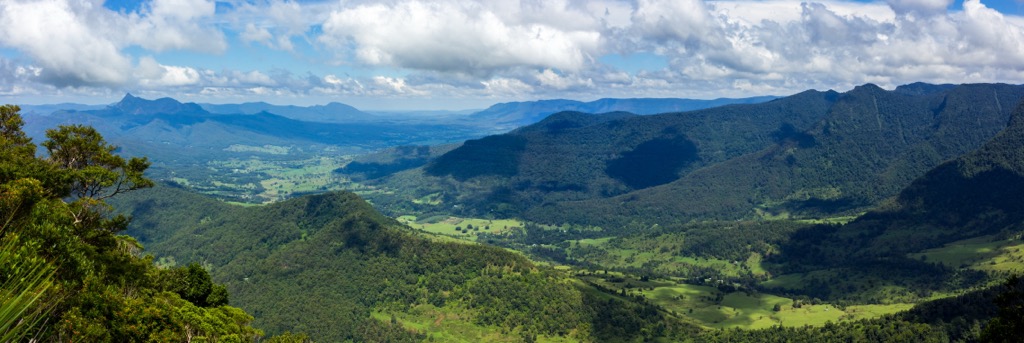
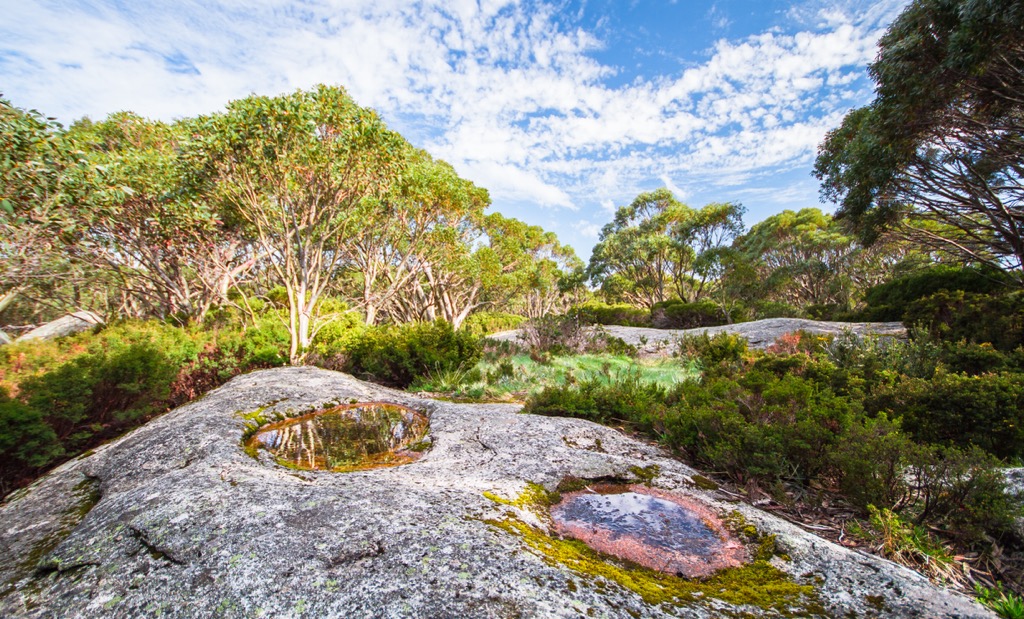
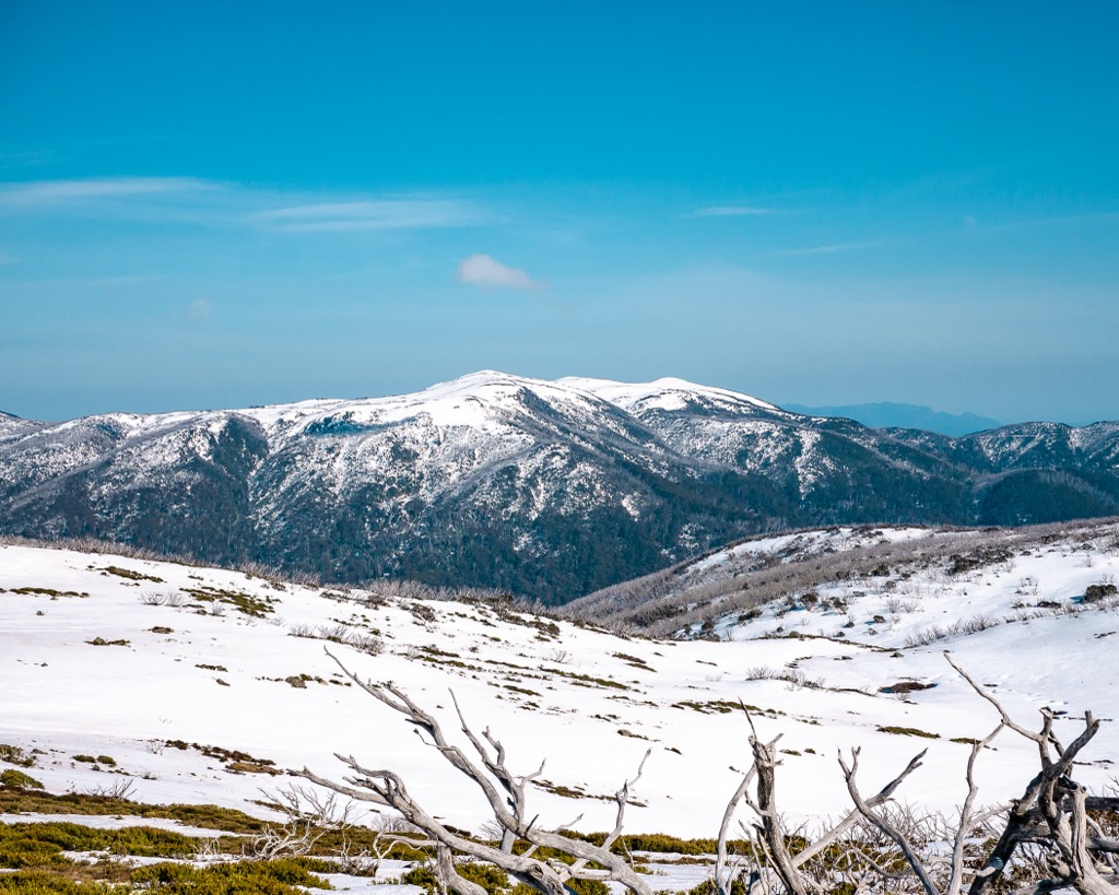
The Great Dividing Range stretches across vastly different climatic zones and vegetation types, including tropical and subtropical rainforests, temperate forests, and alpine regions.
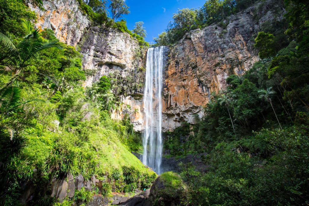
The Wet Tropics of Queensland and the Gondwana Rainforests of Australia, both recognized UNESCO World Heritage Areas, characterize the range’s northern section. Rainforests dominate the mountainsides, home to ancient plants like cycads, ferns, conifers, and antarctic beech.
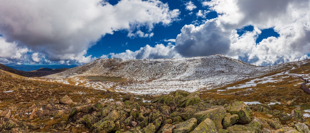
Alpine, sub-alpine, and mountain bushland, including grassy plains, snow gum forests, alpine meadows, and boggy wetlands, characterize the central part of the range around New South Wales, ACT, and Victoria. The lower elevations and foothills are home to forested areas of acacias, eucalyptus, and mountain ash trees.
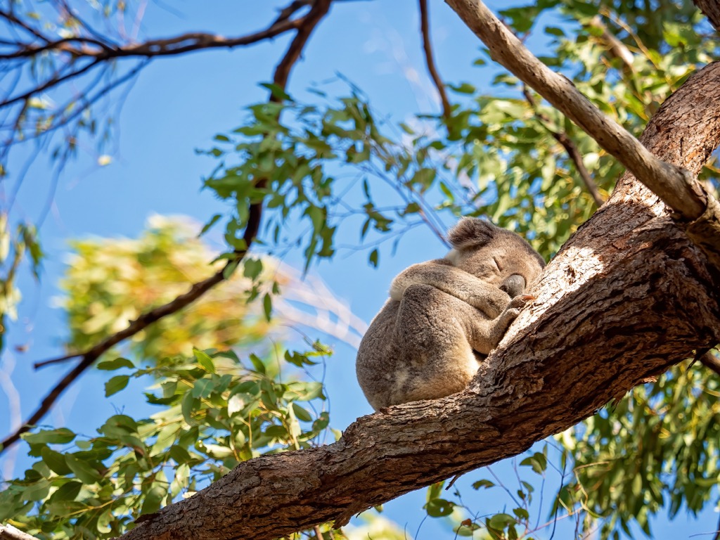
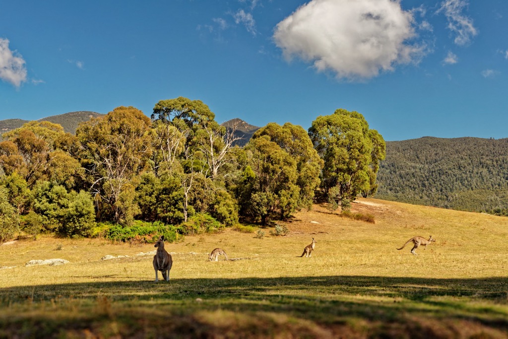
The Great Dividing Range is a rich biodiversity hotspot in Australia. It provides critical habitat for an estimated 70 percent of the country’s threatened species, including Mountain Pygmy-possum, Long-footed Potoroo, Greater Glider, and Koalas. Other native animals include kangaroos, wallabies, wombats, kookaburras, and echidnas.
Many species of non-native animals have been introduced since European colonization, including dogs, cats, pigs, horses, rats, European rabbits, and red foxes.
The Great Dividing Range has been the Traditional Land of various Aboriginal nations and clans for tens of thousands of years. Decorated caves, old campsites, stone tools, axe grinding grooves, and Aboriginal walking trails have survived in many regions.
The first landing on the continent by Europeans was in 1606. William Janszoon, a Dutch explorer, landed on the western side of Cape York in Queensland and charted about 300 km (186 mi) of the coastline. James Cook was the first European to land on the east coast in 1770.
British colonization began in 1788 when the crown proclaimed the Colony of New South Wales. The British first established Australia as a penal colony after the loss of many North American colonies at the time. Convicts settlers totaled about 160,000 over the following years.
Economic development and environmental destruction began throughout the convict phase of the colony. The Crown used convict labor to construct roads, bridges, buildings, and other infrastructure. Convicts also provided much of the labor required to expand agriculture across New South Wales, Victoria, and Queensland throughout the early 1800s.
Deeper exploration of the Great Dividing Range continued as the colony expanded. Local Aboriginal people had long-established routes across the Range, linking the coast with the highlands. Europeans first traversed a similar course in 1813. Gregory Blaxland, W.C. Wentworth, and William Lawson linked Sydney across the Blue Mountains to Bathurst, marking the beginning of settlement expansion inland from the east coast.
Other explorations quickly followed as settlers raced to find suitable agricultural land. Notable European explorers include Allan Cunningham, John Oxley, Hamilton Hume, Paul Edmund Strzelecki, Ludwig Leichhardt, and Thomas Mitchell.
By the 1830s, farmers had developed all of the fertile lowlands of the Great Dividing Range, including Gippsland, the Liverpool Plains, and the Darling Downs.
Exploration of the Great Dividing Range continued as settlers extracted more resources from the land. Logging began in the 1800s. As a result, only 1% of the original Gondwana rainforest remains in the northern part of the range.
In 1851, prospectors first discovered gold in New South Wales and soon afterward in the new colony of Victoria. The discovery led to an influx of migration in the form of a gold rush. The colonial government exported most gold to Britain, where the treasury used it to maintain a gold standard for the pound.
The extraction of resources continued to drive exploration deeper into the highlands. Prospectors found gold in many parts of the Great Dividing Range, including the Ovens Valley, Kiandra, Omeo, Mitta Mitta, Dargo, and Crooked River.
By the 1840s, livestock grazing spread across the Great Dividing Range, particularly in the higher alpine region of New South Wales, ACT, and Victoria. The high mountain plateaus offered lush grazing in the summer after the snow had melted. Leaseholders and graziers built many High Country huts to shelter from the weather and extend their time in the harsh alpine environments. Many of these huts remain within Kosciuszko National Park, Namadgi National Park, and Alpine National Park.
By the early 20th century, National Park designation began to protect parts of the Great Dividing Range. It’s now home to two of the largest park areas in Australia, Kosciuszko National Park and Alpine National Park, as well as hundreds of smaller national parks.
The Great Dividing Range includes hundreds of national parks in Australia. The region is home to the best outdoor recreation opportunities in the country, with abundant hiking trails. Here are some of the most popular places to check out in the region for hiking:
Eungella National Park is in northern Queensland and occupies the Clarke subrange of the Great Dividing Range. It’s home to 18 named mountains, including Mount Dalrymple (1,262 m / 4, 140 ft), one of the highest peaks in the state. Remote mountains and dense rainforests characterize the park.
The best way to explore this part of the range is on the 56 km (35 mi) Mackay Highlands Great Walk. This moderate hike takes you across the top of the Great Dividing Range, with views across Pioneer Valley and opportunities to spot over 220 rainforest bird species.
There are options to camp along the way or utilize local accommodation, with the trail estimated to take 3-5 days to complete. The Queensland Parks website offers more information on this through-hike.
Lamington National Park is in southeast Queensland. Part of the broader Gondwana Rainforests of Australia, the park is a subtropical rainforest filled with waterfalls, ancient trees, and dramatic escarpment views. It’s home to 34 named mountains, the highest and most prominent of which is Mount Bithongabel (1,213 m / 3,980 ft).
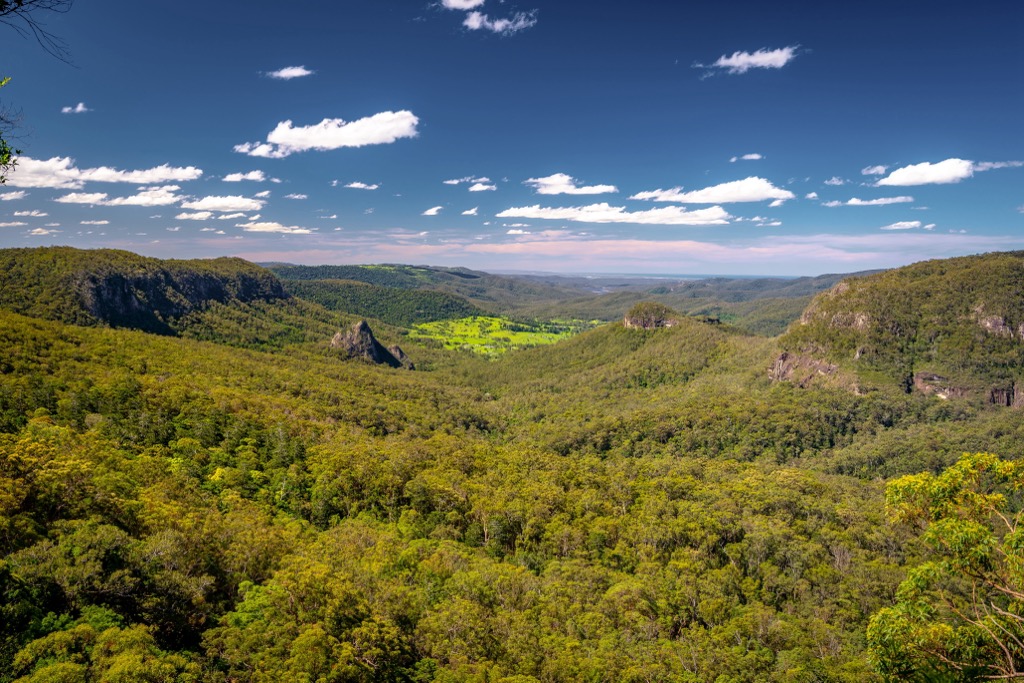
It boasts extensive walking tracks along the McPherson Range, part of the Great Dividing Range. Along with shorter day hikes, the highlight is the multi-day Gold Coast Hinterland Great Walk. This one-way, 54 km (33.5 mi) hike links Lamington National Park with nearby Springbrook National Park.
Taking hikers through the ancient landscape of the Tweed Volcano, this through-hike takes about three days. Find more information about camping options on the Queensland Parks website.
Border Ranges National Park straddles the border of New South Wales and Queensland. It’s part of the Gondwana Rainforests of Australia World Heritage Area, with 30 named mountains inside the park, the highest and most prominent of which is Mount Lindesay (1,183 m / 3,881 ft). Along with the nearby McPherson Range, Springbrook Plateau, and Nightcap National Park, the Border Ranges National Park forms part of a large crater of the ancient Tweed Volcano.
There are several different hiking trails throughout the park. Most of the hikes are rated as easy to moderate in intensity. The Bar Mountain Circuit is one of the most popular trails; this 4 km (2.5 mi) loop trail winds its way down the ridge and takes you to the top of Bar Mountain, providing panoramic views of Mount Lindesay and Mount Barney.
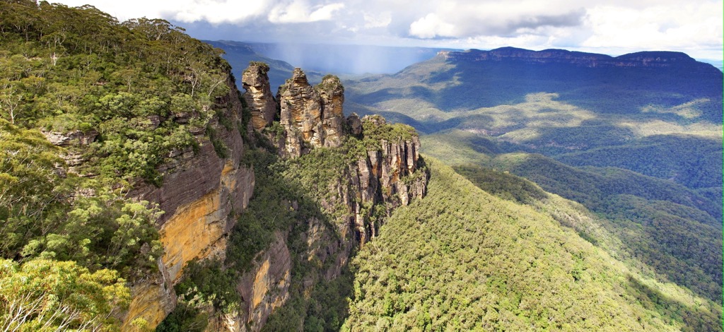
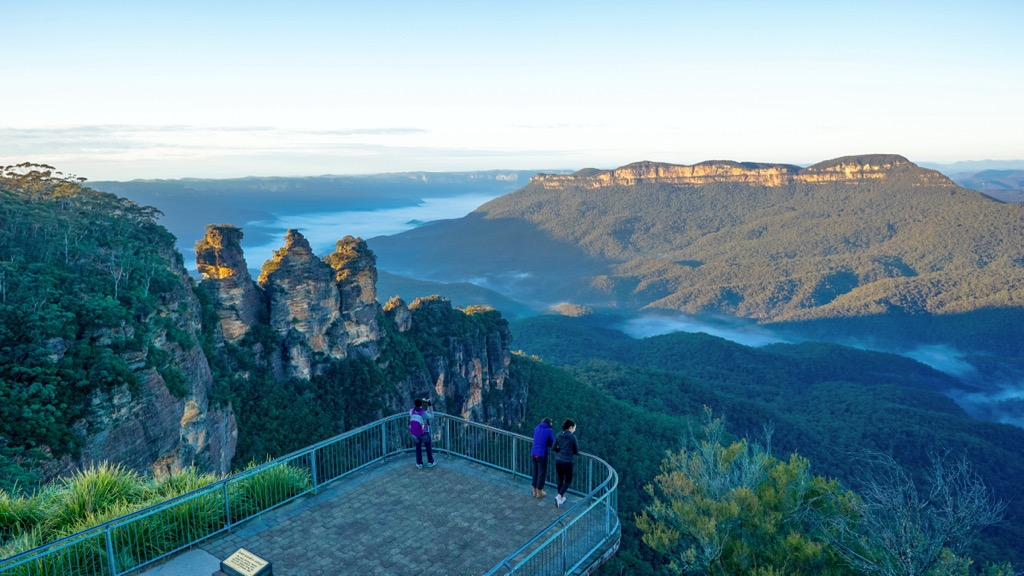
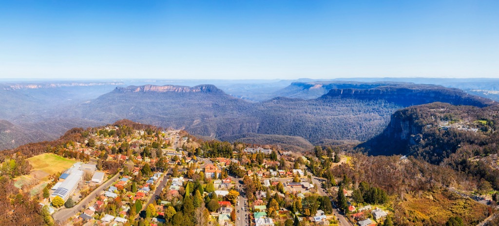
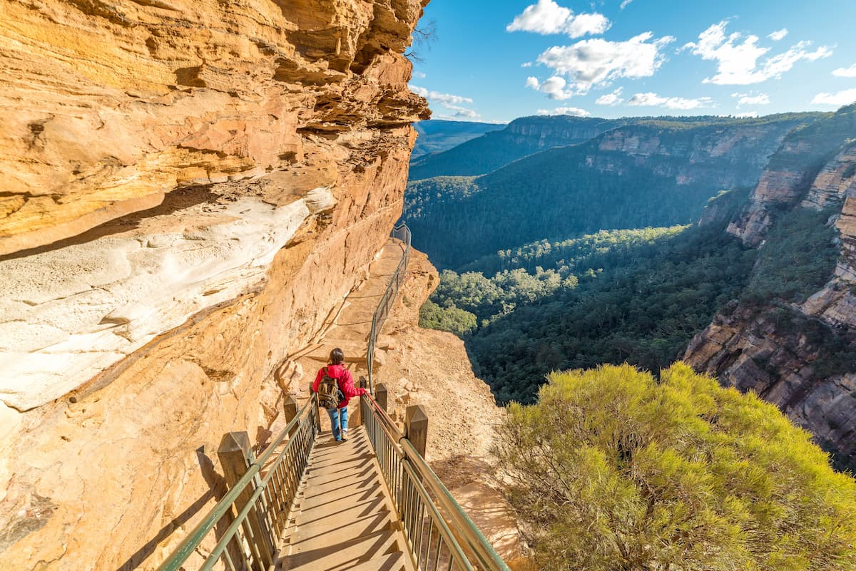
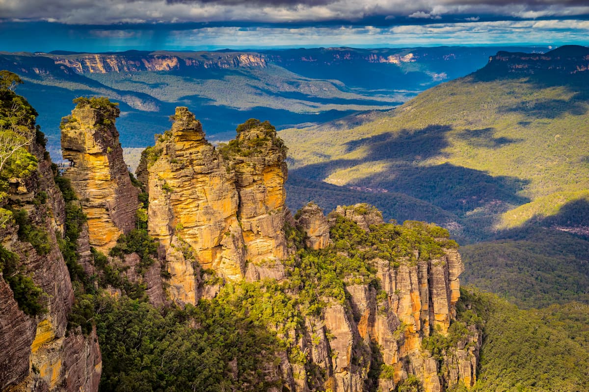
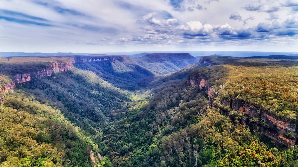
Blue Mountains National Park is in central eastern New South Wales. Just an hour and a half from Sydney, it’s one of the most visited areas of the Great Dividing Range. The park is part of the Greater Blue Mountains World Heritage Area, designated for its significant geological and ecological features.
Hundreds of kilometers of trails within the park are accessible for all fitness levels. Some of the shorter and more popular options include the 6.3 km (4 mi) Grand Canyon Walk through incredible sandstone cliffs, the 3.3 km (2 mi) Wentworth Falls loop, and the 7 km (4.3 mi) Lockleys Pylon Walking Track out to the edge of the Grose Valley.
For something longer and more challenging, the Six Foot Track is a 45 km (28 mi) one-way, multi-day hike from Katoomba to Jenolan Caves. It takes around three days to complete. You can find more information on the NSW Parks website.
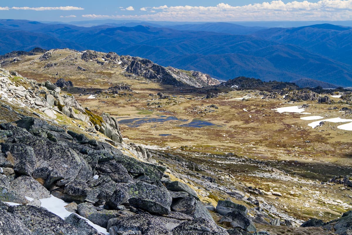
As one of the largest national parks in New South Wales, Kosciuszko National Park covers most of the alpine region in the state down towards the Victorian border. It’s home to Australia’s highest peaks, including Mount Kosciuszko (2,228 m / 7,310 ft). The park is a popular hiking destination in the warmer months and becomes a ski area in winter.
The most popular hike is to the summit of Mount Kosciuszko itself. The 13 km (8 mi) out-and-back from Thredbo takes in breathtaking panoramas and a blanket of wildflowers across the slopes in summer. There’s a longer option to reach the summit from Charlotte Pass instead. Better yet, combine the trails as part of the ultimate Main Range Walk. This 22 km (13.6 mi) loop from Charlotte Pass takes in alpine lakes and mountain views.
The Australian Alps Walking Track also passes through Kosciuszko National Park on its way from Tharwa to Walhalla, offering opportunities for overnight hikes or more challenging adventures.
Namadgi National Park is a protected area in the Australian Capital Territory. Covering the northern extent of the Australian Alps, it’s just 30 km (18.6 mi) south of the capital city of Canberra. The park is home to 54 named mountains, the highest and most prominent of which is Bimberi Peak (1, 913 m / 6, 276 ft).
Home to many trails, from short to longer multi-day hikes, Namadgi is a popular destination. Noteworthy day hikes include the 15 km (9.3 mi) out-and-back up to Mount Tennent (1,375 m / 4,511 ft). Mount Gingera (1,857 m / 6,093 ft) is a tough day hike to one of the highest peaks of the park.
Namadgi National Park is also the beginning of the extended Australian Alps Walking Track that traverses the length of the Australian Alps from the Australian Capital Territory, through New South Wales, and into Victoria. The 650 km (404 mi) long trail begins from Namadgi National Park at Tharwa and ends at Walhalla near Baw Baw National Park.
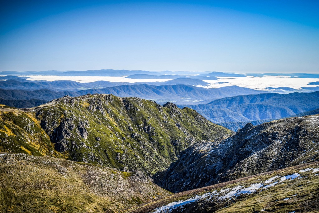
Alpine National Park is one of the biggest national parks of the Great Dividing Range. Encompassing most of the alpine region and High Country in Victoria, the park is a remote wilderness area known for hiking, camping, 4x4 driving, and other outdoor activities.
The park is home to 207 named mountains, including the highest and most prominent peak in the state, Mount Bogong (1,988 m / 6,522 ft). The park is joined to Kosciuszko National Park across the border in New South Wales to cover most of the Australian Alps.
There are plenty of opportunities for hiking, including trails to the highest peaks in the park. Mount Bogong summit can be reached from Mountain Creek via the steep Staircase Spur trail for a 21 km (13 mi) return. The route is often completed in a day but can also turn into an overnight hike with a stay at a mountain hut.
The Australian Alps Walking Track also passes through the Alpine National Park on its way from Tharwa to Walhalla. Naturally, this access offers opportunities for overnight hikes or more challenging multi-day adventures.
Baw Baw National Park covers the southernmost part of the Australian Alps. The park is on the boundary between the Victorian High Country and West Gippsland regions. It is home to 14 named mountains, the highest and most prominent of which is Mount Saint Phillack (1, 572 m / 5, 157 ft).
Baw Baw National Park is home to several walking trails open in the summer. A popular option is the 3 Peaks trail which takes you to three of the park’s highest points on a 15.5 km (9.6 mi) return trail. For something shorter, you can try the 8 km (5 mi) return hike from Mount Erica parking lot that takes you to Mushroom Rocks and the summit of Mount Erica (1511 m / 4957 ft).
Baw Baw National Park also marks the southern section of the Australian Alps Walking Track, a long-distance trail that traverses the length of the Australian Alps. The southern trailhead isat Walhalla, just outside the park boundary. Wild camping permitted in the backcountry here.
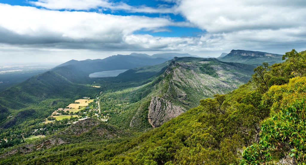
Grampians National Park is a protected area in Victoria’s west. It’s considered the southernmost point of the Great Dividing Range and is on the National Heritage List. The park is home to 69 named mountains, the highest of which is Mount William (1170m/3838 ft).
Grampians National Park is known as one of Victoria’s premier hiking destinations, with plenty of trails across the park. The Pinnacle Track is the most popular hike. The 4.2 km (2.6 mi) return trail leads walkers to the Pinnacle Lookout, with some rock hopping and steel ladders to climb to reach the exposed ridge of the Wonderland Range. Hikers can tackle many other peaks for a more challenging day, including the aptly-named Mount Difficult (806 m/2644 ft) and Mount Rosea (1009 m / 3310 ft). Those looking to add some spontaneity to their day should check out Mount Abrupt (826 m/2709 ft).
For the ultimate hiking experience, tackle the Grampians Peaks Trail. This 160 km (99.4 mi) one-way hike from Mount Zero in the north to Dunkeld in the south takes in some of the highlights of the park area on the two-week trek. There are purpose-built, hike-in campgrounds along the trail for hikers to camp at night. You must book the hike on the Parks Victoria Website before beginning.
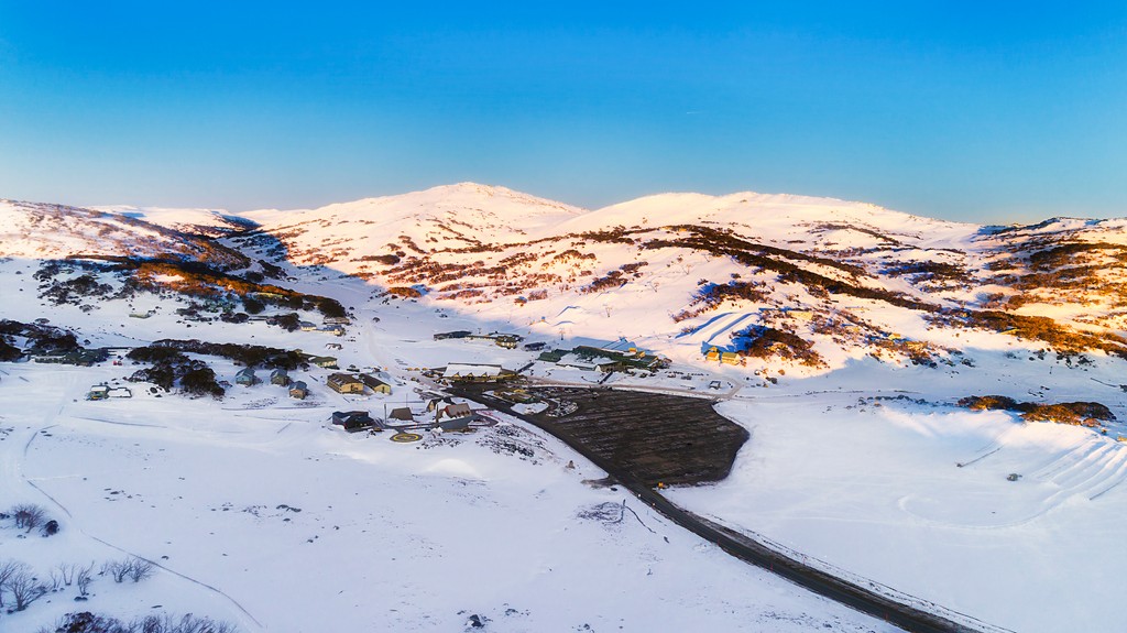
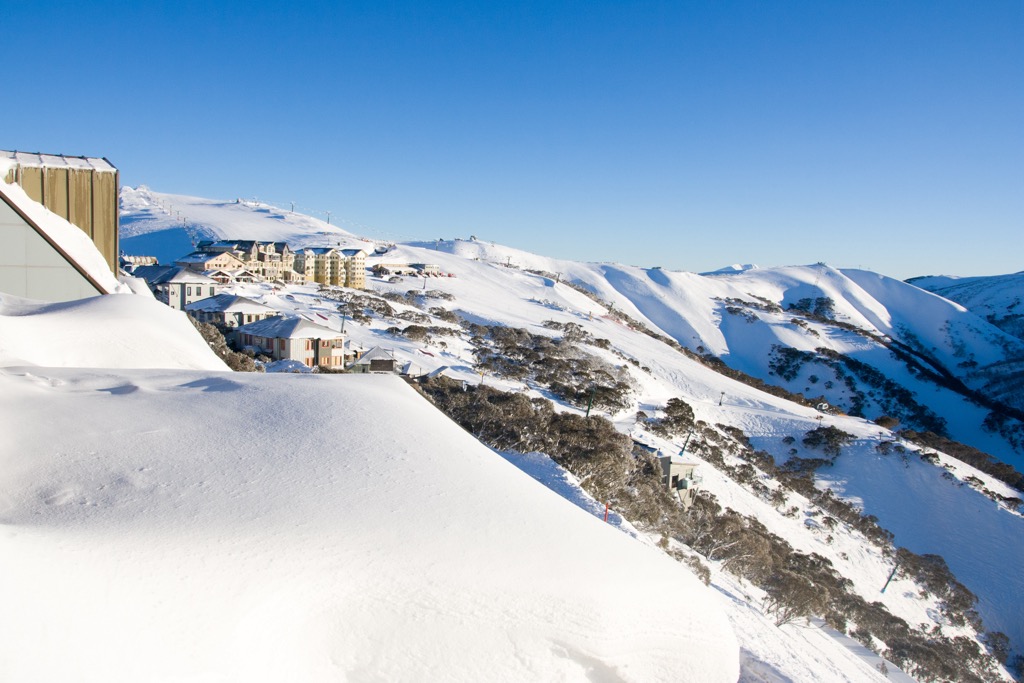
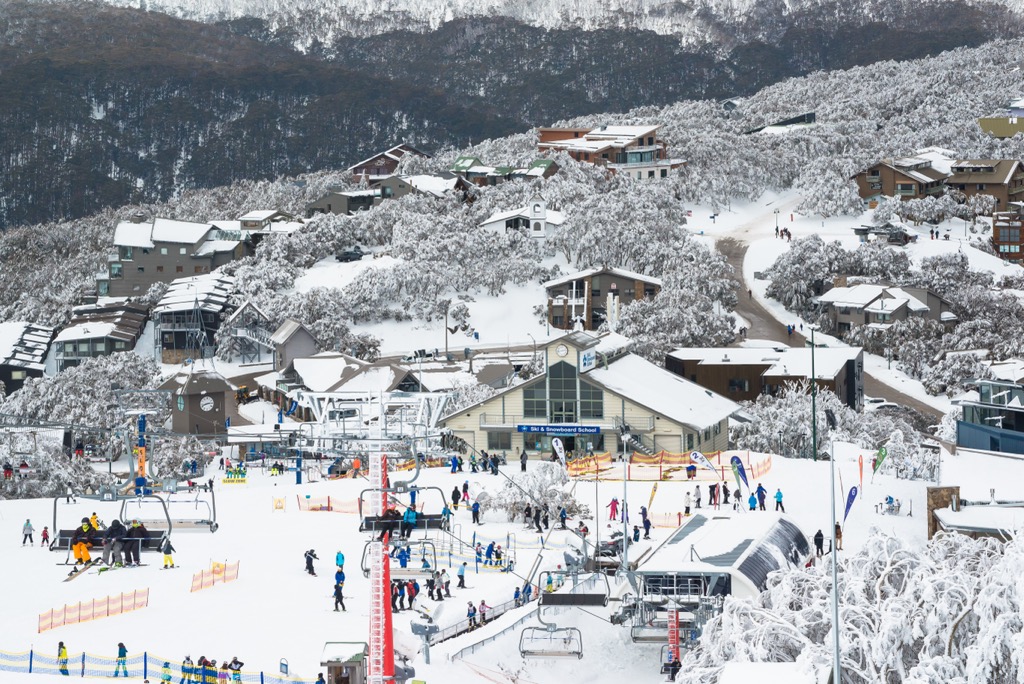
The Great Dividing Range is home to the only skiing areas on the Australian mainland. There are winter snow activities across two states and one territory. Here are the main skiing areas in the range:
Thredbo is in the Australian Alps in New South Wales. With 50 km (31 mi) of slopes and more than ten ski lifts the resort is one of the largest in the country and home to the longest ski runs in Australia.
The resort is best-suited for easy and intermediate skiing, although there are about 10 km (6.2 mi) of black runs for advanced skiers. The Thredbo skiing season runs from early June to late September in general.
Charlotte Pass is another ski resort found within the Australian Alps in NSW. It’s the closest resort to Mount Kosciuszko (2,228 m / 7,310 ft) summit and the Main Range, with more than 10 km (6.2 mi) of slopes and around five ski lifts.
It is best suitable for intermediate skiing. Charlotte Pass’s season is from mid-June to late September.
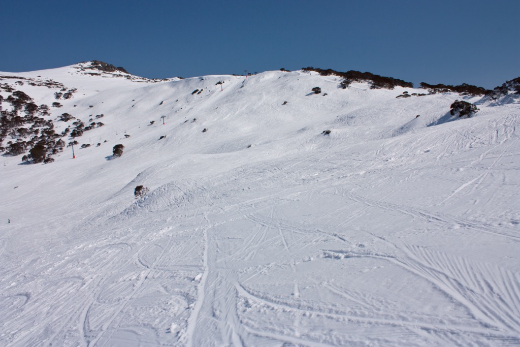
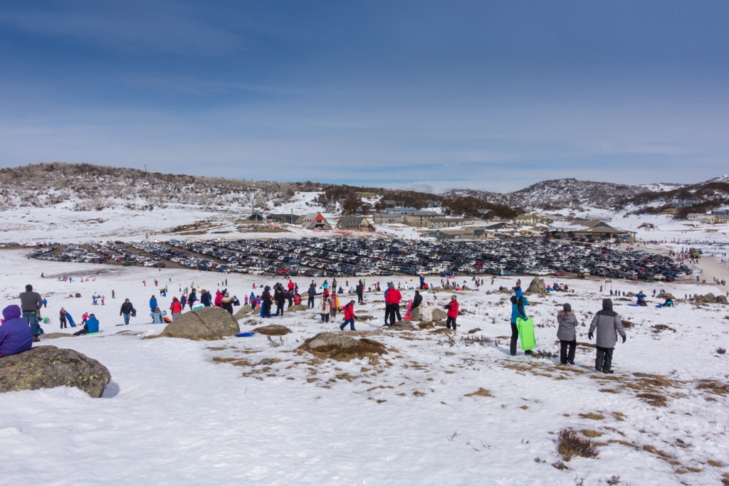
Perisher is the biggest ski resort in Australia. It’s on the Main Range in Kosciuszko National Park and around 32 km (20 mi) drive from the town of Jindabyne. It features more than 65 km (40.3 mi) of slopes and more than 50 ski lifts.
The resort is best suitable for easy and intermediate skiing, but there’s also 10 km (6.2 mi) of black runs for advanced skiers. Perisher’s season is from mid-June to late September or early October.
Hotham Ski Resort is one of the leading commercial skiing areas in Victoria. The resort is in the northeast of the state in the Australian Alps. It’s accessible via the Great Alpine Road, the only major road crossing through the Alpine National Park in Victoria.
Hotham features more than 13 lifts and 80 ski runs, with some stretching up to 2.5 km (1.5 mi) long. The skiing area is primarily for intermediate and advanced skiers, but there’s still plenty of space for beginners. The season runs from early June until September.
Falls Creek Ski Resort is located not far from Hotham, in the Australian Alps. Spread across the Bogong High Plains, resort access is from Mount Beauty or Omeo, off the Great Alpine Road in Victoria.
The resort features over 90 runs accessed by 14 lifts over 450 hectares of land, making it the largest ski resort in the state. The Falls Creek skiing and snowboarding terrain is well suited to beginner and intermediate riders, with less steep terrain than Hotham. The season runs from early June until September.
Mount Buller Ski Resort is in the Australian Alps and is only about 3 hours' drive from Melbourne. For skiing and snowboarding, 48 km (30 mi) of slopes are accessible from 21 lifts.
It’s particularly popular amongst intermediate and advanced skiers and snowboarders, even being the training ground of choice for budding professional winter athletes in Australia. The season runs from early June until September.
The east coast of Australia, along the slopes of the Great Dividing Range, is where you’ll find most of Australia’s biggest cities. Here are the main cities within each state to access various national parks of the range:
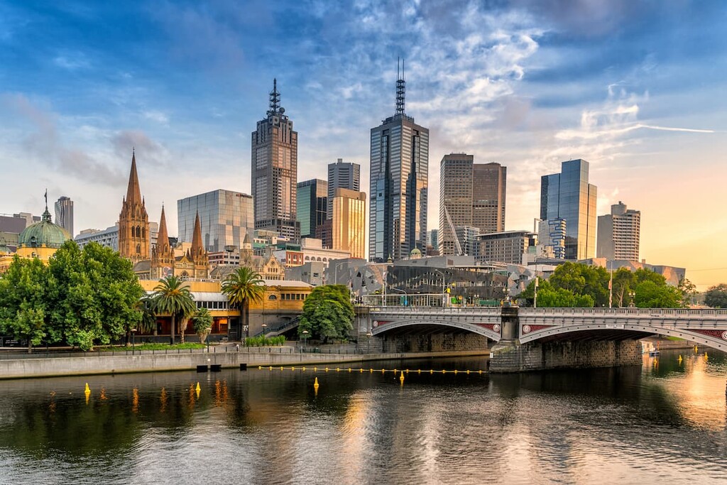
The closest capital city to the southern part of the Great Dividing Range is Melbourne. It’s the central transport hub of Victoria, so you’ll find a domestic and international airport and train and bus stations with services across the state. It provides the ideal base for a trip to Grampians National Park or the Alpine National Park.
Melbourne is known for its nightlife, coffee culture, shopping scene, and sports stadiums. Iconic attractions include the Melbourne Arts Precinct, Federation Square, Bourke Street Mall, and the Southbank area.
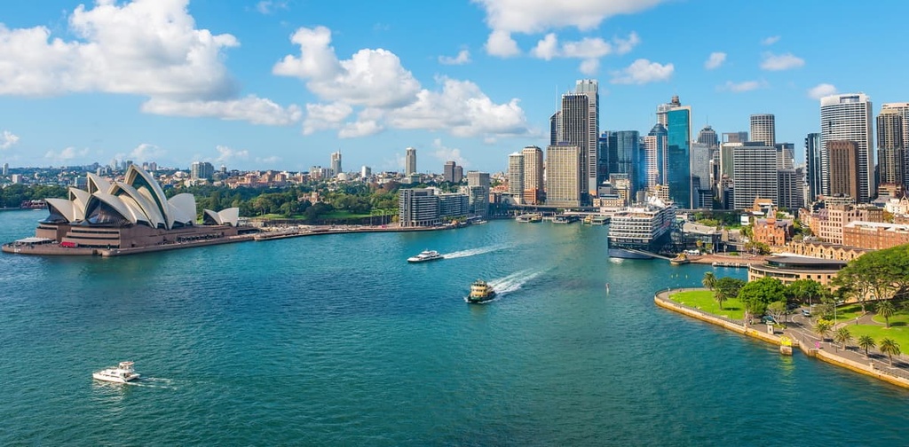
Sydney is on the east coast of New South Wales. It’s the state capital and most populous city in Australia. The metropolis has many transport connections, including a major international airport and train and bus stations.
Sydney is known for its proximity to beautiful beaches and World Heritage Sites such as the Blue Mountains National Park. The city’s most recognizable attractions include the Sydney Opera House, Sydney Harbour Bridge, and Bondi Beach.
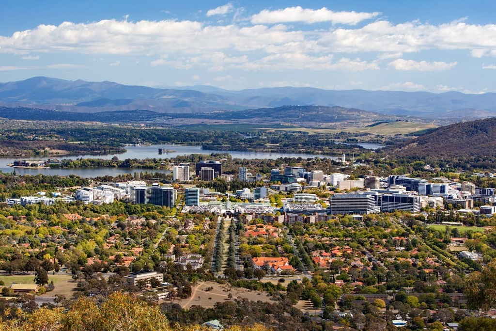
Canberra is the capital city of Australia and encompasses most of the territory known as the Australian Capital Territory (ACT). The city is inland from the east coast and surrounded by the Great Dividing Range.
The city is known for being the home of the Australian Parliament buildings, the National Museum of Australia, and the War Memorial. However, it’s also an ideal base for exploring the Australian Alps. Namadgi National Park is within the ACT boundary, and Kosciuszko National Park is not far south.
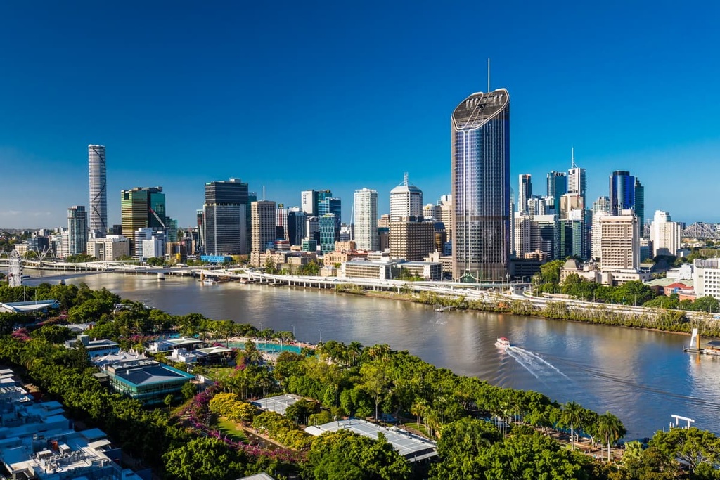
Brisbane is the capital city of the state of Queensland. It’s on the coast of the state’s southeast corner. Brisbane is known for being a more laid-back city compared to Melbourne or Sydney, but is still home to an international airport and major transport hubs.
The Gondwana Rainforests of Australia World Heritage Area of the Great Dividing Range is on the city's doorstep, and includes many national parks. The city is also known for beautiful beaches and coastal islands.


The highest peak in the Great Dividing Range is Mount Kosciuszko, at 2,228 m.
The Great Dividing Range have 12,676 named peaks.


