Scan the QR code and open PeakVisor on your phone
Baw Baw National Park is a protected park area in the state of Victoria in Australia. Covering a large portion of the Baw Baw Plateau, it’s considered the southern boundary of the Australian Alps. The park is home to 14 named mountains, of which the highest and most prominent is Mount Saint Phillack 1572 m / 5157 ft.
Baw Baw National Park covers an area of 13,530 hectares (33,433 acres) in eastern Victoria. It stands at varying altitudes from 1000 (3280 ft) to 1572 metres (5157 ft). The park is located around what is considered the boundary between the Victorian High Country and West Gippsland regions, making it the southernmost section of the Australian Alps.
The Australian Alps is the highest mountain range in Australia, running from the Australian Capital Territory, through New South Wales and into Victoria. It forms part of the larger Great Dividing Range, which traverses the entire eastern side of Australia.
Baw Baw National Park covers much of the Baw Baw Plateau, and sections of the Thomson and Aberfeldy River Valleys around the Mount Baw Baw Alpine Ski Resort. The Baw Baw Plateau is about 20 km (12.4 mi) long, extending from Mount Erica (1511 m / 4957 ft) at the southern end to Mount Whitelaw (1494 m / 4901 ft) at the northern end.
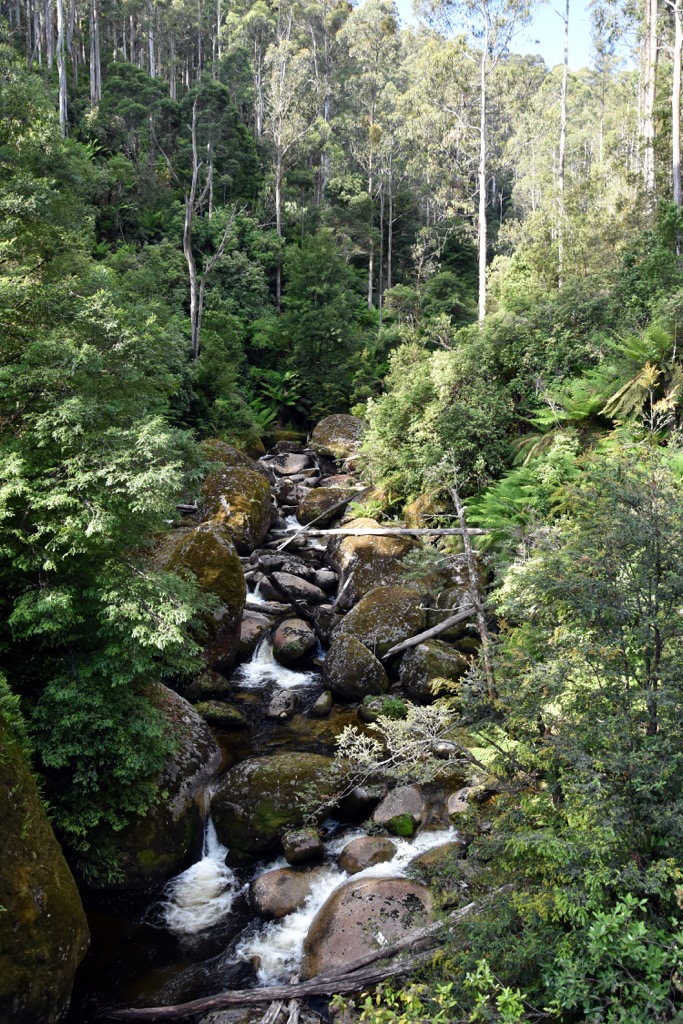
The slopes of the Baw Baw Plateau form the catchment areas for the Thomson River, Thomson Reservoir, Tanjil River and Tyers River.
While it’s a solitary national park, it’s not far from the Yarra Ranges National Park to the west, and Moondarra State Park to the south. As one of the closest alpine regions to Melbourne, Baw Baw National Park is a popular destination all year round, with hiking, mountain biking and skiing.
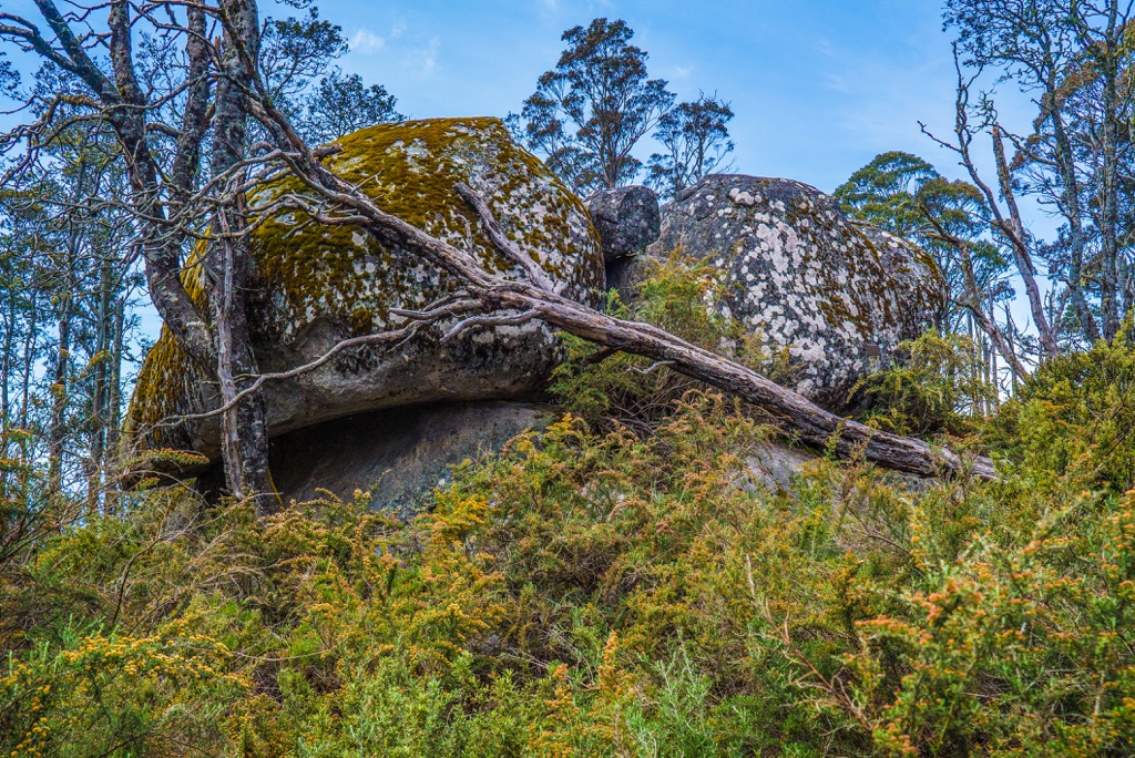
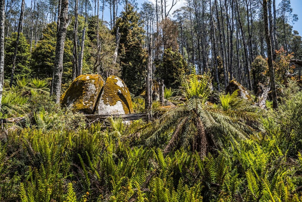
Baw Baw National Park covers most of the Baw Baw Plateau, a largely subalpine landscape. It’s characterized by the Baw Baw Granodiorite, a coarse rock similar to granite. Over time, this rock has been weathered and eroded to form interesting features across the landscape, including concave valleys, tors, stepped valley heads and peaty flats.
Large tors are particularly prominent on the eastern slopes of Mount Erica (1511 m / 4957 ft) and on Mount Mueller (1463 m / 4799 ft). Stepped valley heads can be seen in Tullicoutty Glen, Whitelaw Creek and the west branch of Tanjil River. While peaty flats are evident at Mustering Flat.
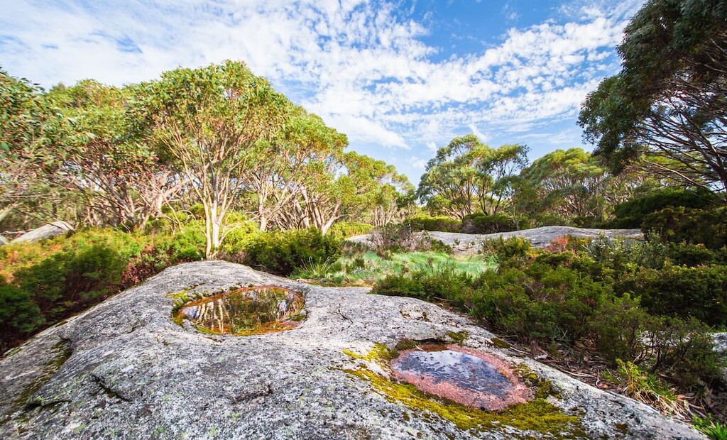
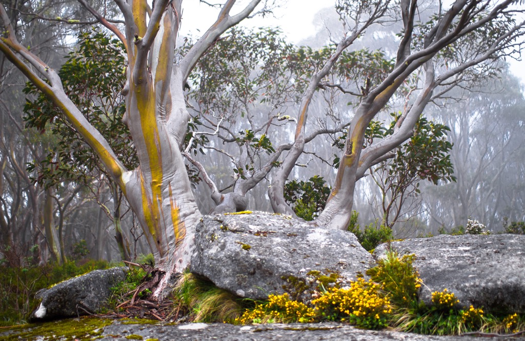
Baw Baw National Park features a unique sup-alpine ecology. The plateau is dominated by woodlands of snow gum trees including Alpine Ash, Shining Gum and Tingaringy Gum, interspersed with Mueller’s Bush-pea, Alpine Pepper and Dusty Daisy-bush.
On lower slopes, particularly in the Thomson and Aberfeldy River Valleys, you’ll also find Mountain Ash, Messmate and Peppermints.
In lower-lying areas of the plateau, there are extensive bogs and peaty swamps of wet alpine heathlands and sphagnum moss. During spring and summer, the open grassy plains around the snow gums spring to life with bright wildflowers, which blanket the plateau in vibrant color.
Despite the higher elevation, Baw Baw National Park is still home to unique native animals. The critically endangered Baw Baw Frog is endemic to the park with major preservation efforts underway to maintain current populations.
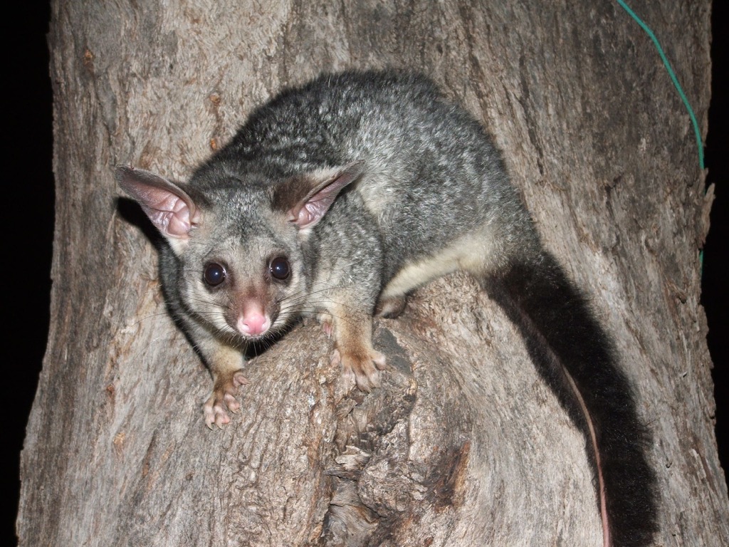
You’ll also find the Common Wombat, Swamp Wallaby, Greater Glider, Yellow-bellied Glider, Sugar Glider, Brush-tailed Possum and Platypus around the national park. The endangered Leadbeater Possum also inhabits the lower elevations in the mountain ash forests.
Baw Baw National Park is located on the custodial land of the Gunaikurnai and Wurundjeri Peoples. The plateau plays an important part of the Aboriginal cultural landscape and dreaming stories.
The area was first explored by Europeans in the mid-1800s. The botanist, Ferdinand von Mueller, made the first recorded ascent of the Baw Baw Plateau by a European in December 1860. He named the peaks Mount Erica (1511 m / 4957 ft) and Mount Mueller (1463 m / 4799 ft).
With the discovery of gold shortly after, there was a mad rush of mining settlements during the 1880s and 1890s. Tracks were cut into the slopes of the plateau but the higher peaks of the plateau were largely left untouched.
In 1906, the Public Works Department constructed a walking trail between Walhalla and Warburton which crossed parts of the Baw Baw Plateau. Unfortunately, most of the huts were destroyed in the 1939 bushfire and the track was never officially reopened. However, it had already begun to attract recreation activities in the region.
In 1945, the Mount Erica division of the Ski Club of Victoria erected a hut on the plateau and became the first organized skiing body on the mountain.
In the 1970s, both hiking and skiing blossomed in the area. The decade saw the first chairlift established for winter access to the slopes, and the long-distance Alpine Walking Track (later called Australian Alps Walking Track) was constructed.
Baw Baw National Park was declared in April 1979 to protect the area for conservation. In November 2008, the park was added to the Australian National Heritage List as one of the 11 areas making up the Australian Alps National Parks and Reserves.
Baw Baw National Park is home to several walking trails open in the summer season. The park is popular for those who want to get some alpine experience, with everything from easier short trails to longer extended overnight hikes.
Here are some of the best hikes in Baw Baw National Park to check out on your next visit.
This is one of the shortest hikes on the plateau, but the 3.5 km (2.1 mi) loop takes you to the summit of Mount Baw Baw (1567 m / 5141 ft). This starts from Baw Baw Village and takes you around to the top of one of the highest points on the plateau.
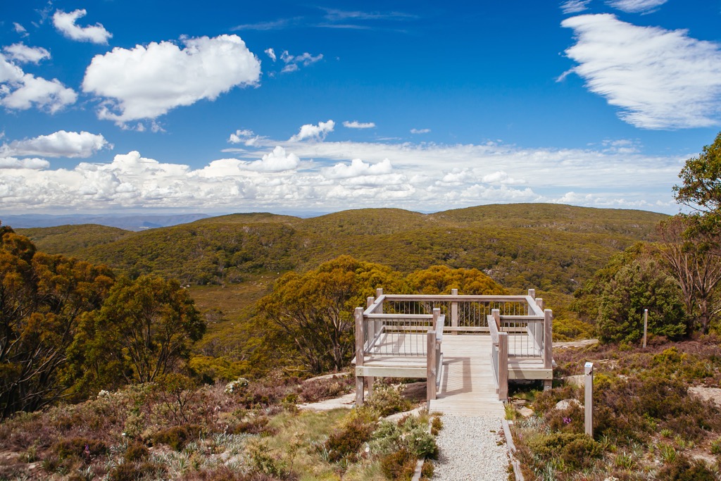
It’s a well maintained trail, with various lookouts and picnic spots along the way to enjoy. It’s perfect for families or anyone wanting a quick hike in the national park.
One of the best all-round hikes in Baw Baw National Park, the 3 Peaks trail takes you to three of the highest points of the park. The 15.5 km (9.6 mi) return trail offers an extended walk that should take up to eight hours of your time. It includes over 400 m (1312 ft) of elevation gain, making it a moderate hike.
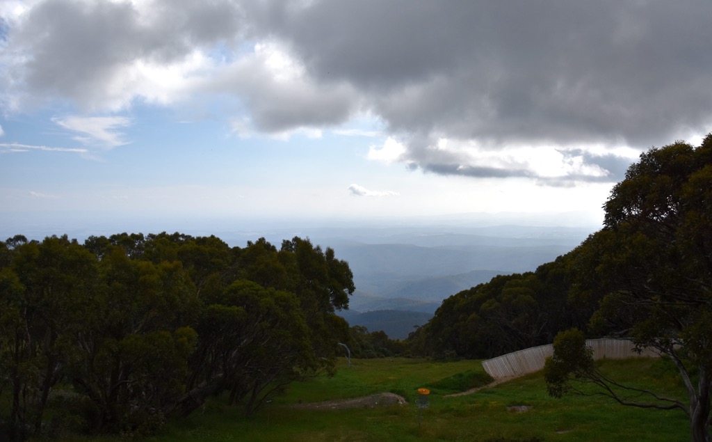
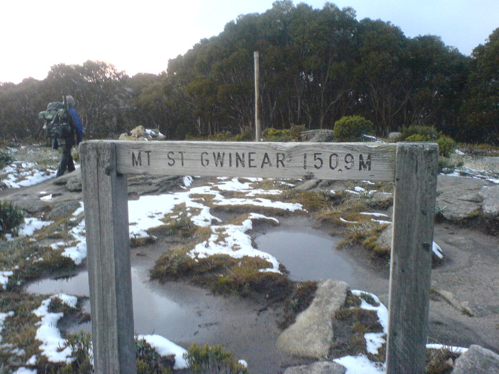
On this hike, you’ll summit Mount Baw Baw (1567 m / 5141 ft), Mount Saint Phillack (1572 m / 5157 ft) and Mount Saint Gwinear (1510 m / 4954 ft) and get magnificent views across the Victorian High Country. It’s the ultimate hike for anyone wanting to get the most out of their time.
This beautiful hike begins from the Mount Erica Carpark, which is accessible off Thomson Valley Road. The 8 km (5 mi) return hike takes you first to Mushroom Rocks, a cluster of giant granite tors. Then, you can continue to the summit of Mount Erica (1511 m / 4957 ft) and the Talbot Hut ruins through Alpine Ash and Sub-alpine Woodland.
The trail from Mushroom Rocks to Mount Erica is more steep, but is still well marked. Unfortunately, there isn’t a view from the summit, but it’s just the satisfaction of having reached the summit that makes it worthwhile.
The moderate hike can be reduced to just 3 km (1.9 mi) return, if you want to forgo the summit and just visit Mushrooms Rocks instead.

For those looking for a long day hike, the 21 km (13 mi) return walk to Whitelaw Hut from Baw Baw Village is ideal. This follows the Australian Alps Walking Track, giving you a taste of this much longer trail.
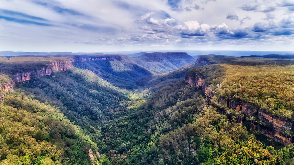
After 10 km (6.2 mi), you’ll come to the site of the old Whitelaw’s Hut, which only has the chimney remaining. However, you’ll experience fantastic views over the Rawson and Aberfeldy rivers and towards the central alpine areas along the way.
The Australian Alps Walking Track is a long distance trail that traverses the length of the Australian Alps from the Australian Capital Territory, through New South Wales and into Victoria.
The 650 km (404 mi) long trail stretches from Namadgi National Park near Canberra down to Walhalla near Baw Baw National Park. The trail itself crosses right through Baw Baw National Park, and there are opportunities to complete short day hikes or overnight hikes on the trail.
Wild camping is permitted on the track, making it possible to complete overnight hikes such as Baw Baw Village to Mushroom Rocks (30 km / 18.6 mi one way) or Walhalla to Baw Baw Village (40 km / 24.8 mi one way).
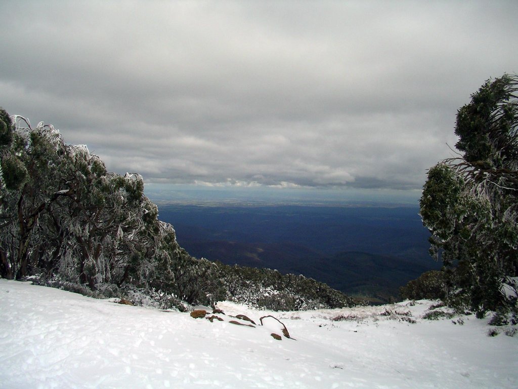
As the closest ski resort to Melbourne, Baw Baw National Park is a popular winter destination. There are plenty of snow activities available at the downhill ski area, including tobogganing, snowboarding and skiing.
There are seven lifts, 15 runs and around 10 km (6.2 mi) of groomed cross-country trails. It’s considered largely moderate skill level terrain, with some more beginner level options as well as advanced terrain.
At the ski resort and village on the plateau, you’ll find ski hire, food outlets, shops, medical and information centres all within an easy stroll of the car parks.
If you want to stay as close to Baw Baw National Park as possible, then staying in Baw Baw Village is the best option. Surrounded by the national park and situated at 1450 m (4757 ft), Baw Baw Village is the heart of the ski resort.
The village features cabins, self-contained apartments and traditional ski lodge accommodation, with a range of prices and group size availability. Accommodation should be booked ahead of time during both the winter and summer seasons through the Mount Baw Baw website.
For hikers, there is also the option for wild camping. Dispersed bush camping is permitted on the Baw Baw Plateau, but there are no permanent facilities. This means leave no trace and use fuel stoves rather than fires. Camping is especially ideal for those planning on doing an overnight hike along the Australian Alps Walking Track.
Baw Baw National Park is quite accessible from towns in West Gippsland and the Yarra Ranges in Victoria. It’s not far off the major Princes Highway, making it possible to purchase supplies and find good accommodation nearby. Here are the closest towns to the national park:
Baw Baw National Park is located in eastern Victoria. It’s the closest alpine resort to Melbourne, so if you’re looking to start or end your trip in a city, it’s not too far away.
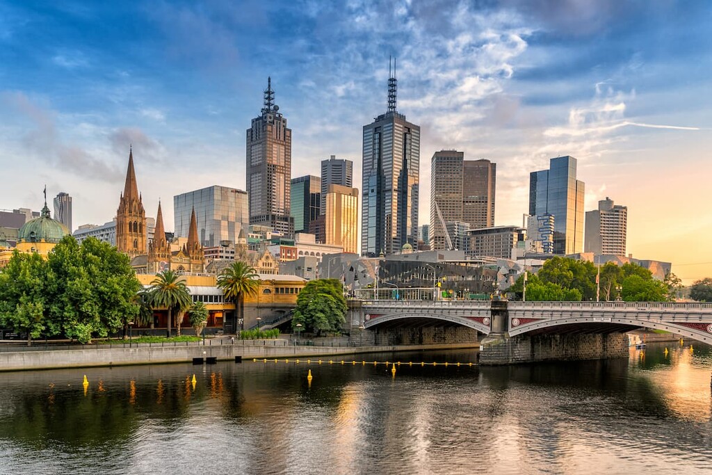
The closest capital city to Baw Baw National Park is Melbourne, which is located 195 km (121 mi) to the west of the park. It’s a relatively easy drive along the Princes Highway from the city, with many towns on the way. Melbourne is the main transport hub of Victoria, so you’ll find a domestic and international airport, as well as train and bus stations.
Melbourne is the capital city of the state of Victoria. It’s well known for its lively nightlife, coffee culture, shopping scene and mixture of architecture. There’s plenty of things to do, with iconic attractions including the Melbourne Arts Precinct, Federation Square, Bourke Street Mall and Southbank area.