
Scan the QR code and open PeakVisor on your phone
Blue Mountains National Park is located in central eastern New South Wales, Australia. Only 1.5 hours’ drive west of the state’s capital Sydney, and accessible by public transport, it’s a major destination for overseas tourists and locals alike.
The park is instantly recognisable for its jaw-dropping scenery; and home to a unique array of Aussie animals and plants as well as Aboriginal and European cultural heritage.
It covers 2690 square kilometres of rugged bushland, escarpments and valleys, with convoluted boundaries a result of fitting the park into the human landscape - formed around the passage of roads, towns and urban areas, and privately owned parcels of land otherwise contained within the protected area.
The highest peak is Bald Mountain at 1268 metres elevation, followed by nearby Mount Werong which is 1230 metres. These peaks are tucked away in the south-west of the Park; however there are plenty of easily accessible hill-top vantage points a short distance from centres like Katoomba.
For most visitors to the Blue Mountains, tackling high peaks isn’t the big drawcard – rather it’s trekking the many walking tracks up, over and around the towering sandstone cliffs that the place is really known for.
All of those cliffs are also a drawcard for rock climbing, abseiling and canyoning. The Blackheath area provides a great cluster of routes for climbers; with plenty more places to visit within an hour’s drive.
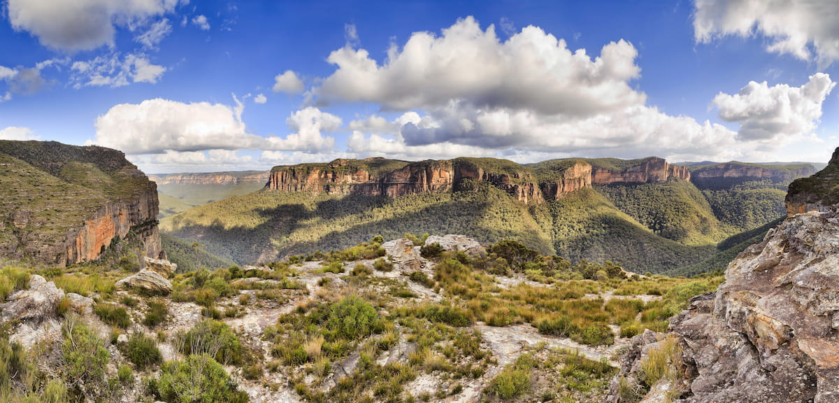
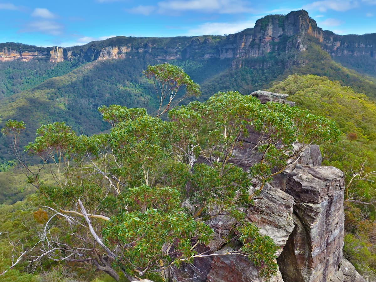
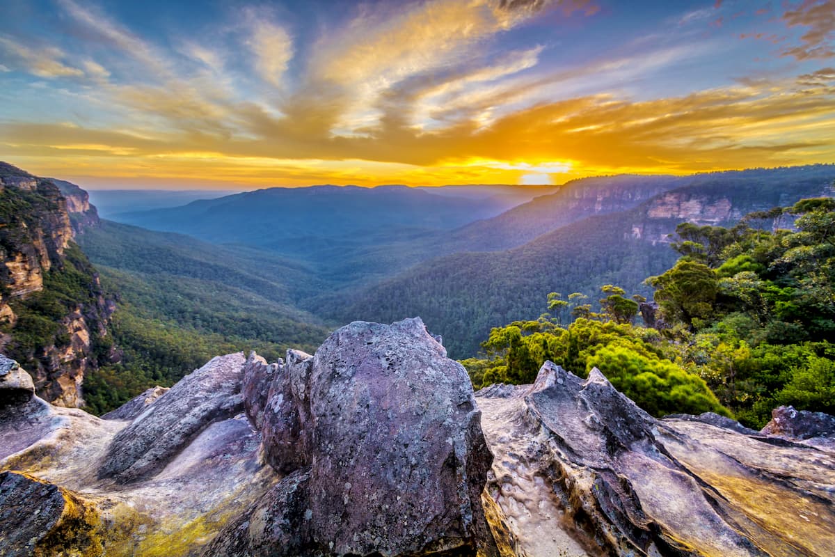
The Park forms part of the continent-spanning Australian Great Dividing Range. Most accurately speaking, the “mountains” are actually a great sandstone plateau; which time and water has carved into the intimidating walled fortress that deterred European exploration of the inland for some time.
Part of the Greater Blue Mountains World Heritage Area – so designated for its significant geological and ecological features – the Mountains are dominated by dry sclerophyll eucalypt forest. The abundant gum trees emit natural oils, which mix with airborne dust and water particles to create the moniker blue haze.
In the sheltered valleys, walkers can discover hidden pockets of lush rainforest; while exposed tops support scrubby heaths that burst with life in a good spring season when the multitude of flowering plants attract nectar-feeders from far and wide.
Visitors from Sydney can make the easy drive out along the M4 and Great Western Highway; which leads into Katoomba and Blackheath. Getting to the south of the Park adds a bit more driving, around to Oberon and Jenolan. The north of the Park is accessible off Bells Line of Road, which runs between Richmond and Lithgow.
Regular trains also run from Sydney to Lithgow; with stations at Glenbrook, Woodford, Faulconbridge, Leura, Wentworth Falls, Katoomba and Blackheath.
The Park can be broken into six key areas; those being Katoomba, Blackheath, Glenbrook, Lower Grose Valley, Mount Wilson and the Southern Blue Mountains.
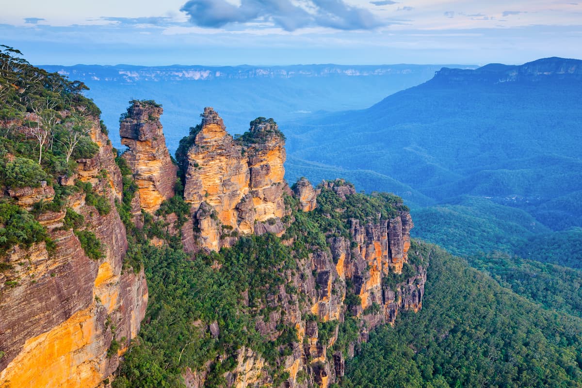
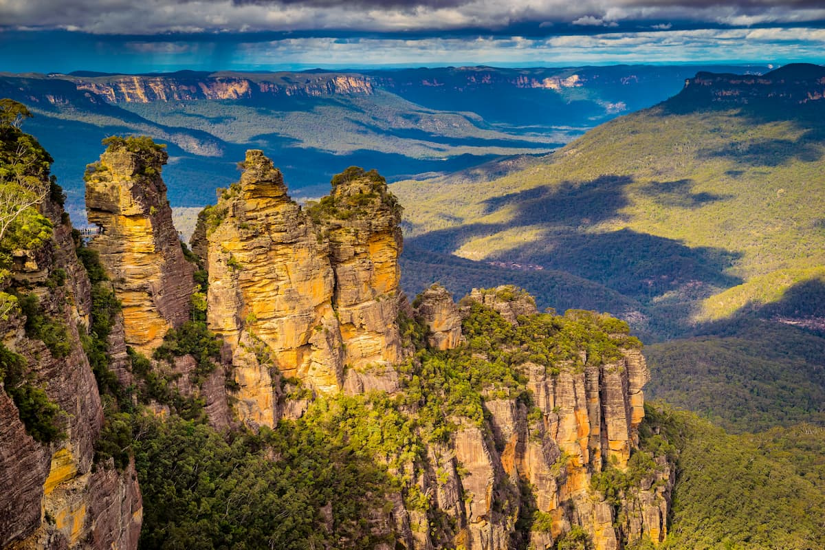
Katoomba is the postcard destination, being the access to the iconic Three Sisters, Wentworth Falls, the Ruined Castle and National Pass walking tracks, Scenic World, the Blue Mountains Visitor Information Centre and guided tour facilities.
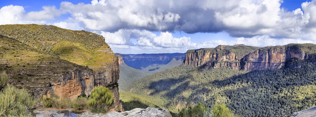
The Blackheath area is a gateway to the inspiring Grose Wilderness; where walkers, cyclists and climbers visit Govetts Leap, the Grand Canyon and Burramoko Ridge. The Blue Mountains Heritage Centre can provide expert information on all aspects of the Park.
Glenbrook encompasses the east of the Park and is the most accessible area for Sydney-siders. There are many walking and cycle tracks, quiet campgrounds and the Red Hands Cave which contains one of the best examples of Aboriginal rock art in the area.
The Lower Grose Valley is less-visited than other areas of the Park, and offers the wild-at-heart remote camping, bushwalking and mountain biking. If getting away from crowds and into nature is your thing; this area should be high on your list.
A visit to the Mount Wilson Area starts with the scenic drive along Bells Line of Road – part of the Greater Blue Mountains Drive – chocked full of scenic lookouts to stop at along the way. The area is another access point for the Grose Wilderness and several challenging walks.
For the adventurous, the Southern Blue Mountains have plenty to offer. Four-wheel drive enthusiasts can make the most of the Oberon-Colong historic stock route and camp at Mount Werong campground along the way. This area gives access to the Kowmung River – a real out-of-the-way adventure destination – as well as the Colong Caves. Nearby Jenolan and Wombeyan Caves are other major drawcards.
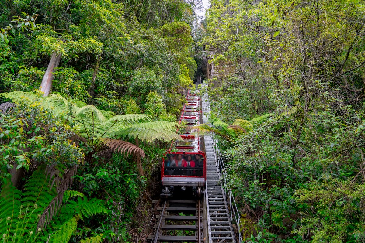
With Katoomba being the hub for visitors; it’s a busy spot but a must-see for first-timers. A trip to the Mountains without admiring the famous Three Sisters from Echo Point Lookout just wouldn’t be complete. As well as that, there’s Scenic World; combining the historic Scenic Railway – a former coal transporter and now the steepest passenger train in the world – with the Scenic Cableway, Skyway and Walkway. It’s a great way to get an immersive but entirely accessible introduction to the Jamison Valley.
Bush walking is the major explorative activity in the Park; and trails range from well-kept and easy for everyone to down-right difficult. In the case of the more remote areas, forging your own path is the choice for the adventurous and well-prepared.
Spring – September to November – is the best time to marvel at the diverse wildflowers in the Park. New South Wales’ floral emblem – the Waratah – can be spotted in many locations and its huge red head is hard to miss.
The milder seasons – spring and autumn – are good for adventuring, without summer’s oppressive heat that makes remote area travel a risky business. No matter the time of year, always bring plenty of water. For all visitors venturing into the bush, adequate water supplies are a must.
There is no shortage of space to stretch the legs along the Blue Mountain’s 140 kilometre plus network of State Heritage Register listed trails. Katoomba, Blackheath and Leura are gateways to many of the better-known routes and scenic vistas – but things in no way end there.
Walks accessed off the Bells Line of Road; and most places in the Southern Blue Mountains; will find paths much less travelled and packed with all of the extreme plateau vistas that the rest of the park is known for.
The following trails provide a brief guide to a few of the better-known walks in the Park, as a starting point for visitors. For those seeking the wildest routes in out of the way recesses, a bit of extra digging will soon uncover other trails worth visiting.
The Three Sisters Walk – This is the most iconic scenic point of the Blue Mountains, which millions of visitors come to get a glimpse of every year. The towering rock spires are sisters ‘Meehni’, ‘Wimlah’, and ‘Gunnedoo’ in the local Aboriginal Dreamtime story.
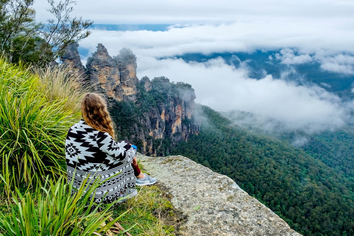
Echo Point Lookout provides the most accessible view right at the Echo Point Visitors Centre; and it’s where so many visitors are happy to get some snaps and continue on their way.
The Three Sisters Walk, alternatively, leads to two other lookouts – Oreades and Lady Game – progressively closer to the rock formation. From Lady Game Lookout, the Giant Stairway continues down to the Honeymoon Bridge and the first Sister herself. It’s a steep climb back up.
From the bottom of the Giant Stairway, walkers can continue their exploration by heading to Katoomba Falls along the Federal Pass; and to the bottom of the Scenic Railway at Scenic World. From here, the last train to the top is at 3:50pm, or a final climb up the Furber Steps.
The Dardanelles Pass loop track is another option from the bottom of Giant Stairway – an energetic 5.3 kilometre trail back to Echo Point via the Marguerite Cascades, up Fern Bower Track and along part of the Prince Henry Cliff Walk.
Ruined Castle Walk is another popular trail on Katoomba’s doorstep. It can be reached by driving to the top of the Golden Stairs on Glenraphael Drive; or for an extended sight-seeing stroll it can be reached by walking from Scenic World along the Federal Pass and Mount Solitary walking tracks.
Weaving down into the rain-forested depths of Jamison Valley and next to the ruined cottages and working of a mining past, walkers then re-gain altitude as they scramble their way up the Ruined Castle itself. The pay-off is unobstructed views of the surrounding valleys.
Grand Canyon Track – Moving over to Blackheath, a quick detour off the highway leads to Evans Lookout, resting atop the high cliffs hemming in the ravine headwater creeks of the Grose Valley. From here, the path dives down into the canyon and trails Greaves Creek for most of its length – putting walkers up close and personal to the cliffs, gum trees, clear waters and rainforest vegetation that are so definitive of the Blue Mountains region. The track climbs back out to the road to finish the loop.
To make a real day of it, regain Evans Lookout and head north-west on the Cliff Top Walking Track. This trail traverses the cliff lines across to Govetts Leap Lookout, and provides a good example of the mountain heath landscape. For this reason, it’s a good walk for spring when the flowers are blooming and birdlife is plentiful.
Six Foot Track – Tackling the historic bridle track linking Katoomba to Jenolan – the original route through the Megalong Valley to Jenolan Caves – is a 46 kilometre adventure waiting for those who want a real immersive Blue Mountains experience.
The Track starts near Explorers Tree, just west of Katoomba (the tree itself – a remnant stump today – is where European explorers Blaxland, Lawson and Wentworth carved their initials on the first successful non-aboriginal crossing of the mountains in 1813).
The Track cuts through national park, state forest and surrounding private property. There’s plenty to see whether you’re keen on the biological, cultural, historic, scenic – or any mix of the afore-mentioned – along the way. Campgrounds, some with simple facilities and others primitive, welcome travellers towards the end of day. There is also the option of the first night in the Six Foot Track Lodge which is about 15 kilometres in, and the last at Jenolan Cottages on the 40 kilometre mark.
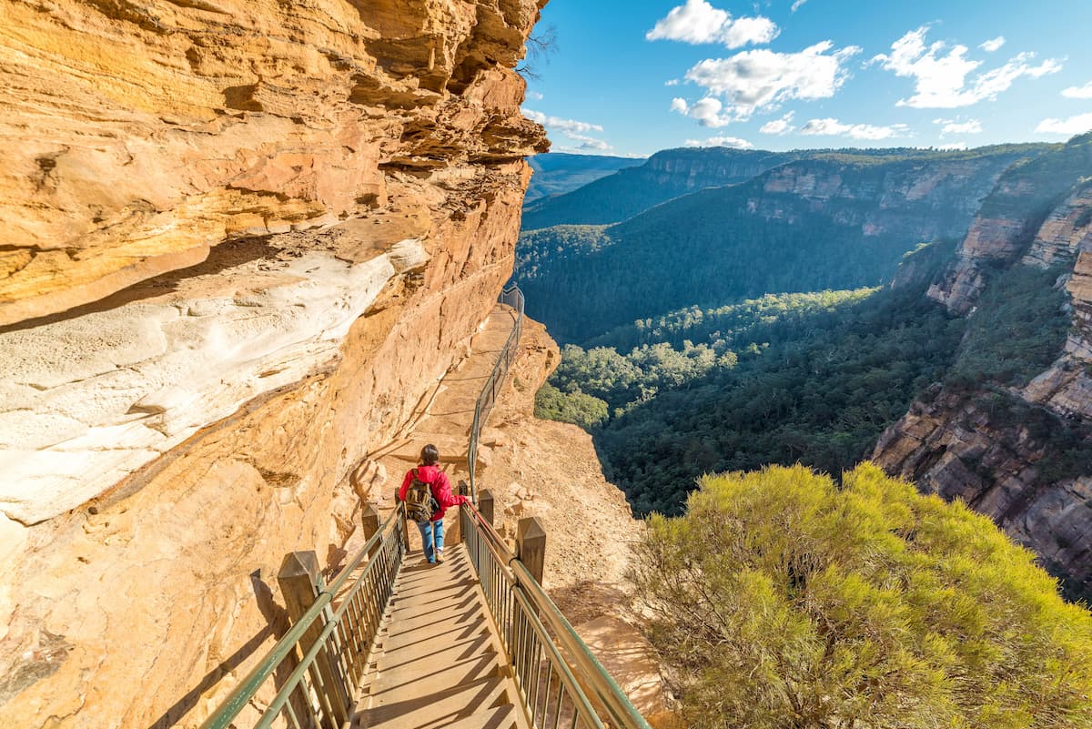
The National Pass Walk features a rather unique bit of path in the Grand Stairway, hewn right into the cliff by hand and dynamite in the early 1900s. Admiring the handiwork of the construction crew on one side (and gawking at the steep descent), the eyes are soon drawn to the spectacular view of the Jamison Valley where the path is cut right into the cliff face itself.
Other than Wentworth Falls themselves, there are a couple of other waterfalls to check out once hitting the bottom of the Valley of the Waters. Empress Falls is a highlight, and for the climbers – this is a good abseiling location.
Climbing back out of the valley, a relaxing pit stop can be found at the Conservation Hut café.
The loop track starts at the Wentworth Falls picnic area. The walk can be quite busy during peak times.
Overcliff-Undercliff Track – another trail breaking away from Wentworth Falls picnic area, Overcliff-Undercliff runs along the top of the rock faces and underneath some of their imposing overhangs as it heads out to the Valley of the Waters. The overhangs really set this trail apart, decked out in ferns and moss where the moisture seeps out from somewhere up above and isn’t fried off by midday temperatures.
Lockleys Pylon Walking Track takes bushwalkers out to the edge of the Grose Valley through rugged heath country. Its starting point, on Mount Hay Road north of Leura, is reached after 10 kilometres of gravel road. This location steers some visitors to more accessible areas instead so the track is usually refreshingly quiet.
It’s a relatively easy 7 kilometre return walk. Lockley’s Pylon itself provides stunning views of the remote bushland of the Grose Valley and the prominent Mount Hay in the east and Mount Banks to the north.
The track is another good spot for admiring wildflowers and birdlife during the spring.
Mount Banks Summit Walk – Mount Banks can be spotted from Bells Line of Road as a prominent bulge erupting out of the landscape. Turning off Bells Line and following the signs to Mount Banks Picnic Area where the trail starts.
There’s a bit of a climb to the top but at only 2.4 kilometres return it’s still a relatively quick trip. Of interest is the basalt capping of the mountain which has made for some rich soils and a forested peak of monkey gums rather than the customary heath scrub.
There’s the option of taking the same path back out or looping around on the Mount Banks Road Cycle Track instead – an extra 5 kilometres leads back to the picnic area again.
Burramoko Ridge (Hanging Rock) Trail – Group size is restricted to eight people on this track as it’s located within the designated Grose Wilderness. The track is fairly easy for both cyclists and walkers as it follows a ridgeline along its length.
The end point is the major drawcard for this route, being Baltzer Lookout and Hanging Rock. The massive slice of cliff hanging precipitously out into the chasm of the upper Grose valley is a sight to behold – and the jump over the gap between solid ground and Hanging Rock is a bit of a rush for anyone wanting to make it right out to the edge.
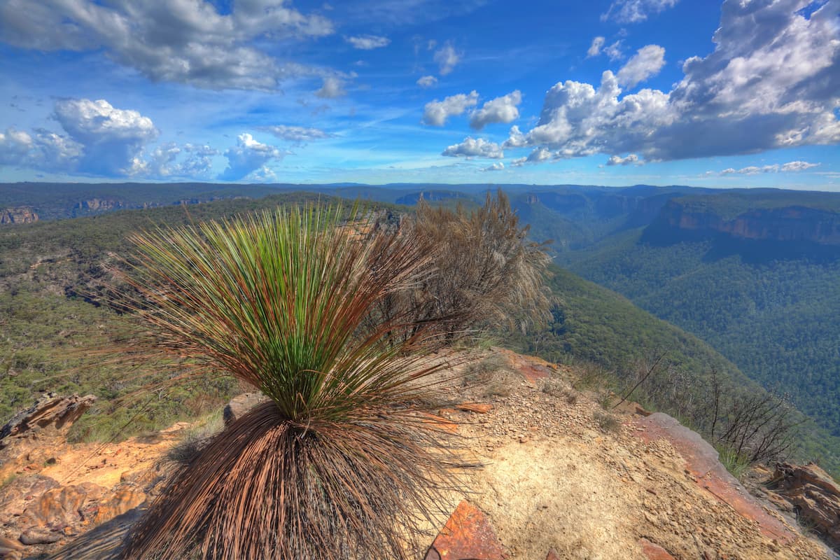
Keep an eye out for the unusual grass trees along the way – another interesting and somewhat uncommon feature of the Australian landscape.
As already mentioned above, Katoomba is the urban heart of Blue Mountains National Park. Its satellite towns, Blackheath and Leura, are other such instantly recognisable destinations for the visitor.
At the junction of Bells Line of Road and the Great Western Highway, Lithgow has an interesting working class history in the way of mining and war-time manufacturing. Tracking the Bells Line of Road back towards Richmond, there are several road-side gems around Bilpin and Kurrajong Heights.
Jenolan and Oberon, though slightly further from the park than other localities, provide services for those wanting to delve into the Southern Blue Mountains area.
There’s plenty of history here as a tourist destination, from a time when Sydney-siders would break away from the big city hustle and bustle for a weekend in “The Mountains”. Historic buildings such as the Carrington Hotel reflect this past, and who knows what might be found in the several antique and collectables shops. The fashion and local handicrafts complete a vibrant shopping scene.
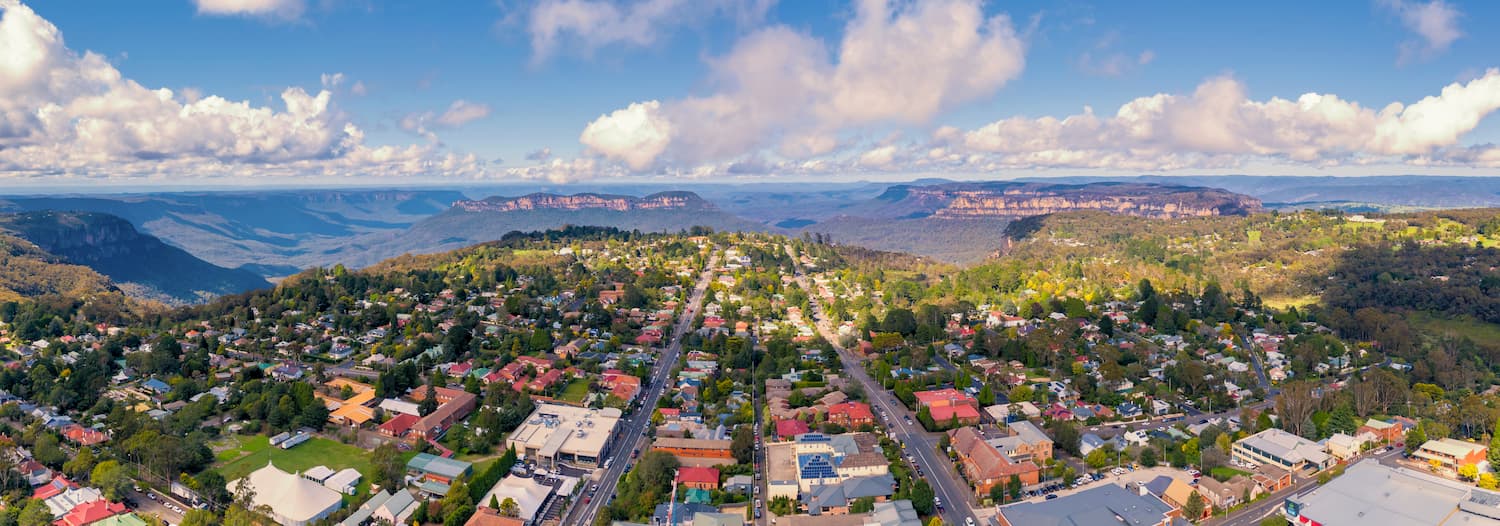
For a refined edge to the area, Leura – 2 kilometres out of Katoomba – is the village to visit for art galleries, gargens, antiques and fine dining.
Blackheath is the access for Grose Wilderness exploration. The Blue Mountains Heritage Centre is well worth a visit to find out everything there is to know about the surrounding area and its Aboriginal and European historic sites. The historic Hydro Majestic Hotel is an icon of the area.
Lithgow is steeped in recent history, from steel manufacture to coal mining to military arms manufacturing. Much of the historic industrial buildings are still in place and make for interesting side-trips while visiting the Blue Mountains.
This is also where to access other destinations such as Hussans Walls Lookout, Wolgan Valley, the Newnes Plateau, the Glow Worm Tunnel; Capertee Valley and Wollemi National Park.
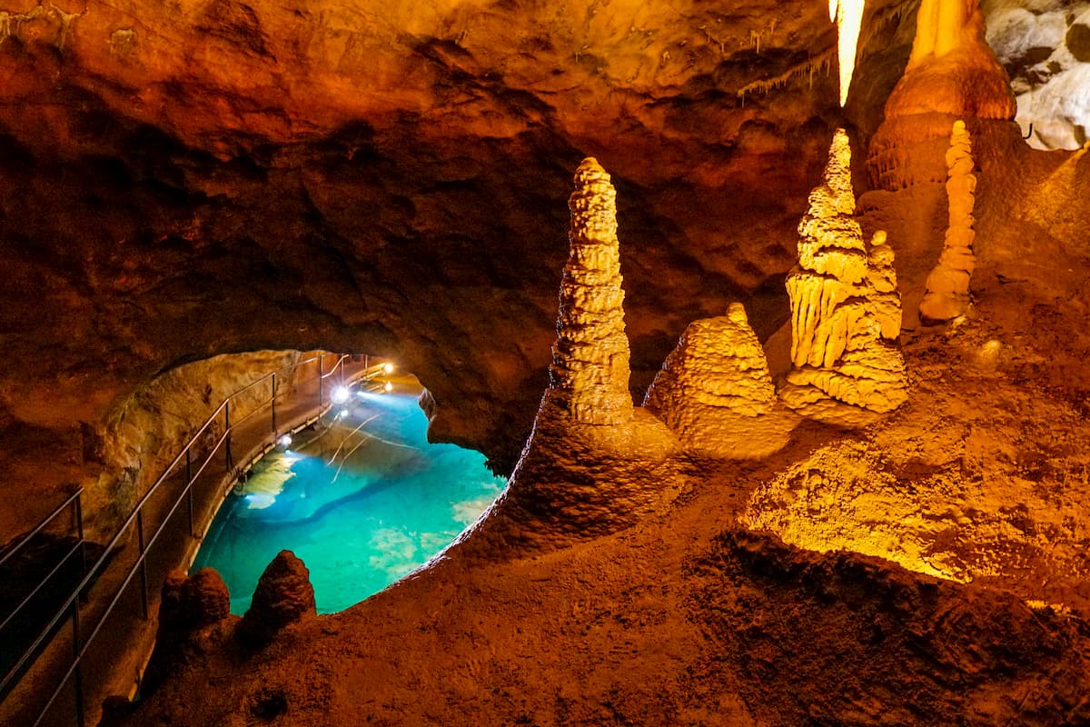
The Jenolan Caves are a definite highlight of the region. A maze of water-carved limestone chasms, intricate stalactites and stalagmites make for one of the world’s finest cave systems. Concerts are played in some of the caverns, while guided tours of the famous and lesser-known caves; and guided adventure caving; soon create an enviable itinerary.
Even above the ground, the area around Jenolan Caves is breathtaking. Whether having reached it via the Six Foot Track or more modern vehicular means; Blue Lake and Grand Arch are both must-see landmarks.
The Jenolan Caves House has been catering for adventurers since 1896 and is the only guesthouse of its kind remaining in Australia. This is a true historic experience with a period interior and timelessly classic rooms.
For more modern accommodations there are also the Mountain Lodge and bush cottages to choose from.


