
Scan the QR code and open PeakVisor on your phone
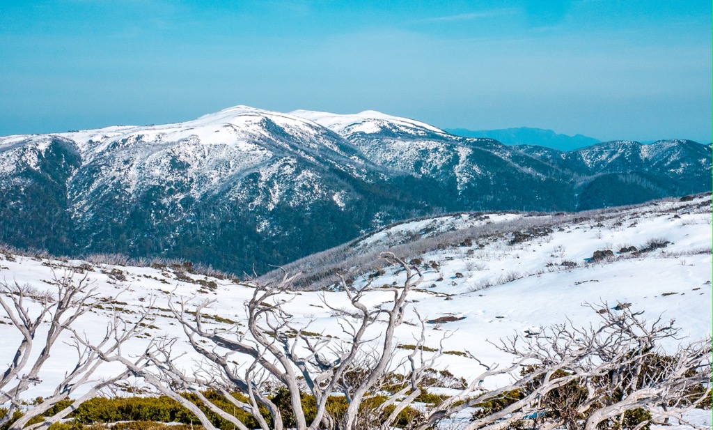
Grampians National Park is a protected area located in the western part of Victoria in Australia. It’s the southernmost point of the Great Dividing Range and has been listed on the National Heritage List since 2006. The 167,219 hectare (413,210 acres) park area is home to 69 named mountains of which the most prominent is Mount William (1170m/3838 ft).
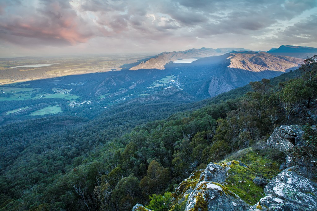
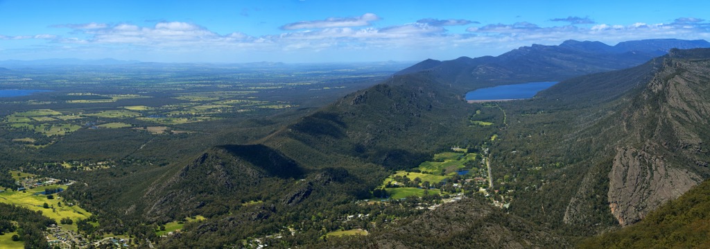
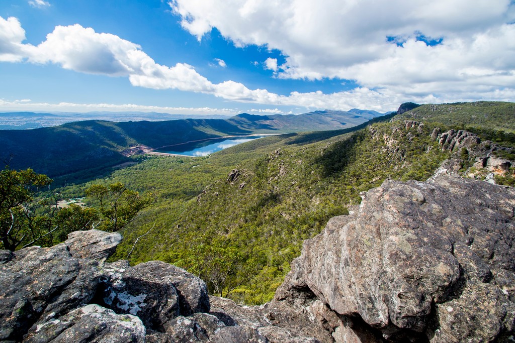
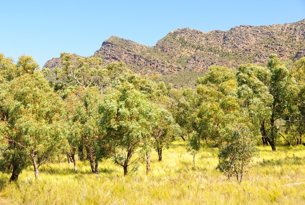
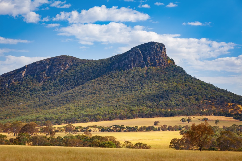
Grampians National Park covers an area of around 167,219 hectares (413,210 acres) in the western part of the Australian state of Victoria. The park is characterized by a striking series of mountain ranges in the Western Victorian Highlands.
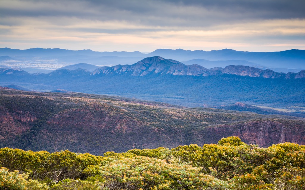
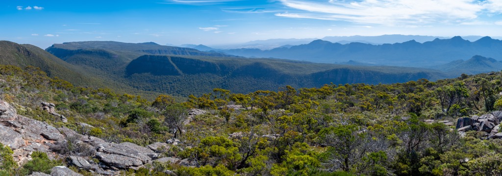
The collection of sandstone ridges roughly run north-south and together make up the southernmost part of the Great Dividing Range. The western side of the Grampians is characterized by more low-angled ridgelines, while the eastern side has a much steeper profile.
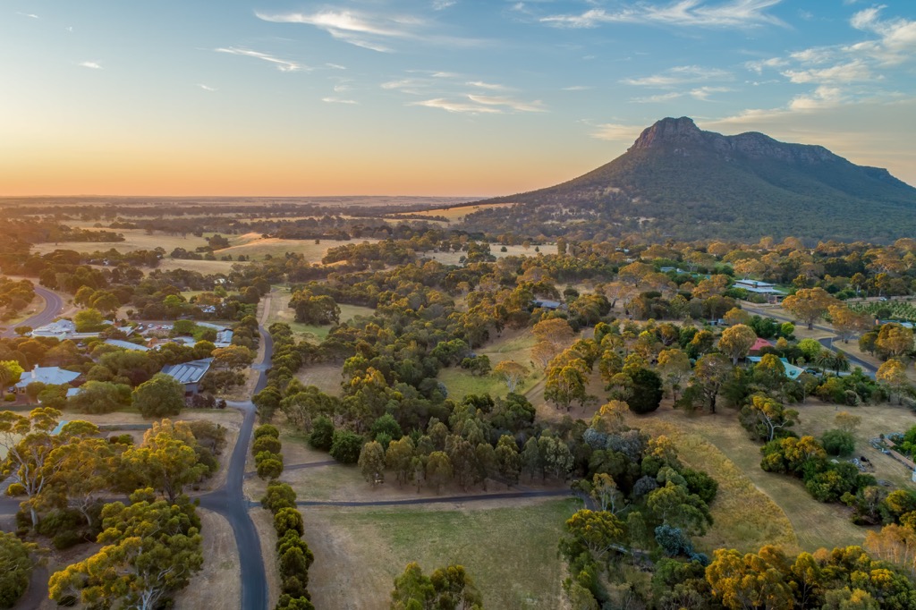
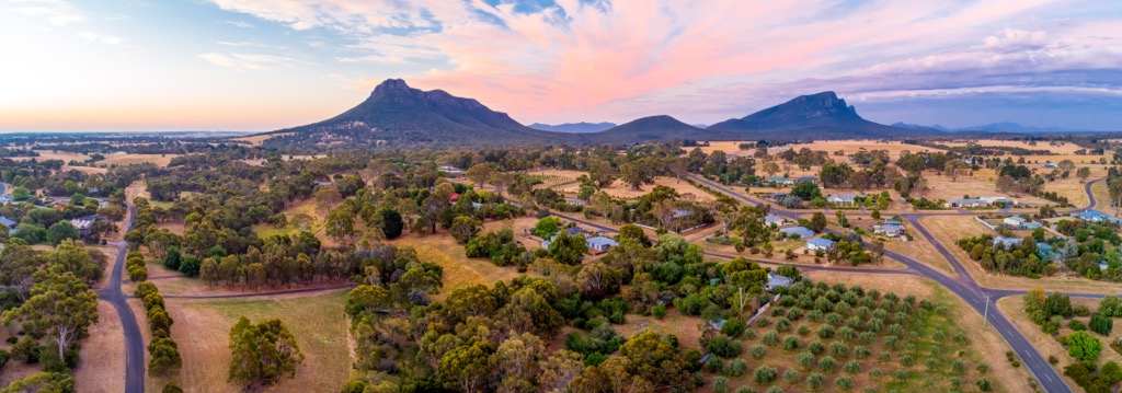
Grampians National Park is generally broken down into the northern section near Dadswells Bridge, the central section known as the Wonderland Range around Halls Gap and the southern section near Dunkeld. The park is surrounded by flat pastoral land, making the jagged ridgelines of the Grampians even more prominent.
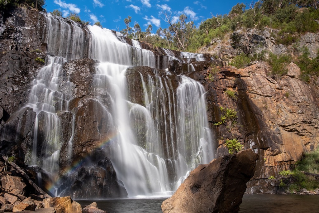
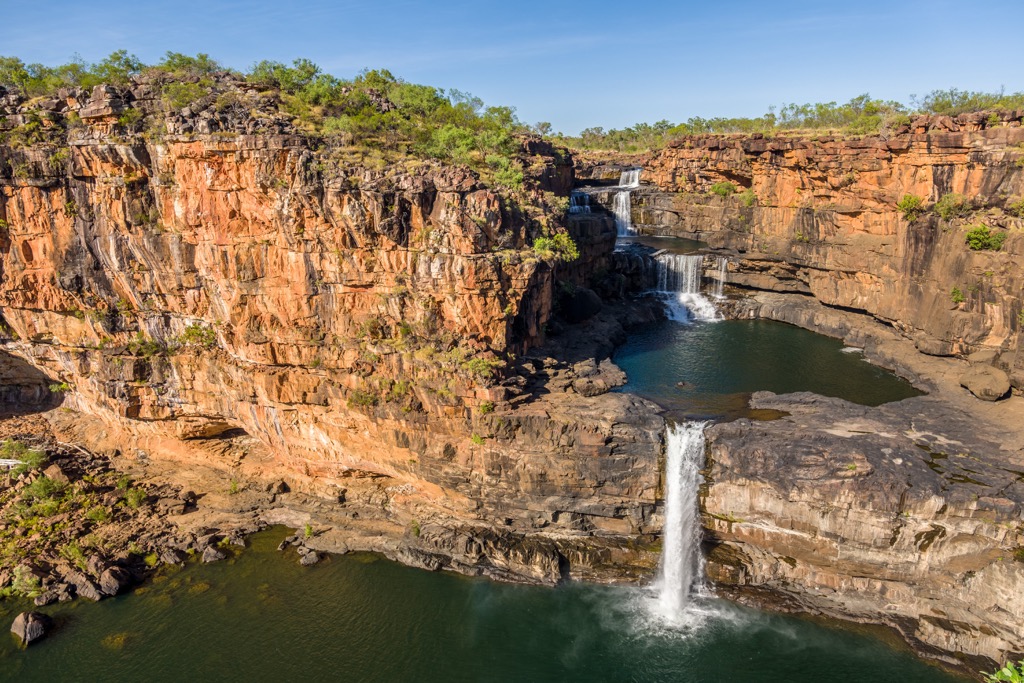
The rocky landscape of the park is carved out by streams, waterfalls and reservoirs. Inside the park boundary you’ll find Moora Moora Reservoir, Lake Bellfield and Wartook Reservoir, along with MacKenzie Falls, Splitters Falls, Silverband Falls and Fish Falls.
The somewhat isolated mountainous park is not connected to any other national park. However, it is close to Black Range State Park, Mount Arapiles-Tooan State Park, Little Desert National Park, and Ararat Regional Park.
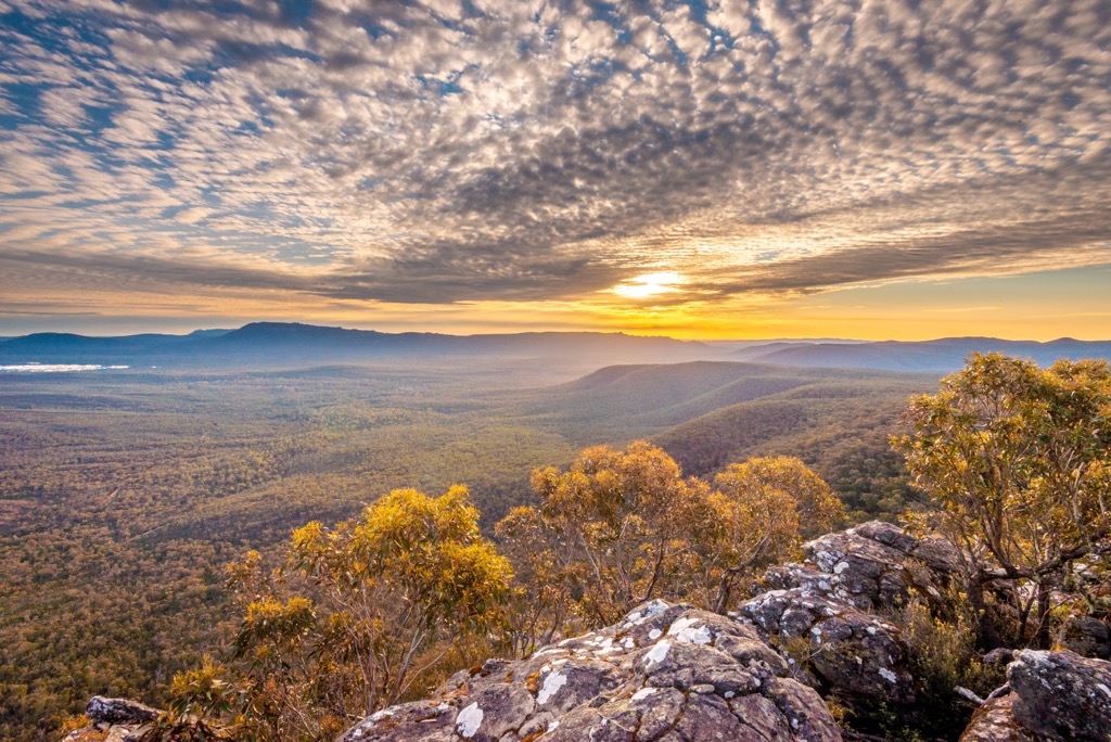
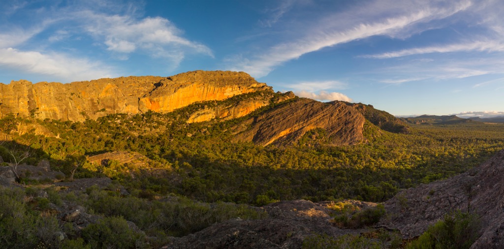
Grampians National Park is made up of rugged sandstone ridges. It’s an ancient landscape that has formed over the past 400 million years. The sandstone material was laid down by rivers during the Devonian period millions of years ago. The sediment was slowly built up to an estimated depth of 7 kilometers (4.3 mi) before being raised, tilted and folded over time into separate mountain ranges.
Over the years since then, the Southern Ocean has receded and erosion has carved out the sandstone into the rugged ridgelines that you see today. Geologists have identified numerous stratigraphic layers such as the Silverband Formation and Mount Difficult and Red Man Bluff Subgroups.
Grampians National Park is home to nine identified ecosystems, including wetlands, heathy forest, woodland, mixed forest and montane. For this reason, it’s one of the most important ecological areas in Victoria.
The park contains over 800 indigenous plant species. Over 40 of these are found exclusively within the Grampians region, including Grampians Gum (Eucalyptus serraensis) and Grampians Parrot-pea (Dillwynia oreodoxa).
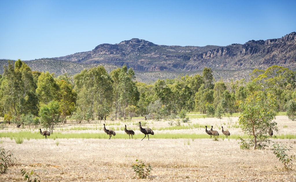
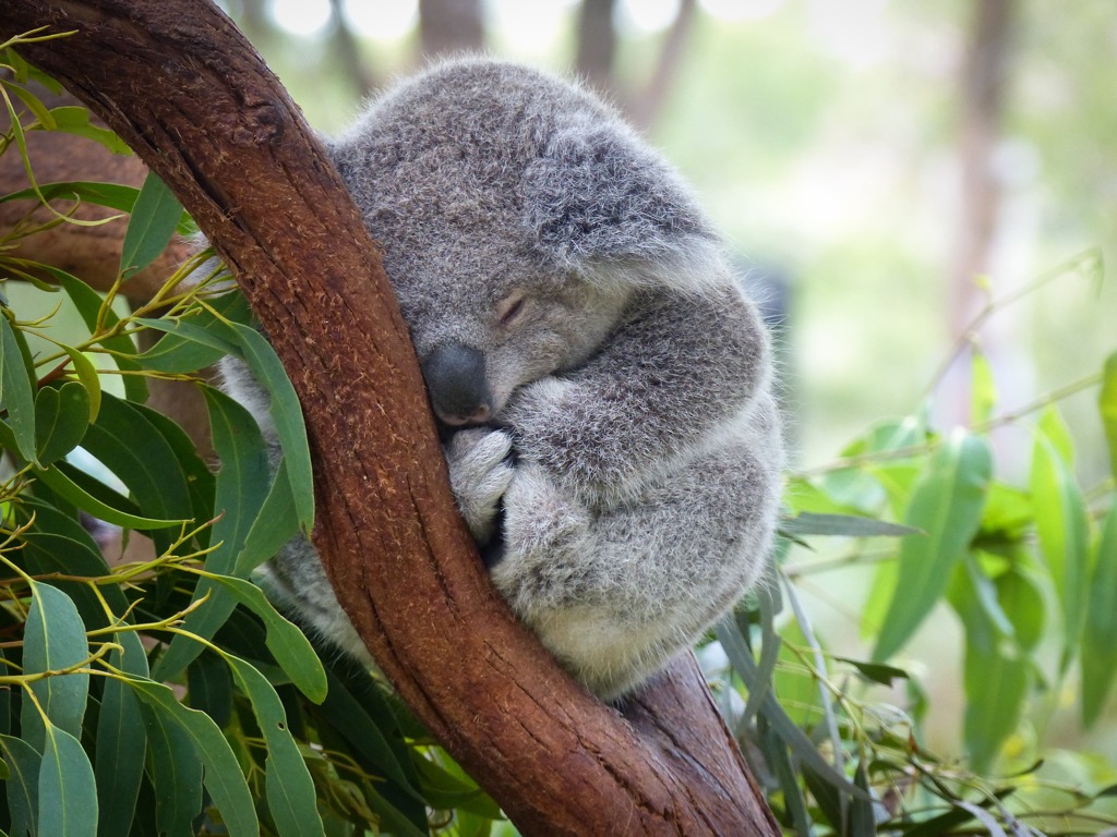
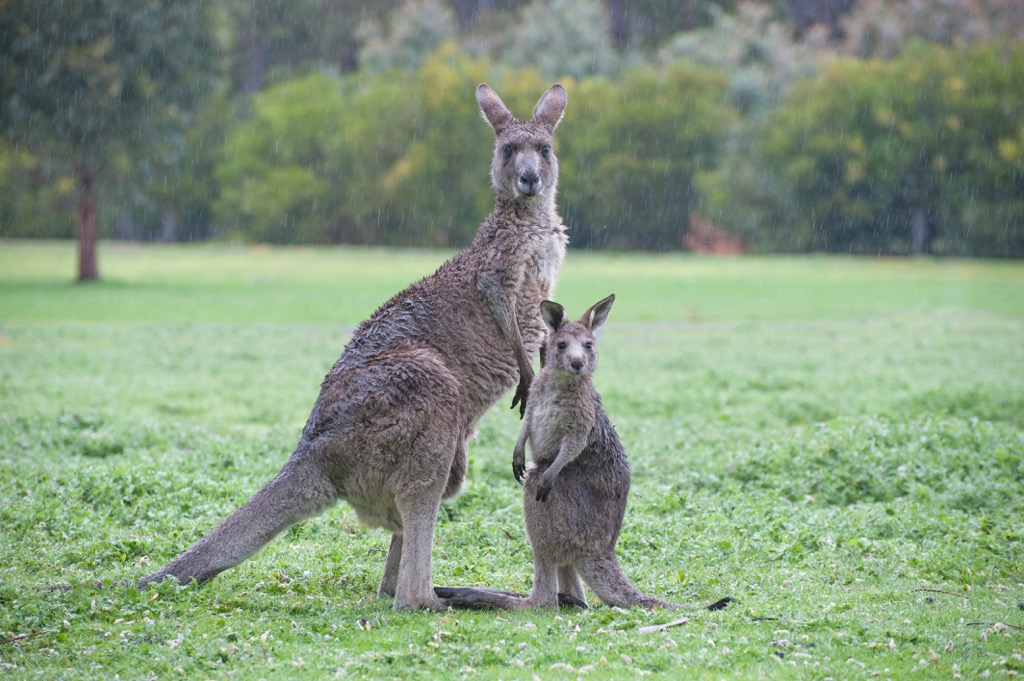
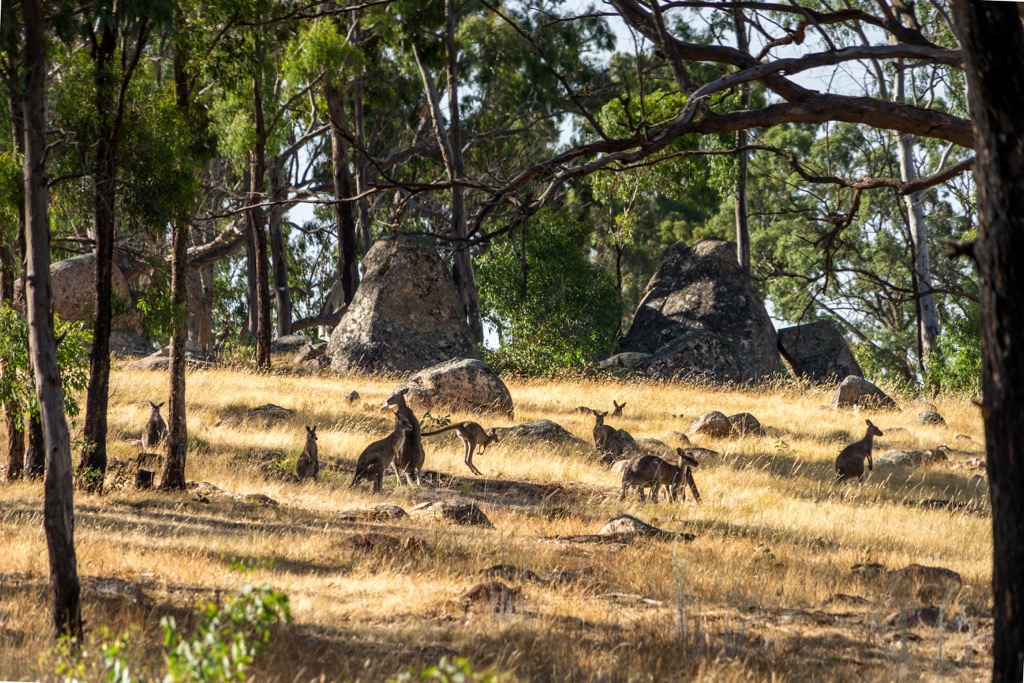
There are also several hundred varieties of bird species and wild animals in the Park. These include many native animals, such as kangaroos, wallabies, koalas, and wombats. You can also spot gliders and nocturnal possums including brushtail, ringtail and eastern pygmy possums and feathertail and squirrel gliders.
Grampians National Park is also a bird watchers paradise. Amongst the 350 bird species found in the region, you may spot emus, colorful parrots, kookaburras, honeyeaters and wedge-tailed eagles.
The Djab Wurrung and Jardwadjali people are the Traditional Owners of Grampians National Park. They refer to the area as Gariwerd, which means “mountain range created by Bunjil” because of its significance with the Dreaming story. According to the story, Gariwerd was central to the creator, Bunjil (Great Ancestral Spirit), who was responsible for the creation of many landscapes in western Victoria.
Gariwerd is one of the richest Indigenous rock art sites in south-eastern Australia. It’s estimated that around 90 percent of Victoria’s rock art can be found within the national park boundary with around 200 individual sites recorded. There is rock art depicting humans, animal tracks, birds and human hands in many locations around the park.
European settlement began in the 1830s with the arrival of Major Thomas Mitchell and later Edward Eyre. Settlers soon arrived to establish pastoral runs and wheat farms in the region after positive reports of fertile ground. The first vineyards in the area were also established in the mid-1800s, with many continuing to operate to this day.
Gold was discovered around Stawell and St Arnaud in the 1850s. The gold rush era of the early 1900s was centered around Mount William Goldmine at Mafeking until 1912. This heralded the construction of railways to Stawell, Ararat and Dunkeld which also contributed to the increase in tourism and recreation into the 20th century.
Tourist roads were constructed in the 1920s, which brought more visitors to the region. It was finally proclaimed a national park on 1 July 1984. It was then listed on the National Heritage List in 2006 for its outstanding natural beauty and Aboriginal cultural significance.
Grampians National Park is known as one of Victoria’s premier hiking destinations. There are plenty of trails to explore, from easy strolls to challenging multi-day walks across the ranges. No matter what kind of hike you’re looking for, there’s something for everyone in the park.
Here are some of the best hikes in Grampians National Park to check out on your next visit.
The northern Grampians lie north of the town of Halls Gap and around the Roses Gap area. This is the more remote and secluded part of the park, with some rugged terrain and incredible rocky landscapes to explore on foot.
There are two ways to reach the top of Mount Stapylton (518 m/1699 ft) in the northern Grampians region. The shorter and more popular option is on the 4 km (2.5 mi) return trail from Mount Zero Picnic Area. The other longer option is from Stapylton Campground and covers 12 km (7.5 mi) return.
Both trails meet at the base of Mount Stapylton after approaching the amphitheater from different sides. The final climb to the top is along an exposed rock face, which takes you around and up to the top of the highest point. To reach the very summit, there is a bit of scrambling involved, although the views can be admired from lower down too.
One of the more remote trails in the park, Briggs Bluff hike begins from Beehive Falls Car Park in the northern Grampians region. The 10.5 km (6.5 mi) return trail takes you across Beehive Falls and up to the top of the cliffs above.
The trail follows along the sandstone ridgeline before becoming more steep as you climb the rock face to the edge of the bluff. There’s no fenced lookout like nearby walks, so make sure you’re careful of the exposed ridge. You must return the same way.
As the name suggests, Mount Difficult (806 m/2644 ft) is one of the most challenging hikes in Grampians National Park. Known as Mount Gar to the Traditional Owners, this incredible rocky peak sits in the northern part of the park.
The 8.5 km (5.3 mi) return hike is a difficult walk requiring some climbing under cliffs and boulders and relentless zig zags up rocky slopes. However, you’re rewarded with incredible views for much of the way which makes the effort worthwhile.
The final walk along the exposed rock to the very top of Mount Difficult can be especially challenging in bad weather, so ensure you have enough time to make it back to the car park before dark.
The central Grampians is characterized by the Wonderland Range which towers over the small town of Halls Gap. This is the most visited part of Grampians National Park, with some great hikes to do.
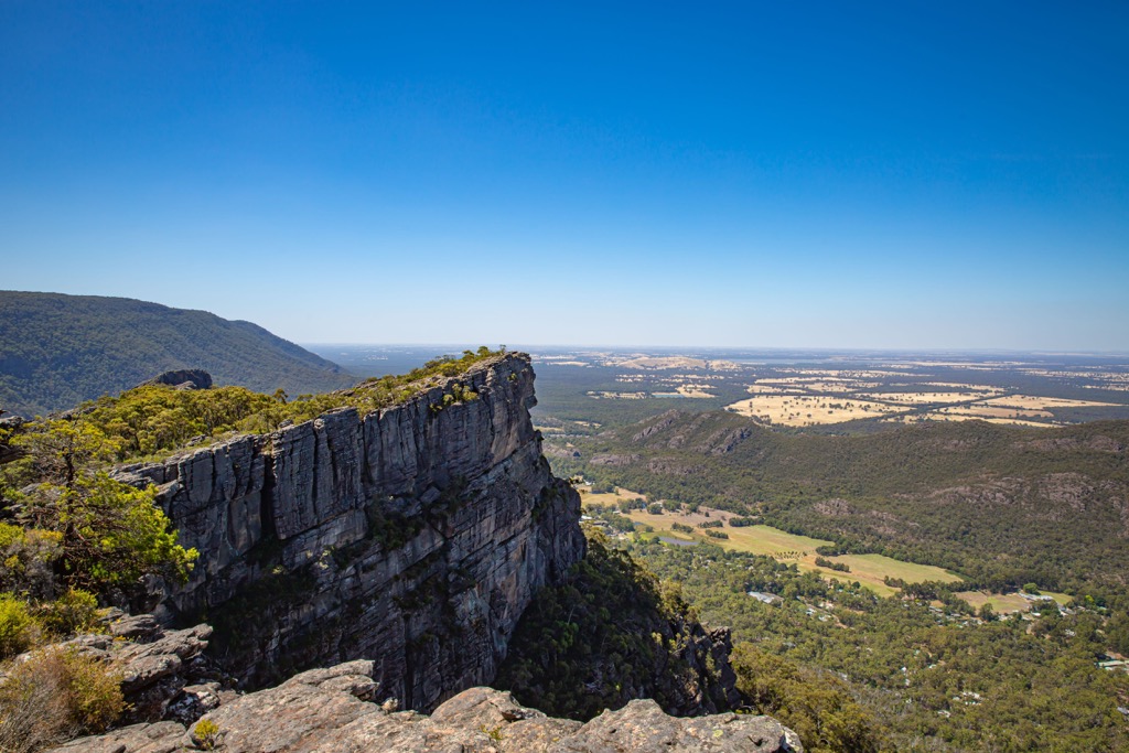
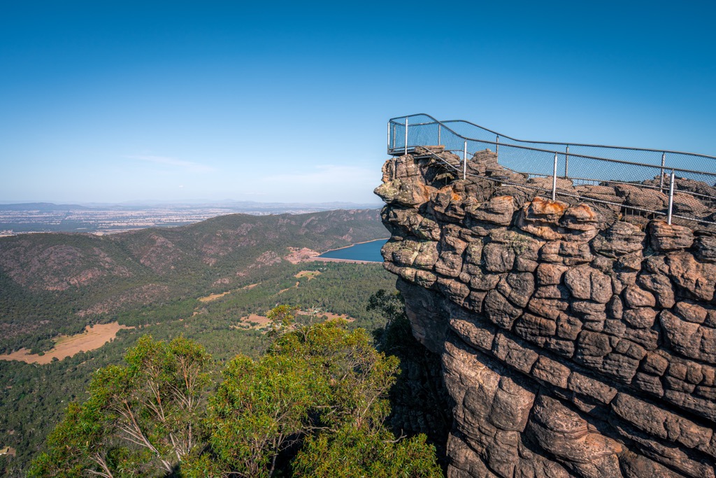
The Pinnacle Track is the most well-known hike in the Grampians National Park. The 4.2 km (2.6 mi) return trail leads walkers to the Pinnacle Lookout above Halls Gap town. The trail is a moderate hike with some rock hopping and steel ladders to climb to reach the exposed ridge of the Wonderland Range.
The lookout is a fenced platform over the edge of the ridge and is a great place to take photos of the surrounding area.
A great hike from near Halls Gap town, Boronia Peak (560 m/1837 ft) is a 6.5 km (4 mi) return trail to a lofty lookout. The trail starts at the end of Tandara Road and follows a well-worn track through the forest.
At the top of the ridge, there’s some moderate rock scrambling required to reach the unfenced and exposed peak. Be careful if you’re not confident on your feet. The view from the top overlooks Halls Gap town and Lake Bellfield.
A longer hike in the Central Grampians region, the 9.5 km (6 mi) return trail begins from Rosea Car Park just a 10 minute drive from Halls Gap. The long walk takes you first through the lowland forest before emerging above the treeline onto a more exposed sub-alpine landscape.
There’s lots of moderate rock hopping and scrambling following painted arrows to traverse the ridgeline to the top of Mount Rosea (1009 m / 3310 ft). There is a fenced viewpoint at the summit offering panoramic views of the whole central Grampians region.
The southern Grampians are considered to be from Dunkeld up towards Halls Gap. It includes some of the shortest but most impressive hikes, including to some of the more prominent peaks.
If you want to reach the highest point of Grampians National Park, then the relatively moderate stroll to Mount William (1170 m/3838 ft) should be on your list. The mountain is known as Mount Duwil to the Traditional Owners.
You can drive for most of the way to Mount William Car Park, from where you must walk the last 2 km (1.2 mi) on a sealed road to the highest point.
At the top you’ll find phone towers and a sundial, but the views are not as impressive as some of the other peaks in the southern and northern Grampians.
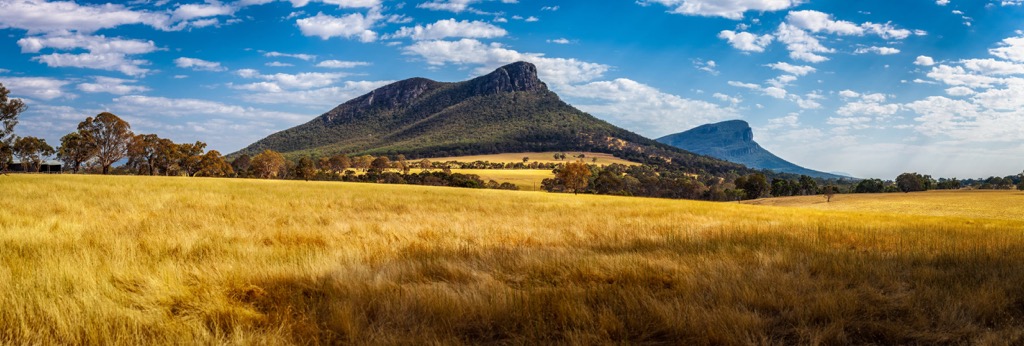
One of the two prominent peaks in the southern Grampians, Mount Sturgeon (550 m/1804 ft) is an impressive and steep hike from the junction of Grampians Road and Victoria Valley Roads.
The steep and relentless climb can be a challenge, but the expansive views sweep over the entire national park and surrounding farmland. The 7 km (4.3 mi) return hike can take anywhere from 2 to 4 hours to complete.
This is the other prominent peak in the southern part of the Grampians National Park and is a popular hike. The 6.5 km (4 mi) return trail to Mount Abrupt (826 m/2709 ft) is a steep hike with plenty of switchbacks cut into the slopes and a final rocky climb to the top.
However, the sweeping views are some of the best in the entire park area. The trail begins and ends from a small car park off the side of the Grampians Tourist Road.
You must be fit and experienced to tackle one of these multi-day trails. However, if you’re a keen hiker, they offer an immersive and spectacular experience in Grampians National Park.
A relatively new addition to the park's landscape, the Grampians Peaks Trail is a 160 km (99.4 mi) one way hike from Mount Zero in the north to Dunkeld in the south. It takes in some of the highlights of the park area on the almost two-week trek, including Red Man Bluff (998 m/3274 ft), Mount William (1170 m/3838 ft), Major Mitchell Plateau, Signal Peak (626 m/2053 ft), Mount Abrupt (826 m/2709 ft) and Mount Sturgeon (550 m/1804 ft).
There are purpose built, hike-in campgrounds along the trail for hikers to camp at night. You can choose to complete a two day section for a weekend or the full distance over 13 days. You must book the hike on the Parks Victoria Website prior to beginning.
For a shorter but equally challenging hike, the Major Mitchell Plateau is a 40 km (24.8 mi) circuit that usually takes around 3 days. It generally starts from Sheeps Hill and climbs the ridgeline towards Mount William (1170 m/3838 ft) summit, the highest point in the park.
The trail then continues to Boundary Gap and another exhilarating climb to Major Mitchell Plateau, which offers incredible panoramic views. It then returns to the start point via Jimmy Creek and Wannon River. The two campgrounds in use on the trail are First Wannon Hiker Campsite and Jimmy Creek Campground.
If you want to spend a few days in Grampians National Park, there are various campgrounds within the park boundary. Most campgrounds require bookings and payment, through the Parks Victoria website, but there are also a couple of free campgrounds available too.
Campgrounds that require bookings and payment are as follows:
If you’re traveling on a budget, you can find the following free campgrounds which operate on a first come first served basis:
Grampians National Park is very accessible and well serviced by small country towns and major highways. Depending on which direction you’re driving from, there are several towns where you can stock up on supplies or find good accommodation to spend the night.
These are the main towns located near the national park:
For skiing and snowboarding enthusiasts, there are 4 ski resorts in Victoria, which are located in the Alpine National Park in the east of the state. So it is also one of the two main areas for skiing in the Australian Alps, the highest region of the Great Dividing Range, which, in turn, is the main mountain range in the country, in pair with neighboring Kosciuszko National Park in New South Wales.
The largest ski resort in Victoria is Falls Creek with more than 50 km (31 mi) of slopes and more than 15 ski lifts. Other major areas for skiing in Victoria are Mt. Buller of a similar size, as well as Mount Hotham with more than 20 km (12 mi) of slopes and more than 10 ski lifts, and Mount Baw Baw with more than 10 km (6 mi) of slopes and more than 5 ski lifts. These are also the main ski resorts near Melbourne, the largest city in Victoria.
Check the Victoria ski resorts map as well as the larger Australia ski resorts map in the World Mountain Lifts section of the site. It includes information about open ski lifts / slopes in Victoria in real-time with opening dates and hours. There are also year-round cable cars, funiculars, cog railways, aerial tramways, and all other types of mountain lifts.
Grampians National Park is located in western Victoria. While you’ll find plenty of small towns and regional cities close to the park, it’s quite a distance from any of the major cities in Australia. If you’re looking to start or end your trip to the national park in a city, then check out one of these options.
The closest capital city to Grampians National Park is Melbourne, which is located 260 km (161 mi) to the southeast of the park. It’s a relatively easy drive along the Western Highway from the city, with many towns on the way. Melbourne is the main transport hub of Victoria. You’ll find the main domestic and international airport there, as well as train and bus stations.
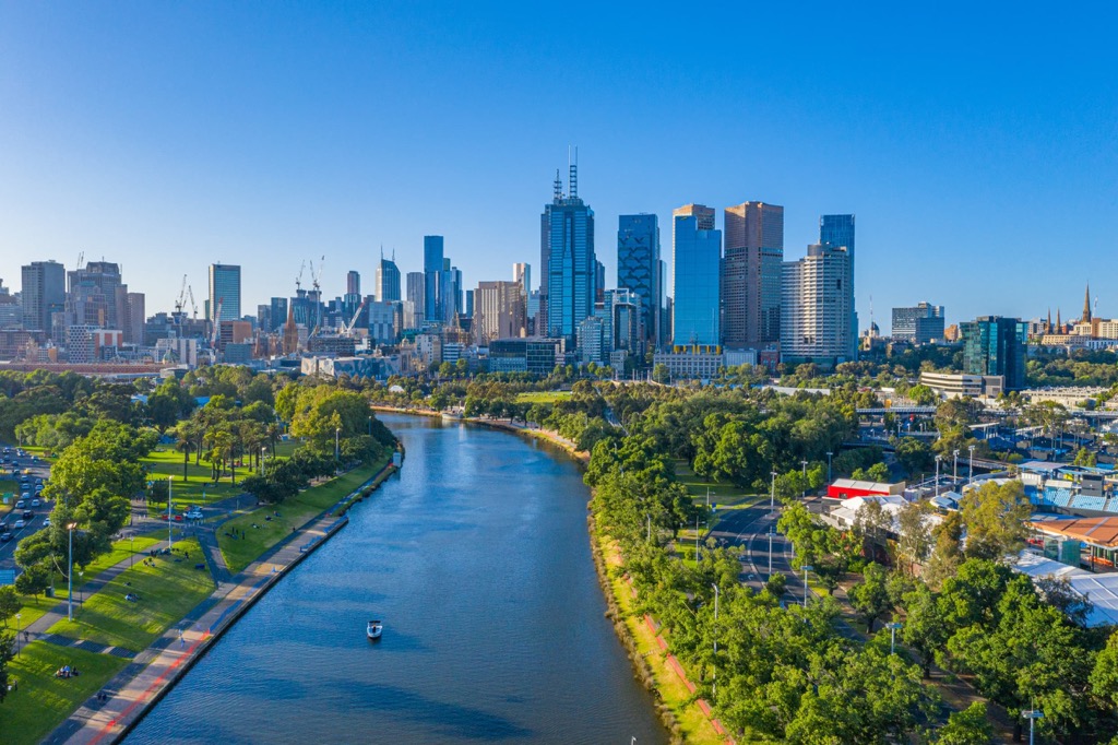
Melbourne is the capital city of the state of Victoria. It’s well known for its lively nightlife, coffee culture and shopping scene. There’s plenty of things to do there, with iconic attractions including the Melbourne Arts Precinct, Federation Square, Bourke Street Mall and Southbank area.
In the other direction, Adelaide is 475 km (295 mi) to the northwest of Grampians National Park. Adelaide is the capital city of South Australia and another place to possibly start your journey. Grampians National Park can be easily reached by driving on the Western Highway from Adelaide.
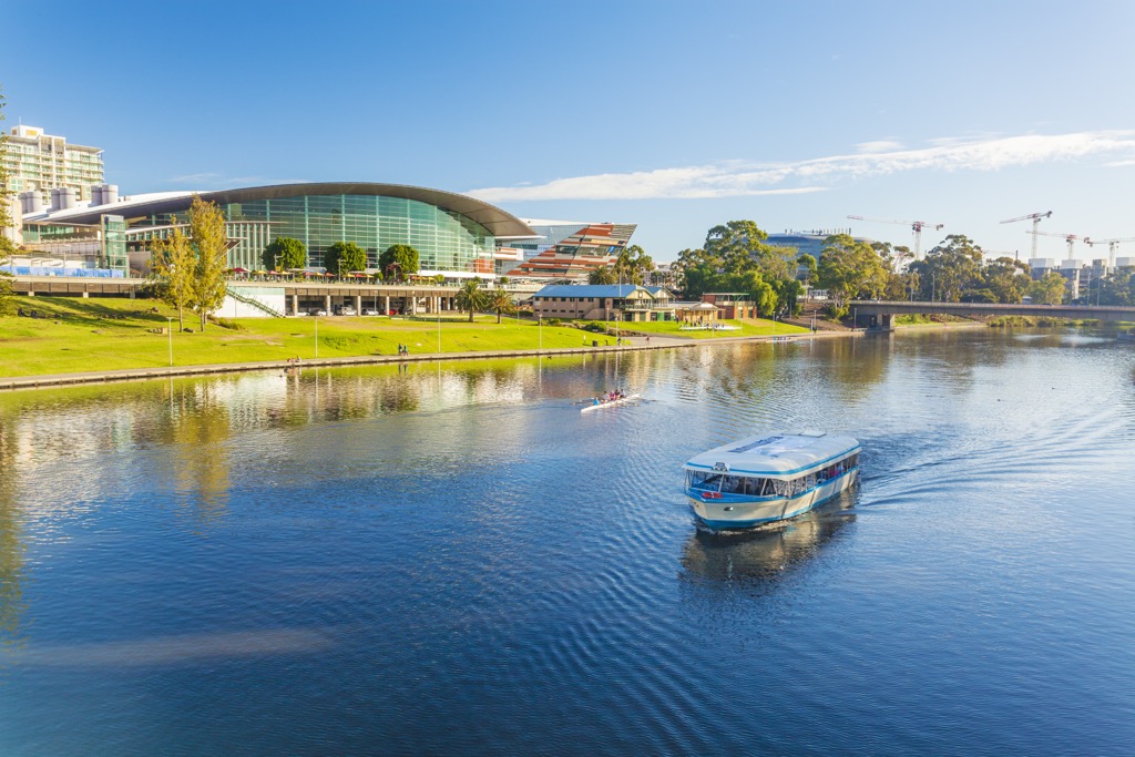
Adelaide has a domestic and international airport, as well as a large bus station. The coastal city is a lively place, although smaller than Melbourne. It still boasts a creative arts scene and plenty of things to do including visiting the incredible gardens, conservation parks, Glenelg coastal area and Art Gallery of South Australia.


