Mount Kosciuszko ( KOZ-ee-USS-koh; Ngarigo: Kunama Namadgi) is mainland Australia's tallest mountain, at 2,228 metres (7,310 ft) above sea level. It is located on the Main Range of the Snowy Mountains in Kosciuszko National Park, part of the Australian Alps National Parks and Reserves, in New South Wales, Australia, and is located west of Crackenback and close to Jindabyne, near the border with Victoria. Mount Kosciuszko is ranked 35th by topographic isolation.
There's a trail called Kosciuszko Walk leading to the summit. Mount Kosciuszko is one of the 1 peaks along the Mount Kosciuszko Summit Walk.
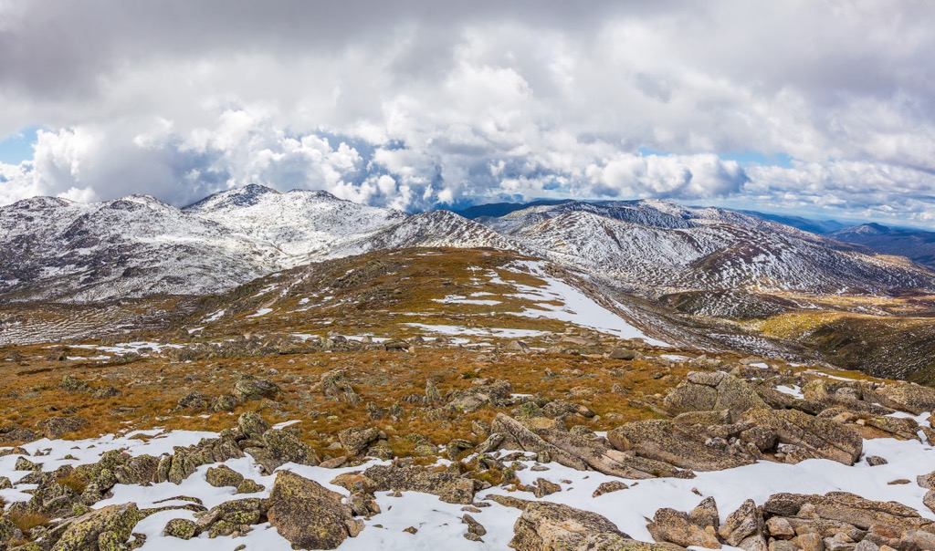
The nearest mountain hut is Seamans Hut located 1 863m/6 113ft ENE of the summit.
By elevation Mount Kosciuszko is
# 1 out of 5016 in New South Wales # 1 out of 233 in Kosciuszko National Park # 1 out of 308 in Snowy Monaro Regional Council # 1 out of 230 in Snowy Valleys Council # 8 out of 21731 in Australia # 1 out of 12558 in the Great Dividing Range
By prominence Mount Kosciuszko is
# 1 out of 5016 in New South Wales # 1 out of 233 in Kosciuszko National Park # 1 out of 308 in Snowy Monaro Regional Council # 1 out of 230 in Snowy Valleys Council # 2 out of 21731 in Australia # 1 out of 12558 in the Great Dividing Range
We use GPS information embedded into the photo when it is available.
3D mountains overlay
Adjust mountain panorama to perfectly match your photos because recorded by camera photo position might be imprecise.
Move tool
Rotate tool
Zoom
More customization
Choose which peak labels should make into the final photo and what photo title should be.
Next
Photo Location
Satellitte
Flat map
Relief map
Latitude
Longitude
Altitude
OR
Latitude
°'''
Longitude
°'''
Apply
Register Peak
Peak Name
Latitude
Longitude
Altitude
Register
Teleport
PeakVisor
This 3D model of Sagarmatha National Park in Nepal was made using the PeakVisor app topographic data. The mobile app features higher precision models worldwide, more topographic details, and works offline. Download PeakVisor maps today.
Download OBJ model
PeakVisor
The download should start shortly. If you find it useful please consider supporting the PeakVisor app.
PeakVisor for iOS and Android
Be a superhero of outdoor navigation with state-of-the-art 3D maps and mountain identification in the palm of your hand!