
Scan the QR code and open PeakVisor on your phone
The Elaho Range include 11 named peaks. The highest is Elaho Mountain at 2,799 m. Other notable peaks include Mittelberg Mountain, Totter Peak and Racoon Mountain.
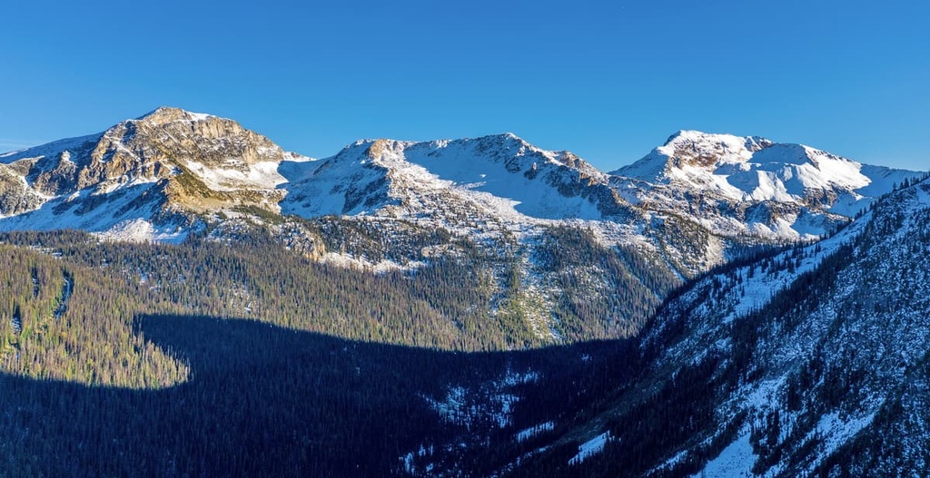
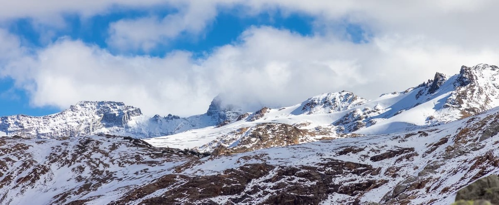
The Elaho Range is a subrange of the Pacific Ranges that’s located along the coast of British Columbia, Canada. The range is home to old-growth forests with Douglas fir trees that are estimated to be over 1,000 years old. The Elaho Glacier is one of many glaciers that extend between the 11 named peaks of the Elaho Range. The highest and most prominent peak in the range is Elaho Mountain (2,799 m/9,183 ft).
The western coast of Canada is covered with the spectacular wilderness and scenic mountains of the Canadian Cordillera.
The westernmost mainland ranges in this part of Canada are the Coast Mountains, which stretch from the Fraser River to Yukon, along the coast of British Columbia. This range includes a number of subranges, such as the Pacific, Kitimat, and Boundary Ranges.
The Elaho Range is a subrange of the Pacific Ranges that’s located in southwest British Columbia. The range covers about 471 square kilometers (182 square miles) of land in the qathet and Squamish-Lillooet Regional Districts. The relatively untouched wilderness of the Elaho Range is accessible via the Squamish Forest Service Road and is largely protected as part of Clendinning Provincial Park.
British Columbia is home to hundreds of provincial parks that protect unique and rare topographic features and habitats. Clendinning Provincial Park preserves old growth forests, hanging valleys, icefalls, and the glaciated peaks of the Elaho Range. Other parks and protected areas that are located near the Elaho Range include:
The Elaho Range is a subrange of the Pacific Ranges, which themselves are a subrange of the Canadian Coast Mountains. The Coast Mountains consist of sedimentary and volcanic rocks, most of which formed as outboard terranes that were later accreted to the west coast of Canada.
Furthermore, the layers of rock that form the Coast Mountains contain batholith intrusions that are granodiorite and quartz diorite in composition. These intrusions are generally called the Coast Intrusions. Some of the subranges in the Coast Mountains consist of sedimentary and volcanic rocks with a granitic core while others are largely granitic in composition.
As part of the Pacific Ranges, the Elaho Range are essentially granitic mountains. The Pacific Ranges are home to the tallest peaks in the Coast Mountains as they contain peaks that once extended above the Pleistocene ice sheet as nunataks.
The lower summits in the range were rounded by the ice sheet. Meanwhile, the high peaks in the range, while not overrun by the ice sheet, were scoured out by cirque glaciers.
There is significant evidence of the glacial erosion on the Elaho Ranga that occurred during the Pleistocene. However, the Elaho Range is still home to the Elaho Glacier, which covers the central portion of the range. Glacial erosion is ongoing in the range to this day.
Within the Coast Mountains, there is a remarkable difference between the heavy vegetation of the western ranges and the eastern ranges. The eastern ranges, such as the Chilcotin Ranges, contain open forests with little to no undergrowth while the western slopes are covered in dense temperate rainforests.
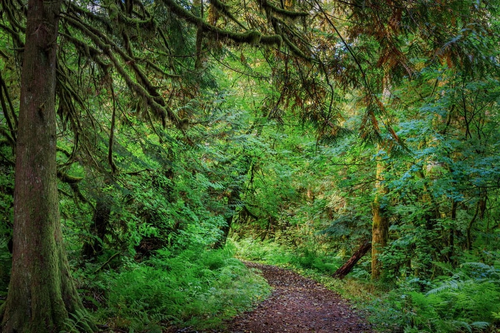
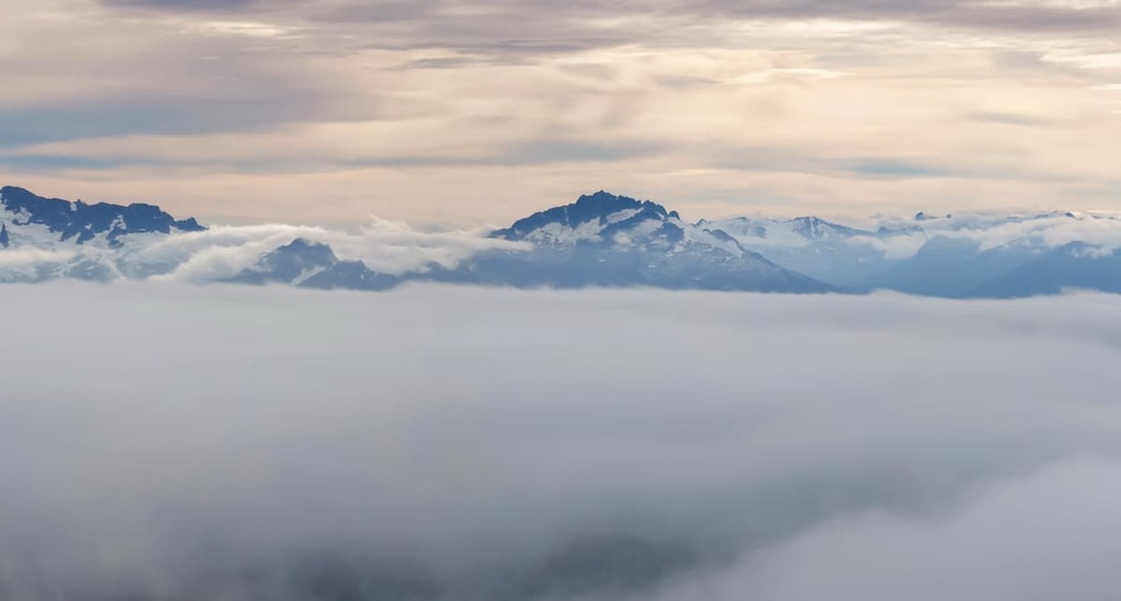
The easternmost ranges of the Coast Mountains lie in the rain shadow of the highest peaks while the western ranges, including the Elaho Range, receive a tremendous amount of precipitation. Laying less than 20 km (12 mi) from tidal waters, the lower slopes and valleys of the Elaho Range are dominated by ancient rainforests while the peaks are covered by glaciers and snowfields.
The rainforests of the Elaho Range are filled with tree species such as western hemlock, western redcedar, amabilis fir, Sitka spruce, and Douglas fir. The upper slopes are also home to stands of yellow cedar and mountain hemlock.
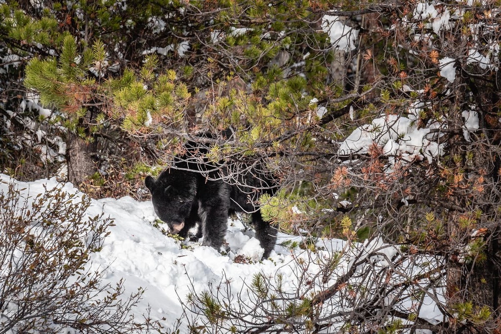
The area surrounding and including the Elaho Range provides important habitat for grizzly bears and black bears. The valleys alongside the range are also migration corridors for black-tailed deer, mountain goats, wolves, and cougars.
The waters of the Elaho River are also home to an abundance of fish species. Anecdotally, the river is home to coho and Chinook salmon, though they are now rarely spotted in the upper parts of the river’s watershed. The waters of the are also inhabited by Dolly Varden, Arctic char, steelhead salmon, bull trout, and coastal cutthroat trout, though some of these are potentially introduced species.
The Cordilleran ice sheet started melting and receding from the valleys of the Pacific Ranges about 15,000 years ago. As the ice receded, vegetation started to grow, which eventually attracted migrating herds of animals.
These herds of animals attracted many species of predators into the new territory. Eventually humans migrated into the region in search of good hunting opportunities. The Elaho Mountains are located in the traditional territory of the St’át’imc and Squamish First Nations. The Squamish Nation is part of the Coast Salish culture while the St’át’imc First Nations are part of the Interior Salish culture.
The Coast Salish culture developed along the west coast of Canada on the islands and along the coast of what’s now called British Columbia. Totem poles and cedar longhouses are a characteristic of the Coast Salish culture that developed over the course of thousands of years along the resource-abundant coast.
The Interior Salish diverged from their coastal ancestors around 4,000 years ago when they moved inland. When members of the Salish culture moved inland into the heart of British Columbia, the region was already home to other communities and nations.
It is uncertain as to exactly why the Interior Salish culture flourished while the previous cultures were lost to history; regardless, the Salish culture came to dominate the Interior. It is believed that the people of the Salish culture had a superior knowledge of fishing that allowed them to survive the changing climatic conditions of the time, when large prey animals became more scarce in the region.
However, despite the fact that the St’át’imc and Squamish First Nations have long lived in the valleys and lower slopes of the Elaho Range, it’s unlikely that anyone had ever summited any of the range’s peaks before about the twentieth century.
The glaciated and otherwise rugged nature of the range’s highest peaks means that climbing in the area generally requires modern climbing techniques and equipment, particularly around the Elaho Glacier.
That said, the area around the nearby Elaho River was opened up to logging in the early 1960s. This has become a point of much contention in the region as the range is home to a sizable amount of old growth forest.
In particular, there are a number of stands of ancient trees found in the forests of the Elaho Range. One such tree, the Elaho Giant (a Douglas fir), was believed to be around 1,000 years old when it died in a wildfire in 2015.
However, the Elaho Range’s main protected area, Clendinning Provincial Park, was not established until 1996, when it was declared a Canadian Protected Area as a result of work by the Squamish Nation and activists such as John Clarke and Randy Stoltmann. It was made a provincial park in 1998 and it currently encomapsses 303 sq. km (117 sq. mi) of land.
The major hiking areas in the Elaho Range are part of Clendinning Provincial Park. While there are no developed hiking routes in Clendinning Provincial Park, there are still many opportunities for backcountry travel.
Hikers can travel along Clendinning Creek and the Elaho River, which serve as the primary access routes to the Elaho Range.
History tells of two surveyors, Clark and Braden, who went missing while traveling along this same Clendinning Creek in 1892. The following year, another pair of surveyors, Smith and Doolittle set out along Chilko and Clendinning Creek to find the missing pair; however, they only managed to find the cap of one of the missing men.
While the surveyor’s expedition didn’t go as planned, most visitors to the Elaho Range are able to enjoy the range’s pristine wilderness and return home. Visitors to the backcountry of the Elaho Range who have the skills to be self-sufficient in an isolated wilderness can set out for an adventure in the beautiful solitude of the region.
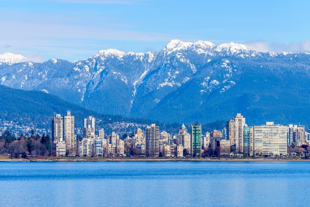
The Elaho Range is located in an isolated area of the rugged Pacific Ranges. While the major city of Vancouver is situated only about 150 km (90 mi) to the south of the range, the range is quite isolated and remote. The following are some of the cities and towns located near the Elaho Range that you can check out during your travels.
Located about 200 km (120 mi) to the south of the Elaho Range, Vancouver is a city nestled along the banks of the Fraser River. Vancouver is the largest city in British Columbia, and it has many cultural attractions for visitors to enjoy, including libraries, museums, performing arts shows, art galleries, and a vibrant nightlife. The city also hosts a number of annual festivals, such as the Pacific National Exhibition.
Vancouver has many great paths to walk, especially in Stanley Park, which is one of North America’s largest urban parks. Some popular hikes around Vancouver include the trails to St. Marks Summit, Quarry Rock, Norvan Falls, and the Grouse Grind. You can also check out both Pacific Spirit Regional Park and Burnaby Lake Park during your visit to Vancouver.
Furthermore, some of the amazing provincial parks that are easily accessible from the Lower Mainland include Garibaldi Provincial Park, Pinecone Burke Provincial Park, Golden Ears Provincial Park, and Mount Seymour Provincial Park. All these parks offer incredible trails and backcountry experiences for the more adventurous among us to check out.
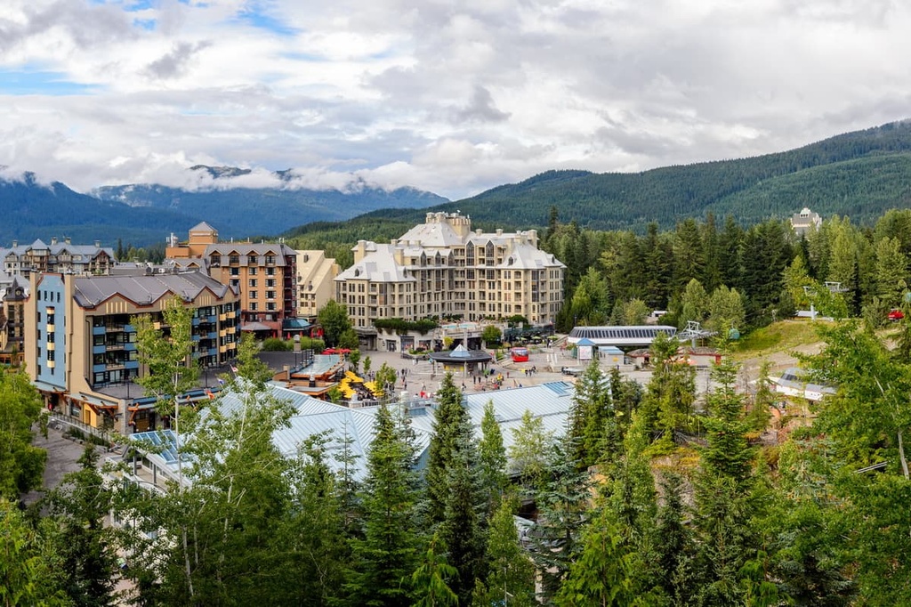
Whistler is a resort community that is located about 50 km (30 mi) to the southeast of the Elaho Range and 120 km (72 mi) away from Vancouver. The community has over two million visitors every year who come for alpine skiing and snowboarding during the winter season. Whistler also offers downhill and mountain biking at the Whistler Blackcomb Resort during the summer months.
Some of Whistler’s popular hikes include the Singing Pass Trail and the High Note Trail to the top of Whistler Mountain. Additionally, one hike that you don’t want to miss while visiting Whistler is the short trek to the train wreck at the south end of town.
Whistler is situated near a number of fantastic hiking areas, such as Garibaldi Provincial Park, Callaghan Lake Provincial Park, and Tantalus Provincial Park. Other nearby wilderness areas to check out include Clendinning Provincial Park and Blackcomb Glacier Provincial Park.
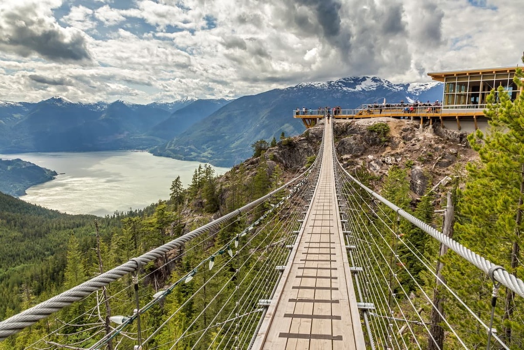
Located at the north end of Howe Sound on the Sea to Sky Highway in British Columbia, Squamish is a community that’s situated 60 km (36 mi) to the south Whistler and about 120 km (72 mi) south of the Elaho Range. Like Whistler, Squamish is a popular destination for tourists in search of outdoor adventure and recreation.
However, while Whistler is known for its ski hills, Squamish is world renowned for its thousands of climbing and bouldering routes. Indeed, climbing is a very popular sport around Squamish, and there are some world-renowned climbing areas to be found within Squamish’s city limits.
Climbing attractions in Squamish include the granite massif called the Stawamus Chief, which features over 300 climbing routes, as well as Shannon Falls, Murrin Park, The Malamute, and the Smoke Bluffs, all of which contain an additional 1,500 routes. Additionally, the area is home to over 2,500 bouldering problems that are published in local guidebooks.
Some of the other nearby hiking areas to check out during a visit to Squamish include Tantalus Provincial Park, Mount Seymour Provincial Park, Garibaldi Provincial Park, and Cypress Provincial Park.


The highest peak in the Elaho Range is Elaho Mountain, at 2,799 m.
The Elaho Range have 11 named peaks.


