
Scan the QR code and open PeakVisor on your phone
With rugged alpine summits above treeline, challenging trails and incredible views, the High Peaks Wilderness is one of the premiere hiking destinations in the northeastern US. There are over 200 miles (322 km) of hiking trails and 126 named mountains in the wilderness, including Mount Marcy, the highest point in the US state of New York at 5,335 ft (1,626 m).
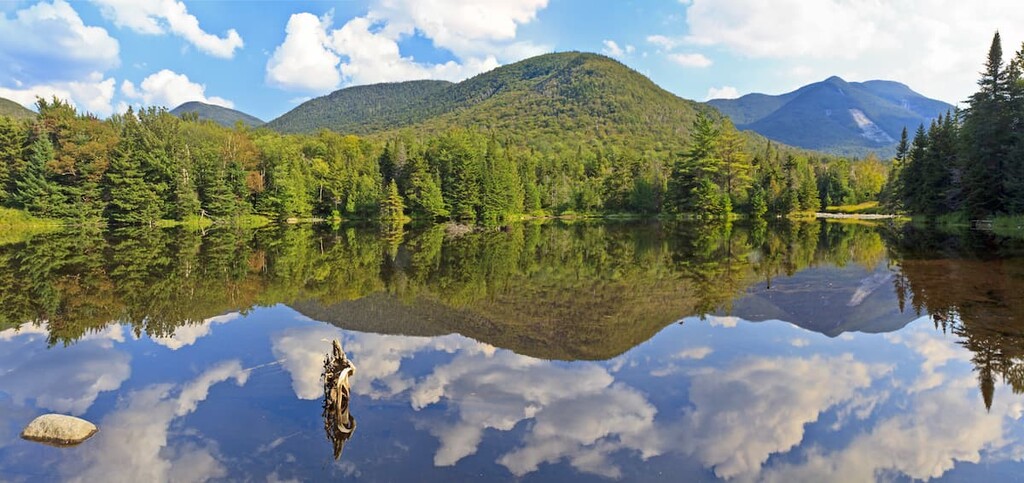
The High Peaks Wilderness is a 430 sq. mile (1,115 sq, km) designated wilderness area in the north-central region of the Adirondack Park. It’s the largest wilderness area in the park and in all of New York.
The High Peaks Wilderness lies to the south of the town of Lake Placid and to the west of Interstate 87 (called I-87 or the Northway). It is also roughly bounded to the north by Route 86, to the west by Route 3, and to the south by Route 28N. Meanwhile, the Raquette River serves as the western edge of the High Peaks Wilderness.
Most of the Adirondacks’ 46 highest peaks are located in the wilderness area (a notable exception is Whiteface Mountain, New York’s fifth highest peak, which is located in the nearby McKenzie Mountain Wilderness).
The High Peaks region is one of the most popular destinations in the park, especially among peak baggers. Hikers who summit all 46 of the High Peaks are known as 46ers—a well-respected club in the Adirondacks due to how tough some of these climbs can be.
You can use the AHP46 list in the PeakVisor app to track your own peak bagging adventure in the Adirondacks, though you’ll need to register your climbs with the ADK46ers in order to claim your status as an official 46er. (There’s also a special badge for hikers who summit all the peaks in the winter.)

The High Peaks are also a major backpacking destination, with over 80 shelters called lean-tos located on the wilderness’ trails. In addition to hiking, the area is a popular destination for rock climbing, skiing, and canoeing. The Adirondack Canoe Route travels 23 miles (37 km) through the western edge of the wilderness.
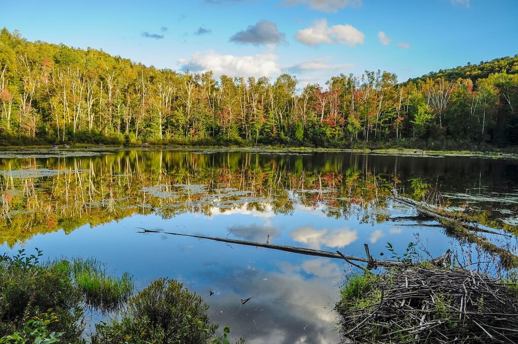
There are swamps and low-lying marshes in the wilderness area, but most of the terrain is high mountains. The highest-elevation lake in New York, scenic Lake Tear of the Clouds, is also located in the High Peaks Wilderness at 4,000 ft (1,219 m) of elevation.
Situated in the heart of the Adirondack Park, the High Peaks Wilderness is surrounded by other excellent hiking areas. The Sentinel Range Wilderness, Giant Mountain Wilderness, Jay Mountain Wilderness and Hurricane Mountain Primitive Area are all adjacent to the High Peaks Wilderness or located just a short drive away.
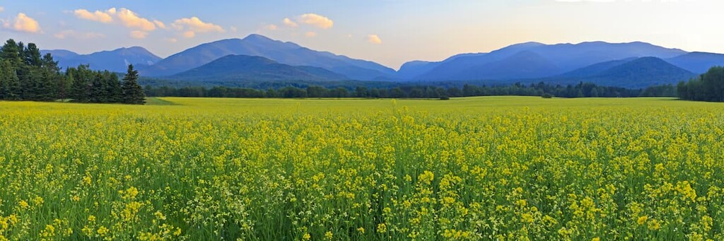
From the open summits of the High Peaks, hikers can take in sweeping views as far south as the Catskills in southern New York, and as far east as both the Berkshires in Massachusetts and across Lake Champlain to Vermont’s Green Mountains. On a clear day, it’s also possible to see as far north as the city of Montreal in Canada.
The High Peaks Wilderness contains the highest mountains of the Adirondacks, a unique dome-shaped mountain range that’s some 160 miles (257 km) wide and 1 mile (1.6 km) high.
The Adirondacks are one of the only mountain ranges on the eastern coast of the US that aren’t part of the Appalachians; rather they have their own distinct geologic history.
The Adirondacks began rising during the Grenville Orogenic Cycle, and they’re still rising about 2 millimeters per year, which is faster than their current rate of erosion. Indeed, some of the bedrock rock of these mountains is over a billion years old.
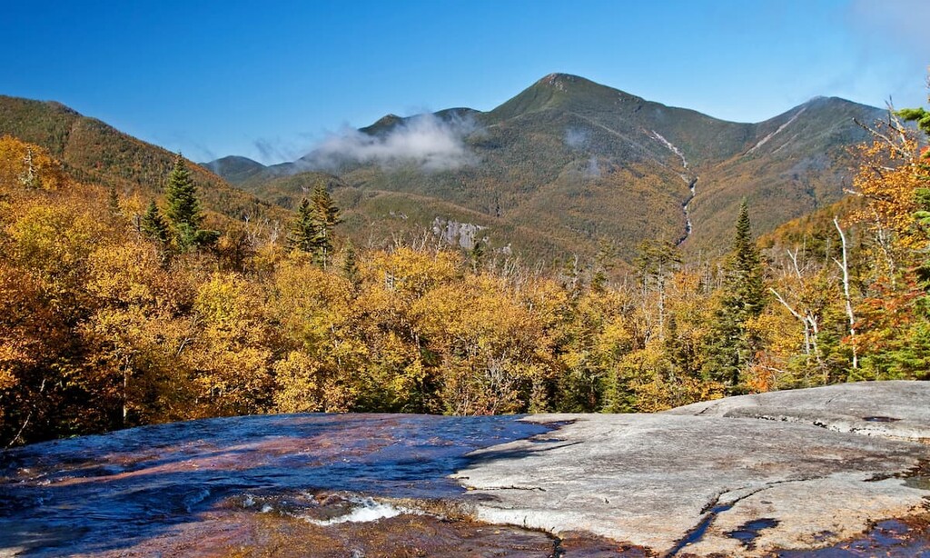
While the bedrock is ancient, most of the landforms in the High Peaks today were formed relatively recently by flowing glaciers during the last glacial maximum. You can still see the effects of glaciation in the amphitheater-shaped cirques, kettle ponds and large boulders (called glacial erratics) found around the High Peaks.
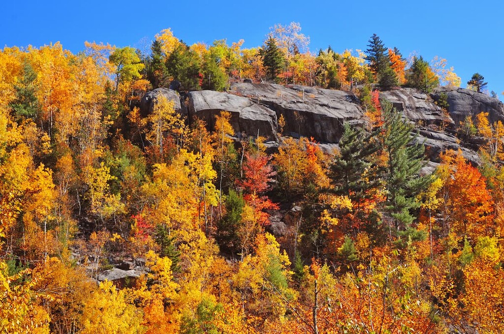
Most of the rock that makes up the High Peaks region is anorthosite, a relatively rare intrusive igneous rock with a high concentration of plagioclase feldspar. Anorthosite is formed under intense pressures that can only occur deep in Earth’s crust towards the mantle. While it’s rare on earth, anorthosite is relatively common on the moon.
The High Peaks Wilderness is home to the sources of several rivers. Notably, Lake Tear of the Clouds, which is believed to be the headwaters of the Hudson River, as well as the sources of the east and west branch of the Ausable River, are all located on Mount Marcy.
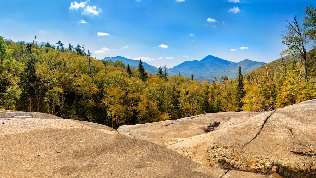
The highest and most prominent point in the High Peaks Wilderness is Mount Marcy at 5,335 ft (1,629 m). Other notable peaks include Algonquin Peak, Haystack Mountain, Skylight Mountain and Basin Mountain.
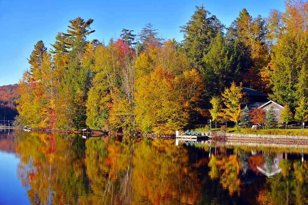
Like the rest of the Adirondacks, the High Peaks Wilderness is covered mostly by a mix of boreal and northern hardwood forests. Pine, spruce, larches, beech and maple trees are common.
The eastern half of the wilderness area features the highest peaks and more coniferous forest, while the western half is considerably lower in elevation and is home to a larger concentration of wetlands.
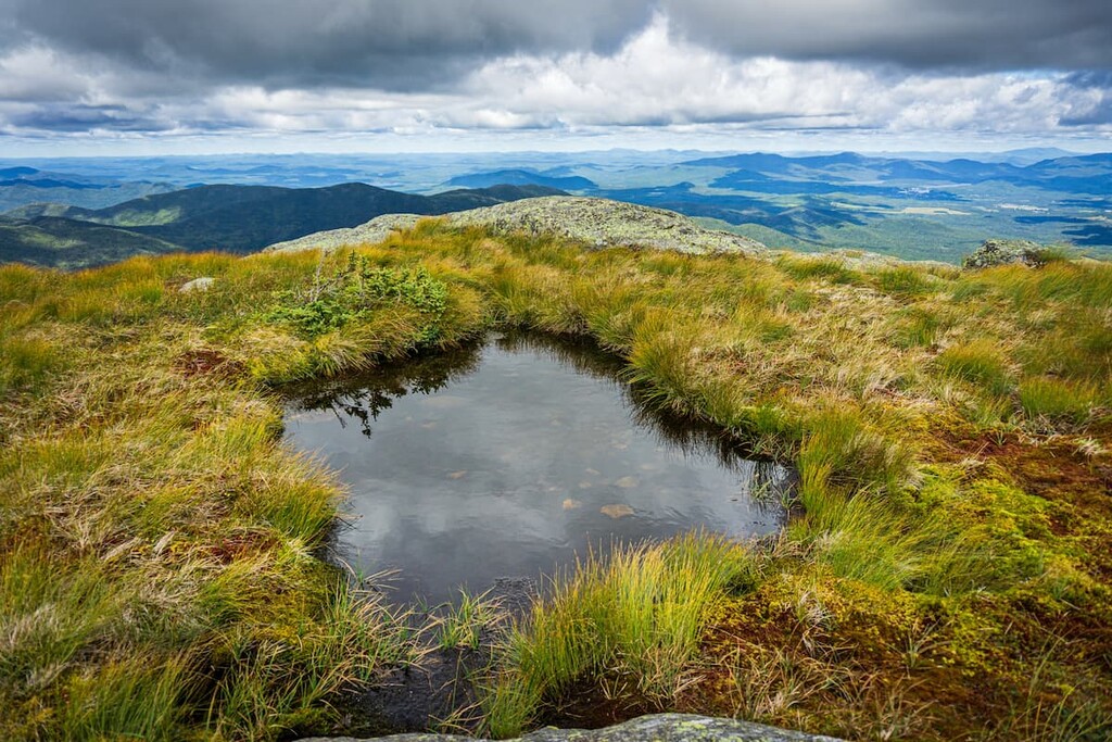
One of the most interesting features of the High Peaks are the roughly 65 acres (26 ha) of alpine tundra scattered across 19 peaks in the region. These above-treeline zones contain hardy, low-lying plants that are adapted for life in the Arctic tundra that’s located thousands of miles to the north.
These alpine zones are some of the rarest ecosystems in the northeast, with the only a few other examples found on the highest peaks in Vermont, New Hampshire and Maine. Some of the rare plants here include sandwort, bearberry willow, and Boott’s rattlesnake root.
The largest mammals in the High Peaks Wilderness are moose, deer and bears. Bear activity is high enough that campers are required to use bear canisters in the eastern part of the wilderness area.
Common birds in the High Peaks Wilderness include wild turkeys, blue birds, and great blue herons. Hikers have also spotted bald eagles, ospreys, and great horned owls.
The oldest human settlements in the Adirondack region date back more than 11,000 years. The most recent Indigenous inhabitants, members of Iroquois groups, arrived in the area between 1,200 and 4,000 years ago.
The most active tribe in the High Peaks region prior to European contact was the Mohawk (Kanienʼkehá꞉ka), the easternmost member of the Iroquois Confederacy (Haudenosaunee). There were approximately 8,000–11,000 Mohawk people in the Adirondack region before the arrival of European settlers.
The arrival of settlers of European descent forced Tribal Nations towards more isolated and inaccessible areas like the Adirondacks. The Mohawk were forced northward toward the Canadian border, where the Saint Regis Mohawk Tribe and Akwesasne/Saint Regis Mohawk Reservation is located today.
These days, more than 100,000 members of the Six Nations live both in the US and Canada, and there are approximately 30,000 people of the Mohawk Nation living in both countries.
Settlers of European descent first came to the High Peaks for mining and timber interests. But, by the start of the Civil War, the mountains also became a popular destination for well-to-do tourists from New York City and Boston.
In fact, then-Vice President Teddy Roosevelt was hiking Mount Marcy in 1901 when he was informed that President William McKinley had been shot and was dying. He made a dangerous midnight ride out of the mountains so he could be sworn in, which is commemorated today by the Roosevelt-Marcy Trail.
During the twentieth century, the Adirondacks became an increasingly popular destination for tourists and hikers. However, the culture of hiking in the High Peaks Wilderness wouldn’t be what it is today without the 46ers, the group of hikers who’ve summited all of the 46 High Peaks in the Adirondacks.
Indeed, brothers Robert and Geogre Marshall, along with their guide, Herbert Clark, first summited all 46 peaks between 1918 and 1925, when only 12 mountains had trails to the top. Other New York residents eventually read about their adventures and started logging their own hikes in the High Peaks. There are over 13,000 official 46ers today. Grace Hudowalski, a founding member of the club, was the first woman and ninth person overall to summit all 46 high peaks.
The High Peaks were officially protected along with the rest of Adirondack Park in 1894, but overuse and ill-informed backcountry practices led to degradation of the landscape. In 1972, the High Peaks were officially designated as a wilderness area to help preserve the region’s natural ecosystems.
The High Peaks Wilderness remains a heavily visited and much-loved place by people from all over the country. Maintaining and preserving the wilderness area under such heavy use is a challenge, but there are still plenty of hikes and adventures to be had in the mountains.
While there are over 200 miles (322 km) of hiking trails in the High Peaks Wilderness, 20 of the 46 High Peaks don’t have official trails to the summit. On most of these mountains, unmaintained “herd paths” have developed over the years. Most are fairly easy to follow, but be sure to take a compass and map if you’re venturing off trail.
Be aware that the High Peaks are heavily visited. Crowding on the trails, roads, and parking lots can be an issue at peak times. Arrive to trailheads early to be sure you’ll find parking, or avoid visiting during summer weekends and holidays.
Starting in May of 2021, the Adirondack Mountain Reserve parking lot on Route 73 in Keene will require reservations for day and overnight hikers and cars. Hikers are also required to keep their group size below 15 people for day hikes and 8 people for overnight trips in the region.
Parking and trail access continues to be an ongoing issue within the park, particularly within the High Peaks Wilderness. Check with the DEC, the Adirondack Mountain Club, the Adirondack Climbers; Coalition, or the Adirondack Daily Enterprise to learn more about latest trail developments if you’re traveling to the mountains from further afield.
The Central Zone is home to tallest mountains and most iconic hikes in the High Peaks, including Mount Marcy and Algonquin Peak.
Via the Van Hoevenberg Trail, summiting Mount Marcy is a grueling 7 mile (11.2 km) one-way trip gaining 3,562 ft (1,086 m) of elevation. Most hikers take 7–10 hours to complete the whole hike, so make sure you start early to ensure that you have plenty of daylight available for your climb. There’s a $15 fee at the trailhead to park at the Adirondak Loj parking lot at Heart Lake.
For a less strenuous day hike, Cascade Mountain is a great choice. It climbs 1,899 ft (579 m) in 2.2 miles (3.5 km) one way and offers great views over the other high peaks. You can also make a short detour to the summit of Porter Mountain for more views. Do keep in mind that the Cascade parking area on Route 73 tends to fill up quickly, so arrive early to avoid disappointment.
If you’re looking for something even more challenging, the Great Range traverse is one of the most strenuous hikes in the High Peaks and the whole Adirondack region.
The Great Range traverse covers over 12 peaks in 25 miles (40 km), gaining 10,000 ft (3,048 m) of elevation along the way. It crosses some of the most scenic areas of the park, including Gothics and Basin Mountain.
For serious climbing with fewer crowds, head to the Outer Zone of the High Peaks Wilderness, which includes the Boreas Ponds Tract, MacIntyre East Tract, and the former Dix Mountain Area (incorporated in High Peaks Wilderness in 2020)
Dix Mountain is a great, less-visited hike that offers stunning views comparable to those from Mount Marcy or Algonquin Peak. The Dix Trail is 6.7 miles (10.8 km) one way and climbs 3,569 ft (1,088 m).
While the western side of the High Peaks Wilderness is lower in elevation, there are still some of the 46 High Peaks in this area, including the peaks of the Seward Range: Mount Donaldson, Mount Emmons, Seymour Mountain and Seward Mountain. These are some of the most remote and least-visited areas of the High Peaks Wilderness.
Additionally, the Northville-Placid Trail, which stretches some 136 miles (218 km) from Northville to the town of Lake Placid, passes through this area.
One of the main attractions in the western part of the High Peaks Wilderness is the Adirondack Canoe Route. The route travels 90 miles (145 km) from Old Forge to Saranac Lake, with a major 23 mile (37 km) segment of the trail following the western edge of the High Peaks Wilderness, along the eastern shores of Long Lake and the Raquette River.
The High Peaks Wilderness is largely undeveloped, but the territory lies across three counties and six towns: Long Lake in Hamilton County; Harrietstown in Franklin County; and North Elba, Keene, Newcombe, and North Hudson in Essex County.
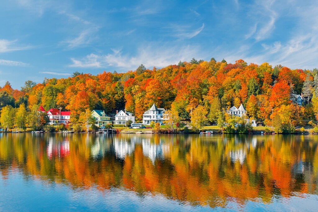
The towns of Keene and Long Lake are small mountain towns, although they do have excellent small hotels, campgrounds and bed and breakfasts. If you’re looking for ritzier resorts or more dining and entertainment options, head for Lake Placid or nearby Saranac Lake.
The closest and most popular base for hikers heading into the High Peaks is the town of Keene (which includes the hamlets of Keene Valley and St. Huberts). These small towns, with a total population of just over 1,000 people, lie just to the north of the High Peaks Wilderness.
In addition to serious peak bagging, visitors to Keene can also enjoy rock climbing (the Beer Walls and the Chapel Pond Slabs off of Route 73 are home to some of the best-known climbs in the area) and easy day hikes to several beautiful waterfalls. The 100-foot (30 m) Roaring Brook Falls and 20-foot (6 m) Bushnell Falls are both worth a visit if you’re in the area.
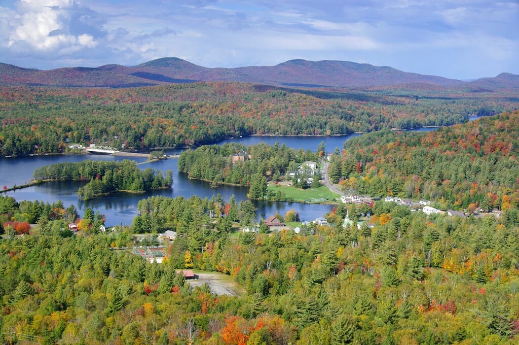
Long Lake is a good access point for the western area of the High Peaks Wilderness, including the Adirondack Canoe Route. The town of approximately 700 people sits at the southern tip of Long Lake, which extends 14 miles (23 km) into the wilderness area.
Because of the easy access to the lake, the town is popular for fishing, boating and swimming, as well as hiking. It’s also a snowmobiling destination in the winter. Additionally, Long Lake is the starting point of the Roosevelt-Marcy Trail.
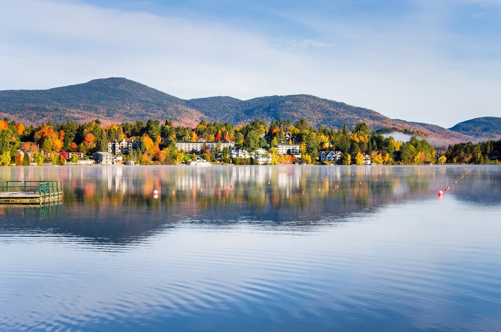
Lake Placid is a town of approximately 2,300 year-round residents that’s located just south of its namesake lake. However, the bulk of the town of Lake Placid is, ironically enough, not located along the shores of Lake Placid, but on the shores of the much smaller (yet no less scenic) Mirror Lake.
The town is one of the main tourist destinations in the Adirondacks, thanks in part to the fact that it hosted the Winter Olympics in 1932 and 1980. The winter sports infrastructure from those events, including the ski jumps, speed skating rink, and bobsled run, are all still in use to this day.
Another main draw to the area is Whiteface Mountain, which looms over the nearby town of Wilmington and offers ample skiing and hiking opportunities.


ahp46
northeast-115-4000ers
adirondack-top-100
fred-beckey-great-peaks
ahp46
northeast-115-4000ers
adirondack-top-100
fred-beckey-great-peaks


