
Scan the QR code and open PeakVisor on your phone
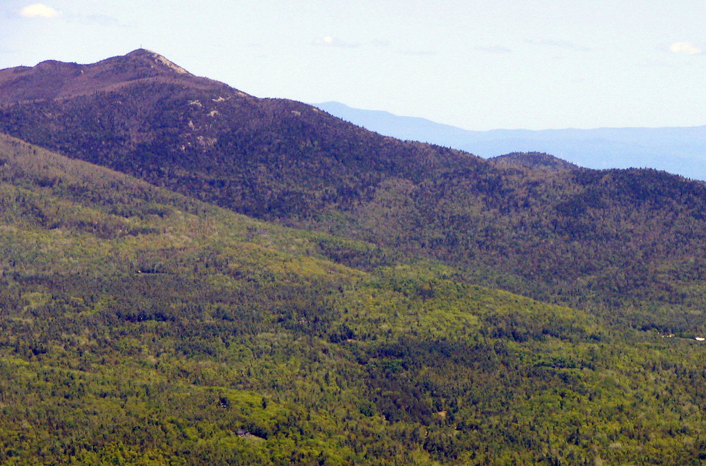
Located in upstate New York in the United States, the Hurricane Mountain Wilderness lies near the western shores of Lake Champlain. The wilderness is part of the Adirondack Forest Preserve in Adirondack Park. There are 17 named mountains in the 13,784 acre (5,578 hectare) wilderness. Hurricane Mountain is the tallest at 3,684 ft (1,123 m) and has a prominence of 1,991 ft (607 m).
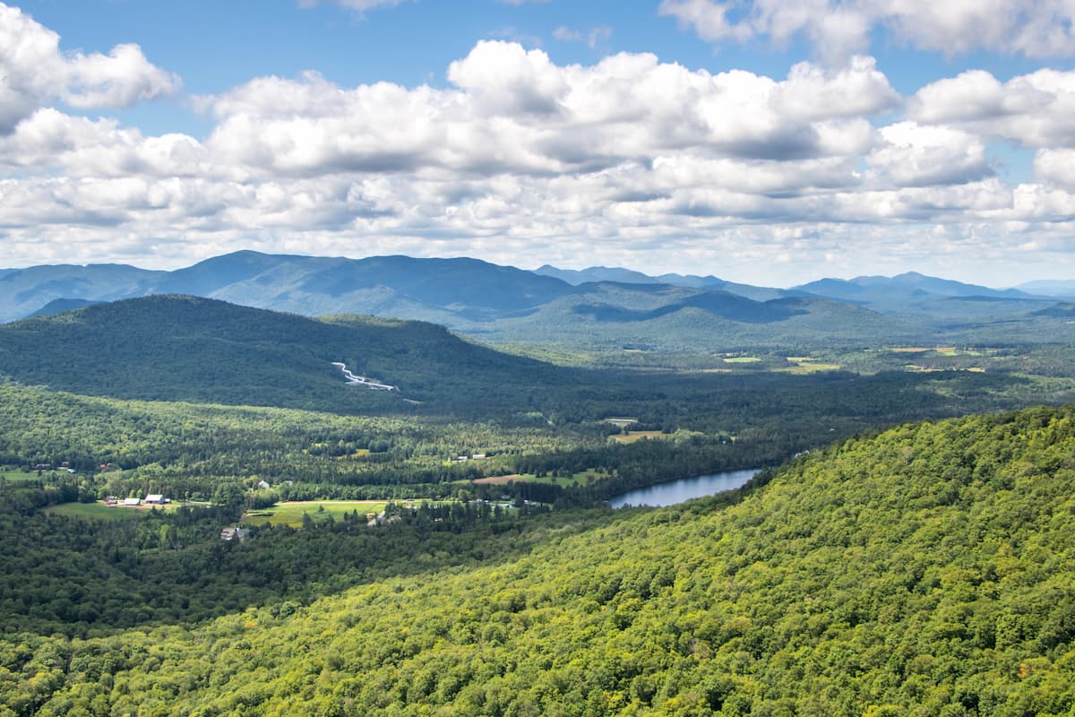
The Hurricane Mountain Wilderness encompasses 13,784 acres (5,578 hectare) in Essex County in northeastern New York. Located just west of Lake Champlain, the wilderness is part of the Adirondack Forest Preserve. The forest preserve is part of Adirondack Park, a 6 million acre (2.43 million ha) protected area roughly aligning with the Adirondack Mountains that consists of public and private lands.
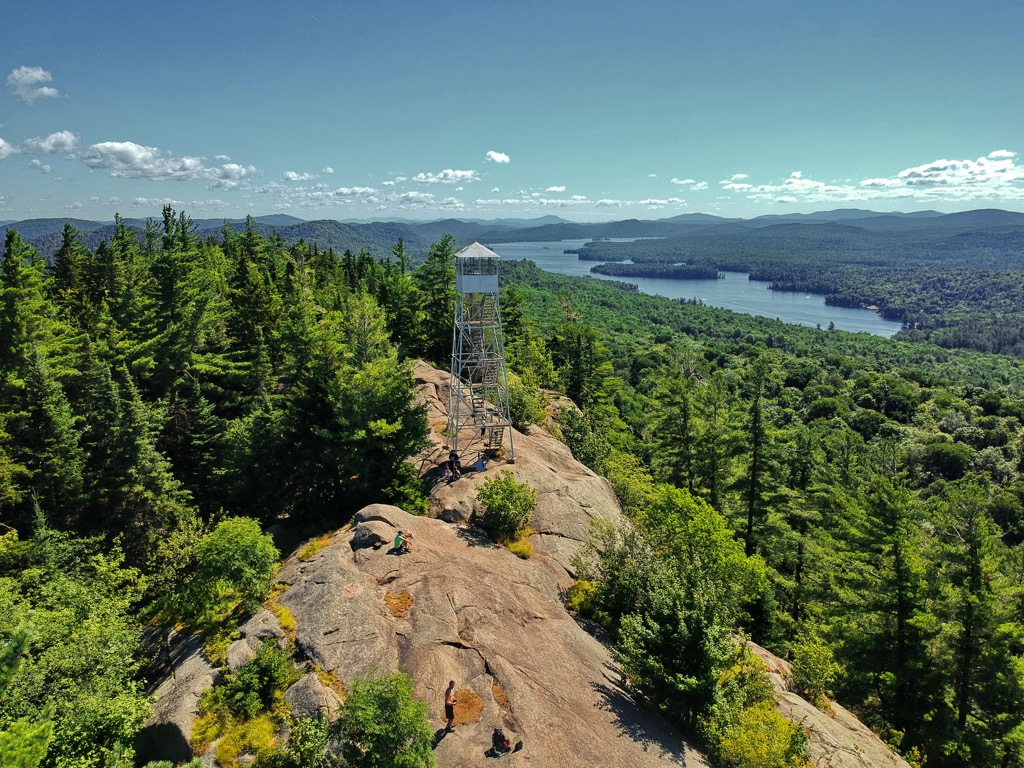
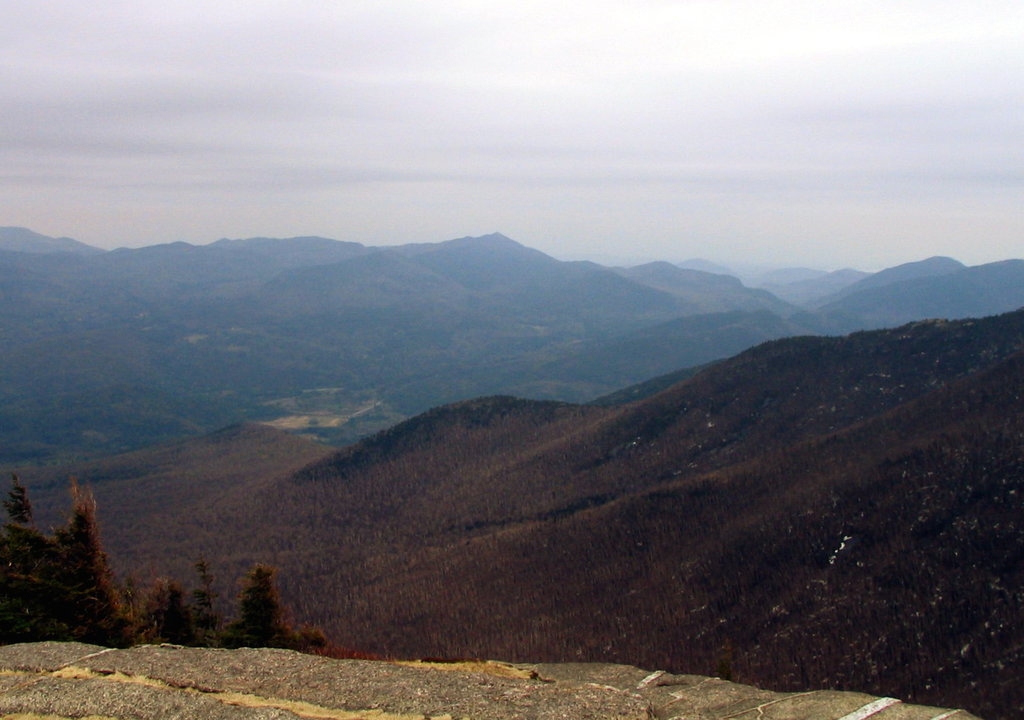
A 35 ft (11 m) fire tower sits on the summit of Hurricane Mountain (3,684 ft/1,123 m), the tallest peak in the wilderness. The tower is a relic of the state’s 20th century efforts towards early wildfire detection. The tower is currently closed to the public but is intended to open after renovations to the structure. From Hurricane Mountain’s summit, one can see the High Peaks, Lake Champlain, and Vermont’s Green Mountains on a clear day.
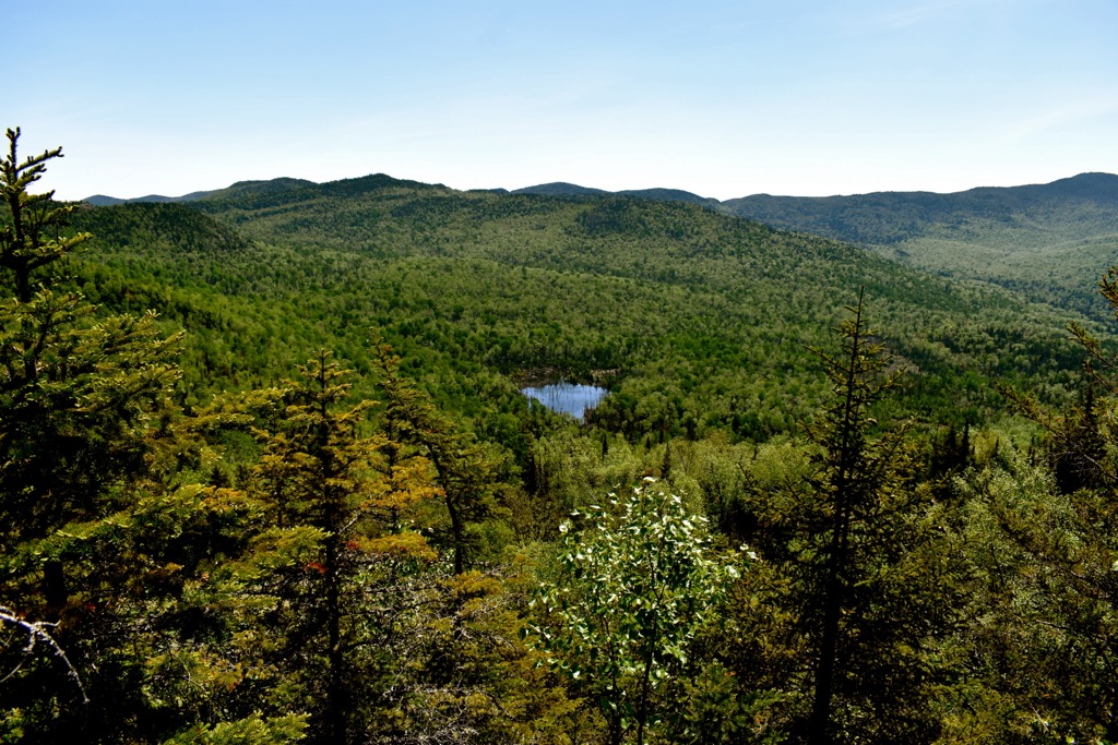
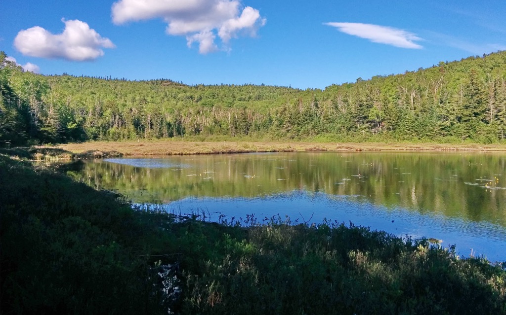
There are 14 mi (22.5 km) of multi-use trails in the wilderness, four primitive campsites, and two lean-tos. There is fishing in Jackson, Gulf, Spruce Mill, and Spruce Hill Brooks. The lower portion of Spruce Mill Brook is stocked with brown and brook trout. The wilderness is part of the Lake Champlain watershed, as well as the watersheds of Ausable and Boquet Rivers.
Rock climbing is popular near Hurricane Crag, a cliff on the southern side of Pitchoff Mountain (2,789 ft/850 m). A smaller wall, Spruce Hill Crag, is located in the woods below for less advanced climbers. Some rock climbing sites are closed during the peregrine falcon nesting season.
Hurricane Mountain Wilderness is surrounded by other wildernesses and wild forests. Jay Mountain Wilderness falls to the north and Giant Mountain Wilderness neighbors it to the south.
Nearby are the High Peaks Wilderness, Sentinel Range Wilderness Area, Taylor Pond Wild Forest, and Wilmington Wild Forest.
The Adirondack Mountains are distinct from many mountain ranges in that they form a dome that measures approximately 160 mi (255 km) across and 1 mi (1.6 km) high.
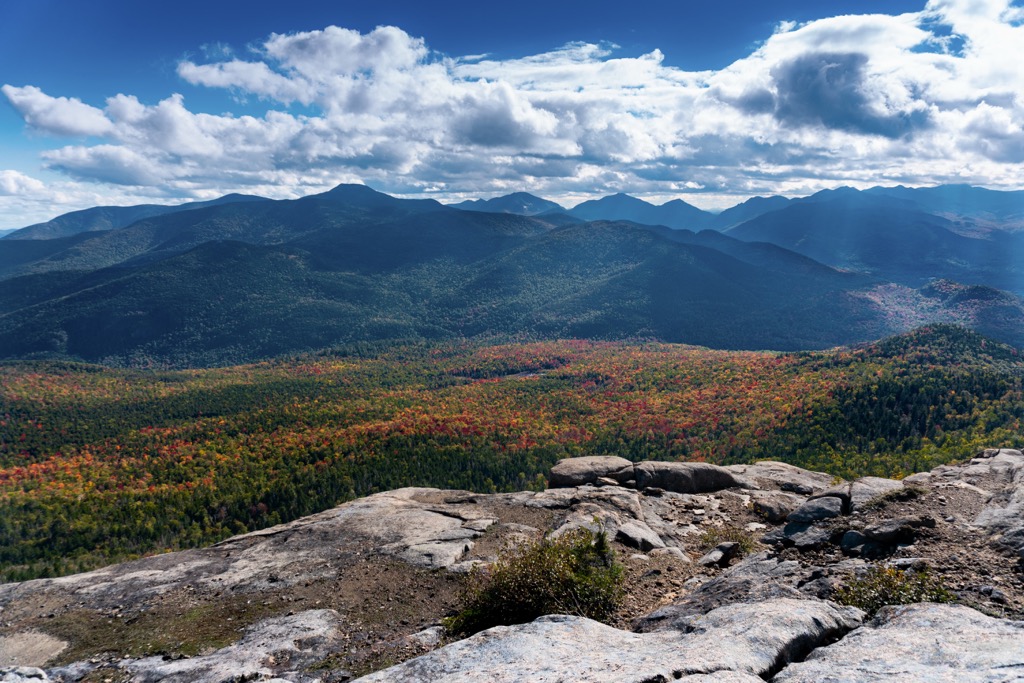
Although the Hurricane Mountain Wilderness does not contain high peaks, it is still considered part of the High Peaks Region due to its bedrock and topography. This region, sometimes called the Central Highlands, extends about 60 mi (96 km) wide and is part of the Grenville Province.
Mountains in the area contain remnants of mountains from more than 1 billion years ago. Layers of sedimentary rock accumulated over these ancient mountains. As the dome of the Adirondacks lifted, the sedimentary rock eroded away and significantly older metamorphic rock was exposed.
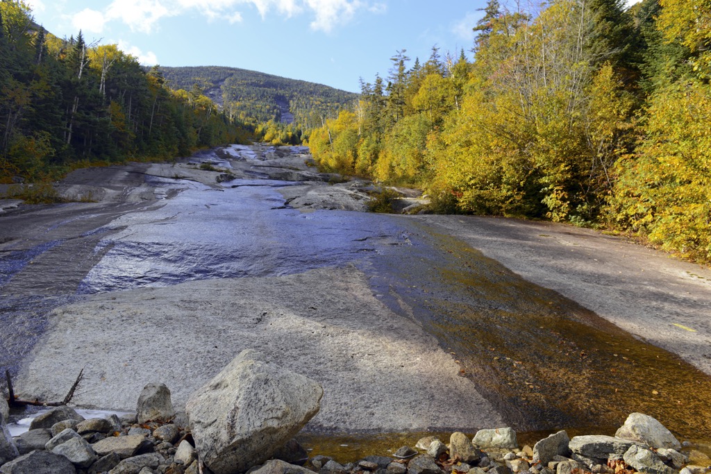
The bedrock is primarily meta anorthosite with some cases of plagioclase feldspar present. A large section of this type of rock is found in the Marcy massif that underlies many of the peaks in the region. It has numerous igneous intrusions that, when eroded, form waterways for streams and waterfalls.
A large dome of meta anorthosite known as Hurricane Dome underlies the Hurricane Mountain Wilderness with gneiss overlying it in the northern section. The region is distinguished by three main geologic features – long straight valleys, curving ridges, and drainage patterns radiating outwards from the dome.
The Hurricane Mountain Wilderness occupies a transition zone between northern boreal forests and mixed forests in the south. There are a handful of forest communities found within the wilderness – successional northern hardwoods, beech-maple mesic, pine-northern hardwood, spruce-northern hardwood, mountain spruce-fir, and spruce-fir on rocky summits. Successional northern hardwood communities are common and the result of wildfires that cleared much of the old growth stands in the early 1900s.
Across these communities, common trees include white birch, quaking aspen, red maple, balsam fir, red spruce, American beech, white ash, Eastern hemlock, and red and white pine. There are several ecological threats to the forests such as beech bark disease, Eastern spruce budworm, forest tent caterpillar, and balsam wooly adelgid.
A number of salamanders, newts, toads, frogs, turtles, and snakes live in the forests and waterways. Medium to large mammals that inhabit the forest include white tailed deer, black bears, coyotes, foxes, raccoons, weasels, bobcats, snowshoe hares, martens, minks, muskrats, beavers, and river otters.
Some birds are residents in the forest but many migrate through or use the area during breeding season. Flycatchers, chickadees, warblers, crossbills, thrushes, wrens, grosbeaks, overbirds, woodpeckers, finches, and turkeys are a few common species. Birds of prey in the area include barred owls, great horned owls, Eastern screech owls, northern goshawks, red tailed hawks, sharp shinned hawks, and broad winged hawks.
Native Americans used the area that is currently the Hurricane Mountain Wilderness but never permanently settled it. Some suggest that the name Hurricane Mountain comes from a Native American name for it which translates to “hill of the wind”. The area falls near the territory of the Mohawk, a tribe of the Iroquois Confederacy. The Mohawk people at times competed with the Algonquin-speaking Mahicans for resources along waterways in Hudson Valley.
The land for the Hurricane Mountain Wilderness was set aside in 1786 as part of an “Old Military Tract”, meant as a symbol of public gratitude in honor of Revolutionary War veterans. However, given the remote nature of the tract, no veterans are recorded to have actually settled there. But not long after, others began to settle in the area, establishing Elizabethtown, Keene, and Lewis.
The roads that form the north and south boundaries are two of the oldest roads in the region, in use as early as 1790 and around 1800, respectively. Lumber and iron were major industries. Timber was harvested for local sawmills, charcoal and potash production.
The main company heading lumber and charcoal production was J. and J. Rogers Company of Ausable Forks. They began their work in the region in the 1830s, growing in size to ultimately cut timber on 1,000 acres (405 ha) annually. The 1890s saw a shift from iron to wood pulp products with a new focus on harvesting softwoods.
During the early 1900s, several fires burned across much of the Adirondacks. They damaged about 15% of the lands now within the park, and most of the lands in the Hurricane Mountain Wilderness. Rock outcrops and stands of white birch are a testament to wildfire’s impact on the land.
There are 14 mi (22.5 km) of trails in the Hurricane Mountain Wilderness that are open to hikers, snowshoers, and cross country skiers. A number of brooks and streams provide good fishing spots, and Pitchoff Mountain and Spruce Hill Crag are popular with rock climbers. There are four primitive campsites and two lean-tos in the wilderness.
There are three trails to the top of Hurricane Mountain (3,684 ft/1,123 m).
East Hurricane Mountain Trail: the trailhead is located at the end of Hurricane Mountain Lane and the trail climbs 1,700 ft (520 m) over 2.7 mi (4.3 km). It becomes steep about 1.2 mi (1.9 km) in.
Hurricane Mountain Trail from 9N: this trail ascends 2,000 ft (610 m) over 3.4 mi (5.5 km) from the Route 9N Trailhead. The path has a mix of steep, rough sections and gradual, moderate climbs.
North Trail: the trail leaves from Crow’s Clearing Trailhead. It gains 1,600 ft (488 m) in elevation over 3 mi (4.8 km). Although it is a longer route, the incline is more gradual. The Gulf Brook lean-to is located along the trail shortly after the Weston Mountain/Lost Pond Trail joins North Trail.
To reach this trail, follow the North Trail from Crow’s Clearing Trailhead towards Hurricane Mountain. About 1.1 mi (1.8 km) from the trailhead is a junction with Lost Pond/Weston Mountain Trail. The trail measures 2.1 mi (3.4 km) and climbs 630 ft (192 m) to Lost Pond and the Biesemeyer Memorial lean-to. Continue on 0.3 mi (0.5 km) while ascending 275 ft (84 m) to reach the summit of Weston Mountain (3,202 ft/976 m).
The trails to Little Crow (2,572 ft/784 m) and Big Crow (2,828 ft/862 m) Mountains can be joined to form a loop trail that is a little over 3 mi (4.8 km). The trail to Little Crow climbs 845 ft (258 m) in 0.9 mi (1.4 km) from Hurricane Road Trailhead. From Little Crow summit, the trail continues 0.6 mi (1 km) and climbs 280 ft (85 m) to reach the summit of Big Crow Mountain. To summit Big Crow Mountain first, there is a 1.6 mi trail (2.6 km) from Crow’s Clearing Trailhead. This hike offers scenic views from the top.
This ridge trail stretches 3 mi (4.8 km) across the Soda Range and connects Big Crow Mountain and Weston Mountain. It can be completed as a 6 mi (9.7 km) loop beginning at Crow’s Clearing Trailhead. The total elevation gain is 1,600 ft (488 m) and the loop can be done summiting either Weston Mountain or Big Crow Mountain first. There are great views from the ridge.
In addition to primitive campsites in the wilderness and established campgrounds nearby, the small towns of Elizabethtown, Keene, and Jay offer basic amenities and lodging.
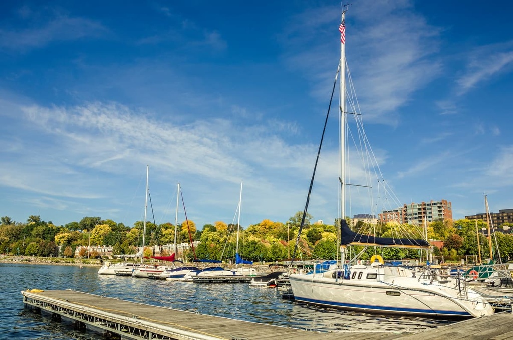
Located 40 mi (65 km) to the east across Lake Champlain, Burlington, Vermont has a population of 42,500. While not a big city, it has a rich community scene and offers lots of outdoor recreation opportunities. Lake Champlain is great for boating, paddling, swimming, and fishing. The ECHO Leahy Center educates visitors on the lake’s natural history and its stewardship.
In town, the South End Arts District boasts numerous galleries filled with paintings, sculptures, prints, photography, jewelry, and ceramics. The Shelburne Museum is an open-air museum where historical buildings have been brought together, renovated, and fully-furnished to create a walk-through tour of Vermont’s history.
For a small city, Burlington has an exciting dining scene. ArtsRiot serves innovative sandwiches in a renovated warehouse that doubles as an art gallery and performance venue. Hen of the Wood offers a fine dining experience with locally-sourced produce and products. There are also a number of other cuisines, bistros, pubs, and cafes. You can find accomodation in the downtown, lakeside, or in the woods in a selection of hotels, B&Bs, and rental cabins.
Albany, New York’s capital, lies 130 mi (210 km) to the south and has a population of 97,000 people. A few top activities to do while exploring the city include taking a tour of the New York State Capitol building, visiting the Albany Institute of History and Art to admire the Hudson River School landscape paintings, or stopping by the Underground Railroad Education Center at the Stephen and Harriet Myers Residence.

To get a breath of fresh air, spend an afternoon at Washington Park, a beautiful park in the city center with gardens, a lake, and meandering paths, or go for a cruise on the Hudson River.
The city has a good selection of cafes, pubs, breweries, Greek, Indian, and farm-to-table restaurants. It’s easy to find accomodation for a budget, near the airport or city center, or outside the city in a beautiful forested setting.


adirondack-top-100
ac-fire-tower-challenge
lake-placid-9ers
adirondack-29ers-challenge
adirondack-top-100
ac-fire-tower-challenge
lake-placid-9ers
adirondack-29ers-challenge


