Scan the QR code and open PeakVisor on your phone
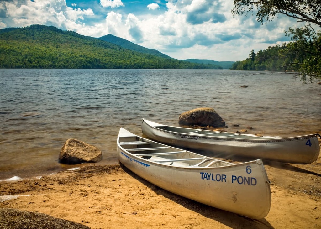
The Taylor Pond Wild Forest is a fragmented series of protected lands located in the northern part of the US state of New York. There are 41 peaks in the protected area, all of which are part of the Adirondack Mountains. Catamount Mountain is the highest and most prominent of the peaks in the wild forest at an elevation of 3,173 ft (967 m).
The 52,280 acres (21,156 ha) of terrain that make up the Taylor Pond Wild Forest in upstate New York are divided between state land and conservation easement land.
A large portion of these protected areas falls within the jurisdiction of the Adirondack Park. Meanwhile, some sections of the Taylor Pond Wild Forest are state forest lands that are part of Terry Mountain State Forest and Burnt Hill State Forest. Other parts of the wild forest are actually conservation easement lands that have allowances for recreation.
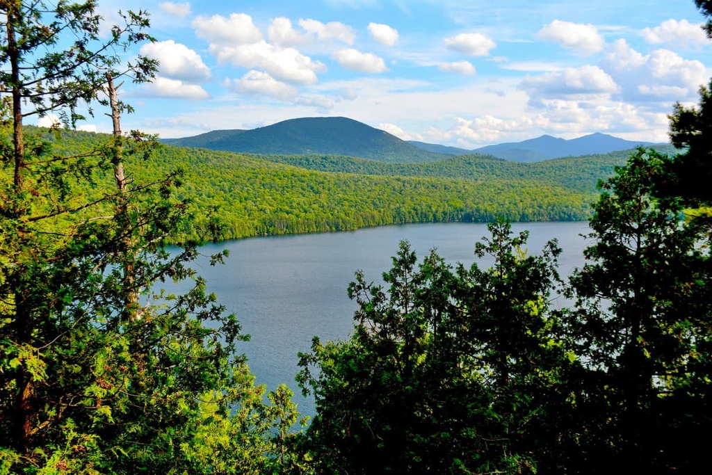
Much of the land in the wild forest surrounds the Saranac River, Franklin Falls Pond, Union Falls Pond, Silver Lake, and Taylor Pond. The mountains within Taylor Pond Wild Forest are part of the Adirondack Mountains. Some of the tallest and most prominent peaks in the wild forest are Catamount Mountain, Duncan Mountain, and Tolman Mountain.
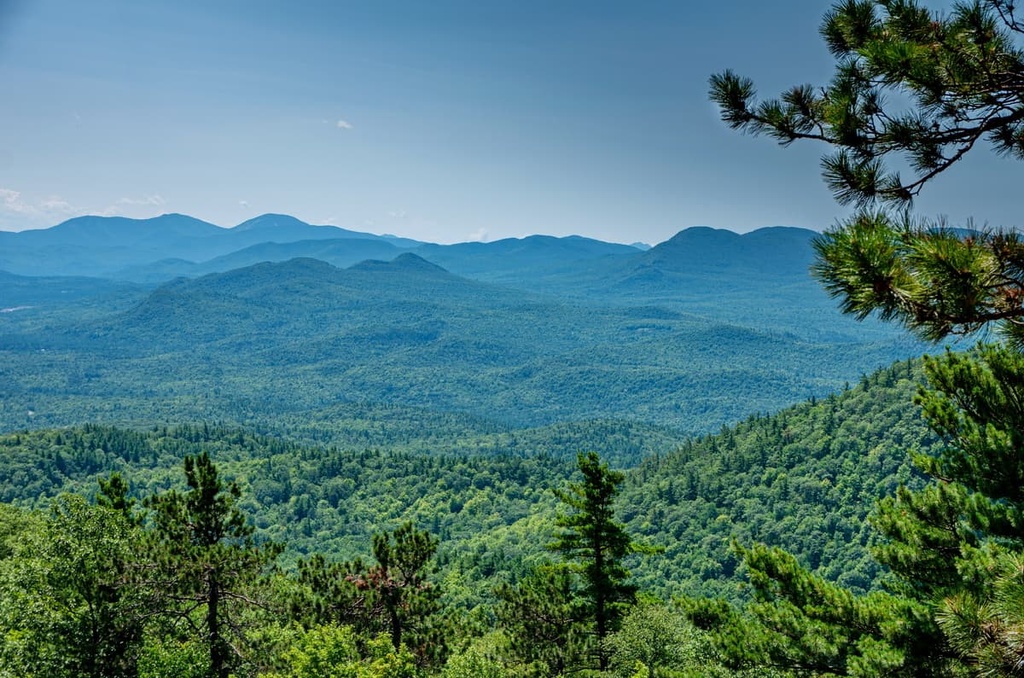
The Adirondacks are a relatively young mountain range made up of ancient rocks. A relatively recent period of glaciation shaped the mountains and surrounding rivers, lakes, ponds, and wetlands into the landscape that we see today.
The geologic history in the Adirondacks dates back more than one billion years. Rocks that are part of the Grenville Province were first deposited in the region in shallow seas. Meanwhile, the peaks themselves were primarily formed by the Grenville orogeny, which uplifted the landscape to form the large cluster of peaks that are now part of the Adirondacks.
However, 400 million years' worth of erosion wore the mountains down from their lofty heights. A period of tectonic separation in the region followed soon afterward as the continental plates underlying the range began to shift apart. Fault lines created by this separation can still be seen in the eastern Adirondacks.
Over the next few hundreds of millions of years, a series of collisions and separations of tectonic plates, including the Taconian orogeny, Alleghanian orogeny, and the eventual splitting of the supercontinent Pangea continued to shift and shape the rock composition in the region.
Roughly 20 million years ago, the Adirondacks began to rise as a dome about 160 mi (257.5 km) wide and 1 mi (1.6 km) high. Erosion then exposed the oldest layers of rocks in the region, some of which date back 1 billion years. To this day, the Adirondacks continue to rise. In fact, they’re growing at an estimated 1 ft (0.3 m) per century.
Glaciers began to shape the mountains and valleys in the range during the Pleistocene epoch, which took place about 2.6 million to 12,000 years ago.
As these glaciers melted, they deposited rocks across the landscape. In some instances, the glaciers deposited huge boulders throughout the range. These boulders are now known as erratics and they can be seen today scattered across the mountains and fields of the Adirondacks.
As the glaciers melted, enormous chunks of ice separated and sunk into the ground. These chunks of ice also left behind depressions that, when falling below the water table, created the round ponds and wetlands that are found throughout the region.
Outwash from different glacial melting patterns left sandy and rocky debris through much of the area. As a result, to this day, the soil in the region tends to be thin, sandy, and relatively infertile. Water from the Adirondacks flows to Lake Champlain, the St. Lawrence River, Lake Ontario, the Hudson River, and the Mohawk River.
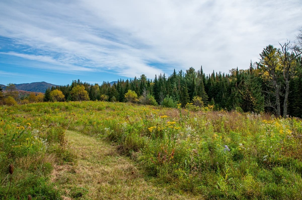
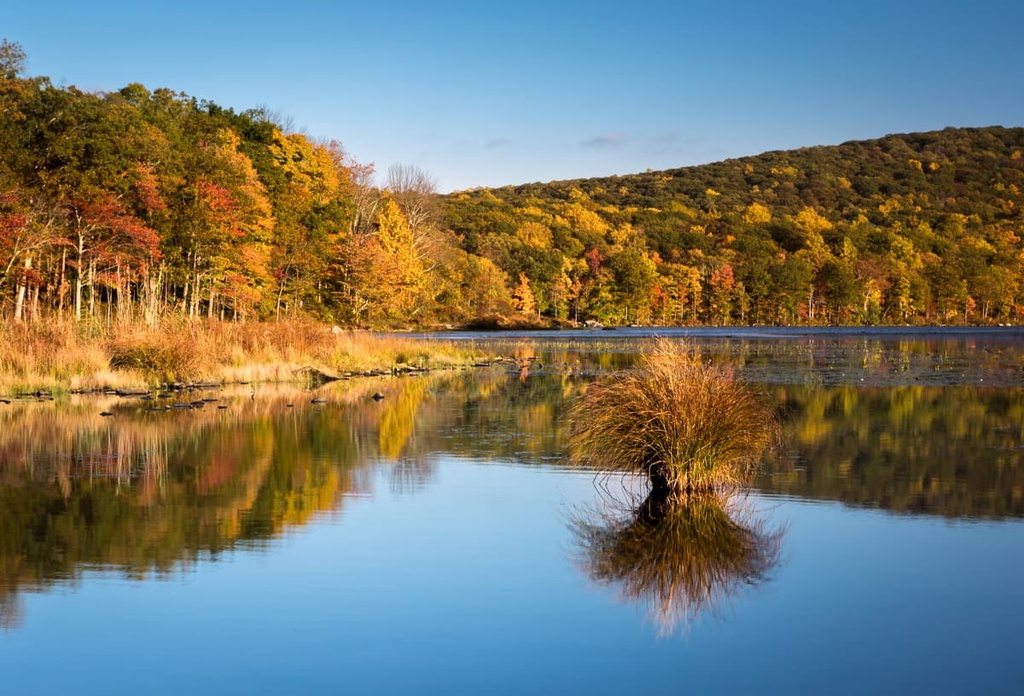
Ponds, lakes, rivers, streams, and wetlands punctuate the forests, low-lying hills, and mountains in upstate New York. Habitats in the region include everything from marshes and bogs to conifer and hardwood forests and alpine zones.
Spruce, hemlock beech, maple, birch, and pine are some of the most commonly seen trees within the temperate forests of the Adirondacks. Moss and lichens grow in the forest as well, and summer ushers in an impressive display of wildflowers.
Alpine bilberry, Lapland rosebay, bearberry willow, mountain sandwort, yew, and juniper fill in the understory of the wild forest. Fiddlehead fern and partridge berry are some of the edible plants that can be harvested in the forest, too.
Mammals commonly found in the forests and valleys of the Adirondacks include moose, black bear, beaver, eastern coyote, river otters, white-tailed deer, and little brown bats. Bald eagles, common loons, peregrine falcons, ospreys, great horned owls, great blue herons, wild turkeys, eastern bluebirds, and chickadees all thrive in the wild forest.
Timber harvesting is allowed on some state forest and conservation easement lands, but not on most forest preserve lands. As the Taylor Pond Wild Forest is a designated “wild forest,” it has much the same protection as a designated wilderness area, so logging isn’t generally allowed. However, the Taylor Pond region was heavily logged in the past, as is the case with most other wild forests in New York State.
Sites dating back to the Paleo-Indian period about 11,000 years ago have been uncovered throughout the region in and around the Taylor Pond Wild Forest. People lived in the area through the Archaic period, primarily as semi-nomadic hunter-gatherers. By the Woodland period, however, many tribes in the region started to shift toward a more agricultural civilization and they began to adopt the use of pottery.
Iroquoian peoples began to settle in the region that is now called the Taylor Pond Wild Forest between 4,000 and 1,200 years ago. The Adirondacks were never fully settled by any one tribe, but multiple tribes of the Iroquois Confederacy made use of the forests and riverways of the region for hunting and cultural purposes, including the Mohawk and Oneida.
The Mahicans, an Algonquian-speaking tribe, also made claims to certain resources and access points in the region. Over the years, there were points of tension among different tribes in the region, in particular over control of the Lake George to Lake Champlain water route. Today, the St. Regis Mohawk Tribe is one of the largest federally recognized tribes in the region.
From the 1600s through the 1800s, various European colonizers passed through and occupied the area, including the Dutch, French, and British. Although there are no major cities within what is now the Adirondack Park, many smaller communities sprung up throughout the region.
Over the centuries, logging and mining (particularly for iron ore) became major industries in the region. These industries led to the widespread destruction of much of the range’s natural landscape and it spurred calls to action from environmentalists who wanted to protect the park.
In the 1880s and 1890s, the New York State legislature listened to these environmentalists and established the Adirondack Park as a forest preserve. In 1894, a new article in the New York State Constitution declared that the park would remain “forever wild.” To this day, the park remains one of the only constitutionally protected areas in the US and around the world.
But the history of the Adirondacks and the Taylor Pond Wild Forest doesn’t end with this constitutional amendment. For example, Poke-O-Moonshine, a mountain within the Taylor Pond Wild Forest that’s now very popular among rock climbers, has a fire tower at its summit.
This fire tower is part of a chapter of history in the region that lasted from the late 1800s through the late 1900s where more than 100 towers were constructed on the tallest peaks across New York to aid in the early detection of forest fires. The Poke-O-Moonshine mountain fire tower was used from its construction in 1912 until 1988.
The land that encompasses Catamount Mountain and Taylor Pond was actually purchased by the state of New York from the Wambat Realty Corporation in 1964 and added to the forest preserve. Over the next few decades, the state acquired an increasingly large area of land in the region from private companies and landholders.
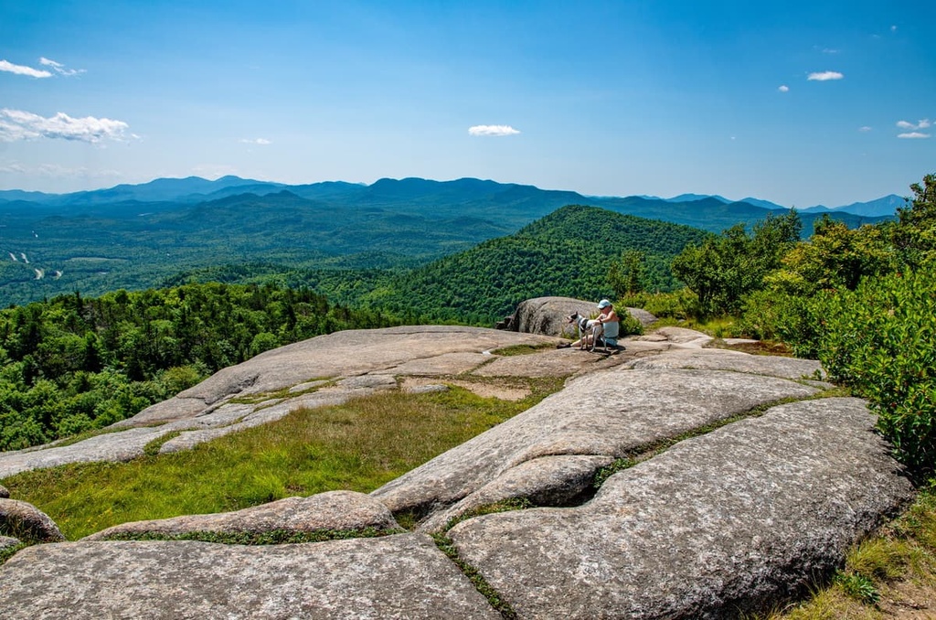
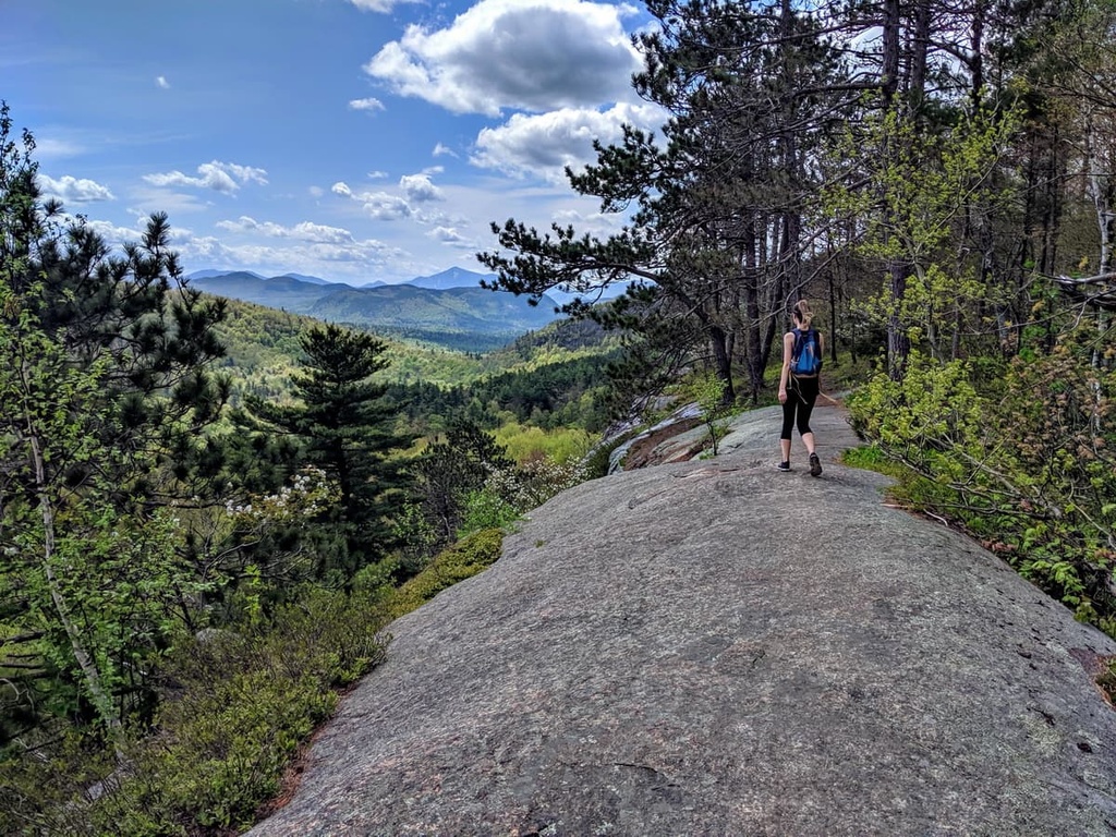
Today, the public spaces of the Taylor Pond Wild Forest are popular destinations for hiking, camping, ice and rock climbing, hunting, trapping, biking, horse riding, cross country skiing, and snowshoeing.
The hikes listed below lead to some of the most popular peaks in the Taylor Pond Wild Forest. Visit New York’s Department of Environmental Conservation’s website to learn more about the best spots to rock and ice climb, boat, fish, bike, hunt, and snowmobile in the region.
This 1.8 mi (2.9 km) trail to the top of Catamount Mountain gains around 1,500 ft (457 m) of elevation and includes one steep, exposed scramble. The view from the summit lets you take in Taylor Pond, Silver Lake, Union Falls Pond, the Wilmington Range, the Stephenson Range, and Whiteface Mountain.
Wild blueberries grow in abundance near the summit of Catamount Mountain during the summer, too. The trailhead for this hike is located on the northern side of Forestdale Road.
The summit of Poke-O-Moonshine Mountain is accessible via two trails, including
Regardless of which trail you take to the summit of Poke-O-Moonshine, be sure to keep an eye out along the way to see if you can spot the peregrine falcons that nest on the mountain’s cliffs.
The trail to the top of Silver Lake Mountain is about 0.9 mi (1.4 km) long and it ascends 900 ft (274 m) from the trailhead.
From the top of Silver Lake Mountain, you can take in views of Silver Lake, Taylor Pond, and Whiteface Mountain. The trailhead for this hike is located on the eastern side of Silver Lake Road.
There are several campgrounds located within and around the Taylor Pond Wild Forest. These campgrounds include:
Campground reservations for publicly run campsites in the Adirondacks are typically done online via ReserveAmerica. Keep in mind that campsites tend to fill up very quickly in the Adirondacks during the summer months, especially on holidays and weekends.
Advance reservations are highly recommended as your chance of getting a campsite on arrival in the region is very low. You can typically make a site reservation for DEC campgrounds in the Adirondacks up to 9 months in advance of your planned trip. Contact the DEC or the campground rangers directly for more specific information about camping in the region.
There are many small towns located around the disjointed sections of the Taylor Pond Forest. Saranac Lake is one small community in the region while Burlington, Vermont, and Montreal, Canada, are two larger cities that are situated less than two hours away by car. Here’s what you need to know before you leave home for your next trip to the Taylor Pond Wild Forest.
Saranac Lake has a population of around 5,700 people and is located a 40-minute drive from the Taylor Pond Campground. Though small, the town of Saranac Lake embodies all the charm of a rural town in upstate New York. Beautiful spots for hiking, biking, fishing, and boating lie only a short distance from town.
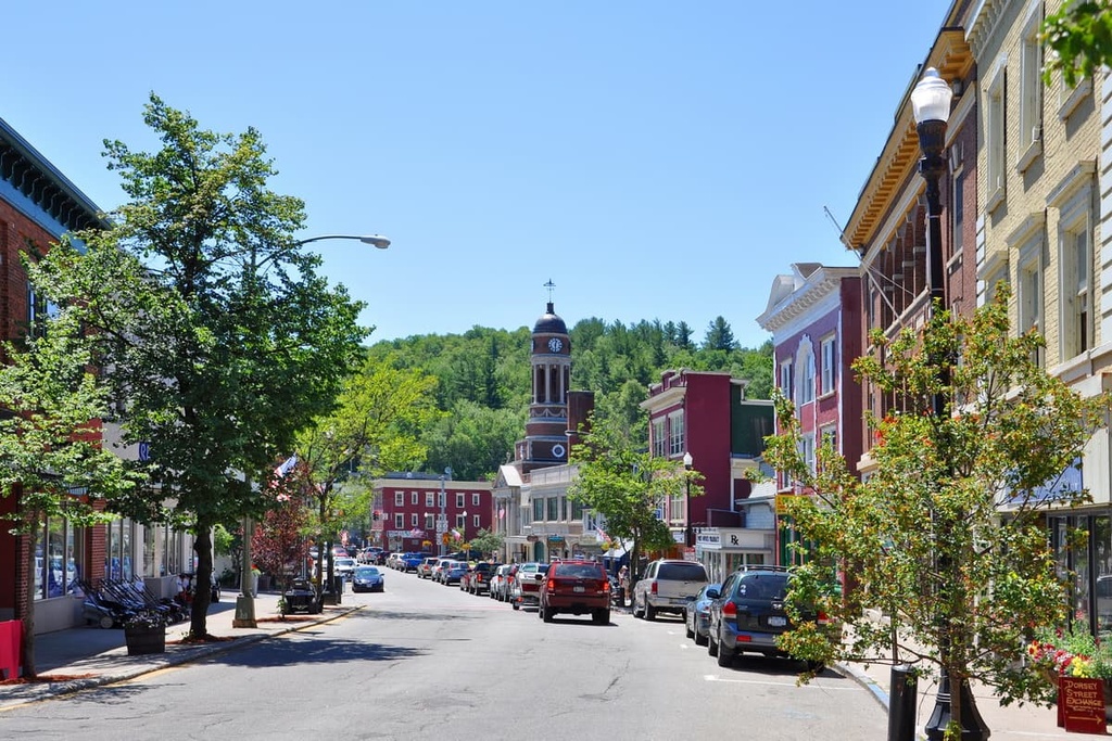
The downtown area of Saranac Lake is bursting at the seams with local galleries and shops, and live music happens in the town year-round. If you want to get to know the area a bit better, check out the Saranac Laboratory Museum, which displays rotating exhibits on local history.
While in Saranac Lake, be sure to enjoy some local food and drinks at any of the town’s many delis, coffee shops, restaurants, breweries, and pubs. Those looking to stay the night in Saranac Lake can choose between a selection of cabins, cottages, camping, inns, lodges, B&Bs, hotels, motels, and vacation rentals.
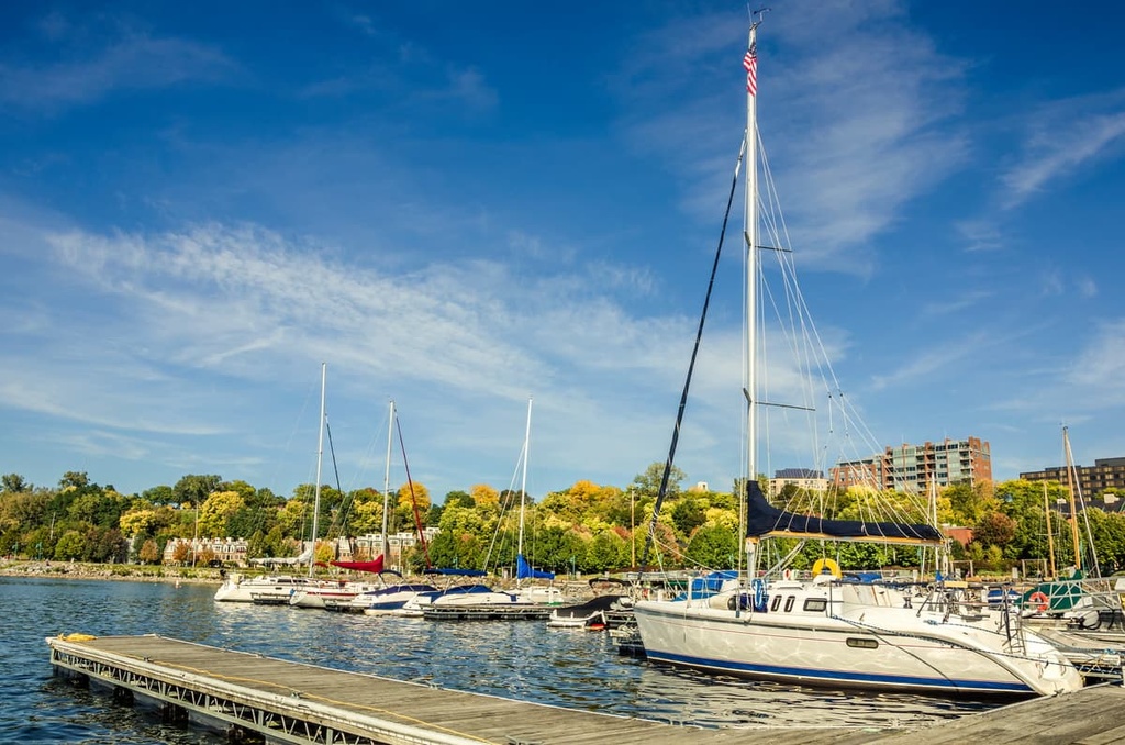
The city of Burlington is located about a 2-hour drive away from the Taylor Pond Wild Forest on the other side of Lake Champlain. With a population of around 42,500 people, Burlington is a vibrant town with many outdoor and cultural attractions.
While in Burlington, you can cruise around Lake Champlain by boat or you can explore the region’s numerous hiking and biking trails. Better yet, be sure to visit the Echo Leahy Center for Lake Champlain, which is a science and nature discovery center that’s focused on local ecosystems and stewardship.
During your trip to Burlington, you can also stop by the Shelburne Museum to soak in art and history that celebrates the natural beauty of Vermont. Many of the restaurants in town source their food from local farms and producers. The town is also home to a robust Nepali community so the Nepalese food in Burlington is top-notch.
Besides the many campgrounds that are located near town, accommodation options in Burlington include the city’s many hotels, motels, and charming inns and B&Bs.
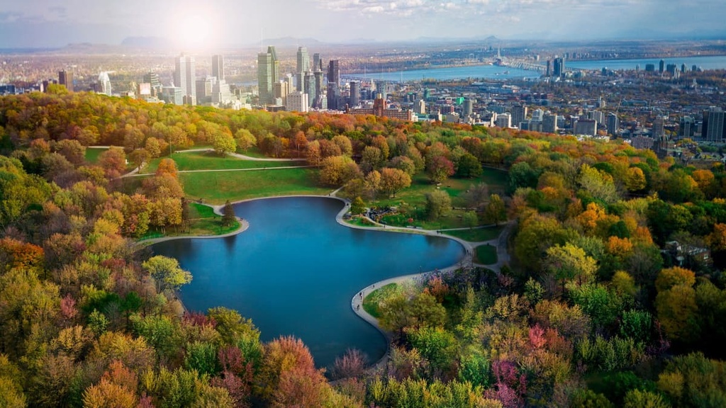
Located less than two hours away from the Taylor Pond Wild Forest across the border in Canada, Montreal is the largest city in the province of Quebec. With around 1.8 million inhabitants, the city of Montreal is a lively place that’s brimming with museums, festivals, markets, shops, and performances.
There are endless culinary options and all varieties of accommodation to choose from in Montreal. If a trip up north is in the books, the Quebec countryside boasts abundant and breathtaking forests, lakes, and mountains to explore, so it’s well worth taking the time to travel around the province if you get the chance.