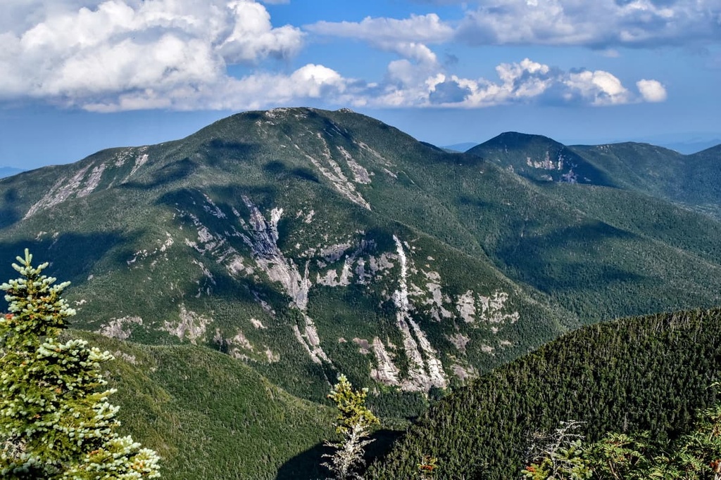
Dix Mountain is the sixth highest peak in the High Peaks Region of the Adirondack Park, and is located roughly on the boundary between the towns of North Hudson and Keene in Essex County, New York. The peak was named in 1837 after John Dix (1798–1879), who was the Secretary of State of New York at the time, and later became the state's governor.
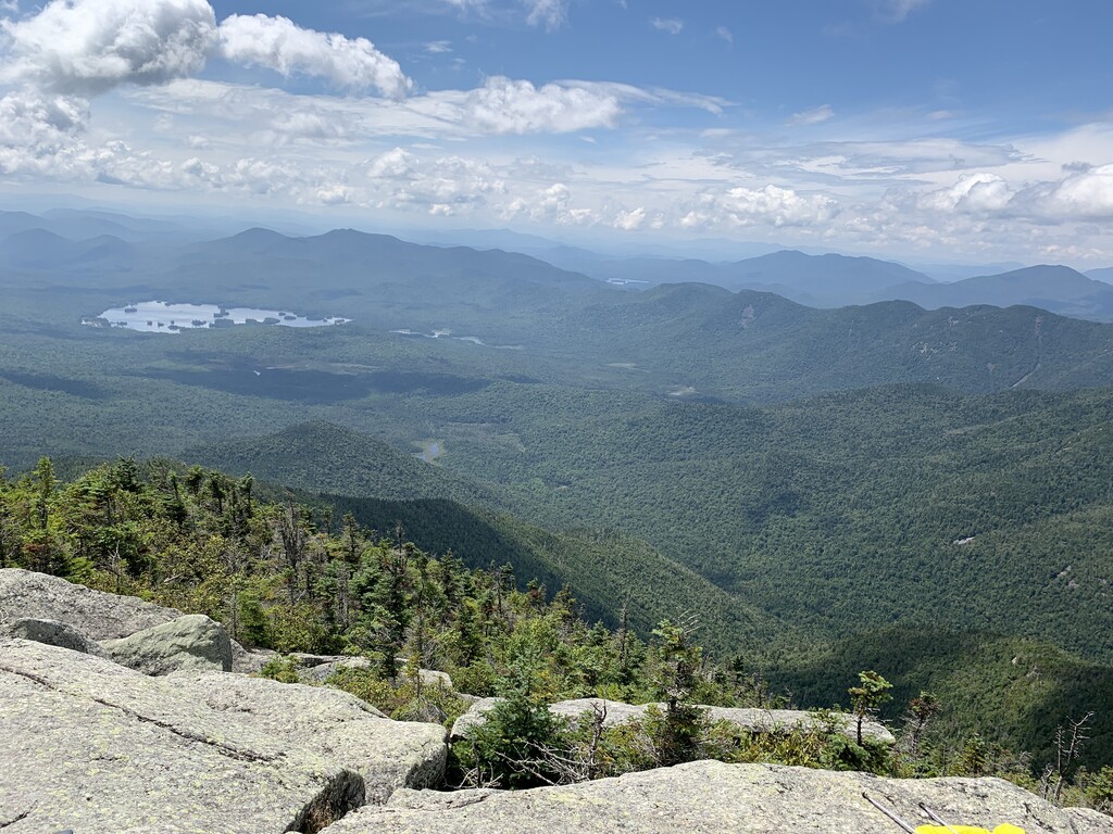
While it stands somewhat south of the main High Peaks region (and in fact is at the center of its own Dix Mountain Wilderness Area) and is more difficult to reach and steep and challenging to climb, the mountain enjoys great popularity with serious hikers not only due to its status as a required peak for Adirondack Forty-Sixers but for open views of the region from its summit, almost as good as those to be found at nearby Mount Marcy with far less crowds.
Dix is also the gateway to four other High Peaks in the Dix Range, all of them, unlike Dix itself, officially trailless: Hough, Macomb, South Dix and Grace Peak. One of the most difficult Adirondack peakbagging challenges is to do all five in the same day; while many have, most hikers prefer to break the trips up into separate assaults on Dix and/or one of the others.
The mountain was reportedly first climbed by a man named Rykert in the course of surveying the town line.
Hikers commonly choose to climb Dix from the south by taking the Elk Lake Trail from the similarly named lake toward Hunters Pass, where a spur leads up to Dix. Less frequently, a lengthy northern ascent can start from the Ausable Club in St. Huberts.
There's a hiking trail (T2) called Dix Trail leading to the summit. Dix Mountain is one of the 2 peaks along the Dix Trail.
By elevation Dix Mountain is
# 8 out of 1601 in Adirondack Park # 8 out of 3825 in New York # 7 out of 126 in High Peaks Wilderness # 8 out of 591 in Essex County # 1 out of 24 in the Dix Range # 8 out of 1678 in the Adirondack Mountains
By prominence Dix Mountain is
# 4 out of 1601 in Adirondack Park # 5 out of 3825 in New York # 2 out of 126 in High Peaks Wilderness # 4 out of 591 in Essex County # 1 out of 24 in the Dix Range # 4 out of 1678 in the Adirondack Mountains
We use GPS information embedded into the photo when it is available.
3D mountains overlay
Adjust mountain panorama to perfectly match your photos because recorded by camera photo position might be imprecise.
Move tool
Rotate tool
Zoom
More customization
Choose which peak labels should make into the final photo and what photo title should be.
Next
Photo Location
Satellitte
Flat map
Relief map
Latitude
Longitude
Altitude
OR
Latitude
°'''
Longitude
°'''
Apply
Register Peak
Peak Name
Latitude
Longitude
Altitude
Register
Teleport
PeakVisor
This 3D model of Sagarmatha National Park in Nepal was made using the PeakVisor app topographic data. The mobile app features higher precision models worldwide, more topographic details, and works offline. Download PeakVisor maps today.
Download OBJ model
PeakVisor
The download should start shortly. If you find it useful please consider supporting the PeakVisor app.
PeakVisor for iOS and Android
Be a superhero of outdoor navigation with state-of-the-art 3D maps and mountain identification in the palm of your hand!