Scan the QR code and open PeakVisor on your phone
Located just north of Lake Placid in the US state of New York, the McKenzie Mountain Wilderness is an expansive tract of pristine wild land, home to dense forests and high mountain peaks. There are 24 named mountains in McKenzie Mountain Wilderness, the highest and the most prominent of which is Moose Mountain 3,888 ft (1,185 m).
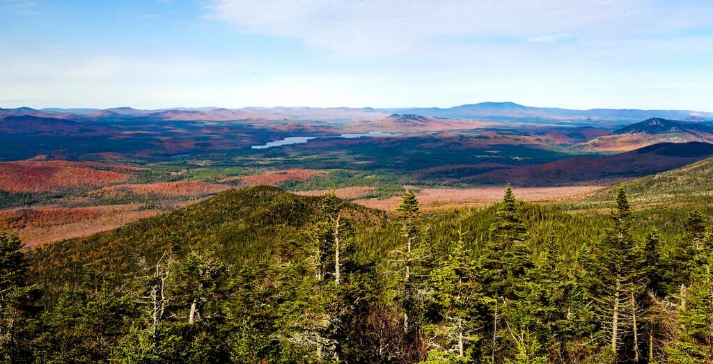
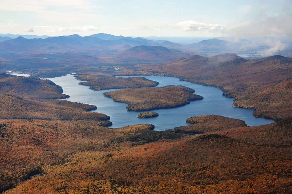
The McKenzie Mountain Wilderness covers 37,616 acres (15,222 ha) of land in western Essex County, New York, in the north-central area of the Adirondack Park. The wilderness area lies at the edge of the High Peaks region, just north of the High Peaks Wilderness. Some of the best views in the northern Adirondacks can be found in the preserve.
While there are 14 miles (22.5 km) of footpaths through the area, the McKenzie Mountain Wilderness is unique in that there are very few trails through the center of the preserve. The rugged interior is genuinely wild and difficult to access for all but the most intrepid of hikers.
This makes the McKenzie Mountain Wilderness a destination for hunting and trapping, especially big game animals. The area also draws rock climbers, skiers, snowshoers, boaters, and paddlers. The Jackrabbit Trail, which connects Saranac Lake with Lake Placid, crosses McKenzie Mountain.
There are several small ponds within the boundaries of the preserve, and the wilderness area is bordered by several large bodies of water including Lake Placid, Franklin Falls Pond, and the Saranac River.
Although motorized recreation is prohibited inside the preserve, boating is allowed on Lake Placid and Moose Pond. There are landings in each waterbody that provide access to the wilderness area’s interior.
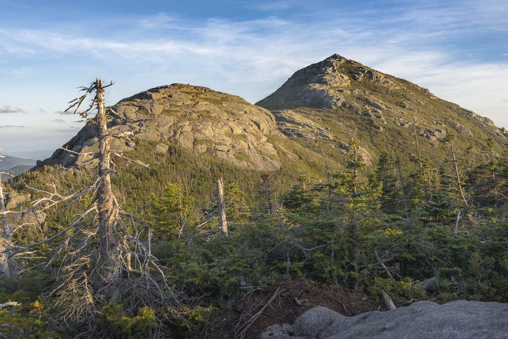
The highest peaks in the McKenzie Mountain Wilderness are Moose Mountain and McKenzie Mountain, which reach 3,888 ft (1,185 m) and 3,855 ft (1,175 m), respectively. No mountains in the wilderness area are tall enough to qualify as an official Adirondack High Peak, but neighboring Whiteface Mountain does.
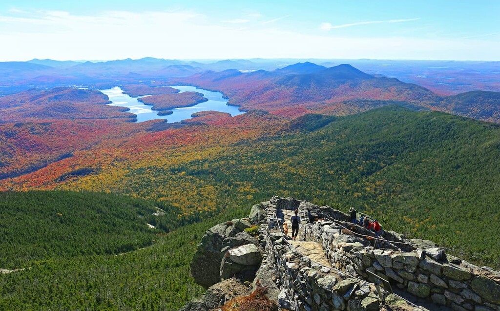
While it’s not technically part of the area, Whiteface is directly adjacent to the McKenzie Mountain Wilderness and one of the summit trails leads through the wilderness area. There are unparalleled views across the wild, untouched land of the preserve from the summit.
Located in the heart of the Adirondack Park, the McKenzie Mountain Wilderness is surrounded by other excellent hiking opportunities. Whiteface Mountain, the High Peaks Wilderness, and the Sentinel Range Wilderness are all a short drive away from the McKenzie Mountain Wilderness.
The McKenzie Mountain Wilderness lies within the Adirondacks, at the center of the unique, 160 mile (257 km) wide, 1 mile (1.6 km) high dome-shaped grouping of mountains that form the range.
The Adirondacks are the only mountains in the US northeast that are not directly related to the Appalachians. The bedrock of these mountains was first formed during the Grenville Orogenic Cycle, which predates the formation of the Appalachians. Some of the rock in these mountains is over a billion years old.
However, the processes that created the Adirondack mountains we see today are much newer, and some are still ongoing. For reasons that are still unclear to scientists, the ancient rocks of the Adirondack dome began to rise from sea level sometime between 10 and 20 million years ago, and they’re still rising today at a rate of about 1 foot (30 cm) per year.
During the last glacial maximum, ice sheets descended from the polar regions and covered this area of New York, carving unique formations into the landscape when they receded. The amphitheater-shaped cirques around Whiteface Mountain are one of the many examples of glacial landforms in the Adirondacks today.
Along with the rest of the Adirondack High Peaks, the tallest peaks of the McKenzie Mountain Wilderness are mostly made up of anorthosite, a coarse, andesine rock. Anorthosite is an intrusive igneous rock with a high concentration of plagioclase feldspar. It is rare on Earth but relatively common on the surface of the moon.
The anorthosite exposed on nearby Whiteface Mountain is characterized by greater deposits of white and gray feldspar, giving it a lighter look than much of the other exposed bedrock in the region.
The highest point in the McKenzie Mountain Wilderness is Moose Mountain at 3,888 ft (1,185 m), followed by McKenzie Mountain, Baldwin Hill, Mount Alton, and Mount Tamarac. There are a total of five mountains over 3,000 ft (914 m) in the area.
The McKenzie Mountain Wilderness is densely forested. It’s part of the greater North American Boreal Forest which extends through most of Canada, in a zone where it meets and mixes with the northern hardwood forests of the eastern US.
At elevations above 2,500 ft (762 m), the forest in the McKenzie Mountain Wilderness is predominantly softwoods featuring spruce and balsam trees. At lower elevations, mixed hardwoods, commonly beech and maple, are found interspersed with conifers.
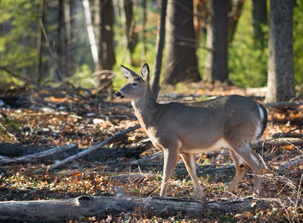
Because the forests of the preserve are so remote and inaccessible, they’re a great habit for larger animals. Deer, black bears, coyotes, and beavers are all common in the area. Notable birds include bald eagles, loons, peregrine falcons, and great horned owls.
The area of the Adirondacks has been inhabited for over 11,000 years. There have been numerous discoveries of Indigenous artifacts in the area around Lake Placid dating back thousands of years, including pottery, tools, weapons, and a half dozen dugout canoes.
The most recent Indigenous inhabitants were members of the Mohawk (Kanienʼkehá꞉ka) Tribe, the easternmost members of the Haudenosaunee (Iroquois) Confederacy, also called the Six Nations. The Confederacy is considered the oldest living participatory democracy on Earth, and it may have served as a model for the US Constitution.
The Mohawk lived mostly in what’s now called the Mohawk Valley south of the Adirondacks, but they were pushed north after the arrival of European and European-American colonists. After the Revolutionary War, the remaining Mohawk were mostly removed from their land, with many being forced to relocate to what is now Canada.
Today, the largest reservation in the area of the Adirondacks is Akwesasne/Saint Regis Mohawk Reservation on the US/Canada border in Franklin County, New York, home to the Saint Regis Mohawk Tribe. About 30,000 Mohawk people live in the US and Canada today.
After European and American settlers came to dominate the landscape, the Adirondacks were exploited for timber and mining interests. By the end of the nineteenth century, however, more and more people were interested in preserving the wild forests of the Adirondacks. Eventually, the Adirondack Park was established in 1892, initially as a way to protect the watershed of the Hudson River.
Locals and visitors have been drawn to the area for recreation since the establishment of the park. The wealthy residents who owned shoreline property around Lake Placid were particularly interested in keeping the area scenic. When clearcutting began on McKenzie Mountain in 1917, residents appealed to the state to purchase the forest land.
There are only a few trails in the McKenzie Mountain Wilderness, and most are located toward the edges of the preserve, adding to its wild character.
While there are no official Adirondack High Peaks in the McKenzie Mountain Wilderness, the hikes up Haystack, McKenzie, and Moose mountains are rugged and challenging. They make a good alternative to the ultra-popular, often crowded hikes in the High Peaks Wilderness.
In addition, Haystack and McKenzie are the tallest of the Saranac Lake 6ers, a hiking challenge involving six peaks in the Saranac Lake area.
If you’re looking for a challenge, these are the best long hikes in the McKenzie Mountain Wilderness.
McKenzie Mountain – 10.4 miles (16.7 km) roundtrip, 2,195 ft (669 m) elevation gain
The summit of McKenzie Mountain offers beautiful views over Lake Placid to Whiteface and the other peaks in the region. This route starts at the Ray Brook Trailhead and features a relatively moderate ascent until the last half mile (800 m), which is steep and challenging.
You can also take the Jackrabbit Trail to the summit, which makes for a 6.3 mile (10 km) roundtrip with 2,063 ft (628 m) of elevation gain. There’s a lean-to on this trail if you want to make it an overnight hike.
Haystack Mountain – 8.1 miles (13 km) roundtrip, 1,758 ft (536 m) elevation gain
This trail, which makes a loop over the Haystack summit, starts from the same Ray Brook Trailhead as McKenzie Mountain. There’s less climbing on this trail than on the path to McKenzie, but it’s still challenging. From the summit, there are great views to the west and southwest.
Moose Mountain – 8.0 miles (12.9 km) roundtrip, 2,230 ft (680 m) elevation gain
To reach the highest peak in the McKenzie Mountain Wilderness, you’ll need to trek deep into the forest. The route shares a trailhead with the Jackrabbit Trail on Whiteface Lane. This trail is less frequently used than the McKenzie or Haystack trails and may feature some bushwacking.
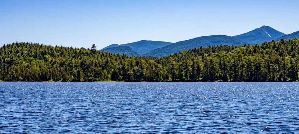
Whiteface Mountain – 12.5 miles (20 km) roundtrip, 3,353 ft (1,021 m) elevation gain
Whiteface is one of the premier day hikes in the area, featuring incredible views as far as Montreal in Quebec on a clear day. One of three trails to the summit passes through the McKenzie Mountain Wilderness.
You can hike this challenging route from the Connery Pond Trailhead on Route 86, or shorten it by taking a boat to Whiteface Landing on the north side of Lake Placid and start your hike from there. There’s a lean-to on this trail 1.1 miles (1.7 km) up the trail.
There are some beautiful shorter hikes in the McKenzie Mountain Wilderness if you’re looking for a quick excursion.
Baker Mountain – 1.7 miles (2.7 km) roundtrip, 879 ft (268 m) elevation gain
This is the most popular hike in the McKenzie Mountain wilderness. It’s short but steep and features incredible views over Lake Placid from the top.
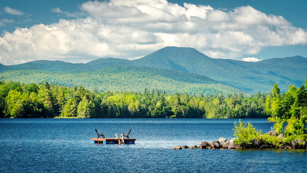
Moose Pond Trail – 3.1 miles (5 km) roundtrip, 219 ft (67 m) elevation gain
This is a moderate trail that leads out to Moose Pond for scenic views over the surrounding mountains. There are several designated sites for tent camping around the pond also.
While the McKenzie Mountain Wilderness is remote and minimally developed, it’s bordered by two of the major tourist destinations in the area.
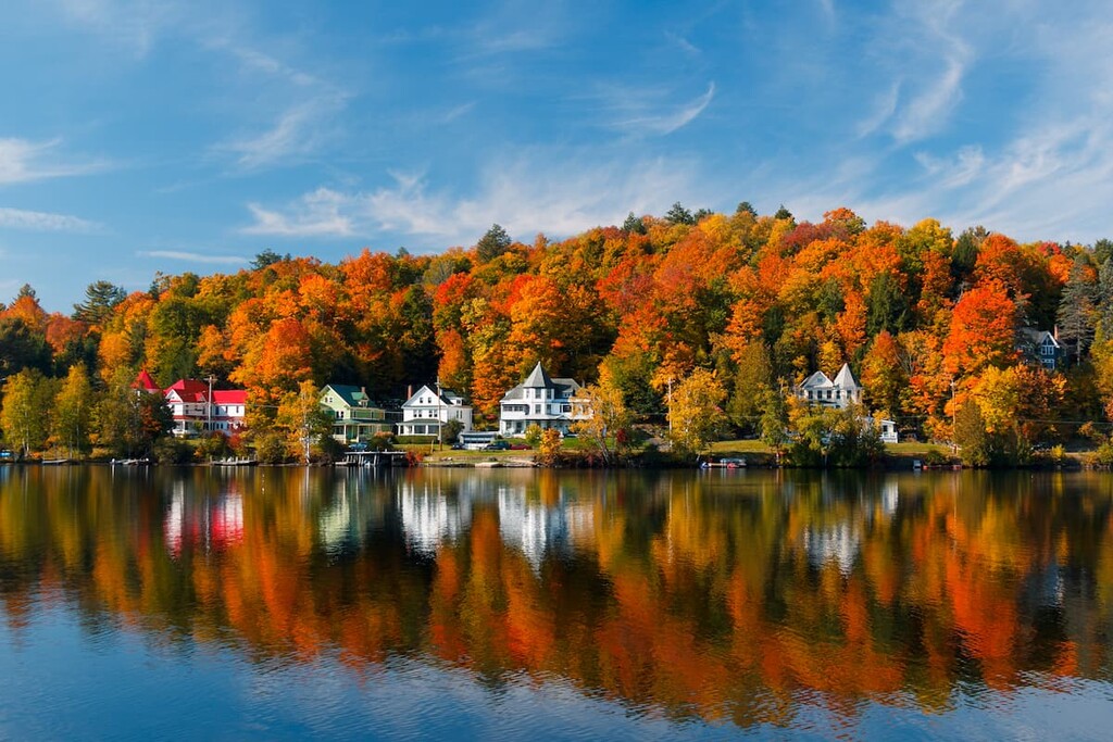
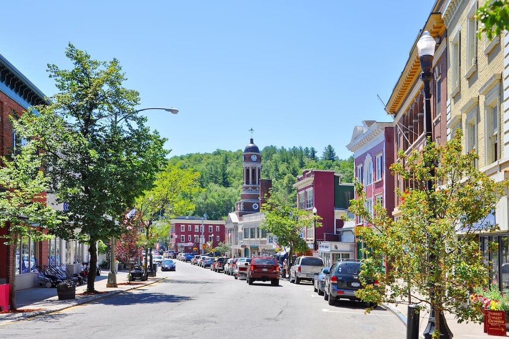
Saranac Lake is a thriving town of 5,000 with stand-out arts and cultural amenities that draw locals and visitors year-round. The town hosts a ten-day winter carnival as well as outdoor concerts and art walks during the summer months. Saranac Lake also has a vibrant downtown area with plenty of shops and galleries.
The town is also home to over 200 historic buildings and the only year-round, professional theater in the Adirondacks. For canoeists, kayakers, and other outdoor enthusiasts, the town offers great access to the surrounding forest lands and lakes, including Lake Flower and Upper, Middle, and Lower Saranac Lakes.
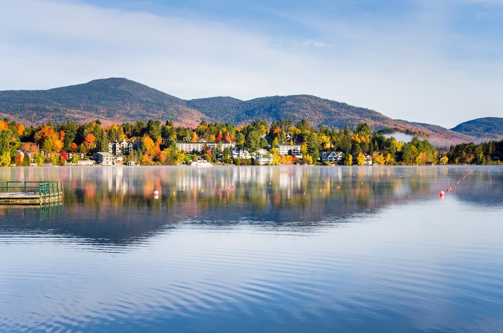
Lake Placid is a tiny town of just 2,300 full-time residents, but it’s been a major destination for over a century, thanks in part to hosting the Winter Olympics in 1932 and 1980. The town still uses and maintains the ski jump, speed skating rink, and bobsled run from those events.
There are great accommodation and dining options in Lake Placid, and the town is centrally located. This makes it a great base for exploring the McKenzie Mountain Wilderness and the most popular areas of the High Peaks Wilderness just south of town.