
Scan the QR code and open PeakVisor on your phone
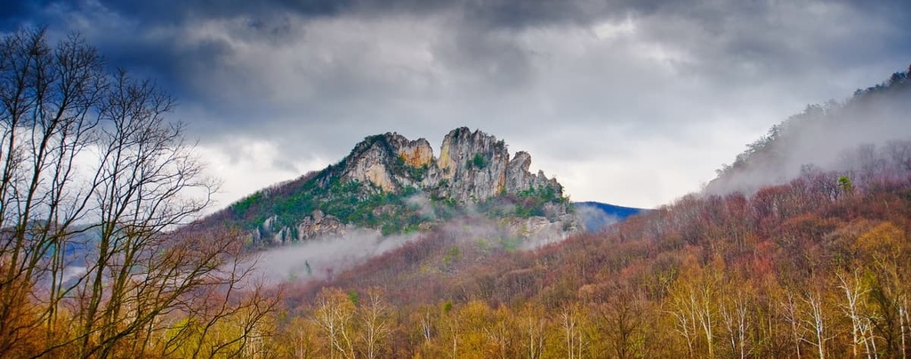
The Fires Creek Backcountry Area is located in the southwestern corner of the US state of North Carolina. The district features a varied and rugged landscape with 28 named mountains. The tallest and most prominent peak in the region is Signal Bald at 5,276 feet (1,608 m) tall with 1,752 feet (534 m) of prominence.
This protected region lies within the Tusquitee Ranger District of the Nantahala National Forest, spanning across the western portion of the US state of North Carolina. The landscape within and surrounding the backcountry area marks the second wettest regions in the continental US, after the Pacific Northwest.
The surrounding forest consists of three major districts: Nantahala Ranger District, Tusquitee Ranger District, and Cheoah Ranger District. Fires Creek Backcountry Area lies entirely within the Tusquitee Ranger District.
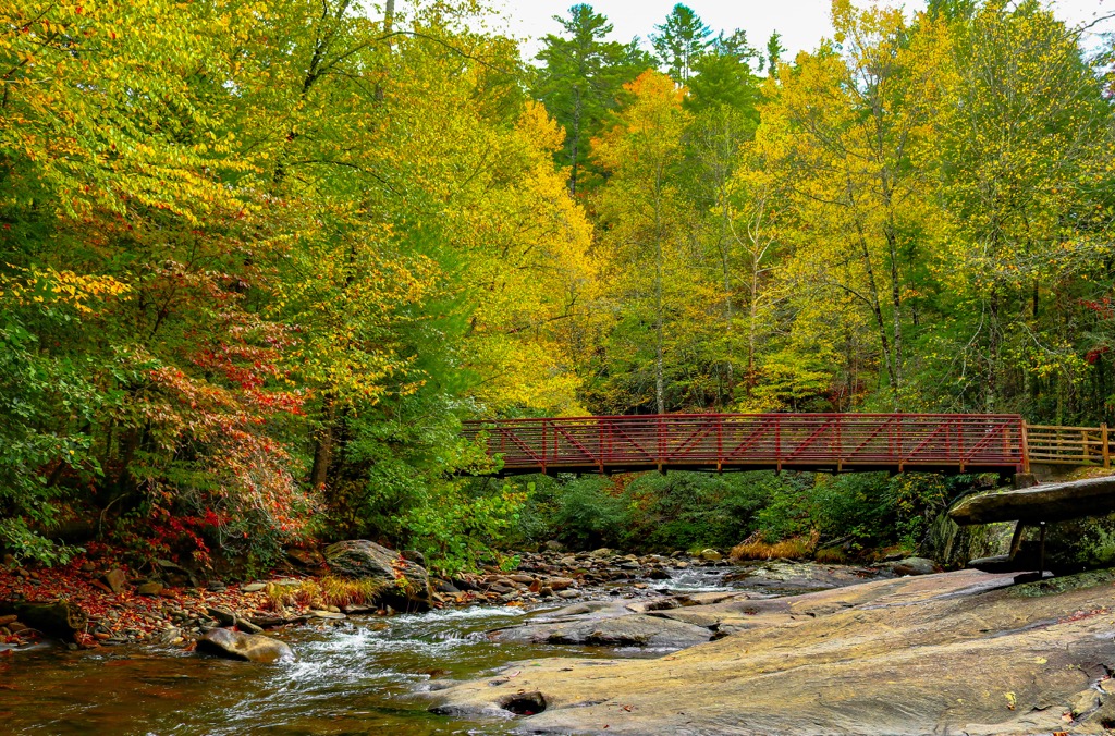
Though relatively small in size, the backcountry area encompasses rugged peaks and ridgelines surrounded by major bodies of water. The Tusquittee Creek marks the southern boundary while the Valley River marks the northern and western boundaries. Just outside the backcountry area lies Nantahala Lake to the east, Chatuge Lake to the south, and Nottely Lake to the southwest.
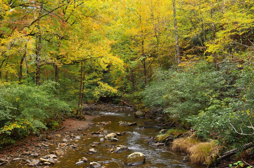
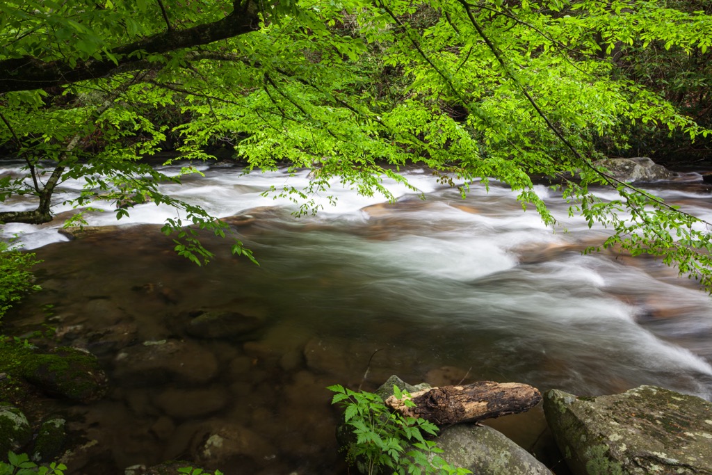
The immense amount of rainfall in the region has allowed for a variety of both flora and fauna to flourish in the area. A majority of the landscape consists of forested hillsides and ridgelines. Narrow valleys and gorges are also common amongst the various waterways.
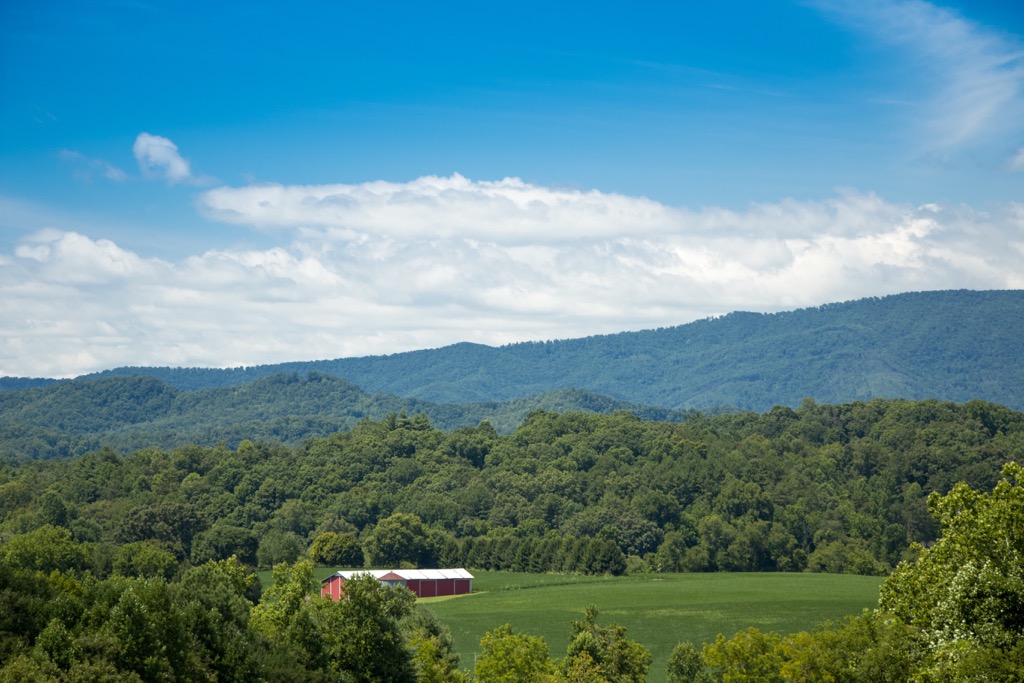
The peaks found within the region are part of the larger Blue Ridge Mountains that run throughout all districts of the surrounding national forest. These mountains are a subrange of the greater Appalachian Mountains.
This backcountry area features less designated trails than many of the surrounding portions of the forest. Just outside the boundaries of the backcountry area are sections of old growth forest, including a large patch in the Joyce Kilmer-Slickrock Wilderness.
Additionally, the Fires Creek Backcountry Area is surrounded by popular outdoor recreation areas. The Nantahala Ranger District lies northeast while the Cheoah Ranger District is located to the north. Meanwhile, the Chattahoochee - Oconee National Forest lies directly to the south and Great Smoky Mountains National Park is situated to the north.
The peaks and ridgelines found throughout the backcountry area, and the rest of the Nantahala National Forest, are part of the Blue Ridge Mountains, a subrange of the Appalachian Mountains. The Blue Ridge Mountains encompass peaks that span from the US state of Georgia northward to Maryland and Pennsylvania.
The Blue Ridge Mountains are part of a geologic province that defines the region with its unique landforms. A majority of the peaks in this region consist of metamorphic and igneous rocks.
Rocks found within the Blue Ridge Mountains date back to the Precambrian and Paleozoic eras. Around 1 billion to 250 million years ago, the Blue Ridge Mountains slowly began forming. The Grenville and Alleghenian orogenies thrust up the peaks that were once part of the seafloor.
Other major mountain ranges, such as the Alps or Himalaya, were formed just 65 million years ago during the Alpine orogeny, making the greater Appalachian Mountains one of the oldest major ranges in the world.
The various waterways found in the region have further carved out the landscape over the course of millions of years. Southwestern North Carolina is known for being rich in minerals such as mica, emeralds, rubies, sapphires, and amethysts.
Major peaks within the Fires Creek Backcountry Area include Signal Bald, Big Peachtree Bald, Big Stamp, Tusquitee Bald, and Potrock Bald.
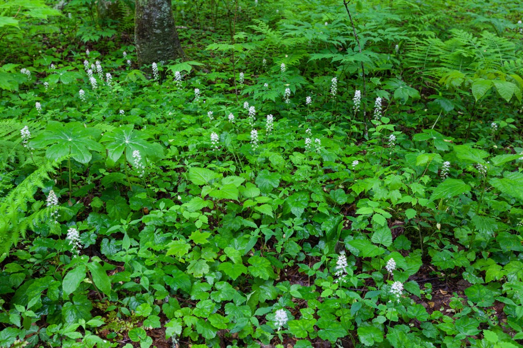
This backcountry area lies within the larger Blue Ridge ecoregion which spans across the southeastern US. Flora and fauna found in the region is very similar to that found in the surrounding national forests.
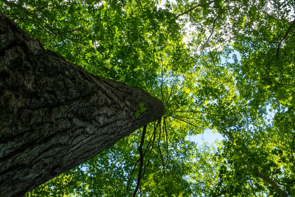
At higher elevations, the forest consists of a mix of northern hardwoods. Lower elevations often consist of oak, chestnut, hickory, heath, and shortleaf pine trees. Some of the tallest peaks are free of trees, allowing for panoramic views of the lush region.
Though the backcountry area is relatively small, the surrounding network of national forest allows for various animal species to thrive. Larger mammals often include bobcats, coyotes, black bears, white-tailed deer, and porcupines. Beavers and river otters are common in the rivers of the region.
Though determining exact territory boundaries is sometimes difficult, the land within and surrounding the Fires Creek Backcountry Area marks part of the ancestral homelands of the Cherokee people. Remnants of Paleo-Indian settlement showcase that groups of people have inhabited the southern US for nearly 8,000 years.
The traditional territory of the Cherokee Nation, and the Eastern Band of Cherokee Indians, spans across present-day North Carolina, Tennessee, and Georgia. The Cherokee people were hunters and gatherers who utilized the plethora of water sources in the region.
A Spanish expedition led by Hernando de Soto in 1540, marked the first recorded contact between the Indigenous groups and the Europeans in present-day Tennessee. The Indigenous people went on to sign numerous treaties and trade deals with the early Irish, English, and Scottish immigrants in the area.
During the 1700s the Cherokee people formed an organized national government that unified the bands of tribes. By the early 1800s, gold was discovered in present-day Georgia, leading to a large influx of settlers throughout the surrounding territory.
As the number of settlers steadily increased, the US government began forcibly removing the Indigenous peoples and forcing them onto reservations. In the process, many Indigenous people were killed as they fought to protect their homelands. The US government tried to force the tribal leaders to sign over their land via the Treaty of New Echota.
Despite the fact that the treaty was never signed, the US government forced the removal of the Indigeous people from their land and onto reservations in Arkansas and Oklahoma. This journey would later be known as the Trail of Tears with nearly a quarter of people dying along the route.
In 1920, then President Woodrow Wilson purchased the land in order to form the Nantahala National Forest. The forest was later remapped and expanded to its current size over the following decades.
The Fires Creek Backcountry Area is home to numerous hiking trails. Hikers should note that the North Carolina portion of the Appalachian Trail lies just east of the backcountry area. Here are a few of the most popular trails in the region:
The Fires Creek Rim Trail is the most popular route in the area that also showcases the beauty of the entire region. The remote trail winds through the forested landscape with multiple climbs and descents throughout.
Hikers pass along major peaks in the region such as Big Peachtree Bald, Big Stamp, Potrock Bald, and Tusquitee Bald. A majority of the route is in the shade with major viewpoints being along the ridgelines and peaks. The entire loop is 25 miles (40 km) long with 7,703 feet (2,348 m) of elevation gain.
This hiking route offers a smaller loop within the stunning and lush forested landscape. Similar to the other route, the trail lies primarily in the forested sections of the landscape with viewpoints scattered throughout.
Both hiking and mountain biking are allowed on the trail. During the wetter months of the year, the trail passes over numerous seasonal creeks. This loop trail is 6.4 miles (10.3 km) long with 1,174 feet (358 m) of elevation gain.
The Welch Farm River Trail lies along the northern boundary of the backcountry area, along the northern banks of the Valley River. This short route is located just outside the backcountry area, within the Welch Farm Nature Preserve.
The out and back route is 1.4 miles (2.3 km) long and features 9 feet (3 m) of elevation gain. Hikers can witness the stunning river views along with the peaks of the backcountry area to the south.
Looking for a place to stay near the Fires Creek Backcountry Area? Here are some of the best cities and villages to check out in the region:
The small town of Franklin lies just east of the backcountry area, situated in the heart of the Nantahala Ranger District. Franklin is home to around 4,000 residents and is popular amongst hikers visiting the region. Between the backcountry area and the town lies a portion of the Appalachian Trail.
The surrounding mountains are known for their plethora of minerals and gems, earning the town of Franklin the nickname “Gem Capital of the World”. Every year Franklin hosts the Macon County Gemboree, a well-known gem and jewelry show. Visitors can also check out the Franklin Gem and Mineral Museum which is free to the public.
The city of Asheville lies northeast of the backcountry area, situated at the confluence of the Swannanoa and French Board rivers. Home to around 91,000 residents, Asheville is the most populous city in western North Carolina.

Surrounded by the Blue Ridge Mountains, Asheville is known for its plethora of outdoor activities and local restaurant scene. The city is also known for its craft beer, having more breweries per capita than nearly any other city in the country. Popular spots in the region include the River Arts District and the Biltmore Estate.
The surrounding forested landscape has enabled Asheville to become a hub for mountain biking, hiking, and trail running. The nearby rivers are popular spots for paddle boarding and whitewater rafting.


