
Scan the QR code and open PeakVisor on your phone
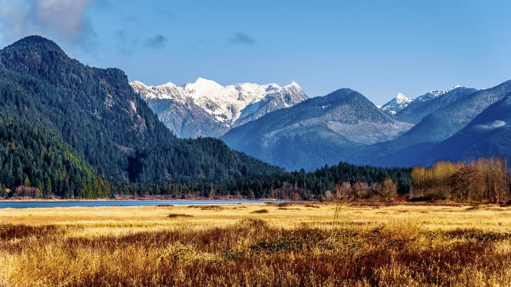
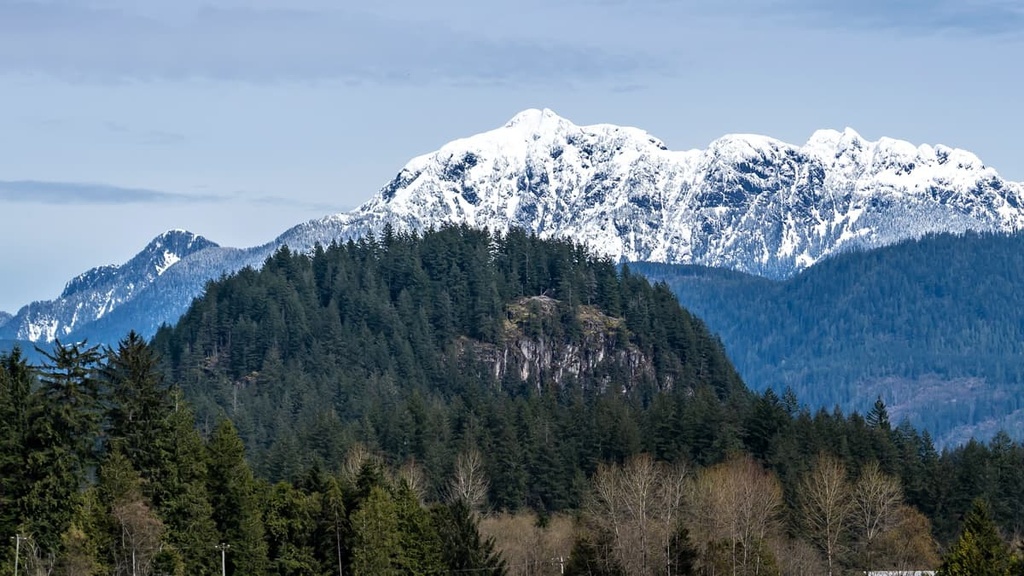
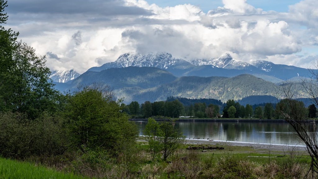
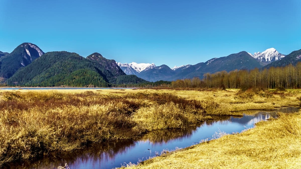
Situated near the southwestern coast of British Columbia, Canada, the Coquitlam Watershed is a major drainage area that encompasses 14 peaks of the Pacific Ranges in the Canadian Coast Mountains. At 1,801 m (5,909 ft) in elevation, The Forefinger is the tallest peak in the watershed while Coquitlam Mountain (1,538 m/5,194 ft) is the most prominent with 693 m (2,274 ft) of prominence.
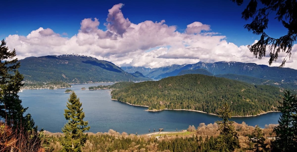
Located in the Lower Mainland of British Columbia, Canada, the Coquitlam Watershed is one of three watersheds that provide drinking water to the 21 municipalities of Metro Vancouver. The other two watersheds (Capilano and Seymour) are located upon the slopes of the North Shore Mountains, while the Coquitlam Watershed is situated in the Coquitlam Ranges.
The Coquitlam Watershed encompasses the peaks and slopes of 14 named mountains, the highest of which is The Forefinger at an elevation of 1,801 m (5,909 ft) above sea level; however, The Forefinger only has 119 m (390 ft) of prominence. As such, Coquitlam Mountain is the most prominent peak in the watershed because it has 693 m (2,274 ft) of prominence.
While all of Metro Vancouver’s watersheds are closed to the public, guided watershed tours are available at Coquitlam for people who want to explore the area. Additionally, there are several major parks located near the watershed that provide recreational opportunities in the region, such as:
The current topography of the Coquitlam Watershed was primarily created during the Pleistocene; however, the underlying bedrock in the region is much older. The mostly granitic mountains of the Coquitlam Watershed are part of the Pacific Ranges of the Canadian Coast Mountains.
The Coast Mountains started forming about 115 million years ago when the Insular Islands were accreted to the western coast of North America. The Insular Islands, which were a chain of islands riding on the Farallon tectonic plate, formed about 300 million years ago.
During the collision and subduction of the Farallon plate beneath North America, the islands were accreted to the continent while the plate subducted beneath the edge of North America. The subduction of the Farallon plate led to the start of the Coast Range Episode, which was a period of volcanic activity that occurred throughout the Coast Mountains.
During the Coast Range Episode, as the Insular Islands were being compressed against the continent, magma intruded the volcanic and sedimentary layers of the ancient island arc. While many volcanoes erupted during this time, the magma intrusion also created the Coast Range batholith. This batholith underlies the Coast Mountains and is the largest single body of granitic rocks in North America.
Over the past 4 million years, the Coast Mountains have experienced rapid uplift, which has been the cause of high rates of erosion and the creation of the current topography of the Coquitlam Watershed. During the Pleistocene, glaciers adorned the peaks of the mountains in the watershed. The cordilleran ice sheet also completely covered the area at least once during this period.

The surface geology of the watershed shows that the region is covered by massive layers of glacial till and sediment from three different time periods. Outwash from the Semiahmoo glaciation, silt and sand from the Olympia non-glacial interval, and sediments from the Fraser glaciation are found across the watershed.
The uppermost layers of sand, gravel, and till that are found in the Coquitlam Watershed were only deposited about 18,000 years ago at the end of the Fraser glaciation. The Fraser glaciation was the most recent glacial maximum in southwest British Columbia. Its end also marked the end of the Pleistocene and the beginning of the Holocene.
The plants and animals found in the Coquitlam Watershed are representative of the typical ecosystems of southwest British Columbia. The ecosystems of the watershed include those of the Pacific Temperate Rainforests, the Mountain Hemlock subalpine zone, and the Coastal Mountain Heather Alpine zone.
The Pacific temperate rainforests that are found in the watershed are referred to as the Coastal Western Hemlock zone in British Columbia. This zone contains the productive forests that are located along the Pacific coast. In general, this zone is also characterized by a large amount of annual rainfall.
Here, you can find an abundance of massive red cedars, Sitka spruce, Douglas fir, and western hemlock trees. Amabilis fir, big leaf maple, and alder are also commonly found among the coastal giants of this zone.
However, significant tracts of forests were logged in the Coquitlam watershed throughout the early twentieth century. While logging was common in the area at the beginning of the twentieth century, conservationists and scientists soon recognized the importance of maintaining healthy forests for water quality and the overall health of the region’s ecosystem.
By the late twentieth century, it was deemed that logging was detrimental to the health of the water and ecosystem in general in the watershed. As a result, logging activities in the watershed came to a halt.
The subalpine of the Coquitlam Watershed serves as the transition zone between the rainforests and the alpine. The relatively narrow subalpine band around the mountains contains forests of mountain hemlock, amabilis fir, and yellow cedar. These forests become more open at higher elevations as they transition into a parkland-like area with stands of trees among open meadows.
Above the treeline, grassy meadows and meadows dominated by heather abound. Wildflowers are prevalent in the region during the spring and summer, and they add a sense of majesty to the alpine peaks. At the highest elevations in the watershed, even the grass and heather refuse to grow, so the peaks are typically rocky and barren.
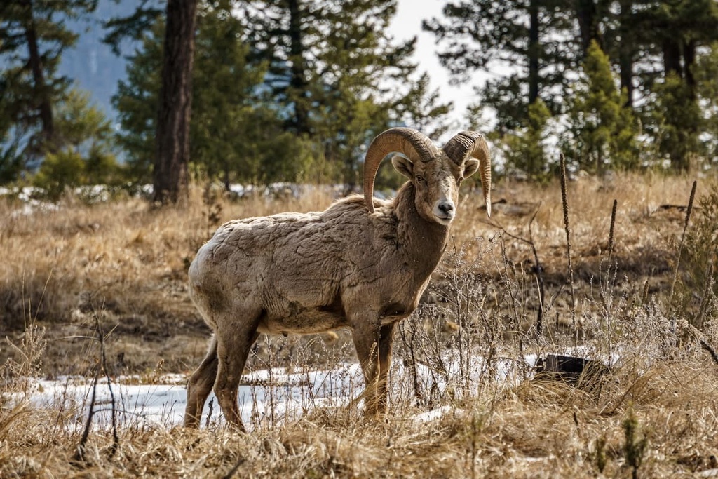
Mountain goats inhabit the alpine areas of the watershed, as do bighorn sheep, especially during the summer months. Marmots and Columbian ground squirrels build their nests below the alpine rocks in the area and they like to forage for vegetation along the tree line.
In the watershed’s valleys, cougars, wolves, grizzly bears, black bears, mule deer, white-tailed deer, and moose all forage and hunt for food. Salmon spawn in the creeks and streams of the watershed, too; however, the damming of the waterways for power generation is a concern for the well-being and sustainability of the local fish population.
The lush, temperate coast of southwest British Columbia has provided an abundance of food and resources for both the historic and contemporary inhabitants of the Coquitlam Watershed region. The watershed is part of the traditional territory of the Kwikwetlem First Nation (kʷikʷəƛ̓əm), who are a Coast Salish people.
Archeological evidence and cultural knowledge suggest that the area surrounding the Coquitlam River has been inhabited by humans continuously for the past 9,000 years. The commencement of human habitation in the region roughly coincides with the time period in which the region would have become habitable after the end of the Fraser glaciation.
The name Kwikwetlem is also a word that refers to a small red fish, namely, the sockeye salmon. According to cultural knowledge held by the Kwikwetlem First Nation, sockeye salmon, which traditionally spawned in the Coquitlam River, would historically arrive in the region in such dense numbers during the spawning season that navigating canoes up the river could become difficult or impossible.
The Kwikwetlem come from a rich tradition and culture. Many members of the Kwikwetlem First Nation and their ancestors are and were expert canoe and paddle makers, master sturgeon fishers, and skilled spirit dancers. Current members of the First Nation continue to draw upon these skills as they steward the land that they have lived upon for generations.
It’s believed that the first people of European descent to venture into the Coquitlam Watershed were Simon Fraser and his team who arrived in the region in 1808. During this trip, Fraser and his group traveled down the Fraser River past the mouth of the Coquitlam River as they made their way toward the Pacific.
It wasn’t until the mid-nineteenth century that non-Indigenous settlers came to the area and founded the current settlements of Coquitlam and Port Coquitlam (though First Nations had been living in the region since time immemorial). Coquitlam was incorporated in 1891, and until 1913, it included the areas of Port Coquitlam and Fraser Mills.
Coquitlam grew from the original Fraser Mills townsite, which was created to house the employees of the recently built sawmill. Having first started operations in 1890, Fraser Mills grew to employ 850 men by 1910. In the early days of the mill, the company’s management inadvertently created a unique French culture in the Lower Mainland of British Columbia by primarily hiring milling and logging industry veterans from Quebec.
While the French-speaking culture on the Lower Mainland is not dominant by any means, the area still maintains historic ties to the French Canadians that once worked at the mill. In addition to logging and milling, farming and gravel mining were the predominant industries in the area until urbanization began in the 1960s.
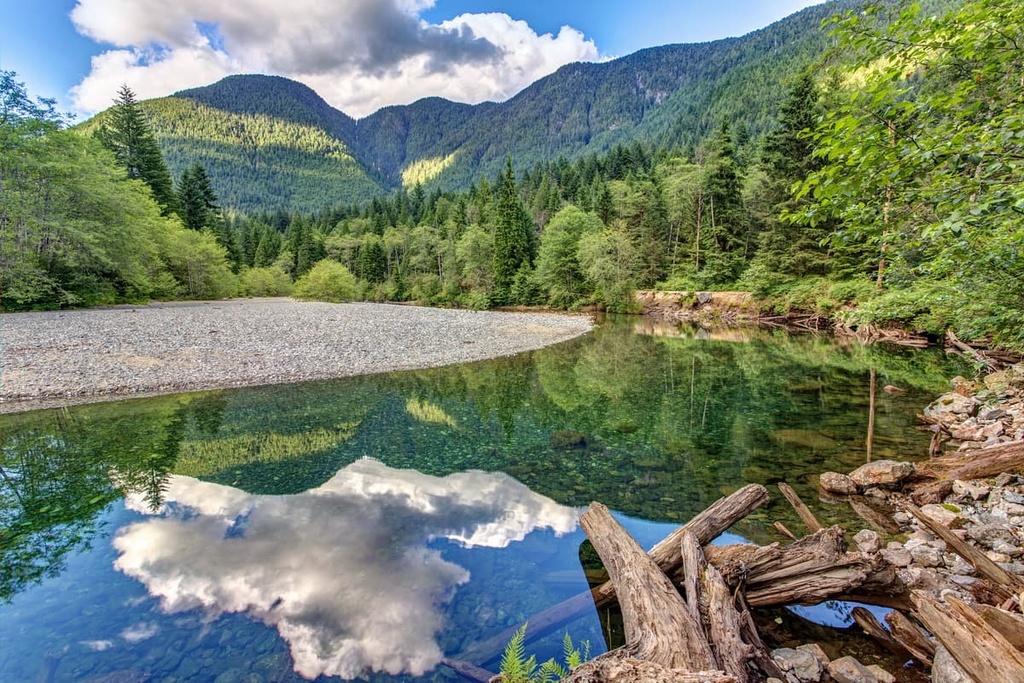
The Coquitlam Watershed is generally closed to the public in order to maintain the high quality of the ecosystem and its waterways; however, there are still opportunities to visit the watershed on a guided tour. Hiking tours are offered during the summer months while snowshoe tours are offered during the winter for people who want to enter the key areas of the watershed.
Additionally, the peaks that are located along the periphery of the watershed are generally accessible via the adjacent provincial parks and recreation areas. The following are some of the main hikes and destinations that are open to the general public and that will take you into the Coquitlam Watershed:
As it is located in what is referred to as the Lower Mainland of British Columbia, the Coquitlam Watershed is situated near many large cities. The following are some of the major cities in the area that are worth checking out during your next trip to the region.
The city of Vancouver is located at the southern end of the Pacific Ranges and is nearly adjacent to the Coquitlam Watershed. Vancouver is British Columbia’s largest city, though it is also one of the youngest cities in the province as it was founded in 1862.
Vancouver is also centrally located in the region, and it offers easy access to many incredible wilderness provincial parks, such as Mount Seymour Provincial Park, Garibaldi Provincial Park, Golden Ears Provincial Parks, and Pinecone Burke Provincial Park. All of these parks feature opportunities for day hikes and weekend camping trips as well as trails for longer backcountry expeditions.
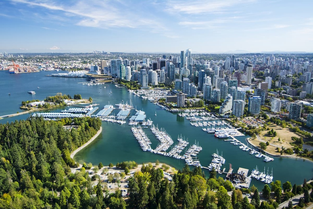
While in the city proper, you can check out Stanley Park, which is one of North America’s largest urban parks. Some of the popular hikes that you can enjoy around Vancouver include the trails in and to St. Marks Summit, Quarry Rock, Grouse Grind, Pacific Spirit Regional Park, Burnaby Lake Park, and Norvan Falls.
Once you’re done hiking for the day, Vancouver has a vibrant nightlife and concert scene for you to enjoy. In fact, many young bands get their big break on Vancouver stages. Other cultural attractions to check out in Vancouver include the city’s many libraries, museums, performing arts venues, and art galleries.
Located at the north end of Howe Sound on the Sea to Sky Highway in British Columbia, the town of Squamish is situated about 100 km (60 mi) to the northwest of the Coquitlam Watershed. The community of Squamish is a popular destination for tourists in search of outdoor adventure and recreation. Indeed, rock climbing and bouldering are extremely popular activities around Squamish.
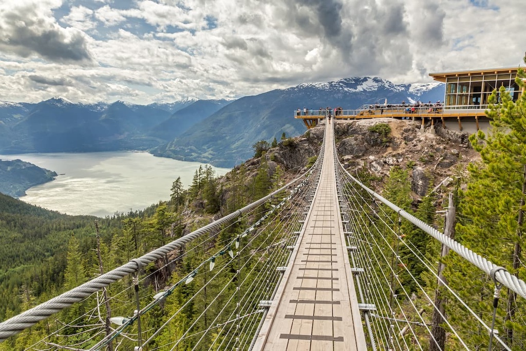
Squamish is also a popular destination for windsurfing, kiteboarding, trail running, rafting, snowmobiling, hiking, mountaineering, and backcountry skiing. Some of the best activities to enjoy in the area include hikes to Shannon Falls and rafting trips down the Squamish and Elaho Rivers.
However, climbing is the main attraction around Squamish as there are thousands of routes that are published in local guide books. Some of Squamish’s most popular routes are located on the granite massif called the Stawamus Chief, which features over 300 climbs. Climbers in the area will also likely want to travel to Shannon Falls, Murrin Park, The Malamute, and the Smoke Bluffs, all of which contain an additional 1,500 climbing routes.


