
Scan the QR code and open PeakVisor on your phone
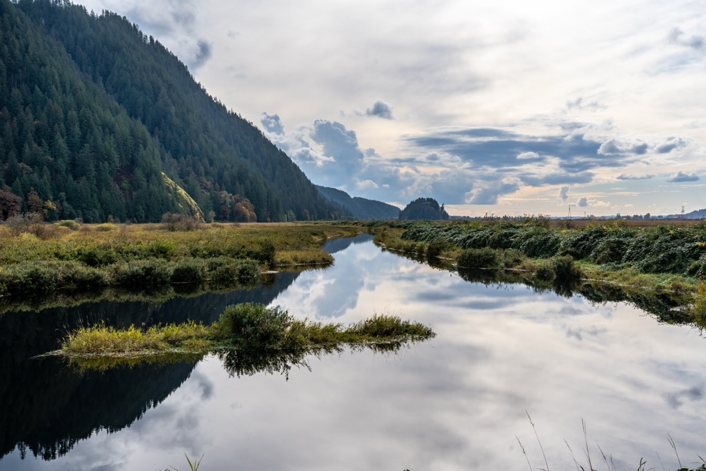
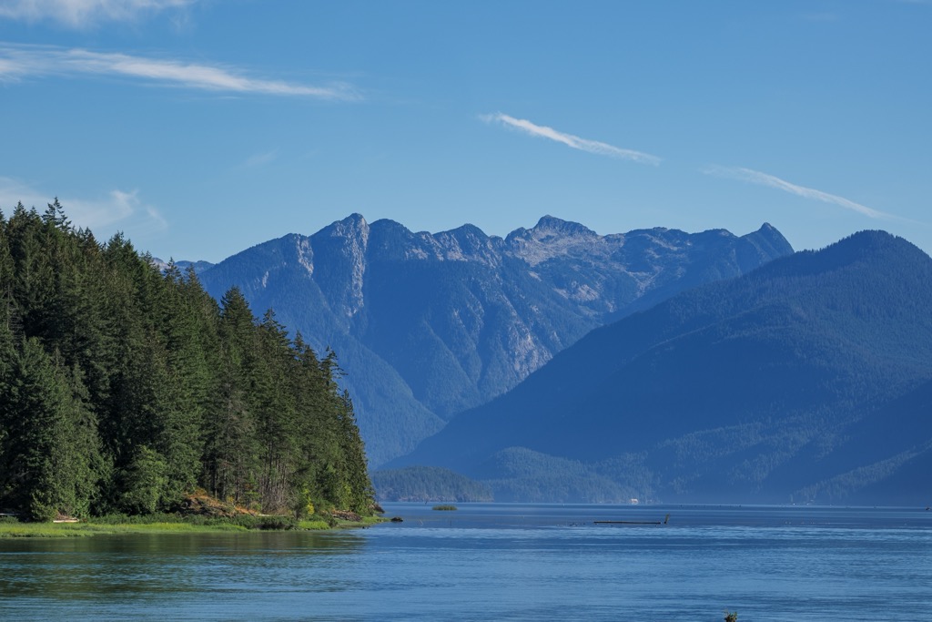
Pitt-Addington Marsh Wildlife Management Area (WMA) is northeast of Metro Vancouver, in British Columbia, Canada. The management area is an alluvial floodplain at the south end of Pitt Lake, which supports over 200 avian species and provides hiking, trail running, and bird-watching opportunities. Big Pine Mountain and Little Pine Mountain stand as granite sentries in the park’s midst, overlooking the changing tides in the world’s largest tidal freshwater lake. The Pitt-Addington Marsh provides visitors with year-round scenic views and serene wilderness alongside BC’s largest metropolitan area.
The Pitt Addington Marsh Wildlife Management Area is a wilderness refuge northeast of the Vancouver Metropolitan Area in British Columbia, Canada. These critical wetlands provide crucial breeding, migration, and wintering habitat for over 200 bird species and 29 mammal species. The park was first established as a wildlife management area in 1987.
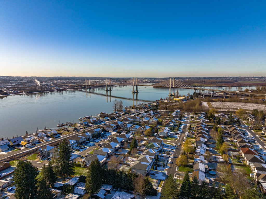
The Pitt-Addington Marshes are at the south end of Pitt Lake, created by glaciers during the Pleistocene and now the world’s largest freshwater tidal lake. Pitt Lake is just north of the cities of Pitt Meadows and Maple Ridge, which are part of Metro Vancouver.
This corner of the province and the Vancouver Metro Area are the most populated area of BC. Highway 1, the Trans-Canada Highway, is the region’s major access road; visitors to the Pitt-Addington Marsh should branch off and follow Rannie Road.
Grant Narrows Regional Park is located at the north end of Rannie Road and provides parking and facilities to Pitt-Addington visitors. Additionally, the Pitt-Polder Ecological Reserve is within the wildlife management area and encompasses the bogs and forests around Big Pine Mountain and Little Pine Mountain.
The wildlife management area is part of the regional and provincial efforts to preserve wildlife habitat, unique natural features, and wilderness recreation areas. Grant Narrows Regional Park at Pitt-Addington Marsh is the gateway to exploration of Pitt Lake and further wilderness adventures in the adjacent Golden Ears Provincial Park and Pinecone Burke Provincial Park.
The following are some other notable parks and wilderness areas near Pitt-Addington Marsh:
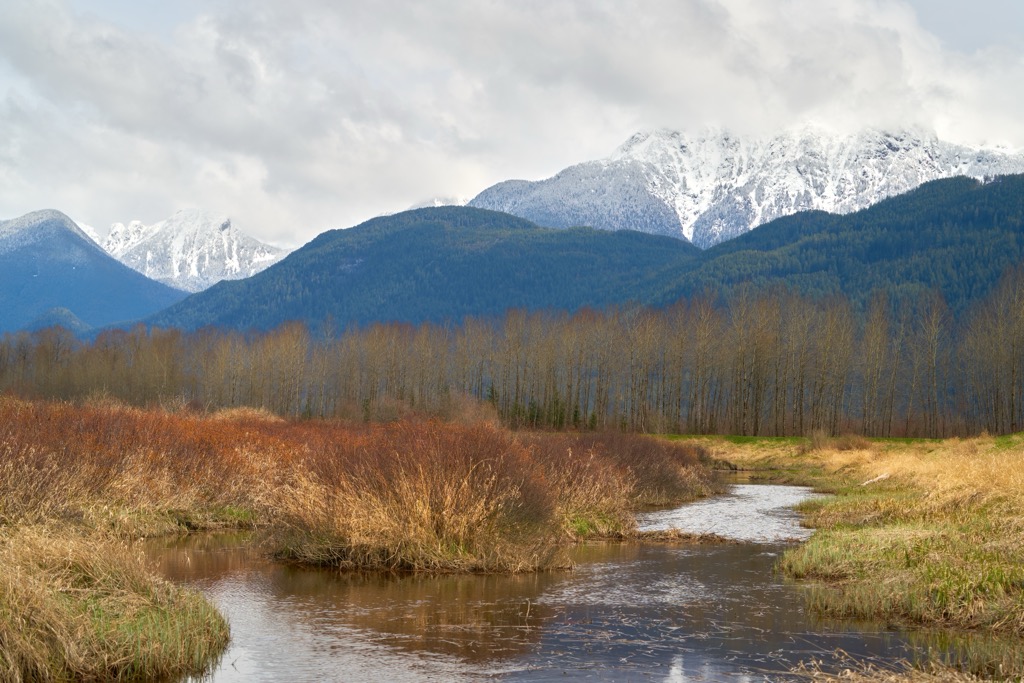
The Coast Mountains dominate the skyline around Metro Vancouver and the Pitt-Addington Marsh. Specifically, the marsh is within the Pacific Ranges of the Coast Mountains; this range began to form about 130 million years ago.
The formation of the Pacific Ranges was part of a relatively rare geological sequence of events. First, the subduction of the Insular plate under North America's west coast led to a series of volcanic events along the coast and the accretion of the Insular Islands to form a new continental margin.
The volcanic activity welded the Insular Islands to the growing mainland and created North America’s largest granite outcrop. Furthermore, the collision of the Insular Islands compressed the old continental margin, causing it to fold, fracture, and uplift as the new Coast Mountains.
The Insular plate finished subducting about 115 million years ago, shutting down the subduction zone and the associated volcanic activity. However, about 100 million years ago, the Farallon plate, which had previously been subducting beneath the Insular plate, had reached the continental margin, setting off a new eruptive period.
Due to crustal thinning caused by the subducting Farallon plate, lava erupted from volcanoes and vents along the coast through the Late Cretaceous. Furthermore, massive amounts of magma were injected into the older igneous and sedimentary rocks of the Insular Belt, forming granite batholiths.
Granite batholiths form when magma cools slowly beneath the surface. The Coast Mountains feature extensive granite batholiths known as the Coast Plutonic Complex. Although many original volcanoes from 100 million years ago have eroded, a vast granitic backbone still underlies the Coast Mountains.
About 85 million years ago, the geology along the west coast began to change again; the northern portion of the Farallon plate had broken off, forming what was known as the Kula plate. A newly forming oceanic ridge was pushing the Kula plate towards North America, forcing it to subduct and heralding a new round of geological events.
The subduction of the Kula plate started the Laramide orogeny, which formed the Canadian Rockies and significantly uplifted the Coast Mountains. Around the Pitt-Addington Marsh, the newly infused molten granite metamorphosed surrounding rocks.
Old ocean sedimentary layers heated into glittering schist while the igneous rocks of previous intrusion became gneiss. In some places, the igneous and sedimentary rocks appear to have nearly melted under intense pressure and heat, creating swirl patterns known as migmatite.
Around two million years ago, more volcanic activity occurred as the Farallon plate broke again, and the new Juan de Fuca plate was subducted beneath the coast. Around this time, the Pleistocene started, and the Canadian landmass slowly became sheathed in ice.
The glaciers formed among the high peaks of the Pacific Range and coalesced into an ice sheet several kilometers thick in some areas. Glaciers flowed through the valley that would become Pitt Lake, deepening the valley during the most recent glacial maximum.
After the most recent glacial ice retreated about 13,000 years ago, the valley filled with ocean water and became one of the many rugged fjords off the west coast. Ocean water flowed into the valley because the weight of the glaciers had pushed down the continent's edge. The melting glaciers were simultaneously refilling the ocean.
By about 10,500 years ago, the continent was rebounding, and sediment flowing out of the adjoining Fraser River filled the fjord, partially cutting it off from tidal flows to form Pitt Lake. Pitt Lake is the largest freshwater tidal fjord lake in the Pacific Ranges.
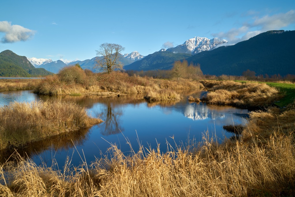
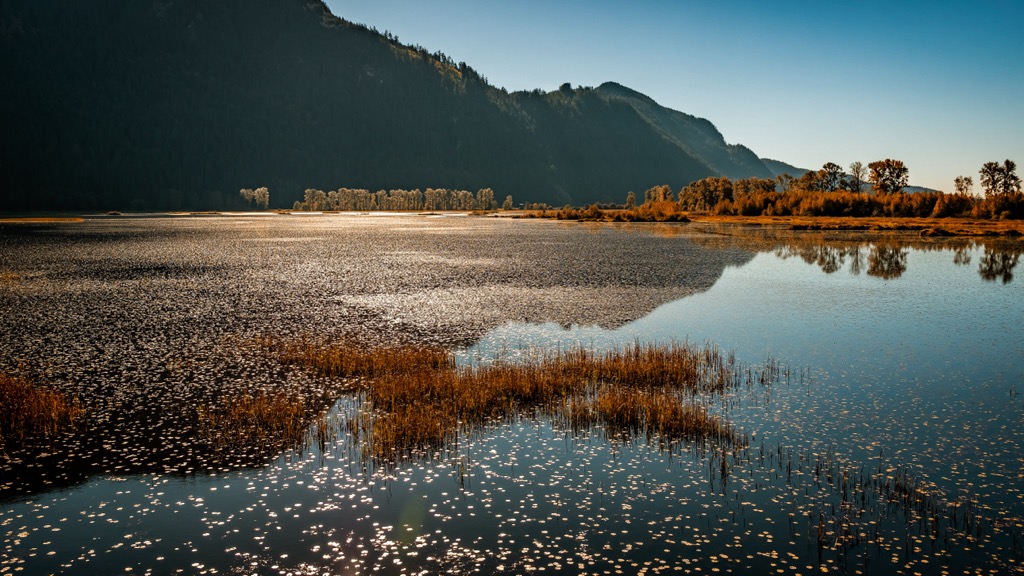
The Fraser River fills the south end of Pitt Lake with sediment in an unusual tidal situation. Rivers typically deposit sediment at their mouth, which the Fraser River does while the tide is out. However, with an incoming tide, the flow of the Fraser River is stalled and redirected up the Pitt River. The reversed flow deposits Fraser River sediment as a rare reverse alluvial fan on the south end of Pitt Lake. The Pitt-Addington Marsh itself formed upon the alluvial deposits from this backflow.
The surface layer of the marsh is about 15 m (50 ft) of river deposits from the Pitt and Fraser Rivers that overlay up to 300 m (980 ft) of marine silt, sand, and clay. The underlying layer of silt, sand, and clay was the sediment that initially cut off the fjord from the ocean to create Pitt Lake at the end of the Pleistocene.
Big Pine Mountain and Little Pine Mountain are granitic knolls that rise roughly in the middle of the delta. These were likely part of ancient magma intrusions from one of the volcanic periods that affected the region. Then, during the Pleistocene, glaciers scoured the softer igneous and sedimentary rocks from around them, leaving them as the most prominent points in the glacial valley.
The Pitt-Addington Marsh Wildlife Management Area is at the northern edge of the Fraser Lowland and occupies a large delta at the southern end of Pitt Lake. Two peaks, Big Pine Mountain and Little Pine Mountain, punctuate the flat alluvial plain and have affected their local ecology.
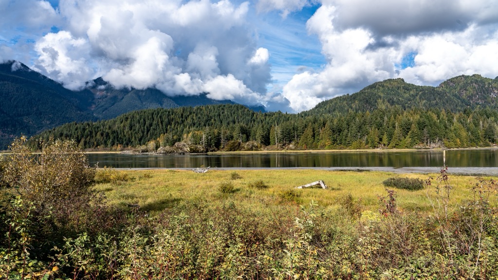
The valleys and peaks surrounding the Pitt-Addington Marsh are part of the Coastal Western Hemlock biogeoclimatic zone, characterized as a temperate rainforest. The forests around the marsh consist of giant red cedars, thick Douglas fir, massive coastal hemlock, big-leaf maple, and alder.
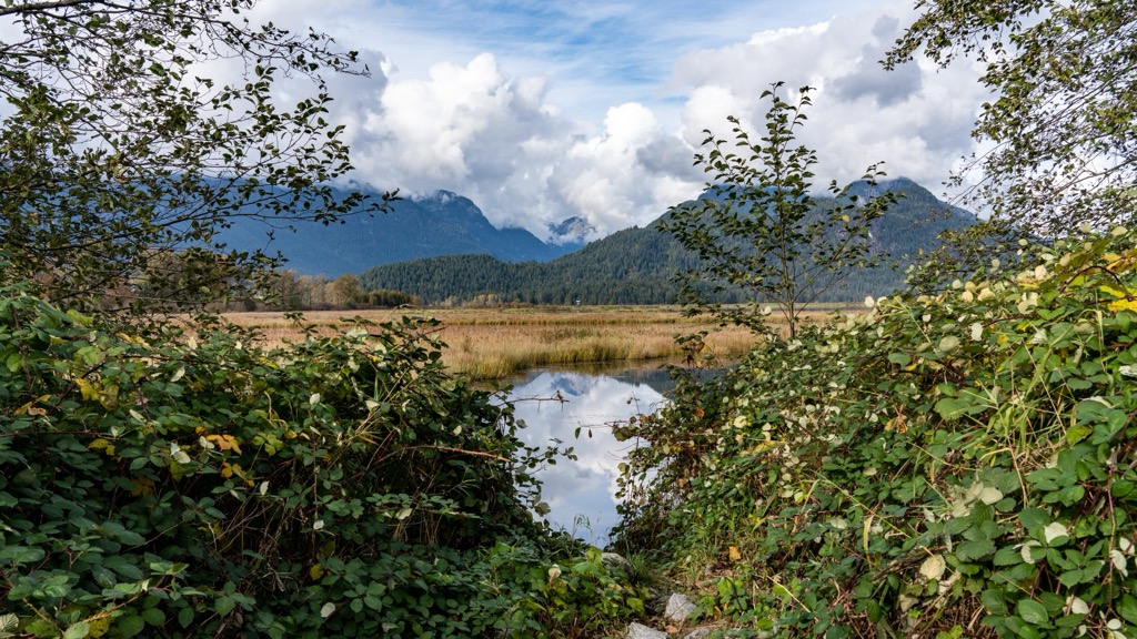
The reserve surrounding the two peaks has the most ecological diversity, while the rest of the marsh is a flat wetland area of sedge bogs. While the general vegetation of the sedge bogs can appear uniform, the park has a great diversity of plants. Some rare plants in the marsh area are sessile-leaved sandbar willow, two-edged water-starwort, and pointed broom sedge.
In the ecological reserve around the knolls and marsh area, it is easy for the untrained eye not to recognize the diversity among the common plants. Heath shrubs dominate the open boglands with species such as Labrador tea, bog laurel, bog cranberry, and bog blueberry. The cloudberry shrub also grows in the boglands. Once widespread in the north, it is no longer common in this area.
Around Big Pine and Little Pine Mountain, lodgepole pine forests grow in addition to paper birch stands. The area around the base of the mountains is still boggy; reed canarygrass is the dominant grass, and hardhack is the dominant understory shrub of these boggy forests.
Higher up the mountains, the composition of the forest changes to lodgepole pine and hemlock forests. Red alder and Douglas fir stands tower above an understory of salmonberry, bracken, lady fer, salal, and red huckleberry.
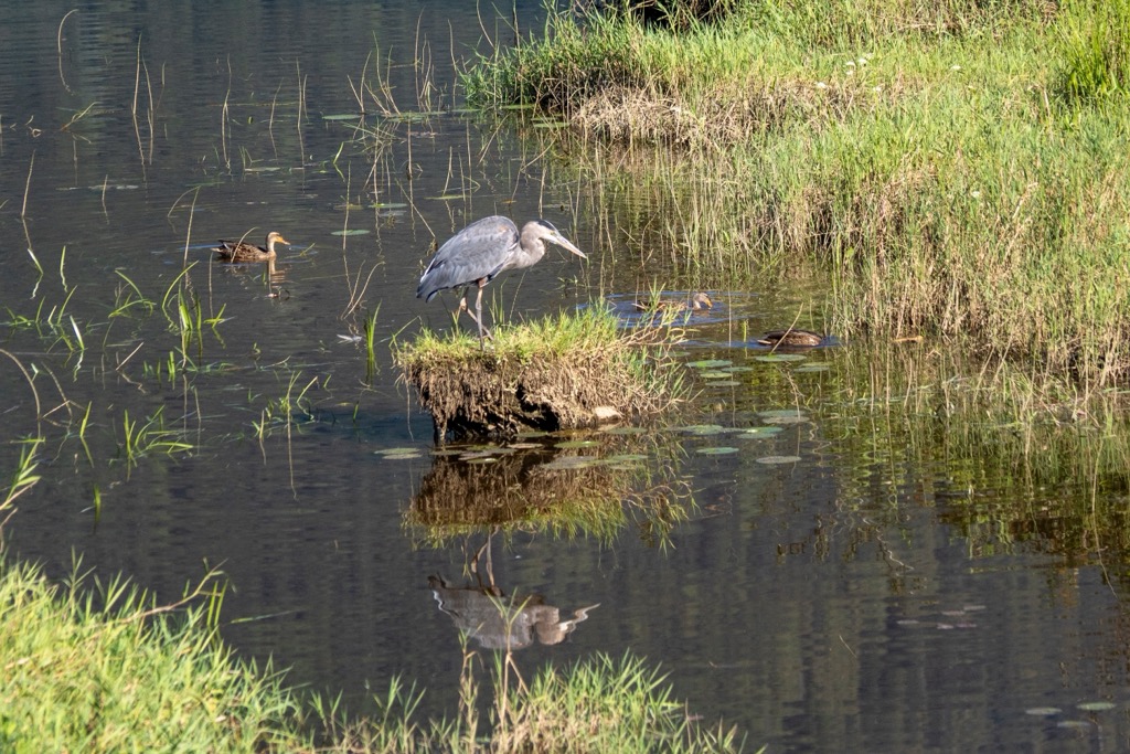
The wetlands of Pitt-Addington Marsh are especially critical for local and migratory birds. Over 200 known bird species inhabit this area and come for seasonal breeding and feeding. However, human activities in the parks and adjacent agriculture are affecting the wildlife and general ecology of the park.
The water levels within the park are lowering, which may be partly caused by climate change; however, it is due mainly to the construction of dikes and drainage ditches. The lower water table has enabled the growth of the forests surrounding Big Pine Mountain.
Among the notable birds are the greater sandhill cranes; the park is one of only two nesting sites in the Lower Fraser Valley. Parts of the park are closed annually between March and August to maintain the breeding and nesting of these magnificent creatures.
Other resident birds include various raptors, which are most common during the winter months. You might see ospreys, turkey vultures, northern harriers, red-tailed hawks, bald eagles, and sharp-shinned hawks circling and hunting.
Canada geese are a common sight in the marsh, as are mallards, teals, pintails, wood ducks, and widgeons. The wetland is home to 29 mammal species, of which coyotes, mule deer, and black bear are the largest.
The Pitt-Addington Marsh WMA is part of the traditional territory of the Katzie First Nation, which includes the entire Pitt and Alouette watersheds, the Fraser River and adjacent lands to Point Roberts, and the lands between the Fraser River and Boundary Bay.
The Katzie are part of the Sto:lo Coast Salish; however, their current government is independent of other tribal councils. European settlers historically referred to them as Fraser River Indians or Fraser Salish, and they speak həṅq̓əmín̓əḿ, which is the downriver dialect of Halkomelem, one of the common Salishan languages.
There are lovely stories of the Katzie people and how they settled the region. The legends tell of how Oe’lecten and Swaneset were among the first five great leaders and how these leaders finished the creator’s work, shaping the territory and creating plants and animals.
The legends then talk of Khaals, the Great Transformer, who came and finished the work of creation. The legendary travels of Khaals took him up and down the Fraser, Pitt, and Alouette rivers, where he performed many feats, such as turning a boastful warrior to stone at the mouth of the Pitt River.
Before his final trip up the Fraser River, Khaals visited the villages of Oe’lecten and Swaneset, near Grant Narrows and Sheridan Hill, respectively, to tell them of the resources he had created for them and taught them how to harvest these resources to ensure the survival of their people.
For generations, the Katzie people flourished in the Pitt, Alouette, and Fraser River valleys. It’s said that before the arrival of the Europeans and the beginning of the smallpox epidemics of the following centuries, they were so numerous that the smoke from their morning fires covered the landscape with a haze.
The Katzie people created their own cartography and nomenclature to help them identify their territory's streams, rivers, berry bogs, mountains, valleys, and peaks. In their language, Pitt Lake translates as ‘Lake of the Katzie’ and the Pitt River as ‘River of the Katzie.’
In addition to the traditional hunting, fishing, and gathering of the Coast Salish people, the Katzie practiced agriculture by cultivating cranberries and a potato-like tuber called wapato in wetland ponds. Some of the wapato ponds were hundreds of feet long.
The relative abundance of resources enabled the Coast Salish to develop a class system and social structure. Part of the Katzie social structure allowed individual families to maintain harvesting rights to certain areas for wapato and cranberries while collectively managing other tracts.
When traders from the Hudson Bay Company arrived in the early nineteenth century, they witnessed hundreds of families traveling to the Katzie territory in autumn to participate in the wapato harvest. It was apparent that wapato was essential to their survival and that it was a valuable trade item as well.
Settlement and colonization of the Lower Mainland brought epidemic diseases to which the natives held no immunity. At first, it was smallpox, then tuberculosis, Spanish influenza, measles, and other ailments which devastated the indigenous populations in wave after wave of deadly epidemics. It was as if the natives had been subjected to ten bubonic plague outbreaks within just a couple of centuries. Ultimately, disease alone reduced their populations by at least 80%.
Near the late twentieth century, local politicians and conservation groups saw the importance of preserving the wetlands at the south end of Pitt Lake for their endangered ecology. As such, Pitt Polder Ecological Reserve was established in 1980, and the Pitt-Addington WMA in 1987.
During colonial times, Europeans created reserves for the remaining Katzie within their traditional territory. As of 1990, about 400 Katzie remained in the Lower Mainland.
All people are welcome to walk along the dikes and through the Pitt-Addington Marsh to enjoy the serenity and wilderness. While visiting the area, remember and acknowledge that sq̓ə́yc̓əyaʔɬ x̌acaʔ (Pitt Lake) and q̓ə́yc̓əyaʔɬ státləw (Pitt River) are the heart of the Katzie territory and the birthplace of their culture.
The Pitt-Addington Wildlife Management Area encompasses nearly 3,000 hectares (7,500 acres) of wetland at the south end of Pitt Lake. The area is a marshy alluvial fan with two significant granite knolls rising from the middle and providing habitat to over 200 bird species, including the greater sandhill crane.
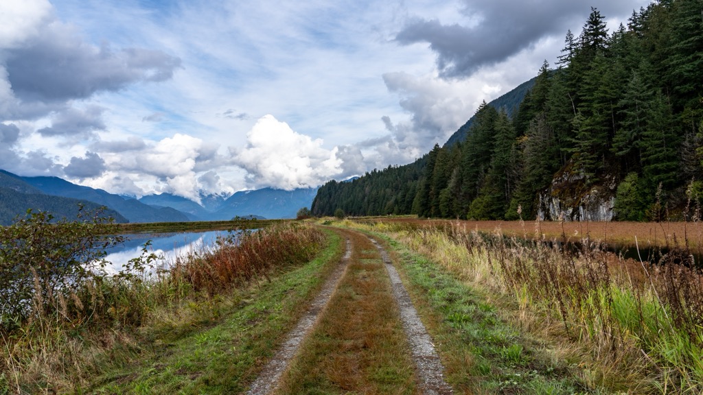
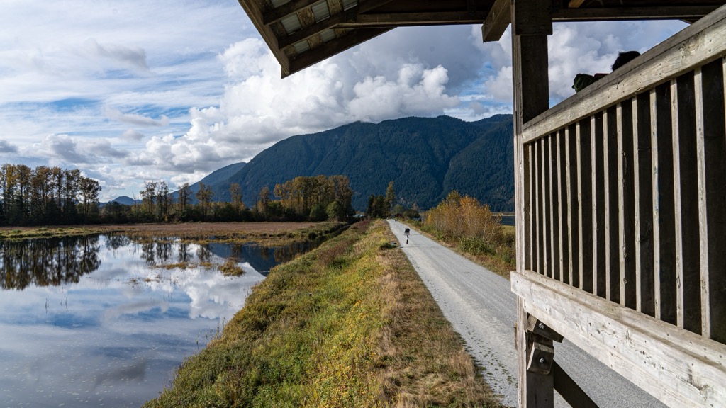
The area is popular with locals as a place to hike, jog, and cycle, as there are about 15 km (9 mi) of trails. The primary route is a nearly 11 km (6.6 mi) loop called the Pitt Wildlife Loop, which starts from the gates at the end of Rannie Road and loops through the marsh.
Along the paths in the park are a viewing pavilion and two viewing towers, favorite spots for birdwatchers to watch for and identify the hundreds of species of birds that live in or migrate through the park.
In addition to hiking, walking, and trail running, visitors to the area may try their hand at fishing or paddling. Canoe rentals are available at Grant Narrows Regional Park, and the Pitt River is considered one of BC’s best fly-fishing and steelhead locales.
The Pitt-Addington Wildlife Management Area is north of Metro Vancouver, adjacent to the towns of Pitt Meadows and Maple Ridge. The area is a beautiful wilderness steeped with the history of the Katzie people, who have lived along the banks of the Pitt River for generations. The following are some nearby cities along with their attractions and wilderness areas for further adventuring.
While the Indigenous Katzie people have occupied the area for over 1,000 years, European settlement along the Pitt River began in the late nineteenth century. The first non-indigenous settlement was known as Bonson’s Landing, established in the 1870s. Settlers constructed the first general store in 1886, now the Pitt Meadows Museum and Archive.
The city is small, with a population of around 20,000, and is considered one of the peaceful bedroom communities of Metro Vancouver.
Aside from its idyllic location along the pleasant Pitt River and having plenty of walking paths, and parks, the beauty of Pitt Meadows is its proximity to many of the wilderness areas of the Lower Mainland. Some of the major parks nearby are Golden Ears and Pinecone Burke Provincial Park.
The Pitt-Addington WMA is only a few kilometers north, and canoe rentals at Grant Narrows Regional Park can help you explore Pitt Lake. From Grant Narrows, visitors can also paddle up Widgeon Creek to explore Widgeon Marsh Regional Park or Widgeon Valley National Wildlife Area.
There are hotel accommodations in Pitt Meadows for travelers and more options in the adjacent cities of Port Coquitlam, Langley, and Maple Ridge. While there are not many attractions in the town, it’s a cozy place to stay while touring the Lower Mainland.
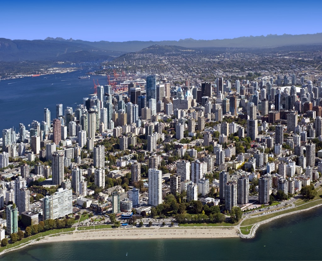
The Vancouver Metropolitan Area includes over twenty municipalities around the city of Vancouver, and locals refer to the area as the Lower Mainland. The Pacific Ranges border the north of the metropolitan area, with many provincial parks and wilderness areas, such as the Pitt-Addington WMA.
Visitors to the city will find many things to do, such as touring the old Gastown or taking a stroll through Stanley Park. Throughout the year, there are many festivals and fairs to visit; one of the largest and most popular is the annual Pacific National Exhibition which includes carnival rides, concerts, and other events.
There are museums, theaters, giant arcades, Playland, golf courses, fine dining, beaches, and many other places to visit while on the Lower Mainland. However, your eyes will regularly turn north to admire the mountains.
North of the city, you’ll find many fantastic wilderness areas where you can hike, paddle, cycle, ride horses, or go on backpacking excursions. The volcanic slopes of Garibaldi Provincial Park are a popular destination, as are Golden Ears and Pinecone Burke Provincial Park.
Mount Seymour Provincial Park, Say Nuth Khaw Yum Provincial Park, and Cypress Provincial Park are also along the northern limits of the metro area. Furthermore, there are ferries across the Georgia Strait to Vancouver Island and the Gulf Islands, which also have countless opportunities for outdoor adventures.


