
Scan the QR code and open PeakVisor on your phone
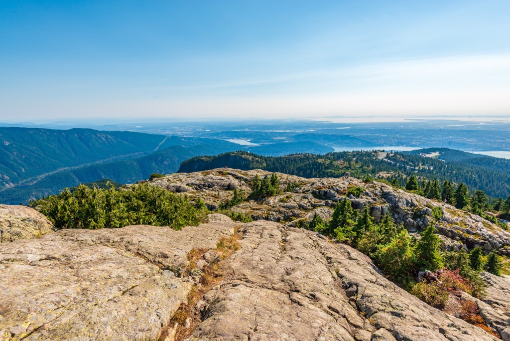
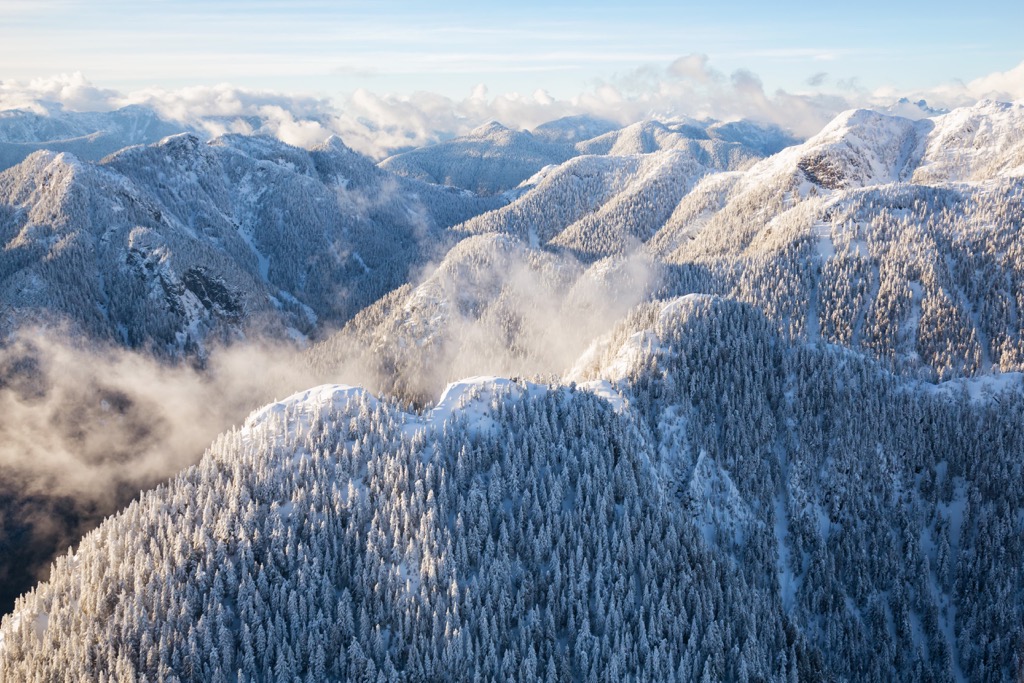
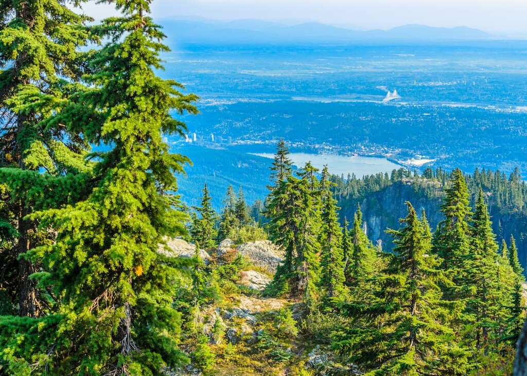
Situated upon what locals of Vancouver call the North Shore, in British Columbia, Canada, Lower Seymour Conservation Reserve is 5,668 hectares of spectacular and rugged landscapes. There are 21 named peaks, forested slopes, and clear creeks and rivers. Mount Burwell (1,541 m/5,056 ft) is the tallest mountain in the reserve and Mount Seymour (1,449 m/4,754 ft) is the most prominent peak with over 450 m (1,490 ft) of prominence.
Lower Seymour Conservation Reserve is located near Metro Vancouver and is part of the Lower Mainland. The reserve is situated north of the Burrard Inlet, in an area locals call the North Shore. The North Shore contains the cities of North and West Vancouver and many parks, reserves, and wilderness areas.
The Seymour Watershed encompasses Lower Seymour Conservation Reserve and as such, the Water Services Department manages the reserve to maintain its recreation, education, environmental values, and its capacity as a healthy water reserve for the adjacent cities.
The reserve has 5,668 ha (14,000 acres) of forested slopes, rugged peaks, creeks, rivers, waterfalls, and lakes. There are 21 named peaks in the park, the tallest of which is Mount Burwell (1,541 m/5,056 ft). Mount Seymour (1,449 m/4,754 ft) is the second tallest peak and the most prominent peak in the reserve.
The Lower Seymour Conservation Reserve is also known locally as the Seymour Demonstration Forest and it is one of many local parks and recreation areas that are managed by the municipalities or are part of the BC Parks folder. Some of the nearby parks and wilderness areas are:
The North Shore and Lower Seymour Conservation Reserve are filled with the igneous and sedimentary rocks and pebbles that relate the geological history of the region. While thousands of kilometers away, starting in the northeast corner of Alberta, the ancient Canadian Shield is the geological heart of the continent.
The Shield is home to some of the oldest known rocks on earth which were created during the original formation of the continents 4 billion years ago. The granite underlying the North Shore is an infantile 100 million years old.
West of the shield, there is a suture along the Alberta – British Columbia border that divides the old from the new. The provincial border roughly coincides with the ancient continental margin of ancient North America. West of the border is 70 million years of continental collisions that accreted, folded, cracked, and made a general geological mess of British Columbia.
The North Vancouver Ranges are on the western edge of immigrant land masses, called terranes, that joined to the continent. The exotic terranes typically formed as volcanic island arcs or microcontinents in the ancient Pacific Ocean. As Pangea was breaking apart, Laurentia, which is the name of the ancient North American continent, was slowly moving west.
During its westward movement, the continental tectonic plate overrode tectonic plates under the Pacific. However, while the oceanic plates slid beneath the continent to have their mass melted down, the land masses that rode upon these plates joined to the edge of Laurentia.
Oceanic plates colliding with and subducting beneath the west coast added exotic terrane to the growing continent. Furthermore, the accretion events folded, cracked, and thrust the layers of rock up into mountain ranges. The subduction of the oceanic plates also created weak areas in the continental crust where magma oozed close to the surface and sometimes erupted as volcanoes.
The magma typically flowed along the seams of the colliding land masses and it would help cement the exotic terranes to the continent. Massive igneous intrusions are present throughout the Coast Ranges, of which the North Shore Ranges are part of. The granitic batholiths created by the intrusions form the backbone of the Coast Range and are known as the Coast Intrusions.
When the eruptions didn’t reach the surface, the magma could take tens of millions of years to finally cool into its crystallized form and in the meantime, the layers above are being eroded. The North Shore Mountains are filled with granite, sedimentary rocks, and quartz with colors of red, purple, green, blue, and yellow.
Metamorphic rocks exist alongside igneous rocks, where the heat of the eruption caused them to change. If the rock feels light in your hand, it is likely pumice that was created from bubbling magma.
The North Vancouver Ranges include the peaks of Capilano, Seymour, and Coquitlam Watershed. Some of the specific ranges include the Britannia Range, Fannin Range, Coquitlam Ranges, and the Golden Ears Ranges. These ranges are the remnants of the magma chambers that supplied the volcanoes of the Lower Mainland.
The North Shore was like a distribution hub and the mountains today are the roots of the ancient volcanoes. The North Vancouver Ranges exist because they rose faster than erosion could cut them down.
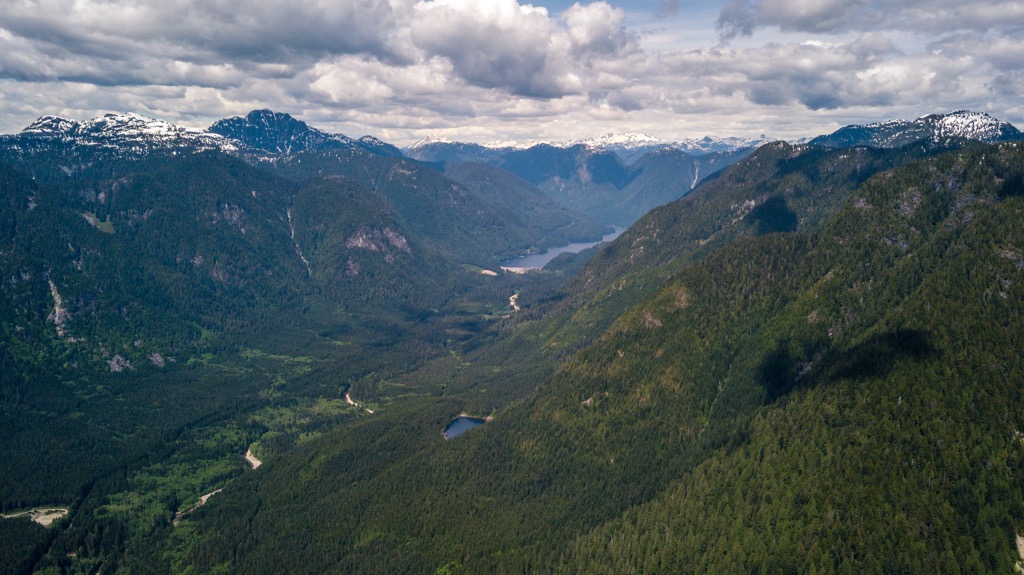
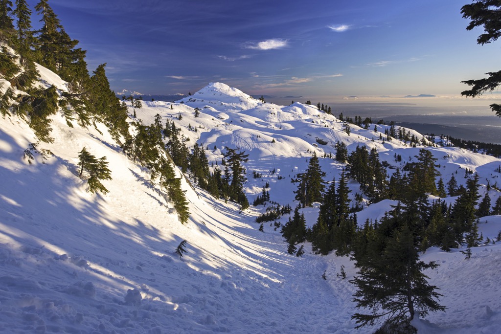
Streams and rivers were a major erosive force that was constantly fighting against the growth of the North Vancouver Ranges. However, today’s topography was primarily created by the 2 km (1.2 mi) thick ice sheet that covered the region during the Pleistocene. The smooth summits show where the ice flowed over, and the jagged peaks are evidence that they escaped the erosive forces of the ice sheet.
Chalky white rocks on Mount Seymour are evidence of minerals turning to clay by hot, and corrosive volcanic waters. Lower on the slopes of Mount Seymour are brown rocks with white fragments that are suspected to have formed by explosion or the cracking of a hardened lava flow top. Lastly, there are fragments of purple hued quartz embedded in the igneous rocks at Seymour’s summit.
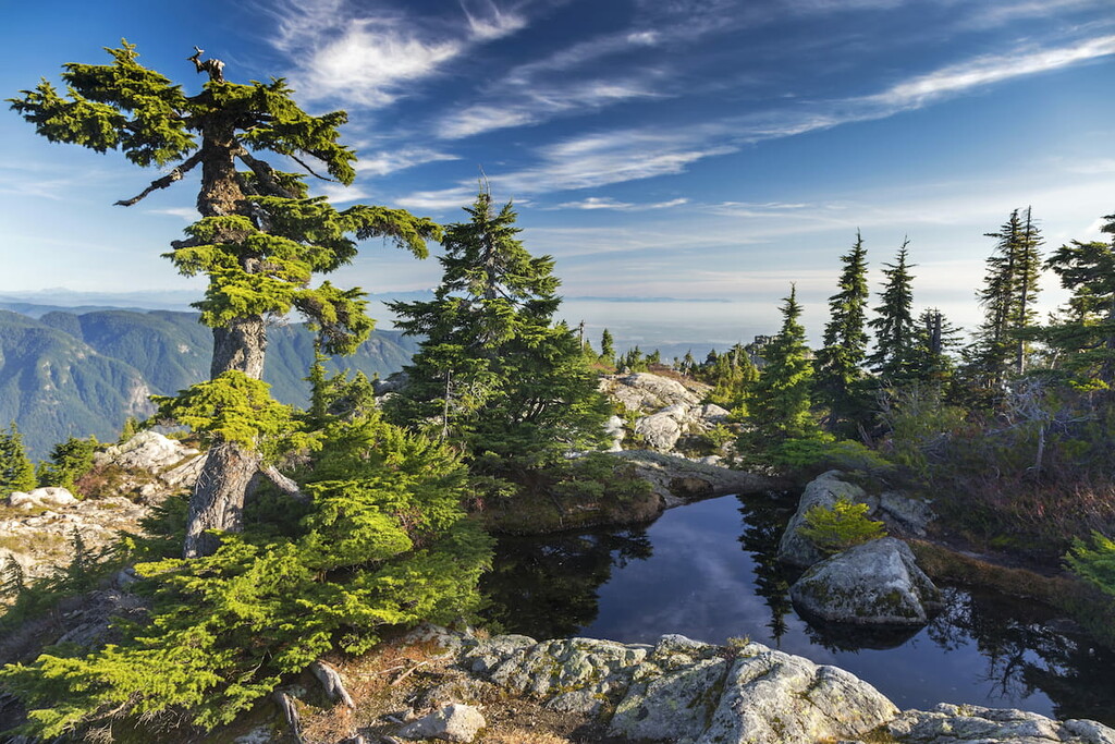
The flora and fauna of Lower Seymour Conservation Reserve are representative of typical ecosystems in coastal, southwest British Columbia. The ecosystems of the reserve include those of the Pacific Temperate Rainforests, the Mountain Hemlock subalpine zone, and a small representation of the Coastal Mountain Heather Alpine zone.
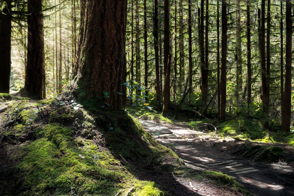
The temperate rainforests of the reserve are characterized as the Coastal Western Hemlock ecosystem of British Columbia. The region is known for an immense amount of rainfall that makes the forests some of the most productive in the world.
The lower slopes and valleys of the reserve will have western hemlock, western red cedar, amabilis fir, big leaf maple, and alder. Sitka spruce may also be found, as it is known to grow within 80 km (48 mi) of the coast. The upper slopes will also have mountain hemlock and stands of yellow cedar.
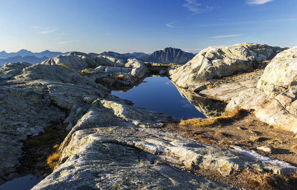
The alpine is typically covered with shrubs and heath interspersed around the rocky outcrops. Wildflowers are prevalent in the region during the spring and summer, and they add a sense of majesty to the alpine peaks. The highest points of the North Vancouver Ranges are rocky and barren, where neither grass nor shrub will grow.
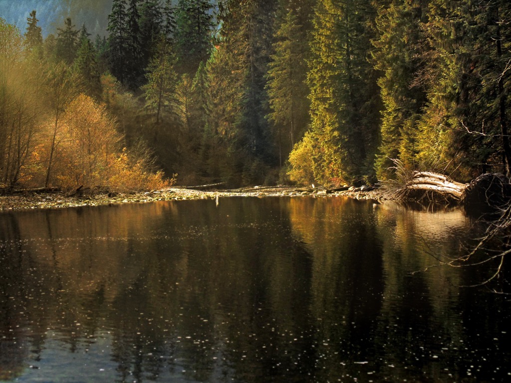
Cougars, wolves, grizzly bears, black bears, mule deer, white-tailed deer, and moose all forage and hunt for food throughout the conservation reserve and region. Salmon spawn in the creeks and streams of the watershed.
Marmots and Columbian ground squirrels build their nests below the alpine rocks forage among the alpine vegetation. Mountain goats and mountain sheep are among the only large mammals that inhabit the alpine areas of the region. Their agility among the precipitous peaks and cliffs allows them to escape most predators.
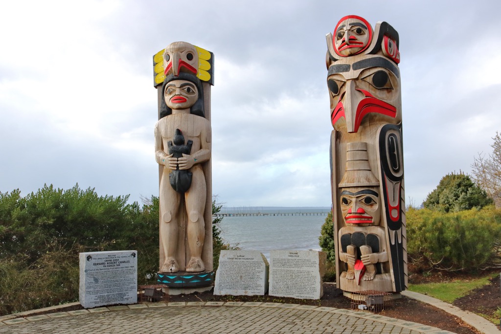
For thousands of years, the Coast Salish ancestors of the Squamish, Tsleil-Waututh, and Musqueam First Nations inhabited the North Vancouver Mountains, along the Burrard Inlet. The indigenous people of the region had incredible knowledge of fishing and harvesting from the sea.
Most other contemporary cultures of the Coast Salish followed a hunter/gatherer lifestyle that left little time to acquire goods, prestige, and other forms of wealth. In general, the abundance of food and other resources that the sea and forests provided to them, the Coast Salish formed relatively complex societies based upon hereditary rights and privileges.
Society was divided into the noble upper class, the lower class, and slaves. While the extent of slavery in west coast indigenous cultures is debated, it is certain that Coast Salish cultures held slaves as simple property, and the children of slaves were born into slavery.
The lower, or common class made up most of the people and they would generally abide by the rules that were set by the nobility. Typically, the nobility controlled fishing areas or other areas to harvest food and resources.
Nobility was typically inherited and based on intertribal kinship. The nobles were generally in charge of resources and were expected to have knowledge of the physical and spiritual worlds. The nobility were generally expected to care for their people, and part of their power and influence came from potlatch ceremonies.
Potlatch ceremonies typically accompanied events such as weddings, births, treaties, and other special occasions. The host of the potlatch would give away lavish gifts to the guests to show their importance and prominence in the community. The more the host could give away, the more esteem and influence they held in the community.
The nobility concentrated their power by combining secular, religious, and economic power within their family units. While it is generally regarded that the common class lived well, it appears to have been difficult to improve your inherited status in life.
For thousands of years, the Coast Salish tradition had thrived along the Pacific coast. While it wasn’t the first culture to emerge along the Pacific, the abundance of resources allowed the people to create a complex society.
The Coast Salish are regarded for the characteristic artwork and carving that usually depict creatures such as salmon, orcas, and the thunderbird. The Coast Salish culture was afforded time to have devoted artisans creating mundane and ceremonial items for their people, such as totem poles.
However, by the 1770s smallpox began to ravage the people of the lower mainland, a full 20 years before Captain George Vancouver encountered the Squamish for the first time. The pandemics of the 1770s were among the most devastating pandemics, killing as much as 30% of the regional population.
In 1792, Captain Vancouver made the first recorded European contact with the indigenous of the Burrard Inlet, a group of Squamish from the village of Homulchesan. Shortly after the arrival of Vancouver and the British, the Spanish arrived to explore the inlet and surrounding waters.
While there were significant attempts to prevent Europeans from settling in the area, such as the Musqueam attack on Simon Fraser, Europeans began to settle in the region. Further pandemics left the indigenous populations unable to provide enough of a deterrent to incoming settlers.
Like most settled areas of Canada, it began with the Hudson’s Bay Trading company outpost. The trading post provided employment for the indigenous; however, it also solidified European influence in the region. Following the trappers came prospectors looking for gold and all the while visitors to the Lower Mainland recognized the value of the massive trees along the coast.
Trapping, logging, mining, commercial fishing, boat building, shipping, and many other industries came to Burrard Inlet and the Metropolitan Area of Vancouver. The traditional area of the Musqueam was engulfed by the growing city of Vancouver and North Vancouver encroached on the Tsleil-Waututh.
There is record of a homestead north of Rice Lake, in Lower Seymour Conservation Reserve; however, no further details are known. Logging was extensive throughout the area, and specifically a shingle company that focused on harvesting red cedar setup camps along the Seymour Creek. The selective harvesting of cedar was ultimately detrimental to the regrowth of the forest.
It was in 1905 that the bureaucrats took notice of the area as a source for drinking water for the burgeoning cities. The Seymour Watershed was created in 1906, at which time, the area was managed in a way that would preserve the watershed as a clean source of drinking water. Increased management of the watershed ultimately led to the development of more sustainable logging in the region.
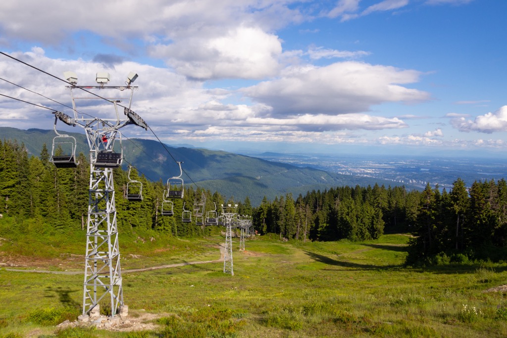
While the metropolis was growing, businessmen were trying to make their mark in the region. Mills and shipyards were constructed along the shore and cabins, chalets, and other hotels were built up in the beautiful mountains to take advantage of the growing interest in downhill skiing.
While not all the planned tourist projects were successful, there are several in the North Vancouver Mountains that are still around, Furthermore, during the early twentieth century, hundreds of locals were building their own cabins upon the slopes, to offer them and their families respite while out skiing. During this time, hundreds of cabins were built on Mount Seymour alone.
The area that is known as Lower Seymour Conservation Reserve, or the Seymour Demonstration Forest was opened to the public in 1987. Typically, the watersheds of the Lower Mainland are not publicly accessible; however, it was decided to open an area of the watershed, to prevent public incursion into the rest of the area.
The demonstration forest shows the ingenuity of H.R. Christie ideas from the 1920s for combined forestry and watershed management. The Seymour Demonstration Forest is also used as a recreational area and for educational purposes showing that logging can be carried out without negative impact on the landscape, waterways, and the wildlife.
The Lower Seymour Conservation Reserve is open to the public year-round for fishing, cycling, hiking, kayaking, and picnicking. The following are some of the major trails in the conservation reserve.
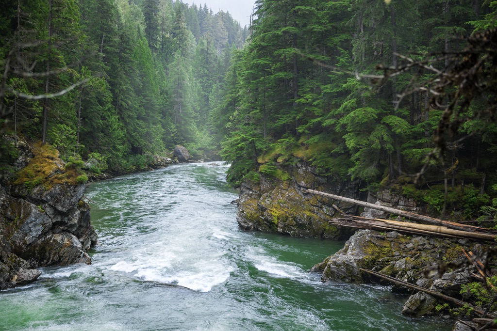
The Seymour River through the conservation reserve is great for experts and beginners with rapids ranging from Class 1 to 5. However, unlike most waterways in the Lower Mainland, paddling on the Seymour River in the reserve is restricted.
Paddlers must pass through security gates to access the river and that can only be done when certain requirements are met. To paddle in the conservation reserve the group leaders must be a member of a recognized paddling organization and have an up-to-date permit with the Lower Seymour Conservation Reserve.
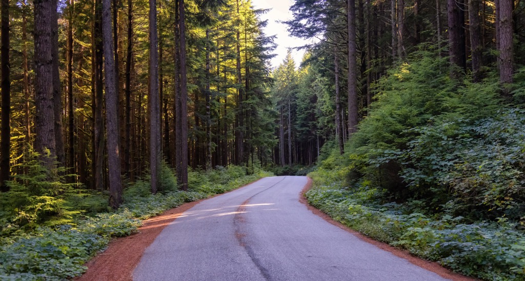
The Seymour Valley Trailway is a 10 km (6 mi) paved path that leads through the Seymour Demonstration Forest. The paved path is great for families and people of all abilities; however, it should be noted that the path slopes slightly down such that the return trip is all uphill. The trail is popular with cyclists and hikers.
Rice Lake is a lovely destination and is an easily accessible wilderness oasis in the Lower Mainland. A gravel trail goes around the lake and connects with the dozen or so other trails that wind through Lower Seymour Conservation Reserve, allowing visitors to easily explore more of the forest, or simply come for a peaceful afternoon picnic.
The coniferous forest provides shade in the summer and is still stunning during the winter. Fishing for rainbow trout in the lake is permitted; however, no boats are allowed on the water. There is a dock that extends into the lake for wildlife viewing or fishing, or anglers can cast from the shore.
Lower Seymour Conservation Reservation is one of the recreation areas that serve the Lower Mainland. The following are some of the major cities in the area.
The city of Vancouver is located at the southern end of the Pacific Ranges and is the namesake of the Vancouver Metropolitan Area that dominates the Lower Mainland of BC. The city of Vancouver is across the Burrard Inlet from Lower Seymour Conservation Reserve. The city of North Vancouver is adjacent to the reserve.
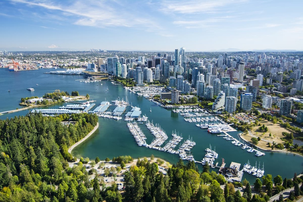
Metro Vancouver is British Columbia’s largest city, though it is also one of the youngest cities in the province as it was founded in 1862. The city is often mistaken for the capital city of BC; however, the capital is Victoria, on Vancouver Island.
While Metro Vancouver stretches from the sea to the mountains, there are still many wilderness parks nearby. Mount Seymour Provincial Park, Garibaldi Provincial Park, Golden Ears Provincial Parks, and Pinecone Burke Provincial Park all have opportunities for day hikes, weekend camping trips as well as trails for longer backcountry expeditions.
While in the city proper, you can check out Stanley Park, which is one of North America’s largest urban parks. Some of the popular hikes that you can enjoy around Vancouver include the trails in and to St. Marks Summit, Quarry Rock, Grouse Grind, Pacific Spirit Regional Park, Burnaby Lake Park, and Norvan Falls.
Squamish is north of Lower Seymour Conservation Reserve, about 60 km (36 mi) along the Sea to Sky Highway that follows Howe Sound. The community of Squamish is a popular destination for tourists in search of outdoor adventure and recreation. Indeed, rock climbing and bouldering are extremely popular activities around Squamish.
Squamish draws visitors looking to go windsurfing, kiteboarding, trail running, rafting, snowmobiling, hiking, mountaineering, and backcountry skiing. However, most people know and visit Squamish for its proximity to some of the finest climbing areas in the region.
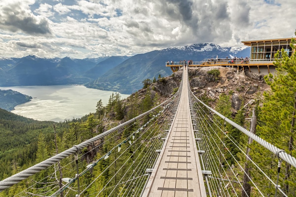
Some of Squamish’s most popular routes are located on the granite massif called the Stawamus Chief, which features over 300 climbs. Shannon Falls, Murrin Park, The Malamute, and the Smoke Bluffs, all of which contain an additional 1,500 climbing routes which are published in local guide books.


