Scan the QR code and open PeakVisor on your phone
A subrange of the North Shore Mountains, the Britannia Range lies along the eastern flank of Howe Sound in British Columbia. The range was named after the H.M.S. Britannia, a 100-gun ship that took part in the Battle of St. Vincent in 1797 and the Battle of Trafalgar in 1805. It’s believed the ship’s captain, Captain G.H. Richards, named the range in 1859.
In 1888 copper was discovered in the area, and in 1900 a mine was established near present-day Britannia Beach.
The range begins north of Brunswick Mountain, in the Deeks Lake/Hanover Mountain region. It is bounded by the Stawamus River and Loch Lomond on the upper Seymour River. The region’s namesake community, Britannia Beach, lies near the northern end of the range.
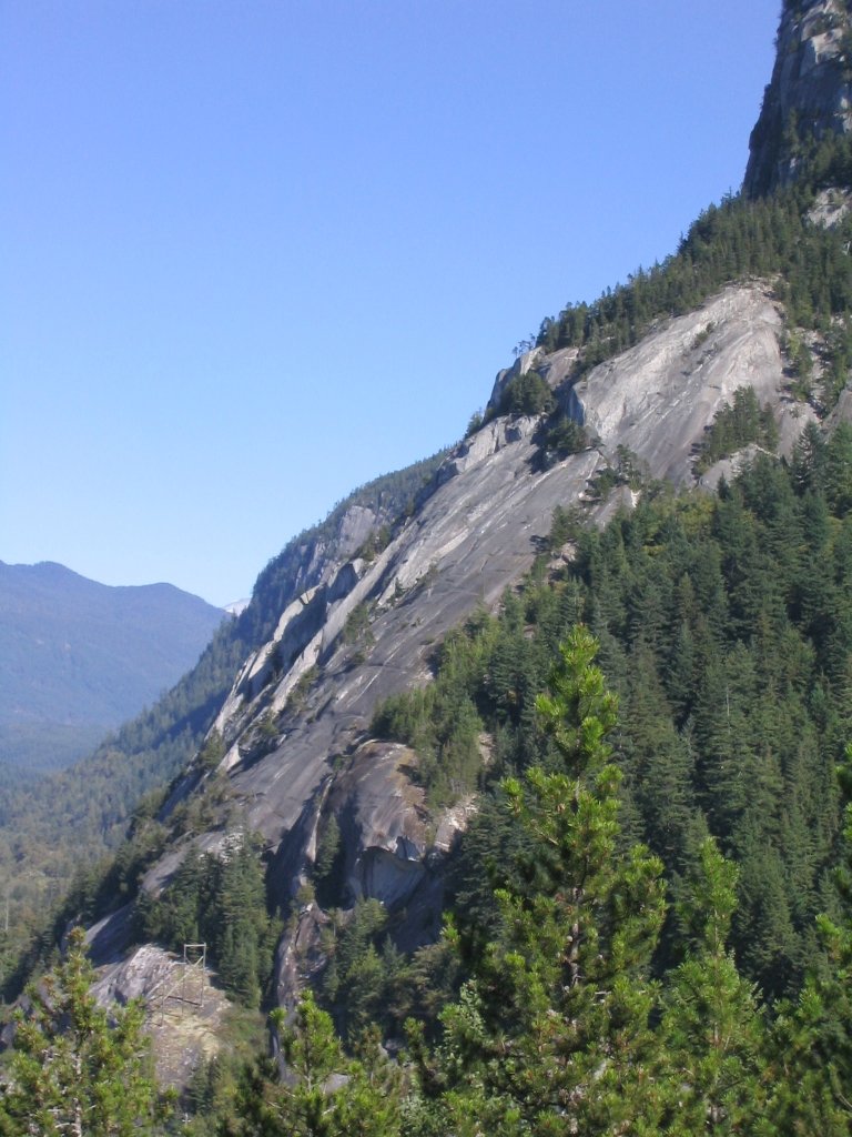
The highest and most prominent peak in the Britannia Range is Sky Pilot Mountain, an iconic, horn-shaped summit that is visible from BC Highway 99. This prominent peak is easily accessible from nearby Squamish and boasts a thrilling class 4 scramble to its summit.
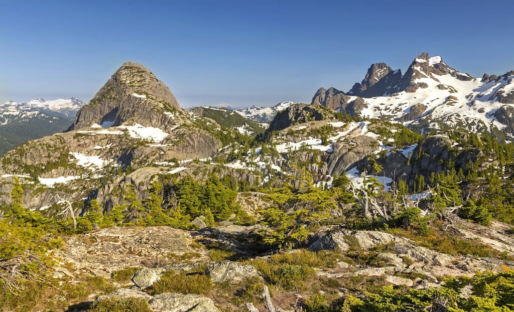
Aside from Sky Pilot Mountain, notable peaks in the Britannia Range include: Ledge Mountain, Co-Pilot Mountain,Mount Sheer, and Ben Lomond. Several of these summits can be reached via climbing or scrambling routes.
Co-Pilot is a satellite summit of Sky Pilot but provides equally commanding views of the surrounding summits and sound. Ben Lomond lies immediately west of Loch Lomond and is believed to be named after the infamous Ben Lomond summit and lake in Scotland. Mount Sheer has a namesake abandoned mining townsite in upper Britannia Creek. The townsite, also known as ‘the other town,’ once provided permanent housing to miners.
Though the Britannia Range is relatively well-known, it’s not generally identified or known by its name. It’s not uncommon for travelers, and even locals, to refer to these summits by their parent range, the North Shore Mountains.
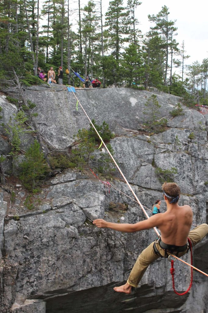
The arduous scramble to the summit of Sky Pilot is a must-do for adventure-seekers visiting Squamish or the Britannia Range. Sky Pilot’s iconic vertical rock face has quickly become one of British Columbia’s most popular accomplishments.
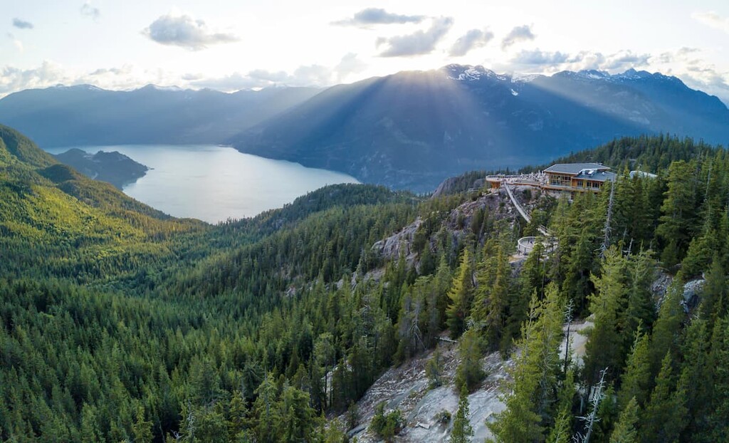
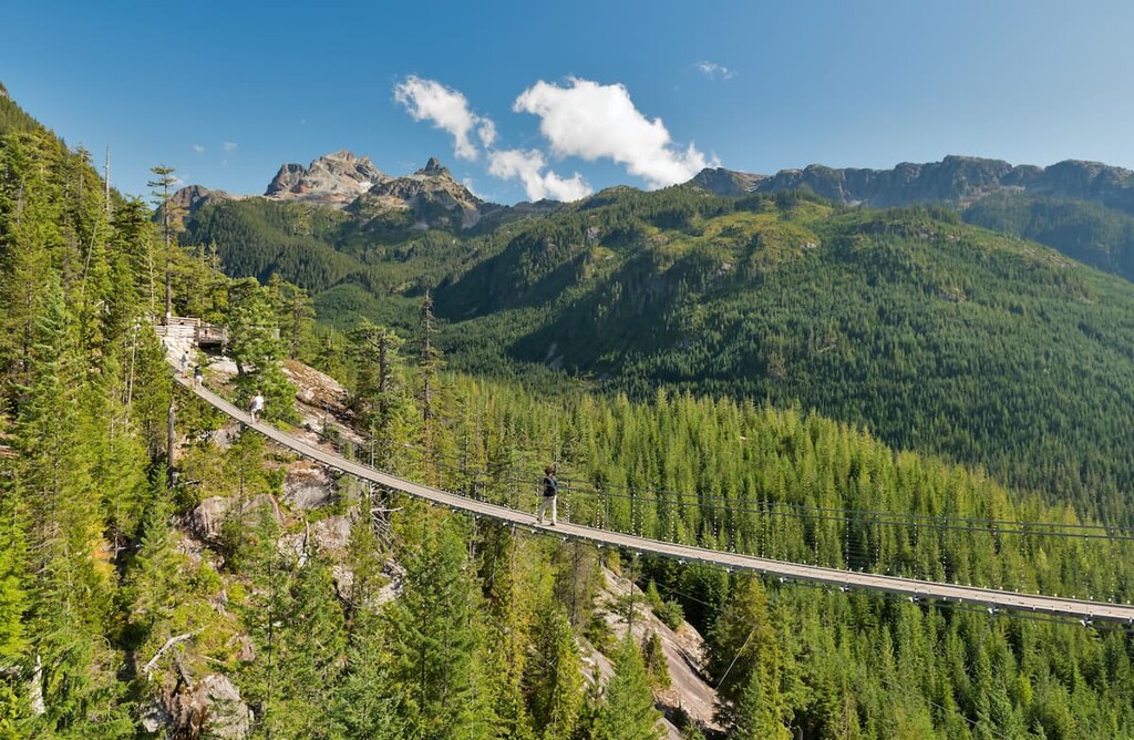
The trek begins by taking the Sea-to-Sky gondola from Shannon Falls. From the top of the gondola, follow signs leading toward Sky Pilot. The trail will travel along a dirt road for a few miles before rising steeply through the forest and dropping into a beautiful meadow between Sky Pilot and Co-Pilot.
From there, hikers will need to follow a series of cairns to the saddle between the two peaks. After reaching the saddle, follow the west ridgeline toward the ‘pink ledges.’ This is where the trail becomes more treacherous, and hikers can expect to encounter a sustained class 4 (possibly low class 5) scramble. Visitors to Sky Pilot should prepare for all weather conditions, exercise caution, and know their limitations. It is not uncommon for there to be snow at higher elevations, even in the summer.
The Skyline Ridge trail offers a direct path up to the alpine region between Sky Pilot and Goat Ridge. The trail stretches for roughly 24 miles and climbs 2,300 feet up the center ridge in the upper Shannon Creek watershed. Along the way, hikers are rewarded with sweeping views of Goat Ridge, Mount Habrich, and the high alpine peaks surrounding Sky Pilot Mountain.
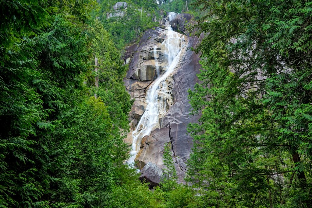
Located along the Sea to Sky Highway, Shannon Falls, British Columbia’s third-tallest waterfall, towers above Howe Sound. The Falls are composed of an impressive series of cliffs, rising almost 1,100 feet above Highway 99. These incredible cascading falls originate from Mount Habrich and Mount Sky Pilot. The most popular trail to the falls is an easy footpath that leads through a forest of Western hemlock, Douglas fir, and Western red cedar along Shannon Creek to a viewpoint of the falls.
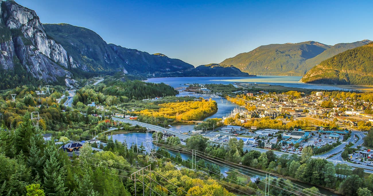
Located just north of Vancouver, Squamish sits at the northern tip of the Howe Sound and is surrounded by incredible outdoor recreation potential. In addition to offering premiere accommodations, restaurants, and amenities, Squamish is less than an hour from several iconic summits in the Squamish-Cheakamus Divide and Britannia Range, as well as Brandywine Falls Provincial Park and Shannon Falls. Squamish is infamous for its epic hiking trails, biking trails, and the scenic sea-to-sky gondola.
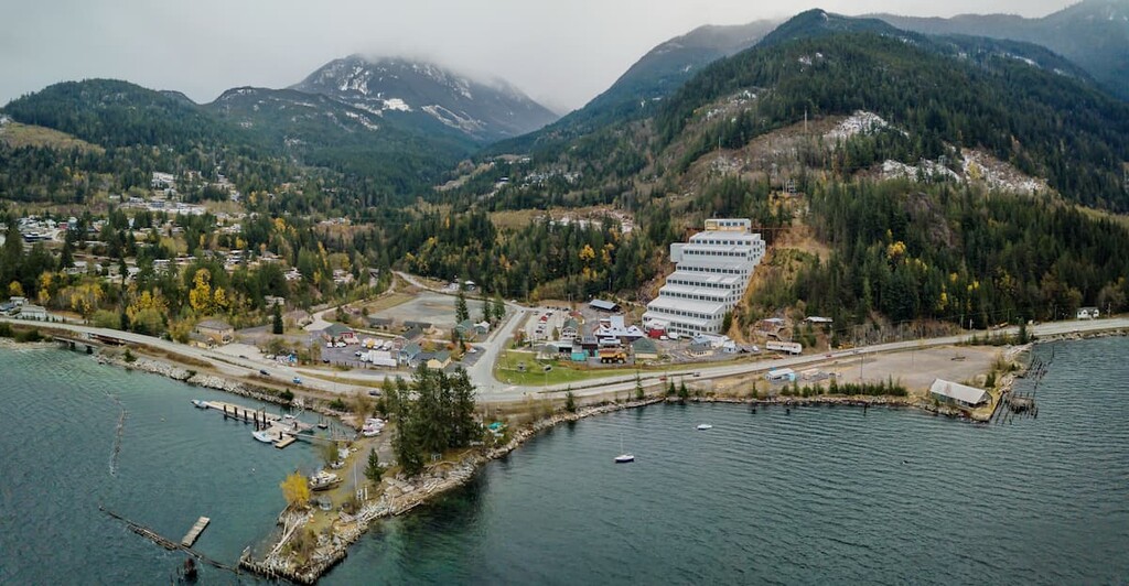
Located above the Sea to Sky Highway, Britannia Beach is a National Historic Site nestled between Vancouver and Whistler. In 1888, copper was discovered on Britannia Mountain which led to the development of the Britannia Mine. In 1975, the BC Museum of Mining was opened and in 1988, it was designated a National Historic Site. The following year, the museum was designated a Historic Landmark. Visitors to Britannia Beach can learn about the region’s captivating mining history via a series of museums and tours. Britannia Beach is also close to several popular B.C. attractions, including Grouse Mountain and the Sea to Sky gondola.


.JPG)