Scan the QR code and open PeakVisor on your phone
Unbeknownst to most Metro Vancouver residents, three principal watersheds are responsible for delivering affordable, potable water to their doorstep. Together, the Capilano, Seymour, and Coquitlam watersheds serve roughly 2.6 million residents spread out over roughly 1,000 square miles.
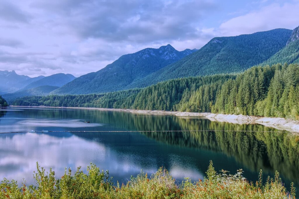
Snowmelt and rainfall in the North Shore and Coquitlam mountains drifts downhill through creeks and streams into several manmade lakes, or reservoirs. These reservoirs are further sustained by high-quality water from three alpine lakes: Burwell Lake, Palisade Lake, and Loch Lomond.
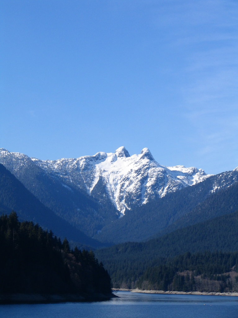
Tucked in the North Shore Mountains, the Capilano watershed encompasses roughly 48,297 acres west of Grouse Mountain and north of the Capilano Suspension Bridge. Eleven tributary streams and several creeks in the Capilano watershed drain from Capilano Mountain into the Capilano River before being carried into Capilano Lake for storage.
The watershed’s namesake reservoir, Capilano Lake, was crafted in 1954 with the construction of the Cleveland Dam. The reservoir is over 3 miles long, half a mile wide, and over 250 feet deep near the dam. Capilano Lake can hold roughly 16.5 billion gallons of water and accounts for nearly 40% of Greater Vancouver’s water supply.
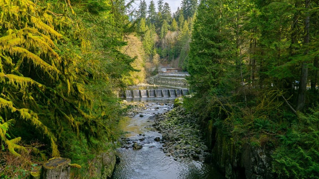
The Cleveland Dam sits above the Capilano River Regional Park along the southern flank of Capilano Lake. Visitors can see the reservoir from Cleveland Dam or from the Capilano River Hatchery. However, the Capilano watershed is closed to the public in order to protect the region’s drinking water from pollution, erosion, fire, or other hazards.

The Capilano River was selected as the first viable water source for the City of Vancouver as early as 1887. In 1889, an intake pipe was constructed, and potable water was piped across the First Narrows of Burrard Inlet into Vancouver.
In 1905, to keep up with Vancouver’s growing population, the Seymour River was identified as a secondary water source for the city. To keep the city’s water free of contaminants, the B.C. government obtained a 999-year lease to designate both the Capilano and Seymour as watershed reserves.
Despite these protections, however, the Capilano watershed continued to see extensive logging activity. Between 1918 and 1931, the Capilano Timber Company logged almost 8,000 acres of old-growth forest in the watershed. In 1931, the Capilano Timber Company abandoned its logging activities in the Capilano Watershed and eventually, in 1999, all three Greater Vancouver watersheds would be closed to logging.
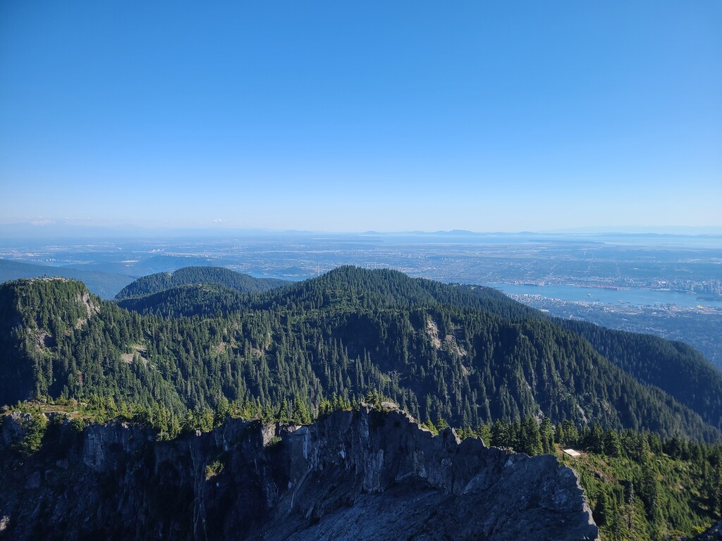
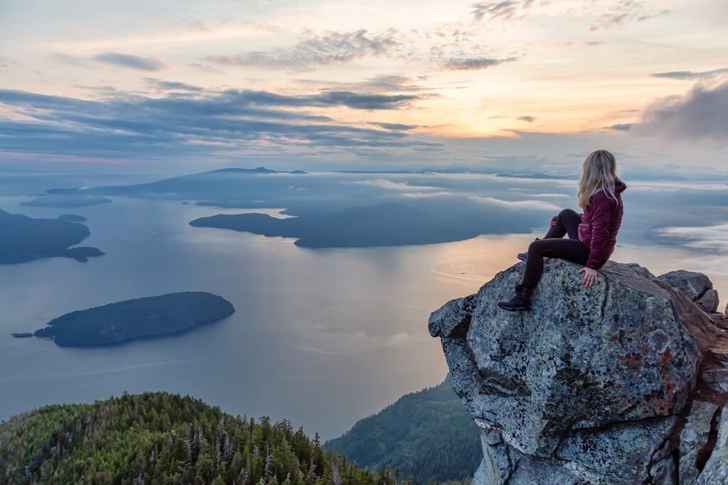
There are 33 named mountains in the Capilano watershed. The tallest peak in the watershed is 5,735-foot Mount Hanover, one of the tallest summits in the North Shore Mountains. Other notable peaks in the watershed include Cathedral Mountain, Mount Windsor, The West Lion, and Coburg Peak. Several of these impressive peaks are tucked within the 7,500-acre Cypress Provincial Park.
Overlooking British Columbia’s largest city, Vancouver, 7,500-acre Cypress Provincial Park highlights the natural beauty found within the North Shore Mountains, a relatively subtle set of summits bounded by Howe Sound and West Vancouver.
Prior to the opening of the Lions Gate Bridge in 1939, avid hikers and skiers in Vancouver would take a ferry across the Burrard Inlet to explore the slopes of Hollyburn Mountain. In the 1970s, B.C. parks designated the area a Provincial Park and opened the Cypress Ski Area in the southern reaches of the park.
Popular trails in the park include: The trail to Eagle Bluffs via Black Mountain, Hollyburn Peak, the Howe Sound Crest trail, and Bowen Lookout.
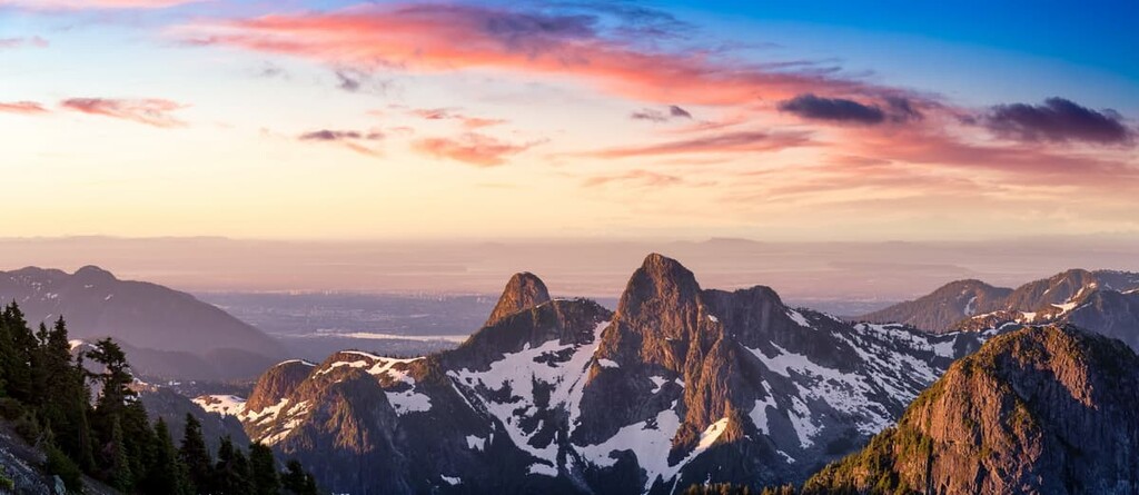
Known for its lush coastal rainforest and steep canyon walls, Capilano River Regional Park is one of twenty-one regional parks operated by Metro Vancouver. The park encompasses most of the upstream areas of the Capilano River below the Cleveland Dam. The park’s most popular attraction is the Cleveland Dam, where visitors are treated with incredible views of Vancouver’s most iconic summits, West Lion and East Lion.
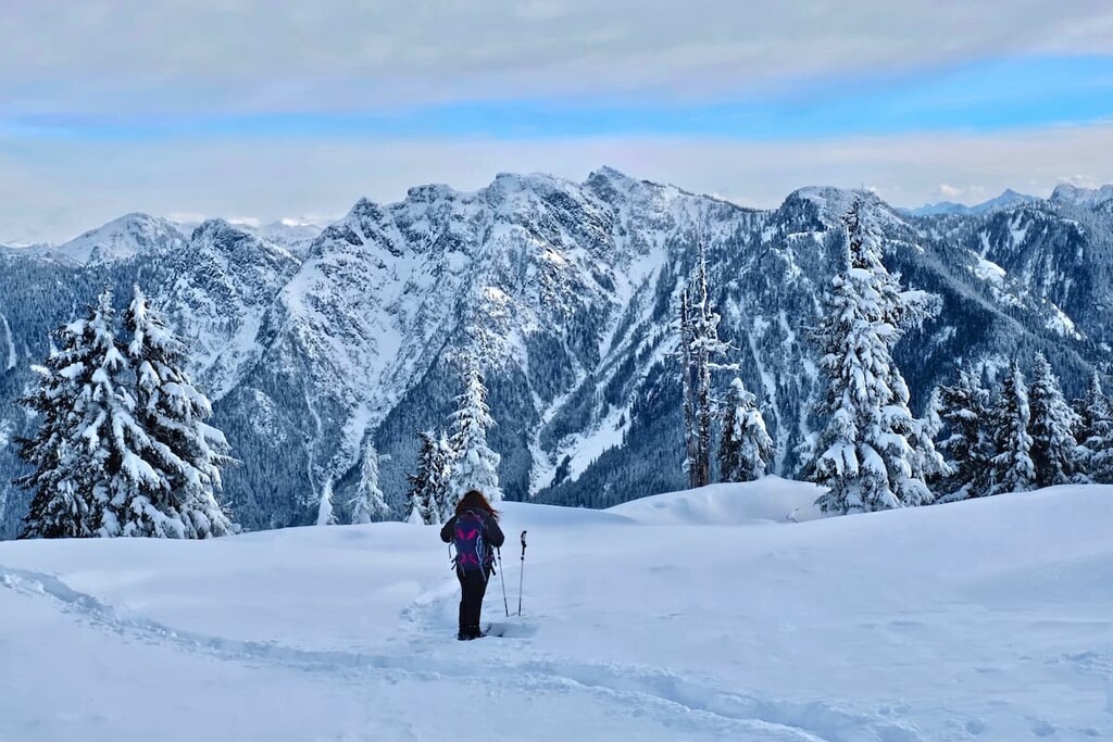
Cypress Mountain Resort offers a full range of downhill skiing, snowboarding, cross-country skiing, tubing, and contains 6 miles of marked self-guided snowshoeing trails. The resort encompasses more than 600 skiable acres across three stunning summits, Mount Strachan, Black Mountain, and Hollyburn Mountain. This all-seasons destination is just 30 minutes from downtown Vancouver, making it accessible to both day trips and weekend getaways. At the upper lot of the Downhill Area, visitors will find the Cypress Creek Lodge, which includes the Cypress Creek Grill, Crazy Raven Bar & Grill, and the Gold Medal Café.
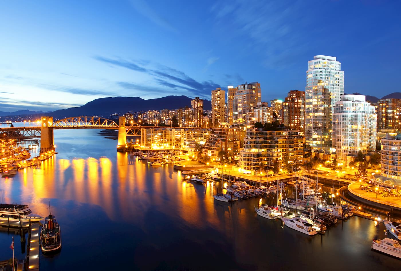
Vancouver is a city packed with pristine beaches, epic suspension bridges, miles of scenic hiking trails, and an abundance of biking, kayaking, and fishing opportunities. The city itself is surrounded by mountains and is known for its thriving art, theater, and music scenes. Vancouver is incredibly walkable and contains several scenic vistas and parks, as well as plenty of accommodations and eateries.