Scan the QR code and open PeakVisor on your phone
Metro Vancouver manages three protected watersheds that provide its 2.7 million residents with clean and affordable drinking water. Together, the Capilano, Seymour, and Coquitlam watersheds cover an area roughly 150 times the size of 43,594-acre Stanley Park.
Snowmelt and rainfall in the North Shore and Coquitlam mountains drifts downhill through creeks and streams into several manmade lakes, or reservoirs. These reservoirs are further sustained by high-quality water from three alpine lakes: Burwell Lake, Palisade Lake, and Loch Lomond.
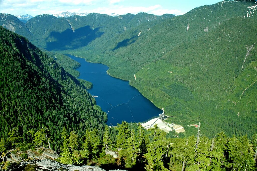
Located in the North Shore Mountains, east of Cathedral Mountain and northwest of the Fannin Range and Mount Seymour Provincial Park, the 30,579-acre Seymour watershed is a long and narrow valley that supplies a third of Vancouver’s potable water.
In 1887, the Capilano River was selected as the first viable water source for the city of Vancouver. However, as the city continued to expand, it quickly became apparent that an additional water source was needed. In 1905, the Seymour River was identified as a valuable water resource.
A few years later, the first intake, a wooden fir stave pipe, was constructed in the Seymour River to carry water beneath the Second Narrows Bridge to residents of Vancouver, Burnaby, and Richmond. In 1928, the Seymour Falls Dam was constructed to form the Seymour reservoir.
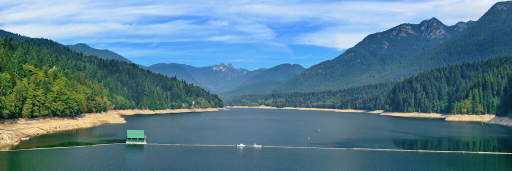
Initially, Seymour Lake was a fairly small reservoir. However, it was expanded in the 1960s. Today, Seymour Lake stretches for 12 miles in a north-south direction and 4.6 miles in a west-east direction. The reservoir is fed by several tributaries, including the Seymour River, Fannin Creek and Gibbens Creek, and can hold upwards of 32 billion liters of potable water.
To keep the city’s water free of contaminants, the B.C. government obtained a 999-year lease to designate both the Capilano and Seymour as watershed reserves. Despite these protections, however, the region continued to see extensive logging activity. In fact, deforestation would continue in the Seymour and Capilano watersheds until 1999, when all three Greater Vancouver watersheds were officially closed to logging.
Like the Capilano watershed, the Seymour watershed remains closed to the public. However, the Lower Seymour Conservation Reserve, just south of the reservoir, is open to the public and offers a variety of scenic hiking trails.
The Seymour watershed contains thirteen named summits. The tallest, Cathedral Mountain, is one of the tallest and most prominent of the North Shore Mountains but remains off-limits due to its location. Another notable peak in the watershed, Ben Lomond, is considered to be one of the most striking summits outside of Squamish, despite its modest elevation.
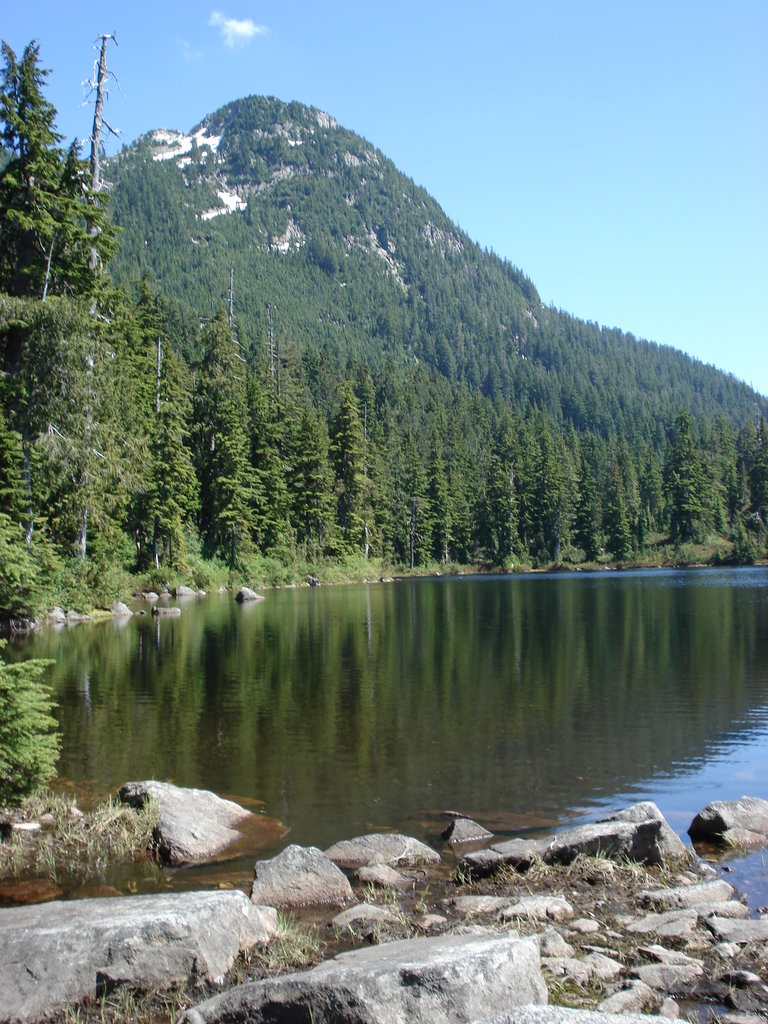
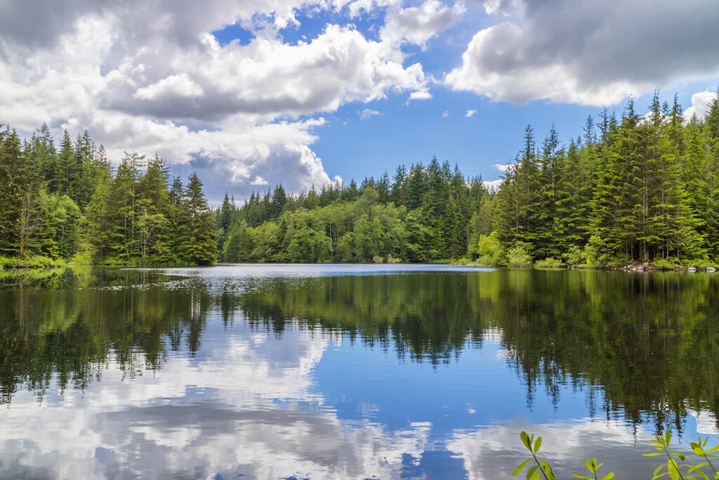
The 14,000-acre Lower Seymour Conservation Reserve is home to spectacular landscapes, including alpine peaks, forested slopes, and pristine waters. Popular among locals, the park contains an impressive network of mountain bike and hiking trails, as well as excellent fishing and paddling opportunities.
The two most popular attractions in the Lower Seymour Conservation Reserve are Rice Lake and the Seymour Valley Trailway, a 6+ mile paved pathway that winds through the park’s lush forest.
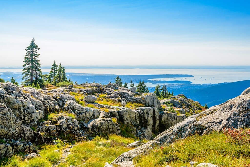
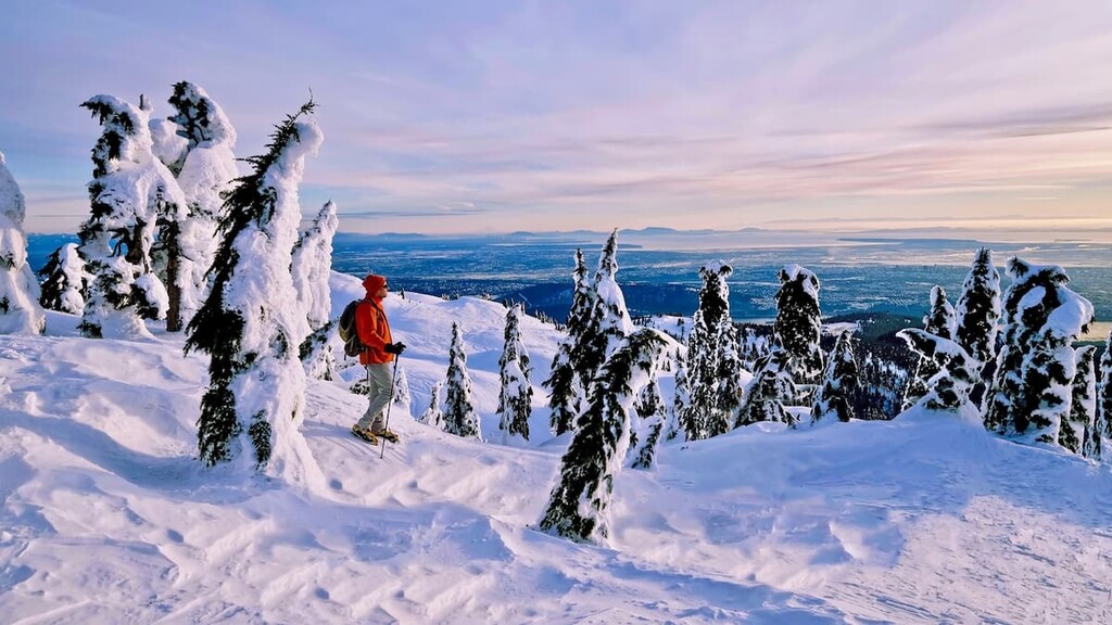
Mount Seymour Provincial Park is an 8,600-acre wilderness park tucked in British Columbia’s Coastal Mountain Range. Just 30 minutes from downtown Vancouver, the park boasts an impressive network of trails that lead to scenic overlooks and panoramic views of Vancouver, Mount Baker, and east over Indian Arm Provincial Park.
Popular trails in Mount Seymour Provincial Park include Dog Mountain, Mount Seymour, Mystery Peak, Mount Elsay, and Brockton Point.
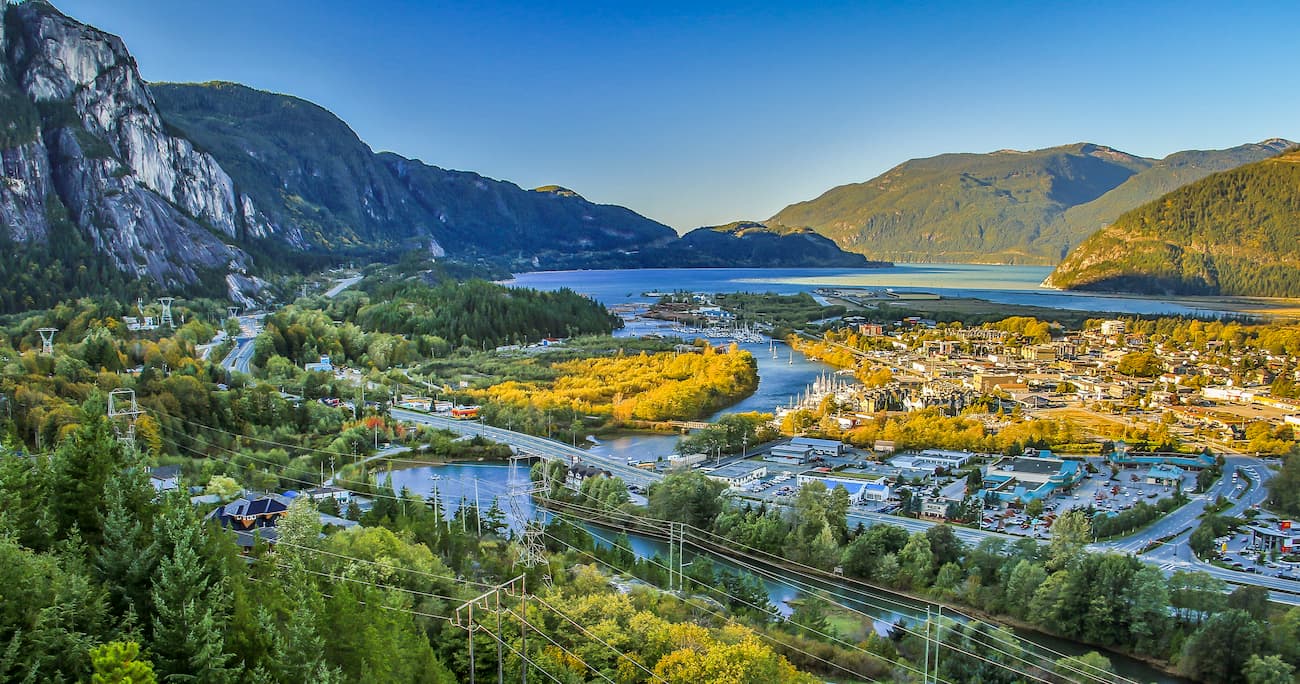
Located just north of Vancouver, Squamish sits at the northern tip of the Howe Sound and is surrounded by incredible outdoor recreation potential. In addition to offering premiere accommodations, restaurants, and amenities, Squamish is less than an hour from several iconic summits in the Squamish-Cheakamus Divide and Britannia Range, as well as Brandywine Falls Provincial Park and Shannon Falls. Squamish is infamous for its epic hiking trails, biking trails, and the scenic sea-to-sky gondola.
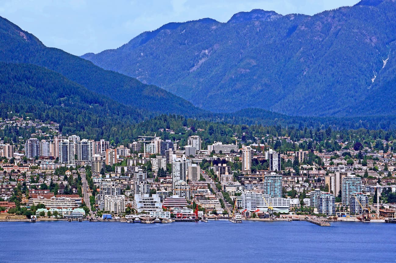
Situated at the foot of the North Shore Mountains, North Vancouver is a beautiful mountain destination packed with tranquil hiking trails, incredible natural attractions, stunning summits, and a variety of delicious dining options. The city sits just 30 minutes from Mount Seymour and is known as a community at the edge of wilderness. In fact, North Vancouver is considered by many to be home to world-class outdoor recreational venues. Visitors can easily travel to the park and spend the day on the slopes before returning to the comforts of their quality accommodations.