








_-_Burcina.jpg)
Curated by Monterosa Outdoor
Biella
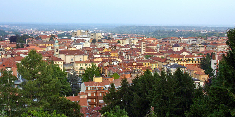
A Piedmontese textile town below the Oropa sanctuary, with the Burcina park above it.
- 1Highlights
- 5Routes
- Featured summit · Bric di Burcina
Highlights
Museo del Territorio Biellese
The territorial museum of Biella, with archaeological finds from the Biellese and rotating exhibitions.
Nothing of this kind in Biella.
Routes
15 from neighbouring places
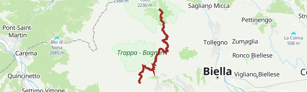
L'itinerario dello spirito
A route through the Mont Mars reserve on the line of the old Oropa procession, which has crossed these ridges for centuries.
- 13.8 km
- Distance
- 1 074 m
- Ascent
- 6 h 59 min
- Duration
- 33
- Check-ins
Cicloturismo: Salita Biella-Oropa
A road ascent from the centre of Biella up the valley to Oropa, finishing near 1,100 m at the head of the road.
- 12.5 km
- Distance
- 93 m
- Ascent
- 1 h 28 min
- Duration
- 9
- Check-ins
Grande Traversata del Biellese: Tappa 1 Santuario di Oropa
The opening stage of the Biellese traverse, climbing from Biella to the Oropa sanctuary below Monte Mucrone.
- 15.5 km
- Distance
- 1 150 m
- Ascent
- 7 h 33 min
- Duration
- 24
- Check-ins
Grande Traversata del Biellese: Tappa 15 Quittengo
A long stage of the Biellese traverse ending at Quittengo in the Cervo valley.
- 15.4 km
- Distance
- 1 250 m
- Ascent
- 8 h 2 min
- Duration
- 11
- Check-ins
Grande Traversata del Biellese: Tappa 7 Pollone
A long stage across the hills above Biella, over the Bric di Burcina and two belvederes before dropping through the Parco della Burcina.
- 20.5 km
- Distance
- 830 m
- Ascent
- 6 h 51 min
- Duration
- 7
- Check-ins
Momenti slow alle porte della Riserva
12.3 km away, in Fontainemore
A very short, level walk at Coumarial, the meadow gateway to the Mont Mars reserve above Fontainemore.
- 962 m
- Distance
- 10 m
- Ascent
- 17 min
- Duration
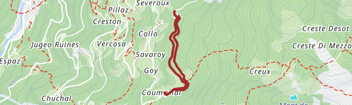
Coumarial-Rifugio Coda
12.4 km away, in Fontainemore
A climb from Pian Coumarial on path 3 through larch and beech to the Alpe Vercosa and on to the Coda hut.
- 5.3 km
- Distance
- 0 m
- Ascent
- 1 h 14 min
- Duration
- 18
- Check-ins
Grande Traversata del Biellese: Tappa 14 Piane di Veglio
7.4 km away, in Campiglia Cervo
The fourteenth stage of the Biellese traverse, running through the Piane di Veglio above the Valle Cervo.
- 19.3 km
- Distance
- 1 072 m
- Ascent
- 7 h 36 min
- Duration
Percorso salute
12.4 km away, in Fontainemore
A short fitness circuit at Fontainemore, on level paths near the village in the lower Lys valley.
- 2.7 km
- Distance
- 72 m
- Ascent
- 48 min
- Duration
Pra de Bosc
12.4 km away, in Fontainemore
A route to the pastures of Pra de Bosc above Fontainemore, through larch wood on the flank of the Lys valley.
- 13.2 km
- Distance
- 517 m
- Ascent
- 4 h 22 min
- Duration
Rifugio Barma
9.4 km away, in Fontainemore
A long climb from Fontainemore to the Barma hut beside its lake, under the ridge of Mont Mars.
- 15.8 km
- Distance
- 1 147 m
- Ascent
- 8 h 30 min
- Duration
- 26
- Check-ins
Plan-du-Juc
12.5 km away, in Fontainemore
A level walk at Plan-du-Juc above Fontainemore, on the wooded shelf on the west side of the Lys valley.
- 6.3 km
- Distance
- 603 m
- Ascent
- 3 h 44 min
- Duration
Sassaz
12.4 km away, in Fontainemore
A walk to Sassaz on the wooded slope above Fontainemore, on old paths between the upland hamlets.
- 9.2 km
- Distance
- 376 m
- Ascent
- 3 h 5 min
- Duration
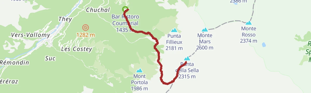
Col della Barma
12.4 km away, in Fontainemore
A long ascent from Fontainemore to the Colle della Barma, the pass on the watershed towards Oropa.
- 14.5 km
- Distance
- 1 086 m
- Ascent
- 7 h 7 min
- Duration
- 25
- Check-ins
Sentiero della cascata
14.1 km away, in Fontainemore
A short walk from Fontainemore up to the waterfall on the stream above the village.
- 2.6 km
- Distance
- 213 m
- Ascent
- 1 h 21 min
- Duration
- 3
- Check-ins
Alpe Leretta
12.4 km away, in Fontainemore
A steep climb from the Lys valley to the Alpe Leretta, one of the pastures above Fontainemore.
- 4.7 km
- Distance
- 348 m
- Ascent
- 2 h 17 min
- Duration
Il gigante nella Riserva
12.5 km away, in Fontainemore
A steep climb on route 2D through the Fontainemore reserve to the top of Mont Mars, the giant of the range.
- 10.0 km
- Distance
- 1 146 m
- Ascent
- 6 h 52 min
- Duration
- 22
- Check-ins
Il sentiero dei balocchi
14.1 km away, in Fontainemore
An easy woodland path above Fontainemore in the lower Lys valley, laid out with wooden toys and play stops for children.
- 5.8 km
- Distance
- 292 m
- Ascent
- 2 h 9 min
- Duration
- 3
- Check-ins
Rifugio Coda
12.4 km away, in Fontainemore
A climb from the Fontainemore side to the Coda hut, on the ridge between the Lys valley and the Biella mountains.
- 10.1 km
- Distance
- 817 m
- Ascent
- 5 h 15 min
- Duration
- 29
- Check-ins
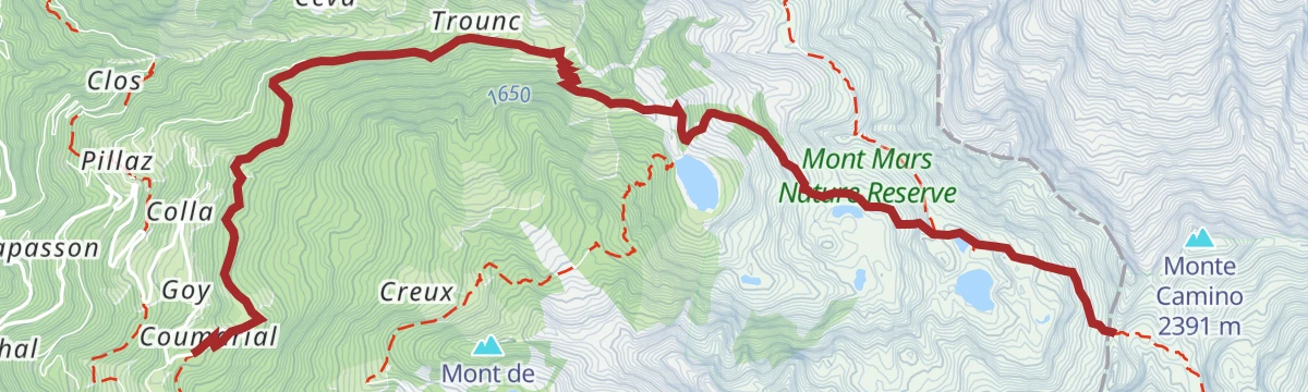
Una croce di confine
12.5 km away, in Fontainemore
A climb through the Mont Mars reserve past the Lei Long and Barma lakes to the boundary cross at the Colle della Barma.
- 7.9 km
- Distance
- 892 m
- Ascent
- 3 h 54 min
- Duration
- 25
- Check-ins
No routes of this kind in Biella yet.
The region's own picks
Featured route
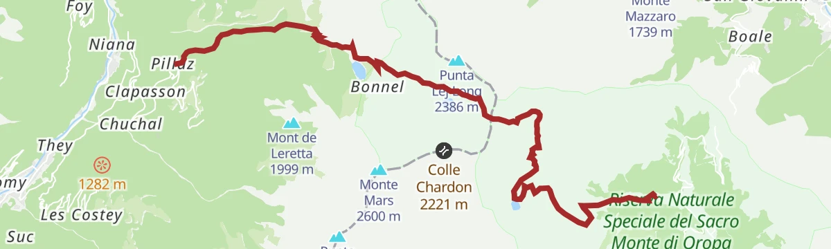
L'itinerario dello spirito
A route through the Mont Mars reserve on the line of the old Oropa procession, which has crossed these ridges for centuries.
Planning a trip to Biella?
Everything else Piedmont has, in one place


Take Biella with you into the mountains
Every route on this page with 3D terrain, GPX navigation and offline maps — including the valleys with no signal.
Data sources
- Official website: italia.it ↗
- Routes and highlights: Monterosa Outdoor, Montmars, Piemonte Outdoor, Italia.it, Biella, Visit Monterosa
- Published as open data by the tourist boards named above.
- Region summary generated from the board's own material.
