An Ode to Hiking
Life in the industrialized world is replete with privilege; the list begins with food security and modern medicine and continues a long way. However, modern Westernized society can often seem bereft of one thing in particular: simplicity.
Hiking is perhaps the ultimate way to return to that feeling of simplicity. After all, what could be simpler than putting one foot in front of the other, feeling the crisp air in your lungs, and the sunshine on your neck? Besides, multiple studies have already shown that our bodies need to walk, providing us with physical and psychological release and a longer, healthier life.
However, hiking is often seasonal. Many places feature summers too hot for a hike, while others are too cold in the winter. Fortunately, there’s a golden season for most of Earth’s finest hiking destinations. Better yet, a hiking vacation is one of the best ways to travel. Check it out:
- It’s cheap. You likely won’t stay in fancy resorts or luxury ski chalets if you’re on a hiking trip. Most hikers prefer to camp or post up in hostels. Plus, you don’t have to pay for activities like a ski pass, nor must you stock up on expensive, fragile gear.
- It’s healthy. Instead of letting yourself go on vacation, why not seek to improve your fitness? Not only is hiking good for your body, but it drastically improves sleep and releases endorphins that improve your mood.
- It’s intimate with nature. Moving quietly at a slow pace through an ecosystem enables you to observe wildlife in a way that is impossible otherwise. Stop to notice a spider on a leaf or a salamander carefully plodding across the trail.
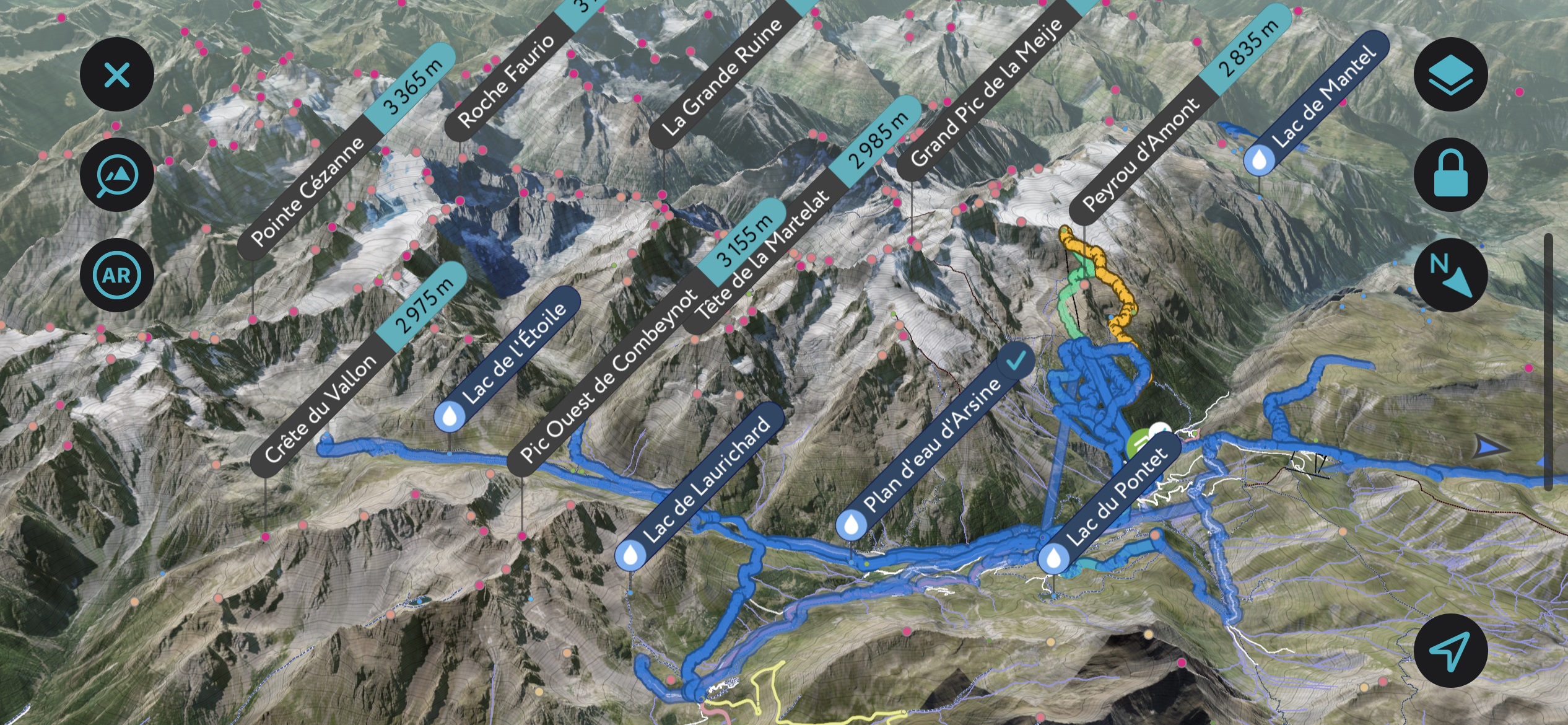
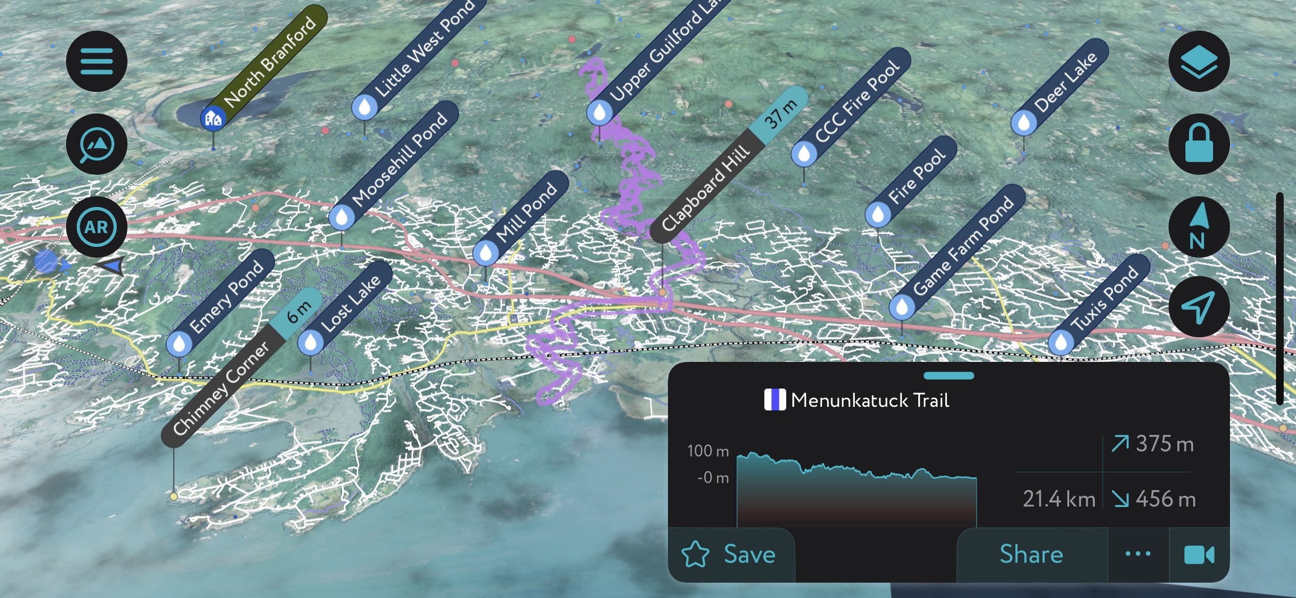
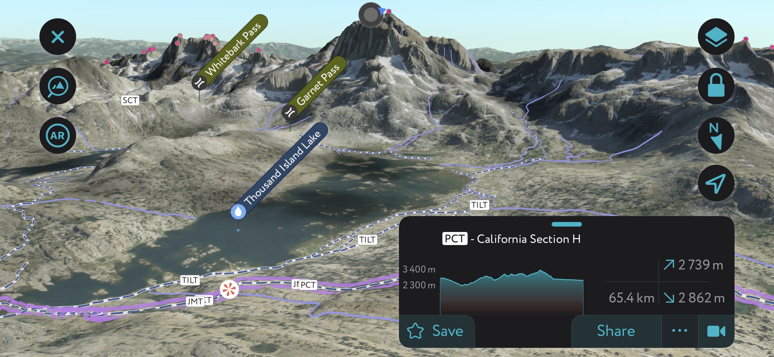
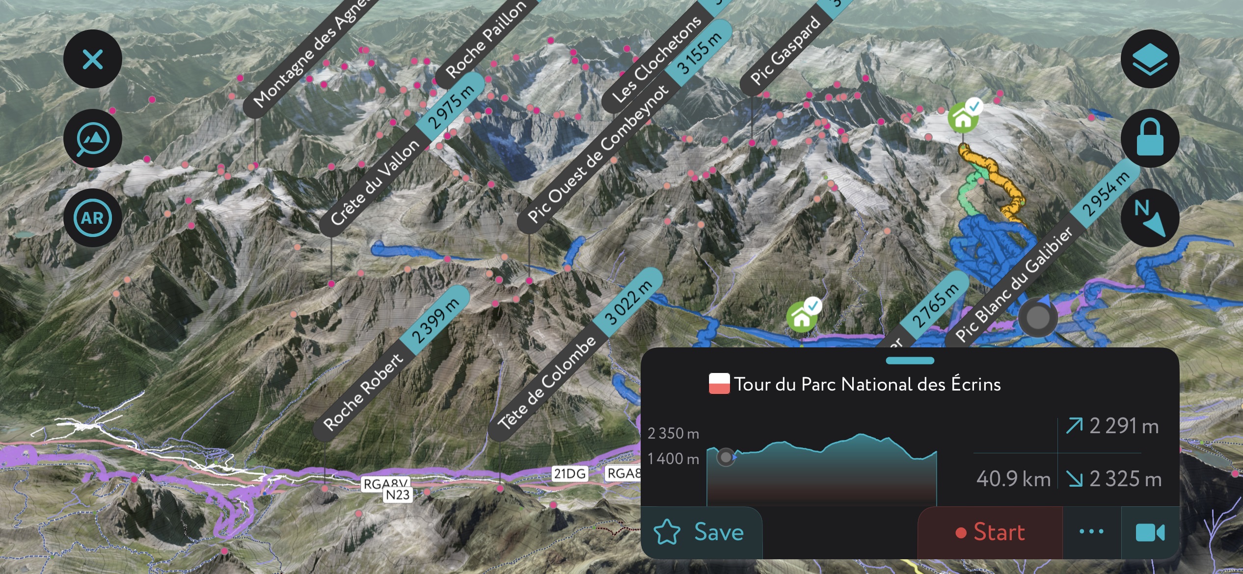
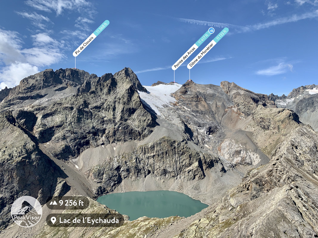
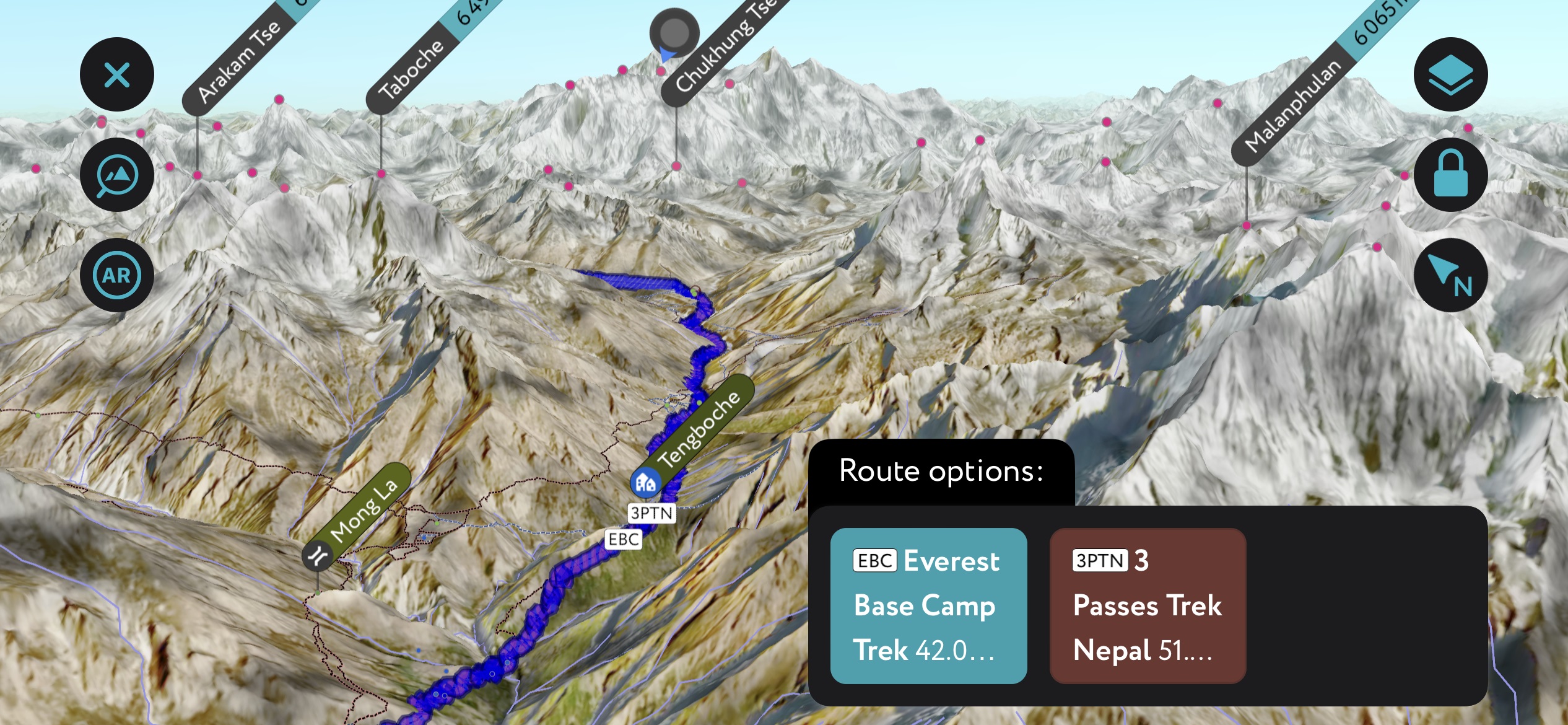
Peak Visor Mobile App
At PeakVisor, we’ve worked hard to develop an app to aid hikers worldwide. Our app features detailed, visually stunning 3D Maps and in-depth information on hundreds of thousands of hiking trails.
Best Hiking Destinations for Every Calendar Month
Keep in mind that each and every month of the calendar year offers incredible hiking at any number of destinations worldwide. I’m not suggesting that these are the best places because every hiker has different requirements; some hikers might not be up for the physical challenge of the Pacific Crest Trail, while others may not be interested in acclimating along the Everest Base Camp Trek.
My article serves to present some ideas to stimulate your imaginative juices. The good news is that there are thousands of lifetimes worth of options, from culturally immersive forays to high-mountain, grueling treks.
Best Hiking in January
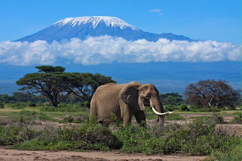
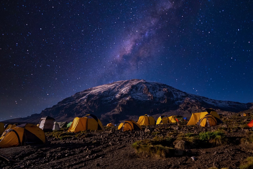
Mount Kilimanjaro / Mount Meru, Tanzania
Mount Kilimanjaro (5,895 m / 19,341 ft), as famous as it is, remains one of the best peaks for enthusiastic hikers. That’s because the summit requires no skills other than determination - well, determination and a hefty wallet. That’s not to say it’s easy; climbers are looking at 4,155 m (13,620 ft) of elevation gain on the classic Machame Route, and an acclimation element stretches the adventure to five to ten days on the mountain.
The Machame Route is a loop with a different ascent and descent and is considered the most scenic option. It’s not, however, the easiest. Other routes start at more remote access points higher up the mountain, requiring less climbing. All in all, seven routes reach the summit.
Kilimanjaro is the largest ‘free-standing’ mountain in the world, meaning it does not exist as part of a greater range (common with volcanoes like Kilimanjaro). Climbers will ascend through several spectacular ecozones. Cultivated land and remnant savanna bush characterize the surrounding lowlands and lower valleys. These forests quickly transition to montane and cloud forests, with a maximum rainfall of up to 3 m (120 in) per annum. The mountain's upper slopes are alpine desert, while the summit features (rapidly retreating) icefields, glaciers, and an overall arctic climate.
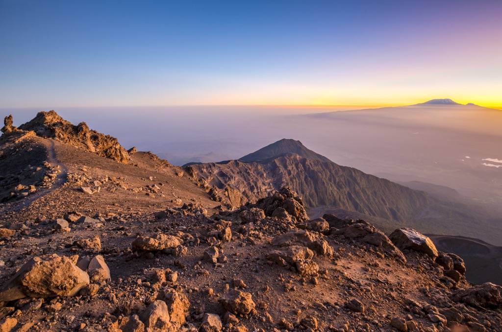
Mount Meru (4,562 m / 14,968 ft) is the less-trafficked peak to the west for a warm-up to Kilimanjaro or just an alternative adventure. Both mountains are easily visible from each other's summits.
January’s adventure is not as simple as other hiking adventures I have listed. Meru and Kilimanjaro require registered guides, a minimum number of porters, and hefty park entrance fees. Climbers almost always ascend in guided group tours (I understand this approach might not be for everybody).
For these reasons, as well as the remote location and climb’s duration, an ascent of Kilimanjaro and Meru will likely cost many thousands of euros (or dollars), which is a limiting factor for most people. Nevertheless, if you have the funds, these peaks offer one of Earth’s most extraordinary adventures.
Best Hiking in February
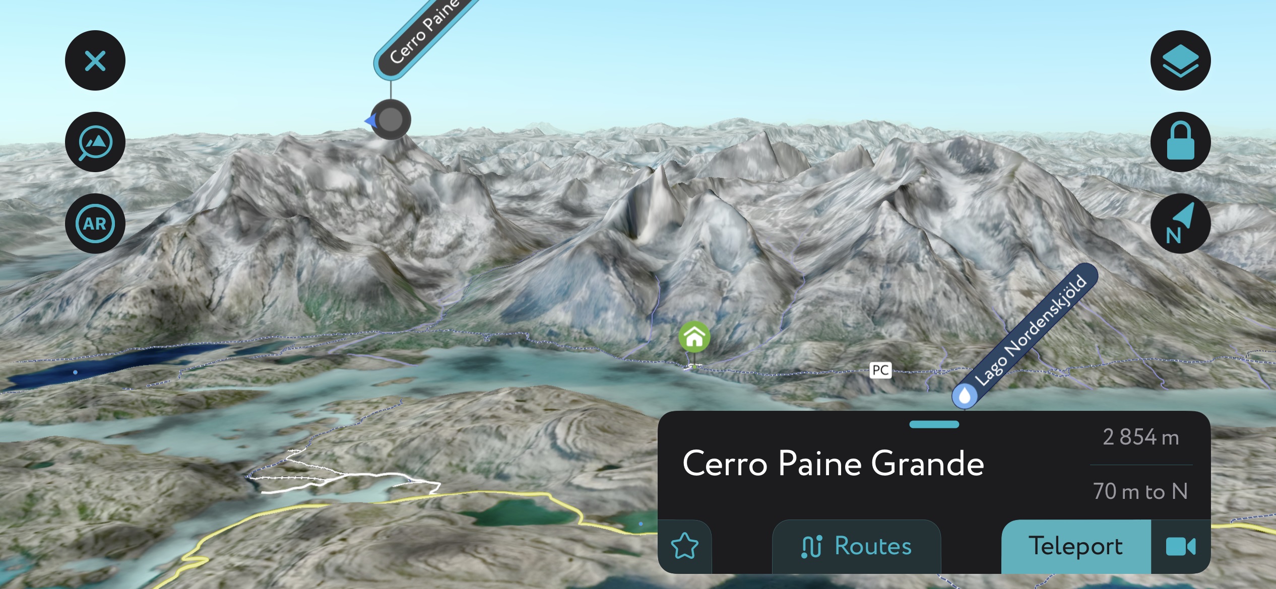
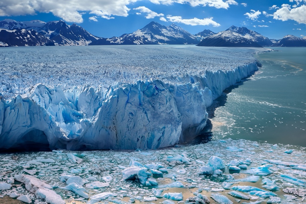
Patagonia
Patagonia is another standard bucket-list destination widely regarded as one of Earth’s most pristine and beautiful destinations.
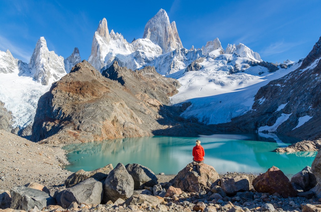
Patagonia’s awe-inspiring geology is the draw for hikers, who primarily stick to the edges of the range. Bombarded by storms for the majority of the year, interior Chilean Patagonia is largely buried beneath three massive icefields. The North Patagonian, South Patagonian, and Cordillera Darwin Icefields are today’s remnants of the Patagonian Ice Sheet, which formed in the last glacial maximum. Ice has carved out unique, towering granite spires like Fitz Roy and turquoise glacial lakes fed by outlet glaciers draining the upper icefields.
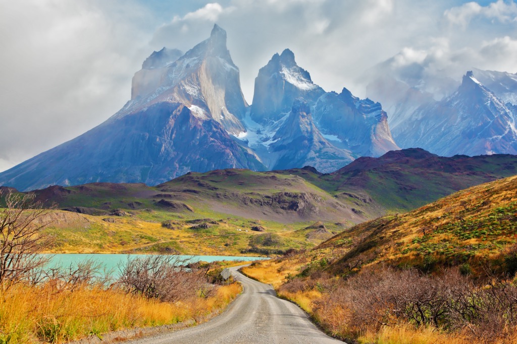
Torres del Paine is the most famous of Chile’s parks, with dozens of day hikes and the legendary ‘W’ and ‘O’ backpacking routes. The O hike is a 6 to 10-day mission that encompasses the W route as well as the park’s backside, which will be by far the less crowded portion. Both hikes require booking campsites and refugios well in advance, so prepare early, or you’ll be limited to day hikes from the park’s headquarters. The silver lining is that limited accommodation means fewer hikers along the route.
The Argentinian village of El Chaltén is the staging point for hikes to see the infamous Fitz Roy, an ultra-prominent granite spire straddling the border between Chile and Argentina. Sitting on the edge of the Southern Patagonian Icefield, the tower is surrounded by glaciers and glacial lakes.
Tierra del Fuego NP in Argentina occupies the southern tip of Patagonia and the South American continent. At 55° south latitude, it’s closer to the Antarctic Peninsula than Buenos Aires. Other Patagonian parks include the Chilean Bernardo O’Higgins NP and Queulat NP, all with excellent hiking opportunities.
Regarding crowds, it’s prudent to expect other hikers on the trail and group accommodations (campsites and refugios). The viewing areas of Torres del Paine and Fitz Roy will likely have many people milling about. Still, Torres del Paine NP sees only 250,000 visitors per annum compared to four million at Grand Teton National Park.
Best Hiking in March
Garden Route, South Africa
The legendary Garden Route refers to the coastal zones stretching from Durban to Cape Town. Hikers will have their pick of national parks and other protected areas along the coast.
The Garden Route is beautiful, laid back, and maybe even a bit rough around the edges compared to what many Westerners are used to. The advice from South Africans? Don’t carry too much money in your wallet, and don’t put up a fight if you get mugged.
Other than that, your winter worries will melt away in this warm, sunny, subtropical paradise. There are hundreds of towns and villages along the route, and each one has dozens of trails. It would take a lifetime to explore everything here. Anyways, here are a few trails to consider:
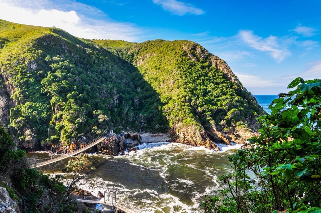
- Harkerville Coastal Hiking Trail: Located in Garden Route National Park, the Harkerville Coastal Hiking Trail winds between the Knysna and Plettenberg Bay and spans approximately 19 km (12 mi). Hikers typically take two days to complete the route, which is reserved for experienced and adventurous souls; expect soaring heights, steep rock walls with safety chains, and narrow cliffside paths.
The trail’s highlights are the views of the Indian Ocean and several uncrowded and pristine beaches. Take a refreshing swim or snorkel in the warm ocean waters of Solar Beach or Sanctuary Beach. The intertidal zones offer a chance to explore tidal pools with colorful fish and octopi.
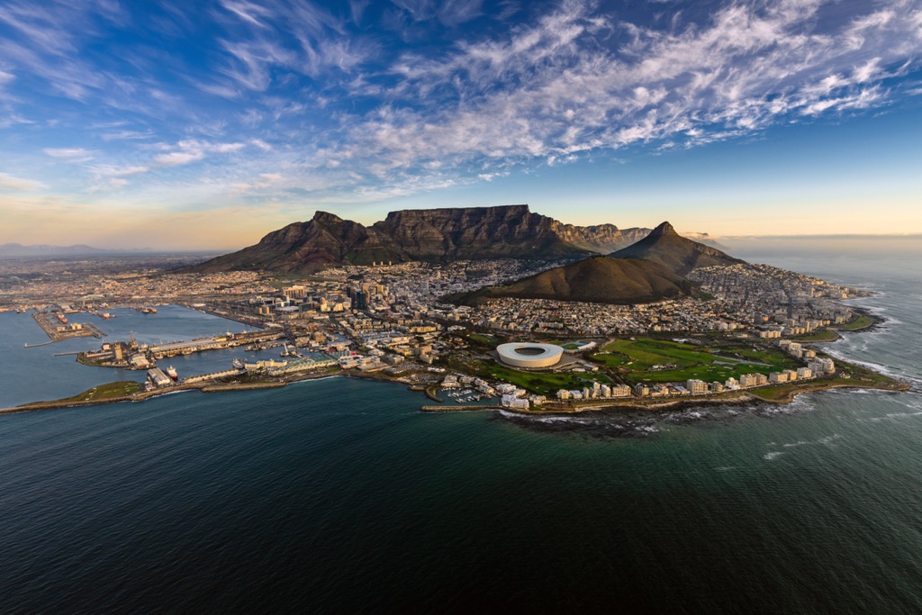
- Platteklip Gorge: The Plattekip Gorge provides a straightforward yet challenging path to Table Mountain’s summit in Table Mountain National Park. The trailhead is easily accessible from the Table Mountain Cable Car station.
Although only 2.2 km (1.4 mi) long, Platteklip Gorge offers a short, steep climb to the summit. One of the highlights of this hike is the spectacular scenery along the way. As you ascend, you'll be treated to breathtaking vistas of Cape Town, Lion's Head, Signal Hill, and the Atlantic Ocean.
The hike also offers opportunities to witness the endemic flora and fauna of the Fynbos ecoregion. If you’re exhausted from the climb or want to save your knees, you can descend via the Table Mountain Cable Car without tackling the steep, downhill hike.
These are just two hikes throughout a vast region with as many bootleg backcountry trails as official routes. My recommendation for traversing between Cape Town and Durban is the Bazbus. You pay for access to the bus for a certain period, i.e., two weeks. Every morning, it passes by in both directions en route to the next hostel.
The bus stops at dozens of towns along the way. It's a great way to meet fellow travelers. The hostels are equally friendly and are the best way for any age group to see the coast of South Africa.
Best Hiking in April
Northbound Pacific Crest Trail (PCT), USA
While Everest Base Camp (EBC) and Kilimanjaro may seem intimidating, the true prize of this list is the PCT. While difficulties vary from season to season and person to person, the PCT has the lowest success rate ( < 25% ) of the three trails traversing the breadth of the continental US (the Great Divide Trail and Appalachian Trail are the other two). The entire route has seen less than 10,000 total completions as of 2023.
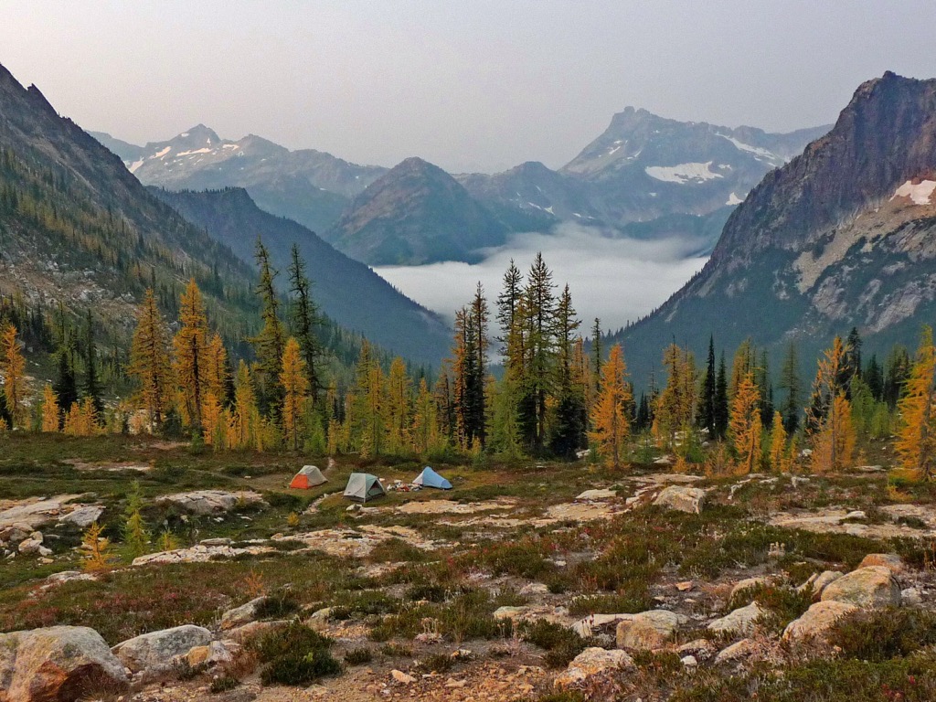
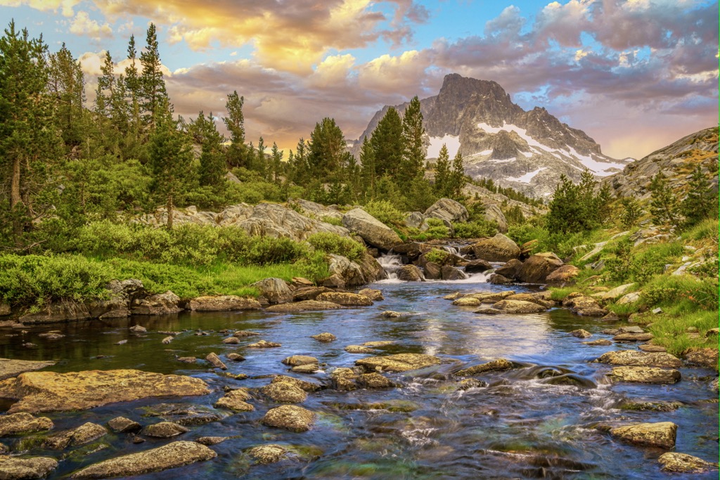
The trail traverses 2,650 miles (4,265 km) in total, tackling the granite expanses of the Sierra Nevada, the rainforests and volcanoes of the Cascades, and ultimately the glaciers of the North Cascades. Hikers must start in mid-to-late-April; the first months are spent between the world’s hottest deserts and mountains high enough to hold deep snow. Start too early, and the Sierra snowpack will bog you down, while hikers who start too late are at risk of boiling alive in the desert crossings of Southern California, particularly the Mojave.
You don’t need technical skills, just pure grit and determination. The route takes about six months. In that time, you’ll start hot in SoCal, grow tired across the Sierra, and end cold and wet - and maybe snow-covered - in the Cascades. The route crosses 25 national forests and seven national parks; it’s everything the mythical Western U.S. offers and the best way to experience the legend of the Wild West.
You can do the PCT cheaper than a trip to summit Kilimanjaro and many other objectives on this list. Most hikers will easily survive on $1000 a month, so this is the best bang for the buck in terms of distance-to-cost ratio. Not to mention the otherworldly fitness and zen mindset that are requirements for completing the trail.
Either way, if you decide to tackle the PCT, you’re going to need a lot more beta than the above four paragraphs. Check out our buddy Mac’s blog for the lowdown on this quest, as well as some added entertainment on the side.
Best Hiking in May
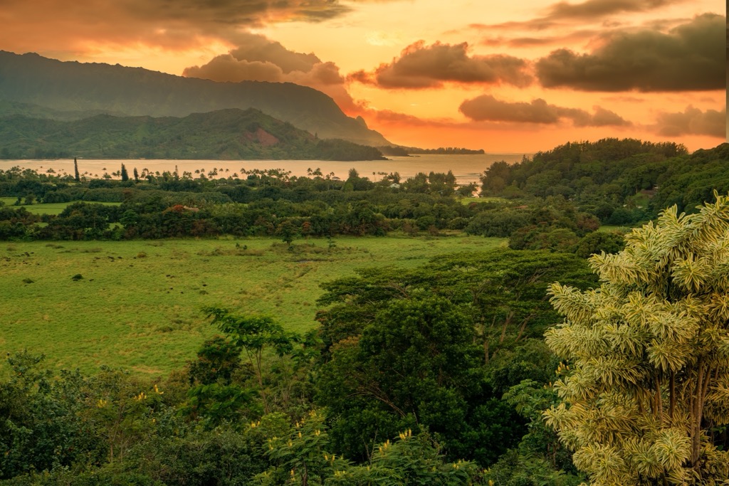
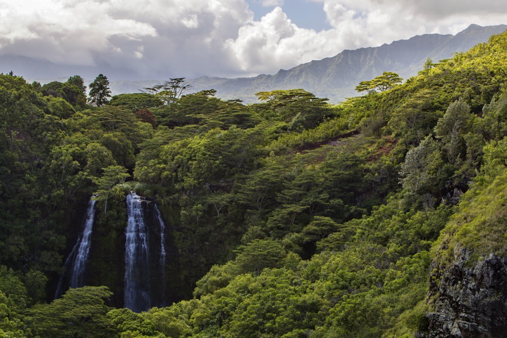
Kaua‘i, Hawai‘i, USA
Kaua‘i is the fourth-largest and wettest of the Hawaiian Islands, often called the ‘Garden Isle’ due to its moist, lush, tropical nature. The island is one of Earth’s most exotic locales and is rife with hiking trails, many of which are moderate hikes of a few kilometers to visit various natural sites like beaches or waterfalls.
Kaua‘i is a laid-back place, and the vibe here is relaxed. If you’re new to the islands, you’ll want to relish every moment on the trail, observing the plant and bird life or basking in the sunshine on a beach (in stark contrast to the 12-hour days on April’s PCT).
Precipitation rates are extraordinarily varied throughout the island, so it’s possible to find perenially sunny beaches with tropical rainforest just a stone’s throw away. The island is also the site of one of Earth’s wettest locales, the weather station atop Mount Waialeale (371 inches / 9.25 meters per annum) at the heart of the island. Meanwhile, the beaches of Southwestern Kaua‘i receive less than 20 inches (50 cm) of rain per annum.
May is a perfect month to visit because it’s the beginning of the dry season but not yet the high season when everything gets crowded and expensive.
Best Hiking in June
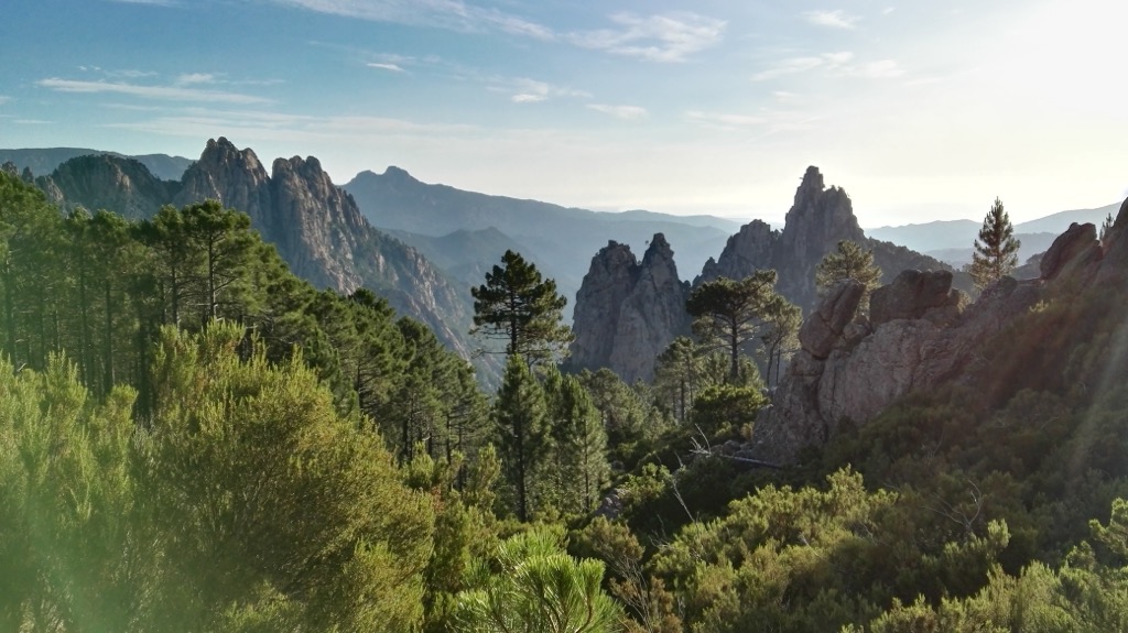
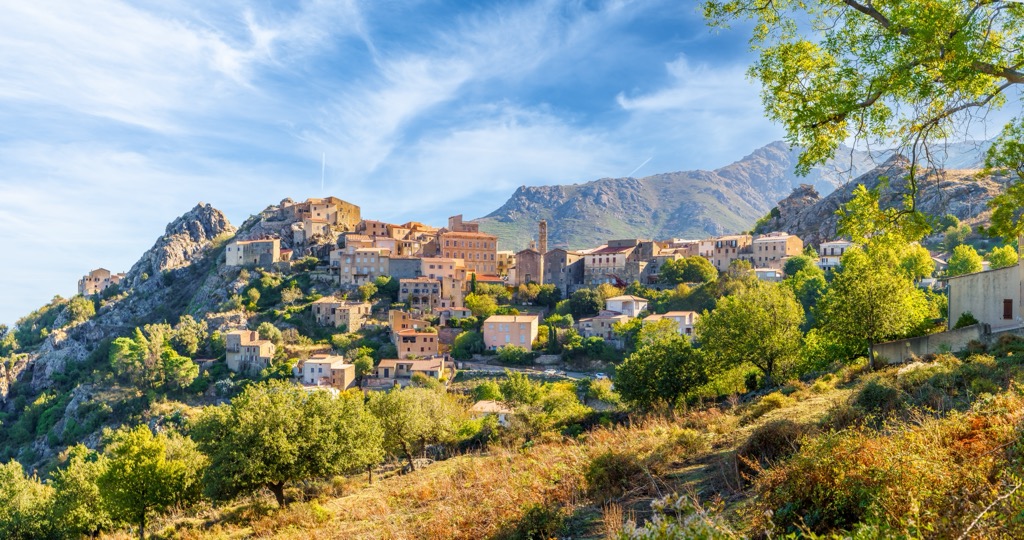
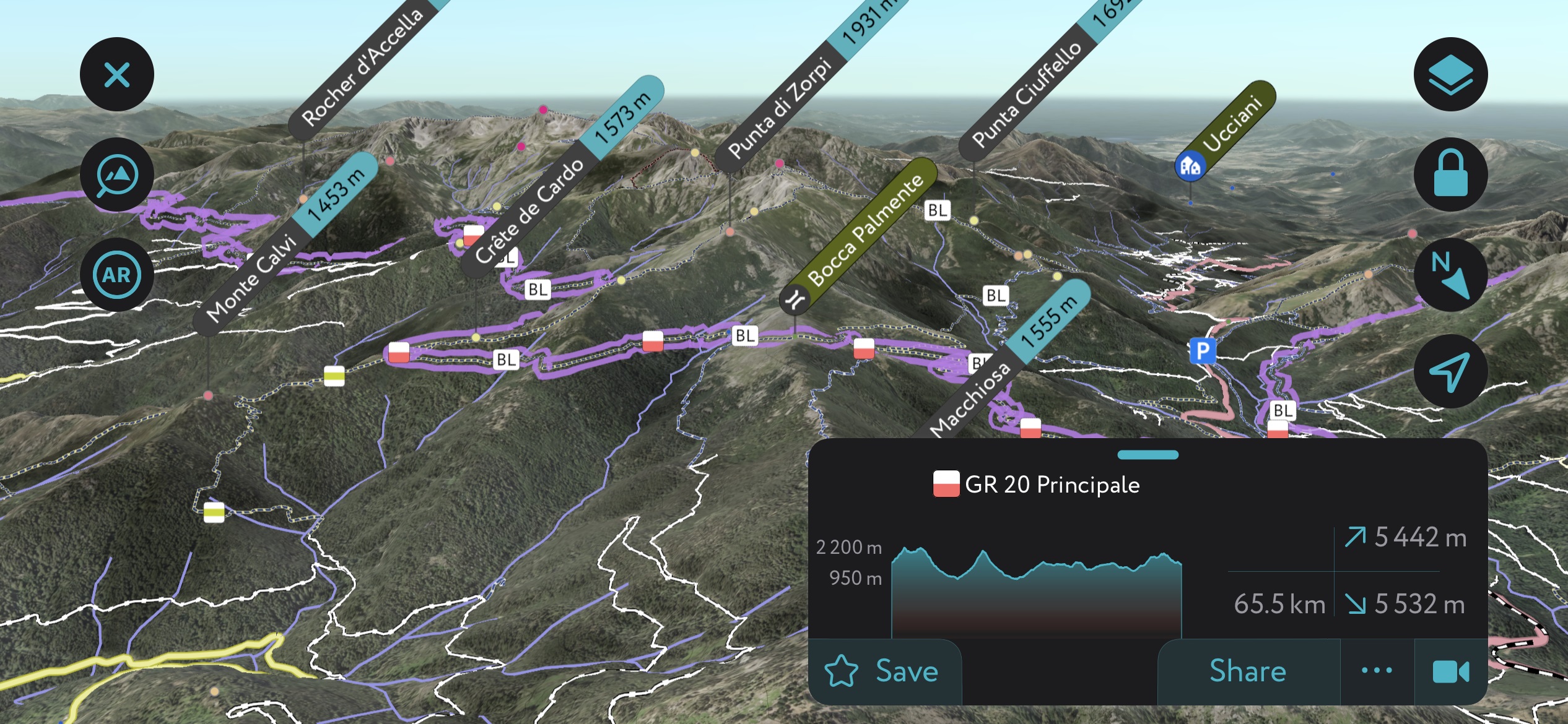
GR-20 Corsica, France
The GR-20 is one of Europe’s most famous long-distance hikes and traverses the mountainous spine along the island’s center. It’s possible to do the route in a week or even less, but most hikers take their time, stopping at swimming holes, alpine meadows, refuges, and villages. Numerous side excursions visit peaks and lakes not directly on the trail.
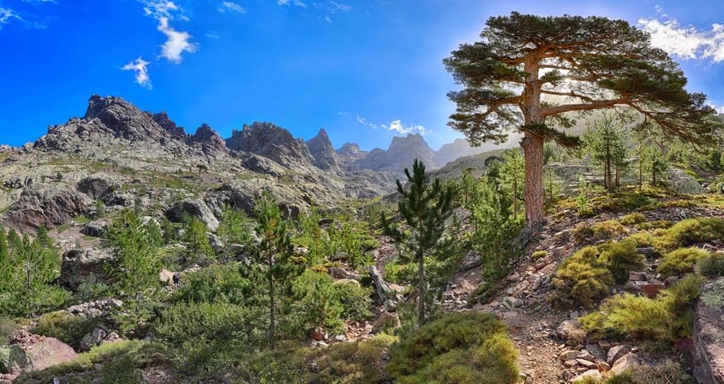
July and August are likely to offer the most stable weather, but Corsica and the GR-20 are frustratingly crowded during this time. I recommend June (or September) for this hike (and visiting any part of Corsica) to avoid crowds. The alpine meadows will be bursting with wildflowers, and the vegetation will be at its greenest before the heat of the summer takes its toll.
On the other hand, June is more likely to bring rain showers and snow crossings along the trail. For me, a lack of crowds and heat makes it worth it, but other hikers may feel differently.
Hikers can bring tents and camp at the refuges or pay for a dorm-style bed. Technically, wild camping along the trail is forbidden. Check out this no-frills website for a treasure trove of information on the GR-20. They also have the route’s GPX files, which you can upload to the PeakVisor Mobile App - although we already have the GR-20 on our maps.
Best Hiking in July
Lofoten Islands, Norway
Most of Norway is above the Arctic Circle, and Lofoten is no exception. The only negative about going in July is that you won’t see the Northern Lights; they appear between September and March. However, you’ll be catching the peak of Lofoten’s short but beautiful summer season.
The last two Julys in the French Alps were often too hot to do strenuous hikes below 1500 meters. As continental Europe becomes increasingly subject to the “July fry,” escaping to the north country is refreshing. Lofoten is a group of islands, fjords, mountains, and glaciers on the west coast of Norway. With plenty of moderating influence from the sea, it stays cool here, even in the deepest part of the summer.
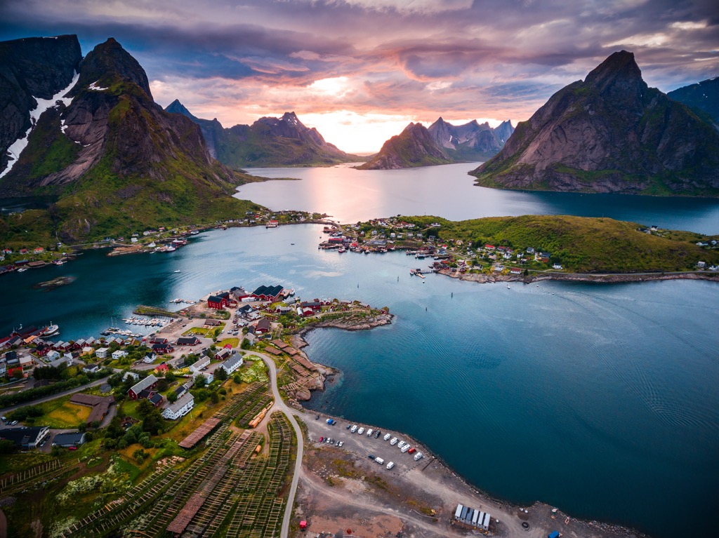
Reinebringen requires a steep climb leading to a panorama of Reinefjorden and the Lofoten Wall. The route can be slippery and is challenging overall. The views, however, are the finest in all of Lofoten.
On the other hand, Bunes Beach is a leisurely 2-3 hour stroll with little elevation gain. The beach is wonderfully secluded, and the whole endeavor involves a ferry ride in both directions. It’s perfect for groups who want to get outside but don’t have the appetite to scale one of the many precipitous summits in their immediate vicinity. What’s not to love?
Norway is expensive, but it's all worth it for a getaway of great hiking, culture, and perfectly tanned and ruddy-faced locals.
Best Hiking in August
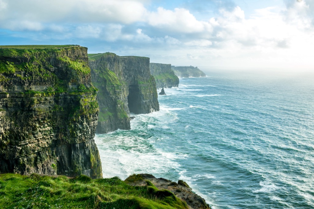
Ireland
Europe and the U.S. get slammed with crowds during August. I saw this in person for the first time this last summer in the French Alps. Yet, the weather is perfect in the mountains of Europe during this time. So where to go? How about the land of Leprechauns and, more importantly, draft Guinness.
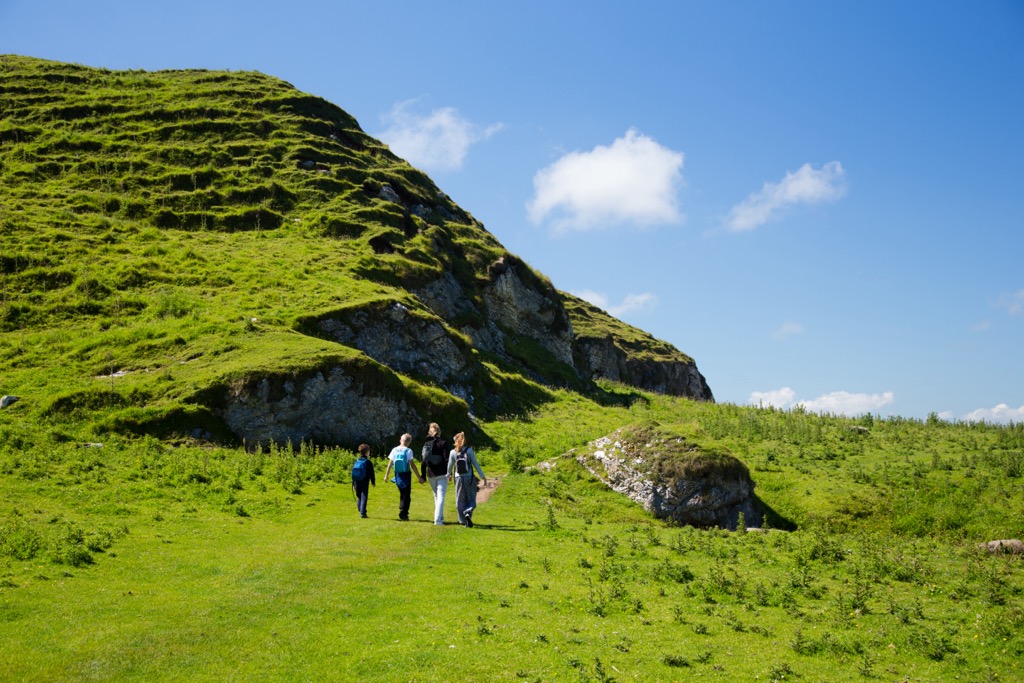
Some of the hikes I included on this list are well-known even to people who don’t hike much (e.g., Everest Base Camp). Ireland is not one of those places. In fact, I didn’t know there was world-class hiking in Ireland until I conversed with some friendly Irish folks a couple of years ago who couldn’t have been more excited about it. So, what makes Ireland a great spot for hiking?
- Fewer crowds than in other parts of Europe, like the Pyrenees and Alps, during the summer.
- Loads of history. Ancient villages with thatched roof houses and rolling green pastureland define the Irish countryside.
- Cool temperatures. Southern Europe has been getting hot in the summer, even in the mountains. Ireland is wet; you won’t have as many sunny days, but you’ll stay cooler. That’s what makes this place so darn green.
- Hikes tend to be more moderate.
- There are thousands of trail options, from short morning hikes to multi-day expeditions.
- Stop by a pub for an Irish brew or three before, during, and after your hike. It’s Ireland’s laid-back vibe that makes the place even more special.
There are countless blogs with great beta for hiking trails and the like. Youth hostels and rural villages will keep the trip affordable. If you live in Europe, cheap flights like Ryanair make Ireland accessible.
Best Hiking in September
GR-50 / GR-54 Tour des Écrins Parc National, France
The Alps deserve at least one month on this list, and I think September is that month for a couple of reasons. There’s too much snow in June, and July / August are busy and hot. September is that golden month where it’s still summer but with cooler temperatures and the kids back in school.
There are many areas in the Alps with excellent hiking. I wouldn’t be surprised if there were a million hiking trails in the Alps; there are about three dozen just in my one tiny village. However, one route stands out to me over all the places I’ve been in the Alps, which, admittedly, is not everywhere.
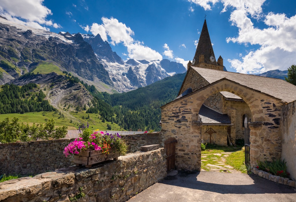
The Tour des Écrins Parc National is about as rugged an adventure as you can take in the densely populated Alp region. The two GR routes are similar and share much of the same route, but there are differences; namely, the GR-50 is about twice as long.
GR-54: Traversing through Hautes-Alpes and neighboring Isere, this 188.6 km (117 mi) route is not for the faint of heart. Most hikers take about a week to finish, give or take a day. There is plenty of accommodation in the form of mountain huts on the route. Still, there are also infinite opportunities for wild camping if you don’t mind carrying the extra weight (with 12,000 m (40,000 ft) of elevation gain, every ounce makes a difference).
Start in the town of Bourg d’Oisans and traverse through the heart of the Écrins in a loop back to Bourg. The route is exceptionally strenuous and passes as high as 2,800 m (9,186 ft), so the season is usually July, August, and September. June can also work if you’re prepared to cross snow.
Most hiking is in a national park, so no pets are allowed, and wild camping is restricted to one night in the same place. The Écrins is wild, beautiful, and free to enter, but many rules are in place to protect the environment. Be aware of and follow these rules during your trip.
GR-50: The GR-50 is longer than the 54, but the hiking is more mellow (although still highly challenging). At 371 km (230 mi), expect to spend at least two weeks on the trail. The total elevation gain is 19,000 m (62,000 ft). The route only ascends to 2,400 m (7,874 ft), so the season is longer - you can often do this route anytime between May and October without hitting too much snow.
Like the GR-54 - and many other European backpacking routes - you can carry camping equipment and sleep outside or utilize a massive network of huts.
The route doesn’t pass through the heart of the Écrins, instead taking a wider loop around the park's outskirts and above the Durance Valley. The trail begins in Bourg d’Oisans, meandering above Gap and the Lac du Serre-Ponçon. The loop travels up the Durance Valley, above Briançon, then back west toward La Grave and eventually Bourg.
Best Hiking in October
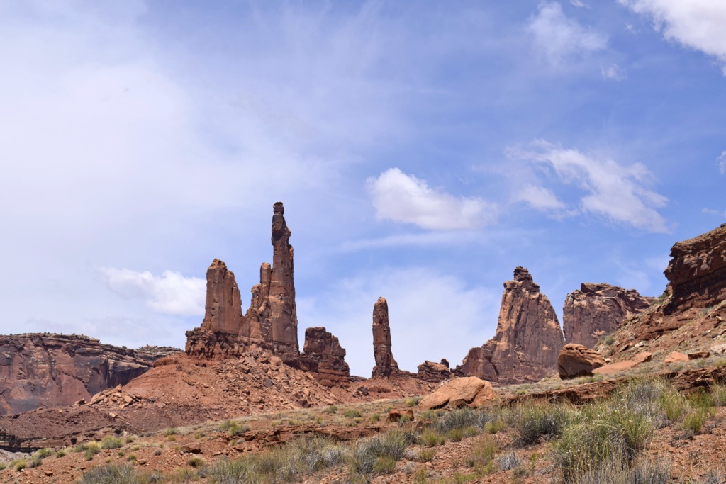
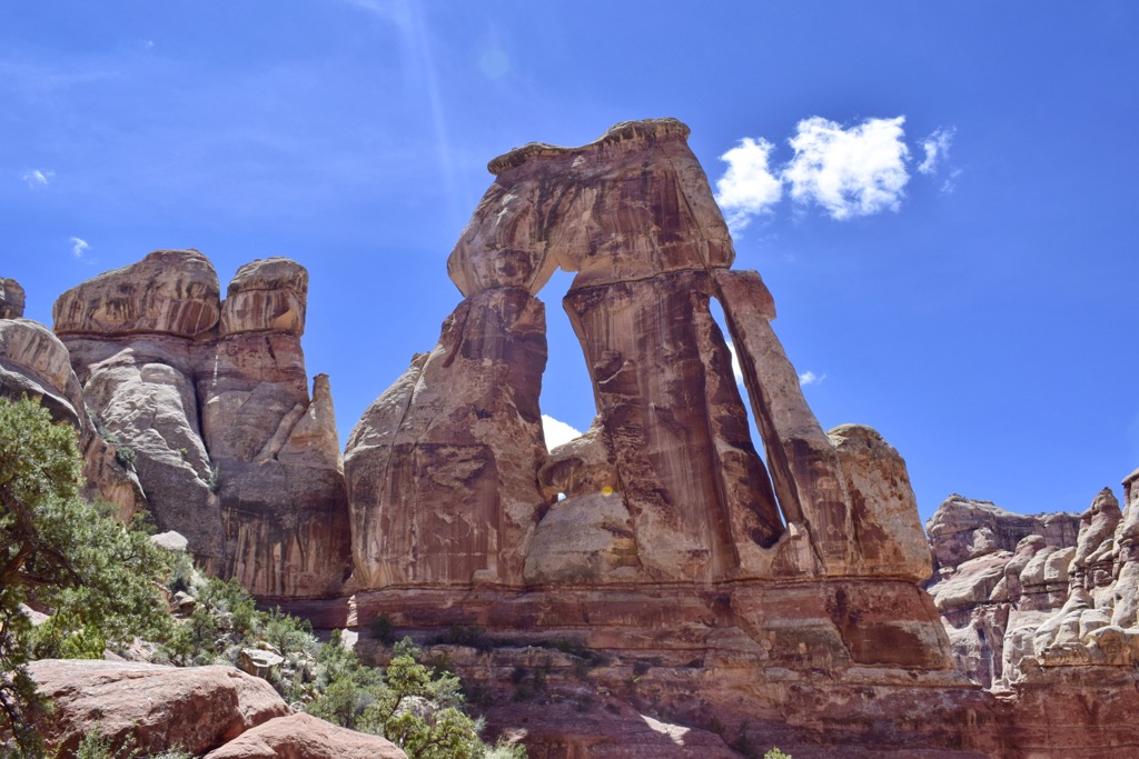
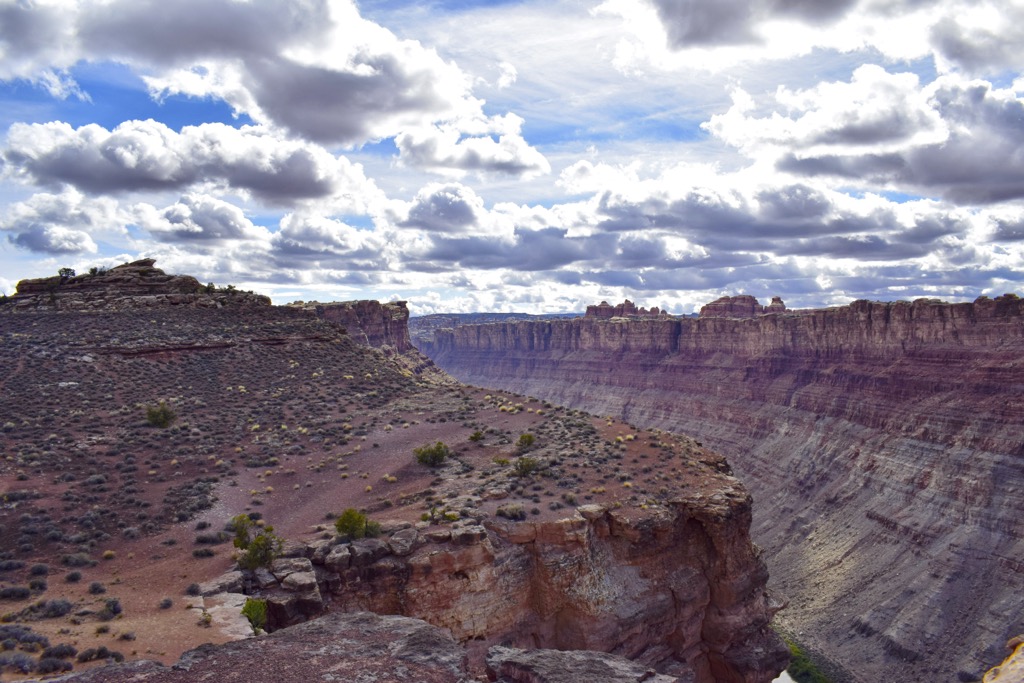
Moab, Utah, USA
There’s nowhere else on Earth quite like Utah’s canyon country and Moab in the center of it all. Once a mean little mining town in a forgotten desert, Moab is now a bastion of hikers, adrenaline junkies (BASE jumpers, high liners), redneck 4x4 drivers, climbers, mountain bikers, trail runners, canyoners, rafters, and National Park tourists. Last but not least is the skiing, which can be epic when the dry powder falls in abundance on the guardians of Moab, the La Sal Mountains.
It’s one giant eclectic mix of people and can get busy. Fortunately, BLM camping abounds throughout the surrounding desert. One statistic I’ve heard pointed to 100,000 visitors in the area each day during the high season. Still, out in the desert, you’d hardly know it (the town gets congested, though).
Canyonlands National Park and Arches National Park are the two parks in the Moab vicinity, and both feature excellent hiking. Canyonlands features longer hikes, while Arches is mostly short hikes to extraordinary rock formations (many of which are accessible by car). Canyonlands is divided into districts on either side of the Colorado River: the Needles District and the Island in the Sky District. Meanwhile, the Manti-La Sal National Forest encompasses the La Sal Mountains.
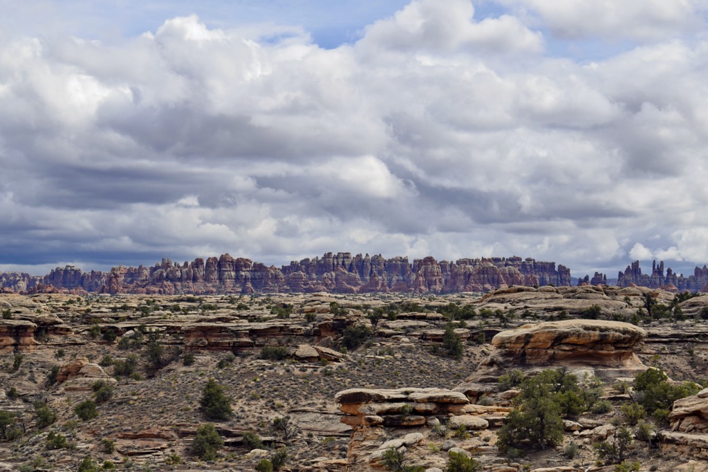
My personal favorite hike in Moab is the Druid Arch in the Needles District of Canyonlands. It’s a 10-20 mile (16 - 32 km) hike, depending on how you get there (many trails are crisscrossing the Needles, and you can take any number of routes, some less direct than others). The journey takes you through pristine desert meadows (in sharp contrast to the overgrazed pasture throughout the public land surrounding the parks). Slot canyons, seasonal washes, and slabby scrambles round out this hike. The Druid Arch itself is something of an impressionistic masterpiece, like a wilderness Picasso.
A mysterious third district of Canyonlands is known simply as The Maze. Only 2,000 people per year venture here, mostly with 4x4 jeeps. As one park ranger explained to me with a gleam in his eye, it is the most remote place in the continental US. No trails exist in this desert wilderness, but there are plenty of intriguing canyons, arches, and various other sandstone formations if you’re willing to trek through the boiling desert to find them. The approach is either a pack-raft trip across the Colorado River or a circuitous, days-long 4x4 mission along a backcountry double track.
Conversely, Arches is host to dozens of short, family-friendly hikes to see Suessian sandstone formations, though with significantly denser crowds. The Moab region has something for every level of hiker throughout its vast expanse and numerous zones.
Best Hiking in November
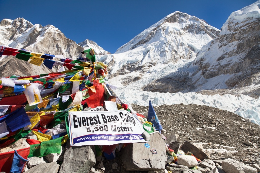
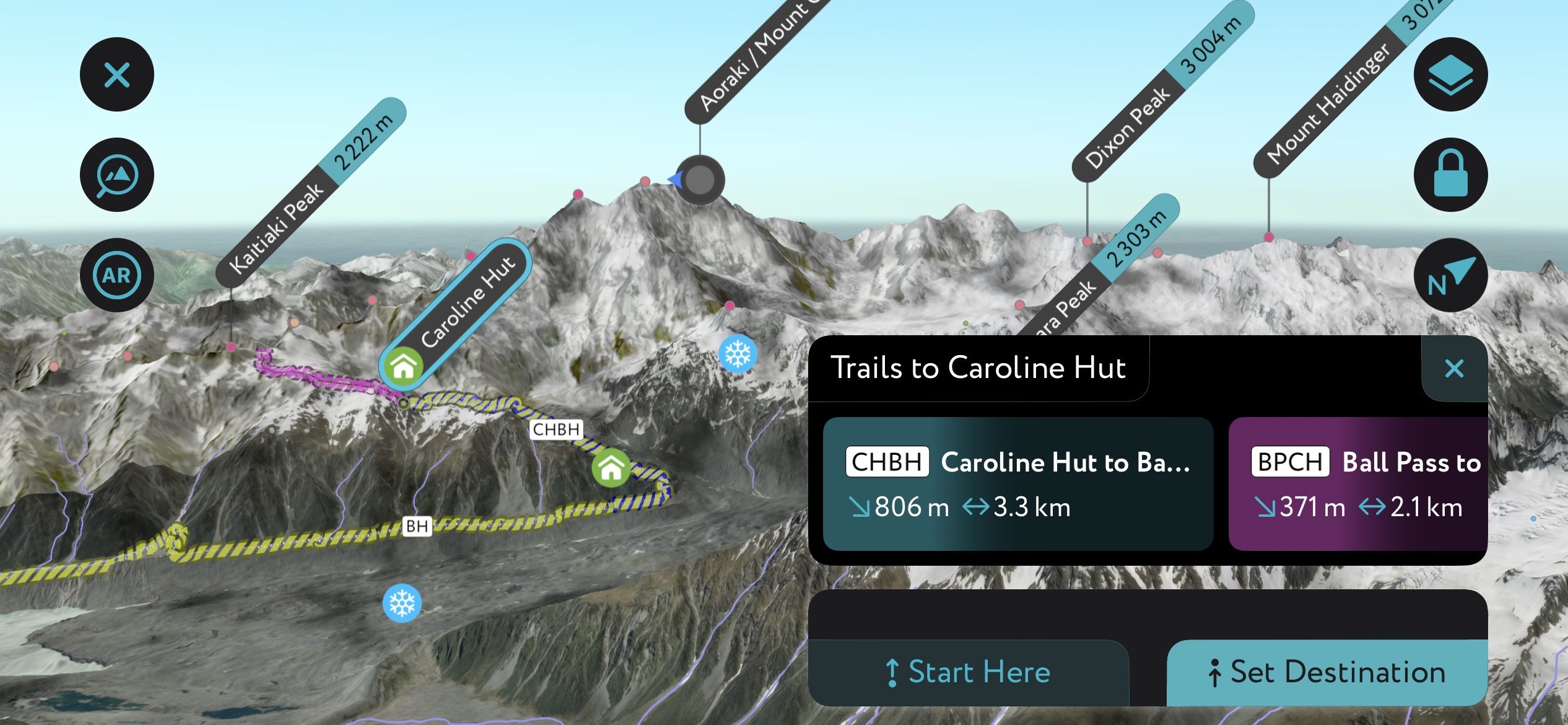
Everest Base Camp
Known simply as EBC, the trek to the base of the world’s highest peak is likely also the world’s most famous. As you’ve likely read about, crowding and pollution are significant issues on Everest. Yet, to see the grandeur of this massive peak in real life is priceless.
That’s why I’ve recommended doing the trek in November after the October crowds have dispersed. You’ll be as likely to have dry weather and clear skies with perfect views of Everest. Cold will be more of an issue, so come prepared with extra layers. There will also likely be some snow on parts of the trek.
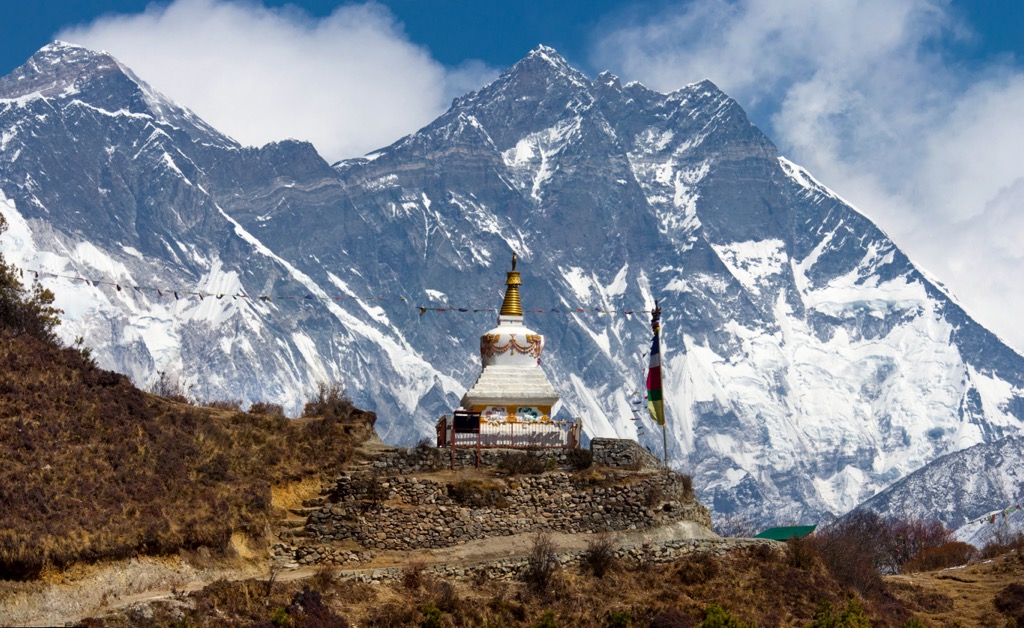
A trip to the staging ground of Everest generally takes at least a couple of weeks due to days spent traveling and acclimating in addition to hiking. The route links remote Sherpa villages like Namchee Bazaar and Tengboche Monastery. EBC itself sits directly under the imposing Khumbu Icefall, which appears unscalable from afar (indeed, the only reason so many people can summit Everest is because the Sherpas have installed ladder bridges across the gaping crevasses and tumbling seracs).
Acclimation consists of day hikes to surrounding high points followed by descents and lower elevations for sleeping. In fact, these side excursions provide the best views of Everest, much better than EBC itself.
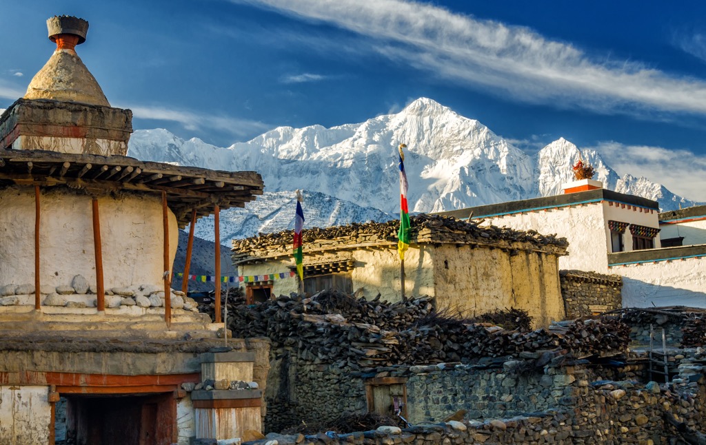
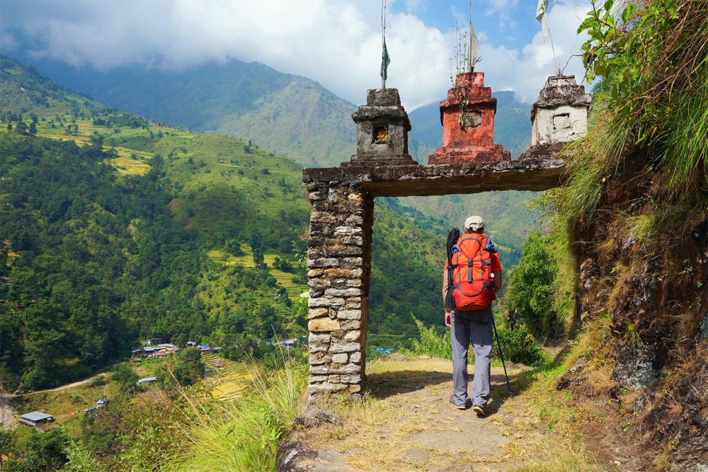
Annapurna Circuit
The second most famous trek in the region is the Annapurna Circuit, which takes you around the entire Annapurna Massif. Usually completed in 14 to 18 days of walking, the route reaches as high as Thorong La Pass (5,416m / 17,769ft) and offers excellent views of Annapurna I and Dhaulagiri.
You can also ride a mountain bike on this circuit, an activity that is becoming increasingly popular. Like Everest, the Annapurna Circuit involves quite a bit of acclimatization; going high and sleeping low before summiting the passes is essential.
Best Hiking in December
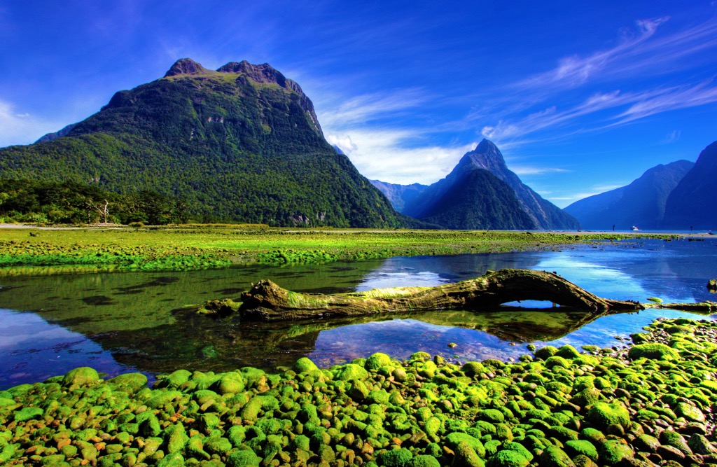
New Zealand
If you’ve made it to December, you’re in luck because we’ve saved the best for last.
Perhaps the world’s finest hiking destination, New Zealand is host to numerous ecozones, climates, and mountain ranges. December in New Zealand is equivalent to June in the Northern Hemisphere; spring is fully sprung, the days are long, and the legendary pastoral greenery is at its most vivid.
What makes New Zealand so great for hiking? Several reasons come to mind:
- The country is relatively small, so once you’ve arrived, you can hire a vehicle and drive all around relatively quickly. That said, getting to New Zealand is not the easiest, and airfare can be expensive.
- The diversity of climates is rare. Coastal rainforests, alpine slopes, high-mountain icefields, and vast temperate lakes are just a few of the zones you can experience.
- The Great Walks: New Zealand has categorized its ten best multi-day hikes into the ‘Great Walks,’ meant to showcase the country’s diversity. The Great Walks are all uniquely beautiful and accessible; most are only about 3-4 days on the trail, perfect for discovering remote places without a weeks-long commitment.
- New Zealand’s isolation makes it a hub for endemic species. Walking through the forests is like an alien world to visitors because many species are found nowhere else on Earth.
- Reasonable temperatures. Due to the maritime influence, it’s never too hot or too cold in New Zealand. Some folks may find the rain undesirable, but it’s what makes the environment so beautiful. However, there are drier parts in the country’s east.
- Urban access to nature. New Zealand’s cities are unanimously close to parks, trail networks, and other natural places.
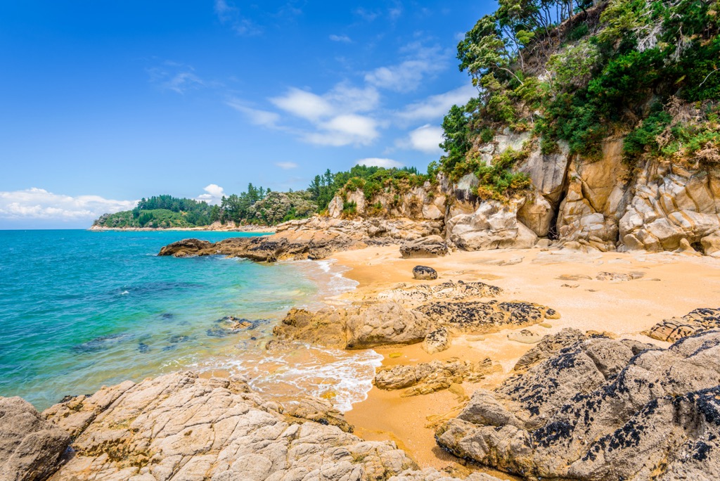
Check out the Abel Tasman Coast Track for a 51 km (32 mi) stroll along the beaches and coastal forests of Abel Tasman National Park, the South Island’s sunniest locale. Relative to some of the other Great Walks, this hike is moderate, with little elevation gain, and possible to do any time of year.
The Milford Track is NZ's most famous (and popular) multi-day hike. It’s also considered one of the best walks in the world. The 53 km (34 mi) trek takes 3-5 days and cuts through Fiordland National Park on the South Island.
Due to demand, NZ’s Dept. of Conservation requires bookings for the Great Walks. One of the downsides is that the most popular trails, like the Milford Track in Fiordland National Park, are nearly impossible to secure. The advantage is that crowding is not an issue if you manage to secure a spot. While the strict regulations may be bothersome, they are necessary to preserve ecological integrity; there are simply too many people who want to take these hikes.
Besides the great walks, there are thousands of trails throughout New Zealand. Check out the PeakVisor app for more details.