
Scan the QR code and open PeakVisor on your phone
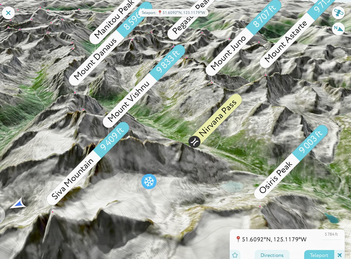
The Pantheon Range include 24 named peaks. The highest is Mount Vishnu at 2,999 m. Other notable peaks include Byamee Mountain, Mount Astarte and Mount Zeus.
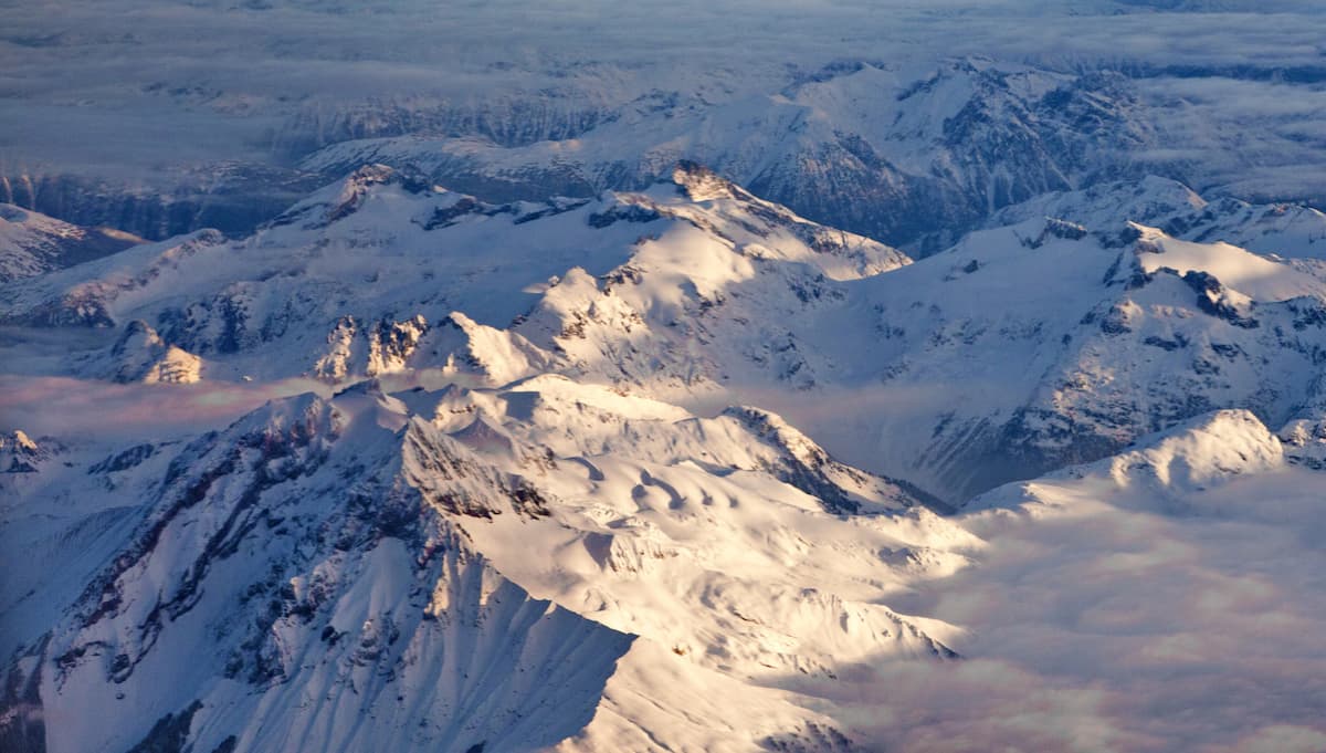
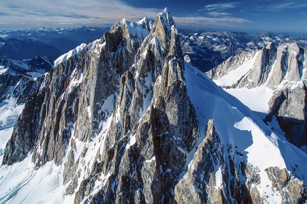
With towering peaks, snow-capped summits, and rugged terrain, the Pantheon Range is a remote subrange of the Canadian Coast Mountains located in the southwestern region of the province of British Columbia in Canada. The range contains 31 named mountains, the highest and most prominent of which is Mount Vishnu (2,997m/9,833ft).
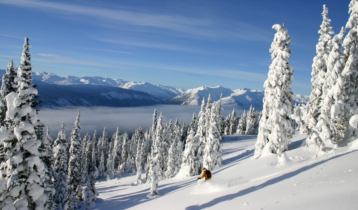
Located in the southern part of British Columbia’s Cariboo Regional District, the 1,930 sq. km (745 sq. mi) Pantheon Range is a stunning collection of peaks that offers great scrambling and climbing opportunities in the summer as well as excellent backcountry skiing in the winter.
The range is bounded by the Homathko River to the east and the Klinaklini River to the west and it is surrounded by other mountain ranges on nearly all sides. In particular, the Pantheon Range is located to the west of the Niut Range and the Homathko Icefield and to the east of a collection of peaks within the Canadian Coast Mountains.
Moreover, the Pantheon Range is situated to the north of the Waddington Range and the Whitemantle Range, as well as to the south of the Fraser Plateau of the British Columbia Interior and the Kitimat Ranges.
While the Pantheon Range isn’t located within any major parks or conservancies, it is situated within close proximity to a number of outdoor recreation and wildlife management areas.
These include Tweedsmuir Provincial Park to the north, Dzawadi/Upper Klinaklini River Conservancy to the west, and Homathko River-Tatlayoko Protected Area, Ts'ilʔos Provincial Park, and South Chilcotin Mountains Provincial Park to the east.
The Pantheon Range is part of the Canadian Coast Mountains, which is a massive chain of peaks that stretches some 1,600km (990mi) from the southern part of British Columbia, through the southeastern panhandle of the US state of Alaska, and into the southern part of the Yukon.
This range is part of a large system of mountain ranges known as the American Cordillera that connects the Brooks Range of Alaska in the north to the Andes in Argentina and Chile to the south.
Moreover, the Canadian Coast Mountains are part of a large region known colloquially as the Ring of Fire, which encompasses much of the coastal areas in the Pacific Ocean. This region is most famous for its high level of volcanic and seismic activity and it includes everything from the Aleutian Range in Alaska to the Southern Alps in New Zealand.
Over the past tens of millions of years, the region in and around the Pantheon Range has experienced widespread tectonic subduction, which has helped build the landscape into the mountain range that we see today. The region is also composed mostly of metamorphic and igneous rocks, which have formed over millions of years as a result of regional volcanism and tectonic forces.
Additionally, the Pantheon Range, alongside many of the other neighboring Canadian Coast Mountains subranges, including the Waddington Range, have experienced extensive ice cover in recent years.
Throughout the Pleistocene, much of the region was covered in thick ice sheets, which have left behind many U-shaped valleys and stunning geological formations. Glaciers and icefields can still be seen in and around the Pantheon region today, such as in the Homathko Icefield and the Ha-Iltzuk Icefield.
Major peaks in the Pantheon Range include Mount Vishnu, Mount Astarte, Mount Zeus, Hermes Peak, Mount Thor, Perkins Peak, and Fenris Mountain.
Like its parent range, the Canadian Coast Mountains, the Pantheon Range is home to a number of different ecosystems.
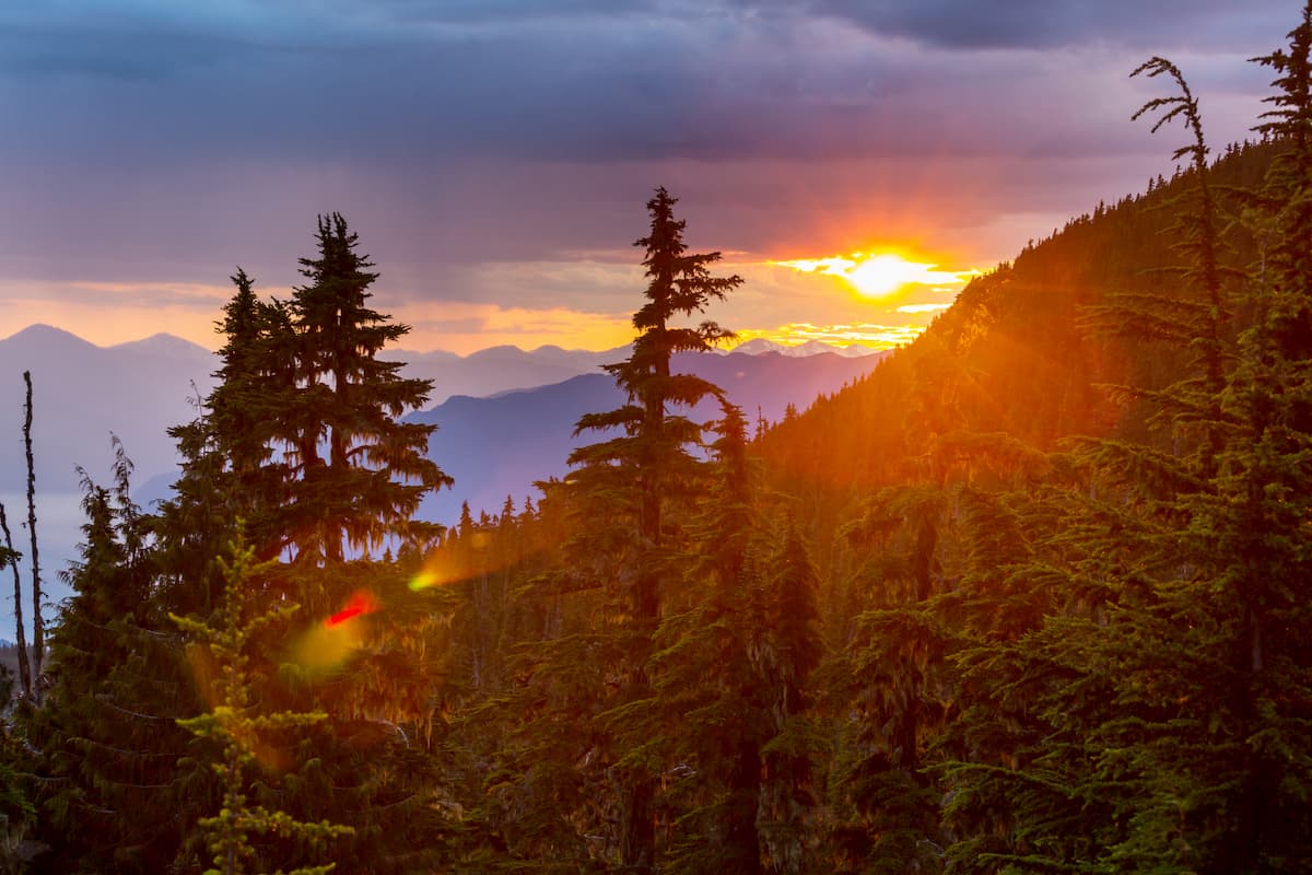
At the lowest elevations within valleys, the range is home to dense forest cover, with large stands of conifers dominating the landscape. Technically speaking, the range is located just outside the generally agreed-upon boundaries of the Great Bear Rainforest, though similar flora and fauna can be throughout the region.
Meanwhile, at the highest elevations, the Pantheon Range is particularly jagged and it contains sizable snowfields and glaciers. As a result, much of the loftiest parts of the range are relatively free of vegetation, save for some alpine meadows at the mid-elevations.
Although the highest elevations of the Pantheon Range are rugged and remote, the lower-elevation areas in the range and the surrounding area have long been home to humans. The region is part of the traditional territory of many First Nations, including the Tŝilhqot'in Nation, the Southern Dakelh Nation Alliance, the Da'naxda'xw-Awaetlala First Nation, and the Homalco First Nation (Xwémalhkwu), among others.
Due to the remoteness of the range, it went relatively unvisited by European settlers in the 18th and 19th centuries, though the surrounding region, particularly in the Chilcotin Country to the north did have a Hudson’s Bay Company trading post known as Fort Chilcotin in the 1830s and 1840s before it was moved to Fort Kluskus.
In the 1860s, the region to the north of the Pantheon Range saw the outbreak of the Chilcotin War. The war started when a businessman by the name of Alfred Waddington attempted to build a road from Bute Inlet to Barkerville.
However, Waddington’s construction crews illegally entered the territory of the Tŝilhqot'in Nation, leading to violence and, eventually, the execution of six Tŝilhqot'in chiefs. The chiefs were later exonerated in 2014, and in 2018, Prime Minister Justin Trudeau gave an official apology for the wrongful executions.
These days, the region around the Pantheon Range remains remote, though there are quite a few towns and settlements to the north of the range.
The range itself is perhaps less frequently visited than the peaks in the nearby provincial parks, though it is actually a fairly popular heli-skiing destination in the winter months. In particular, the Pantheon Range’s difficulty of access and its towering stature make it an excellent place to seek out backcountry powder in the winter.
Within the Pantheon Range, there are plenty of great adventures to be had. However, the range itself is difficult to access and much of the region is trailless, so competence in backcountry navigation is a must for all visitors.
Moreover, the ruggedness of the Pantheon Range means that many of the peak ascents require technical climbing skills, or, at the very least an extended scramble. Therefore, venturing into the Pantheon Range is a serious undertaking.
Although any of the range’s peaks could be worthy projects for the ambitious mountaineer, perhaps the most iconic route option is the Pantheon and Waddington Range Traverse, which is a 2 to 3 week ski tour.
Depending on how much time you have on your hands, one could actually reach the outskirts of the northern edge of the Pantheon Range on the Chilcotin-Bella Coola Highway (BC Highway 20), though most climbers would want to organize an air taxi pickup or drop-off both within the Pantheon Range and within the much more remote Waddington Range.
Looking for a place to stay before your trip to the Pantheon Range? Here are some of the best places to check out:
The community of Tatla Lake is situated just to the northeast of the Pantheon Range on the Chilcotin-Bella Coola Highway (BC Highway 20), about a 10 hour drive to the north of Vancouver. Although the community is quite small, it does have shops, restaurants, and hotels for visitors to enjoy.
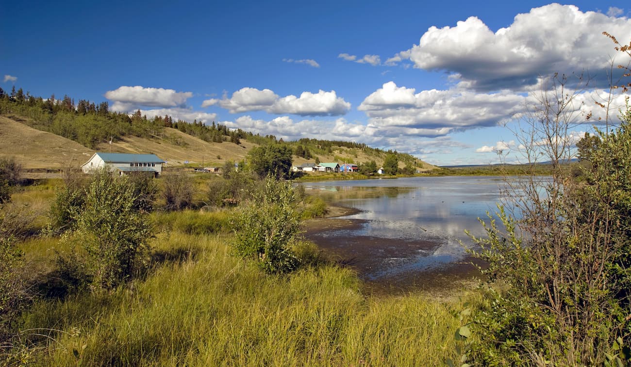
Moreover, just 30 minutes to the south of Tatla Lake is White Saddle Air Service, which is one of the region’s premier air taxi operators. If you’re looking to venture into the Pantheon Range, an air taxi is usually your best bet, so Tatla Lake is a great place to start your trip.
Situated to the northwest of the Pantheon Range, the community of Bella Coola is home to about 2,000 residents who live in the Bella Coola River Valley. Bella Coola is just under 3 hours by road to Tatla Lake and it is right outside Tweedsmuir Provincial Park, so it’s a popular destination in the region.
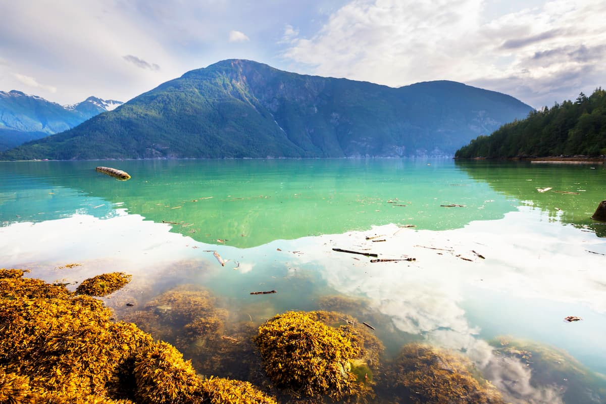
The community is accessible by road on the Chilcotin-Bella Coola Highway (BC Highway 20), and it has both a small airport and marine access on BC Ferries.
The most populous city in British Columbia, the city of Vancouver is home to about 630,000 residents, while about 2.4 million people live in the Greater Vancouver area. Vancouver is frequently ranked high in terms of livability and quality of life, though it is also one of the most expensive cities in Canada.
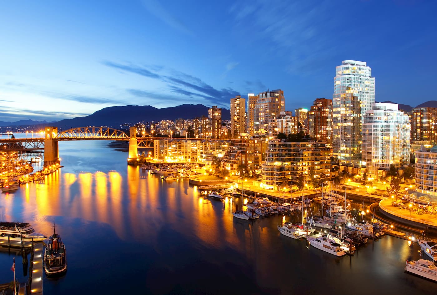
It is located about a 10 hour drive to the south of the Pantheon Range, though climbers can also fly from the city to Bella Coola and start their journey from there.


The highest peak in the Pantheon Range is Mount Vishnu, at 2,999 m.
The Pantheon Range have 24 named peaks.


