
Scan the QR code and open PeakVisor on your phone
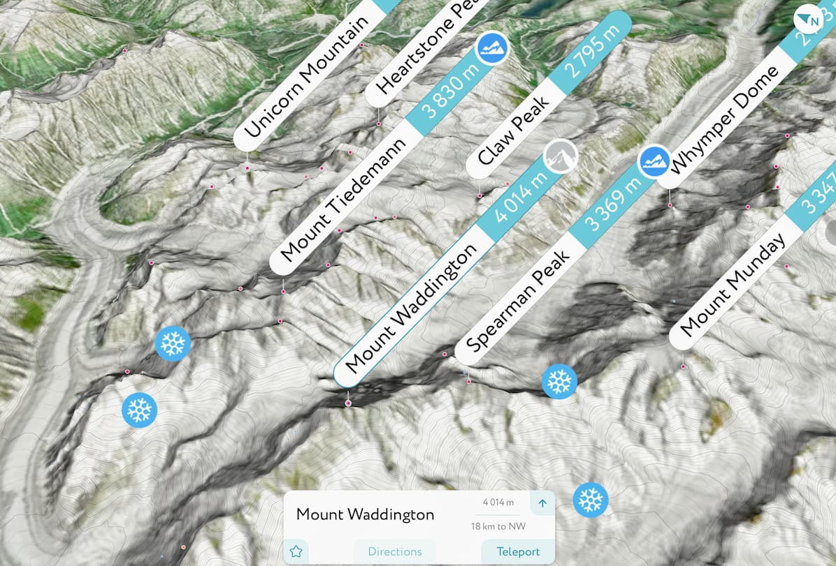
The Waddington Range include 89 named peaks. The highest is Mount Waddington at 4,014 m. Other notable peaks include Mount Tiedemann, Combatant Mountain and Asperity Mountain.
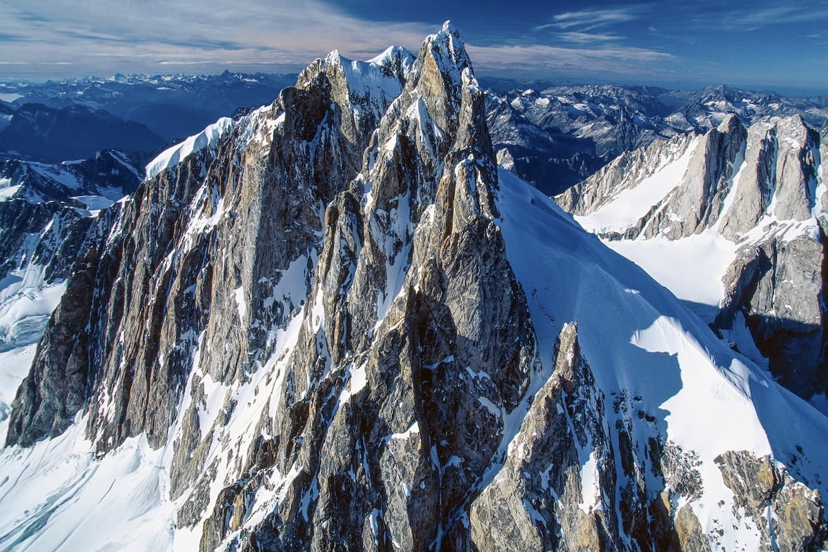
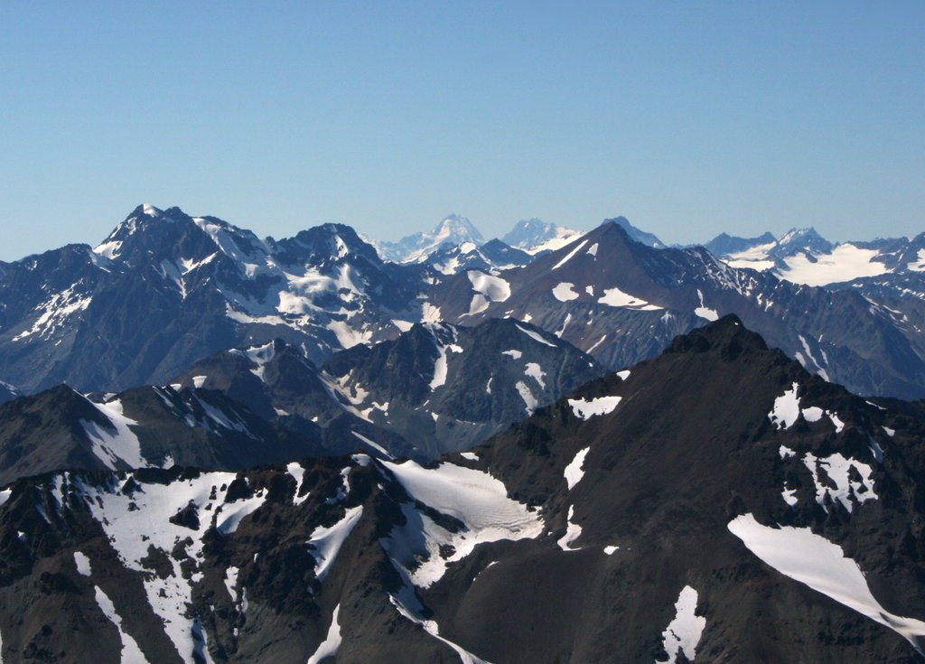
Mystery shrouds Mount Waddington, a 13,169-foot massif surrounded by British Columbia’s Coast Range. In the 1920s, Mount Waddington was simply known as ‘Mystery Mountain,’ because although it could be spotted from Vancouver Island, it hadn’t been accessed or climbed.
In the 1920s, an incredible mountaineering duo, Phyllis and Don Munday, set out to find and summit the fabled Mystery Mountain after experts insisted that this impressive, glacier-laden peak simply didn’t exist.
Little did they know, their attempts to locate ‘Mystery Mountain’ would become a decade-long obsession. In 1926, relentless avalanches kept the duo from summiting the peak, but they finally had photographs of the mountain and proof that the impressive pinnacle was real.
Over the next decade, the Mundays would return to the mountain eight times, documenting their extraordinary efforts and experiences tackling the grueling landscape surrounding Mount Waddington. Their documented travels, packed with drama, near-death experiences, and encounters with wildlife, generated a lot of buzz around the mountain and its surrounding summits.
Unfortunately, the Mundays never reached the summit of ‘Mystery Mountain.’ In 1936, two climbers, Fritz Wiessner and Bill House would finally reach the summit.
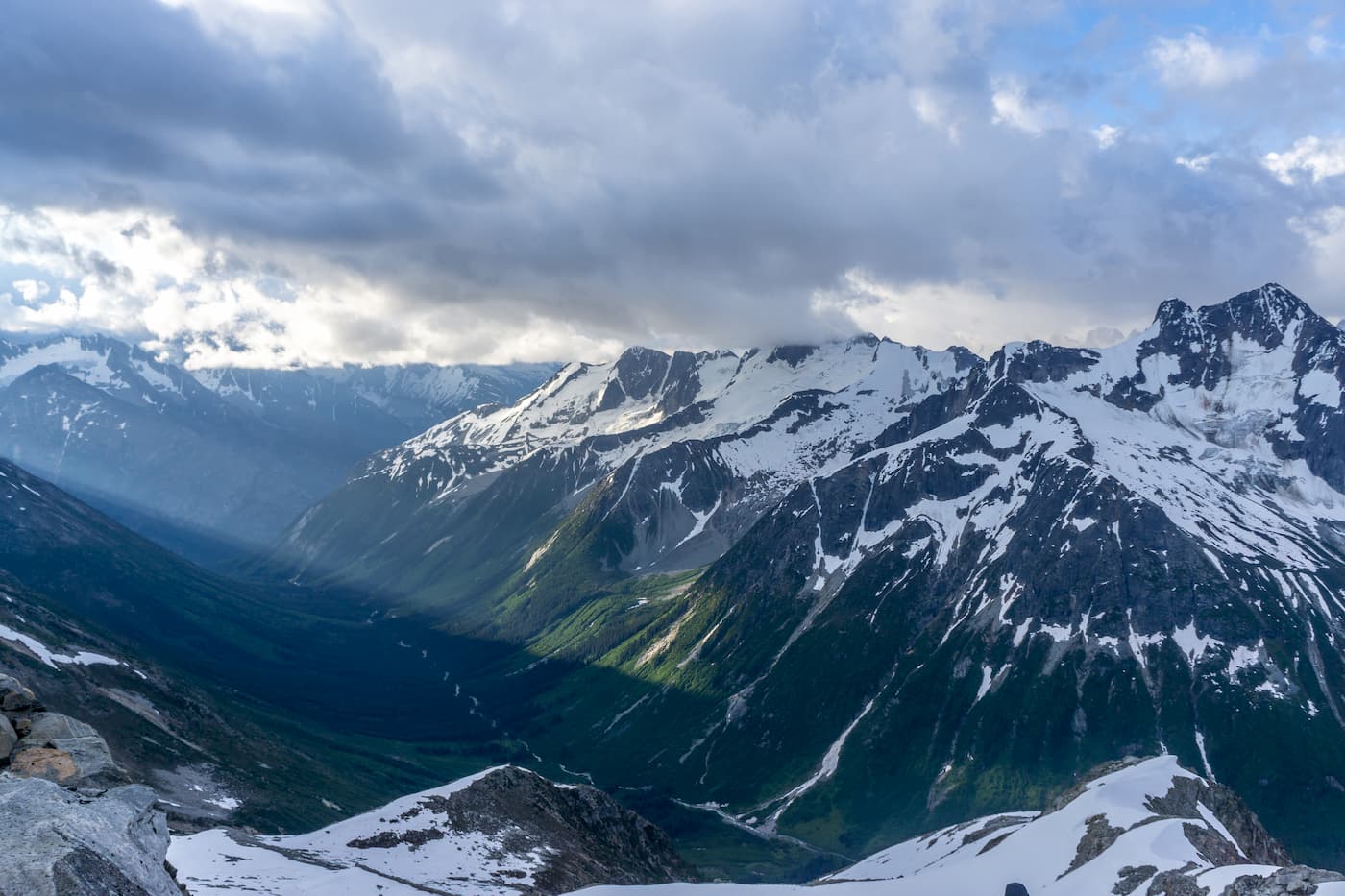
Today, the area surrounding Mount Waddington is still considered an extremely rugged and complex landscape. The Waddington Range, which only encompasses roughly 1,545 square miles, is the highest of the Pacific Ranges and Coast Mountains. Unlike other, more contiguous icefield-massifs in the Coast Mountains, the Waddington Range is known for its peak-studded and multifaceted terrain. Even today, this region of the Coast Mountains is considered too remote and too difficult for the everyday climber.
Though Mount Waddington is the most iconic summit in the range, several remarkable summits are tucked in the Waddington Range, including Mount Tiedemann, Combatant Mountain, Spearman Peak, Mount Munday, and Asperity Mountain.
Due to the involved planning and skills required to ascend Waddington, this iconic peak and its neighboring summits mostly attract highly skilled and experienced climbers and mountaineers. According to the American Alpine Institute, however, despite the region’s reputation as being rugged and relatively inaccessible, there are several good routes on rock and glacier for both novice and expert climbers.
Easier Routes in the range include:
Mount Waddington, the Kiwi Route – This is known as the easiest way to reach the summit. Climbers attempting the true summit will have to overcome the technical challenges of the summit pyramid and will likely encounter icy climbing conditions.
Mount Combatant, Northwest Ridge – A snow climb with mid-fifth class rock climbing.
Mount Tiedemann, BCMC route – Considered the most logical route on Tiedemann. This route requires some mixed climbing in mid-fifth range and a snow arete to the summit.
It’s worth noting that several companies also offer guided trips to the summit of Waddington Peak, Bravo Peak, Spearman Peak, Combatant Mountain, Mount Tiedemann, and Asperity Mountain.
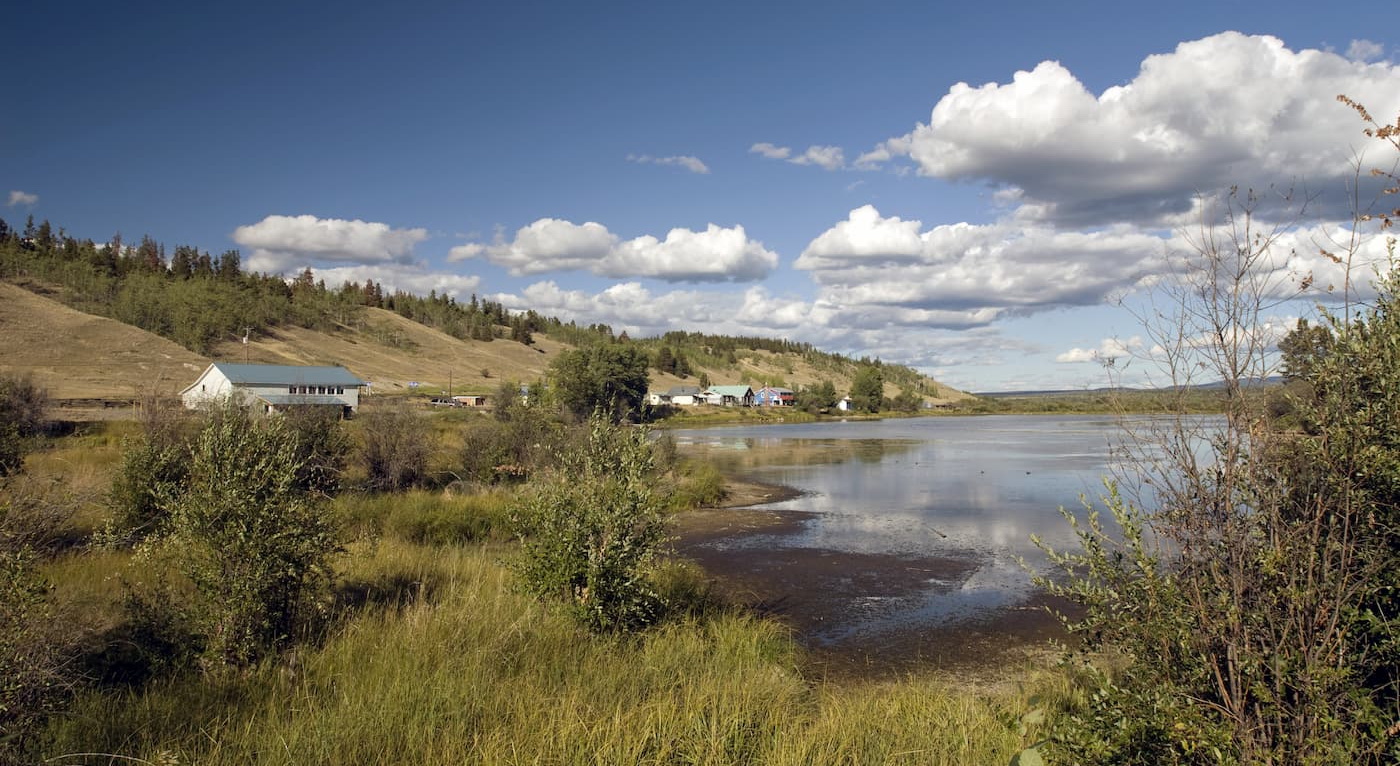
The small community of Tatla Lake sits on Bella Coola Road, which leads from Williams Lake across the Chilcotin Plateau and Coast Mountains to Bella Coola on the west coast of central British Columbia.
Tatla Lake is a helicopter tour access point for several incredible wilderness destinations, including Mount Waddington. Due to the remote nature of this region, visitors looking to head into the backcountry often hire local guides in Tatla Lake. Tatla Lake is also a common starting point for guided climbs of several Waddington Range summits.


.jpg)
ultra
glacier
4000ers-canada
11ers-bc
fred-beckey-great-peaks
canada-sampler
british-columbia-ultras
ultra
glacier
4000ers-canada
11ers-bc
fred-beckey-great-peaks
canada-sampler
british-columbia-ultras
The highest peak in the Waddington Range is Mount Waddington, at 4,014 m.
The Waddington Range have 89 named peaks.


