
Scan the QR code and open PeakVisor on your phone
The Whitemantle Range include 23 named peaks. The highest is Whitemantle Mountain at 2,982 m. Other notable peaks include Outrider Peak, Mount Stanton and Barb Mountain.
The Whitemantle Range of British Columbia, Canada was named for its snow and glacier covered peaks and slopes. Located along the western coast of the province in the Pacific Ranges of the Canadian Coast Mountains, the Whitemantle Range has over 23 named peaks, the highest and most prominent of which is Whitemantle Mountain (2,982 m/9,783 ft).
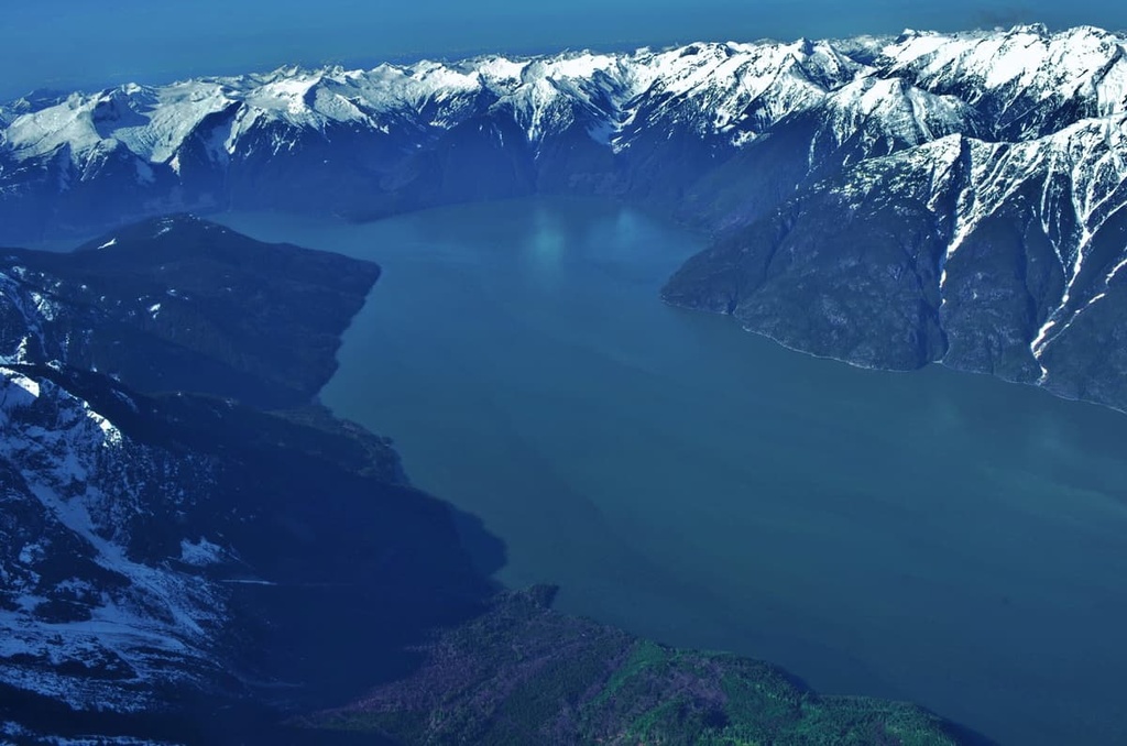
Standing some 2,982 m (9,783 ft) above sea level, Whitemantle Mountain is the tallest and most prominent mountain in the Whitemantle Range. The Whitemantle Range sits between the Knight and Bute Inlets, which are located along the coast of British Columbia, Canada. The range is actually a subrange of the Pacific Ranges of the Canadian Coast Mountains.
Additionally, the Whitemantle Range is located just to the south of the higher and more rugged Waddington Range, which is the highest range in the Canadian Coast Mountains. The Waddington Range is home to its namesake Mount Waddington, which is the tallest mountain in the Coast Mountains.
Due to its remoteness, planes and helicopters are among the most common ways to travel to the Whitemantle Range. The range is also accessible via kayak or charter boat to the head of the Knight or Bute Inlets. Finally, there are old logging roads in the area; however, the logging roads are not necessarily maintained.
The Homathko Estuary Provincial Park and Dzawadi / Klinaklini Estuary Conservancy are both located at the base of the Whitemantle Range. While there are no other protected areas in the Whitemantle Range itself, there are a few parks located nearby, such as:
The Whitemantle Range is part of the Pacific Ranges, which, in turn, are a subrange of the Coast Mountains of western British Columbia. The Pacific Ranges are part of an ancient terrane called Wrangellia.
The Wrangellia terrane started forming about 380 million years ago as an undersea volcano erupted and lava spread across the floor of the Pacific Ocean. The sea floor rifted 230 million years ago creating the major lava beds and rock layers of Wrangellia. One of the rock formations that was created at this time was the Karmutzen formation, which is a 6-km (3.7 mi) thick layer of basal sediment-sill complexes and hardened lava flows.
As the seafloor continued rifting, the Farallon Plate on which Wrangellia had formed was slowly pushed beneath the west coast of North America. As the plate subducted beneath the continent, the relatively buoyant Wrangellia island arc floated above the crust and collided with the west coast of Canada about 100 million years ago.
The Wrangellia Terrane forms part of the Pacific Ranges of the Coast Mountains, the Vancouver Island Ranges, and Haida Gwaii. The rocks that form the Whitemantle Range are the granitic intruded layers of sediment and volcanic rock of the Wrangellia terrane.
The topography of the range was created during the Tertiary period as the newly forming continental divide pushed water westward and back toward the Pacific. The new rivers and waterways in the region started cutting deep valleys through the mountains, as the water flowed to the Pacific. Additionally, the region’s topography was heavily influenced by the glaciers of the Pleistocene.
Over the past 2 million years, the range has seen at least four distinct glacial maximums, the last of which finally ended about 15,000 years ago. These glaciers formed in the high peaks and coalesced into the Cordilleran Ice Sheet. Eventually, the weight of these glaciers eroded the layers of rock in the region to form major valleys, including the King and Bute Inlets, which are located on either side of the range.
The inlets and other fjord-like features of the west coast were formed from glaciers as they carved their way down toward the sea, creating wide U-shaped valleys in the process. As the glaciers melted, the sea level rose to fill the newly formed coastal valleys, thereby creating the long inlets and fjords of the west coast.
There are many glaciers to be found among the peaks of the Whitemantle Range. These glaciers are still carving out the alpine valleys, cirques, and horn-like peaks that you can see in the region today. Additionally, former glaciers have left evidence of their passing as piles of rock and rubble called moraines, which you can spot as you traverse across the landscape.
Most of the Whitemantle Range is alpine terrain that is covered with long-lasting snowpack and glaciers.
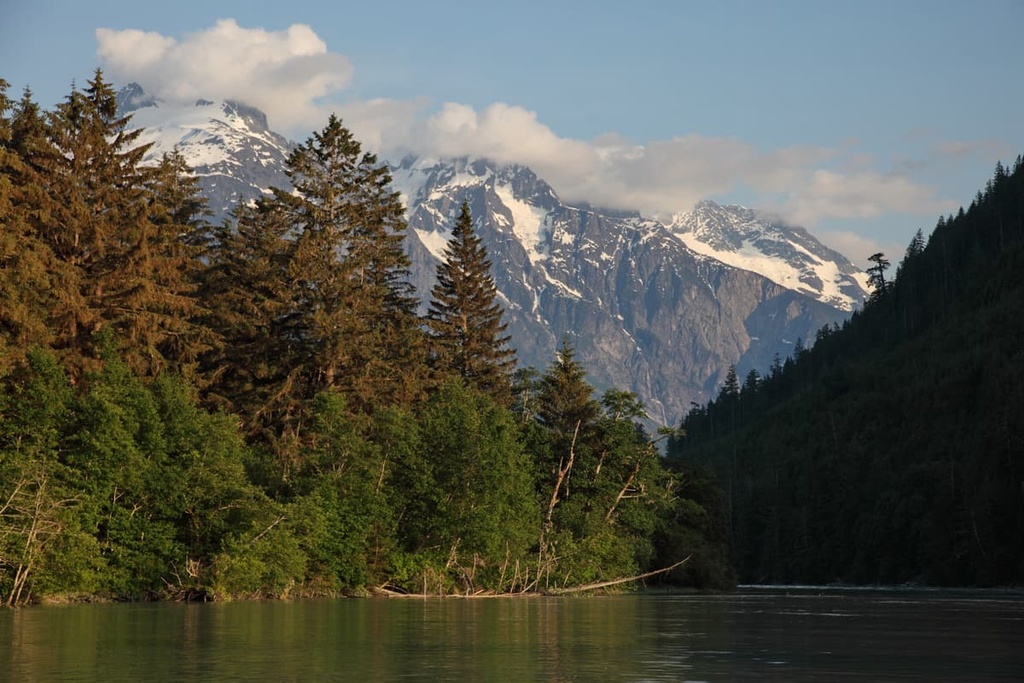
Where the snow melts for long enough, there are strong communities of plants that are dominated by mountain heather. The subalpine is dominated by forests of mountain hemlock and amabilis fir while the lowest elevations of the range are filled with the giant trees of the northern rainforests.
The rainforests are predominantly located along the west coast of Canada, and while typically abundant along the coast, the Whitemantle Range is generally too high in elevation to support the rainforest ecology. However, the coast along the inlets is covered with giant western hemlock, amabilis fir, Sitka spruce, Douglas fir, and western red cedar.
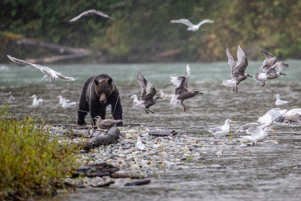
The range is home to many of the alpine animals that are typical in the region, such as mountain goats, stone sheep, ground squirrels, and marmots. Caribou, elk, moose, cougars, black bears, grizzly bears, and wolves all inhabit the range; however, most will retreat to the lower elevations along the coast during the winter months.
The Whitemantle Range is in the traditional territory of Coast Salish First Nations; however, the high elevation and relative inaccessibility of this area has long prevented major settlement in the range.
That said, the land surrounding the Whitemantle Range is part of the traditional territory of many First Nations, including the Musgamagw Dzawada'enuxw, the Kwakwaka'wakw, and the Da’naxda’xw-Awaetlatla, among others.
While it is possible and likely that people traversed the range hundreds or thousands of years ago, most of the activity in the range has likely happened in the past century.
In the first half of the twentieth century while most of the major mountains of the Rockies and Interior British Columbia had been climbed, the west coast was still remote and inhospitable.
On a trip to the Mount Arrowsmith Massif on Vancouver Island in 1925, Don and Phyllis Munday spotted a peak on the mainland that they believed to be taller than Mount Robson, which was the peak currently accepted as the tallest peak located entirely within British Columbia.
The peak that they spied was located to the east of the Bute Inlet. The Mundays decided to call it Mystery Mountain for the time being. Over the next decade, the couple made annual expeditions through the Whitemantle Range and beyond, until they finally made it to Mount Waddington.
During their decade-long odyssey in the Pacific Ranges, Don Munday said the following of the Whitemantle Ranges, “there will always be mountains to climb, but not always mountains for original exploration, and these two challenging task must command close views into the western section of the Whitemantle Range.”
From 1960 to 2003, John Clarke spent six or more months a year traveling the backcountry. During this time, he spent much of his efforts traversing the Whitemantle Range and climbing its peaks. Some of his ascents include a solo climb of Mount Stanton, a group effort of Comrade Peaks, and his climb up Whitemantle Mountain.
Clarke would fly over his intended traverse, dropping food caches that he hoped would still be there when he arrived. Most of the information on the Whitemantle Range is owed to Clarke, who spent a lot of time hiking and climbing in the range, often alone.
The Whitemantle Range is a remote wilderness located in the Pacific Ranges of the Coast Mountains. The difficulty in traveling to the region has made it one of the least visited mountainous areas in British Columbia, and, as such, there are no official trails in the range.
However, through the efforts of John Clarke, there are many detailed descriptions of the routes that he took when he was climbing in the range. His route descriptions include information from his summit expeditions to Mount Stanton, Comrade Peaks, Whitemantle Mountain, and his traverses across the range.
If you’re planning a trip to the Whitemantle Range, it’s highly recommended that you check out past trip reports from Clarke and others who have followed him. Travel to the Whitemantle Range is only recommended for experienced mountaineers or for people joining guided expeditions, though there are relatively few guiding companies that operate in the area.
The Whitemantle Range is situated in the remote Pacific Ranges along the rugged coast of British Columbia. Access to the range is often by helicopter, float plane, kayak, or charter boat from Vancouver Island. The following are some of the cities and communities through which adventurers can gain access to the Whitemantle Range.
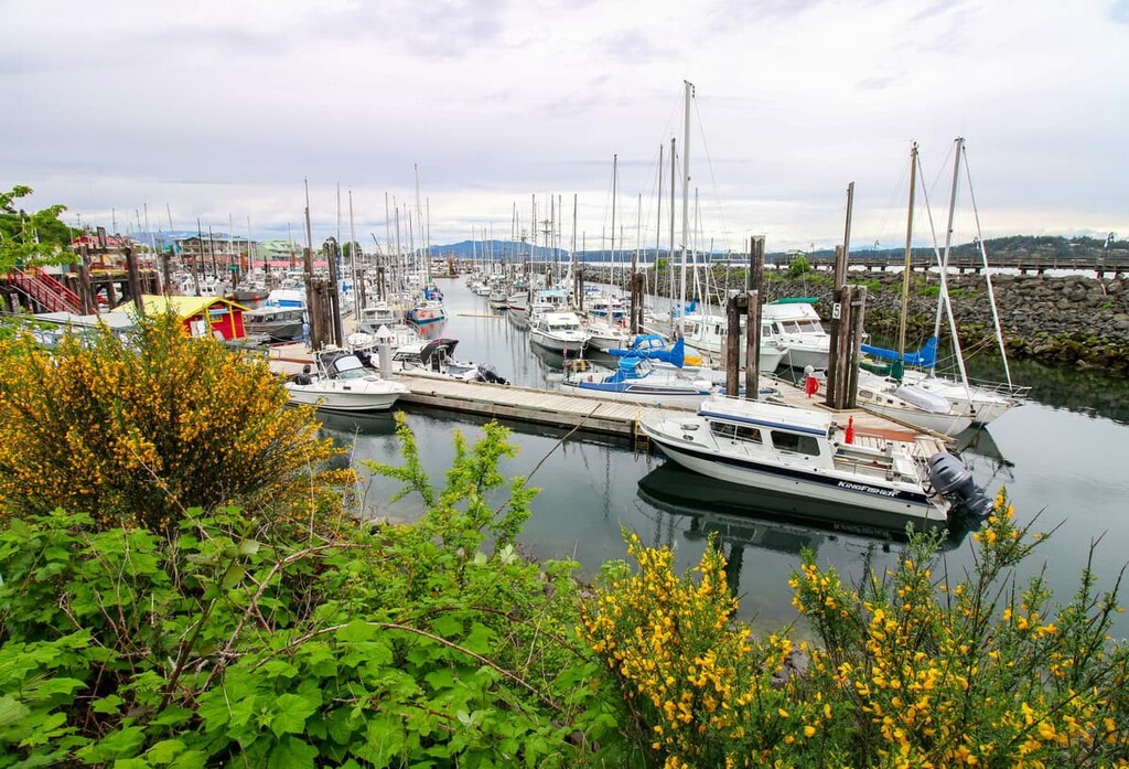
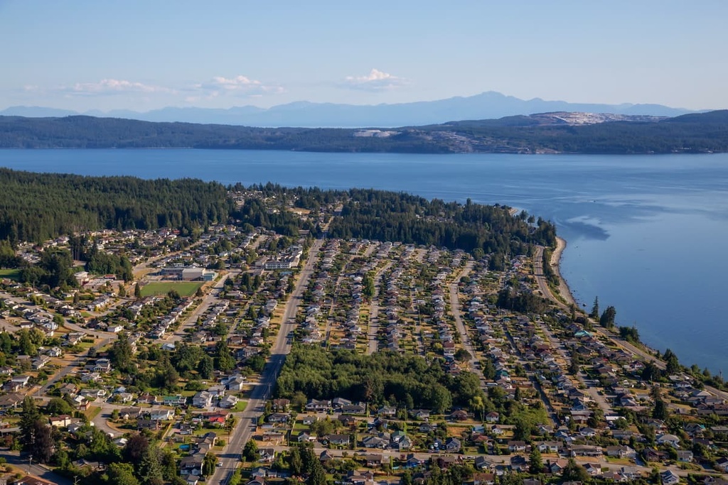
Since it is located across the Georgia Strait from the Whitemantle Range, charter boats and planes to the range are often hired out of the town Campbell River, which is located on Vancouver Island. In fact, Campbell River is the access point for many other incredible destinations in the region, too.
From Campbell River, adventurers can take the ferry to Quadra Island and beyond to Cortes Island and the other ports in the Discovery Islands. The city is also the gateway to the north of Vancouver Island where there are incredible lakes and hiking areas at Schoen Lake Provincial Park, Nimpkish Lake Provincial Park, or the islands of Broughton Archipelago Marine Provincial Park.
Elk Falls Provincial Park is located only a short drive from the city, where well maintained trails lead though incredible forests filled with massive red cedars, Douglas fir, and bigleaf maple. A suspension bridge spans the river and there are several vantage points where you can view the falls.
Some of the other trails around Campbell River are the Campbell River Lookout Trail, Mount Menzies, and the Quinsam River Hatchery Trail. The weather is beautiful, the food is great, the wilderness is beautiful and majestic, all of which make Campbell River a worthwhile destination for anyone visiting Vancouver Island.
The city of Powell River is the regional capital of the qathet Regional District. It is located along the shores of the Malaspina Strait. The city and surrounding area are only accessible by ferry or plane, as deep fjords prevent a road from being constructed to the community. Once you make it to Powell River, there are many beautiful wilderness parks and hiking trails to check out in the region.
Charter boats and planes can be hired from Powell River to reach the remote mountains of the Pacific Ranges. There are several recreational areas near Powell River, such as Inland Lake Provincial Park; however, the gem of the wilderness in the area is arguably the Sunshine Coast Trail.
The Sunshine Coast Trail is a 180 km (108 mi) backcountry trail that traverses the coast of qathet Regional District. The trail winds through old growth forests, along lake shores, and along beaches for all to enjoy.


The highest peak in the Whitemantle Range is Whitemantle Mountain, at 2,982 m.
The Whitemantle Range have 23 named peaks.


