
Scan the QR code and open PeakVisor on your phone
The Mahoosuc Range include 67 named peaks. The highest is Old Speck Mountain at 1,276 m. Other notable peaks include Goose Eye Mountain, Mahoosuc Arm and Goose Eye Mountain - North Peak.
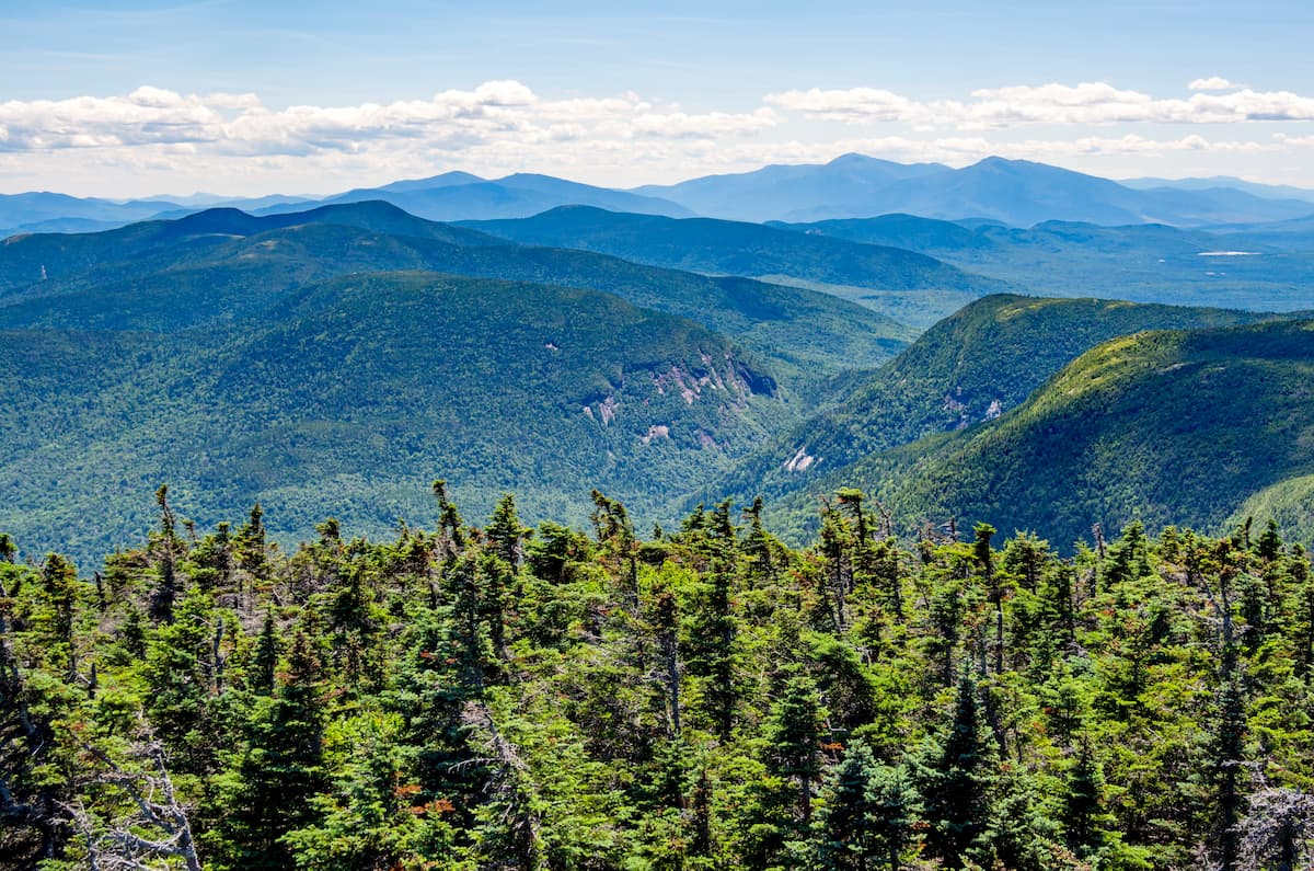
Home to some truly rugged terrain, the Mahoosuc Range is a collection of peaks located in the US states of New Hampshire and Maine. The range contains 63 named mountains, the highest and most prominent of which is Old Speck Mountain (4,190ft/1,277m).
Technically speaking, the Mahoosuc Range is the northernmost extension of the White Mountains, which is a large collection of peaks in northern New Hampshire and western Maine. It is located within Coos County in New Hampshire and Oxford County in Maine.
The Mahoosuc Range is located almost entirely north of US Route 2 in northern New Hampshire and Maine. It is also almost completely bounded by NH Route 16 to the west near the town of Gorham, and Maine Route 26 to the north and east.
Additionally, the Mahoosuc Range is situated in a highly mountainous part of the northeastern United States. It is just to the southwest of the Longfellow Mountains, which contains the tallest peak in Maine, Mount Katahdin.
Meanwhile, to the southeast are the rolling hills and mountains of the New England Upland. The rest of the White Mountains border the range to the south while the westernmost extent of the New England Upland is located to the west.
Finally, the peaks of the Canadian Appalachians are located just north of the Mahoosuc Range. They start just north of the US's border with Québec in Canada and extend throughout the eastern part of the province and much of Atlantic Canada.
Geologically, the Mahoosuc Range is part of the White Mountains, which is a subrange of the greater Appalachian Mountains.
The geologic history of the Mahoosuc Range and the White Mountains, which are inextricably linked, started about 400-500 million years ago when the region was actually located near the equator and was covered by a shallow inland sea.
As the seafloor spread, the sea started to widen, and sediments started to deposit in the Iapetus sea creating rocks that are now part of the region's Littleton Formation. Eventually, during the earliest part of the Ordovician, the seafloor started to close up again, starting a period of subduction and creating a chain of volcanic islands.
Not long after, during the early Devonian, this chain of volcanic islands collided with the remnants of the supercontinent of Rodinia, which was, at this point the proto-North America continent of Laurentia. This collision marked the beginning of the Taconic orogeny, which was responsible for the formation of the Taconic Mountains and the Green Mountains to the west.
Later, during the Middle Devonian, a series of terranes accreted to the east coast proto-North America, severely deforming the bedrock and creating very high mountains that were perhaps higher than the modern-day Alps or Himalaya.
This deformation helped form the White Mountains. However, the most notable part of this mountain building event was the region's widespread volcanic activity. As a result of this widespread volcanism, large amounts of magma formed below the surface of the Earth, which, as it cooled, started to form the granite that dominates the region to this day.
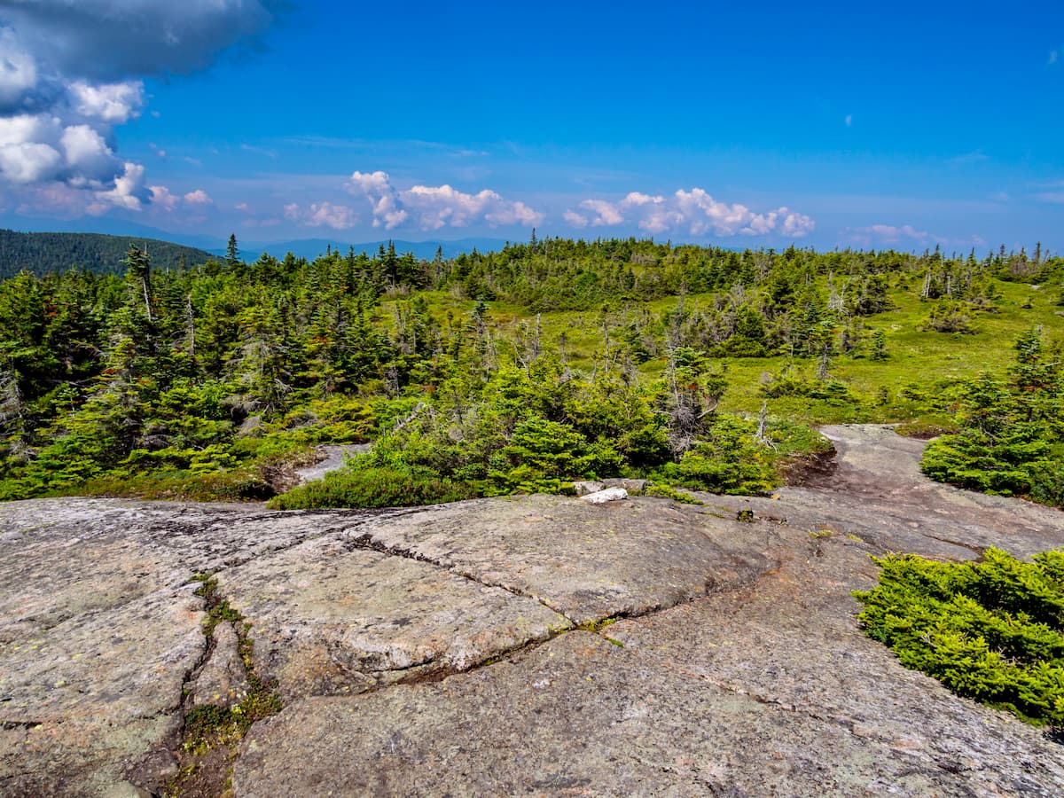
More recently, during the Pleistocene, the White Mountains and the Mahoosuc Range experienced extensive glaciation. These glaciers carved out many of the region's characteristic features, like U-shaped valleys (called “notches” in this part of the country), as well as alpine cirques.
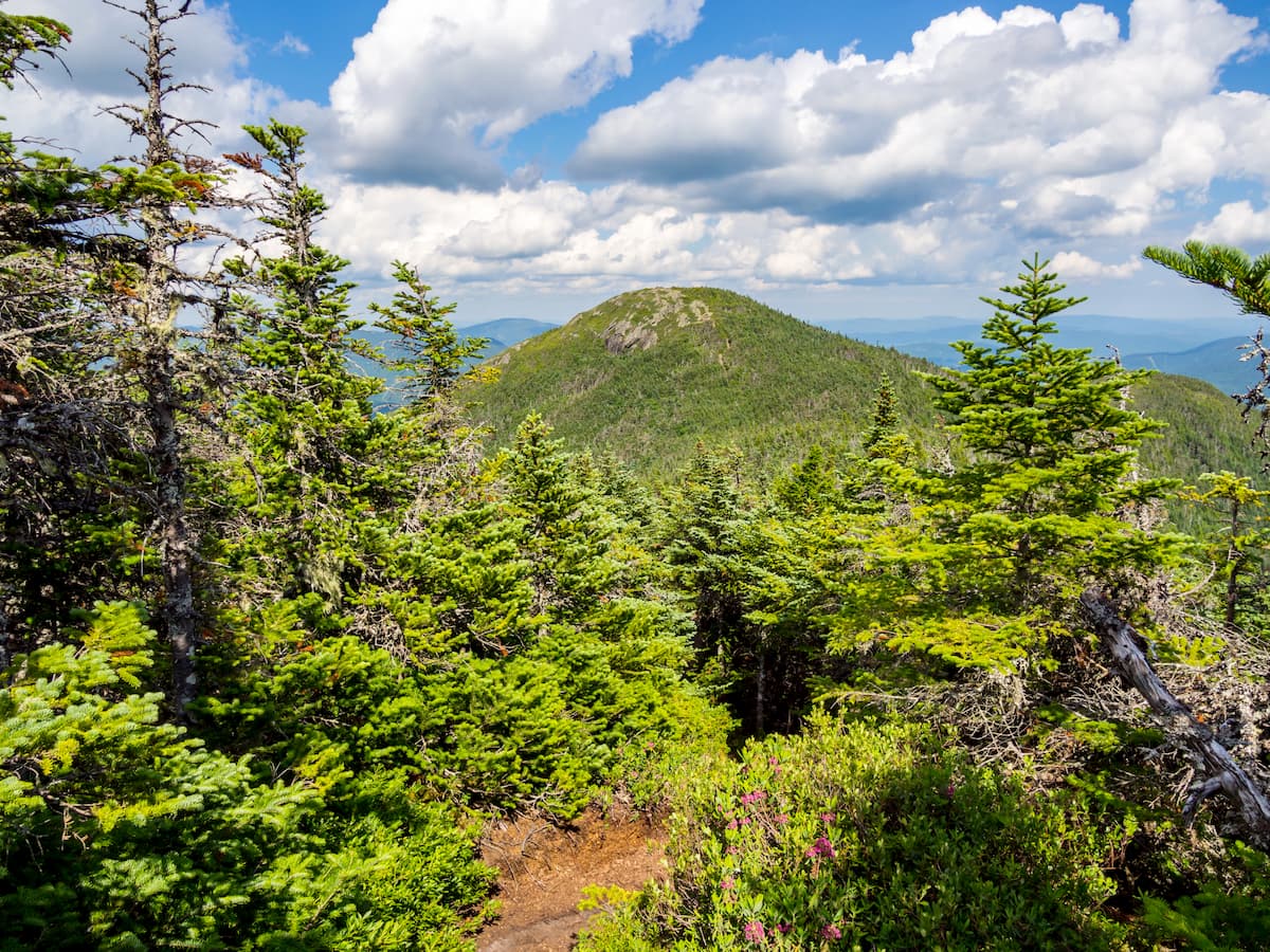
Major peaks in the range include Old Speck Mountain, Goose Eye Mountain, Mount Carlo, Mount Success, and Mahoosuc Mountain.
Like the rest of New England, the Mahoosuc Range is located within the New England/Acadian forests ecoregion. This ecoregion covers much of Vermont, New Hampshire, Massachusetts, Maine, eastern Québec (except the Gaspésie), New Brunswick, and Nova Scotia.
The Mahoosuc Range and the rest of the White Mountains are located in an area that's a bit of a climate anomaly for the ecoregion. While most of the ecoregion is the warm summer humid continental climate (Koppen Dfb), the highest summits of the range can be technically classified as subarctic (Koppen Dfc).
For the most part, however, the range is heavily forested and exhibits a climate that's typical of the region. Much of the range is covered by coniferous forests of white spruce, red pine, red spruce, balsam fir, jack pine, white pine, yellow birch, and paper birch.
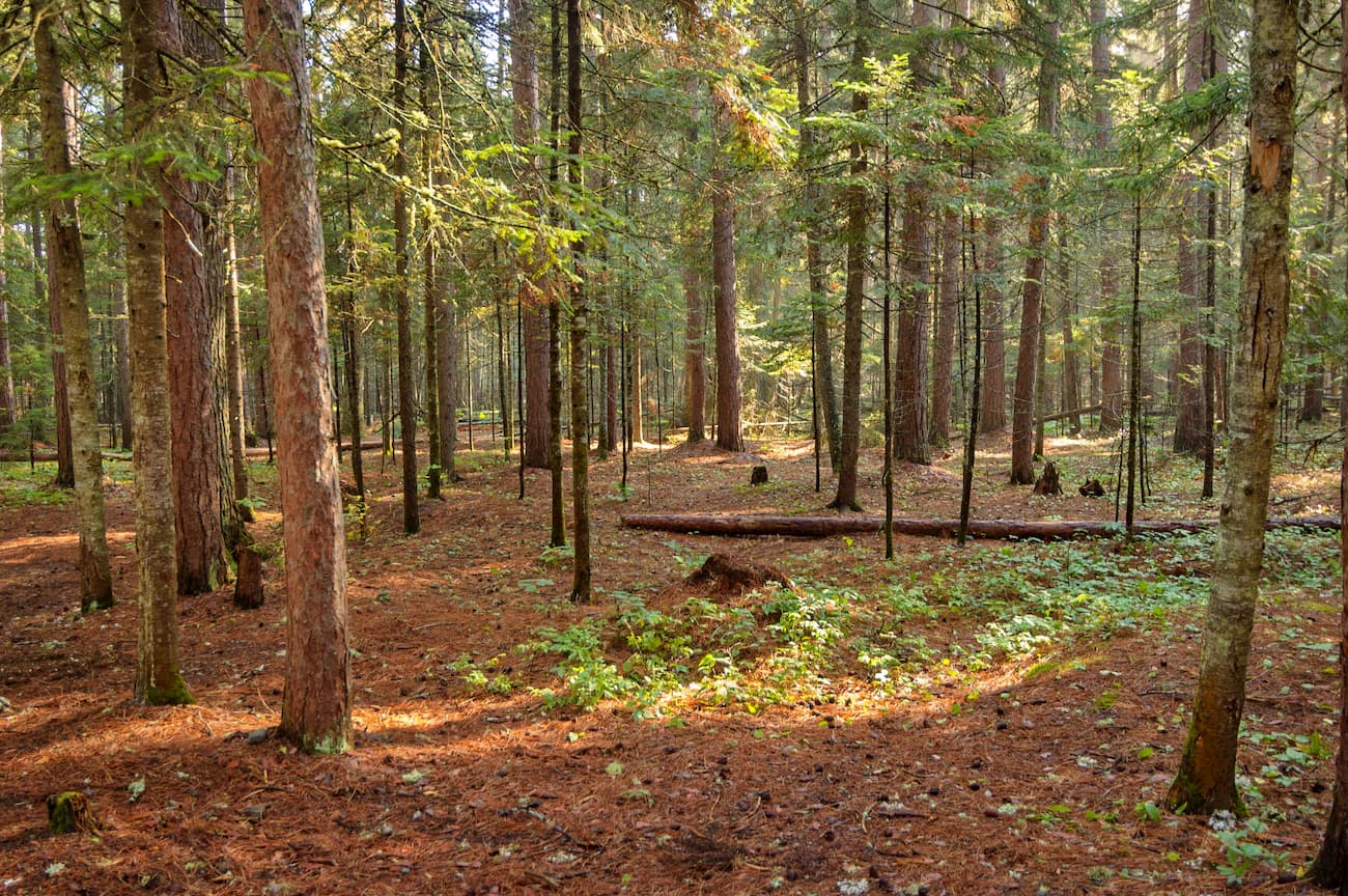
However, significant portions of the region were heavily logged in years past, so there are only a few stands of old growth forest remaining. That being said, to the north of Mahoosuc Notch, there is a small area of old growth forest containing old beech, birch, and maple trees.
As far as animals go, the Mahoosuc Range is home to a decent amount of medium-to large mammal species. This includes foxes, coyotes, fishers, white-tailed deer, bobcats, moose, and black bears.
The Mahoosuc Range and the surrounding area have a long and rich history of human inhabitation. A number of groups lived in and around the range long before the arrival of European settlers and consider the region to be their ancestral homelands, most notably, the tribes of the Wabanaki Confederacy and the Anasagunticook (Androscoggin).
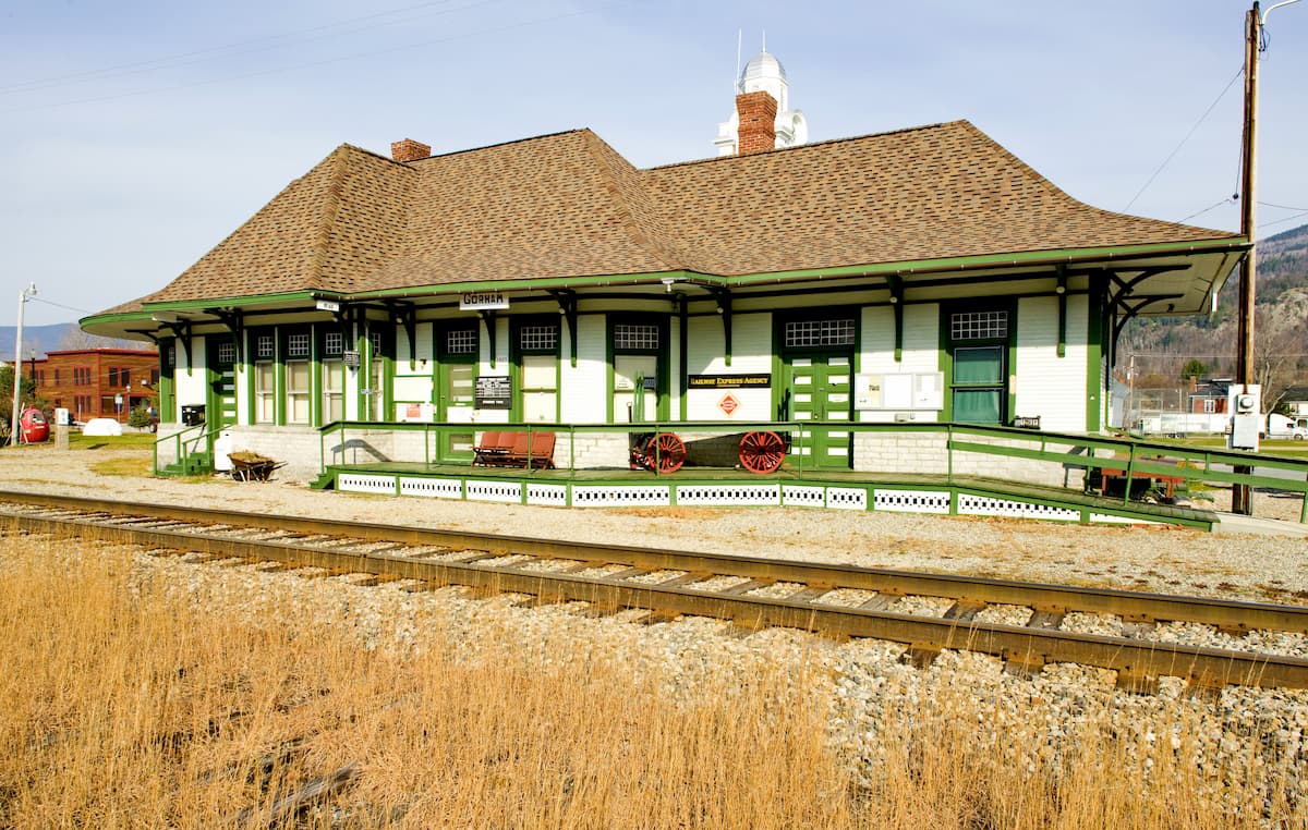
Due to the area's inland location, it was settled by Europeans many decades after the establishment of the first colonies along the coast. The nearby town of Gorham, New Hampshire wasn't formally started as a community until around 1770 and, for years, it was mostly a small community of farmers and loggers.
The arrival of the St. Lawrence and Atlantic Railroad to the town of Gorham in the 1850s quickly turned the town into a railroad town, bringing tourists in droves. Although much of the tourism was concentrated on the high peaks of the White Mountains and Pinkham Notch to the south, the Mahoosuc Range invariably saw some visitors, too.
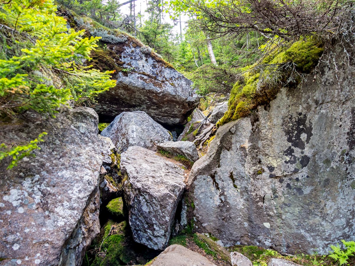
Moreover, the completion of the Appalachian Trail in 1937 also spurred an increase in visitors to the range. Indeed, the Mahoosuc Range is often considered to be home to one of the trail's most difficult sections within Mahoosuc Notch.
While the Mahoosuc Range is not included within the boundaries of the White Mountain National Forest, it is partially located within Grafton Notch State Park. The land within the park was first purchased by the state of Maine in 1963 and then expanded throughout the 1960s and 1970s to its current boundaries.
Within the park, visitors can see excellent remnants of the region's glacial past, including the notch itself, which is a massive glacially carved valley. There are a number of great gorges and waterfalls in the park for visitors to check out, too, including Walker Falls and Screw Auger Falls.
For the more vertically minded among us, the Mahoosuc Range also offers some excellent ice climbing opportunities in addition to some rugged hiking trails.
Although it's often overshadowed by its popular neighbor to the south, the White Mountains, the Mahoosuc Range offers some fantastic hiking trails and outdoor recreation opportunities. Here are some of the best places to check out in the range.
The Appalachian Trail cuts right through the Mahoosuc Range as it traverses from the heart of the White Mountains to the south to the Longfellow Mountains to the east. Interestingly, the portion of the trail that cuts through the range is known locally as the Mahoosuc Trail, which predates the formal AT by about 7 years.
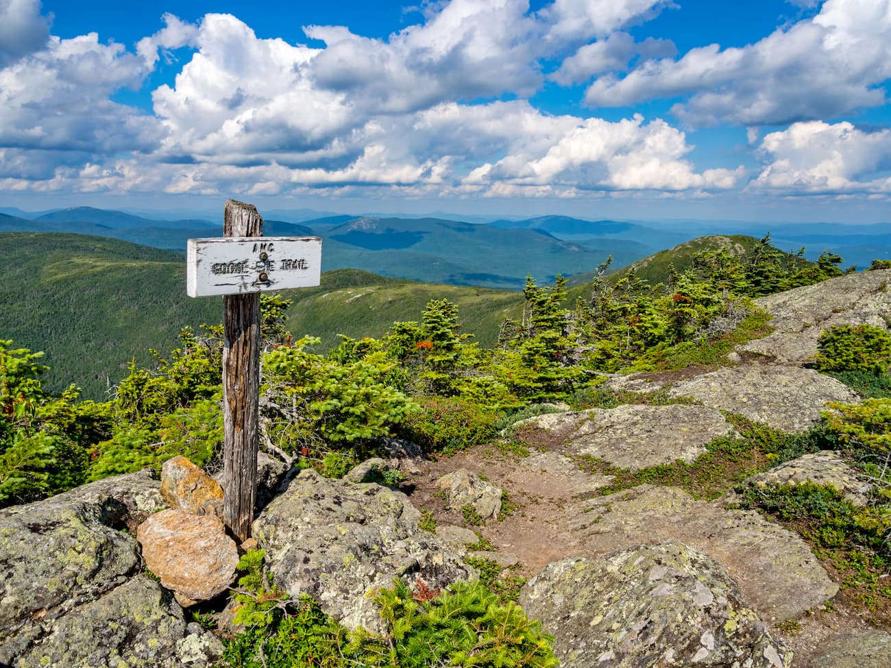
Often called the most difficult section of the Appalachian Trail, the portion that runs through the Mahoosuc Range is notoriously rugged. The last 13.1 miles (21.1km) of the AT in New Hampshire are located within the range while the first 12.8 miles (20.6km) of the trail in Maine are also within the Mahoosucs.
In particular, the most strenuous portion of the trail is perhaps the section that traverses Mahoosuc Notch. This part of the trail offers a number of 10 foot (3m) drops and there are sections where people have to remove their packs just to squeeze around a boulder. However, if you're up for a leg-burning workout, the Mahoosuc Trail is a solid choice.
The 9.6 mile (15.4km) Wright Trail is a well marked day hike within the Mahoosuc Range. It starts near Riley Township in Maine and offers a steep, rigorous climb up to the summit of Goose Eye Mountain. From the top of the peak, hikers can get spectacular views of the surrounding Mahoosucs, as well as the Presidential Range to the south.
Here are some of the best places to stay during your next visit to the Mahoosuc Range:
North Conway is a community of about 2,300 people located just south of the Mahoosuc Range at the heart of the White Mountains. The town is a popular outdoor recreation destination, thanks to its proximity to the White Mountains and to its local ski resorts.
For people who like to shop, North Conway also offers a large number of outlet stores in its downtown area. There are plenty of hotels and restaurants within the town, which makes it a good place to stay if you're visiting the region.
While there is no air service to North Conway, the Concord Coach Lines does offer bus transportation around the region and to Boston Logan International Airport.
The city of Berlin is located just west of the Mahoosuc Range at the intersection of Routes 16 and 110. It is home to about 10,000 people and is part of New Hampshire's Great North Woods Region.
Berlin actually has quite a unique history of outdoor recreation. The city is the home of what is likely the oldest ski club in the world, the Nansen Ski Club (a.k.a.. The North American Ski Club or Nordamerikansk Skiklubben), which was founded by a group of Scandinavian immigrants in the late 1800s. It was also the site of the large Nansen Ski Jump from 1936 until its closure in 1988.
Augusta is the capital of the state of Maine and is home to about 19,000 people. The city is situated to the east of the range within Kennebec County, Maine. Interestingly, it is the third least populous state capital in the country, trailing only behind Vermont's Montpelier and Peirre in South Dakota.
Although Augusta does, technically, have an airport, it has quite limited service. It is only a short drive from the airport in Portland, Maine, which offers connections to major destinations around the country.


The highest peak in the Mahoosuc Range is Old Speck Mountain, at 1,276 m.
The Mahoosuc Range have 67 named peaks.


