
Share

Scan the QR code and open PeakVisor on your phone
Scan the QR code and open PeakVisor on your phone
The Yading Nature Reserve, located within Daocheng County (稻城县), Garze Autonomous Tibetan Prefecture (甘孜藏族自治州), Sichuan Province(四川省), is one of China’s most spectacular and pristine nature reserves. It contains some of Sichuan’s highest and most beautiful snow-capped peaks, located within the greater Hengduan Mountain Range, which forms the easternmost edge of the Himalayas. Both cultural and recreational opportunities abound in Yading, as it is not only a well-protected Nature Reserve with a complex and expansive network of hiking trails, but it is also an important cultural site for Tibetan Buddhism. Located on the eastern edge of the Qinghai-Tibet Plateau, Yading—along with the rest of the Garze Tibetan Autonomous Prefecture and other parts of Sichuan, Qinghai, Gansu, and Yunnan provinces—is geographically, culturally, and ethnically contiguous with the Tibetan Province. However, as it doesn’t share a political designation, travel in Western Sichuan is much easier than in Tibet proper, and only requires a normal visa like the rest of China. This makes Yading Nature Reserve a fantastic place to visit if you are searching for soaring Himalayan peaks, amazing hiking opportunities, and fascinating Tibetan culture, but don’t necessarily want to travel with a guided tour group.
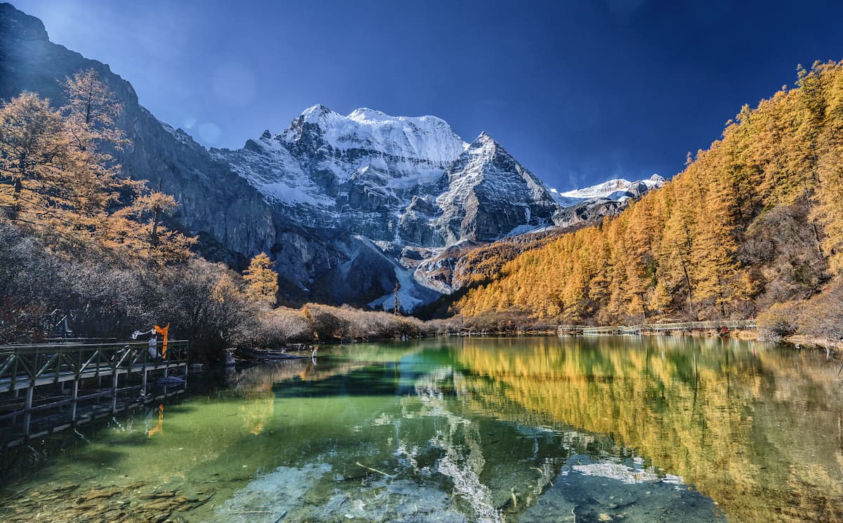
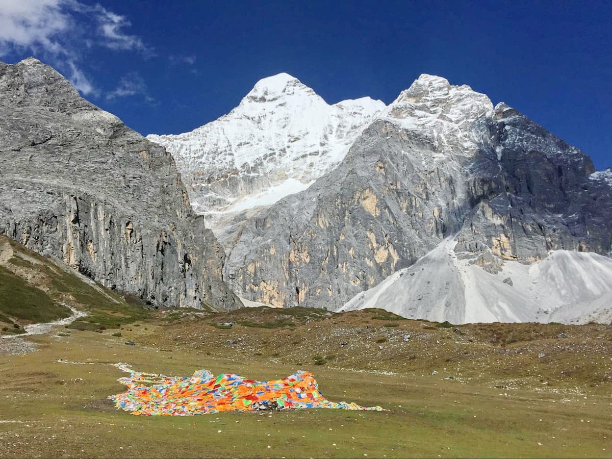
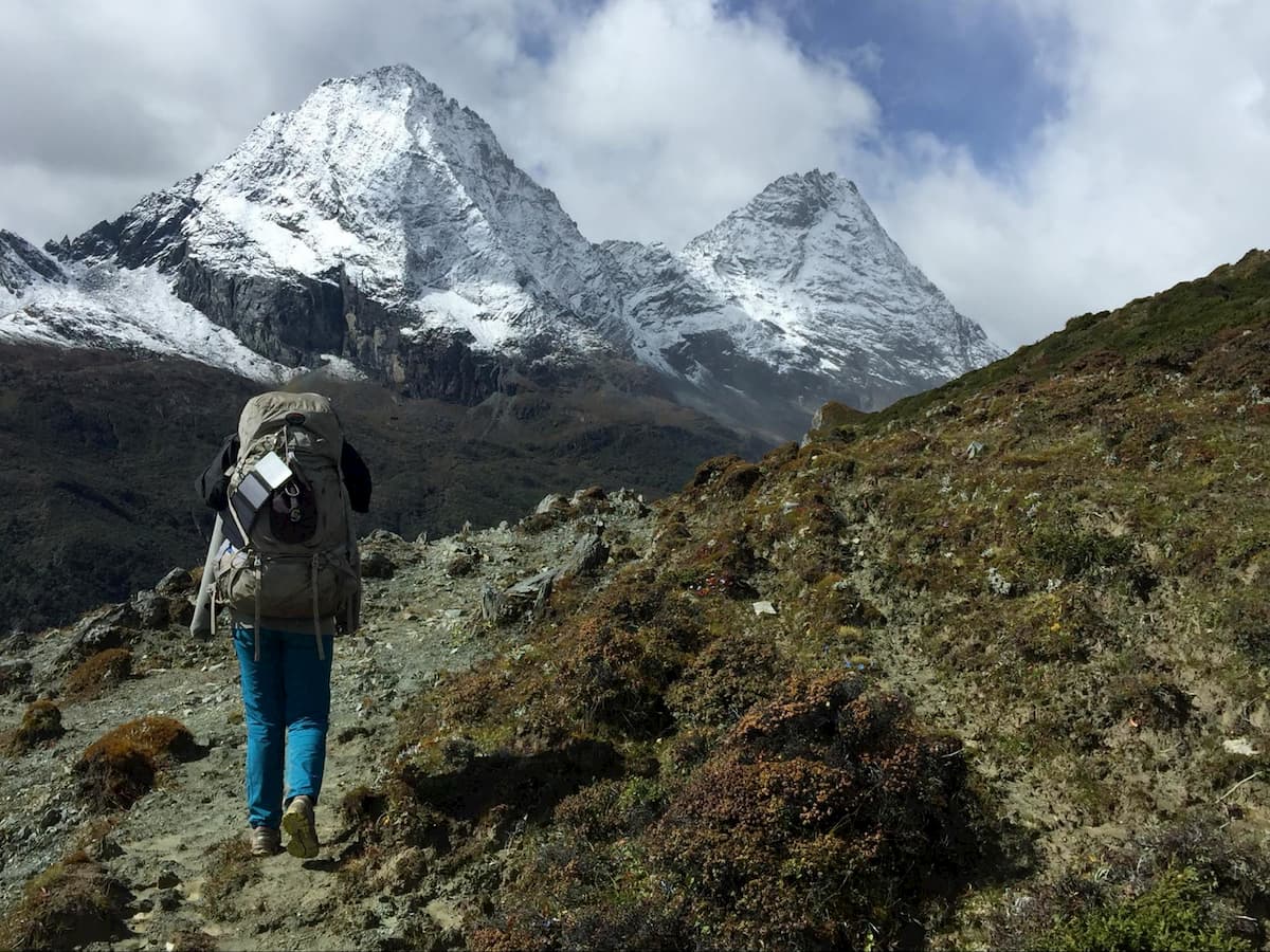
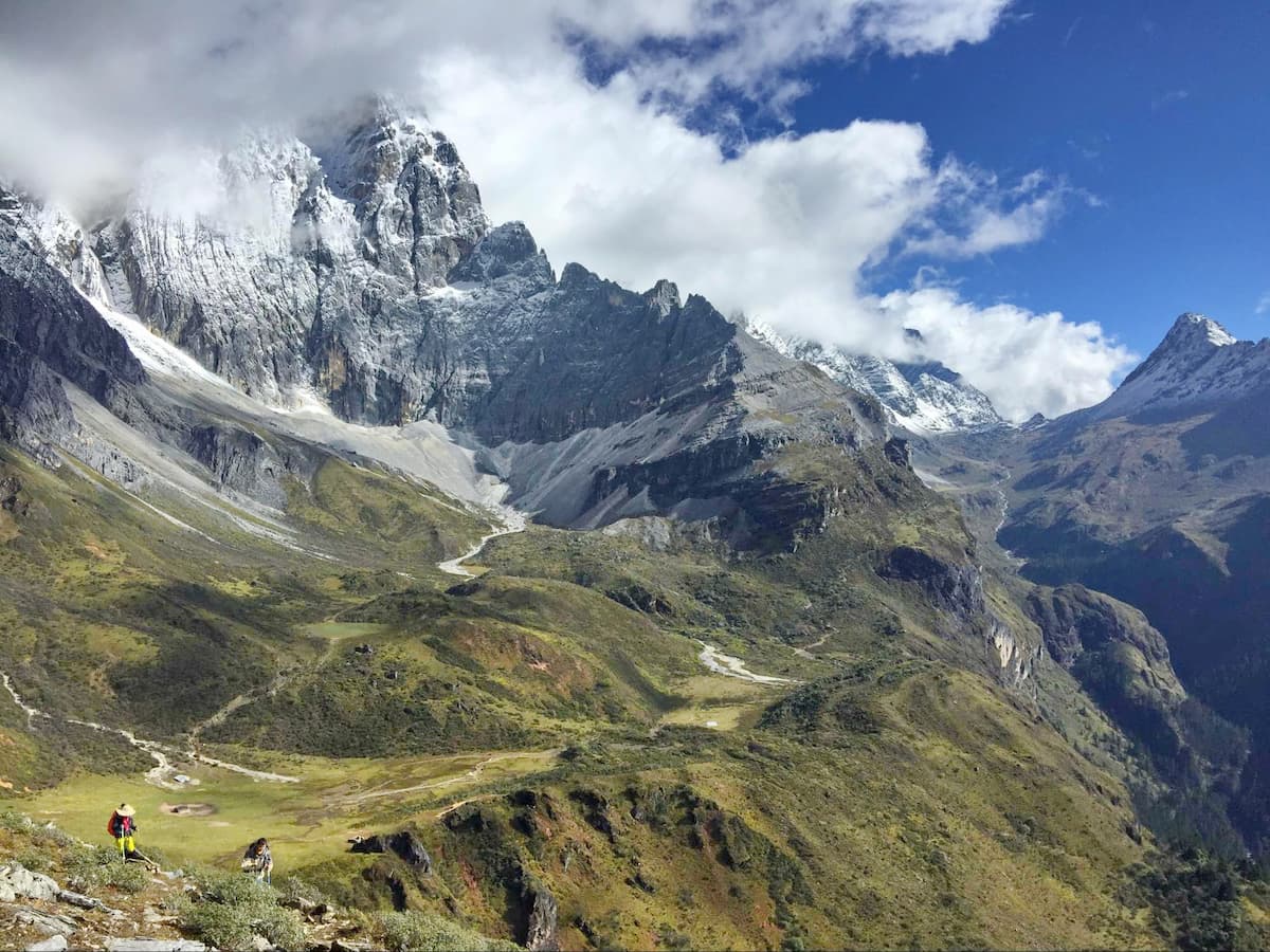
Although it was first designated a National Natural Scenic Area by the Chinese Government in 2001, and a UNESCO Biosphere Reserve in 2003, it’s history and significance to the Tibetan people extends back much further in history. The entire Garze Prefecture is traditionally part of the Kham region of Tibet, one of the three main Tibetan regions. In Tibetan Buddhism, mountains and mountain ranges are often assigned spiritual significance, and the most important among them are sometimes considered to be physical manifestations of Buddhist deities, as is the case with the three main peaks of the Yading Nature Reserve. The highest and most central peak, Xiannairi (Chenresig in Tibetan), stands at 6,032 meters, and is believed to be a manifestation of the Boddhisatva of Compassion, Avalokiteshvara. Directly east of Xiannairi, across the main valley of the tourist area, is Xiaruoduo (Chana Dorje in Tibetan), which is 5,863 meters high and is believed to be a manifestation of Vajrapani, the Boddhisatva of Power. The third holy peak, which is just south of Xiannairi, is Yangmaiyong (Jampelyang in Tibetan), and is 5,906 meters high and is believed to represent Manjusri, the Boddhisatva of Wisdom. The Tibetan name for Yading can be translated to “The Great Snow Mountains of the Three Boddhisatvas,” and so the Nature Reserve is focused on these three peaks and the valleys and lakes that lay between them.
The central zone and main tourist area of Yading is centered around the three holy peaks mentioned above, and as such this article focuses mainly on those areas. However, the entire reserve contains over 1,400 square kilometers of towering peaks and glacially carved valleys, including 32 peaks above 4,500 meters in elevation, 10 above 5,000 meters, and 1 above 6,000 meters (Xiannairi). Between them all lay a surprising level of biodiversity, with 1,200 species of vascular plants and 291 species of vertebrates, including 12 that are protected within the Protection Class I by the Chinese Government, including snow leopards and Black-Necked cranes. About 1,200 local Tibetans live within the Nature Reserve itself, with many more located just outside of its borders.
Yading Village (亚丁村) is the traditional Tibetan village that lies within the Nature Reserve itself, and is the only place with accommodation within the reserve boundaries. It is a small, quaint village with a fair number of options for traditional Tibetan and Chinese food and souvenirs, but apart from that it is not incredibly noteworthy. There has been a construction boom over the past decade to accommodate the influx of tourists, which for some may detract from the “traditional” or “authentic” feel of the town. The tourist bus from the entrance, which everyone must take to reach the center of the reserve, stops in the Yading Village to pick-up and drop-off visitors. If you choose to stay here, be sure to book far in advance and expect to pay significantly more than you would staying outside the park boundaries (more on that below).
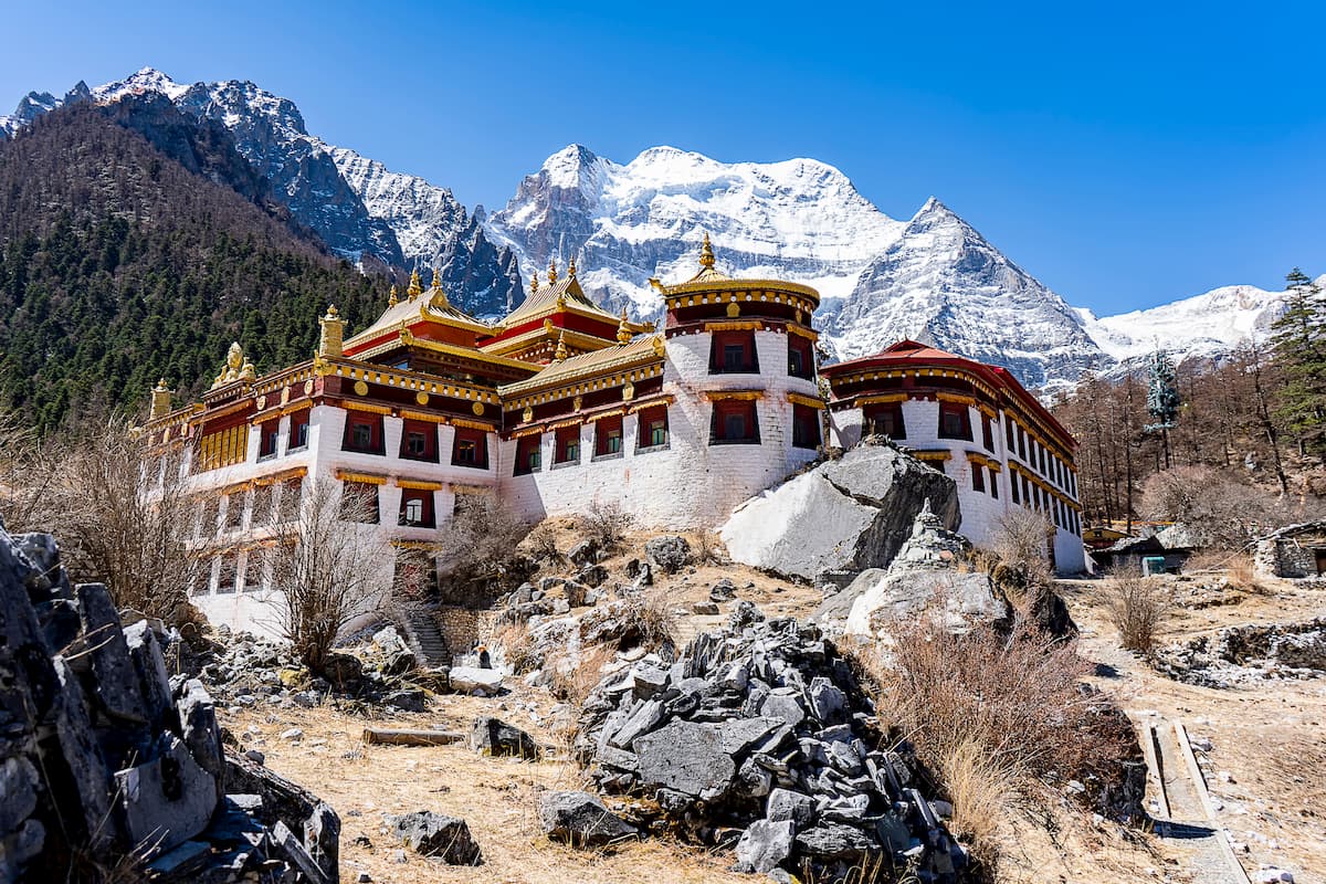
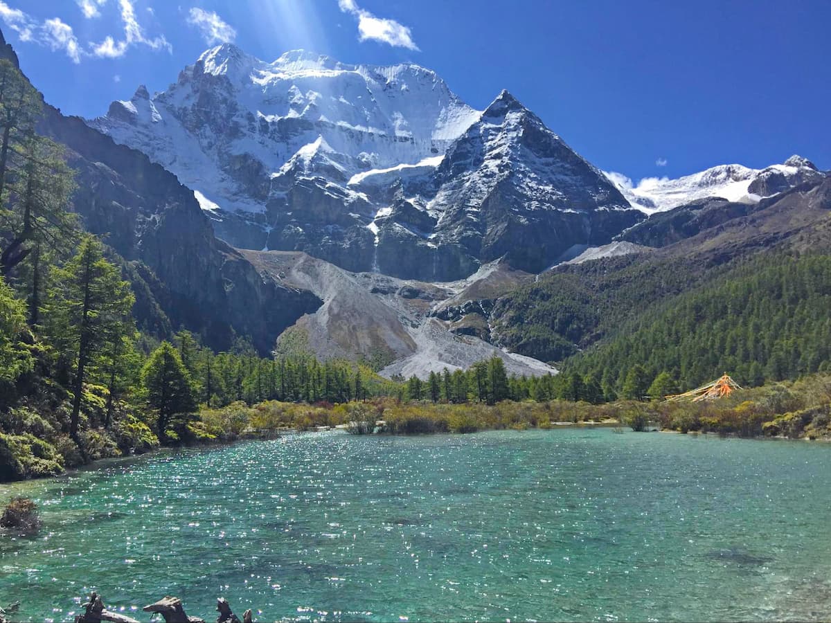
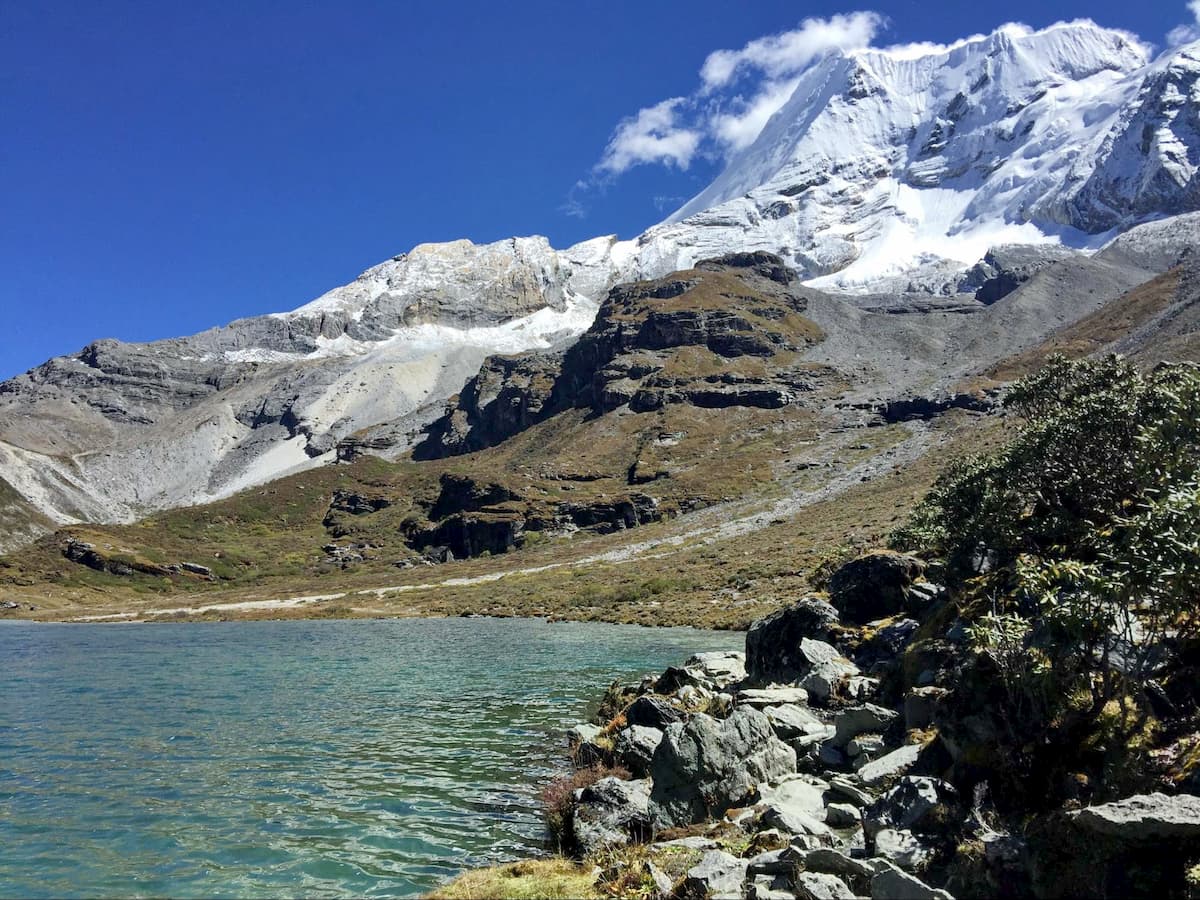
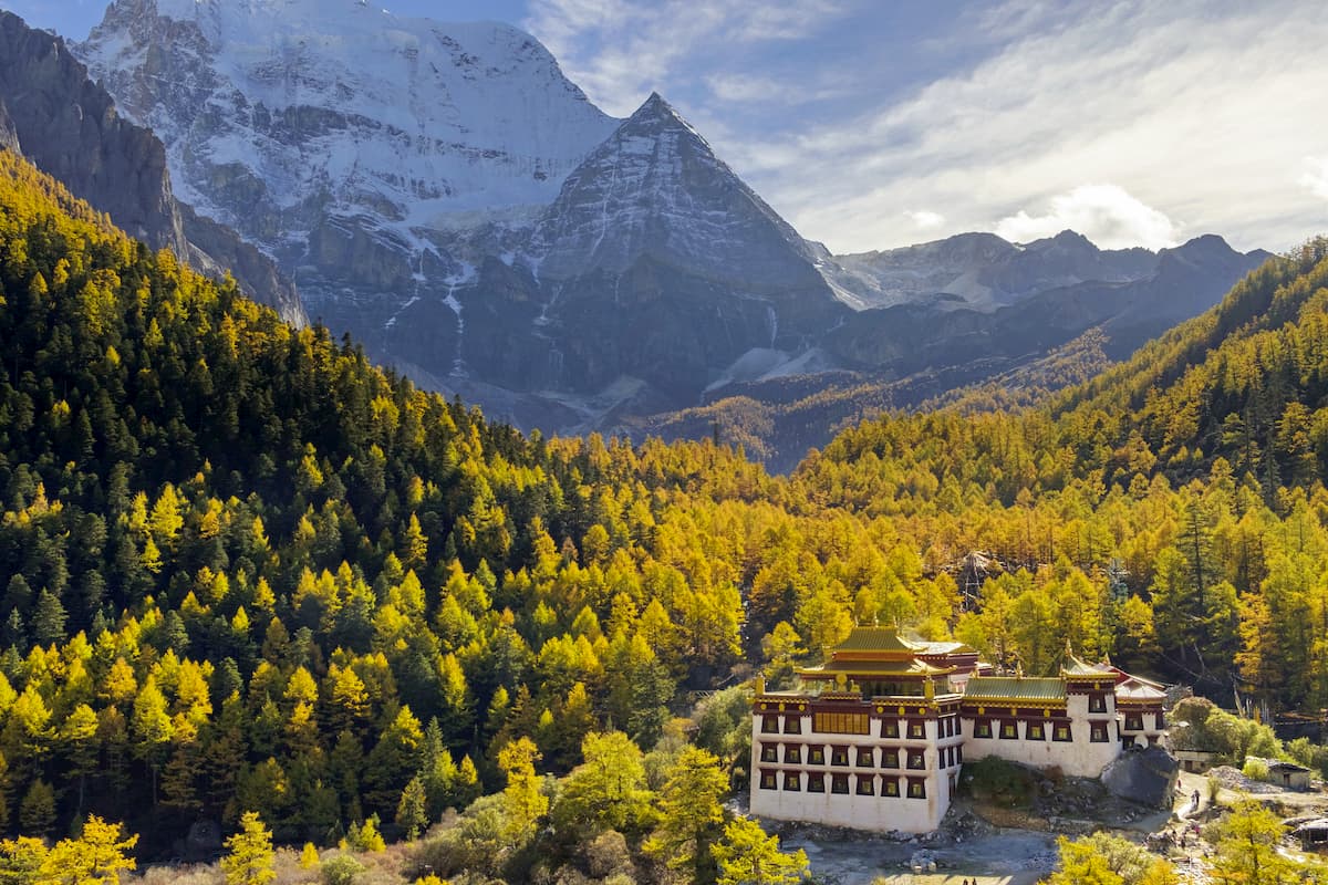
Chonggu Monastery (冲古寺) is maybe the most important non-natural landmark within the reserve, and the first that you will come across after leaving Yading Village. The tourist bus will drop you off just north of the monastery, so follow the crowds towards the main valley, and after 10 minutes or so, you’ll reach the monastery. It sits directly underneath the peak of Xiannairi at around 3,900 meters, which provides an excellent backdrop for photographs, and it is thought to be around 800 years old—though presumably has been renovated and/or rebuilt. There is no additional fee to enter the monastery, and is definitely worth a quick stop to get a sense of the religious traditions associated with this area. The real attractions, however, lay beyond the monastery, as this is the starting and ending point of all of the major hikes in the area, so don’t linger too long.
Pearl Lake (卓玛拉错) — 3 km round trip, 120 meters elevation gain, out and back.
The shortest and easiest day hike takes you to Pearl Lake, a beautiful alpine lake directly behind Chonggu Monastery. The lake sits directly beneath the towering walls of Xiannairi, so on a clear day don’t miss this vantage point. To get there, simply follow the trails and boardwalks behind the monastery until you reach the lake (the signage is fairly good here, and there will likely be many other hikers along the trail). It is about 3 km round trip with about 100 meters of elevation gain. Alternatively, both the Inner and Outer Kora will pass Pearl Lake at the very end, so if you are doing those hikes you can save the lake for later.
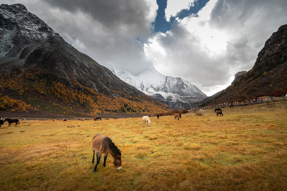
Luorong Pasture (洛绒牛场) — 12-13 km round trip, 280 meters elevation gain, out and back, (electric car available).
This is a leisurely, but somewhat lengthy, hike down the main valley in the middle of all three holy peaks to a wide-open and beautiful pasture with stunning views of the three mountains. It first takes you through Chonggu meadow—a beautiful sight in itself with a network of pristine streams flowing through it—before turning south after a few kilometers and climbing the gently sloping valley to Luorong Pasture. It follows a network of criss-crossing trails, metal-grated boardwalks, wooden boardwalks, and paved roads to get to the pasture, and navigation is again fairly simple here, just keep heading up the main valley following signs and people. There is also the option to take an electric car from Chonggu Monastery all the way to Luorong Pasture, which costs an additional 80 RMB for a round trip ticket, and 50 RMB for a one-way ticket. This might not be a bad option if you also want to go to Milk Lake and Five Colors Lake, or aren’t too confident in your high-altitude hiking ability (Luorong Pasture sits at around 4,180 meters).
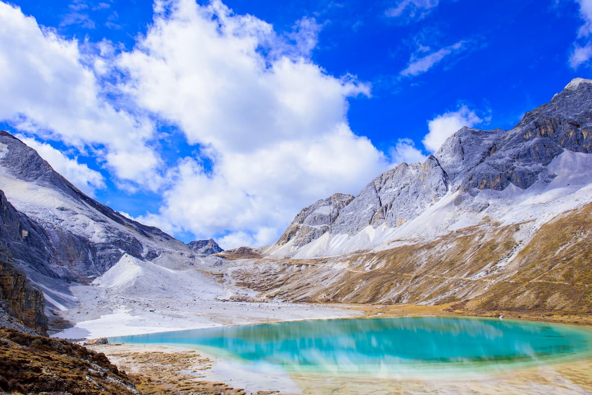
Milk Lake (牛奶海) and Five Colors Lake (五色湖) — 11 km round trip, 400-meter elevation gain, out and back (from Luorong Pasture).
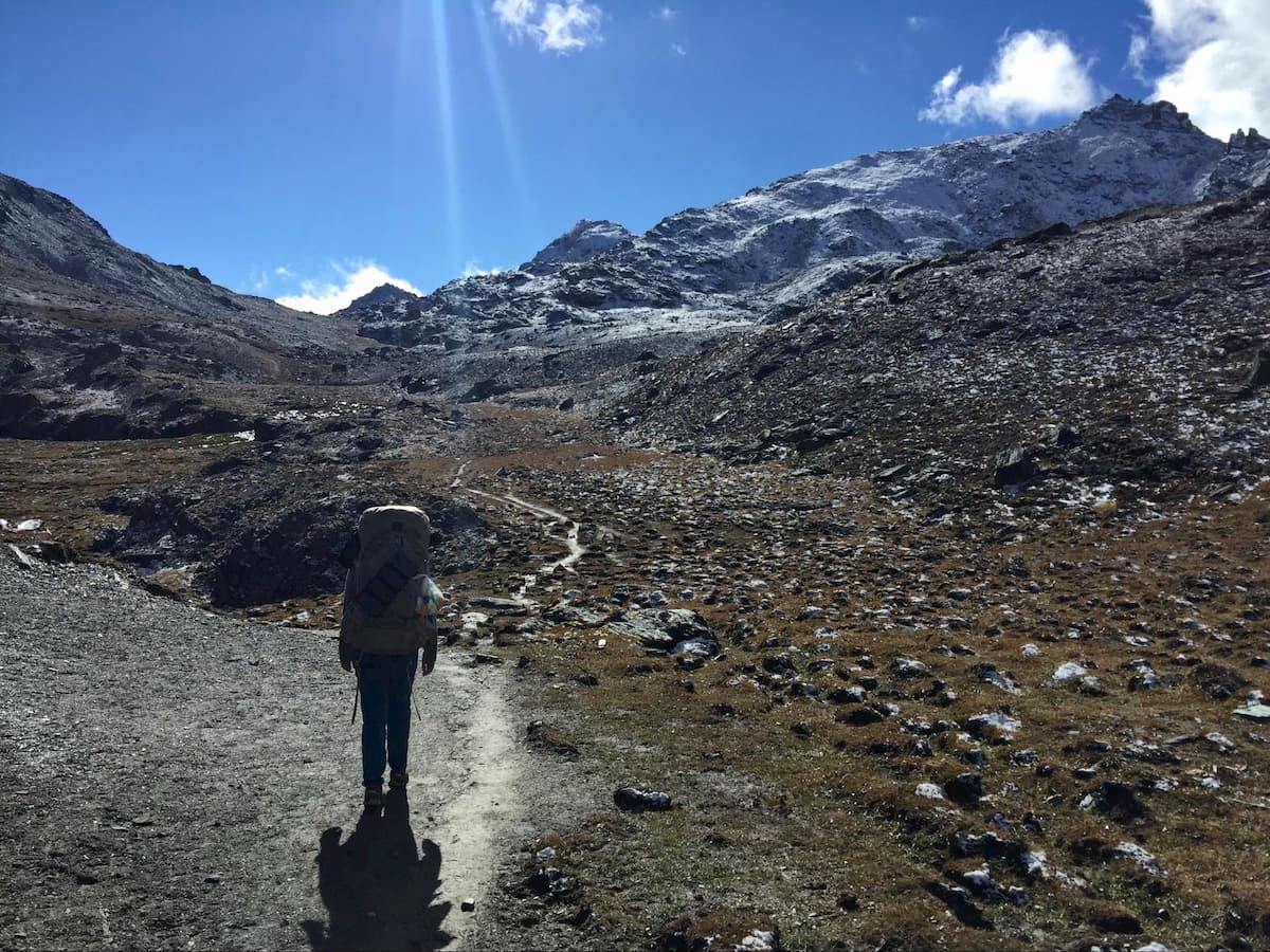
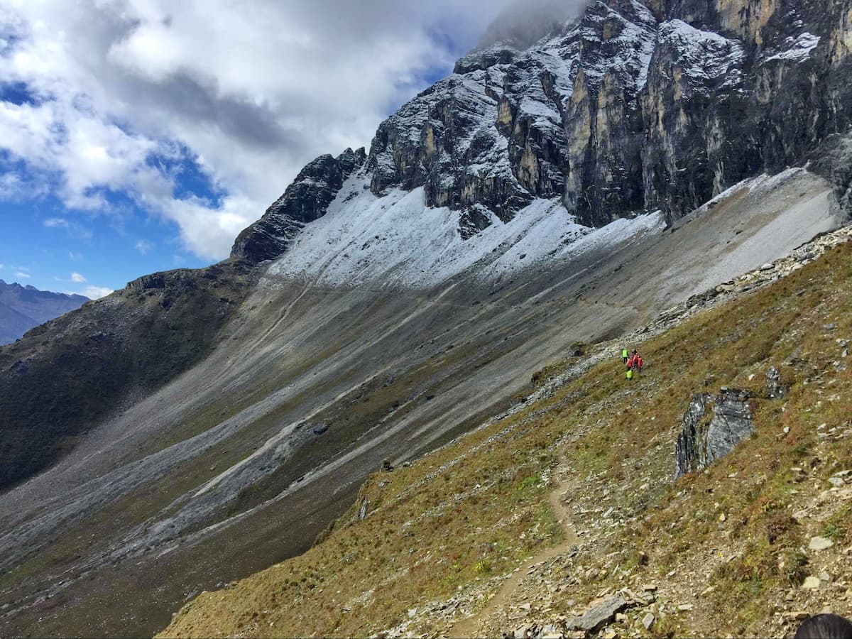
These are technically two separate destinations, but they are so close together it would be silly to visit one and not the other. Located beyond Luorong Pasture and just beneath a major pass on the Inner and Outer Koras, these two glacial lakes lay nestled tightly between the imposing faces of Chenresig and Jampalyang, with stunning views of both. This is where the hiking leaves the boardwalks, and gets more challenging, with dirt trails and steep elevation gain, but you are rewarded with spectacular views in a truly high-alpine environment. To get there, once again continue up the valley past Luorong Pasture, which at this point takes you west-southwest, and climb up around 5 km to Milk Lake. Five Colors lake is located just above and about behind (to the Northeast) Milk Lake, about .5 km further. Hiking all the way from Chonggu Monastery and back in one day without the help of electric car would be about 24 kilometers, or 15 miles, so if doing this be sure to leave early in the morning, as there is no accommodation outside of Yading Village, and camping before the two lakes is prohibited. If you are hoping to camp, see the two hikes below.
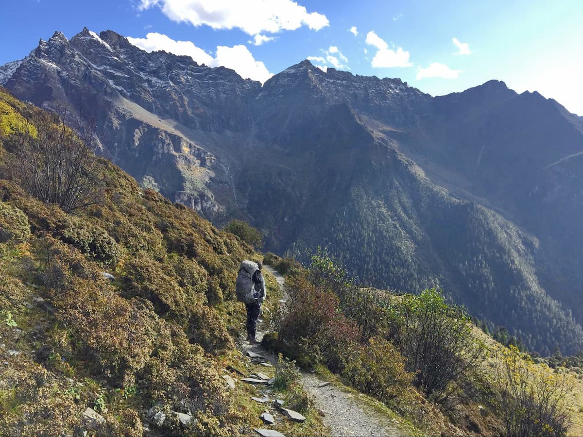
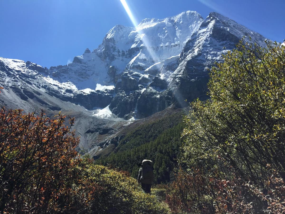
There are two primary route options for overnight hiking in the Yading Nature Reserve, both offering some of the most spectacular trekking in the world: the Inner Kora and the Outer Kora. According to Tibetan Buddhist Tradition, completely circumnavigating a holy mountain, known in Tibetan as a “Kora”, affords especially good karma to those who complete it, and as such is an important pilgrimage for many Tibetan Buddhists. There are many mountains in the Tibetan world for which completing a kora is of significance, but the Outer Kora in Yading, which circles not one but three holy mountains, is of particular importance. If you don’t have time for the full 5-day trek which circumnavigates all three holy mountains, the Inner Kora, which encircles Xiannairi, is a good alternative and can be easily completed in two days.
Bear in mind, like most hiking in China, once you are in the backcountry you are truly on your own. There are no resources, very little signage, and many small side trails that make navigation difficult. These treks are very possible to do independently, but it is recommended that you don’t if you have not done your research or are not fully confident in your backpacking and outdoor skills. If you are not, there are guide services available.
Inner Kora: 24 km, 1,400-meter elevation gain, loop.
This overnight trek starts and ends at Chonggu Monastery, circumnavigating Xiannairi, the tallest of the three holy mountains of Yading. The beginning of the trek simply follows the day-hiking trails from Chonggu Monastery to Luorong Pasture and Milk Lake. As such, you can skip the first 6 km by taking the electric car, but for the full “kora” experience it is recommended to walk. It is also possible to hike this route in the opposite direction, but a “kora” is technically always in the counter-clockwise direction, so most people hike it accordingly.
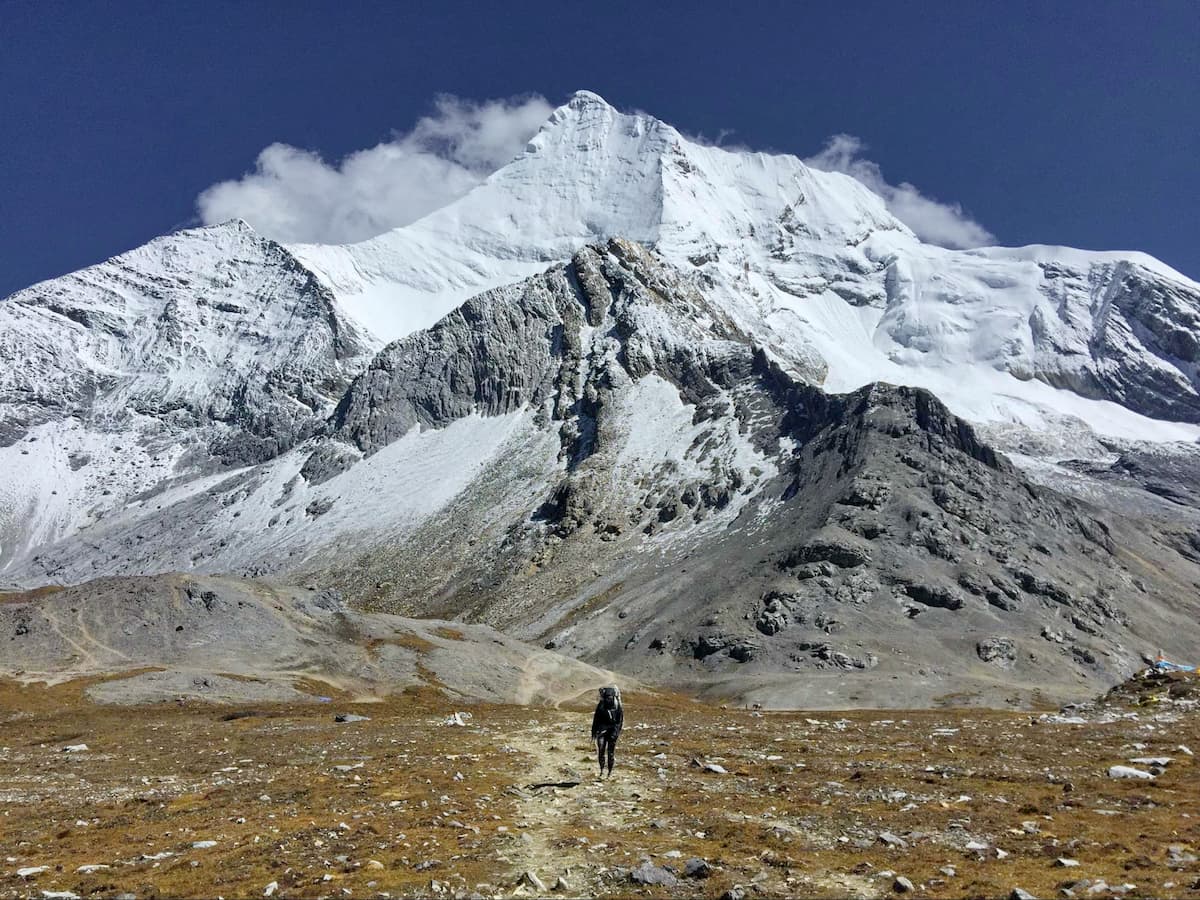
Milk Lake, continue up towards the pass that you have been walking towards all along (to the Southwest) for about 2 kilometers with 200 meters of elevation gain. You will then reach a wide open, windswept col adjoining the holy mountains surrounding you, which is the first pass of the trip, and lies at around 4,600 meters. The views from here are completely surreal, and if the trail to Milk Lake felt crowded, you will now likely be experiencing complete solitude, as very few hikers go past the lakes. Keep your eyes peeled for wildlife as well, a herd of Blue Sheep has been spotted atop this pass.
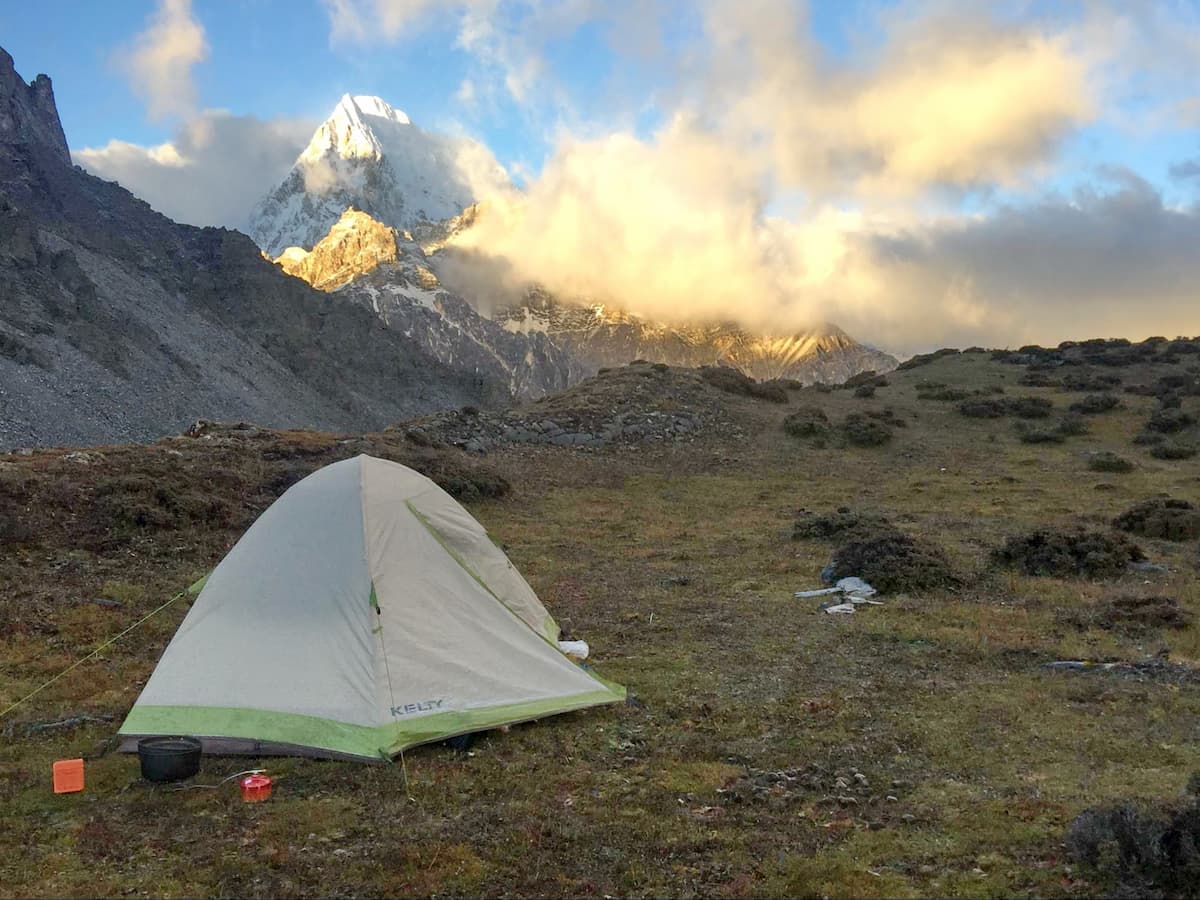
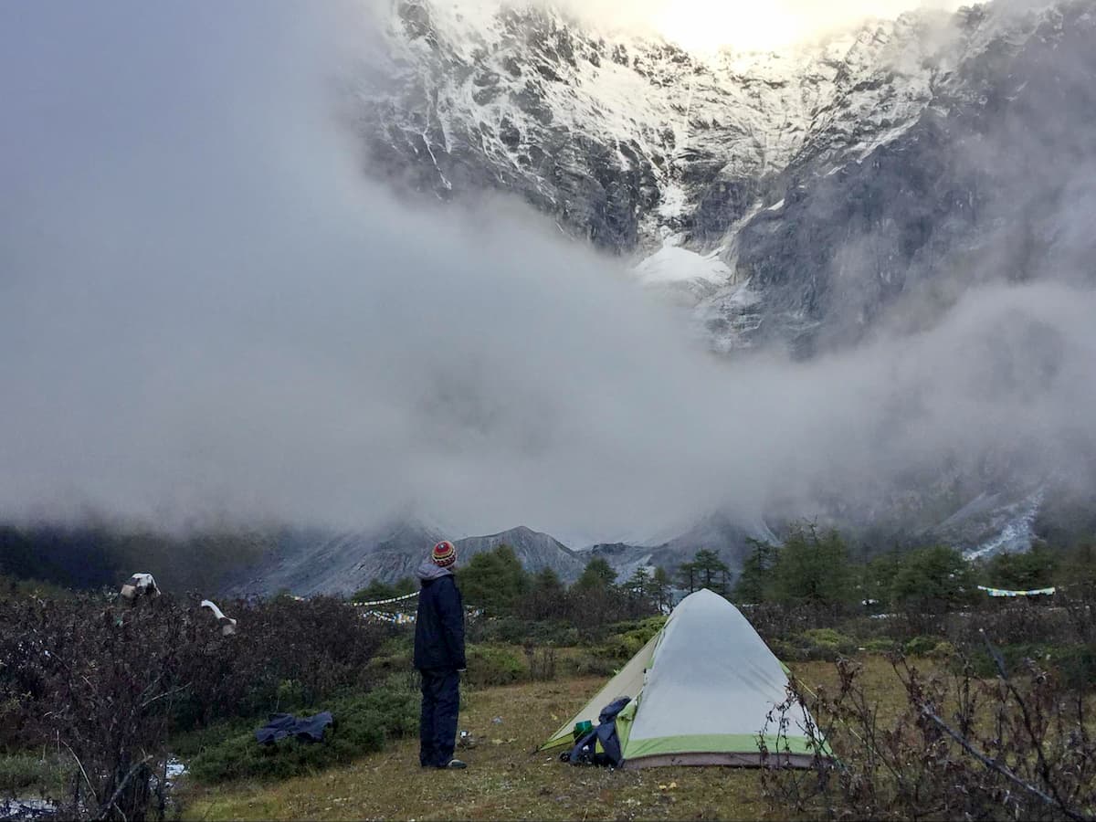
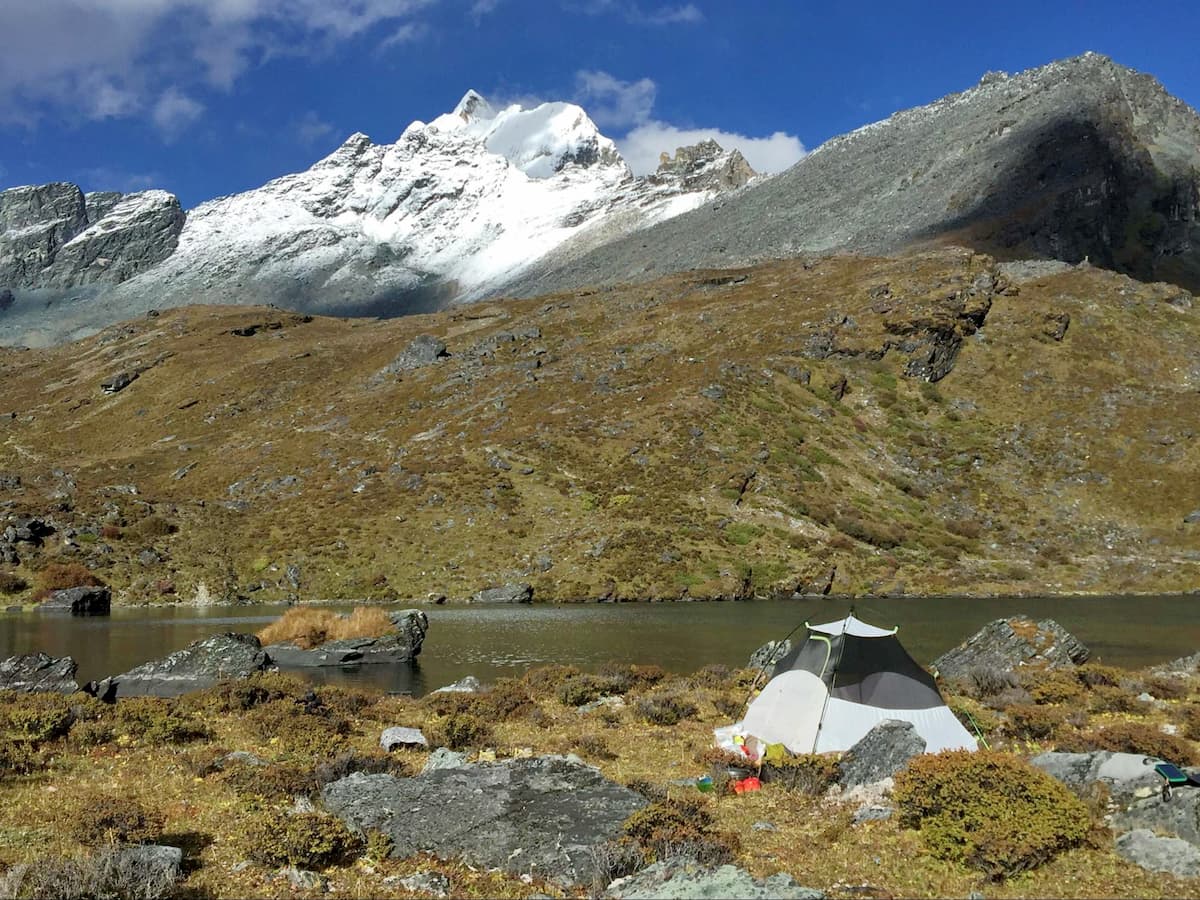
From the top of the pass, there are a few intersecting trails, but for the Inner Kora you will want to turn right (Northwest) and head down the valley behind Xiannairi. It's about 2.5 km from the junction to the bottom of the valley, which is where most people spend the night on the Inner Kora. This is a beautiful area, but in peak season it receives a lot of traffic from commercial trekking groups with large numbers or people who, unfortunately, have been known to leave trash behind. There is another suitable place to camp further along the trail, but this is the most convenient and most scenic, and has ample water sources.
From the campsite in this valley, the valley drops off, but the trail hugs the mountain on the right side for another 4 km or so to a smaller amphitheater just beneath the second and final pass of the inner kora. This area contains a few stone huts and plenty of flat spots for camping if you decided to keep going on the first day. There was a small running water source available here when it was hiked in October.
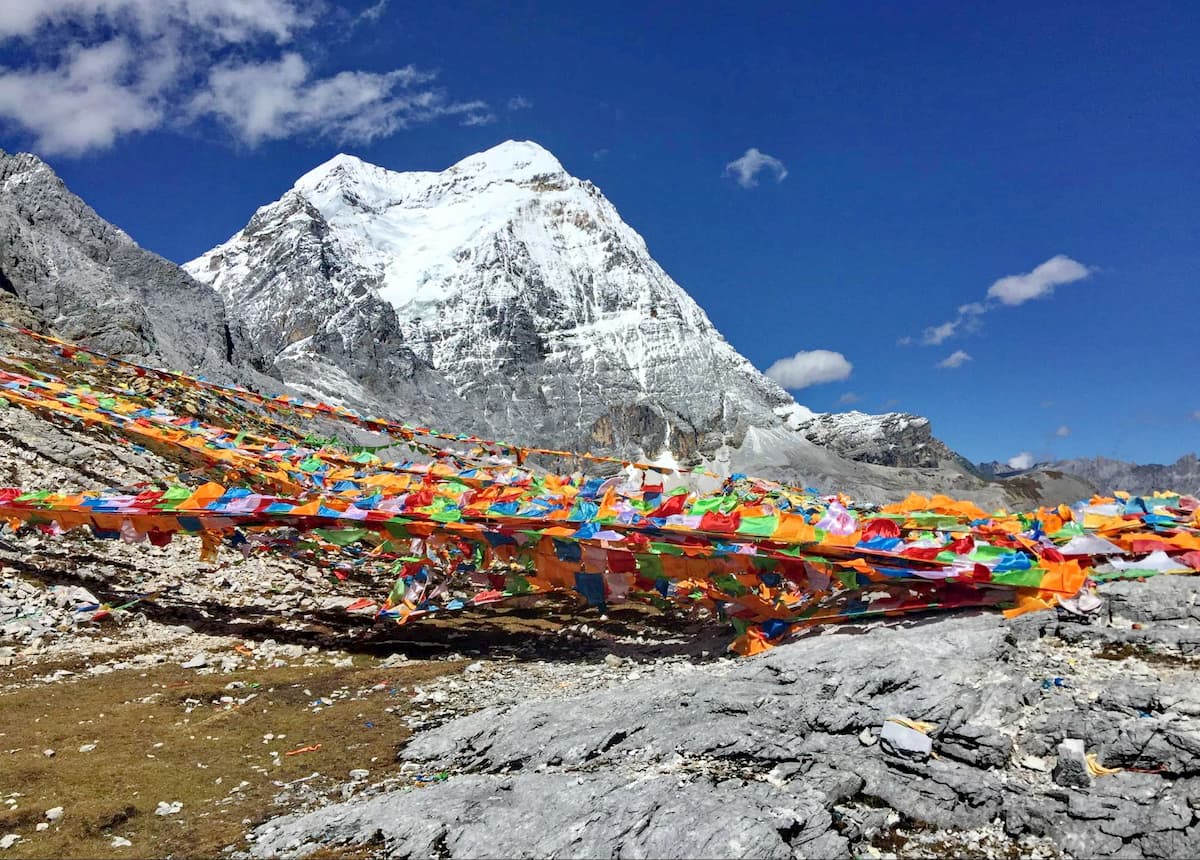
The pass is just over 4,650 meters above sea level, which makes it the highest point along the inner kora. Climb through the tunnel of prayer flags and then descend down the final valley of the trek, Xiannairi revealing itself more and more with every step. It's a little less than 4 kilometers down the fairly gradually descending path to the base of the valley, the main tourist area, and Chonggu monastery. Here, the Inner Kora is complete!
Outer Kora: 54 km, 3,700-meter elevation gain, loop.
This trek can be done in 4-7 days depending on your hiking speed and pack weight, but below I’ve described the 6-day trek we took with the campsites we used and major landmarks passed. This is one of the most spectacular treks I have ever done. I did this trek in October 2018, and wrote a detailed trip report for my website: https://www.yunnantrails.com/yading-outer-kora. Much of this information is taken from there.
Day 1 — 5-7 kilometers, 600-700 meters elevation gain.
This day can be as short or as long as you like. Many people cross the first pass and camp on the other side, but we opted for a shorter day since it took a while to get inside the Nature Reserve and find the trailhead.
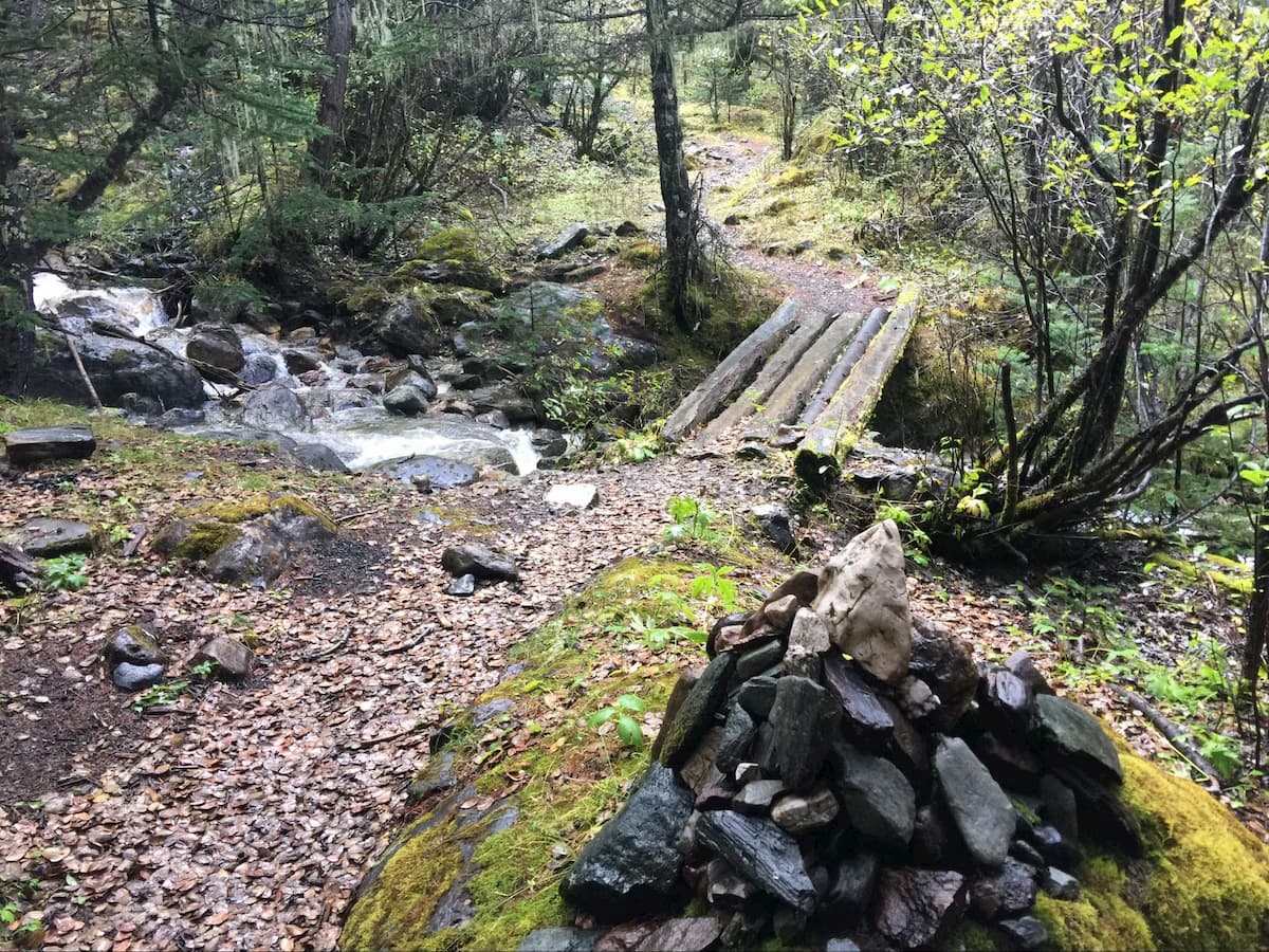
The trailhead is relatively difficult to find. From Chonggu Monastery, walk south towards Luorong Pasture until you hit the metal-grated boardwalk. Try and cut back onto the paved road as soon as you can (which is supposed to be reserved for the electric carts, so you may meet some resistance from the workers). In a few hundred meters, you should see a path left of the road veering off into the forest, marked by a nondescript stone tablet. This should be less than a kilometer from the monastery, but if you're still unsure, keep following the path; it should run parallel to the road for a bit and then start climbing steeply into the forest. After 20-30 minutes if you cross a stream via a small wooden bridge, you're on the right path. After 2.5 km or so, you should come out of the forest and into the beautiful canyon you will spend the rest of the day hiking up.
After about 3.5 km from the trailhead, you should come to Baiyun Pasture, a popular lunch/camping spot and a great place to rest and take in the view of Chenresig across the valley (weather permitting). You can see all three holy mountains from this spot in good weather. After the pasture, the trail is pretty straightforward, and hugs the right side of the gurgling stream coming down from the first pass.
There are plentiful camping options both before and after the first pass. We camped a bit earlier at a spot about 5 km from the trailhead, and 4,600 meters above sea level. Be very careful about Acute Mountain Sickness. We were probably lucky not to have experienced any negative effects of the elevation.
Day 2 — 13 to 15 km; 400 m elevation gain; 900 meters elevation loss:
In short, this day climbs up to the top of the first pass, and then descends down to the valley on the backside of Xiaruoduo (Chana Dorje). From where we camped it was less than 2 km to the top of Pass 1, but that doesn't mean it was easy—topping out at 4,900 meters above sea level, this is the highest you will be on the entire Outer Kora.
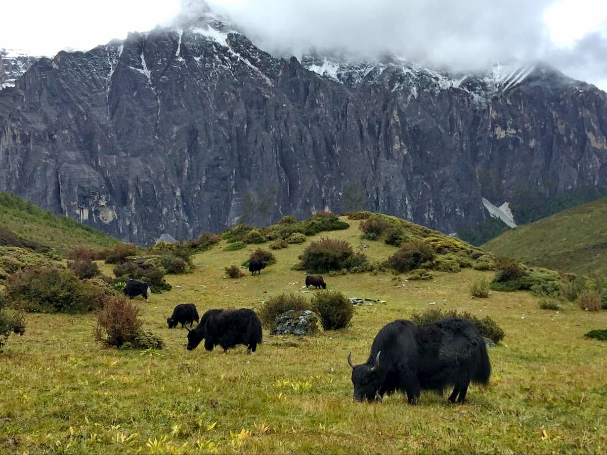
After pass 1, the trail descends down the next valley for about 5 km before coming onto a small village with a handful of houses and yak pastures. Angle toward the right after the village, close to the stream, and soon you begin descending fairly steeply until you cross the river around kilometer 12.6. After the crossing, the trail climbs briefly and then descends for about 2.5 km through a dense, lush conifer forest, before coming out into the valley at the base of Chenadorje's imposing backside. After another 1-1.5 kms, there are plenty of open flat areas for camping. This is an astonishingly beautiful campsite.
Day 3 — 17 km; 1,000 m elevation gain; 850 meters elevation loss:
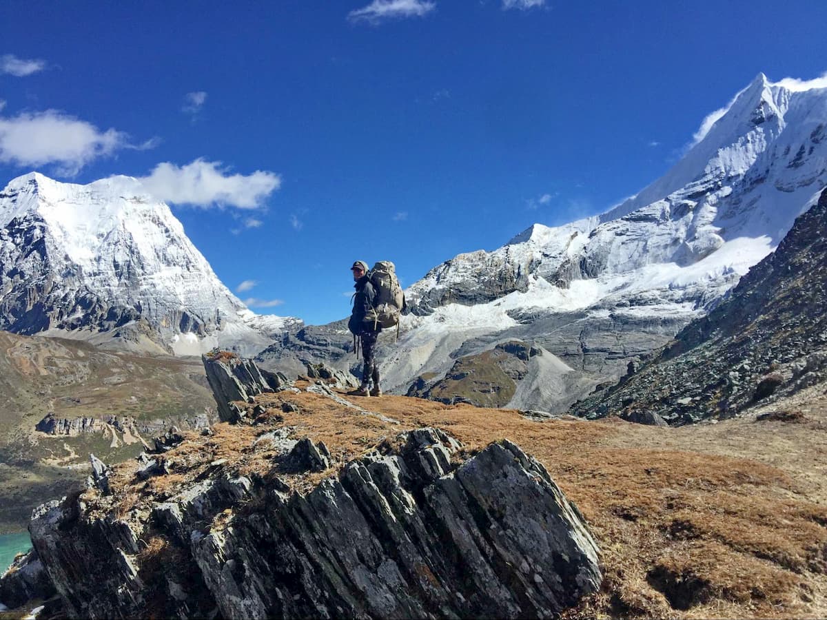
This is a very physically demanding day. Begin by traversing the Chenadorje valley for about one km to the Southwest, and then climbing steeply through the forest on the other side. After another kilometer and 250 meters of elevation gain, you come over Pass 2 which is fairly anti-climactic and could even be grouped together with Pass 3. It leads into a modest hanging valley before passing some stone huts and turning towards Pass 3, which is about another kilometer on. This pass is a memorable one, and the scenery as you come over the hump is absolutely incredible.
The valley leading up to pass 4 is long and beautiful, and descends for about 4 kilometers before beginning the ascent. It ascends gradually for about .5 km, then steeply for another .75 km before topping out a little over 4,700 meters. There was a significant amount of snow on this pass when we hiked it in October, but not enough to thwart passage or require crampons.

If you want to call it a day after this, there are some camping options before and after Pass 4, with plenty of water sources nearby. If you're feeling good, continue on towards Pass 5 and one of the most spectacular campsites on the route—"the amphitheater”. The valley after pass 4 gradually descends for about 4 km to the base of pass 5, which is smaller than the previous one but still formidable. Along the way you will cross a couple of large scree fields, as well as a stupa marking the "official" halfway point of the kora. It's another 600 meters to the top of Pass 5, and from there a quick kilometer down to the breathtaking amphitheater.
FYI, if there are commercial trekking groups, they will almost certainly camp at the amphitheater. There was a group of about 200 people there when we arrived, but we were able to find a nice secluded spot separate from all of them.
Day 4 — 9 kilometers; 600 meters elevation gain; 300 meters elevation loss:
From the amphitheater, the trail climbs steadily for about 5 km to Pass 6, crossing a few very precipitous scree fields, gaining about 500 meters of elevation. This pass tops out just above 4,700 meters.
After Pass 6, the trail stays relatively level for about 3.5 to 4 km through stunning mars-like landscapes before dropping down to Joseph Rock's Rock, a milestone of sorts along the trail where Joseph Rock—the famous botanist who explored China during the early 1900's—stopped for lunch one day, or something like that. It's a good lunch spot, and there is some good camping in the area and by the lake just above it. You can obviously go further on this day—Wisdom Lake, on the other side of the next pass, is the most popular campsite. We were trying to avoid the large trekking group and so stopped early.
Day 5 - 11 kilometers, 500 meters of elevation gain, 600 meters of elevation loss:
The trail ascends from the lake above Joseph Rock’s Rock and quickly comes upon Pass 7, from where the views become absolutely breathtaking. Spend some time taking it in. Then head down to Wisdom Lake (or Snake Lake to some)—it's a little less than 2 km from the top of the pass to the other side of the lake where the main camping area is. If you camped here, you may be able to finish the entire Kora on this day.
From the Wisdom Lake Campsite, it's about 1500 meters to the top of Pass 8, where there is a three-way trail junction, marking the point where the Outer Kora meets the Inner Kora, and the trails coming from Milk Lake and Five-Colors Lake. From here, you simply follow the Inner Kora directions above, and head down into the valley behind Xiannairi. If you’re not concerned with finishing the Kora or pressed for time, you can also just head down into the central valley towards Luorong pasture and end the trek a bit early.
We camped just below Pass 9, the last pass of the trip, choosing to forgo camping in the valley behind Xiannairi in order to, once again, avoid the large trekking groups.
Day 6 - 5 kilometers; 200 meters elevation gain, 500 meters elevation loss:
This was our last day, starting from the small amphitheater below the last pass and ending at Chonggu Monastery, as described in the Inner Kora section.
There are a number of different ways to get to Yading Nature Reserve, the easiest being to fly into the newly constructed Daocheng Yading Airport (Code: DCY), which holds the impressive superlative as the highest airport in the world at 4,411 meters. It used to be a two-day bus trip from Chengdu, with a one-night stopover in Kangding (康定) (subject to change), but due to the construction of new roads the trip may now only take one day (12 hours) from Chengdu to Daocheng, and cost 270 RMB.
You can also start from Kunming, fly or drive or take the bus to Shangri-la, spend a night there to begin acclimatizing, and then take an eight-hour bus to Daocheng the next day. Keep in mind that infrastructure is being rapidly constructed all over China, so driving times in can change suddenly from year-to-year.
From Daocheng city, it is another 1.5 hours by shared van or taxi to the town of Riwa (also called Shangri-La, but not to be confused with the Shangri-La in Yunnan Province). The entrance to Yading Nature Reserve, and the end of the public highway, is on the edge of this town. From the official entrance, it is not possible to drive private vehicles into the reserve, so everyone must take the public tourist buses to get to the main scenic area and the locations described above. The entrance fee to Yading is 270 yuan, which includes the initial tourist bus to the central area (but not the electric carts to Luorong pasture).
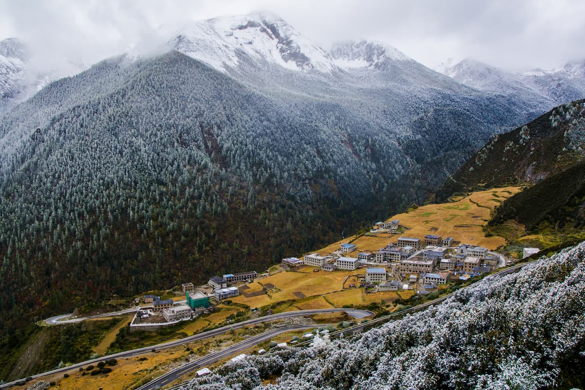
A relatively non-descript town with an elevation of 3,750 meters, this is a good place to stay, acclimate, and stock up on supplies before entering the Yading Nature Reserve, especially if you are going on a longer trek. There are plenty of hotels and guesthouses, and they will likely be cheaper than in the town of Riwa (Shangri-La).
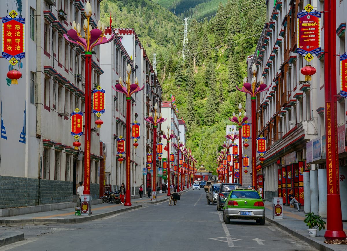
This town was originally called Riwa (and still is on Chinese maps), but has been re-named Shangri-La in an attempt to re-brand Yading as the one true “Shangri-La” from the epic poem Paradise Lost by John Milton (placing it in direct competition with the Yunnan town of the same name). Whether or not the Yading Nature Reserve is the original “Shangri-La” as described by Milton, the town of Riwa is decidedly not, and really just serves as the entry point to the reserve. There has been an explosion of hotels, guesthouses, and hostels of all price ranges, but expect to pay more than in neighboring Daocheng, especially in peak season (National Day Week, Spring Festival, and other holidays).
Explore Yading Nature Reserve with the PeakVisor 3D Map and identify its summits.


