Scan the QR code and open PeakVisor on your phone
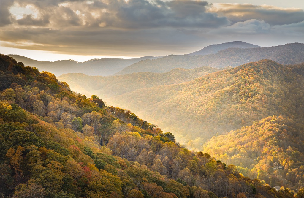
The South Mountain Gameland is located in the western portion of the US state of North Carolina. The district features a varied and rugged landscape with 26 named mountains. The tallest and most prominent peak in the region is Icy Knob at 3,012 ft (918 m) tall with 1,785 ft (544 m) of prominence.
This protected region covers land in the South Mountains in western North Carolina. The rugged landscape features numerous pearls, ridgelines, and valleys, which have been eroded over the course of millions of years.
The gamelands lie in the Piedmont region of the state, surrounded by relatively flat land. The surrounding range spans 100,000 acres (40,469 ha) across the state and is divided into the South Mountain Gameland and the South Mountains State Park.
Hiking is available throughout the rugged region though there are no defined trails and minimal signage posting. Those visiting the region should be equipped with detailed maps and able to navigate. Some of the primitive trails in the gameland lead to fire lookout towers.
The South Mountain Gameland covers land in Burke, Cleveland, McDowell, and Rutherford counties. A majority of the landscape is covered in forested hillsides, predominantly featuring deciduous trees and low growing shrubs.
Additionally, the South Mountain Gameland is surrounded by popular outdoor recreation areas. The South Mountain State Park lies directly north while Chimney Rock State Park and Florence Nature Preserve lie to the southwest. The Pisgah National Forest and Blue Ridge Parkway are situated to the west while Sumter National Forest and Nantahala National Forest lie to the southwest.
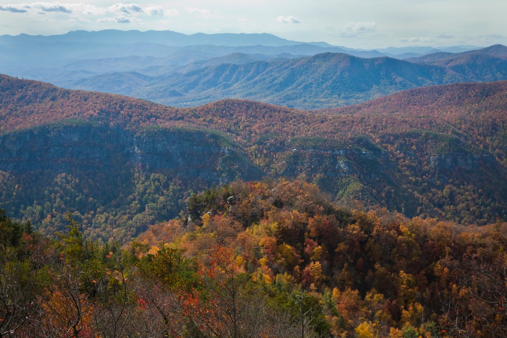
The peaks and ridgelines found throughout the South Mountain Gameland are part of the South Mountains, a subrange of the Blue Ridge Mountains which extend from the US state of Georgia northward to Maryland and Pennsylvania.
The Blue Ridge Mountains are also a subrange of the Appalachian Mountains which span along the east coast of the US into the Canadian province of Newfoundland and Labrador. The South Mountains are separated from the rest of the Appalachian Mountains in the state by the Catawba River valley which lies to the west.
These peaks mark the tallest mountains in the Piedmont region of the state which is relatively flat compared to the western portion of North Carolina. The gameland lies within the Blue Ridge Mountain geologic province where peaks consist of both igneous and metamorphic rocks.
Rocks found in the gameland, and the rest of the Blue Ridge Mountains, date back to the Precambrian and the Paleozoic eras. These peaks and ridgelines began forming around 1 billion to 250 million years ago during the Grenville and Alleghenian orogenies.
During this time the peaks lay along the seafloor while tectonic shifting thrust the peaks upwards. Over the course of millions of years, the peaks were slowly eroded, leaving behind the rugged landscape visible today.
The land west of the gameland is known for being incredibly rich in minerals such as mica, emeralds, rubies, sapphires, and amethysts.
Major peaks within the South Mountain Gameland include Icy Knob, Silver Creek Knob, Benn Knob, and Covington Mountain.
The ecology of South Mountain Gameland is similar to that of the nearby Pisgah National Forest and Nantahala National Forest.
Lower and mid-elevations consist of vast sections of shortleaf pine-oak heath, and oak-hickory forests. Other hardwood woodlands are also common. The higher peaks in the gameland consist of a mix of spruce-fir woodlands.
Low growing shrubs are common throughout the gameland. Many of the taller peaks in the region feature minimal amounts of tree coverage, allowing for panoramic views of the landscape.
Common animal species found in the gameland include white-tailed deer, bobcats, black bears, coyotes, and beavers. The various waterways within and outside the gameland are home to brook trout, rainbow trout, and brown trout. Hunting, trapping, and fishing are all permitted in sections of the gameland.

The land in and surrounding the South Mountain Gameland has been inhabited by humans for thousands of years, long before the arrival of European settlers.
Though determining exact territorial boundaries can be difficult, this region marks part of the ancestral homelands of the Cherokee people. Remnants of Paleo-Indian culture have been found throughout the southeastern US, dating back as early as 8,000 years ago.
The ancestral homelands and traditional territory of the Cherokee Nation, and the Eastern Band of Cherokee Indians, spans across present-day North Carolina, Tennessee, and Georgia. The abundance of animals, and plethora of fresh water sources, led to the settling of the Cherokee people throughout the region.
In 1540, a Spanish expedition led by Hernando de Soto, marked the first recorded contact between the Indigneous people and European settlers, taking place in present day Tennessee. As settlers began inhabiting the region, the Cherokee tribe formed various trade deals and treaties with the Irish, English, and Scottish immigrants in the area.
The various bands of Cherokee tribes formed a unified government in the early 1700s while continuing to trade with some of the early immigrants. During the early 1800s, gold was discovered just south of the region in present-day Georgia. This discovery led to a large influx of settlers who disregarded the Indigneous peoples claim to the land.
The discovery of gold led to the US government forcibly removing the Cherokee people and other tribes. Many settlers who were backed the the US Army would harass, attack, and murder members of the tribe who fought to protect their ancestral homelands. During this time the US government also attempted to get the tribal leaders to sign over all of their land through the Treaty of New Echota.
Though the Cherokee tribal leaders never signed the treaty, the US government still forcibly removed all Indigenous people who remained in the region. Members of the Cherokee tribe were forced onto reservations in present-day Arkansas and Oklahoma.
This long journey from the east coast to the reservations would later be known as the Trail of Tears. It is estimated that nearly a quarter of all those who began the journey died along the route.
The neighboring South Mountains State Park was established in 1975. Today the game lands are used for hiking, hunting, trapping, and fishing. Those visiting the region should wear bright colors and always be aware of when hunting season is taking place.
The South Mountain Gameland does not contain any maintained trails. However, there are around 20 miles (32 km) of primitive trails throughout. Those visiting should be equipped with detailed maps and navigation skills. There are multiple designated trails in the neighboring South Mountain State Park. Here are a few of the most popular trails in the region:
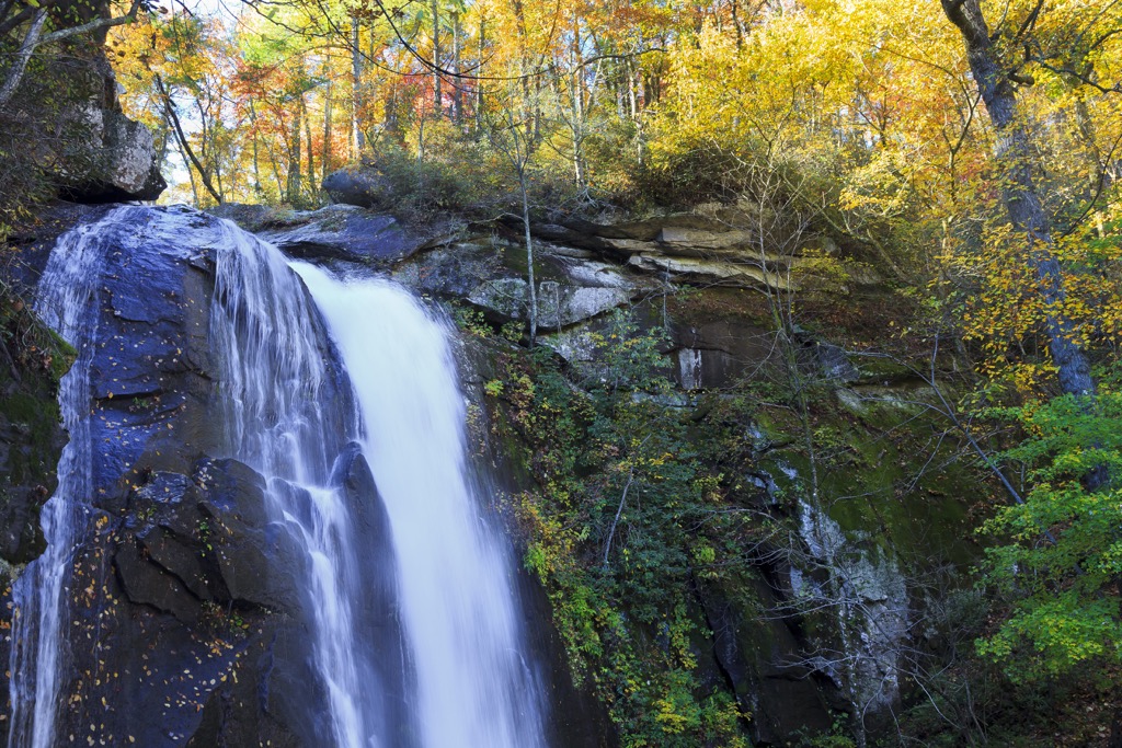
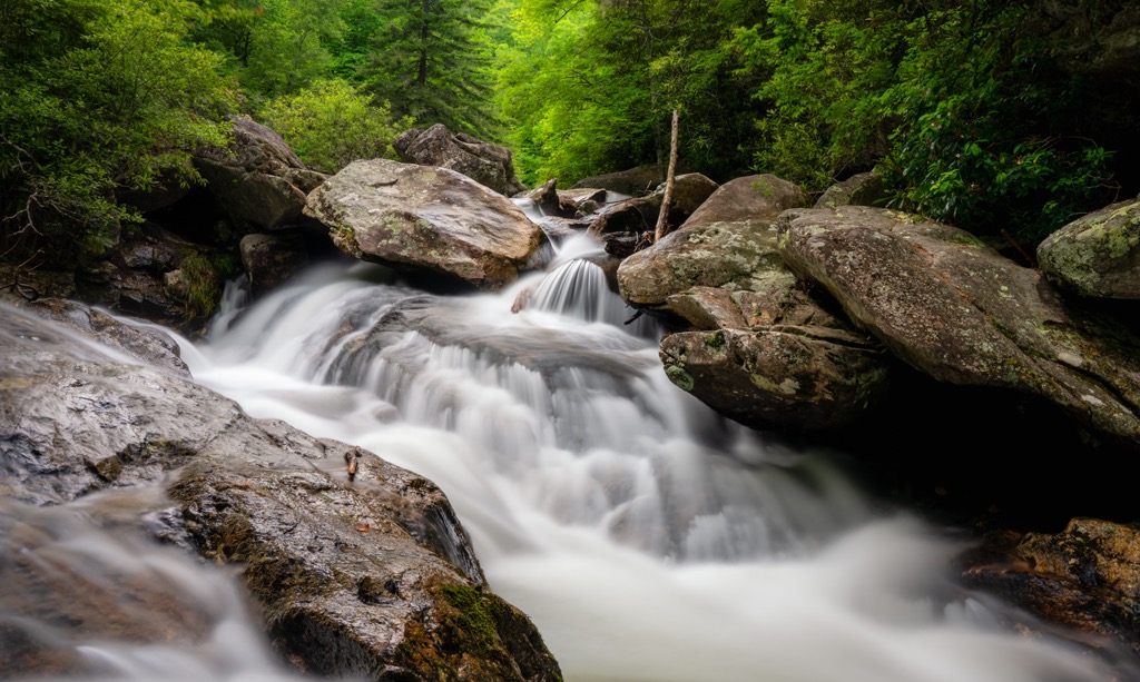
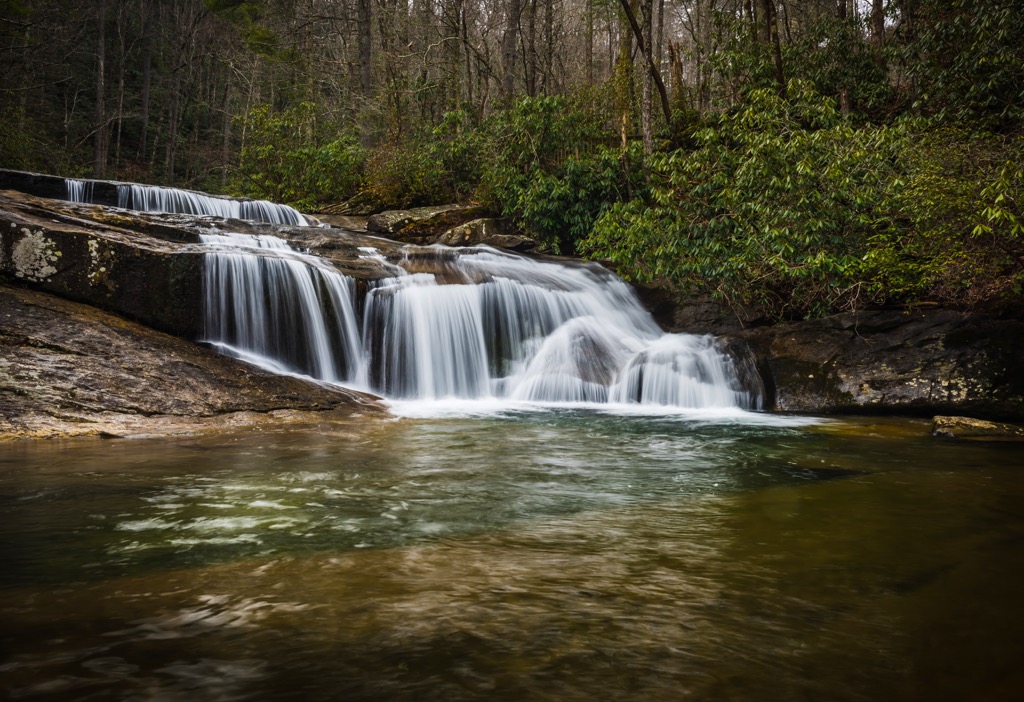
This short out and back trail is one of the best kept trails in the entire gameland. Situated in the center of the gameland, the trail descends steadily along a dirt path. There are a few creek crossings so hikers should be prepared to get their feet wet.
The falls feature a series of small drops and rocky pools, carved into the rock face. A majority of the trail is shaded by tree coverage. Round trip this hike is 1.4 miles (2.25 km) in length with 114 feet (35 m) of elevation gain.
The South Mountains State Park shares a boundary with the gameland and features dozens of designated hiking routes. Those who are not comfortable with navigating in the gamelands should explore the well marked trails in this region:
Looking for a place to stay near the South Mountain Gameland? Here are some of the best cities and villages to check out in the region:
Hickory lies northeast of the South Mountain Gameland and marks the closest major city. Home to around 45,000 residents, the city lies just south of Lake Hickory which was created by a dam along the Catawba River.
The quaint city is known for its history in furniture manufacturing and in recent years has blossomed into a more tourist economy. The downtown streets are lined with local shops, restaurants, and breweries. The city is also home to the Hickory Aviation Museum and the Hickory Museum of Art.
The city of Asheville lies northwest of the gamelands. Situated along the confluence of the Swannanoa and French Board rivers, Asheville is home to around 91,000 residents. As the most populous city in western North Carolina, it is the economic and cultural hub of the region.
The Blue Ridge Mountains surround the city enabling it to thrive as an outdoor recreation destination. Mountain biking, trail running, and hiking are popular activities in the surrounding forests and mountains. Paddleboarding and whitewater rafting are common along the various waterways of the region.
Asheville is also known as being a hub for craft breweries, being home to the most breweries per capita in the country. Popular spots in the region include the River Arts District and the Biltmore Estate.