
Scan the QR code and open PeakVisor on your phone
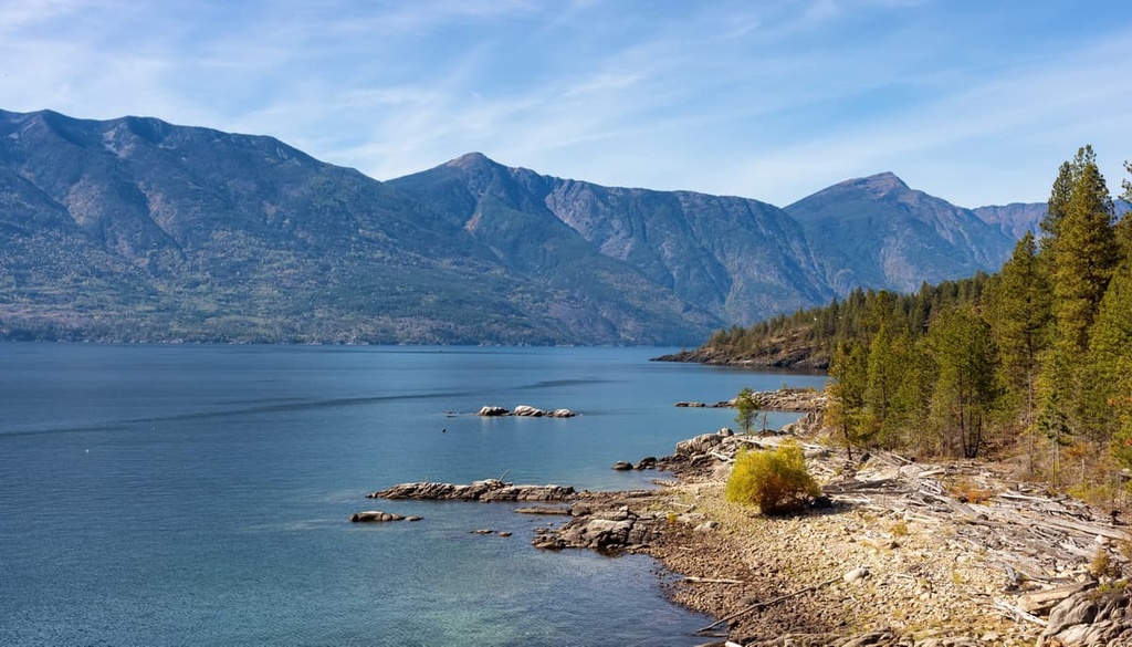
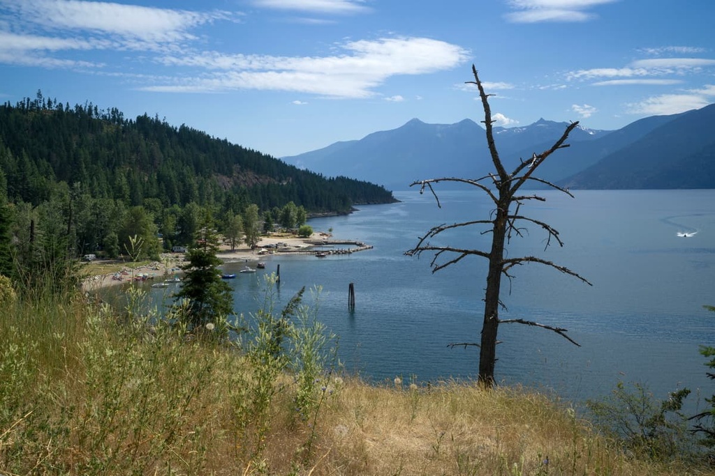
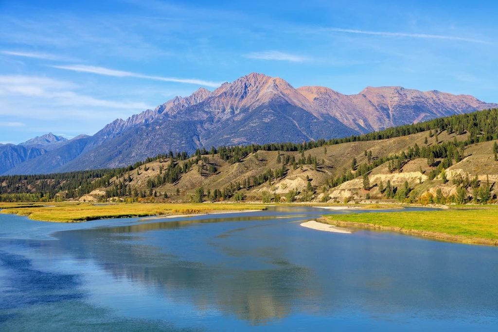
Lockhart Creek Provincial Park is a protected area that’s located along the eastern shore of Kootenay Lake in southeastern British Columbia, Canada. It was established in order to protect the nearly intact watershed that drains into the lake via Lockhart Creek. The park contains remnants of an old-growth cedar forest and is a culturally important area for local First Nations, including the Ktunaxa. Within the park, there are 2 named peaks: Akokli Mountain and Mount Davie.
Located along the eastern edge of the Regional District of Central Kootenay in the southeastern corner of British Columbia, Lockhart Creek Provincial Park is a protected area that extends from the eastern shore of Kootenay Lake into the Purcell Mountains.
Accessible via Highway 3A, Lockhart Creek Provincial Park rises from a low point along the shores of the lake to high points at the peaks of Akokli Mountain and Mount Davie. It encompasses over 37 square kilometers (14 sq. mi) of the Lockhart Creek watershed. The park preserves the watershed’s unique ecology and protects it from the pressures of commercial logging.
Lockhart Creek Provincial Park is located in the Purcell Mountains, which are a subrange of the Columbia Mountains. Situated across Kootenay Lake from the park is the Nelson Range of the Selkirk Mountains, which is also a subrange of the Columbia Mountains.
Additionally, Kianuko Provincial Park is located just to the east of Lockhart Creek Provincial Park in the Moyie Range of the Purcell Mountains. Other parks that are located nearby include:
As it is situated along the eastern shore of Kootenay Lake in Southern British Columbia, Lockhart Creek Provincial Park encompasses parts of the western edge of the Purcell Mountains. The Selkirks occupy the western shore of the lake, though both the Purcell Mountains and the Selkirk Mountains are part of the greater Columbia Mountains.
The Purcell Mountains encompass a roughly triangular area that is about 300 km (190 mi) by 80 km (50 mi) at its longest and widest points. The Purcells extend to the west from the Rocky Mountain Trench to the valley occupied by Kootenay Lake and Duncan Lake. In this valley, you can also find the Beaver and Duncan rivers, which separate the Purcells from the Selkirk Mountains.
The underlying rocks of the Purcells are incredibly old compared to many of the younger rocks that compose the adjacent Rocky Mountains. Metamorphic and sedimentary rocks that date back to the Proterozoic are found throughout the range.
Many of the oldest rocks in the region have been intruded by granitic batholiths. These granite batholiths are especially apparent in places like Bugaboo Provincial Park, where they form incredible granite spires that project through the glaciers.
Quartzite, argillaceous quartzite, argillite, and limestone are the main sedimentary and metamorphic rocks that are found in the Purcells. While the rocks of the Purcells are often overturned and have frequently complex folds, the lithology of the Purcells is much more uniform compared to the adjacent Selkirk Mountains.
An interesting aspect of the Purcells that influences the topography of Lockhart Creek Provincial Park is that the axis of the range is west of center. What this means is that the east-flowing creeks in the range typically have gentle slopes while the west-flowing creeks are short and steep. In particular, the Lockhart Creek drainage descends the steep slopes of Akokli Mountain and Mount Davie, creating the steep-sided gullies and ravines that we see in the park to this day.
The formation of the Purcell and Columbia Mountains started about 160 million years ago, making them some of the oldest major ranges in western Canada. The period of mountain building that created the Columbia Mountains is called the Sevier orogeny. It lasted for about 110 million years, and it partly coincided with the Laramide orogeny and the creation of the Rocky Mountains.
During this orogeny, as an oceanic plate slid under the North American plate, the thickened crust was compressed and heated. This compression and heating allowed for the creation of mountains as layers of rocks were stacked and folded on top of each other.
In western Canada, the Columbia Mountains were among the first mountains to form. They were then followed by the Coast Mountains, which were created as the coast began to deform. Afterward, the Rocky Mountains started to take shape, making them one of the youngest ranges in western Canada.
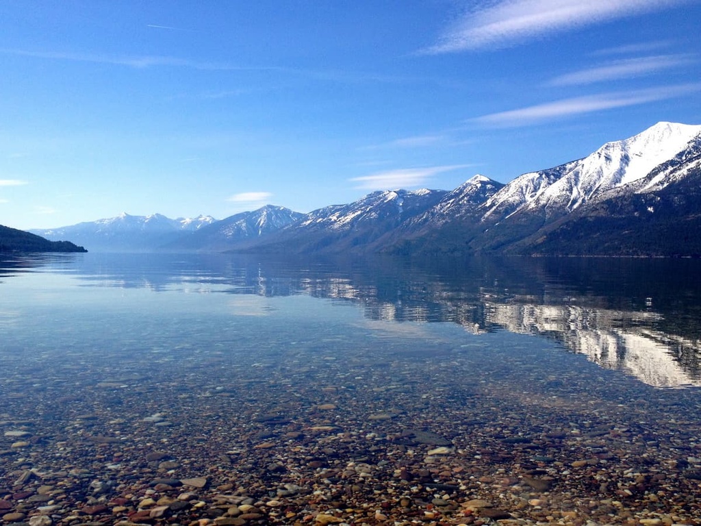
During the Pleistocene epoch, this part of the continent was covered by over 1 km (0.6 mi) of glacial ice. These glaciers cover summits that were as high as 2,400 m (8,000 ft) in elevation within the Purcell Mountains.
As the ice sheet formed and flowed, it created striations on the rocks that it eroded, and it carried glacial debris and erratics to lower elevations. These glacial striations and deposits indicate that the ice sheet generally flowed to the south along slopes of pre-Pleistocene topographical features.
Before the Pleistocene, the summits of Akokli Mountain and Mount Davie were likely more rugged than they are today; however, as the ice sheet flowed over them, their jagged peaks were eroded away.
In other areas of the region, magnificently rugged peaks and ridges look much the same now as they did before the Pleistocene. This is because they stood above the ice as monadnocks and were only affected by local cirque and alpine glaciation.
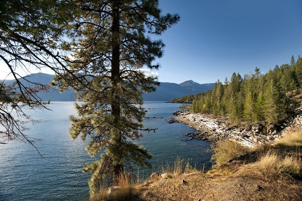
The steep slopes and western exposures of the mountains of the Lockhart Creek watershed create the conditions for a diverse and unique ecosystem in the provincial park.
While the summits of Akokli Mountain and Mount Davie are generally rocky and barren, their low elevation summits ensure that they have a relatively high elevation subalpine zone. This subalpine zone features hardy brush and sedge, but it quickly transitions into dense forests as you make your way down toward Kootenay Lake.
Within the park, the highest elevation forests typically feature stands of Engelmann spruce and subalpine fir. Meanwhile, Douglas fir, red cedar, and western hemlock tend to grow at lower elevations in the region. The park also features an old-growth cedar-hemlock forest that’s located along Lockhart Creek.
Additionally, the western edge of the Purcell Mountains cast a rain shadow across the eastern slopes. As such, Lockhart Creek Provincial Park receives more precipitation than the eastern mountains in the region. This relatively high level of precipitation allows a diversity of tree species to grow in the park.
As far as wildlife goes, rainbow trout, bull trout, and kokanee all inhabit Lockhart Creek. Grizzly bears, black bears, deer, and bighorn sheep are all commonly seen in and around the park. Cougars, wolves, caribou, moose, and elk are also known to travel the corridor along Kootenay Lake.
Archeological evidence suggests that about 11,500 years ago as the glaciers started to melt, people began migrating into the eastern part of the Kootenay Valley and the region around what is now Lockhart Creek Provincial Park. The earliest artifacts of human habitation in the region were found in the southern Purcell Mountains, and they are part of what is called the Goatfell Complex.
As it is located within the traditional territory of the Ktunaxa Nation, Lockhart Creek Provincial Park includes many Indigenous trail systems, traditional use areas, and spiritually and culturally important areas.
There is a theory that the present-day Ktunaxa Nation are direct descendants of the original inhabitants of the valley from 11,500 years ago. This theory proposes that the modern-day Ktunaxa are descendants of the original inhabitants of the region. Researchers who argue for this theory state that, since there has been no break in the region’s 11,500-year archeological record, there is no evidence that the original inhabitants of the area ever emigrated from the region.
The Ktunaxa traditionally had a very wide-reaching territory that extended to the foothills to the east of the Rocky Mountains where they would hunt buffalo on the prairies. However, their knowledge of buffalo hunting and their many other shared cultural practices with the First Nations of the prairies raise questions about the validity of the theory that the Ktunaxa are the descendants of the first people to arrive in the Kootenay Valley.
In fact, there is another theory that suggests that the modern-day Ktunaxa are the descendants of a group that was forced eastward and off the plains as the Blackfoot Confederacy came to dominate the region. This theory would explain why the Ktunaxa have such a strong tradition of buffalo hunting. However, more information is needed to confirm either theory.
To this day, there are many cultural sites that are located in and around Lockhart Creek Provincial Park. They include petroglyphs, ancient quarries, workshops, trails, tools, arrow tips, and spearheads. The lifestyle of the Ktunaxa, which traditionally included seasonal hunting and gathering, remained relatively unchanged for millennia until fur traders arrived in the area at the beginning of the nineteenth century.
The first Europeans to enter the area that is now the provincial park were possibly led by Alexander Mackenzie during his expedition in the late eighteenth century. Indeed, Mackenzie and his team may have been the first Europeans to make contact with the Ktunaxa. Captain John Palliser further mapped the Kootenay region during his expeditions in the nineteenth century.
In the years since Europeans first started colonizing and settling the region around Kootenay Lake, the area has developed a strong tourism industry. The park itself was established in 1995 in order to protect one of the few undeveloped drainages in the area.
All of the towns that are located near Lockhart Creek Provincial Park got their start thanks to the burgeoning forestry and mining industries, which dominated the area throughout the twentieth century. Nowadays, most of the cities in the region feature resorts that cater to skiers and other outdoor enthusiasts.
The stunning wilderness of Lockhart Creek Provincial Park contains several incredible trails.
Some of the park’s trails are historic travel and trade routes that were traditionally used by the First Nations in the region. Meanwhile, other trails in the region take you to the top of the park’s two peaks. Here are the best trails in Lockhart Creek Provincial Park to check out during your next visit to the region.
The official Lockhart Trail follows the northern side of Lockhart Creek from the shores of Kootenay Lake to the upper slopes of Akokli Mountain. This 23 km (14 mi) out-and-back trail has over 1,600 m (5,200 ft) of elevation gain and is considered to be quite difficult.
The Lockhart Trail is a great option for a strenuous day hike or a backpacking trip. After traveling for a couple of hours up the creek, the trail passes an old cabin site, which is a popular destination for hikers. The Lockhart Trail also connects to a number of other trails that lead to places like the nearby Baker Lake and Kianuko Provincial Park.
With only 410 m (1,350 ft) of elevation gain, the trek to the summit of Mount Davie is considered a relatively easy scramble. Please note, however, that this is an easy scramble (rather than an easy hike) as there is some relatively exposed terrain on the route. This trail requires bushwhacking and route-finding as well as a section of scrambling on a steeper slope near the summit.
While there is no official trail to the summit of Mount Davie, this route follows game trails, creeks, gullies, and a grassy slope that all lead towards the top of the mountain. From the summit, you’ll be rewarded with views of Akokli Mountain, Haystack Mountain, Snowcrest Mountain, and a view of the greater Selkirk Mountains across Kootenay Lake.
Navigating your way to the summit of Akokli Mountain requires strong route-finding abilities as you’ll need to travel along a moderately difficult scrambling route. While there is no official trail to the summit, the most common route to the top of Akokli Mountain leads through the forest to the southeast ridge. Another option is to take the northeast ridge to the summit.
All of the routes to the summit of Akokli Mountain contain significant areas of at least class 3, if not class 4 scrambling along with around 725 m (2,400 ft) of elevation gain. This means that you should expect long periods of exposed scrambling while climbing to the top of Akokli Mountain. Therefore, this hike is best for people who are confident in their scrambling abilities.
While the trek to the summit of Akokli Mountain is not for beginners, it is a nice option for experienced scramblers. Even though this hike is a bit more challenging than other treks in the region, people who make it to the top of Akokli are rewarded with spectacular views and the opportunity to add their names to the peak’s summit registry.
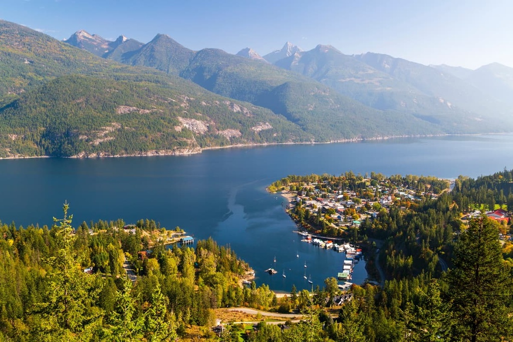
The Columbia Mountains are filled with many stunning wilderness locations for visitors to explore. The following are some of the cities and towns that are located closest to Lockhart Creek Provincial Park for you to visit during your next trip to the region.
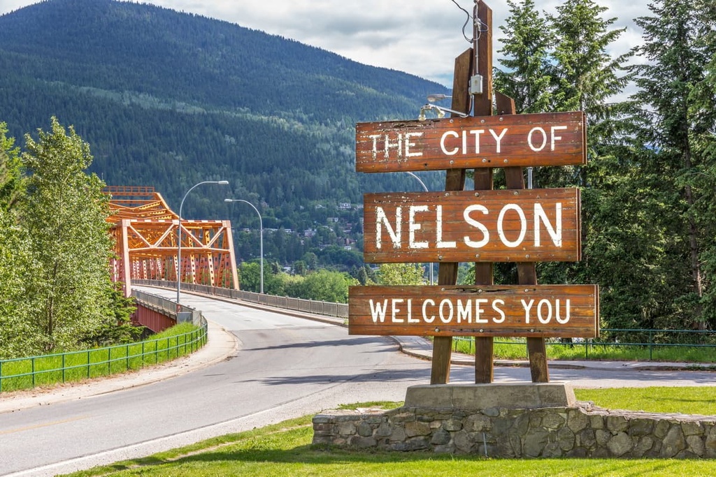
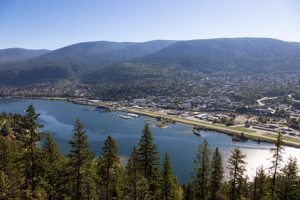
Situated along the shore of the west arm of Kootenay Lake, Nelson is one of the three major cities in the Kootenay Boundary Regional District along with Castlegar and Trail. As the city of Nelson is located about 40 km (24 mi) to the west of Lockhart Creek, a ferry ride across Kootenay Lake is generally the shortest route from the city to the park.
The city of Nelson was established during the regional gold and silver rushes of the late nineteenth century; however, it soon grew to be a major supplier for the local mines and a regional transportation hub. The city was named in 1888 after Hugh Nelson, the Lieutenant Governor of British Columbia at the time.
Over the years, Nelson has since pivoted from its status as a forestry and mining town to become a city that’s focused on arts and tourism. While part of the city’s charm comes from its early twentieth century chateau-style civic buildings made of granite, the restoration of the historic Baker Street buildings in the 1980s allowed Nelson to become the tourist destination that it is today.
Nelson is also home to many artists and writers who helped the town to become one of the best communities for the arts in Canada. The city has a vibrant and diverse artisanal community, and many of the local artists draw inspiration for their work from the surrounding wilderness.
Two of the most popular hikes in Nelson are the Pulpit Rock Trail, which leads to a view of the city, and the trail that leads along the ridge of Elephant Mountain and offers panoramic views of the area. Other hiking areas that are located near Nelson include Valhalla Provincial Park, West Arm Provincial Park, Kokanee Glacier Provincial Park, and the Purcell Wilderness Conservancy Provincial Park.
The Ktunaxa were the first people to occupy and use the land that’s located around present-day Creston. They would traditionally paddle their unique sturgeon-nosed canoes across the region’s flooded flats to harvest wild rice. Several settlers obtained lots in the area after William A. Baillie-Grohman noted, while on a hunting trip to the area with future US president Teddy Roosevelt in 1882, the agricultural potential of the land if it were protected from flooding.
As settlement of the area increased, the Canadian Pacific Railway expanded its tracks across the mountains of southern British Columbia. The arrival of the railroad in Creston connected the settlement with the rest of Canada and helped it grow into the community that it is today.
The community of Creston is located about 50 km (30 mi) to the south of Lockhart Creek Provincial Park, so it’s a great place to stay if you want to travel through the region. Creston also boasts its own tourist opportunities as the community offers everything from wine tours and yoga retreats to backcountry wilderness excursions.
Some of the many popular wilderness areas that are located near Creston include Kianuko Provincial Park and Lockhart Creek Provincial Park. Creston is also situated close to the Idaho Panhandle National Forests and the Kootenai National Forest in the US states of Idaho and Montana.
At the end of the nineteenth century, as the railways were expanding westward, Colonel Baker convinced the Canadian Pacific Railway to run their Crowsnest Pass line through the community of Cranbrook. The arrival of the railway cemented the town's importance in the area, and by 1905, Cranbrook had become the commercial and industrial center of the region.
Nowadays, there are a couple of notable attractions in Cranbrook for tourists and locals to enjoy. The first of these attractions is the 26 km (16 mi) North Star Rails to Trails hike that leads from Cranbrook and travels along the old Canadian Pacific Railway right of way to the town of Kimberley. This right of way was actually donated to the community in order to create a paved trail between the two towns.
The second major attraction in the city is the Cranbrook History Center, which is a museum that showcases passenger rail cars from the early 1900s. It also boasts a collection of natural history specimens and artifacts from the early residents of the region. The museum is considered to be of national and international importance thanks to the amazing cultural exhibits that it contains.
While the cultural exhibits in the town’s museum are undoubtedly interesting, the surrounding wilderness areas also offer an unforgettable experience for visitors to Cranbrook. Some of the many wilderness areas that are worth visiting during a trip to Cranbrook include Top of the World Provincial Park, Mount Fernie Provincial Park, Purcell Wilderness Conservancy Provincial Park, and St. Mary’s Alpine Provincial Park.


